Columbia River
Map


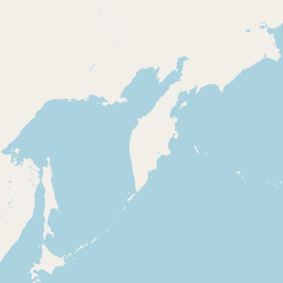


Leaflet | <a href="https://www.openstreetmap.org/copyright">© OpenStreetMap contributors</a>
Item
| Property | Value |
|---|---|
| id | 1423587 |
| downstream_mainstem_id | |
| encompassing_mainstem_basins | |
| featuretype | ['https://www.opengis.net/def/schema/hy_features/hyf/HY_FlowPath', 'https://www.opengis.net/def/schema/hy_features/hyf/HY_WaterBody'] |
| fid | 28595 |
| head_2020huc12 | 170102010202 |
| head_nhdpv1_comid | 24294178 |
| head_nhdpv2_comid | https://geoconnex.us/nhdplusv2/comid/24294178 |
| head_nhdpv2huc12 | https://geoconnex.us/nhdplusv2/huc12/170102010202 |
| head_rf1id | 45772 |
| lengthkm | 1998.3 |
| name_at_outlet | Columbia River |
| name_at_outlet_gnis_id | 1140014 |
| new_mainstemid | |
| outlet_2020huc12 | 170800060500 |
| outlet_drainagearea_sqkm | 622126.5 |
| outlet_nhdpv1_comid | 23832907 |
| outlet_nhdpv2_comid | https://geoconnex.us/nhdplusv2/comid/23832907 |
| outlet_nhdpv2huc12 | https://geoconnex.us/nhdplusv2/huc12/170800060500 |
| outlet_rf1id | 61101 |
| superseded | False |
| uri | https://geoconnex.us/ref/mainstems/1423587 |
Graph Results
| monitoringLocation | https://sta.geoconnex.dev/collections/USGS/Things/items/'USGS-12323250' |
|---|---|
| siteName | USGS-12323250 |
| datasetDescription | Gage height / USGS-12323250-a697806c5dfa46969392f0beb35d2b29 |
| type | Stream |
| url | https://waterdata.usgs.gov/monitoring-location/12323250/#parameterCode=00065 |
| variableMeasured | Gage height / USGS-12323250-a697806c5dfa46969392f0beb35d2b29 |
| variableUnit | ft |
| measurementTechnique | observation |
| temporalCoverage | 2024-08-30T09:15:00Z/2024-09-09T18:45:00Z |
| distributionName | USGS Instantaneous Values Service |
| distributionURL | https://waterservices.usgs.gov/nwis/iv/?sites=USGS:12323250¶meterCd=00065&format=rdb |
| distributionFormat | text/tab-separated-values |
| wkt | POINT (-112.563488888889 45.996575) |
| monitoringLocation | https://sta.geoconnex.dev/collections/USGS/Things/items/'USGS-12323250' |
|---|---|
| siteName | USGS-12323250 |
| datasetDescription | Gage height / USGS-12323250-a697806c5dfa46969392f0beb35d2b29 |
| type | Stream |
| url | https://waterdata.usgs.gov/monitoring-location/12323250/#parameterCode=00065 |
| variableMeasured | Gage height / USGS-12323250-a697806c5dfa46969392f0beb35d2b29 |
| variableUnit | ft |
| measurementTechnique | observation |
| temporalCoverage | 2024-08-30T09:15:00Z/2024-09-09T18:45:00Z |
| distributionName | USGS SensorThings API |
| distributionURL | https://labs.waterdata.usgs.gov/sta/v1.1/Datastreams('a697806c5dfa46969392f0beb35d2b29')?$expand=Thing,Observations |
| distributionFormat | application/json |
| wkt | POINT (-112.563488888889 45.996575) |
| monitoringLocation | https://sta.geoconnex.dev/collections/USGS/Things/items/'USGS-12323250' |
|---|---|
| siteName | USGS-12323250 |
| datasetDescription | Discharge cubic feet per second / USGS-12323250-ec4b7143f2094060ba7c35b4447c95b0 |
| type | Stream |
| url | https://waterdata.usgs.gov/monitoring-location/12323250/#parameterCode=00060 |
| variableMeasured | Discharge |
| variableUnit | ft^3/s |
| measurementTechnique | observation |
| temporalCoverage | 2024-08-30T09:15:00Z/2024-09-09T18:45:00Z |
| distributionName | USGS Instantaneous Values Service |
| distributionURL | https://waterservices.usgs.gov/nwis/iv/?sites=USGS:12323250¶meterCd=00060&format=rdb |
| distributionFormat | text/tab-separated-values |
| wkt | POINT (-112.563488888889 45.996575) |
| monitoringLocation | https://sta.geoconnex.dev/collections/USGS/Things/items/'USGS-12323250' |
|---|---|
| siteName | USGS-12323250 |
| datasetDescription | Discharge cubic feet per second / USGS-12323250-ec4b7143f2094060ba7c35b4447c95b0 |
| type | Stream |
| url | https://waterdata.usgs.gov/monitoring-location/12323250/#parameterCode=00060 |
| variableMeasured | Discharge |
| variableUnit | ft^3/s |
| measurementTechnique | observation |
| temporalCoverage | 2024-08-30T09:15:00Z/2024-09-09T18:45:00Z |
| distributionName | USGS SensorThings API |
| distributionURL | https://labs.waterdata.usgs.gov/sta/v1.1/Datastreams('ec4b7143f2094060ba7c35b4447c95b0')?$expand=Thing,Observations |
| distributionFormat | application/json |
| wkt | POINT (-112.563488888889 45.996575) |
| monitoringLocation | https://sta.geoconnex.dev/collections/USGS/Things/items/'USGS-12324400' |
|---|---|
| siteName | USGS-12324400 |
| datasetDescription | Temperature water degrees Celsius / USGS-12324400-8cadc9cd0d614b1d8bfa0a39e059eca6 |
| type | Stream |
| url | https://waterdata.usgs.gov/monitoring-location/12324400/#parameterCode=00010 |
| variableMeasured | Temperature |
| variableUnit | degC |
| measurementTechnique | observation |
| temporalCoverage | 2024-08-30T09:15:00Z/2024-09-09T18:45:00Z |
| distributionName | USGS Instantaneous Values Service |
| distributionURL | https://waterservices.usgs.gov/nwis/iv/?sites=USGS:12324400¶meterCd=00010&format=rdb |
| distributionFormat | text/tab-separated-values |
| wkt | POINT (-112.789686111111 46.5109111111111) |
| monitoringLocation | https://sta.geoconnex.dev/collections/USGS/Things/items/'USGS-12324400' |
|---|---|
| siteName | USGS-12324400 |
| datasetDescription | Temperature water degrees Celsius / USGS-12324400-8cadc9cd0d614b1d8bfa0a39e059eca6 |
| type | Stream |
| url | https://waterdata.usgs.gov/monitoring-location/12324400/#parameterCode=00010 |
| variableMeasured | Temperature |
| variableUnit | degC |
| measurementTechnique | observation |
| temporalCoverage | 2024-08-30T09:15:00Z/2024-09-09T18:45:00Z |
| distributionName | USGS SensorThings API |
| distributionURL | https://labs.waterdata.usgs.gov/sta/v1.1/Datastreams('8cadc9cd0d614b1d8bfa0a39e059eca6')?$expand=Thing,Observations |
| distributionFormat | application/json |
| wkt | POINT (-112.789686111111 46.5109111111111) |
| monitoringLocation | https://sta.geoconnex.dev/collections/USGS/Things/items/'USGS-12324400' |
|---|---|
| siteName | USGS-12324400 |
| datasetDescription | Discharge / USGS-12324400-23b2a99137434a89ab0e96ab3a6c684a |
| type | Stream |
| url | https://waterdata.usgs.gov/monitoring-location/12324400/#parameterCode=00060 |
| variableMeasured | Discharge / USGS-12324400-23b2a99137434a89ab0e96ab3a6c684a |
| variableUnit | ft^3/s |
| measurementTechnique | observation |
| temporalCoverage | 2024-08-30T09:15:00Z/2024-09-09T18:45:00Z |
| distributionName | USGS Instantaneous Values Service |
| distributionURL | https://waterservices.usgs.gov/nwis/iv/?sites=USGS:12324400¶meterCd=00060&format=rdb |
| distributionFormat | text/tab-separated-values |
| wkt | POINT (-112.789686111111 46.5109111111111) |
| monitoringLocation | https://sta.geoconnex.dev/collections/USGS/Things/items/'USGS-12324400' |
|---|---|
| siteName | USGS-12324400 |
| datasetDescription | Discharge / USGS-12324400-23b2a99137434a89ab0e96ab3a6c684a |
| type | Stream |
| url | https://waterdata.usgs.gov/monitoring-location/12324400/#parameterCode=00060 |
| variableMeasured | Discharge / USGS-12324400-23b2a99137434a89ab0e96ab3a6c684a |
| variableUnit | ft^3/s |
| measurementTechnique | observation |
| temporalCoverage | 2024-08-30T09:15:00Z/2024-09-09T18:45:00Z |
| distributionName | USGS SensorThings API |
| distributionURL | https://labs.waterdata.usgs.gov/sta/v1.1/Datastreams('23b2a99137434a89ab0e96ab3a6c684a')?$expand=Thing,Observations |
| distributionFormat | application/json |
| wkt | POINT (-112.789686111111 46.5109111111111) |
| monitoringLocation | https://sta.geoconnex.dev/collections/USGS/Things/items/'USGS-12324400' |
|---|---|
| siteName | USGS-12324400 |
| datasetDescription | Gage height / USGS-12324400-cf74fc1dd5284f8dacaf16fe3e9bf456 |
| type | Stream |
| url | https://waterdata.usgs.gov/monitoring-location/12324400/#parameterCode=00065 |
| variableMeasured | Gage height / USGS-12324400-cf74fc1dd5284f8dacaf16fe3e9bf456 |
| variableUnit | ft |
| measurementTechnique | observation |
| temporalCoverage | 2024-08-30T09:15:00Z/2024-09-09T18:45:00Z |
| distributionName | USGS Instantaneous Values Service |
| distributionURL | https://waterservices.usgs.gov/nwis/iv/?sites=USGS:12324400¶meterCd=00065&format=rdb |
| distributionFormat | text/tab-separated-values |
| wkt | POINT (-112.789686111111 46.5109111111111) |
| monitoringLocation | https://sta.geoconnex.dev/collections/USGS/Things/items/'USGS-12324400' |
|---|---|
| siteName | USGS-12324400 |
| datasetDescription | Gage height / USGS-12324400-cf74fc1dd5284f8dacaf16fe3e9bf456 |
| type | Stream |
| url | https://waterdata.usgs.gov/monitoring-location/12324400/#parameterCode=00065 |
| variableMeasured | Gage height / USGS-12324400-cf74fc1dd5284f8dacaf16fe3e9bf456 |
| variableUnit | ft |
| measurementTechnique | observation |
| temporalCoverage | 2024-08-30T09:15:00Z/2024-09-09T18:45:00Z |
| distributionName | USGS SensorThings API |
| distributionURL | https://labs.waterdata.usgs.gov/sta/v1.1/Datastreams('cf74fc1dd5284f8dacaf16fe3e9bf456')?$expand=Thing,Observations |
| distributionFormat | application/json |
| wkt | POINT (-112.789686111111 46.5109111111111) |
| monitoringLocation | https://sta.geoconnex.dev/collections/USGS/Things/items/'USGS-12324400' |
|---|---|
| siteName | USGS-12324400 |
| datasetDescription | Turbidity water unfiltered monochrome near infra-red LED light 780-900 nm detection angle 90 +-2.5 degrees formazin nephelometric units (FNU) / USGS-12324400-6d0212b05fd045c583f17aca8b283935 |
| type | Stream |
| url | https://waterdata.usgs.gov/monitoring-location/12324400/#parameterCode=63680 |
| variableMeasured | Turbidity |
| variableUnit | _FNU |
| measurementTechnique | observation |
| temporalCoverage | 2024-08-30T18:30:00Z/2024-09-09T18:45:00Z |
| distributionName | USGS Instantaneous Values Service |
| distributionURL | https://waterservices.usgs.gov/nwis/iv/?sites=USGS:12324400¶meterCd=63680&format=rdb |
| distributionFormat | text/tab-separated-values |
| wkt | POINT (-112.789686111111 46.5109111111111) |
| monitoringLocation | https://sta.geoconnex.dev/collections/USGS/Things/items/'USGS-12324400' |
|---|---|
| siteName | USGS-12324400 |
| datasetDescription | Turbidity water unfiltered monochrome near infra-red LED light 780-900 nm detection angle 90 +-2.5 degrees formazin nephelometric units (FNU) / USGS-12324400-6d0212b05fd045c583f17aca8b283935 |
| type | Stream |
| url | https://waterdata.usgs.gov/monitoring-location/12324400/#parameterCode=63680 |
| variableMeasured | Turbidity |
| variableUnit | _FNU |
| measurementTechnique | observation |
| temporalCoverage | 2024-08-30T18:30:00Z/2024-09-09T18:45:00Z |
| distributionName | USGS SensorThings API |
| distributionURL | https://labs.waterdata.usgs.gov/sta/v1.1/Datastreams('6d0212b05fd045c583f17aca8b283935')?$expand=Thing,Observations |
| distributionFormat | application/json |
| wkt | POINT (-112.789686111111 46.5109111111111) |
| monitoringLocation | https://sta.geoconnex.dev/collections/USGS/Things/items/'USGS-12324400' |
|---|---|
| siteName | USGS-12324400 |
| datasetDescription | Specific conductance water unfiltered microsiemens per centimeter at 25 degrees Celsius / USGS-12324400-c3699adb1f434a18a8da3b65d08d5680 |
| type | Stream |
| url | https://waterdata.usgs.gov/monitoring-location/12324400/#parameterCode=00095 |
| variableMeasured | Specific conductance |
| variableUnit | uS/cm |
| measurementTechnique | observation |
| temporalCoverage | 2024-08-30T09:15:00Z/2024-09-09T18:45:00Z |
| distributionName | USGS Instantaneous Values Service |
| distributionURL | https://waterservices.usgs.gov/nwis/iv/?sites=USGS:12324400¶meterCd=00095&format=rdb |
| distributionFormat | text/tab-separated-values |
| wkt | POINT (-112.789686111111 46.5109111111111) |
| monitoringLocation | https://sta.geoconnex.dev/collections/USGS/Things/items/'USGS-12324400' |
|---|---|
| siteName | USGS-12324400 |
| datasetDescription | Specific conductance water unfiltered microsiemens per centimeter at 25 degrees Celsius / USGS-12324400-c3699adb1f434a18a8da3b65d08d5680 |
| type | Stream |
| url | https://waterdata.usgs.gov/monitoring-location/12324400/#parameterCode=00095 |
| variableMeasured | Specific conductance |
| variableUnit | uS/cm |
| measurementTechnique | observation |
| temporalCoverage | 2024-08-30T09:15:00Z/2024-09-09T18:45:00Z |
| distributionName | USGS SensorThings API |
| distributionURL | https://labs.waterdata.usgs.gov/sta/v1.1/Datastreams('c3699adb1f434a18a8da3b65d08d5680')?$expand=Thing,Observations |
| distributionFormat | application/json |
| wkt | POINT (-112.789686111111 46.5109111111111) |
| monitoringLocation | https://sta.geoconnex.dev/collections/USGS/Things/items/'USGS-12389000' |
|---|---|
| siteName | USGS-12389000 |
| datasetDescription | Discharge / USGS-12389000-9a2f4c0deada4ddf9b382e073aa2abee |
| type | Stream |
| url | https://waterdata.usgs.gov/monitoring-location/12389000/#parameterCode=00060 |
| variableMeasured | Discharge / USGS-12389000-9a2f4c0deada4ddf9b382e073aa2abee |
| variableUnit | ft^3/s |
| measurementTechnique | observation |
| temporalCoverage | 2024-08-30T09:15:00Z/2024-09-09T18:45:00Z |
| distributionName | USGS Instantaneous Values Service |
| distributionURL | https://waterservices.usgs.gov/nwis/iv/?sites=USGS:12389000¶meterCd=00060&format=rdb |
| distributionFormat | text/tab-separated-values |
| wkt | POINT (-114.856533333333 47.4292) |
| monitoringLocation | https://sta.geoconnex.dev/collections/USGS/Things/items/'USGS-12389000' |
|---|---|
| siteName | USGS-12389000 |
| datasetDescription | Discharge / USGS-12389000-9a2f4c0deada4ddf9b382e073aa2abee |
| type | Stream |
| url | https://waterdata.usgs.gov/monitoring-location/12389000/#parameterCode=00060 |
| variableMeasured | Discharge / USGS-12389000-9a2f4c0deada4ddf9b382e073aa2abee |
| variableUnit | ft^3/s |
| measurementTechnique | observation |
| temporalCoverage | 2024-08-30T09:15:00Z/2024-09-09T18:45:00Z |
| distributionName | USGS SensorThings API |
| distributionURL | https://labs.waterdata.usgs.gov/sta/v1.1/Datastreams('9a2f4c0deada4ddf9b382e073aa2abee')?$expand=Thing,Observations |
| distributionFormat | application/json |
| wkt | POINT (-114.856533333333 47.4292) |
| monitoringLocation | https://sta.geoconnex.dev/collections/USGS/Things/items/'USGS-12389000' |
|---|---|
| siteName | USGS-12389000 |
| datasetDescription | Gage height / USGS-12389000-c51751f7d2b14a86b65c7dc262c31324 |
| type | Stream |
| url | https://waterdata.usgs.gov/monitoring-location/12389000/#parameterCode=00065 |
| variableMeasured | Gage height / USGS-12389000-c51751f7d2b14a86b65c7dc262c31324 |
| variableUnit | ft |
| measurementTechnique | observation |
| temporalCoverage | 2024-08-30T09:15:00Z/2024-09-09T18:45:00Z |
| distributionName | USGS SensorThings API |
| distributionURL | https://labs.waterdata.usgs.gov/sta/v1.1/Datastreams('c51751f7d2b14a86b65c7dc262c31324')?$expand=Thing,Observations |
| distributionFormat | application/json |
| wkt | POINT (-114.856533333333 47.4292) |
| monitoringLocation | https://sta.geoconnex.dev/collections/USGS/Things/items/'USGS-12389000' |
|---|---|
| siteName | USGS-12389000 |
| datasetDescription | Gage height / USGS-12389000-c51751f7d2b14a86b65c7dc262c31324 |
| type | Stream |
| url | https://waterdata.usgs.gov/monitoring-location/12389000/#parameterCode=00065 |
| variableMeasured | Gage height / USGS-12389000-c51751f7d2b14a86b65c7dc262c31324 |
| variableUnit | ft |
| measurementTechnique | observation |
| temporalCoverage | 2024-08-30T09:15:00Z/2024-09-09T18:45:00Z |
| distributionName | USGS Instantaneous Values Service |
| distributionURL | https://waterservices.usgs.gov/nwis/iv/?sites=USGS:12389000¶meterCd=00065&format=rdb |
| distributionFormat | text/tab-separated-values |
| wkt | POINT (-114.856533333333 47.4292) |
| monitoringLocation | https://sta.geoconnex.dev/collections/USGS/Things/items/'USGS-12340500' |
|---|---|
| siteName | USGS-12340500 |
| datasetDescription | Discharge / USGS-12340500-6994e7cede044cd19cfcdb3da8e122fb |
| type | Stream |
| url | https://waterdata.usgs.gov/monitoring-location/12340500/#parameterCode=00060 |
| variableMeasured | Discharge / USGS-12340500-6994e7cede044cd19cfcdb3da8e122fb |
| variableUnit | ft^3/s |
| measurementTechnique | observation |
| temporalCoverage | 2024-08-30T09:15:00Z/2024-09-09T18:00:00Z |
| distributionName | USGS Instantaneous Values Service |
| distributionURL | https://waterservices.usgs.gov/nwis/iv/?sites=USGS:12340500¶meterCd=00060&format=rdb |
| distributionFormat | text/tab-separated-values |
| wkt | POINT (-113.932119444444 46.8767638888889) |
| monitoringLocation | https://sta.geoconnex.dev/collections/USGS/Things/items/'USGS-12340500' |
|---|---|
| siteName | USGS-12340500 |
| datasetDescription | Discharge / USGS-12340500-6994e7cede044cd19cfcdb3da8e122fb |
| type | Stream |
| url | https://waterdata.usgs.gov/monitoring-location/12340500/#parameterCode=00060 |
| variableMeasured | Discharge / USGS-12340500-6994e7cede044cd19cfcdb3da8e122fb |
| variableUnit | ft^3/s |
| measurementTechnique | observation |
| temporalCoverage | 2024-08-30T09:15:00Z/2024-09-09T18:00:00Z |
| distributionName | USGS SensorThings API |
| distributionURL | https://labs.waterdata.usgs.gov/sta/v1.1/Datastreams('6994e7cede044cd19cfcdb3da8e122fb')?$expand=Thing,Observations |
| distributionFormat | application/json |
| wkt | POINT (-113.932119444444 46.8767638888889) |
| monitoringLocation | https://sta.geoconnex.dev/collections/USGS/Things/items/'USGS-12340500' |
|---|---|
| siteName | USGS-12340500 |
| datasetDescription | Temperature water degrees Celsius / USGS-12340500-51fbf6eeb3754c80b585b31cffef4aa4 |
| type | Stream |
| url | https://waterdata.usgs.gov/monitoring-location/12340500/#parameterCode=00010 |
| variableMeasured | Temperature |
| variableUnit | degC |
| measurementTechnique | observation |
| temporalCoverage | 2024-08-30T09:15:00Z/2024-09-09T18:00:00Z |
| distributionName | USGS Instantaneous Values Service |
| distributionURL | https://waterservices.usgs.gov/nwis/iv/?sites=USGS:12340500¶meterCd=00010&format=rdb |
| distributionFormat | text/tab-separated-values |
| wkt | POINT (-113.932119444444 46.8767638888889) |
| monitoringLocation | https://sta.geoconnex.dev/collections/USGS/Things/items/'USGS-12340500' |
|---|---|
| siteName | USGS-12340500 |
| datasetDescription | Temperature water degrees Celsius / USGS-12340500-51fbf6eeb3754c80b585b31cffef4aa4 |
| type | Stream |
| url | https://waterdata.usgs.gov/monitoring-location/12340500/#parameterCode=00010 |
| variableMeasured | Temperature |
| variableUnit | degC |
| measurementTechnique | observation |
| temporalCoverage | 2024-08-30T09:15:00Z/2024-09-09T18:00:00Z |
| distributionName | USGS SensorThings API |
| distributionURL | https://labs.waterdata.usgs.gov/sta/v1.1/Datastreams('51fbf6eeb3754c80b585b31cffef4aa4')?$expand=Thing,Observations |
| distributionFormat | application/json |
| wkt | POINT (-113.932119444444 46.8767638888889) |
| monitoringLocation | https://sta.geoconnex.dev/collections/USGS/Things/items/'USGS-12340500' |
|---|---|
| siteName | USGS-12340500 |
| datasetDescription | Specific conductance water unfiltered microsiemens per centimeter at 25 degrees Celsius / USGS-12340500-248feec20e1044438de7f796e858ec01 |
| type | Stream |
| url | https://waterdata.usgs.gov/monitoring-location/12340500/#parameterCode=00095 |
| variableMeasured | Specific conductance |
| variableUnit | uS/cm |
| measurementTechnique | observation |
| temporalCoverage | 2024-08-30T09:15:00Z/2024-09-09T18:00:00Z |
| distributionName | USGS Instantaneous Values Service |
| distributionURL | https://waterservices.usgs.gov/nwis/iv/?sites=USGS:12340500¶meterCd=00095&format=rdb |
| distributionFormat | text/tab-separated-values |
| wkt | POINT (-113.932119444444 46.8767638888889) |
| monitoringLocation | https://sta.geoconnex.dev/collections/USGS/Things/items/'USGS-12340500' |
|---|---|
| siteName | USGS-12340500 |
| datasetDescription | Specific conductance water unfiltered microsiemens per centimeter at 25 degrees Celsius / USGS-12340500-248feec20e1044438de7f796e858ec01 |
| type | Stream |
| url | https://waterdata.usgs.gov/monitoring-location/12340500/#parameterCode=00095 |
| variableMeasured | Specific conductance |
| variableUnit | uS/cm |
| measurementTechnique | observation |
| temporalCoverage | 2024-08-30T09:15:00Z/2024-09-09T18:00:00Z |
| distributionName | USGS SensorThings API |
| distributionURL | https://labs.waterdata.usgs.gov/sta/v1.1/Datastreams('248feec20e1044438de7f796e858ec01')?$expand=Thing,Observations |
| distributionFormat | application/json |
| wkt | POINT (-113.932119444444 46.8767638888889) |
| monitoringLocation | https://sta.geoconnex.dev/collections/USGS/Things/items/'USGS-12340500' |
|---|---|
| siteName | USGS-12340500 |
| datasetDescription | Gage height / USGS-12340500-8386bbd292ea43339166467d72a241bf |
| type | Stream |
| url | https://waterdata.usgs.gov/monitoring-location/12340500/#parameterCode=00065 |
| variableMeasured | Gage height / USGS-12340500-8386bbd292ea43339166467d72a241bf |
| variableUnit | ft |
| measurementTechnique | observation |
| temporalCoverage | 2024-08-30T09:15:00Z/2024-09-09T18:00:00Z |
| distributionName | USGS Instantaneous Values Service |
| distributionURL | https://waterservices.usgs.gov/nwis/iv/?sites=USGS:12340500¶meterCd=00065&format=rdb |
| distributionFormat | text/tab-separated-values |
| wkt | POINT (-113.932119444444 46.8767638888889) |
| monitoringLocation | https://sta.geoconnex.dev/collections/USGS/Things/items/'USGS-12340500' |
|---|---|
| siteName | USGS-12340500 |
| datasetDescription | Gage height / USGS-12340500-8386bbd292ea43339166467d72a241bf |
| type | Stream |
| url | https://waterdata.usgs.gov/monitoring-location/12340500/#parameterCode=00065 |
| variableMeasured | Gage height / USGS-12340500-8386bbd292ea43339166467d72a241bf |
| variableUnit | ft |
| measurementTechnique | observation |
| temporalCoverage | 2024-08-30T09:15:00Z/2024-09-09T18:00:00Z |
| distributionName | USGS SensorThings API |
| distributionURL | https://labs.waterdata.usgs.gov/sta/v1.1/Datastreams('8386bbd292ea43339166467d72a241bf')?$expand=Thing,Observations |
| distributionFormat | application/json |
| wkt | POINT (-113.932119444444 46.8767638888889) |
| monitoringLocation | https://sta.geoconnex.dev/collections/USGS/Things/items/'USGS-12340500' |
|---|---|
| siteName | USGS-12340500 |
| datasetDescription | Turbidity water unfiltered monochrome near infra-red LED light 780-900 nm detection angle 90 +-2.5 degrees formazin nephelometric units (FNU) / USGS-12340500-8fdb670866114f4a96a339f03250f7bb |
| type | Stream |
| url | https://waterdata.usgs.gov/monitoring-location/12340500/#parameterCode=63680 |
| variableMeasured | Turbidity |
| variableUnit | _FNU |
| measurementTechnique | observation |
| temporalCoverage | 2024-08-30T09:15:00Z/2024-09-09T18:00:00Z |
| distributionName | USGS Instantaneous Values Service |
| distributionURL | https://waterservices.usgs.gov/nwis/iv/?sites=USGS:12340500¶meterCd=63680&format=rdb |
| distributionFormat | text/tab-separated-values |
| wkt | POINT (-113.932119444444 46.8767638888889) |
| monitoringLocation | https://sta.geoconnex.dev/collections/USGS/Things/items/'USGS-12340500' |
|---|---|
| siteName | USGS-12340500 |
| datasetDescription | Turbidity water unfiltered monochrome near infra-red LED light 780-900 nm detection angle 90 +-2.5 degrees formazin nephelometric units (FNU) / USGS-12340500-8fdb670866114f4a96a339f03250f7bb |
| type | Stream |
| url | https://waterdata.usgs.gov/monitoring-location/12340500/#parameterCode=63680 |
| variableMeasured | Turbidity |
| variableUnit | _FNU |
| measurementTechnique | observation |
| temporalCoverage | 2024-08-30T09:15:00Z/2024-09-09T18:00:00Z |
| distributionName | USGS SensorThings API |
| distributionURL | https://labs.waterdata.usgs.gov/sta/v1.1/Datastreams('8fdb670866114f4a96a339f03250f7bb')?$expand=Thing,Observations |
| distributionFormat | application/json |
| wkt | POINT (-113.932119444444 46.8767638888889) |
| monitoringLocation | https://sta.geoconnex.dev/collections/USGS/Things/items/'USGS-12323750' |
|---|---|
| siteName | USGS-12323750 |
| datasetDescription | Gage height / USGS-12323750-212e8a37ed634fb283666c860cf904d1 |
| type | Stream |
| url | https://waterdata.usgs.gov/monitoring-location/12323750/#parameterCode=00065 |
| variableMeasured | Gage height / USGS-12323750-212e8a37ed634fb283666c860cf904d1 |
| variableUnit | ft |
| measurementTechnique | observation |
| temporalCoverage | 2024-08-30T09:15:00Z/2024-09-09T18:15:00Z |
| distributionName | USGS Instantaneous Values Service |
| distributionURL | https://waterservices.usgs.gov/nwis/iv/?sites=USGS:12323750¶meterCd=00065&format=rdb |
| distributionFormat | text/tab-separated-values |
| wkt | POINT (-112.780561111111 46.1794972222222) |
| monitoringLocation | https://sta.geoconnex.dev/collections/USGS/Things/items/'USGS-12323750' |
|---|---|
| siteName | USGS-12323750 |
| datasetDescription | Gage height / USGS-12323750-212e8a37ed634fb283666c860cf904d1 |
| type | Stream |
| url | https://waterdata.usgs.gov/monitoring-location/12323750/#parameterCode=00065 |
| variableMeasured | Gage height / USGS-12323750-212e8a37ed634fb283666c860cf904d1 |
| variableUnit | ft |
| measurementTechnique | observation |
| temporalCoverage | 2024-08-30T09:15:00Z/2024-09-09T18:15:00Z |
| distributionName | USGS SensorThings API |
| distributionURL | https://labs.waterdata.usgs.gov/sta/v1.1/Datastreams('212e8a37ed634fb283666c860cf904d1')?$expand=Thing,Observations |
| distributionFormat | application/json |
| wkt | POINT (-112.780561111111 46.1794972222222) |
| monitoringLocation | https://sta.geoconnex.dev/collections/USGS/Things/items/'USGS-12323750' |
|---|---|
| siteName | USGS-12323750 |
| datasetDescription | Discharge cubic feet per second / USGS-12323750-3d8d9e5c487145698bb8333e9038a1eb |
| type | Stream |
| url | https://waterdata.usgs.gov/monitoring-location/12323750/#parameterCode=00060 |
| variableMeasured | Discharge |
| variableUnit | ft^3/s |
| measurementTechnique | observation |
| temporalCoverage | 2024-08-30T09:15:00Z/2024-09-09T18:15:00Z |
| distributionName | USGS SensorThings API |
| distributionURL | https://labs.waterdata.usgs.gov/sta/v1.1/Datastreams('3d8d9e5c487145698bb8333e9038a1eb')?$expand=Thing,Observations |
| distributionFormat | application/json |
| wkt | POINT (-112.780561111111 46.1794972222222) |
| monitoringLocation | https://sta.geoconnex.dev/collections/USGS/Things/items/'USGS-12323750' |
|---|---|
| siteName | USGS-12323750 |
| datasetDescription | Discharge cubic feet per second / USGS-12323750-3d8d9e5c487145698bb8333e9038a1eb |
| type | Stream |
| url | https://waterdata.usgs.gov/monitoring-location/12323750/#parameterCode=00060 |
| variableMeasured | Discharge |
| variableUnit | ft^3/s |
| measurementTechnique | observation |
| temporalCoverage | 2024-08-30T09:15:00Z/2024-09-09T18:15:00Z |
| distributionName | USGS Instantaneous Values Service |
| distributionURL | https://waterservices.usgs.gov/nwis/iv/?sites=USGS:12323750¶meterCd=00060&format=rdb |
| distributionFormat | text/tab-separated-values |
| wkt | POINT (-112.780561111111 46.1794972222222) |
| monitoringLocation | https://sta.geoconnex.dev/collections/USGS/Things/items/'USGS-12323750' |
|---|---|
| siteName | USGS-12323750 |
| datasetDescription | Temperature water degrees Celsius / USGS-12323750-4102048374ad42baa0fdd37237480855 |
| type | Stream |
| url | https://waterdata.usgs.gov/monitoring-location/12323750/#parameterCode=00010 |
| variableMeasured | Temperature |
| variableUnit | degC |
| measurementTechnique | observation |
| temporalCoverage | 2024-08-30T09:15:00Z/2024-09-09T18:15:00Z |
| distributionName | USGS Instantaneous Values Service |
| distributionURL | https://waterservices.usgs.gov/nwis/iv/?sites=USGS:12323750¶meterCd=00010&format=rdb |
| distributionFormat | text/tab-separated-values |
| wkt | POINT (-112.780561111111 46.1794972222222) |
| monitoringLocation | https://sta.geoconnex.dev/collections/USGS/Things/items/'USGS-12323750' |
|---|---|
| siteName | USGS-12323750 |
| datasetDescription | Temperature water degrees Celsius / USGS-12323750-4102048374ad42baa0fdd37237480855 |
| type | Stream |
| url | https://waterdata.usgs.gov/monitoring-location/12323750/#parameterCode=00010 |
| variableMeasured | Temperature |
| variableUnit | degC |
| measurementTechnique | observation |
| temporalCoverage | 2024-08-30T09:15:00Z/2024-09-09T18:15:00Z |
| distributionName | USGS SensorThings API |
| distributionURL | https://labs.waterdata.usgs.gov/sta/v1.1/Datastreams('4102048374ad42baa0fdd37237480855')?$expand=Thing,Observations |
| distributionFormat | application/json |
| wkt | POINT (-112.780561111111 46.1794972222222) |
| monitoringLocation | https://sta.geoconnex.dev/collections/USGS/Things/items/'USGS-12391950' |
|---|---|
| siteName | USGS-12391950 |
| datasetDescription | Gage height feet / USGS-12391950-297943283bd945fa9e015514052d0ece |
| type | Stream |
| url | https://waterdata.usgs.gov/monitoring-location/12391950/#parameterCode=00065 |
| variableMeasured | Gage height |
| variableUnit | ft |
| measurementTechnique | observation |
| temporalCoverage | 2024-08-30T09:15:00Z/2024-09-09T18:45:00Z |
| distributionName | USGS Instantaneous Values Service |
| distributionURL | https://waterservices.usgs.gov/nwis/iv/?sites=USGS:12391950¶meterCd=00065&format=rdb |
| distributionFormat | text/tab-separated-values |
| wkt | POINT (-116.072777777778 48.0880555555556) |
| monitoringLocation | https://sta.geoconnex.dev/collections/USGS/Things/items/'USGS-12391950' |
|---|---|
| siteName | USGS-12391950 |
| datasetDescription | Gage height feet / USGS-12391950-297943283bd945fa9e015514052d0ece |
| type | Stream |
| url | https://waterdata.usgs.gov/monitoring-location/12391950/#parameterCode=00065 |
| variableMeasured | Gage height |
| variableUnit | ft |
| measurementTechnique | observation |
| temporalCoverage | 2024-08-30T09:15:00Z/2024-09-09T18:45:00Z |
| distributionName | USGS SensorThings API |
| distributionURL | https://labs.waterdata.usgs.gov/sta/v1.1/Datastreams('297943283bd945fa9e015514052d0ece')?$expand=Thing,Observations |
| distributionFormat | application/json |
| wkt | POINT (-116.072777777778 48.0880555555556) |
| monitoringLocation | https://sta.geoconnex.dev/collections/USGS/Things/items/'USGS-12391950' |
|---|---|
| siteName | USGS-12391950 |
| datasetDescription | Discharge / USGS-12391950-f6becc9293b64792b9d292cd25ec5e7e |
| type | Stream |
| url | https://waterdata.usgs.gov/monitoring-location/12391950/#parameterCode=00060 |
| variableMeasured | Discharge / USGS-12391950-f6becc9293b64792b9d292cd25ec5e7e |
| variableUnit | ft^3/s |
| measurementTechnique | observation |
| temporalCoverage | 2024-08-30T09:15:00Z/2024-09-09T18:45:00Z |
| distributionName | USGS Instantaneous Values Service |
| distributionURL | https://waterservices.usgs.gov/nwis/iv/?sites=USGS:12391950¶meterCd=00060&format=rdb |
| distributionFormat | text/tab-separated-values |
| wkt | POINT (-116.072777777778 48.0880555555556) |
| monitoringLocation | https://sta.geoconnex.dev/collections/USGS/Things/items/'USGS-12391950' |
|---|---|
| siteName | USGS-12391950 |
| datasetDescription | Discharge / USGS-12391950-f6becc9293b64792b9d292cd25ec5e7e |
| type | Stream |
| url | https://waterdata.usgs.gov/monitoring-location/12391950/#parameterCode=00060 |
| variableMeasured | Discharge / USGS-12391950-f6becc9293b64792b9d292cd25ec5e7e |
| variableUnit | ft^3/s |
| measurementTechnique | observation |
| temporalCoverage | 2024-08-30T09:15:00Z/2024-09-09T18:45:00Z |
| distributionName | USGS SensorThings API |
| distributionURL | https://labs.waterdata.usgs.gov/sta/v1.1/Datastreams('f6becc9293b64792b9d292cd25ec5e7e')?$expand=Thing,Observations |
| distributionFormat | application/json |
| wkt | POINT (-116.072777777778 48.0880555555556) |
| monitoringLocation | https://sta.geoconnex.dev/collections/USGS/Things/items/'USGS-453845121564001' |
|---|---|
| siteName | USGS-453845121564001 |
| datasetDescription | Barometric pressure millimeters of mercury / USGS-453845121564001-a1b9840324d24ca698e8d41cc57c7c2b |
| type | Stream |
| url | https://waterdata.usgs.gov/monitoring-location/453845121564001/#parameterCode=00025 |
| variableMeasured | Barometric pressure |
| variableUnit | mmHg |
| measurementTechnique | observation |
| temporalCoverage | 2024-08-30T10:00:00Z/2024-09-09T19:00:00Z |
| distributionName | USGS Instantaneous Values Service |
| distributionURL | https://waterservices.usgs.gov/nwis/iv/?sites=USGS:453845121564001¶meterCd=00025&format=rdb |
| distributionFormat | text/tab-separated-values |
| wkt | POINT (-121.945637054172 45.6456726206776) |
| monitoringLocation | https://sta.geoconnex.dev/collections/USGS/Things/items/'USGS-453845121564001' |
|---|---|
| siteName | USGS-453845121564001 |
| datasetDescription | Barometric pressure millimeters of mercury / USGS-453845121564001-a1b9840324d24ca698e8d41cc57c7c2b |
| type | Stream |
| url | https://waterdata.usgs.gov/monitoring-location/453845121564001/#parameterCode=00025 |
| variableMeasured | Barometric pressure |
| variableUnit | mmHg |
| measurementTechnique | observation |
| temporalCoverage | 2024-08-30T10:00:00Z/2024-09-09T19:00:00Z |
| distributionName | USGS SensorThings API |
| distributionURL | https://labs.waterdata.usgs.gov/sta/v1.1/Datastreams('a1b9840324d24ca698e8d41cc57c7c2b')?$expand=Thing,Observations |
| distributionFormat | application/json |
| wkt | POINT (-121.945637054172 45.6456726206776) |
| monitoringLocation | https://sta.geoconnex.dev/collections/USGS/Things/items/'USGS-453845121564001' |
|---|---|
| siteName | USGS-453845121564001 |
| datasetDescription | Temperature water degrees Celsius / USGS-453845121564001-c191cd1f763d408b864a712eb76e46f6 |
| type | Stream |
| url | https://waterdata.usgs.gov/monitoring-location/453845121564001/#parameterCode=00010 |
| variableMeasured | Temperature |
| variableUnit | degC |
| measurementTechnique | observation |
| temporalCoverage | 2024-08-30T10:00:00Z/2024-09-09T19:00:00Z |
| distributionName | USGS Instantaneous Values Service |
| distributionURL | https://waterservices.usgs.gov/nwis/iv/?sites=USGS:453845121564001¶meterCd=00010&format=rdb |
| distributionFormat | text/tab-separated-values |
| wkt | POINT (-121.945637054172 45.6456726206776) |
| monitoringLocation | https://sta.geoconnex.dev/collections/USGS/Things/items/'USGS-453845121564001' |
|---|---|
| siteName | USGS-453845121564001 |
| datasetDescription | Temperature water degrees Celsius / USGS-453845121564001-c191cd1f763d408b864a712eb76e46f6 |
| type | Stream |
| url | https://waterdata.usgs.gov/monitoring-location/453845121564001/#parameterCode=00010 |
| variableMeasured | Temperature |
| variableUnit | degC |
| measurementTechnique | observation |
| temporalCoverage | 2024-08-30T10:00:00Z/2024-09-09T19:00:00Z |
| distributionName | USGS SensorThings API |
| distributionURL | https://labs.waterdata.usgs.gov/sta/v1.1/Datastreams('c191cd1f763d408b864a712eb76e46f6')?$expand=Thing,Observations |
| distributionFormat | application/json |
| wkt | POINT (-121.945637054172 45.6456726206776) |
| monitoringLocation | https://sta.geoconnex.dev/collections/USGS/Things/items/'USGS-453845121564001' |
|---|---|
| siteName | USGS-453845121564001 |
| datasetDescription | Total partial pressure of dissolved gases water unfiltered percent of saturation / USGS-453845121564001-f53fce7e9a904ecc8d74f4101b43e88a |
| type | Stream |
| url | https://waterdata.usgs.gov/monitoring-location/453845121564001/#parameterCode=00048 |
| variableMeasured | Total partial pressure of dissolved gases |
| variableUnit | % |
| measurementTechnique | observation |
| temporalCoverage | 2024-08-30T10:00:00Z/2024-09-09T19:00:00Z |
| distributionName | USGS Instantaneous Values Service |
| distributionURL | https://waterservices.usgs.gov/nwis/iv/?sites=USGS:453845121564001¶meterCd=00048&format=rdb |
| distributionFormat | text/tab-separated-values |
| wkt | POINT (-121.945637054172 45.6456726206776) |
| monitoringLocation | https://sta.geoconnex.dev/collections/USGS/Things/items/'USGS-453845121564001' |
|---|---|
| siteName | USGS-453845121564001 |
| datasetDescription | Total partial pressure of dissolved gases water unfiltered percent of saturation / USGS-453845121564001-f53fce7e9a904ecc8d74f4101b43e88a |
| type | Stream |
| url | https://waterdata.usgs.gov/monitoring-location/453845121564001/#parameterCode=00048 |
| variableMeasured | Total partial pressure of dissolved gases |
| variableUnit | % |
| measurementTechnique | observation |
| temporalCoverage | 2024-08-30T10:00:00Z/2024-09-09T19:00:00Z |
| distributionName | USGS SensorThings API |
| distributionURL | https://labs.waterdata.usgs.gov/sta/v1.1/Datastreams('f53fce7e9a904ecc8d74f4101b43e88a')?$expand=Thing,Observations |
| distributionFormat | application/json |
| wkt | POINT (-121.945637054172 45.6456726206776) |
| monitoringLocation | https://sta.geoconnex.dev/collections/USGS/Things/items/'USGS-453845121564001' |
|---|---|
| siteName | USGS-453845121564001 |
| datasetDescription | Total partial pressure of dissolved gases water unfiltered millimeters of mercury / USGS-453845121564001-23dee3b285214466aa275bf85ab3a93e |
| type | Stream |
| url | https://waterdata.usgs.gov/monitoring-location/453845121564001/#parameterCode=00047 |
| variableMeasured | Total partial pressure of dissolved gases |
| variableUnit | mmHg |
| measurementTechnique | observation |
| temporalCoverage | 2024-08-30T10:00:00Z/2024-09-09T19:00:00Z |
| distributionName | USGS Instantaneous Values Service |
| distributionURL | https://waterservices.usgs.gov/nwis/iv/?sites=USGS:453845121564001¶meterCd=00047&format=rdb |
| distributionFormat | text/tab-separated-values |
| wkt | POINT (-121.945637054172 45.6456726206776) |
| monitoringLocation | https://sta.geoconnex.dev/collections/USGS/Things/items/'USGS-453845121564001' |
|---|---|
| siteName | USGS-453845121564001 |
| datasetDescription | Total partial pressure of dissolved gases water unfiltered millimeters of mercury / USGS-453845121564001-23dee3b285214466aa275bf85ab3a93e |
| type | Stream |
| url | https://waterdata.usgs.gov/monitoring-location/453845121564001/#parameterCode=00047 |
| variableMeasured | Total partial pressure of dissolved gases |
| variableUnit | mmHg |
| measurementTechnique | observation |
| temporalCoverage | 2024-08-30T10:00:00Z/2024-09-09T19:00:00Z |
| distributionName | USGS SensorThings API |
| distributionURL | https://labs.waterdata.usgs.gov/sta/v1.1/Datastreams('23dee3b285214466aa275bf85ab3a93e')?$expand=Thing,Observations |
| distributionFormat | application/json |
| wkt | POINT (-121.945637054172 45.6456726206776) |
| monitoringLocation | https://sta.geoconnex.dev/collections/USGS/Things/items/'USGS-453845121564001' |
|---|---|
| siteName | USGS-453845121564001 |
| datasetDescription | DCP battery voltage volts / USGS-453845121564001-c652c4bb2c9f4aa7b98121f09610cd62 |
| type | Stream |
| url | https://waterdata.usgs.gov/monitoring-location/453845121564001/#parameterCode=70969 |
| variableMeasured | DCP battery voltage |
| variableUnit | V |
| measurementTechnique | observation |
| temporalCoverage | 2024-08-30T10:00:00Z/2024-09-09T19:00:00Z |
| distributionName | USGS Instantaneous Values Service |
| distributionURL | https://waterservices.usgs.gov/nwis/iv/?sites=USGS:453845121564001¶meterCd=70969&format=rdb |
| distributionFormat | text/tab-separated-values |
| wkt | POINT (-121.945637054172 45.6456726206776) |
| monitoringLocation | https://sta.geoconnex.dev/collections/USGS/Things/items/'USGS-453845121564001' |
|---|---|
| siteName | USGS-453845121564001 |
| datasetDescription | DCP battery voltage volts / USGS-453845121564001-c652c4bb2c9f4aa7b98121f09610cd62 |
| type | Stream |
| url | https://waterdata.usgs.gov/monitoring-location/453845121564001/#parameterCode=70969 |
| variableMeasured | DCP battery voltage |
| variableUnit | V |
| measurementTechnique | observation |
| temporalCoverage | 2024-08-30T10:00:00Z/2024-09-09T19:00:00Z |
| distributionName | USGS SensorThings API |
| distributionURL | https://labs.waterdata.usgs.gov/sta/v1.1/Datastreams('c652c4bb2c9f4aa7b98121f09610cd62')?$expand=Thing,Observations |
| distributionFormat | application/json |
| wkt | POINT (-121.945637054172 45.6456726206776) |
| monitoringLocation | https://sta.geoconnex.dev/collections/USGS/Things/items/'USGS-12323800' |
|---|---|
| siteName | USGS-12323800 |
| datasetDescription | Gage height / USGS-12323800-0eaea1ede84f48aea62b1c5a5b77c9ca |
| type | Stream |
| url | https://waterdata.usgs.gov/monitoring-location/12323800/#parameterCode=00065 |
| variableMeasured | Gage height / USGS-12323800-0eaea1ede84f48aea62b1c5a5b77c9ca |
| variableUnit | ft |
| measurementTechnique | observation |
| temporalCoverage | 2024-08-30T09:15:00Z/2024-09-09T18:30:00Z |
| distributionName | USGS Instantaneous Values Service |
| distributionURL | https://waterservices.usgs.gov/nwis/iv/?sites=USGS:12323800¶meterCd=00065&format=rdb |
| distributionFormat | text/tab-separated-values |
| wkt | POINT (-112.76735 46.2082416666667) |
| monitoringLocation | https://sta.geoconnex.dev/collections/USGS/Things/items/'USGS-12323800' |
|---|---|
| siteName | USGS-12323800 |
| datasetDescription | Gage height / USGS-12323800-0eaea1ede84f48aea62b1c5a5b77c9ca |
| type | Stream |
| url | https://waterdata.usgs.gov/monitoring-location/12323800/#parameterCode=00065 |
| variableMeasured | Gage height / USGS-12323800-0eaea1ede84f48aea62b1c5a5b77c9ca |
| variableUnit | ft |
| measurementTechnique | observation |
| temporalCoverage | 2024-08-30T09:15:00Z/2024-09-09T18:30:00Z |
| distributionName | USGS SensorThings API |
| distributionURL | https://labs.waterdata.usgs.gov/sta/v1.1/Datastreams('0eaea1ede84f48aea62b1c5a5b77c9ca')?$expand=Thing,Observations |
| distributionFormat | application/json |
| wkt | POINT (-112.76735 46.2082416666667) |
| monitoringLocation | https://sta.geoconnex.dev/collections/USGS/Things/items/'USGS-12323800' |
|---|---|
| siteName | USGS-12323800 |
| datasetDescription | Specific conductance water unfiltered microsiemens per centimeter at 25 degrees Celsius / USGS-12323800-b09d5a70ad2d49709a5b9b6c09661184 |
| type | Stream |
| url | https://waterdata.usgs.gov/monitoring-location/12323800/#parameterCode=00095 |
| variableMeasured | Specific conductance |
| variableUnit | uS/cm |
| measurementTechnique | observation |
| temporalCoverage | 2024-08-30T09:15:00Z/2024-09-09T18:30:00Z |
| distributionName | USGS SensorThings API |
| distributionURL | https://labs.waterdata.usgs.gov/sta/v1.1/Datastreams('b09d5a70ad2d49709a5b9b6c09661184')?$expand=Thing,Observations |
| distributionFormat | application/json |
| wkt | POINT (-112.76735 46.2082416666667) |
| monitoringLocation | https://sta.geoconnex.dev/collections/USGS/Things/items/'USGS-12323800' |
|---|---|
| siteName | USGS-12323800 |
| datasetDescription | Specific conductance water unfiltered microsiemens per centimeter at 25 degrees Celsius / USGS-12323800-b09d5a70ad2d49709a5b9b6c09661184 |
| type | Stream |
| url | https://waterdata.usgs.gov/monitoring-location/12323800/#parameterCode=00095 |
| variableMeasured | Specific conductance |
| variableUnit | uS/cm |
| measurementTechnique | observation |
| temporalCoverage | 2024-08-30T09:15:00Z/2024-09-09T18:30:00Z |
| distributionName | USGS Instantaneous Values Service |
| distributionURL | https://waterservices.usgs.gov/nwis/iv/?sites=USGS:12323800¶meterCd=00095&format=rdb |
| distributionFormat | text/tab-separated-values |
| wkt | POINT (-112.76735 46.2082416666667) |
| monitoringLocation | https://sta.geoconnex.dev/collections/USGS/Things/items/'USGS-12323800' |
|---|---|
| siteName | USGS-12323800 |
| datasetDescription | Temperature water degrees Celsius / USGS-12323800-dc9b5f6ed54b44d5a9db21cd283633d7 |
| type | Stream |
| url | https://waterdata.usgs.gov/monitoring-location/12323800/#parameterCode=00010 |
| variableMeasured | Temperature |
| variableUnit | degC |
| measurementTechnique | observation |
| temporalCoverage | 2024-08-30T09:15:00Z/2024-09-09T18:30:00Z |
| distributionName | USGS Instantaneous Values Service |
| distributionURL | https://waterservices.usgs.gov/nwis/iv/?sites=USGS:12323800¶meterCd=00010&format=rdb |
| distributionFormat | text/tab-separated-values |
| wkt | POINT (-112.76735 46.2082416666667) |
| monitoringLocation | https://sta.geoconnex.dev/collections/USGS/Things/items/'USGS-12323800' |
|---|---|
| siteName | USGS-12323800 |
| datasetDescription | Temperature water degrees Celsius / USGS-12323800-dc9b5f6ed54b44d5a9db21cd283633d7 |
| type | Stream |
| url | https://waterdata.usgs.gov/monitoring-location/12323800/#parameterCode=00010 |
| variableMeasured | Temperature |
| variableUnit | degC |
| measurementTechnique | observation |
| temporalCoverage | 2024-08-30T09:15:00Z/2024-09-09T18:30:00Z |
| distributionName | USGS SensorThings API |
| distributionURL | https://labs.waterdata.usgs.gov/sta/v1.1/Datastreams('dc9b5f6ed54b44d5a9db21cd283633d7')?$expand=Thing,Observations |
| distributionFormat | application/json |
| wkt | POINT (-112.76735 46.2082416666667) |
| monitoringLocation | https://sta.geoconnex.dev/collections/USGS/Things/items/'USGS-12323800' |
|---|---|
| siteName | USGS-12323800 |
| datasetDescription | Turbidity water unfiltered monochrome near infra-red LED light 780-900 nm detection angle 90 +-2.5 degrees formazin nephelometric units (FNU) / USGS-12323800-ed1adb12d156417aa3e272aed66bc8f4 |
| type | Stream |
| url | https://waterdata.usgs.gov/monitoring-location/12323800/#parameterCode=63680 |
| variableMeasured | Turbidity |
| variableUnit | _FNU |
| measurementTechnique | observation |
| temporalCoverage | 2024-08-30T09:15:00Z/2024-09-09T18:30:00Z |
| distributionName | USGS SensorThings API |
| distributionURL | https://labs.waterdata.usgs.gov/sta/v1.1/Datastreams('ed1adb12d156417aa3e272aed66bc8f4')?$expand=Thing,Observations |
| distributionFormat | application/json |
| wkt | POINT (-112.76735 46.2082416666667) |
| monitoringLocation | https://sta.geoconnex.dev/collections/USGS/Things/items/'USGS-12323800' |
|---|---|
| siteName | USGS-12323800 |
| datasetDescription | Turbidity water unfiltered monochrome near infra-red LED light 780-900 nm detection angle 90 +-2.5 degrees formazin nephelometric units (FNU) / USGS-12323800-ed1adb12d156417aa3e272aed66bc8f4 |
| type | Stream |
| url | https://waterdata.usgs.gov/monitoring-location/12323800/#parameterCode=63680 |
| variableMeasured | Turbidity |
| variableUnit | _FNU |
| measurementTechnique | observation |
| temporalCoverage | 2024-08-30T09:15:00Z/2024-09-09T18:30:00Z |
| distributionName | USGS Instantaneous Values Service |
| distributionURL | https://waterservices.usgs.gov/nwis/iv/?sites=USGS:12323800¶meterCd=63680&format=rdb |
| distributionFormat | text/tab-separated-values |
| wkt | POINT (-112.76735 46.2082416666667) |
| monitoringLocation | https://sta.geoconnex.dev/collections/USGS/Things/items/'USGS-12323800' |
|---|---|
| siteName | USGS-12323800 |
| datasetDescription | Discharge cubic feet per second / USGS-12323800-4da2fc6abce8477da5175bdcc8a39b06 |
| type | Stream |
| url | https://waterdata.usgs.gov/monitoring-location/12323800/#parameterCode=00060 |
| variableMeasured | Discharge |
| variableUnit | ft^3/s |
| measurementTechnique | observation |
| temporalCoverage | 2024-08-30T09:15:00Z/2024-09-09T18:30:00Z |
| distributionName | USGS Instantaneous Values Service |
| distributionURL | https://waterservices.usgs.gov/nwis/iv/?sites=USGS:12323800¶meterCd=00060&format=rdb |
| distributionFormat | text/tab-separated-values |
| wkt | POINT (-112.76735 46.2082416666667) |
| monitoringLocation | https://sta.geoconnex.dev/collections/USGS/Things/items/'USGS-12323800' |
|---|---|
| siteName | USGS-12323800 |
| datasetDescription | Discharge cubic feet per second / USGS-12323800-4da2fc6abce8477da5175bdcc8a39b06 |
| type | Stream |
| url | https://waterdata.usgs.gov/monitoring-location/12323800/#parameterCode=00060 |
| variableMeasured | Discharge |
| variableUnit | ft^3/s |
| measurementTechnique | observation |
| temporalCoverage | 2024-08-30T09:15:00Z/2024-09-09T18:30:00Z |
| distributionName | USGS SensorThings API |
| distributionURL | https://labs.waterdata.usgs.gov/sta/v1.1/Datastreams('4da2fc6abce8477da5175bdcc8a39b06')?$expand=Thing,Observations |
| distributionFormat | application/json |
| wkt | POINT (-112.76735 46.2082416666667) |
| monitoringLocation | https://sta.geoconnex.dev/collections/USGS/Things/items/'USGS-12331800' |
|---|---|
| siteName | USGS-12331800 |
| datasetDescription | Gage height / USGS-12331800-e7d841ddae2b4fecadf2aa1db7a6f7af |
| type | Stream |
| url | https://waterdata.usgs.gov/monitoring-location/12331800/#parameterCode=00065 |
| variableMeasured | Gage height / USGS-12331800-e7d841ddae2b4fecadf2aa1db7a6f7af |
| variableUnit | ft |
| measurementTechnique | observation |
| temporalCoverage | 2024-08-30T09:15:00Z/2024-09-09T18:15:00Z |
| distributionName | USGS Instantaneous Values Service |
| distributionURL | https://waterservices.usgs.gov/nwis/iv/?sites=USGS:12331800¶meterCd=00065&format=rdb |
| distributionFormat | text/tab-separated-values |
| wkt | POINT (-113.330780555556 46.7119138888889) |
| monitoringLocation | https://sta.geoconnex.dev/collections/USGS/Things/items/'USGS-12331800' |
|---|---|
| siteName | USGS-12331800 |
| datasetDescription | Gage height / USGS-12331800-e7d841ddae2b4fecadf2aa1db7a6f7af |
| type | Stream |
| url | https://waterdata.usgs.gov/monitoring-location/12331800/#parameterCode=00065 |
| variableMeasured | Gage height / USGS-12331800-e7d841ddae2b4fecadf2aa1db7a6f7af |
| variableUnit | ft |
| measurementTechnique | observation |
| temporalCoverage | 2024-08-30T09:15:00Z/2024-09-09T18:15:00Z |
| distributionName | USGS SensorThings API |
| distributionURL | https://labs.waterdata.usgs.gov/sta/v1.1/Datastreams('e7d841ddae2b4fecadf2aa1db7a6f7af')?$expand=Thing,Observations |
| distributionFormat | application/json |
| wkt | POINT (-113.330780555556 46.7119138888889) |
| monitoringLocation | https://sta.geoconnex.dev/collections/USGS/Things/items/'USGS-12331800' |
|---|---|
| siteName | USGS-12331800 |
| datasetDescription | Discharge / USGS-12331800-f1165d337081483b84f3dc9e8410f84d |
| type | Stream |
| url | https://waterdata.usgs.gov/monitoring-location/12331800/#parameterCode=00060 |
| variableMeasured | Discharge / USGS-12331800-f1165d337081483b84f3dc9e8410f84d |
| variableUnit | ft^3/s |
| measurementTechnique | observation |
| temporalCoverage | 2024-08-30T09:15:00Z/2024-09-09T18:15:00Z |
| distributionName | USGS Instantaneous Values Service |
| distributionURL | https://waterservices.usgs.gov/nwis/iv/?sites=USGS:12331800¶meterCd=00060&format=rdb |
| distributionFormat | text/tab-separated-values |
| wkt | POINT (-113.330780555556 46.7119138888889) |
| monitoringLocation | https://sta.geoconnex.dev/collections/USGS/Things/items/'USGS-12331800' |
|---|---|
| siteName | USGS-12331800 |
| datasetDescription | Discharge / USGS-12331800-f1165d337081483b84f3dc9e8410f84d |
| type | Stream |
| url | https://waterdata.usgs.gov/monitoring-location/12331800/#parameterCode=00060 |
| variableMeasured | Discharge / USGS-12331800-f1165d337081483b84f3dc9e8410f84d |
| variableUnit | ft^3/s |
| measurementTechnique | observation |
| temporalCoverage | 2024-08-30T09:15:00Z/2024-09-09T18:15:00Z |
| distributionName | USGS SensorThings API |
| distributionURL | https://labs.waterdata.usgs.gov/sta/v1.1/Datastreams('f1165d337081483b84f3dc9e8410f84d')?$expand=Thing,Observations |
| distributionFormat | application/json |
| wkt | POINT (-113.330780555556 46.7119138888889) |
| monitoringLocation | https://sta.geoconnex.dev/collections/USGS/Things/items/'USGS-12353650' |
|---|---|
| siteName | USGS-12353650 |
| datasetDescription | Temperature water / USGS-12353650-98ae097b490743f18c2479428b69f5d5 |
| type | Stream |
| url | https://waterdata.usgs.gov/monitoring-location/12353650/#parameterCode=00010 |
| variableMeasured | Temperature |
| variableUnit | degC |
| measurementTechnique | observation |
| temporalCoverage | 2024-08-30T09:15:00Z/2024-09-09T18:15:00Z |
| distributionName | USGS SensorThings API |
| distributionURL | https://labs.waterdata.usgs.gov/sta/v1.1/Datastreams('98ae097b490743f18c2479428b69f5d5')?$expand=Thing,Observations |
| distributionFormat | application/json |
| wkt | POINT (-114.890409000486 47.1963160776463) |
| monitoringLocation | https://sta.geoconnex.dev/collections/USGS/Things/items/'USGS-12353650' |
|---|---|
| siteName | USGS-12353650 |
| datasetDescription | Temperature water / USGS-12353650-98ae097b490743f18c2479428b69f5d5 |
| type | Stream |
| url | https://waterdata.usgs.gov/monitoring-location/12353650/#parameterCode=00010 |
| variableMeasured | Temperature |
| variableUnit | degC |
| measurementTechnique | observation |
| temporalCoverage | 2024-08-30T09:15:00Z/2024-09-09T18:15:00Z |
| distributionName | USGS Instantaneous Values Service |
| distributionURL | https://waterservices.usgs.gov/nwis/iv/?sites=USGS:12353650¶meterCd=00010&format=rdb |
| distributionFormat | text/tab-separated-values |
| wkt | POINT (-114.890409000486 47.1963160776463) |
| monitoringLocation | https://sta.geoconnex.dev/collections/USGS/Things/items/'USGS-12395500' |
|---|---|
| siteName | USGS-12395500 |
| datasetDescription | Gage height feet / USGS-12395500-15fe5021ba234df2870cd0d0e96e22c1 |
| type | Stream |
| url | https://waterdata.usgs.gov/monitoring-location/12395500/#parameterCode=00065 |
| variableMeasured | Gage height |
| variableUnit | ft |
| measurementTechnique | observation |
| temporalCoverage | 2024-08-30T09:15:00Z/2024-09-09T18:45:00Z |
| distributionName | USGS Instantaneous Values Service |
| distributionURL | https://waterservices.usgs.gov/nwis/iv/?sites=USGS:12395500¶meterCd=00065&format=rdb |
| distributionFormat | text/tab-separated-values |
| wkt | POINT (-117.034166666667 48.1822222222222) |
| monitoringLocation | https://sta.geoconnex.dev/collections/USGS/Things/items/'USGS-12395500' |
|---|---|
| siteName | USGS-12395500 |
| datasetDescription | Gage height feet / USGS-12395500-15fe5021ba234df2870cd0d0e96e22c1 |
| type | Stream |
| url | https://waterdata.usgs.gov/monitoring-location/12395500/#parameterCode=00065 |
| variableMeasured | Gage height |
| variableUnit | ft |
| measurementTechnique | observation |
| temporalCoverage | 2024-08-30T09:15:00Z/2024-09-09T18:45:00Z |
| distributionName | USGS SensorThings API |
| distributionURL | https://labs.waterdata.usgs.gov/sta/v1.1/Datastreams('15fe5021ba234df2870cd0d0e96e22c1')?$expand=Thing,Observations |
| distributionFormat | application/json |
| wkt | POINT (-117.034166666667 48.1822222222222) |
| monitoringLocation | https://sta.geoconnex.dev/collections/USGS/Things/items/'USGS-12395500' |
|---|---|
| siteName | USGS-12395500 |
| datasetDescription | Discharge / USGS-12395500-9e78cf6cb275499c940c0ead9b7c6c3c |
| type | Stream |
| url | https://waterdata.usgs.gov/monitoring-location/12395500/#parameterCode=00060 |
| variableMeasured | Discharge / USGS-12395500-9e78cf6cb275499c940c0ead9b7c6c3c |
| variableUnit | ft^3/s |
| measurementTechnique | observation |
| temporalCoverage | 2024-08-30T09:15:00Z/2024-09-09T18:30:00Z |
| distributionName | USGS SensorThings API |
| distributionURL | https://labs.waterdata.usgs.gov/sta/v1.1/Datastreams('9e78cf6cb275499c940c0ead9b7c6c3c')?$expand=Thing,Observations |
| distributionFormat | application/json |
| wkt | POINT (-117.034166666667 48.1822222222222) |
| monitoringLocation | https://sta.geoconnex.dev/collections/USGS/Things/items/'USGS-12395500' |
|---|---|
| siteName | USGS-12395500 |
| datasetDescription | Discharge / USGS-12395500-9e78cf6cb275499c940c0ead9b7c6c3c |
| type | Stream |
| url | https://waterdata.usgs.gov/monitoring-location/12395500/#parameterCode=00060 |
| variableMeasured | Discharge / USGS-12395500-9e78cf6cb275499c940c0ead9b7c6c3c |
| variableUnit | ft^3/s |
| measurementTechnique | observation |
| temporalCoverage | 2024-08-30T09:15:00Z/2024-09-09T18:30:00Z |
| distributionName | USGS Instantaneous Values Service |
| distributionURL | https://waterservices.usgs.gov/nwis/iv/?sites=USGS:12395500¶meterCd=00060&format=rdb |
| distributionFormat | text/tab-separated-values |
| wkt | POINT (-117.034166666667 48.1822222222222) |
| monitoringLocation | https://sta.geoconnex.dev/collections/USGS/Things/items/'USGS-14128600' |
|---|---|
| siteName | USGS-14128600 |
| datasetDescription | Gage height / USGS-14128600-12a9e06427aa477a982b78109e33dfef |
| type | Stream |
| url | https://waterdata.usgs.gov/monitoring-location/14128600/#parameterCode=00065 |
| variableMeasured | Gage height / USGS-14128600-12a9e06427aa477a982b78109e33dfef |
| variableUnit | ft |
| measurementTechnique | observation |
| temporalCoverage | 2024-08-30T09:15:00Z/2024-09-09T18:50:00Z |
| distributionName | USGS SensorThings API |
| distributionURL | https://labs.waterdata.usgs.gov/sta/v1.1/Datastreams('12a9e06427aa477a982b78109e33dfef')?$expand=Thing,Observations |
| distributionFormat | application/json |
| wkt | POINT (-121.868412518112 45.6992835179461) |
| monitoringLocation | https://sta.geoconnex.dev/collections/USGS/Things/items/'USGS-14128600' |
|---|---|
| siteName | USGS-14128600 |
| datasetDescription | Gage height / USGS-14128600-12a9e06427aa477a982b78109e33dfef |
| type | Stream |
| url | https://waterdata.usgs.gov/monitoring-location/14128600/#parameterCode=00065 |
| variableMeasured | Gage height / USGS-14128600-12a9e06427aa477a982b78109e33dfef |
| variableUnit | ft |
| measurementTechnique | observation |
| temporalCoverage | 2024-08-30T09:15:00Z/2024-09-09T18:50:00Z |
| distributionName | USGS Instantaneous Values Service |
| distributionURL | https://waterservices.usgs.gov/nwis/iv/?sites=USGS:14128600¶meterCd=00065&format=rdb |
| distributionFormat | text/tab-separated-values |
| wkt | POINT (-121.868412518112 45.6992835179461) |
| monitoringLocation | https://sta.geoconnex.dev/collections/USGS/Things/items/'USGS-12472800' |
|---|---|
| siteName | USGS-12472800 |
| datasetDescription | Discharge / USGS-12472800-41cb90b43f244a24808bfa8e635d462b |
| type | Stream |
| url | https://waterdata.usgs.gov/monitoring-location/12472800/#parameterCode=00060 |
| variableMeasured | Discharge / USGS-12472800-41cb90b43f244a24808bfa8e635d462b |
| variableUnit | ft^3/s |
| measurementTechnique | observation |
| temporalCoverage | 2024-08-30T09:15:00Z/2024-09-09T18:15:00Z |
| distributionName | USGS Instantaneous Values Service |
| distributionURL | https://waterservices.usgs.gov/nwis/iv/?sites=USGS:12472800¶meterCd=00060&format=rdb |
| distributionFormat | text/tab-separated-values |
| wkt | POINT (-119.864763981225 46.6287436911915) |
| monitoringLocation | https://sta.geoconnex.dev/collections/USGS/Things/items/'USGS-12472800' |
|---|---|
| siteName | USGS-12472800 |
| datasetDescription | Discharge / USGS-12472800-41cb90b43f244a24808bfa8e635d462b |
| type | Stream |
| url | https://waterdata.usgs.gov/monitoring-location/12472800/#parameterCode=00060 |
| variableMeasured | Discharge / USGS-12472800-41cb90b43f244a24808bfa8e635d462b |
| variableUnit | ft^3/s |
| measurementTechnique | observation |
| temporalCoverage | 2024-08-30T09:15:00Z/2024-09-09T18:15:00Z |
| distributionName | USGS SensorThings API |
| distributionURL | https://labs.waterdata.usgs.gov/sta/v1.1/Datastreams('41cb90b43f244a24808bfa8e635d462b')?$expand=Thing,Observations |
| distributionFormat | application/json |
| wkt | POINT (-119.864763981225 46.6287436911915) |
| monitoringLocation | https://sta.geoconnex.dev/collections/USGS/Things/items/'USGS-12472800' |
|---|---|
| siteName | USGS-12472800 |
| datasetDescription | Gage height / USGS-12472800-971992de72fb4caa98f1a5ae22d7a2c1 |
| type | Stream |
| url | https://waterdata.usgs.gov/monitoring-location/12472800/#parameterCode=00065 |
| variableMeasured | Gage height / USGS-12472800-971992de72fb4caa98f1a5ae22d7a2c1 |
| variableUnit | ft |
| measurementTechnique | observation |
| temporalCoverage | 2024-08-30T09:15:00Z/2024-09-09T18:15:00Z |
| distributionName | USGS Instantaneous Values Service |
| distributionURL | https://waterservices.usgs.gov/nwis/iv/?sites=USGS:12472800¶meterCd=00065&format=rdb |
| distributionFormat | text/tab-separated-values |
| wkt | POINT (-119.864763981225 46.6287436911915) |
| monitoringLocation | https://sta.geoconnex.dev/collections/USGS/Things/items/'USGS-12472800' |
|---|---|
| siteName | USGS-12472800 |
| datasetDescription | Gage height / USGS-12472800-971992de72fb4caa98f1a5ae22d7a2c1 |
| type | Stream |
| url | https://waterdata.usgs.gov/monitoring-location/12472800/#parameterCode=00065 |
| variableMeasured | Gage height / USGS-12472800-971992de72fb4caa98f1a5ae22d7a2c1 |
| variableUnit | ft |
| measurementTechnique | observation |
| temporalCoverage | 2024-08-30T09:15:00Z/2024-09-09T18:15:00Z |
| distributionName | USGS SensorThings API |
| distributionURL | https://labs.waterdata.usgs.gov/sta/v1.1/Datastreams('971992de72fb4caa98f1a5ae22d7a2c1')?$expand=Thing,Observations |
| distributionFormat | application/json |
| wkt | POINT (-119.864763981225 46.6287436911915) |
| monitoringLocation | https://sta.geoconnex.dev/collections/USGS/Things/items/'USGS-12396455' |
|---|---|
| siteName | USGS-12396455 |
| datasetDescription | Lake or reservoir water surface elevation above NGVD 1929 feet / USGS-12396455-59fe430c6c7249c48503d0b782b934a6 |
| type | Stream |
| url | https://waterdata.usgs.gov/monitoring-location/12396455/#parameterCode=62614 |
| variableMeasured | Lake or reservoir water surface elevation above NGVD 1929 |
| variableUnit | ft |
| measurementTechnique | observation |
| temporalCoverage | 2024-08-30T09:15:00Z/2024-09-09T18:30:00Z |
| distributionName | USGS Instantaneous Values Service |
| distributionURL | https://waterservices.usgs.gov/nwis/iv/?sites=USGS:12396455¶meterCd=62614&format=rdb |
| distributionFormat | text/tab-separated-values |
| wkt | POINT (-117.413299568345 48.7410262253006) |
| monitoringLocation | https://sta.geoconnex.dev/collections/USGS/Things/items/'USGS-12396455' |
|---|---|
| siteName | USGS-12396455 |
| datasetDescription | Lake or reservoir water surface elevation above NGVD 1929 feet / USGS-12396455-59fe430c6c7249c48503d0b782b934a6 |
| type | Stream |
| url | https://waterdata.usgs.gov/monitoring-location/12396455/#parameterCode=62614 |
| variableMeasured | Lake or reservoir water surface elevation above NGVD 1929 |
| variableUnit | ft |
| measurementTechnique | observation |
| temporalCoverage | 2024-08-30T09:15:00Z/2024-09-09T18:30:00Z |
| distributionName | USGS SensorThings API |
| distributionURL | https://labs.waterdata.usgs.gov/sta/v1.1/Datastreams('59fe430c6c7249c48503d0b782b934a6')?$expand=Thing,Observations |
| distributionFormat | application/json |
| wkt | POINT (-117.413299568345 48.7410262253006) |
| monitoringLocation | https://sta.geoconnex.dev/collections/USGS/Things/items/'USGS-12396500' |
|---|---|
| siteName | USGS-12396500 |
| datasetDescription | Gage height / USGS-12396500-1c9d1f64a6cd4093913ab88ec7c41991 |
| type | Stream |
| url | https://waterdata.usgs.gov/monitoring-location/12396500/#parameterCode=00065 |
| variableMeasured | Gage height / USGS-12396500-1c9d1f64a6cd4093913ab88ec7c41991 |
| variableUnit | ft |
| measurementTechnique | observation |
| temporalCoverage | 2024-08-30T09:15:00Z/2024-09-09T19:00:00Z |
| distributionName | USGS Instantaneous Values Service |
| distributionURL | https://waterservices.usgs.gov/nwis/iv/?sites=USGS:12396500¶meterCd=00065&format=rdb |
| distributionFormat | text/tab-separated-values |
| wkt | POINT (-117.416355921137 48.7810273565934) |
| monitoringLocation | https://sta.geoconnex.dev/collections/USGS/Things/items/'USGS-12396500' |
|---|---|
| siteName | USGS-12396500 |
| datasetDescription | Gage height / USGS-12396500-1c9d1f64a6cd4093913ab88ec7c41991 |
| type | Stream |
| url | https://waterdata.usgs.gov/monitoring-location/12396500/#parameterCode=00065 |
| variableMeasured | Gage height / USGS-12396500-1c9d1f64a6cd4093913ab88ec7c41991 |
| variableUnit | ft |
| measurementTechnique | observation |
| temporalCoverage | 2024-08-30T09:15:00Z/2024-09-09T19:00:00Z |
| distributionName | USGS SensorThings API |
| distributionURL | https://labs.waterdata.usgs.gov/sta/v1.1/Datastreams('1c9d1f64a6cd4093913ab88ec7c41991')?$expand=Thing,Observations |
| distributionFormat | application/json |
| wkt | POINT (-117.416355921137 48.7810273565934) |
| monitoringLocation | https://sta.geoconnex.dev/collections/USGS/Things/items/'USGS-12396500' |
|---|---|
| siteName | USGS-12396500 |
| datasetDescription | Discharge / USGS-12396500-ce5b806a46944acb9e74af1a21b62ef7 |
| type | Stream |
| url | https://waterdata.usgs.gov/monitoring-location/12396500/#parameterCode=00060 |
| variableMeasured | Discharge / USGS-12396500-ce5b806a46944acb9e74af1a21b62ef7 |
| variableUnit | ft^3/s |
| measurementTechnique | observation |
| temporalCoverage | 2024-08-30T09:15:00Z/2024-09-09T19:00:00Z |
| distributionName | USGS Instantaneous Values Service |
| distributionURL | https://waterservices.usgs.gov/nwis/iv/?sites=USGS:12396500¶meterCd=00060&format=rdb |
| distributionFormat | text/tab-separated-values |
| wkt | POINT (-117.416355921137 48.7810273565934) |
| monitoringLocation | https://sta.geoconnex.dev/collections/USGS/Things/items/'USGS-12396500' |
|---|---|
| siteName | USGS-12396500 |
| datasetDescription | Discharge / USGS-12396500-ce5b806a46944acb9e74af1a21b62ef7 |
| type | Stream |
| url | https://waterdata.usgs.gov/monitoring-location/12396500/#parameterCode=00060 |
| variableMeasured | Discharge / USGS-12396500-ce5b806a46944acb9e74af1a21b62ef7 |
| variableUnit | ft^3/s |
| measurementTechnique | observation |
| temporalCoverage | 2024-08-30T09:15:00Z/2024-09-09T19:00:00Z |
| distributionName | USGS SensorThings API |
| distributionURL | https://labs.waterdata.usgs.gov/sta/v1.1/Datastreams('ce5b806a46944acb9e74af1a21b62ef7')?$expand=Thing,Observations |
| distributionFormat | application/json |
| wkt | POINT (-117.416355921137 48.7810273565934) |
| monitoringLocation | https://sta.geoconnex.dev/collections/USGS/Things/items/'USGS-12396500' |
|---|---|
| siteName | USGS-12396500 |
| datasetDescription | Gage height / USGS-12396500-dea67e89fcc54472ae9db8e097a637fb |
| type | Stream |
| url | https://waterdata.usgs.gov/monitoring-location/12396500/#parameterCode=00065 |
| variableMeasured | Gage height / USGS-12396500-dea67e89fcc54472ae9db8e097a637fb |
| variableUnit | ft |
| measurementTechnique | observation |
| temporalCoverage | 2024-08-30T09:15:00Z/2024-09-09T19:00:00Z |
| distributionName | USGS Instantaneous Values Service |
| distributionURL | https://waterservices.usgs.gov/nwis/iv/?sites=USGS:12396500¶meterCd=00065&format=rdb |
| distributionFormat | text/tab-separated-values |
| wkt | POINT (-117.416355921137 48.7810273565934) |
| monitoringLocation | https://sta.geoconnex.dev/collections/USGS/Things/items/'USGS-12396500' |
|---|---|
| siteName | USGS-12396500 |
| datasetDescription | Gage height / USGS-12396500-dea67e89fcc54472ae9db8e097a637fb |
| type | Stream |
| url | https://waterdata.usgs.gov/monitoring-location/12396500/#parameterCode=00065 |
| variableMeasured | Gage height / USGS-12396500-dea67e89fcc54472ae9db8e097a637fb |
| variableUnit | ft |
| measurementTechnique | observation |
| temporalCoverage | 2024-08-30T09:15:00Z/2024-09-09T19:00:00Z |
| distributionName | USGS SensorThings API |
| distributionURL | https://labs.waterdata.usgs.gov/sta/v1.1/Datastreams('dea67e89fcc54472ae9db8e097a637fb')?$expand=Thing,Observations |
| distributionFormat | application/json |
| wkt | POINT (-117.416355921137 48.7810273565934) |
| monitoringLocation | https://sta.geoconnex.dev/collections/USGS/Things/items/'USGS-12323600' |
|---|---|
| siteName | USGS-12323600 |
| datasetDescription | None / USGS-12323600-0ad19026de9740918a718e90a5fe4ca2 |
| type | Stream |
| url | https://waterdata.usgs.gov/monitoring-location/12323600/#parameterCode=00010 |
| variableMeasured | None / USGS-12323600-0ad19026de9740918a718e90a5fe4ca2 |
| variableUnit | degC |
| measurementTechnique | observation |
| temporalCoverage | 2024-08-30T09:15:00Z/2024-09-09T18:30:00Z |
| distributionName | USGS Instantaneous Values Service |
| distributionURL | https://waterservices.usgs.gov/nwis/iv/?sites=USGS:12323600¶meterCd=00010&format=rdb |
| distributionFormat | text/tab-separated-values |
| wkt | POINT (-112.805283333333 46.1077583333333) |
| monitoringLocation | https://sta.geoconnex.dev/collections/USGS/Things/items/'USGS-12323600' |
|---|---|
| siteName | USGS-12323600 |
| datasetDescription | None / USGS-12323600-0ad19026de9740918a718e90a5fe4ca2 |
| type | Stream |
| url | https://waterdata.usgs.gov/monitoring-location/12323600/#parameterCode=00010 |
| variableMeasured | None / USGS-12323600-0ad19026de9740918a718e90a5fe4ca2 |
| variableUnit | degC |
| measurementTechnique | observation |
| temporalCoverage | 2024-08-30T09:15:00Z/2024-09-09T18:30:00Z |
| distributionName | USGS SensorThings API |
| distributionURL | https://labs.waterdata.usgs.gov/sta/v1.1/Datastreams('0ad19026de9740918a718e90a5fe4ca2')?$expand=Thing,Observations |
| distributionFormat | application/json |
| wkt | POINT (-112.805283333333 46.1077583333333) |
| monitoringLocation | https://sta.geoconnex.dev/collections/USGS/Things/items/'USGS-12323600' |
|---|---|
| siteName | USGS-12323600 |
| datasetDescription | Gage height / USGS-12323600-185e9f1c23b5406a8a82abf0de2f4bbd |
| type | Stream |
| url | https://waterdata.usgs.gov/monitoring-location/12323600/#parameterCode=00065 |
| variableMeasured | Gage height / USGS-12323600-185e9f1c23b5406a8a82abf0de2f4bbd |
| variableUnit | ft |
| measurementTechnique | observation |
| temporalCoverage | 2024-08-30T09:15:00Z/2024-09-09T18:30:00Z |
| distributionName | USGS SensorThings API |
| distributionURL | https://labs.waterdata.usgs.gov/sta/v1.1/Datastreams('185e9f1c23b5406a8a82abf0de2f4bbd')?$expand=Thing,Observations |
| distributionFormat | application/json |
| wkt | POINT (-112.805283333333 46.1077583333333) |
| monitoringLocation | https://sta.geoconnex.dev/collections/USGS/Things/items/'USGS-12323600' |
|---|---|
| siteName | USGS-12323600 |
| datasetDescription | Gage height / USGS-12323600-185e9f1c23b5406a8a82abf0de2f4bbd |
| type | Stream |
| url | https://waterdata.usgs.gov/monitoring-location/12323600/#parameterCode=00065 |
| variableMeasured | Gage height / USGS-12323600-185e9f1c23b5406a8a82abf0de2f4bbd |
| variableUnit | ft |
| measurementTechnique | observation |
| temporalCoverage | 2024-08-30T09:15:00Z/2024-09-09T18:30:00Z |
| distributionName | USGS Instantaneous Values Service |
| distributionURL | https://waterservices.usgs.gov/nwis/iv/?sites=USGS:12323600¶meterCd=00065&format=rdb |
| distributionFormat | text/tab-separated-values |
| wkt | POINT (-112.805283333333 46.1077583333333) |
| monitoringLocation | https://sta.geoconnex.dev/collections/USGS/Things/items/'USGS-12323600' |
|---|---|
| siteName | USGS-12323600 |
| datasetDescription | Discharge / USGS-12323600-3efc7778c58e4bee94f1a81ff29c14be |
| type | Stream |
| url | https://waterdata.usgs.gov/monitoring-location/12323600/#parameterCode=00060 |
| variableMeasured | Discharge / USGS-12323600-3efc7778c58e4bee94f1a81ff29c14be |
| variableUnit | ft^3/s |
| measurementTechnique | observation |
| temporalCoverage | 2024-08-30T09:15:00Z/2024-09-09T18:30:00Z |
| distributionName | USGS Instantaneous Values Service |
| distributionURL | https://waterservices.usgs.gov/nwis/iv/?sites=USGS:12323600¶meterCd=00060&format=rdb |
| distributionFormat | text/tab-separated-values |
| wkt | POINT (-112.805283333333 46.1077583333333) |
| monitoringLocation | https://sta.geoconnex.dev/collections/USGS/Things/items/'USGS-12323600' |
|---|---|
| siteName | USGS-12323600 |
| datasetDescription | Discharge / USGS-12323600-3efc7778c58e4bee94f1a81ff29c14be |
| type | Stream |
| url | https://waterdata.usgs.gov/monitoring-location/12323600/#parameterCode=00060 |
| variableMeasured | Discharge / USGS-12323600-3efc7778c58e4bee94f1a81ff29c14be |
| variableUnit | ft^3/s |
| measurementTechnique | observation |
| temporalCoverage | 2024-08-30T09:15:00Z/2024-09-09T18:30:00Z |
| distributionName | USGS SensorThings API |
| distributionURL | https://labs.waterdata.usgs.gov/sta/v1.1/Datastreams('3efc7778c58e4bee94f1a81ff29c14be')?$expand=Thing,Observations |
| distributionFormat | application/json |
| wkt | POINT (-112.805283333333 46.1077583333333) |
| monitoringLocation | https://sta.geoconnex.dev/collections/USGS/Things/items/'USGS-12324680' |
|---|---|
| siteName | USGS-12324680 |
| datasetDescription | Gage height / USGS-12324680-3b3af7b857ff4da4bde06a855161a827 |
| type | Stream |
| url | https://waterdata.usgs.gov/monitoring-location/12324680/#parameterCode=00065 |
| variableMeasured | Gage height / USGS-12324680-3b3af7b857ff4da4bde06a855161a827 |
| variableUnit | ft |
| measurementTechnique | observation |
| temporalCoverage | 2024-08-30T09:15:00Z/2024-09-09T18:45:00Z |
| distributionName | USGS SensorThings API |
| distributionURL | https://labs.waterdata.usgs.gov/sta/v1.1/Datastreams('3b3af7b857ff4da4bde06a855161a827')?$expand=Thing,Observations |
| distributionFormat | application/json |
| wkt | POINT (-112.928713888889 46.5899888888889) |
| monitoringLocation | https://sta.geoconnex.dev/collections/USGS/Things/items/'USGS-12324680' |
|---|---|
| siteName | USGS-12324680 |
| datasetDescription | Gage height / USGS-12324680-3b3af7b857ff4da4bde06a855161a827 |
| type | Stream |
| url | https://waterdata.usgs.gov/monitoring-location/12324680/#parameterCode=00065 |
| variableMeasured | Gage height / USGS-12324680-3b3af7b857ff4da4bde06a855161a827 |
| variableUnit | ft |
| measurementTechnique | observation |
| temporalCoverage | 2024-08-30T09:15:00Z/2024-09-09T18:45:00Z |
| distributionName | USGS Instantaneous Values Service |
| distributionURL | https://waterservices.usgs.gov/nwis/iv/?sites=USGS:12324680¶meterCd=00065&format=rdb |
| distributionFormat | text/tab-separated-values |
| wkt | POINT (-112.928713888889 46.5899888888889) |
| monitoringLocation | https://sta.geoconnex.dev/collections/USGS/Things/items/'USGS-12324680' |
|---|---|
| siteName | USGS-12324680 |
| datasetDescription | Discharge / USGS-12324680-baab47b298ea4a24b2dd677dc915ff3b |
| type | Stream |
| url | https://waterdata.usgs.gov/monitoring-location/12324680/#parameterCode=00060 |
| variableMeasured | Discharge / USGS-12324680-baab47b298ea4a24b2dd677dc915ff3b |
| variableUnit | ft^3/s |
| measurementTechnique | observation |
| temporalCoverage | 2024-08-30T09:15:00Z/2024-09-09T18:45:00Z |
| distributionName | USGS Instantaneous Values Service |
| distributionURL | https://waterservices.usgs.gov/nwis/iv/?sites=USGS:12324680¶meterCd=00060&format=rdb |
| distributionFormat | text/tab-separated-values |
| wkt | POINT (-112.928713888889 46.5899888888889) |
| monitoringLocation | https://sta.geoconnex.dev/collections/USGS/Things/items/'USGS-12324680' |
|---|---|
| siteName | USGS-12324680 |
| datasetDescription | Discharge / USGS-12324680-baab47b298ea4a24b2dd677dc915ff3b |
| type | Stream |
| url | https://waterdata.usgs.gov/monitoring-location/12324680/#parameterCode=00060 |
| variableMeasured | Discharge / USGS-12324680-baab47b298ea4a24b2dd677dc915ff3b |
| variableUnit | ft^3/s |
| measurementTechnique | observation |
| temporalCoverage | 2024-08-30T09:15:00Z/2024-09-09T18:45:00Z |
| distributionName | USGS SensorThings API |
| distributionURL | https://labs.waterdata.usgs.gov/sta/v1.1/Datastreams('baab47b298ea4a24b2dd677dc915ff3b')?$expand=Thing,Observations |
| distributionFormat | application/json |
| wkt | POINT (-112.928713888889 46.5899888888889) |
| monitoringLocation | https://sta.geoconnex.dev/collections/USGS/Things/items/'USGS-12398600' |
|---|---|
| siteName | USGS-12398600 |
| datasetDescription | Temperature water / USGS-12398600-141fab4c8091443ea79134011eff312e |
| type | Stream |
| url | https://waterdata.usgs.gov/monitoring-location/12398600/#parameterCode=00010 |
| variableMeasured | Temperature |
| variableUnit | degC |
| measurementTechnique | observation |
| temporalCoverage | 2024-08-30T09:15:00Z/2024-09-09T18:15:00Z |
| distributionName | USGS SensorThings API |
| distributionURL | https://labs.waterdata.usgs.gov/sta/v1.1/Datastreams('141fab4c8091443ea79134011eff312e')?$expand=Thing,Observations |
| distributionFormat | application/json |
| wkt | POINT (-117.353579371087 48.9988140903832) |
| monitoringLocation | https://sta.geoconnex.dev/collections/USGS/Things/items/'USGS-12398600' |
|---|---|
| siteName | USGS-12398600 |
| datasetDescription | Temperature water / USGS-12398600-141fab4c8091443ea79134011eff312e |
| type | Stream |
| url | https://waterdata.usgs.gov/monitoring-location/12398600/#parameterCode=00010 |
| variableMeasured | Temperature |
| variableUnit | degC |
| measurementTechnique | observation |
| temporalCoverage | 2024-08-30T09:15:00Z/2024-09-09T18:15:00Z |
| distributionName | USGS Instantaneous Values Service |
| distributionURL | https://waterservices.usgs.gov/nwis/iv/?sites=USGS:12398600¶meterCd=00010&format=rdb |
| distributionFormat | text/tab-separated-values |
| wkt | POINT (-117.353579371087 48.9988140903832) |
| monitoringLocation | https://sta.geoconnex.dev/collections/USGS/Things/items/'USGS-12398600' |
|---|---|
| siteName | USGS-12398600 |
| datasetDescription | Pressure diss gases %saturation / USGS-12398600-730c8eef46e949cda8be1e4ecfc64a8d |
| type | Stream |
| url | https://waterdata.usgs.gov/monitoring-location/12398600/#parameterCode=00048 |
| variableMeasured | Pressure |
| variableUnit | % |
| measurementTechnique | observation |
| temporalCoverage | 2024-08-30T09:15:00Z/2024-09-09T18:15:00Z |
| distributionName | USGS Instantaneous Values Service |
| distributionURL | https://waterservices.usgs.gov/nwis/iv/?sites=USGS:12398600¶meterCd=00048&format=rdb |
| distributionFormat | text/tab-separated-values |
| wkt | POINT (-117.353579371087 48.9988140903832) |
| monitoringLocation | https://sta.geoconnex.dev/collections/USGS/Things/items/'USGS-12398600' |
|---|---|
| siteName | USGS-12398600 |
| datasetDescription | Pressure diss gases %saturation / USGS-12398600-730c8eef46e949cda8be1e4ecfc64a8d |
| type | Stream |
| url | https://waterdata.usgs.gov/monitoring-location/12398600/#parameterCode=00048 |
| variableMeasured | Pressure |
| variableUnit | % |
| measurementTechnique | observation |
| temporalCoverage | 2024-08-30T09:15:00Z/2024-09-09T18:15:00Z |
| distributionName | USGS SensorThings API |
| distributionURL | https://labs.waterdata.usgs.gov/sta/v1.1/Datastreams('730c8eef46e949cda8be1e4ecfc64a8d')?$expand=Thing,Observations |
| distributionFormat | application/json |
| wkt | POINT (-117.353579371087 48.9988140903832) |
| monitoringLocation | https://sta.geoconnex.dev/collections/USGS/Things/items/'USGS-12398600' |
|---|---|
| siteName | USGS-12398600 |
| datasetDescription | Barometric pressure millimeters of mercury / USGS-12398600-814cdee2db5142d4979008a0a7f6f104 |
| type | Stream |
| url | https://waterdata.usgs.gov/monitoring-location/12398600/#parameterCode=00025 |
| variableMeasured | Barometric pressure |
| variableUnit | mmHg |
| measurementTechnique | observation |
| temporalCoverage | 2024-08-30T09:15:00Z/2024-09-09T18:15:00Z |
| distributionName | USGS Instantaneous Values Service |
| distributionURL | https://waterservices.usgs.gov/nwis/iv/?sites=USGS:12398600¶meterCd=00025&format=rdb |
| distributionFormat | text/tab-separated-values |
| wkt | POINT (-117.353579371087 48.9988140903832) |
| monitoringLocation | https://sta.geoconnex.dev/collections/USGS/Things/items/'USGS-12398600' |
|---|---|
| siteName | USGS-12398600 |
| datasetDescription | Barometric pressure millimeters of mercury / USGS-12398600-814cdee2db5142d4979008a0a7f6f104 |
| type | Stream |
| url | https://waterdata.usgs.gov/monitoring-location/12398600/#parameterCode=00025 |
| variableMeasured | Barometric pressure |
| variableUnit | mmHg |
| measurementTechnique | observation |
| temporalCoverage | 2024-08-30T09:15:00Z/2024-09-09T18:15:00Z |
| distributionName | USGS SensorThings API |
| distributionURL | https://labs.waterdata.usgs.gov/sta/v1.1/Datastreams('814cdee2db5142d4979008a0a7f6f104')?$expand=Thing,Observations |
| distributionFormat | application/json |
| wkt | POINT (-117.353579371087 48.9988140903832) |
| monitoringLocation | https://sta.geoconnex.dev/collections/USGS/Things/items/'USGS-12398600' |
|---|---|
| siteName | USGS-12398600 |
| datasetDescription | Depth of sensor below water surface feet / USGS-12398600-9722bfc0e7444fb2b7fc4f08653ff05a |
| type | Stream |
| url | https://waterdata.usgs.gov/monitoring-location/12398600/#parameterCode=72147 |
| variableMeasured | Depth of sensor below water surface |
| variableUnit | ft |
| measurementTechnique | observation |
| temporalCoverage | 2024-08-30T09:15:00Z/2024-09-09T18:15:00Z |
| distributionName | USGS Instantaneous Values Service |
| distributionURL | https://waterservices.usgs.gov/nwis/iv/?sites=USGS:12398600¶meterCd=72147&format=rdb |
| distributionFormat | text/tab-separated-values |
| wkt | POINT (-117.353579371087 48.9988140903832) |
| monitoringLocation | https://sta.geoconnex.dev/collections/USGS/Things/items/'USGS-12398600' |
|---|---|
| siteName | USGS-12398600 |
| datasetDescription | Depth of sensor below water surface feet / USGS-12398600-9722bfc0e7444fb2b7fc4f08653ff05a |
| type | Stream |
| url | https://waterdata.usgs.gov/monitoring-location/12398600/#parameterCode=72147 |
| variableMeasured | Depth of sensor below water surface |
| variableUnit | ft |
| measurementTechnique | observation |
| temporalCoverage | 2024-08-30T09:15:00Z/2024-09-09T18:15:00Z |
| distributionName | USGS SensorThings API |
| distributionURL | https://labs.waterdata.usgs.gov/sta/v1.1/Datastreams('9722bfc0e7444fb2b7fc4f08653ff05a')?$expand=Thing,Observations |
| distributionFormat | application/json |
| wkt | POINT (-117.353579371087 48.9988140903832) |
| monitoringLocation | https://sta.geoconnex.dev/collections/USGS/Things/items/'USGS-12398600' |
|---|---|
| siteName | USGS-12398600 |
| datasetDescription | Pressure diss gases / USGS-12398600-b0424b0920fe436498b6e771d1687e1b |
| type | Stream |
| url | https://waterdata.usgs.gov/monitoring-location/12398600/#parameterCode=00047 |
| variableMeasured | Pressure |
| variableUnit | mmHg |
| measurementTechnique | observation |
| temporalCoverage | 2024-08-30T09:15:00Z/2024-09-09T18:15:00Z |
| distributionName | USGS SensorThings API |
| distributionURL | https://labs.waterdata.usgs.gov/sta/v1.1/Datastreams('b0424b0920fe436498b6e771d1687e1b')?$expand=Thing,Observations |
| distributionFormat | application/json |
| wkt | POINT (-117.353579371087 48.9988140903832) |
| monitoringLocation | https://sta.geoconnex.dev/collections/USGS/Things/items/'USGS-12398600' |
|---|---|
| siteName | USGS-12398600 |
| datasetDescription | Pressure diss gases / USGS-12398600-b0424b0920fe436498b6e771d1687e1b |
| type | Stream |
| url | https://waterdata.usgs.gov/monitoring-location/12398600/#parameterCode=00047 |
| variableMeasured | Pressure |
| variableUnit | mmHg |
| measurementTechnique | observation |
| temporalCoverage | 2024-08-30T09:15:00Z/2024-09-09T18:15:00Z |
| distributionName | USGS Instantaneous Values Service |
| distributionURL | https://waterservices.usgs.gov/nwis/iv/?sites=USGS:12398600¶meterCd=00047&format=rdb |
| distributionFormat | text/tab-separated-values |
| wkt | POINT (-117.353579371087 48.9988140903832) |
| monitoringLocation | https://sta.geoconnex.dev/collections/USGS/Things/items/'USGS-12323242' |
|---|---|
| siteName | USGS-12323242 |
| datasetDescription | Gage height / USGS-12323242-4601ae9ecf7d49eaba720333b61ab815 |
| type | Stream |
| url | https://waterdata.usgs.gov/monitoring-location/12323242/#parameterCode=00065 |
| variableMeasured | Gage height / USGS-12323242-4601ae9ecf7d49eaba720333b61ab815 |
| variableUnit | ft |
| measurementTechnique | observation |
| temporalCoverage | 2024-08-30T09:15:00Z/2024-09-09T18:45:00Z |
| distributionName | USGS Instantaneous Values Service |
| distributionURL | https://waterservices.usgs.gov/nwis/iv/?sites=USGS:12323242¶meterCd=00065&format=rdb |
| distributionFormat | text/tab-separated-values |
| wkt | POINT (-112.538761111111 45.9957277777778) |
| monitoringLocation | https://sta.geoconnex.dev/collections/USGS/Things/items/'USGS-12323242' |
|---|---|
| siteName | USGS-12323242 |
| datasetDescription | Gage height / USGS-12323242-4601ae9ecf7d49eaba720333b61ab815 |
| type | Stream |
| url | https://waterdata.usgs.gov/monitoring-location/12323242/#parameterCode=00065 |
| variableMeasured | Gage height / USGS-12323242-4601ae9ecf7d49eaba720333b61ab815 |
| variableUnit | ft |
| measurementTechnique | observation |
| temporalCoverage | 2024-08-30T09:15:00Z/2024-09-09T18:45:00Z |
| distributionName | USGS SensorThings API |
| distributionURL | https://labs.waterdata.usgs.gov/sta/v1.1/Datastreams('4601ae9ecf7d49eaba720333b61ab815')?$expand=Thing,Observations |
| distributionFormat | application/json |
| wkt | POINT (-112.538761111111 45.9957277777778) |
| monitoringLocation | https://sta.geoconnex.dev/collections/USGS/Things/items/'USGS-12323242' |
|---|---|
| siteName | USGS-12323242 |
| datasetDescription | Specific conductance water unfiltered microsiemens per centimeter at 25 degrees Celsius / USGS-12323242-53942b5f049a4e80a3dd512632707aa4 |
| type | Stream |
| url | https://waterdata.usgs.gov/monitoring-location/12323242/#parameterCode=00095 |
| variableMeasured | Specific conductance |
| variableUnit | uS/cm |
| measurementTechnique | observation |
| temporalCoverage | 2024-08-30T09:15:00Z/2024-09-09T18:45:00Z |
| distributionName | USGS Instantaneous Values Service |
| distributionURL | https://waterservices.usgs.gov/nwis/iv/?sites=USGS:12323242¶meterCd=00095&format=rdb |
| distributionFormat | text/tab-separated-values |
| wkt | POINT (-112.538761111111 45.9957277777778) |
| monitoringLocation | https://sta.geoconnex.dev/collections/USGS/Things/items/'USGS-12323242' |
|---|---|
| siteName | USGS-12323242 |
| datasetDescription | Specific conductance water unfiltered microsiemens per centimeter at 25 degrees Celsius / USGS-12323242-53942b5f049a4e80a3dd512632707aa4 |
| type | Stream |
| url | https://waterdata.usgs.gov/monitoring-location/12323242/#parameterCode=00095 |
| variableMeasured | Specific conductance |
| variableUnit | uS/cm |
| measurementTechnique | observation |
| temporalCoverage | 2024-08-30T09:15:00Z/2024-09-09T18:45:00Z |
| distributionName | USGS SensorThings API |
| distributionURL | https://labs.waterdata.usgs.gov/sta/v1.1/Datastreams('53942b5f049a4e80a3dd512632707aa4')?$expand=Thing,Observations |
| distributionFormat | application/json |
| wkt | POINT (-112.538761111111 45.9957277777778) |
| monitoringLocation | https://sta.geoconnex.dev/collections/USGS/Things/items/'USGS-12323242' |
|---|---|
| siteName | USGS-12323242 |
| datasetDescription | Turbidity water unfiltered monochrome near infra-red LED light 780-900 nm detection angle 90 +-2.5 degrees formazin nephelometric units (FNU) / USGS-12323242-d88ac25c8cab42d0a093843c705c7763 |
| type | Stream |
| url | https://waterdata.usgs.gov/monitoring-location/12323242/#parameterCode=63680 |
| variableMeasured | Turbidity |
| variableUnit | _FNU |
| measurementTechnique | observation |
| temporalCoverage | 2024-08-30T09:15:00Z/2024-09-09T18:45:00Z |
| distributionName | USGS Instantaneous Values Service |
| distributionURL | https://waterservices.usgs.gov/nwis/iv/?sites=USGS:12323242¶meterCd=63680&format=rdb |
| distributionFormat | text/tab-separated-values |
| wkt | POINT (-112.538761111111 45.9957277777778) |
| monitoringLocation | https://sta.geoconnex.dev/collections/USGS/Things/items/'USGS-12323242' |
|---|---|
| siteName | USGS-12323242 |
| datasetDescription | Turbidity water unfiltered monochrome near infra-red LED light 780-900 nm detection angle 90 +-2.5 degrees formazin nephelometric units (FNU) / USGS-12323242-d88ac25c8cab42d0a093843c705c7763 |
| type | Stream |
| url | https://waterdata.usgs.gov/monitoring-location/12323242/#parameterCode=63680 |
| variableMeasured | Turbidity |
| variableUnit | _FNU |
| measurementTechnique | observation |
| temporalCoverage | 2024-08-30T09:15:00Z/2024-09-09T18:45:00Z |
| distributionName | USGS SensorThings API |
| distributionURL | https://labs.waterdata.usgs.gov/sta/v1.1/Datastreams('d88ac25c8cab42d0a093843c705c7763')?$expand=Thing,Observations |
| distributionFormat | application/json |
| wkt | POINT (-112.538761111111 45.9957277777778) |
| monitoringLocation | https://sta.geoconnex.dev/collections/USGS/Things/items/'USGS-12323242' |
|---|---|
| siteName | USGS-12323242 |
| datasetDescription | Discharge / USGS-12323242-bf5ec112d0fc47d4a72019a58d2012c2 |
| type | Stream |
| url | https://waterdata.usgs.gov/monitoring-location/12323242/#parameterCode=00060 |
| variableMeasured | Discharge / USGS-12323242-bf5ec112d0fc47d4a72019a58d2012c2 |
| variableUnit | ft^3/s |
| measurementTechnique | observation |
| temporalCoverage | 2024-08-30T09:15:00Z/2024-09-09T18:45:00Z |
| distributionName | USGS SensorThings API |
| distributionURL | https://labs.waterdata.usgs.gov/sta/v1.1/Datastreams('bf5ec112d0fc47d4a72019a58d2012c2')?$expand=Thing,Observations |
| distributionFormat | application/json |
| wkt | POINT (-112.538761111111 45.9957277777778) |
| monitoringLocation | https://sta.geoconnex.dev/collections/USGS/Things/items/'USGS-12323242' |
|---|---|
| siteName | USGS-12323242 |
| datasetDescription | Discharge / USGS-12323242-bf5ec112d0fc47d4a72019a58d2012c2 |
| type | Stream |
| url | https://waterdata.usgs.gov/monitoring-location/12323242/#parameterCode=00060 |
| variableMeasured | Discharge / USGS-12323242-bf5ec112d0fc47d4a72019a58d2012c2 |
| variableUnit | ft^3/s |
| measurementTechnique | observation |
| temporalCoverage | 2024-08-30T09:15:00Z/2024-09-09T18:45:00Z |
| distributionName | USGS Instantaneous Values Service |
| distributionURL | https://waterservices.usgs.gov/nwis/iv/?sites=USGS:12323242¶meterCd=00060&format=rdb |
| distributionFormat | text/tab-separated-values |
| wkt | POINT (-112.538761111111 45.9957277777778) |
| monitoringLocation | https://sta.geoconnex.dev/collections/USGS/Things/items/'USGS-12323242' |
|---|---|
| siteName | USGS-12323242 |
| datasetDescription | Temperature water degrees Celsius / USGS-12323242-b30268ba3cd84500aea3acfa0ab74a47 |
| type | Stream |
| url | https://waterdata.usgs.gov/monitoring-location/12323242/#parameterCode=00010 |
| variableMeasured | Temperature |
| variableUnit | degC |
| measurementTechnique | observation |
| temporalCoverage | 2024-08-30T09:15:00Z/2024-09-09T18:45:00Z |
| distributionName | USGS SensorThings API |
| distributionURL | https://labs.waterdata.usgs.gov/sta/v1.1/Datastreams('b30268ba3cd84500aea3acfa0ab74a47')?$expand=Thing,Observations |
| distributionFormat | application/json |
| wkt | POINT (-112.538761111111 45.9957277777778) |
| monitoringLocation | https://sta.geoconnex.dev/collections/USGS/Things/items/'USGS-12323242' |
|---|---|
| siteName | USGS-12323242 |
| datasetDescription | Temperature water degrees Celsius / USGS-12323242-b30268ba3cd84500aea3acfa0ab74a47 |
| type | Stream |
| url | https://waterdata.usgs.gov/monitoring-location/12323242/#parameterCode=00010 |
| variableMeasured | Temperature |
| variableUnit | degC |
| measurementTechnique | observation |
| temporalCoverage | 2024-08-30T09:15:00Z/2024-09-09T18:45:00Z |
| distributionName | USGS Instantaneous Values Service |
| distributionURL | https://waterservices.usgs.gov/nwis/iv/?sites=USGS:12323242¶meterCd=00010&format=rdb |
| distributionFormat | text/tab-separated-values |
| wkt | POINT (-112.538761111111 45.9957277777778) |
| monitoringLocation | https://sta.geoconnex.dev/collections/USGS/Things/items/'USGS-12334550' |
|---|---|
| siteName | USGS-12334550 |
| datasetDescription | Gage height feet / USGS-12334550-33580ff95c5b4020b48ee3c44f382621 |
| type | Stream |
| url | https://waterdata.usgs.gov/monitoring-location/12334550/#parameterCode=00065 |
| variableMeasured | Gage height |
| variableUnit | ft |
| measurementTechnique | observation |
| temporalCoverage | 2024-08-30T09:15:00Z/2024-09-09T18:45:00Z |
| distributionName | USGS Instantaneous Values Service |
| distributionURL | https://waterservices.usgs.gov/nwis/iv/?sites=USGS:12334550¶meterCd=00065&format=rdb |
| distributionFormat | text/tab-separated-values |
| wkt | POINT (-113.814030555556 46.8259111111111) |
| monitoringLocation | https://sta.geoconnex.dev/collections/USGS/Things/items/'USGS-12334550' |
|---|---|
| siteName | USGS-12334550 |
| datasetDescription | Gage height feet / USGS-12334550-33580ff95c5b4020b48ee3c44f382621 |
| type | Stream |
| url | https://waterdata.usgs.gov/monitoring-location/12334550/#parameterCode=00065 |
| variableMeasured | Gage height |
| variableUnit | ft |
| measurementTechnique | observation |
| temporalCoverage | 2024-08-30T09:15:00Z/2024-09-09T18:45:00Z |
| distributionName | USGS SensorThings API |
| distributionURL | https://labs.waterdata.usgs.gov/sta/v1.1/Datastreams('33580ff95c5b4020b48ee3c44f382621')?$expand=Thing,Observations |
| distributionFormat | application/json |
| wkt | POINT (-113.814030555556 46.8259111111111) |
| monitoringLocation | https://sta.geoconnex.dev/collections/USGS/Things/items/'USGS-12334550' |
|---|---|
| siteName | USGS-12334550 |
| datasetDescription | Discharge cubic feet per second / USGS-12334550-3c67b25a48d74addbb4f1b373ed6d307 |
| type | Stream |
| url | https://waterdata.usgs.gov/monitoring-location/12334550/#parameterCode=00060 |
| variableMeasured | Discharge |
| variableUnit | ft^3/s |
| measurementTechnique | observation |
| temporalCoverage | 2024-08-30T09:15:00Z/2024-09-09T18:45:00Z |
| distributionName | USGS Instantaneous Values Service |
| distributionURL | https://waterservices.usgs.gov/nwis/iv/?sites=USGS:12334550¶meterCd=00060&format=rdb |
| distributionFormat | text/tab-separated-values |
| wkt | POINT (-113.814030555556 46.8259111111111) |
| monitoringLocation | https://sta.geoconnex.dev/collections/USGS/Things/items/'USGS-12334550' |
|---|---|
| siteName | USGS-12334550 |
| datasetDescription | Discharge cubic feet per second / USGS-12334550-3c67b25a48d74addbb4f1b373ed6d307 |
| type | Stream |
| url | https://waterdata.usgs.gov/monitoring-location/12334550/#parameterCode=00060 |
| variableMeasured | Discharge |
| variableUnit | ft^3/s |
| measurementTechnique | observation |
| temporalCoverage | 2024-08-30T09:15:00Z/2024-09-09T18:45:00Z |
| distributionName | USGS SensorThings API |
| distributionURL | https://labs.waterdata.usgs.gov/sta/v1.1/Datastreams('3c67b25a48d74addbb4f1b373ed6d307')?$expand=Thing,Observations |
| distributionFormat | application/json |
| wkt | POINT (-113.814030555556 46.8259111111111) |
| monitoringLocation | https://sta.geoconnex.dev/collections/USGS/Things/items/'USGS-12399500' |
|---|---|
| siteName | USGS-12399500 |
| datasetDescription | Gage height / USGS-12399500-a1489f5900394255973ebe6a6e9a05d1 |
| type | Stream |
| url | https://waterdata.usgs.gov/monitoring-location/12399500/#parameterCode=00065 |
| variableMeasured | Gage height / USGS-12399500-a1489f5900394255973ebe6a6e9a05d1 |
| variableUnit | ft |
| measurementTechnique | observation |
| temporalCoverage | 2024-08-30T09:15:00Z/2024-09-09T19:00:00Z |
| distributionName | USGS Instantaneous Values Service |
| distributionURL | https://waterservices.usgs.gov/nwis/iv/?sites=USGS:12399500¶meterCd=00065&format=rdb |
| distributionFormat | text/tab-separated-values |
| wkt | POINT (-117.629420596239 49.0007496555087) |
| monitoringLocation | https://sta.geoconnex.dev/collections/USGS/Things/items/'USGS-12399500' |
|---|---|
| siteName | USGS-12399500 |
| datasetDescription | Gage height / USGS-12399500-a1489f5900394255973ebe6a6e9a05d1 |
| type | Stream |
| url | https://waterdata.usgs.gov/monitoring-location/12399500/#parameterCode=00065 |
| variableMeasured | Gage height / USGS-12399500-a1489f5900394255973ebe6a6e9a05d1 |
| variableUnit | ft |
| measurementTechnique | observation |
| temporalCoverage | 2024-08-30T09:15:00Z/2024-09-09T19:00:00Z |
| distributionName | USGS SensorThings API |
| distributionURL | https://labs.waterdata.usgs.gov/sta/v1.1/Datastreams('a1489f5900394255973ebe6a6e9a05d1')?$expand=Thing,Observations |
| distributionFormat | application/json |
| wkt | POINT (-117.629420596239 49.0007496555087) |
| monitoringLocation | https://sta.geoconnex.dev/collections/USGS/Things/items/'USGS-12399500' |
|---|---|
| siteName | USGS-12399500 |
| datasetDescription | Gage height / USGS-12399500-3eb819e23b1b415d876fd6ffcbe06f2a |
| type | Stream |
| url | https://waterdata.usgs.gov/monitoring-location/12399500/#parameterCode=00065 |
| variableMeasured | Gage height / USGS-12399500-3eb819e23b1b415d876fd6ffcbe06f2a |
| variableUnit | ft |
| measurementTechnique | observation |
| temporalCoverage | 2024-08-30T09:15:00Z/2024-09-09T18:00:00Z |
| distributionName | USGS Instantaneous Values Service |
| distributionURL | https://waterservices.usgs.gov/nwis/iv/?sites=USGS:12399500¶meterCd=00065&format=rdb |
| distributionFormat | text/tab-separated-values |
| wkt | POINT (-117.629420596239 49.0007496555087) |
| monitoringLocation | https://sta.geoconnex.dev/collections/USGS/Things/items/'USGS-12399500' |
|---|---|
| siteName | USGS-12399500 |
| datasetDescription | Gage height / USGS-12399500-3eb819e23b1b415d876fd6ffcbe06f2a |
| type | Stream |
| url | https://waterdata.usgs.gov/monitoring-location/12399500/#parameterCode=00065 |
| variableMeasured | Gage height / USGS-12399500-3eb819e23b1b415d876fd6ffcbe06f2a |
| variableUnit | ft |
| measurementTechnique | observation |
| temporalCoverage | 2024-08-30T09:15:00Z/2024-09-09T18:00:00Z |
| distributionName | USGS SensorThings API |
| distributionURL | https://labs.waterdata.usgs.gov/sta/v1.1/Datastreams('3eb819e23b1b415d876fd6ffcbe06f2a')?$expand=Thing,Observations |
| distributionFormat | application/json |
| wkt | POINT (-117.629420596239 49.0007496555087) |
| monitoringLocation | https://sta.geoconnex.dev/collections/USGS/Things/items/'USGS-12399500' |
|---|---|
| siteName | USGS-12399500 |
| datasetDescription | Discharge / USGS-12399500-d7c7ca98889d4eabb16d80fbdb090168 |
| type | Stream |
| url | https://waterdata.usgs.gov/monitoring-location/12399500/#parameterCode=00060 |
| variableMeasured | Discharge / USGS-12399500-d7c7ca98889d4eabb16d80fbdb090168 |
| variableUnit | ft^3/s |
| measurementTechnique | observation |
| temporalCoverage | 2024-08-30T09:15:00Z/2024-09-09T18:00:00Z |
| distributionName | USGS SensorThings API |
| distributionURL | https://labs.waterdata.usgs.gov/sta/v1.1/Datastreams('d7c7ca98889d4eabb16d80fbdb090168')?$expand=Thing,Observations |
| distributionFormat | application/json |
| wkt | POINT (-117.629420596239 49.0007496555087) |
| monitoringLocation | https://sta.geoconnex.dev/collections/USGS/Things/items/'USGS-12399500' |
|---|---|
| siteName | USGS-12399500 |
| datasetDescription | Discharge / USGS-12399500-d7c7ca98889d4eabb16d80fbdb090168 |
| type | Stream |
| url | https://waterdata.usgs.gov/monitoring-location/12399500/#parameterCode=00060 |
| variableMeasured | Discharge / USGS-12399500-d7c7ca98889d4eabb16d80fbdb090168 |
| variableUnit | ft^3/s |
| measurementTechnique | observation |
| temporalCoverage | 2024-08-30T09:15:00Z/2024-09-09T18:00:00Z |
| distributionName | USGS Instantaneous Values Service |
| distributionURL | https://waterservices.usgs.gov/nwis/iv/?sites=USGS:12399500¶meterCd=00060&format=rdb |
| distributionFormat | text/tab-separated-values |
| wkt | POINT (-117.629420596239 49.0007496555087) |