Snake River
Map


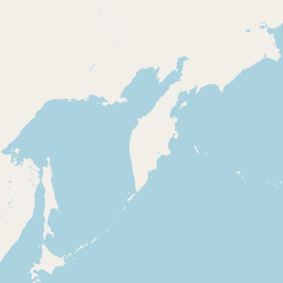


Leaflet | <a href="https://www.openstreetmap.org/copyright">© OpenStreetMap contributors</a>
Item
| Property | Value |
|---|---|
| id | 1423796 |
| downstream_mainstem_id | https://geoconnex.us/ref/mainstems/1423587 |
| encompassing_mainstem_basins | ['https://geoconnex.us/ref/mainstems/1423587'] |
| featuretype | ['https://www.opengis.net/def/schema/hy_features/hyf/HY_FlowPath', 'https://www.opengis.net/def/schema/hy_features/hyf/HY_WaterBody'] |
| fid | 29387 |
| head_2020huc12 | 170401010201 |
| head_nhdpv1_comid | 23123613 |
| head_nhdpv2_comid | https://geoconnex.us/nhdplusv2/comid/23123613 |
| head_nhdpv2huc12 | https://geoconnex.us/nhdplusv2/huc12/170401010101 |
| head_rf1id | 47697 |
| lengthkm | 1703.0 |
| name_at_outlet | Snake River |
| name_at_outlet_gnis_id | 1533479 |
| new_mainstemid | |
| outlet_2020huc12 | 170601100404 |
| outlet_drainagearea_sqkm | 243230.0 |
| outlet_nhdpv1_comid | 23475172 |
| outlet_nhdpv2_comid | https://geoconnex.us/nhdplusv2/comid/23475172 |
| outlet_nhdpv2huc12 | https://geoconnex.us/nhdplusv2/huc12/170601100404 |
| outlet_rf1id | 62117 |
| superseded | False |
| uri | https://geoconnex.us/ref/mainstems/1423796 |
Graph Results
| monitoringLocation | https://sta.geoconnex.dev/collections/USGS/Things/items/'USGS-13172500' |
|---|---|
| siteName | USGS-13172500 |
| datasetDescription | Gage height / USGS-13172500-113337b9bf774b4293fe8f73e24bd013 |
| type | Stream |
| url | https://waterdata.usgs.gov/monitoring-location/13172500/#parameterCode=00065 |
| variableMeasured | Gage height / USGS-13172500-113337b9bf774b4293fe8f73e24bd013 |
| variableUnit | ft |
| measurementTechnique | observation |
| temporalCoverage | 2024-08-30T09:15:00Z/2024-09-09T18:15:00Z |
| distributionName | USGS SensorThings API |
| distributionURL | https://labs.waterdata.usgs.gov/sta/v1.1/Datastreams('113337b9bf774b4293fe8f73e24bd013')?$expand=Thing,Observations |
| distributionFormat | application/json |
| wkt | POINT (-116.390638888889 43.2548138888889) |
| monitoringLocation | https://sta.geoconnex.dev/collections/USGS/Things/items/'USGS-13172500' |
|---|---|
| siteName | USGS-13172500 |
| datasetDescription | Gage height / USGS-13172500-113337b9bf774b4293fe8f73e24bd013 |
| type | Stream |
| url | https://waterdata.usgs.gov/monitoring-location/13172500/#parameterCode=00065 |
| variableMeasured | Gage height / USGS-13172500-113337b9bf774b4293fe8f73e24bd013 |
| variableUnit | ft |
| measurementTechnique | observation |
| temporalCoverage | 2024-08-30T09:15:00Z/2024-09-09T18:15:00Z |
| distributionName | USGS Instantaneous Values Service |
| distributionURL | https://waterservices.usgs.gov/nwis/iv/?sites=USGS:13172500¶meterCd=00065&format=rdb |
| distributionFormat | text/tab-separated-values |
| wkt | POINT (-116.390638888889 43.2548138888889) |
| monitoringLocation | https://sta.geoconnex.dev/collections/USGS/Things/items/'USGS-13172500' |
|---|---|
| siteName | USGS-13172500 |
| datasetDescription | Discharge cubic feet per second / USGS-13172500-9a244daa95eb409399a5384a36e338dd |
| type | Stream |
| url | https://waterdata.usgs.gov/monitoring-location/13172500/#parameterCode=00060 |
| variableMeasured | Discharge |
| variableUnit | ft^3/s |
| measurementTechnique | observation |
| temporalCoverage | 2024-08-30T09:15:00Z/2024-09-09T18:15:00Z |
| distributionName | USGS Instantaneous Values Service |
| distributionURL | https://waterservices.usgs.gov/nwis/iv/?sites=USGS:13172500¶meterCd=00060&format=rdb |
| distributionFormat | text/tab-separated-values |
| wkt | POINT (-116.390638888889 43.2548138888889) |
| monitoringLocation | https://sta.geoconnex.dev/collections/USGS/Things/items/'USGS-13172500' |
|---|---|
| siteName | USGS-13172500 |
| datasetDescription | Discharge cubic feet per second / USGS-13172500-9a244daa95eb409399a5384a36e338dd |
| type | Stream |
| url | https://waterdata.usgs.gov/monitoring-location/13172500/#parameterCode=00060 |
| variableMeasured | Discharge |
| variableUnit | ft^3/s |
| measurementTechnique | observation |
| temporalCoverage | 2024-08-30T09:15:00Z/2024-09-09T18:15:00Z |
| distributionName | USGS SensorThings API |
| distributionURL | https://labs.waterdata.usgs.gov/sta/v1.1/Datastreams('9a244daa95eb409399a5384a36e338dd')?$expand=Thing,Observations |
| distributionFormat | application/json |
| wkt | POINT (-116.390638888889 43.2548138888889) |
| monitoringLocation | https://sta.geoconnex.dev/collections/USGS/Things/items/'USGS-13093383' |
|---|---|
| siteName | USGS-13093383 |
| datasetDescription | Temperature water degrees Celsius / USGS-13093383-2ecc9d3be69b4189aa8b34bf3804afab |
| type | Stream |
| url | https://waterdata.usgs.gov/monitoring-location/13093383/#parameterCode=00010 |
| variableMeasured | Temperature |
| variableUnit | degC |
| measurementTechnique | observation |
| temporalCoverage | 2024-08-30T09:15:00Z/2024-09-09T18:30:00Z |
| distributionName | USGS Instantaneous Values Service |
| distributionURL | https://waterservices.usgs.gov/nwis/iv/?sites=USGS:13093383¶meterCd=00010&format=rdb |
| distributionFormat | text/tab-separated-values |
| wkt | POINT (-114.628752777778 42.6518222222222) |
| monitoringLocation | https://sta.geoconnex.dev/collections/USGS/Things/items/'USGS-13093383' |
|---|---|
| siteName | USGS-13093383 |
| datasetDescription | Temperature water degrees Celsius / USGS-13093383-2ecc9d3be69b4189aa8b34bf3804afab |
| type | Stream |
| url | https://waterdata.usgs.gov/monitoring-location/13093383/#parameterCode=00010 |
| variableMeasured | Temperature |
| variableUnit | degC |
| measurementTechnique | observation |
| temporalCoverage | 2024-08-30T09:15:00Z/2024-09-09T18:30:00Z |
| distributionName | USGS SensorThings API |
| distributionURL | https://labs.waterdata.usgs.gov/sta/v1.1/Datastreams('2ecc9d3be69b4189aa8b34bf3804afab')?$expand=Thing,Observations |
| distributionFormat | application/json |
| wkt | POINT (-114.628752777778 42.6518222222222) |
| monitoringLocation | https://sta.geoconnex.dev/collections/USGS/Things/items/'USGS-13093383' |
|---|---|
| siteName | USGS-13093383 |
| datasetDescription | Gage height feet / USGS-13093383-ca41b3ae4fb14e27bcce3287e2c22c51 |
| type | Stream |
| url | https://waterdata.usgs.gov/monitoring-location/13093383/#parameterCode=00065 |
| variableMeasured | Gage height |
| variableUnit | ft |
| measurementTechnique | observation |
| temporalCoverage | 2024-08-30T09:15:00Z/2024-09-09T18:30:00Z |
| distributionName | USGS Instantaneous Values Service |
| distributionURL | https://waterservices.usgs.gov/nwis/iv/?sites=USGS:13093383¶meterCd=00065&format=rdb |
| distributionFormat | text/tab-separated-values |
| wkt | POINT (-114.628752777778 42.6518222222222) |
| monitoringLocation | https://sta.geoconnex.dev/collections/USGS/Things/items/'USGS-13093383' |
|---|---|
| siteName | USGS-13093383 |
| datasetDescription | Gage height feet / USGS-13093383-ca41b3ae4fb14e27bcce3287e2c22c51 |
| type | Stream |
| url | https://waterdata.usgs.gov/monitoring-location/13093383/#parameterCode=00065 |
| variableMeasured | Gage height |
| variableUnit | ft |
| measurementTechnique | observation |
| temporalCoverage | 2024-08-30T09:15:00Z/2024-09-09T18:30:00Z |
| distributionName | USGS SensorThings API |
| distributionURL | https://labs.waterdata.usgs.gov/sta/v1.1/Datastreams('ca41b3ae4fb14e27bcce3287e2c22c51')?$expand=Thing,Observations |
| distributionFormat | application/json |
| wkt | POINT (-114.628752777778 42.6518222222222) |
| monitoringLocation | https://sta.geoconnex.dev/collections/USGS/Things/items/'USGS-13093383' |
|---|---|
| siteName | USGS-13093383 |
| datasetDescription | Turbidity FNU / USGS-13093383-38fea22f239f402b8bd3188b48decb93 |
| type | Stream |
| url | https://waterdata.usgs.gov/monitoring-location/13093383/#parameterCode=63680 |
| variableMeasured | Turbidity |
| variableUnit | _FNU |
| measurementTechnique | observation |
| temporalCoverage | 2024-08-30T09:15:00Z/2024-09-09T18:30:00Z |
| distributionName | USGS SensorThings API |
| distributionURL | https://labs.waterdata.usgs.gov/sta/v1.1/Datastreams('38fea22f239f402b8bd3188b48decb93')?$expand=Thing,Observations |
| distributionFormat | application/json |
| wkt | POINT (-114.628752777778 42.6518222222222) |
| monitoringLocation | https://sta.geoconnex.dev/collections/USGS/Things/items/'USGS-13093383' |
|---|---|
| siteName | USGS-13093383 |
| datasetDescription | Turbidity FNU / USGS-13093383-38fea22f239f402b8bd3188b48decb93 |
| type | Stream |
| url | https://waterdata.usgs.gov/monitoring-location/13093383/#parameterCode=63680 |
| variableMeasured | Turbidity |
| variableUnit | _FNU |
| measurementTechnique | observation |
| temporalCoverage | 2024-08-30T09:15:00Z/2024-09-09T18:30:00Z |
| distributionName | USGS Instantaneous Values Service |
| distributionURL | https://waterservices.usgs.gov/nwis/iv/?sites=USGS:13093383¶meterCd=63680&format=rdb |
| distributionFormat | text/tab-separated-values |
| wkt | POINT (-114.628752777778 42.6518222222222) |
| monitoringLocation | https://sta.geoconnex.dev/collections/USGS/Things/items/'USGS-13093383' |
|---|---|
| siteName | USGS-13093383 |
| datasetDescription | Discharge / USGS-13093383-5f40c3178c6148408dc9fba90334f922 |
| type | Stream |
| url | https://waterdata.usgs.gov/monitoring-location/13093383/#parameterCode=00060 |
| variableMeasured | Discharge / USGS-13093383-5f40c3178c6148408dc9fba90334f922 |
| variableUnit | ft^3/s |
| measurementTechnique | observation |
| temporalCoverage | 2024-08-30T09:15:00Z/2024-09-09T18:30:00Z |
| distributionName | USGS Instantaneous Values Service |
| distributionURL | https://waterservices.usgs.gov/nwis/iv/?sites=USGS:13093383¶meterCd=00060&format=rdb |
| distributionFormat | text/tab-separated-values |
| wkt | POINT (-114.628752777778 42.6518222222222) |
| monitoringLocation | https://sta.geoconnex.dev/collections/USGS/Things/items/'USGS-13093383' |
|---|---|
| siteName | USGS-13093383 |
| datasetDescription | Discharge / USGS-13093383-5f40c3178c6148408dc9fba90334f922 |
| type | Stream |
| url | https://waterdata.usgs.gov/monitoring-location/13093383/#parameterCode=00060 |
| variableMeasured | Discharge / USGS-13093383-5f40c3178c6148408dc9fba90334f922 |
| variableUnit | ft^3/s |
| measurementTechnique | observation |
| temporalCoverage | 2024-08-30T09:15:00Z/2024-09-09T18:30:00Z |
| distributionName | USGS SensorThings API |
| distributionURL | https://labs.waterdata.usgs.gov/sta/v1.1/Datastreams('5f40c3178c6148408dc9fba90334f922')?$expand=Thing,Observations |
| distributionFormat | application/json |
| wkt | POINT (-114.628752777778 42.6518222222222) |
| monitoringLocation | https://sta.geoconnex.dev/collections/USGS/Things/items/'USGS-13093383' |
|---|---|
| siteName | USGS-13093383 |
| datasetDescription | Specific cond at 25C / USGS-13093383-4c60cde1fe1e41238476a6bcd85da17f |
| type | Stream |
| url | https://waterdata.usgs.gov/monitoring-location/13093383/#parameterCode=00095 |
| variableMeasured | Specific cond at 25C / USGS-13093383-4c60cde1fe1e41238476a6bcd85da17f |
| variableUnit | uS/cm |
| measurementTechnique | observation |
| temporalCoverage | 2024-08-30T09:15:00Z/2024-09-09T18:30:00Z |
| distributionName | USGS Instantaneous Values Service |
| distributionURL | https://waterservices.usgs.gov/nwis/iv/?sites=USGS:13093383¶meterCd=00095&format=rdb |
| distributionFormat | text/tab-separated-values |
| wkt | POINT (-114.628752777778 42.6518222222222) |
| monitoringLocation | https://sta.geoconnex.dev/collections/USGS/Things/items/'USGS-13093383' |
|---|---|
| siteName | USGS-13093383 |
| datasetDescription | Specific cond at 25C / USGS-13093383-4c60cde1fe1e41238476a6bcd85da17f |
| type | Stream |
| url | https://waterdata.usgs.gov/monitoring-location/13093383/#parameterCode=00095 |
| variableMeasured | Specific cond at 25C / USGS-13093383-4c60cde1fe1e41238476a6bcd85da17f |
| variableUnit | uS/cm |
| measurementTechnique | observation |
| temporalCoverage | 2024-08-30T09:15:00Z/2024-09-09T18:30:00Z |
| distributionName | USGS SensorThings API |
| distributionURL | https://labs.waterdata.usgs.gov/sta/v1.1/Datastreams('4c60cde1fe1e41238476a6bcd85da17f')?$expand=Thing,Observations |
| distributionFormat | application/json |
| wkt | POINT (-114.628752777778 42.6518222222222) |
| monitoringLocation | https://sta.geoconnex.dev/collections/USGS/Things/items/'USGS-13087995' |
|---|---|
| siteName | USGS-13087995 |
| datasetDescription | Discharge / USGS-13087995-2a5b707b55614196abceaaa009e0a8a2 |
| type | Stream |
| url | https://waterdata.usgs.gov/monitoring-location/13087995/#parameterCode=00060 |
| variableMeasured | Discharge / USGS-13087995-2a5b707b55614196abceaaa009e0a8a2 |
| variableUnit | ft^3/s |
| measurementTechnique | observation |
| temporalCoverage | 2024-08-30T09:15:00Z/2024-09-09T18:30:00Z |
| distributionName | USGS Instantaneous Values Service |
| distributionURL | https://waterservices.usgs.gov/nwis/iv/?sites=USGS:13087995¶meterCd=00060&format=rdb |
| distributionFormat | text/tab-separated-values |
| wkt | POINT (-114.018333333333 42.5280555555556) |
| monitoringLocation | https://sta.geoconnex.dev/collections/USGS/Things/items/'USGS-13087995' |
|---|---|
| siteName | USGS-13087995 |
| datasetDescription | Discharge / USGS-13087995-2a5b707b55614196abceaaa009e0a8a2 |
| type | Stream |
| url | https://waterdata.usgs.gov/monitoring-location/13087995/#parameterCode=00060 |
| variableMeasured | Discharge / USGS-13087995-2a5b707b55614196abceaaa009e0a8a2 |
| variableUnit | ft^3/s |
| measurementTechnique | observation |
| temporalCoverage | 2024-08-30T09:15:00Z/2024-09-09T18:30:00Z |
| distributionName | USGS SensorThings API |
| distributionURL | https://labs.waterdata.usgs.gov/sta/v1.1/Datastreams('2a5b707b55614196abceaaa009e0a8a2')?$expand=Thing,Observations |
| distributionFormat | application/json |
| wkt | POINT (-114.018333333333 42.5280555555556) |
| monitoringLocation | https://sta.geoconnex.dev/collections/USGS/Things/items/'USGS-13087995' |
|---|---|
| siteName | USGS-13087995 |
| datasetDescription | Gage height / USGS-13087995-f396ea3c245a4ed880fb99d2fb1913a4 |
| type | Stream |
| url | https://waterdata.usgs.gov/monitoring-location/13087995/#parameterCode=00065 |
| variableMeasured | Gage height / USGS-13087995-f396ea3c245a4ed880fb99d2fb1913a4 |
| variableUnit | ft |
| measurementTechnique | observation |
| temporalCoverage | 2024-08-30T09:15:00Z/2024-09-09T18:30:00Z |
| distributionName | USGS Instantaneous Values Service |
| distributionURL | https://waterservices.usgs.gov/nwis/iv/?sites=USGS:13087995¶meterCd=00065&format=rdb |
| distributionFormat | text/tab-separated-values |
| wkt | POINT (-114.018333333333 42.5280555555556) |
| monitoringLocation | https://sta.geoconnex.dev/collections/USGS/Things/items/'USGS-13087995' |
|---|---|
| siteName | USGS-13087995 |
| datasetDescription | Gage height / USGS-13087995-f396ea3c245a4ed880fb99d2fb1913a4 |
| type | Stream |
| url | https://waterdata.usgs.gov/monitoring-location/13087995/#parameterCode=00065 |
| variableMeasured | Gage height / USGS-13087995-f396ea3c245a4ed880fb99d2fb1913a4 |
| variableUnit | ft |
| measurementTechnique | observation |
| temporalCoverage | 2024-08-30T09:15:00Z/2024-09-09T18:30:00Z |
| distributionName | USGS SensorThings API |
| distributionURL | https://labs.waterdata.usgs.gov/sta/v1.1/Datastreams('f396ea3c245a4ed880fb99d2fb1913a4')?$expand=Thing,Observations |
| distributionFormat | application/json |
| wkt | POINT (-114.018333333333 42.5280555555556) |
| monitoringLocation | https://sta.geoconnex.dev/collections/USGS/Things/items/'USGS-13317660' |
|---|---|
| siteName | USGS-13317660 |
| datasetDescription | Discharge / USGS-13317660-0dd77a0f72f94aa99eb0fee5792e7a26 |
| type | Stream |
| url | https://waterdata.usgs.gov/monitoring-location/13317660/#parameterCode=00060 |
| variableMeasured | Discharge / USGS-13317660-0dd77a0f72f94aa99eb0fee5792e7a26 |
| variableUnit | ft^3/s |
| measurementTechnique | observation |
| temporalCoverage | 2024-08-30T09:15:00Z/2024-09-09T18:45:00Z |
| distributionName | USGS Instantaneous Values Service |
| distributionURL | https://waterservices.usgs.gov/nwis/iv/?sites=USGS:13317660¶meterCd=00060&format=rdb |
| distributionFormat | text/tab-separated-values |
| wkt | POINT (-116.916944444444 46.0030555555556) |
| monitoringLocation | https://sta.geoconnex.dev/collections/USGS/Things/items/'USGS-13317660' |
|---|---|
| siteName | USGS-13317660 |
| datasetDescription | Discharge / USGS-13317660-0dd77a0f72f94aa99eb0fee5792e7a26 |
| type | Stream |
| url | https://waterdata.usgs.gov/monitoring-location/13317660/#parameterCode=00060 |
| variableMeasured | Discharge / USGS-13317660-0dd77a0f72f94aa99eb0fee5792e7a26 |
| variableUnit | ft^3/s |
| measurementTechnique | observation |
| temporalCoverage | 2024-08-30T09:15:00Z/2024-09-09T18:45:00Z |
| distributionName | USGS SensorThings API |
| distributionURL | https://labs.waterdata.usgs.gov/sta/v1.1/Datastreams('0dd77a0f72f94aa99eb0fee5792e7a26')?$expand=Thing,Observations |
| distributionFormat | application/json |
| wkt | POINT (-116.916944444444 46.0030555555556) |
| monitoringLocation | https://sta.geoconnex.dev/collections/USGS/Things/items/'USGS-13317660' |
|---|---|
| siteName | USGS-13317660 |
| datasetDescription | Temperature water / USGS-13317660-3a1ad82652ba48fda4d660627026f3f4 |
| type | Stream |
| url | https://waterdata.usgs.gov/monitoring-location/13317660/#parameterCode=00010 |
| variableMeasured | Temperature |
| variableUnit | degC |
| measurementTechnique | observation |
| temporalCoverage | 2024-08-30T09:15:00Z/2024-09-09T18:45:00Z |
| distributionName | USGS Instantaneous Values Service |
| distributionURL | https://waterservices.usgs.gov/nwis/iv/?sites=USGS:13317660¶meterCd=00010&format=rdb |
| distributionFormat | text/tab-separated-values |
| wkt | POINT (-116.916944444444 46.0030555555556) |
| monitoringLocation | https://sta.geoconnex.dev/collections/USGS/Things/items/'USGS-13317660' |
|---|---|
| siteName | USGS-13317660 |
| datasetDescription | Temperature water / USGS-13317660-3a1ad82652ba48fda4d660627026f3f4 |
| type | Stream |
| url | https://waterdata.usgs.gov/monitoring-location/13317660/#parameterCode=00010 |
| variableMeasured | Temperature |
| variableUnit | degC |
| measurementTechnique | observation |
| temporalCoverage | 2024-08-30T09:15:00Z/2024-09-09T18:45:00Z |
| distributionName | USGS SensorThings API |
| distributionURL | https://labs.waterdata.usgs.gov/sta/v1.1/Datastreams('3a1ad82652ba48fda4d660627026f3f4')?$expand=Thing,Observations |
| distributionFormat | application/json |
| wkt | POINT (-116.916944444444 46.0030555555556) |
| monitoringLocation | https://sta.geoconnex.dev/collections/USGS/Things/items/'USGS-13317660' |
|---|---|
| siteName | USGS-13317660 |
| datasetDescription | Gage height / USGS-13317660-b9b9f1a598704134917941822a6ea6d4 |
| type | Stream |
| url | https://waterdata.usgs.gov/monitoring-location/13317660/#parameterCode=00065 |
| variableMeasured | Gage height / USGS-13317660-b9b9f1a598704134917941822a6ea6d4 |
| variableUnit | ft |
| measurementTechnique | observation |
| temporalCoverage | 2024-08-30T09:15:00Z/2024-09-09T18:45:00Z |
| distributionName | USGS Instantaneous Values Service |
| distributionURL | https://waterservices.usgs.gov/nwis/iv/?sites=USGS:13317660¶meterCd=00065&format=rdb |
| distributionFormat | text/tab-separated-values |
| wkt | POINT (-116.916944444444 46.0030555555556) |
| monitoringLocation | https://sta.geoconnex.dev/collections/USGS/Things/items/'USGS-13317660' |
|---|---|
| siteName | USGS-13317660 |
| datasetDescription | Gage height / USGS-13317660-b9b9f1a598704134917941822a6ea6d4 |
| type | Stream |
| url | https://waterdata.usgs.gov/monitoring-location/13317660/#parameterCode=00065 |
| variableMeasured | Gage height / USGS-13317660-b9b9f1a598704134917941822a6ea6d4 |
| variableUnit | ft |
| measurementTechnique | observation |
| temporalCoverage | 2024-08-30T09:15:00Z/2024-09-09T18:45:00Z |
| distributionName | USGS SensorThings API |
| distributionURL | https://labs.waterdata.usgs.gov/sta/v1.1/Datastreams('b9b9f1a598704134917941822a6ea6d4')?$expand=Thing,Observations |
| distributionFormat | application/json |
| wkt | POINT (-116.916944444444 46.0030555555556) |
| monitoringLocation | https://sta.geoconnex.dev/collections/USGS/Things/items/'USGS-13213100' |
|---|---|
| siteName | USGS-13213100 |
| datasetDescription | Gage height / USGS-13213100-35c252ac5d054cd289c4e1a6f61e9215 |
| type | Stream |
| url | https://waterdata.usgs.gov/monitoring-location/13213100/#parameterCode=00065 |
| variableMeasured | Gage height / USGS-13213100-35c252ac5d054cd289c4e1a6f61e9215 |
| variableUnit | ft |
| measurementTechnique | observation |
| temporalCoverage | 2024-08-30T09:15:00Z/2024-09-09T18:30:00Z |
| distributionName | USGS Instantaneous Values Service |
| distributionURL | https://waterservices.usgs.gov/nwis/iv/?sites=USGS:13213100¶meterCd=00065&format=rdb |
| distributionFormat | text/tab-separated-values |
| wkt | POINT (-116.9825 43.8761111111111) |
| monitoringLocation | https://sta.geoconnex.dev/collections/USGS/Things/items/'USGS-13213100' |
|---|---|
| siteName | USGS-13213100 |
| datasetDescription | Gage height / USGS-13213100-35c252ac5d054cd289c4e1a6f61e9215 |
| type | Stream |
| url | https://waterdata.usgs.gov/monitoring-location/13213100/#parameterCode=00065 |
| variableMeasured | Gage height / USGS-13213100-35c252ac5d054cd289c4e1a6f61e9215 |
| variableUnit | ft |
| measurementTechnique | observation |
| temporalCoverage | 2024-08-30T09:15:00Z/2024-09-09T18:30:00Z |
| distributionName | USGS SensorThings API |
| distributionURL | https://labs.waterdata.usgs.gov/sta/v1.1/Datastreams('35c252ac5d054cd289c4e1a6f61e9215')?$expand=Thing,Observations |
| distributionFormat | application/json |
| wkt | POINT (-116.9825 43.8761111111111) |
| monitoringLocation | https://sta.geoconnex.dev/collections/USGS/Things/items/'USGS-13213100' |
|---|---|
| siteName | USGS-13213100 |
| datasetDescription | Discharge / USGS-13213100-e20178eeaab54a70b0925dc30ec83ef3 |
| type | Stream |
| url | https://waterdata.usgs.gov/monitoring-location/13213100/#parameterCode=00060 |
| variableMeasured | Discharge / USGS-13213100-e20178eeaab54a70b0925dc30ec83ef3 |
| variableUnit | ft^3/s |
| measurementTechnique | observation |
| temporalCoverage | 2024-08-30T09:15:00Z/2024-09-09T18:30:00Z |
| distributionName | USGS Instantaneous Values Service |
| distributionURL | https://waterservices.usgs.gov/nwis/iv/?sites=USGS:13213100¶meterCd=00060&format=rdb |
| distributionFormat | text/tab-separated-values |
| wkt | POINT (-116.9825 43.8761111111111) |
| monitoringLocation | https://sta.geoconnex.dev/collections/USGS/Things/items/'USGS-13213100' |
|---|---|
| siteName | USGS-13213100 |
| datasetDescription | Discharge / USGS-13213100-e20178eeaab54a70b0925dc30ec83ef3 |
| type | Stream |
| url | https://waterdata.usgs.gov/monitoring-location/13213100/#parameterCode=00060 |
| variableMeasured | Discharge / USGS-13213100-e20178eeaab54a70b0925dc30ec83ef3 |
| variableUnit | ft^3/s |
| measurementTechnique | observation |
| temporalCoverage | 2024-08-30T09:15:00Z/2024-09-09T18:30:00Z |
| distributionName | USGS SensorThings API |
| distributionURL | https://labs.waterdata.usgs.gov/sta/v1.1/Datastreams('e20178eeaab54a70b0925dc30ec83ef3')?$expand=Thing,Observations |
| distributionFormat | application/json |
| wkt | POINT (-116.9825 43.8761111111111) |
| monitoringLocation | https://sta.geoconnex.dev/collections/USGS/Things/items/'USGS-13057000' |
|---|---|
| siteName | USGS-13057000 |
| datasetDescription | Gage height / USGS-13057000-73dce2b966c24d0b888659779909303d |
| type | Stream |
| url | https://waterdata.usgs.gov/monitoring-location/13057000/#parameterCode=00065 |
| variableMeasured | Gage height / USGS-13057000-73dce2b966c24d0b888659779909303d |
| variableUnit | ft |
| measurementTechnique | observation |
| temporalCoverage | 2024-08-30T09:15:00Z/2024-09-09T18:30:00Z |
| distributionName | USGS Instantaneous Values Service |
| distributionURL | https://waterservices.usgs.gov/nwis/iv/?sites=USGS:13057000¶meterCd=00065&format=rdb |
| distributionFormat | text/tab-separated-values |
| wkt | POINT (-111.979166666667 43.7527777777778) |
| monitoringLocation | https://sta.geoconnex.dev/collections/USGS/Things/items/'USGS-13057000' |
|---|---|
| siteName | USGS-13057000 |
| datasetDescription | Gage height / USGS-13057000-73dce2b966c24d0b888659779909303d |
| type | Stream |
| url | https://waterdata.usgs.gov/monitoring-location/13057000/#parameterCode=00065 |
| variableMeasured | Gage height / USGS-13057000-73dce2b966c24d0b888659779909303d |
| variableUnit | ft |
| measurementTechnique | observation |
| temporalCoverage | 2024-08-30T09:15:00Z/2024-09-09T18:30:00Z |
| distributionName | USGS SensorThings API |
| distributionURL | https://labs.waterdata.usgs.gov/sta/v1.1/Datastreams('73dce2b966c24d0b888659779909303d')?$expand=Thing,Observations |
| distributionFormat | application/json |
| wkt | POINT (-111.979166666667 43.7527777777778) |
| monitoringLocation | https://sta.geoconnex.dev/collections/USGS/Things/items/'USGS-13057000' |
|---|---|
| siteName | USGS-13057000 |
| datasetDescription | Discharge / USGS-13057000-e4ef0509a88745a9b9cbc0ccd0ebec96 |
| type | Stream |
| url | https://waterdata.usgs.gov/monitoring-location/13057000/#parameterCode=00060 |
| variableMeasured | Discharge / USGS-13057000-e4ef0509a88745a9b9cbc0ccd0ebec96 |
| variableUnit | ft^3/s |
| measurementTechnique | observation |
| temporalCoverage | 2024-08-30T09:15:00Z/2024-09-09T18:30:00Z |
| distributionName | USGS Instantaneous Values Service |
| distributionURL | https://waterservices.usgs.gov/nwis/iv/?sites=USGS:13057000¶meterCd=00060&format=rdb |
| distributionFormat | text/tab-separated-values |
| wkt | POINT (-111.979166666667 43.7527777777778) |
| monitoringLocation | https://sta.geoconnex.dev/collections/USGS/Things/items/'USGS-13057000' |
|---|---|
| siteName | USGS-13057000 |
| datasetDescription | Discharge / USGS-13057000-e4ef0509a88745a9b9cbc0ccd0ebec96 |
| type | Stream |
| url | https://waterdata.usgs.gov/monitoring-location/13057000/#parameterCode=00060 |
| variableMeasured | Discharge / USGS-13057000-e4ef0509a88745a9b9cbc0ccd0ebec96 |
| variableUnit | ft^3/s |
| measurementTechnique | observation |
| temporalCoverage | 2024-08-30T09:15:00Z/2024-09-09T18:30:00Z |
| distributionName | USGS SensorThings API |
| distributionURL | https://labs.waterdata.usgs.gov/sta/v1.1/Datastreams('e4ef0509a88745a9b9cbc0ccd0ebec96')?$expand=Thing,Observations |
| distributionFormat | application/json |
| wkt | POINT (-111.979166666667 43.7527777777778) |
| monitoringLocation | https://sta.geoconnex.dev/collections/USGS/Things/items/'USGS-13058529' |
|---|---|
| siteName | USGS-13058529 |
| datasetDescription | Gage height feet / USGS-13058529-9856b2de17354517965e8f81421e8a4a |
| type | Stream |
| url | https://waterdata.usgs.gov/monitoring-location/13058529/#parameterCode=00065 |
| variableMeasured | Gage height |
| variableUnit | ft |
| measurementTechnique | observation |
| temporalCoverage | 2024-08-30T09:15:00Z/2024-09-09T18:30:00Z |
| distributionName | USGS Instantaneous Values Service |
| distributionURL | https://waterservices.usgs.gov/nwis/iv/?sites=USGS:13058529¶meterCd=00065&format=rdb |
| distributionFormat | text/tab-separated-values |
| wkt | POINT (-112.048055555556 43.5747222222222) |
| monitoringLocation | https://sta.geoconnex.dev/collections/USGS/Things/items/'USGS-13058529' |
|---|---|
| siteName | USGS-13058529 |
| datasetDescription | Gage height feet / USGS-13058529-9856b2de17354517965e8f81421e8a4a |
| type | Stream |
| url | https://waterdata.usgs.gov/monitoring-location/13058529/#parameterCode=00065 |
| variableMeasured | Gage height |
| variableUnit | ft |
| measurementTechnique | observation |
| temporalCoverage | 2024-08-30T09:15:00Z/2024-09-09T18:30:00Z |
| distributionName | USGS SensorThings API |
| distributionURL | https://labs.waterdata.usgs.gov/sta/v1.1/Datastreams('9856b2de17354517965e8f81421e8a4a')?$expand=Thing,Observations |
| distributionFormat | application/json |
| wkt | POINT (-112.048055555556 43.5747222222222) |
| monitoringLocation | https://sta.geoconnex.dev/collections/USGS/Things/items/'USGS-13058529' |
|---|---|
| siteName | USGS-13058529 |
| datasetDescription | Discharge / USGS-13058529-a8de8643ffe3474da8d7555b2a3d6b4b |
| type | Stream |
| url | https://waterdata.usgs.gov/monitoring-location/13058529/#parameterCode=00060 |
| variableMeasured | Discharge / USGS-13058529-a8de8643ffe3474da8d7555b2a3d6b4b |
| variableUnit | ft^3/s |
| measurementTechnique | observation |
| temporalCoverage | 2024-08-30T09:15:00Z/2024-09-09T18:30:00Z |
| distributionName | USGS Instantaneous Values Service |
| distributionURL | https://waterservices.usgs.gov/nwis/iv/?sites=USGS:13058529¶meterCd=00060&format=rdb |
| distributionFormat | text/tab-separated-values |
| wkt | POINT (-112.048055555556 43.5747222222222) |
| monitoringLocation | https://sta.geoconnex.dev/collections/USGS/Things/items/'USGS-13058529' |
|---|---|
| siteName | USGS-13058529 |
| datasetDescription | Discharge / USGS-13058529-a8de8643ffe3474da8d7555b2a3d6b4b |
| type | Stream |
| url | https://waterdata.usgs.gov/monitoring-location/13058529/#parameterCode=00060 |
| variableMeasured | Discharge / USGS-13058529-a8de8643ffe3474da8d7555b2a3d6b4b |
| variableUnit | ft^3/s |
| measurementTechnique | observation |
| temporalCoverage | 2024-08-30T09:15:00Z/2024-09-09T18:30:00Z |
| distributionName | USGS SensorThings API |
| distributionURL | https://labs.waterdata.usgs.gov/sta/v1.1/Datastreams('a8de8643ffe3474da8d7555b2a3d6b4b')?$expand=Thing,Observations |
| distributionFormat | application/json |
| wkt | POINT (-112.048055555556 43.5747222222222) |
| monitoringLocation | https://sta.geoconnex.dev/collections/USGS/Things/items/'USGS-13290450' |
|---|---|
| siteName | USGS-13290450 |
| datasetDescription | Discharge / USGS-13290450-f0171a9a77464f01891a7458a5c10d9b |
| type | Stream |
| url | https://waterdata.usgs.gov/monitoring-location/13290450/#parameterCode=00060 |
| variableMeasured | Discharge / USGS-13290450-f0171a9a77464f01891a7458a5c10d9b |
| variableUnit | ft^3/s |
| measurementTechnique | observation |
| temporalCoverage | 2024-08-30T09:15:00Z/2024-09-09T18:30:00Z |
| distributionName | USGS Instantaneous Values Service |
| distributionURL | https://waterservices.usgs.gov/nwis/iv/?sites=USGS:13290450¶meterCd=00060&format=rdb |
| distributionFormat | text/tab-separated-values |
| wkt | POINT (-116.696944444444 45.2544444444444) |
| monitoringLocation | https://sta.geoconnex.dev/collections/USGS/Things/items/'USGS-13290450' |
|---|---|
| siteName | USGS-13290450 |
| datasetDescription | Discharge / USGS-13290450-f0171a9a77464f01891a7458a5c10d9b |
| type | Stream |
| url | https://waterdata.usgs.gov/monitoring-location/13290450/#parameterCode=00060 |
| variableMeasured | Discharge / USGS-13290450-f0171a9a77464f01891a7458a5c10d9b |
| variableUnit | ft^3/s |
| measurementTechnique | observation |
| temporalCoverage | 2024-08-30T09:15:00Z/2024-09-09T18:30:00Z |
| distributionName | USGS SensorThings API |
| distributionURL | https://labs.waterdata.usgs.gov/sta/v1.1/Datastreams('f0171a9a77464f01891a7458a5c10d9b')?$expand=Thing,Observations |
| distributionFormat | application/json |
| wkt | POINT (-116.696944444444 45.2544444444444) |
| monitoringLocation | https://sta.geoconnex.dev/collections/USGS/Things/items/'USGS-13290450' |
|---|---|
| siteName | USGS-13290450 |
| datasetDescription | Gage height / USGS-13290450-0cb1465757654f6a90fd1696fa654381 |
| type | Stream |
| url | https://waterdata.usgs.gov/monitoring-location/13290450/#parameterCode=00065 |
| variableMeasured | Gage height / USGS-13290450-0cb1465757654f6a90fd1696fa654381 |
| variableUnit | ft |
| measurementTechnique | observation |
| temporalCoverage | 2024-08-30T09:15:00Z/2024-09-09T18:30:00Z |
| distributionName | USGS Instantaneous Values Service |
| distributionURL | https://waterservices.usgs.gov/nwis/iv/?sites=USGS:13290450¶meterCd=00065&format=rdb |
| distributionFormat | text/tab-separated-values |
| wkt | POINT (-116.696944444444 45.2544444444444) |
| monitoringLocation | https://sta.geoconnex.dev/collections/USGS/Things/items/'USGS-13290450' |
|---|---|
| siteName | USGS-13290450 |
| datasetDescription | Gage height / USGS-13290450-0cb1465757654f6a90fd1696fa654381 |
| type | Stream |
| url | https://waterdata.usgs.gov/monitoring-location/13290450/#parameterCode=00065 |
| variableMeasured | Gage height / USGS-13290450-0cb1465757654f6a90fd1696fa654381 |
| variableUnit | ft |
| measurementTechnique | observation |
| temporalCoverage | 2024-08-30T09:15:00Z/2024-09-09T18:30:00Z |
| distributionName | USGS SensorThings API |
| distributionURL | https://labs.waterdata.usgs.gov/sta/v1.1/Datastreams('0cb1465757654f6a90fd1696fa654381')?$expand=Thing,Observations |
| distributionFormat | application/json |
| wkt | POINT (-116.696944444444 45.2544444444444) |
| monitoringLocation | https://sta.geoconnex.dev/collections/USGS/Things/items/'USGS-13094000' |
|---|---|
| siteName | USGS-13094000 |
| datasetDescription | Discharge / USGS-13094000-a3a136b731254468a9713f656b9ca142 |
| type | Stream |
| url | https://waterdata.usgs.gov/monitoring-location/13094000/#parameterCode=00060 |
| variableMeasured | Discharge / USGS-13094000-a3a136b731254468a9713f656b9ca142 |
| variableUnit | ft^3/s |
| measurementTechnique | observation |
| temporalCoverage | 2024-08-30T09:15:00Z/2024-09-09T18:30:00Z |
| distributionName | USGS Instantaneous Values Service |
| distributionURL | https://waterservices.usgs.gov/nwis/iv/?sites=USGS:13094000¶meterCd=00060&format=rdb |
| distributionFormat | text/tab-separated-values |
| wkt | POINT (-114.712222222222 42.6658333333333) |
| monitoringLocation | https://sta.geoconnex.dev/collections/USGS/Things/items/'USGS-13094000' |
|---|---|
| siteName | USGS-13094000 |
| datasetDescription | Discharge / USGS-13094000-a3a136b731254468a9713f656b9ca142 |
| type | Stream |
| url | https://waterdata.usgs.gov/monitoring-location/13094000/#parameterCode=00060 |
| variableMeasured | Discharge / USGS-13094000-a3a136b731254468a9713f656b9ca142 |
| variableUnit | ft^3/s |
| measurementTechnique | observation |
| temporalCoverage | 2024-08-30T09:15:00Z/2024-09-09T18:30:00Z |
| distributionName | USGS SensorThings API |
| distributionURL | https://labs.waterdata.usgs.gov/sta/v1.1/Datastreams('a3a136b731254468a9713f656b9ca142')?$expand=Thing,Observations |
| distributionFormat | application/json |
| wkt | POINT (-114.712222222222 42.6658333333333) |
| monitoringLocation | https://sta.geoconnex.dev/collections/USGS/Things/items/'USGS-13094000' |
|---|---|
| siteName | USGS-13094000 |
| datasetDescription | Gage height feet / USGS-13094000-09ef238e7dee4e8d989c953fffb27cce |
| type | Stream |
| url | https://waterdata.usgs.gov/monitoring-location/13094000/#parameterCode=00065 |
| variableMeasured | Gage height |
| variableUnit | ft |
| measurementTechnique | observation |
| temporalCoverage | 2024-08-30T09:15:00Z/2024-09-09T18:30:00Z |
| distributionName | USGS Instantaneous Values Service |
| distributionURL | https://waterservices.usgs.gov/nwis/iv/?sites=USGS:13094000¶meterCd=00065&format=rdb |
| distributionFormat | text/tab-separated-values |
| wkt | POINT (-114.712222222222 42.6658333333333) |
| monitoringLocation | https://sta.geoconnex.dev/collections/USGS/Things/items/'USGS-13094000' |
|---|---|
| siteName | USGS-13094000 |
| datasetDescription | Gage height feet / USGS-13094000-09ef238e7dee4e8d989c953fffb27cce |
| type | Stream |
| url | https://waterdata.usgs.gov/monitoring-location/13094000/#parameterCode=00065 |
| variableMeasured | Gage height |
| variableUnit | ft |
| measurementTechnique | observation |
| temporalCoverage | 2024-08-30T09:15:00Z/2024-09-09T18:30:00Z |
| distributionName | USGS SensorThings API |
| distributionURL | https://labs.waterdata.usgs.gov/sta/v1.1/Datastreams('09ef238e7dee4e8d989c953fffb27cce')?$expand=Thing,Observations |
| distributionFormat | application/json |
| wkt | POINT (-114.712222222222 42.6658333333333) |
| monitoringLocation | https://sta.geoconnex.dev/collections/USGS/Things/items/'USGS-13010065' |
|---|---|
| siteName | USGS-13010065 |
| datasetDescription | Gage height / USGS-13010065-23109959f51342dd84df9e52c7a2a728 |
| type | Stream |
| url | https://waterdata.usgs.gov/monitoring-location/13010065/#parameterCode=00065 |
| variableMeasured | Gage height / USGS-13010065-23109959f51342dd84df9e52c7a2a728 |
| variableUnit | ft |
| measurementTechnique | observation |
| temporalCoverage | 2024-08-30T09:15:00Z/2024-09-09T18:30:00Z |
| distributionName | USGS SensorThings API |
| distributionURL | https://labs.waterdata.usgs.gov/sta/v1.1/Datastreams('23109959f51342dd84df9e52c7a2a728')?$expand=Thing,Observations |
| distributionFormat | application/json |
| wkt | POINT (-110.6675 44.0988888888889) |
| monitoringLocation | https://sta.geoconnex.dev/collections/USGS/Things/items/'USGS-13010065' |
|---|---|
| siteName | USGS-13010065 |
| datasetDescription | Gage height / USGS-13010065-23109959f51342dd84df9e52c7a2a728 |
| type | Stream |
| url | https://waterdata.usgs.gov/monitoring-location/13010065/#parameterCode=00065 |
| variableMeasured | Gage height / USGS-13010065-23109959f51342dd84df9e52c7a2a728 |
| variableUnit | ft |
| measurementTechnique | observation |
| temporalCoverage | 2024-08-30T09:15:00Z/2024-09-09T18:30:00Z |
| distributionName | USGS Instantaneous Values Service |
| distributionURL | https://waterservices.usgs.gov/nwis/iv/?sites=USGS:13010065¶meterCd=00065&format=rdb |
| distributionFormat | text/tab-separated-values |
| wkt | POINT (-110.6675 44.0988888888889) |
| monitoringLocation | https://sta.geoconnex.dev/collections/USGS/Things/items/'USGS-13010065' |
|---|---|
| siteName | USGS-13010065 |
| datasetDescription | Temperature water degrees Celsius / USGS-13010065-48e74b78e6f74a04b9a5266438b3f14b |
| type | Stream |
| url | https://waterdata.usgs.gov/monitoring-location/13010065/#parameterCode=00010 |
| variableMeasured | Temperature |
| variableUnit | degC |
| measurementTechnique | observation |
| temporalCoverage | 2024-08-30T09:15:00Z/2024-09-09T18:30:00Z |
| distributionName | USGS Instantaneous Values Service |
| distributionURL | https://waterservices.usgs.gov/nwis/iv/?sites=USGS:13010065¶meterCd=00010&format=rdb |
| distributionFormat | text/tab-separated-values |
| wkt | POINT (-110.6675 44.0988888888889) |
| monitoringLocation | https://sta.geoconnex.dev/collections/USGS/Things/items/'USGS-13010065' |
|---|---|
| siteName | USGS-13010065 |
| datasetDescription | Temperature water degrees Celsius / USGS-13010065-48e74b78e6f74a04b9a5266438b3f14b |
| type | Stream |
| url | https://waterdata.usgs.gov/monitoring-location/13010065/#parameterCode=00010 |
| variableMeasured | Temperature |
| variableUnit | degC |
| measurementTechnique | observation |
| temporalCoverage | 2024-08-30T09:15:00Z/2024-09-09T18:30:00Z |
| distributionName | USGS SensorThings API |
| distributionURL | https://labs.waterdata.usgs.gov/sta/v1.1/Datastreams('48e74b78e6f74a04b9a5266438b3f14b')?$expand=Thing,Observations |
| distributionFormat | application/json |
| wkt | POINT (-110.6675 44.0988888888889) |
| monitoringLocation | https://sta.geoconnex.dev/collections/USGS/Things/items/'USGS-13010065' |
|---|---|
| siteName | USGS-13010065 |
| datasetDescription | Discharge / USGS-13010065-7107b7c2f0a34019a1530fe32e3c32f9 |
| type | Stream |
| url | https://waterdata.usgs.gov/monitoring-location/13010065/#parameterCode=00060 |
| variableMeasured | Discharge / USGS-13010065-7107b7c2f0a34019a1530fe32e3c32f9 |
| variableUnit | ft^3/s |
| measurementTechnique | observation |
| temporalCoverage | 2024-08-30T09:15:00Z/2024-09-09T18:30:00Z |
| distributionName | USGS Instantaneous Values Service |
| distributionURL | https://waterservices.usgs.gov/nwis/iv/?sites=USGS:13010065¶meterCd=00060&format=rdb |
| distributionFormat | text/tab-separated-values |
| wkt | POINT (-110.6675 44.0988888888889) |
| monitoringLocation | https://sta.geoconnex.dev/collections/USGS/Things/items/'USGS-13010065' |
|---|---|
| siteName | USGS-13010065 |
| datasetDescription | Discharge / USGS-13010065-7107b7c2f0a34019a1530fe32e3c32f9 |
| type | Stream |
| url | https://waterdata.usgs.gov/monitoring-location/13010065/#parameterCode=00060 |
| variableMeasured | Discharge / USGS-13010065-7107b7c2f0a34019a1530fe32e3c32f9 |
| variableUnit | ft^3/s |
| measurementTechnique | observation |
| temporalCoverage | 2024-08-30T09:15:00Z/2024-09-09T18:30:00Z |
| distributionName | USGS SensorThings API |
| distributionURL | https://labs.waterdata.usgs.gov/sta/v1.1/Datastreams('7107b7c2f0a34019a1530fe32e3c32f9')?$expand=Thing,Observations |
| distributionFormat | application/json |
| wkt | POINT (-110.6675 44.0988888888889) |
| monitoringLocation | https://sta.geoconnex.dev/collections/USGS/Things/items/'USGS-13069500' |
|---|---|
| siteName | USGS-13069500 |
| datasetDescription | Discharge cubic feet per second / USGS-13069500-9d96208d36224e4e8cea65c6090300e3 |
| type | Stream |
| url | https://waterdata.usgs.gov/monitoring-location/13069500/#parameterCode=00060 |
| variableMeasured | Discharge |
| variableUnit | ft^3/s |
| measurementTechnique | observation |
| temporalCoverage | 2024-08-30T09:15:00Z/2024-09-09T18:15:00Z |
| distributionName | USGS Instantaneous Values Service |
| distributionURL | https://waterservices.usgs.gov/nwis/iv/?sites=USGS:13069500¶meterCd=00060&format=rdb |
| distributionFormat | text/tab-separated-values |
| wkt | POINT (-112.518888888889 43.1252777777778) |
| monitoringLocation | https://sta.geoconnex.dev/collections/USGS/Things/items/'USGS-13069500' |
|---|---|
| siteName | USGS-13069500 |
| datasetDescription | Discharge cubic feet per second / USGS-13069500-9d96208d36224e4e8cea65c6090300e3 |
| type | Stream |
| url | https://waterdata.usgs.gov/monitoring-location/13069500/#parameterCode=00060 |
| variableMeasured | Discharge |
| variableUnit | ft^3/s |
| measurementTechnique | observation |
| temporalCoverage | 2024-08-30T09:15:00Z/2024-09-09T18:15:00Z |
| distributionName | USGS SensorThings API |
| distributionURL | https://labs.waterdata.usgs.gov/sta/v1.1/Datastreams('9d96208d36224e4e8cea65c6090300e3')?$expand=Thing,Observations |
| distributionFormat | application/json |
| wkt | POINT (-112.518888888889 43.1252777777778) |
| monitoringLocation | https://sta.geoconnex.dev/collections/USGS/Things/items/'USGS-13069500' |
|---|---|
| siteName | USGS-13069500 |
| datasetDescription | Gage height feet / USGS-13069500-c82ac9322e4d44c094a0fc7289635172 |
| type | Stream |
| url | https://waterdata.usgs.gov/monitoring-location/13069500/#parameterCode=00065 |
| variableMeasured | Gage height |
| variableUnit | ft |
| measurementTechnique | observation |
| temporalCoverage | 2024-08-30T09:15:00Z/2024-09-09T18:15:00Z |
| distributionName | USGS SensorThings API |
| distributionURL | https://labs.waterdata.usgs.gov/sta/v1.1/Datastreams('c82ac9322e4d44c094a0fc7289635172')?$expand=Thing,Observations |
| distributionFormat | application/json |
| wkt | POINT (-112.518888888889 43.1252777777778) |
| monitoringLocation | https://sta.geoconnex.dev/collections/USGS/Things/items/'USGS-13069500' |
|---|---|
| siteName | USGS-13069500 |
| datasetDescription | Gage height feet / USGS-13069500-c82ac9322e4d44c094a0fc7289635172 |
| type | Stream |
| url | https://waterdata.usgs.gov/monitoring-location/13069500/#parameterCode=00065 |
| variableMeasured | Gage height |
| variableUnit | ft |
| measurementTechnique | observation |
| temporalCoverage | 2024-08-30T09:15:00Z/2024-09-09T18:15:00Z |
| distributionName | USGS Instantaneous Values Service |
| distributionURL | https://waterservices.usgs.gov/nwis/iv/?sites=USGS:13069500¶meterCd=00065&format=rdb |
| distributionFormat | text/tab-separated-values |
| wkt | POINT (-112.518888888889 43.1252777777778) |
| monitoringLocation | https://sta.geoconnex.dev/collections/USGS/Things/items/'USGS-13018750' |
|---|---|
| siteName | USGS-13018750 |
| datasetDescription | Discharge / USGS-13018750-130823781e6145dfaf720c1f4a173f82 |
| type | Stream |
| url | https://waterdata.usgs.gov/monitoring-location/13018750/#parameterCode=00060 |
| variableMeasured | Discharge / USGS-13018750-130823781e6145dfaf720c1f4a173f82 |
| variableUnit | ft^3/s |
| measurementTechnique | observation |
| temporalCoverage | 2024-08-30T09:15:00Z/2024-09-09T18:30:00Z |
| distributionName | USGS Instantaneous Values Service |
| distributionURL | https://waterservices.usgs.gov/nwis/iv/?sites=USGS:13018750¶meterCd=00060&format=rdb |
| distributionFormat | text/tab-separated-values |
| wkt | POINT (-110.738611111111 43.3722222222222) |
| monitoringLocation | https://sta.geoconnex.dev/collections/USGS/Things/items/'USGS-13018750' |
|---|---|
| siteName | USGS-13018750 |
| datasetDescription | Discharge / USGS-13018750-130823781e6145dfaf720c1f4a173f82 |
| type | Stream |
| url | https://waterdata.usgs.gov/monitoring-location/13018750/#parameterCode=00060 |
| variableMeasured | Discharge / USGS-13018750-130823781e6145dfaf720c1f4a173f82 |
| variableUnit | ft^3/s |
| measurementTechnique | observation |
| temporalCoverage | 2024-08-30T09:15:00Z/2024-09-09T18:30:00Z |
| distributionName | USGS SensorThings API |
| distributionURL | https://labs.waterdata.usgs.gov/sta/v1.1/Datastreams('130823781e6145dfaf720c1f4a173f82')?$expand=Thing,Observations |
| distributionFormat | application/json |
| wkt | POINT (-110.738611111111 43.3722222222222) |
| monitoringLocation | https://sta.geoconnex.dev/collections/USGS/Things/items/'USGS-13018750' |
|---|---|
| siteName | USGS-13018750 |
| datasetDescription | Temperature water degrees Celsius / USGS-13018750-bfa7624dbe3a4540a98477e172a74c4e |
| type | Stream |
| url | https://waterdata.usgs.gov/monitoring-location/13018750/#parameterCode=00010 |
| variableMeasured | Temperature |
| variableUnit | degC |
| measurementTechnique | observation |
| temporalCoverage | 2024-08-30T09:15:00Z/2024-09-09T18:30:00Z |
| distributionName | USGS Instantaneous Values Service |
| distributionURL | https://waterservices.usgs.gov/nwis/iv/?sites=USGS:13018750¶meterCd=00010&format=rdb |
| distributionFormat | text/tab-separated-values |
| wkt | POINT (-110.738611111111 43.3722222222222) |
| monitoringLocation | https://sta.geoconnex.dev/collections/USGS/Things/items/'USGS-13018750' |
|---|---|
| siteName | USGS-13018750 |
| datasetDescription | Temperature water degrees Celsius / USGS-13018750-bfa7624dbe3a4540a98477e172a74c4e |
| type | Stream |
| url | https://waterdata.usgs.gov/monitoring-location/13018750/#parameterCode=00010 |
| variableMeasured | Temperature |
| variableUnit | degC |
| measurementTechnique | observation |
| temporalCoverage | 2024-08-30T09:15:00Z/2024-09-09T18:30:00Z |
| distributionName | USGS SensorThings API |
| distributionURL | https://labs.waterdata.usgs.gov/sta/v1.1/Datastreams('bfa7624dbe3a4540a98477e172a74c4e')?$expand=Thing,Observations |
| distributionFormat | application/json |
| wkt | POINT (-110.738611111111 43.3722222222222) |
| monitoringLocation | https://sta.geoconnex.dev/collections/USGS/Things/items/'USGS-13018750' |
|---|---|
| siteName | USGS-13018750 |
| datasetDescription | Dissolved oxygen water unfiltered milligrams per liter / USGS-13018750-853b9a165b0846fa936ae09d14734bc6 |
| type | Stream |
| url | https://waterdata.usgs.gov/monitoring-location/13018750/#parameterCode=00300 |
| variableMeasured | Dissolved oxygen |
| variableUnit | mg/l |
| measurementTechnique | observation |
| temporalCoverage | 2024-08-30T09:15:00Z/2024-09-09T18:30:00Z |
| distributionName | USGS Instantaneous Values Service |
| distributionURL | https://waterservices.usgs.gov/nwis/iv/?sites=USGS:13018750¶meterCd=00300&format=rdb |
| distributionFormat | text/tab-separated-values |
| wkt | POINT (-110.738611111111 43.3722222222222) |
| monitoringLocation | https://sta.geoconnex.dev/collections/USGS/Things/items/'USGS-13018750' |
|---|---|
| siteName | USGS-13018750 |
| datasetDescription | Dissolved oxygen water unfiltered milligrams per liter / USGS-13018750-853b9a165b0846fa936ae09d14734bc6 |
| type | Stream |
| url | https://waterdata.usgs.gov/monitoring-location/13018750/#parameterCode=00300 |
| variableMeasured | Dissolved oxygen |
| variableUnit | mg/l |
| measurementTechnique | observation |
| temporalCoverage | 2024-08-30T09:15:00Z/2024-09-09T18:30:00Z |
| distributionName | USGS SensorThings API |
| distributionURL | https://labs.waterdata.usgs.gov/sta/v1.1/Datastreams('853b9a165b0846fa936ae09d14734bc6')?$expand=Thing,Observations |
| distributionFormat | application/json |
| wkt | POINT (-110.738611111111 43.3722222222222) |
| monitoringLocation | https://sta.geoconnex.dev/collections/USGS/Things/items/'USGS-13018750' |
|---|---|
| siteName | USGS-13018750 |
| datasetDescription | Specific conductance water unfiltered microsiemens per centimeter at 25 degrees Celsius / USGS-13018750-f66b63bf97f145b1a9b7e3739a01ba92 |
| type | Stream |
| url | https://waterdata.usgs.gov/monitoring-location/13018750/#parameterCode=00095 |
| variableMeasured | Specific conductance |
| variableUnit | uS/cm |
| measurementTechnique | observation |
| temporalCoverage | 2024-08-30T09:15:00Z/2024-09-09T18:30:00Z |
| distributionName | USGS Instantaneous Values Service |
| distributionURL | https://waterservices.usgs.gov/nwis/iv/?sites=USGS:13018750¶meterCd=00095&format=rdb |
| distributionFormat | text/tab-separated-values |
| wkt | POINT (-110.738611111111 43.3722222222222) |
| monitoringLocation | https://sta.geoconnex.dev/collections/USGS/Things/items/'USGS-13018750' |
|---|---|
| siteName | USGS-13018750 |
| datasetDescription | Specific conductance water unfiltered microsiemens per centimeter at 25 degrees Celsius / USGS-13018750-f66b63bf97f145b1a9b7e3739a01ba92 |
| type | Stream |
| url | https://waterdata.usgs.gov/monitoring-location/13018750/#parameterCode=00095 |
| variableMeasured | Specific conductance |
| variableUnit | uS/cm |
| measurementTechnique | observation |
| temporalCoverage | 2024-08-30T09:15:00Z/2024-09-09T18:30:00Z |
| distributionName | USGS SensorThings API |
| distributionURL | https://labs.waterdata.usgs.gov/sta/v1.1/Datastreams('f66b63bf97f145b1a9b7e3739a01ba92')?$expand=Thing,Observations |
| distributionFormat | application/json |
| wkt | POINT (-110.738611111111 43.3722222222222) |
| monitoringLocation | https://sta.geoconnex.dev/collections/USGS/Things/items/'USGS-13018750' |
|---|---|
| siteName | USGS-13018750 |
| datasetDescription | Gage height / USGS-13018750-1321d7e241414eee849829fbbcb7eb5c |
| type | Stream |
| url | https://waterdata.usgs.gov/monitoring-location/13018750/#parameterCode=00065 |
| variableMeasured | Gage height / USGS-13018750-1321d7e241414eee849829fbbcb7eb5c |
| variableUnit | ft |
| measurementTechnique | observation |
| temporalCoverage | 2024-08-30T09:15:00Z/2024-09-09T18:30:00Z |
| distributionName | USGS SensorThings API |
| distributionURL | https://labs.waterdata.usgs.gov/sta/v1.1/Datastreams('1321d7e241414eee849829fbbcb7eb5c')?$expand=Thing,Observations |
| distributionFormat | application/json |
| wkt | POINT (-110.738611111111 43.3722222222222) |
| monitoringLocation | https://sta.geoconnex.dev/collections/USGS/Things/items/'USGS-13018750' |
|---|---|
| siteName | USGS-13018750 |
| datasetDescription | Gage height / USGS-13018750-1321d7e241414eee849829fbbcb7eb5c |
| type | Stream |
| url | https://waterdata.usgs.gov/monitoring-location/13018750/#parameterCode=00065 |
| variableMeasured | Gage height / USGS-13018750-1321d7e241414eee849829fbbcb7eb5c |
| variableUnit | ft |
| measurementTechnique | observation |
| temporalCoverage | 2024-08-30T09:15:00Z/2024-09-09T18:30:00Z |
| distributionName | USGS Instantaneous Values Service |
| distributionURL | https://waterservices.usgs.gov/nwis/iv/?sites=USGS:13018750¶meterCd=00065&format=rdb |
| distributionFormat | text/tab-separated-values |
| wkt | POINT (-110.738611111111 43.3722222222222) |
| monitoringLocation | https://sta.geoconnex.dev/collections/USGS/Things/items/'USGS-13018750' |
|---|---|
| siteName | USGS-13018750 |
| datasetDescription | pH water unfiltered field standard units / USGS-13018750-8e057cead4194103829afa053e8ac1e4 |
| type | Stream |
| url | https://waterdata.usgs.gov/monitoring-location/13018750/#parameterCode=00400 |
| variableMeasured | pH |
| variableUnit | pH Units |
| measurementTechnique | observation |
| temporalCoverage | 2024-08-30T09:15:00Z/2024-09-09T18:30:00Z |
| distributionName | USGS Instantaneous Values Service |
| distributionURL | https://waterservices.usgs.gov/nwis/iv/?sites=USGS:13018750¶meterCd=00400&format=rdb |
| distributionFormat | text/tab-separated-values |
| wkt | POINT (-110.738611111111 43.3722222222222) |
| monitoringLocation | https://sta.geoconnex.dev/collections/USGS/Things/items/'USGS-13018750' |
|---|---|
| siteName | USGS-13018750 |
| datasetDescription | pH water unfiltered field standard units / USGS-13018750-8e057cead4194103829afa053e8ac1e4 |
| type | Stream |
| url | https://waterdata.usgs.gov/monitoring-location/13018750/#parameterCode=00400 |
| variableMeasured | pH |
| variableUnit | pH Units |
| measurementTechnique | observation |
| temporalCoverage | 2024-08-30T09:15:00Z/2024-09-09T18:30:00Z |
| distributionName | USGS SensorThings API |
| distributionURL | https://labs.waterdata.usgs.gov/sta/v1.1/Datastreams('8e057cead4194103829afa053e8ac1e4')?$expand=Thing,Observations |
| distributionFormat | application/json |
| wkt | POINT (-110.738611111111 43.3722222222222) |
| monitoringLocation | https://sta.geoconnex.dev/collections/USGS/Things/items/'USGS-13081500' |
|---|---|
| siteName | USGS-13081500 |
| datasetDescription | Discharge / USGS-13081500-685173d3a4d84ca4b6b95c769cbf5fb0 |
| type | Stream |
| url | https://waterdata.usgs.gov/monitoring-location/13081500/#parameterCode=00060 |
| variableMeasured | Discharge / USGS-13081500-685173d3a4d84ca4b6b95c769cbf5fb0 |
| variableUnit | ft^3/s |
| measurementTechnique | observation |
| temporalCoverage | 2024-08-30T09:15:00Z/2024-09-09T18:30:00Z |
| distributionName | USGS SensorThings API |
| distributionURL | https://labs.waterdata.usgs.gov/sta/v1.1/Datastreams('685173d3a4d84ca4b6b95c769cbf5fb0')?$expand=Thing,Observations |
| distributionFormat | application/json |
| wkt | POINT (-113.500277777778 42.6727777777778) |
| monitoringLocation | https://sta.geoconnex.dev/collections/USGS/Things/items/'USGS-13081500' |
|---|---|
| siteName | USGS-13081500 |
| datasetDescription | Discharge / USGS-13081500-685173d3a4d84ca4b6b95c769cbf5fb0 |
| type | Stream |
| url | https://waterdata.usgs.gov/monitoring-location/13081500/#parameterCode=00060 |
| variableMeasured | Discharge / USGS-13081500-685173d3a4d84ca4b6b95c769cbf5fb0 |
| variableUnit | ft^3/s |
| measurementTechnique | observation |
| temporalCoverage | 2024-08-30T09:15:00Z/2024-09-09T18:30:00Z |
| distributionName | USGS Instantaneous Values Service |
| distributionURL | https://waterservices.usgs.gov/nwis/iv/?sites=USGS:13081500¶meterCd=00060&format=rdb |
| distributionFormat | text/tab-separated-values |
| wkt | POINT (-113.500277777778 42.6727777777778) |
| monitoringLocation | https://sta.geoconnex.dev/collections/USGS/Things/items/'USGS-13081500' |
|---|---|
| siteName | USGS-13081500 |
| datasetDescription | Gage height feet / USGS-13081500-744e563128de4c5ebd86fb4ea9303e39 |
| type | Stream |
| url | https://waterdata.usgs.gov/monitoring-location/13081500/#parameterCode=00065 |
| variableMeasured | Gage height |
| variableUnit | ft |
| measurementTechnique | observation |
| temporalCoverage | 2024-08-30T09:15:00Z/2024-09-09T18:30:00Z |
| distributionName | USGS Instantaneous Values Service |
| distributionURL | https://waterservices.usgs.gov/nwis/iv/?sites=USGS:13081500¶meterCd=00065&format=rdb |
| distributionFormat | text/tab-separated-values |
| wkt | POINT (-113.500277777778 42.6727777777778) |
| monitoringLocation | https://sta.geoconnex.dev/collections/USGS/Things/items/'USGS-13081500' |
|---|---|
| siteName | USGS-13081500 |
| datasetDescription | Gage height feet / USGS-13081500-744e563128de4c5ebd86fb4ea9303e39 |
| type | Stream |
| url | https://waterdata.usgs.gov/monitoring-location/13081500/#parameterCode=00065 |
| variableMeasured | Gage height |
| variableUnit | ft |
| measurementTechnique | observation |
| temporalCoverage | 2024-08-30T09:15:00Z/2024-09-09T18:30:00Z |
| distributionName | USGS SensorThings API |
| distributionURL | https://labs.waterdata.usgs.gov/sta/v1.1/Datastreams('744e563128de4c5ebd86fb4ea9303e39')?$expand=Thing,Observations |
| distributionFormat | application/json |
| wkt | POINT (-113.500277777778 42.6727777777778) |
| monitoringLocation | https://sta.geoconnex.dev/collections/USGS/Things/items/'USGS-13011000' |
|---|---|
| siteName | USGS-13011000 |
| datasetDescription | Discharge / USGS-13011000-9b11f9ce541f4ff8848d87fdc67c3d40 |
| type | Stream |
| url | https://waterdata.usgs.gov/monitoring-location/13011000/#parameterCode=00060 |
| variableMeasured | Discharge / USGS-13011000-9b11f9ce541f4ff8848d87fdc67c3d40 |
| variableUnit | ft^3/s |
| measurementTechnique | observation |
| temporalCoverage | 2024-08-30T09:15:00Z/2024-09-09T18:30:00Z |
| distributionName | USGS Instantaneous Values Service |
| distributionURL | https://waterservices.usgs.gov/nwis/iv/?sites=USGS:13011000¶meterCd=00060&format=rdb |
| distributionFormat | text/tab-separated-values |
| wkt | POINT (-110.586621868209 43.8585181926325) |
| monitoringLocation | https://sta.geoconnex.dev/collections/USGS/Things/items/'USGS-13011000' |
|---|---|
| siteName | USGS-13011000 |
| datasetDescription | Discharge / USGS-13011000-9b11f9ce541f4ff8848d87fdc67c3d40 |
| type | Stream |
| url | https://waterdata.usgs.gov/monitoring-location/13011000/#parameterCode=00060 |
| variableMeasured | Discharge / USGS-13011000-9b11f9ce541f4ff8848d87fdc67c3d40 |
| variableUnit | ft^3/s |
| measurementTechnique | observation |
| temporalCoverage | 2024-08-30T09:15:00Z/2024-09-09T18:30:00Z |
| distributionName | USGS SensorThings API |
| distributionURL | https://labs.waterdata.usgs.gov/sta/v1.1/Datastreams('9b11f9ce541f4ff8848d87fdc67c3d40')?$expand=Thing,Observations |
| distributionFormat | application/json |
| wkt | POINT (-110.586621868209 43.8585181926325) |
| monitoringLocation | https://sta.geoconnex.dev/collections/USGS/Things/items/'USGS-13011000' |
|---|---|
| siteName | USGS-13011000 |
| datasetDescription | Gage height / USGS-13011000-746fc7389b9846ae982b86b9c14731f0 |
| type | Stream |
| url | https://waterdata.usgs.gov/monitoring-location/13011000/#parameterCode=00065 |
| variableMeasured | Gage height / USGS-13011000-746fc7389b9846ae982b86b9c14731f0 |
| variableUnit | ft |
| measurementTechnique | observation |
| temporalCoverage | 2024-08-30T09:15:00Z/2024-09-09T18:30:00Z |
| distributionName | USGS Instantaneous Values Service |
| distributionURL | https://waterservices.usgs.gov/nwis/iv/?sites=USGS:13011000¶meterCd=00065&format=rdb |
| distributionFormat | text/tab-separated-values |
| wkt | POINT (-110.586621868209 43.8585181926325) |
| monitoringLocation | https://sta.geoconnex.dev/collections/USGS/Things/items/'USGS-13011000' |
|---|---|
| siteName | USGS-13011000 |
| datasetDescription | Gage height / USGS-13011000-746fc7389b9846ae982b86b9c14731f0 |
| type | Stream |
| url | https://waterdata.usgs.gov/monitoring-location/13011000/#parameterCode=00065 |
| variableMeasured | Gage height / USGS-13011000-746fc7389b9846ae982b86b9c14731f0 |
| variableUnit | ft |
| measurementTechnique | observation |
| temporalCoverage | 2024-08-30T09:15:00Z/2024-09-09T18:30:00Z |
| distributionName | USGS SensorThings API |
| distributionURL | https://labs.waterdata.usgs.gov/sta/v1.1/Datastreams('746fc7389b9846ae982b86b9c14731f0')?$expand=Thing,Observations |
| distributionFormat | application/json |
| wkt | POINT (-110.586621868209 43.8585181926325) |
| monitoringLocation | https://sta.geoconnex.dev/collections/USGS/Things/items/'USGS-13011000' |
|---|---|
| siteName | USGS-13011000 |
| datasetDescription | Temperature water degrees Celsius / USGS-13011000-8462ae0d938c48f8b0f67fea303e87e2 |
| type | Stream |
| url | https://waterdata.usgs.gov/monitoring-location/13011000/#parameterCode=00010 |
| variableMeasured | Temperature |
| variableUnit | degC |
| measurementTechnique | observation |
| temporalCoverage | 2024-08-30T09:15:00Z/2024-09-09T18:30:00Z |
| distributionName | USGS SensorThings API |
| distributionURL | https://labs.waterdata.usgs.gov/sta/v1.1/Datastreams('8462ae0d938c48f8b0f67fea303e87e2')?$expand=Thing,Observations |
| distributionFormat | application/json |
| wkt | POINT (-110.586621868209 43.8585181926325) |
| monitoringLocation | https://sta.geoconnex.dev/collections/USGS/Things/items/'USGS-13011000' |
|---|---|
| siteName | USGS-13011000 |
| datasetDescription | Temperature water degrees Celsius / USGS-13011000-8462ae0d938c48f8b0f67fea303e87e2 |
| type | Stream |
| url | https://waterdata.usgs.gov/monitoring-location/13011000/#parameterCode=00010 |
| variableMeasured | Temperature |
| variableUnit | degC |
| measurementTechnique | observation |
| temporalCoverage | 2024-08-30T09:15:00Z/2024-09-09T18:30:00Z |
| distributionName | USGS Instantaneous Values Service |
| distributionURL | https://waterservices.usgs.gov/nwis/iv/?sites=USGS:13011000¶meterCd=00010&format=rdb |
| distributionFormat | text/tab-separated-values |
| wkt | POINT (-110.586621868209 43.8585181926325) |
| monitoringLocation | https://sta.geoconnex.dev/collections/USGS/Things/items/'USGS-13037500' |
|---|---|
| siteName | USGS-13037500 |
| datasetDescription | Discharge / USGS-13037500-b49c4401fdc140d19642457d31da1e9c |
| type | Stream |
| url | https://waterdata.usgs.gov/monitoring-location/13037500/#parameterCode=00060 |
| variableMeasured | Discharge / USGS-13037500-b49c4401fdc140d19642457d31da1e9c |
| variableUnit | ft^3/s |
| measurementTechnique | observation |
| temporalCoverage | 2024-08-30T09:15:00Z/2024-09-09T18:30:00Z |
| distributionName | USGS Instantaneous Values Service |
| distributionURL | https://waterservices.usgs.gov/nwis/iv/?sites=USGS:13037500¶meterCd=00060&format=rdb |
| distributionFormat | text/tab-separated-values |
| wkt | POINT (-111.66 43.6125) |
| monitoringLocation | https://sta.geoconnex.dev/collections/USGS/Things/items/'USGS-13037500' |
|---|---|
| siteName | USGS-13037500 |
| datasetDescription | Discharge / USGS-13037500-b49c4401fdc140d19642457d31da1e9c |
| type | Stream |
| url | https://waterdata.usgs.gov/monitoring-location/13037500/#parameterCode=00060 |
| variableMeasured | Discharge / USGS-13037500-b49c4401fdc140d19642457d31da1e9c |
| variableUnit | ft^3/s |
| measurementTechnique | observation |
| temporalCoverage | 2024-08-30T09:15:00Z/2024-09-09T18:30:00Z |
| distributionName | USGS SensorThings API |
| distributionURL | https://labs.waterdata.usgs.gov/sta/v1.1/Datastreams('b49c4401fdc140d19642457d31da1e9c')?$expand=Thing,Observations |
| distributionFormat | application/json |
| wkt | POINT (-111.66 43.6125) |
| monitoringLocation | https://sta.geoconnex.dev/collections/USGS/Things/items/'USGS-13037500' |
|---|---|
| siteName | USGS-13037500 |
| datasetDescription | Gage height / USGS-13037500-f0b0eb2c7dc24d3d907dc2b4fb0c5d57 |
| type | Stream |
| url | https://waterdata.usgs.gov/monitoring-location/13037500/#parameterCode=00065 |
| variableMeasured | Gage height / USGS-13037500-f0b0eb2c7dc24d3d907dc2b4fb0c5d57 |
| variableUnit | ft |
| measurementTechnique | observation |
| temporalCoverage | 2024-08-30T09:15:00Z/2024-09-09T18:30:00Z |
| distributionName | USGS Instantaneous Values Service |
| distributionURL | https://waterservices.usgs.gov/nwis/iv/?sites=USGS:13037500¶meterCd=00065&format=rdb |
| distributionFormat | text/tab-separated-values |
| wkt | POINT (-111.66 43.6125) |
| monitoringLocation | https://sta.geoconnex.dev/collections/USGS/Things/items/'USGS-13037500' |
|---|---|
| siteName | USGS-13037500 |
| datasetDescription | Gage height / USGS-13037500-f0b0eb2c7dc24d3d907dc2b4fb0c5d57 |
| type | Stream |
| url | https://waterdata.usgs.gov/monitoring-location/13037500/#parameterCode=00065 |
| variableMeasured | Gage height / USGS-13037500-f0b0eb2c7dc24d3d907dc2b4fb0c5d57 |
| variableUnit | ft |
| measurementTechnique | observation |
| temporalCoverage | 2024-08-30T09:15:00Z/2024-09-09T18:30:00Z |
| distributionName | USGS SensorThings API |
| distributionURL | https://labs.waterdata.usgs.gov/sta/v1.1/Datastreams('f0b0eb2c7dc24d3d907dc2b4fb0c5d57')?$expand=Thing,Observations |
| distributionFormat | application/json |
| wkt | POINT (-111.66 43.6125) |
| monitoringLocation | https://sta.geoconnex.dev/collections/USGS/Things/items/'USGS-13057155' |
|---|---|
| siteName | USGS-13057155 |
| datasetDescription | Gage height / USGS-13057155-56c7177a8cad42e3a110f147042ded49 |
| type | Stream |
| url | https://waterdata.usgs.gov/monitoring-location/13057155/#parameterCode=00065 |
| variableMeasured | Gage height / USGS-13057155-56c7177a8cad42e3a110f147042ded49 |
| variableUnit | ft |
| measurementTechnique | observation |
| temporalCoverage | 2024-08-30T09:15:00Z/2024-09-09T18:15:00Z |
| distributionName | USGS Instantaneous Values Service |
| distributionURL | https://waterservices.usgs.gov/nwis/iv/?sites=USGS:13057155¶meterCd=00065&format=rdb |
| distributionFormat | text/tab-separated-values |
| wkt | POINT (-112.058611111111 43.6047222222222) |
| monitoringLocation | https://sta.geoconnex.dev/collections/USGS/Things/items/'USGS-13057155' |
|---|---|
| siteName | USGS-13057155 |
| datasetDescription | Gage height / USGS-13057155-56c7177a8cad42e3a110f147042ded49 |
| type | Stream |
| url | https://waterdata.usgs.gov/monitoring-location/13057155/#parameterCode=00065 |
| variableMeasured | Gage height / USGS-13057155-56c7177a8cad42e3a110f147042ded49 |
| variableUnit | ft |
| measurementTechnique | observation |
| temporalCoverage | 2024-08-30T09:15:00Z/2024-09-09T18:15:00Z |
| distributionName | USGS SensorThings API |
| distributionURL | https://labs.waterdata.usgs.gov/sta/v1.1/Datastreams('56c7177a8cad42e3a110f147042ded49')?$expand=Thing,Observations |
| distributionFormat | application/json |
| wkt | POINT (-112.058611111111 43.6047222222222) |
| monitoringLocation | https://sta.geoconnex.dev/collections/USGS/Things/items/'USGS-13057155' |
|---|---|
| siteName | USGS-13057155 |
| datasetDescription | Discharge cubic feet per second / USGS-13057155-cff5f031384e4246b591359ef6631af6 |
| type | Stream |
| url | https://waterdata.usgs.gov/monitoring-location/13057155/#parameterCode=00060 |
| variableMeasured | Discharge |
| variableUnit | ft^3/s |
| measurementTechnique | observation |
| temporalCoverage | 2024-08-30T09:15:00Z/2024-09-09T18:15:00Z |
| distributionName | USGS Instantaneous Values Service |
| distributionURL | https://waterservices.usgs.gov/nwis/iv/?sites=USGS:13057155¶meterCd=00060&format=rdb |
| distributionFormat | text/tab-separated-values |
| wkt | POINT (-112.058611111111 43.6047222222222) |
| monitoringLocation | https://sta.geoconnex.dev/collections/USGS/Things/items/'USGS-13057155' |
|---|---|
| siteName | USGS-13057155 |
| datasetDescription | Discharge cubic feet per second / USGS-13057155-cff5f031384e4246b591359ef6631af6 |
| type | Stream |
| url | https://waterdata.usgs.gov/monitoring-location/13057155/#parameterCode=00060 |
| variableMeasured | Discharge |
| variableUnit | ft^3/s |
| measurementTechnique | observation |
| temporalCoverage | 2024-08-30T09:15:00Z/2024-09-09T18:15:00Z |
| distributionName | USGS SensorThings API |
| distributionURL | https://labs.waterdata.usgs.gov/sta/v1.1/Datastreams('cff5f031384e4246b591359ef6631af6')?$expand=Thing,Observations |
| distributionFormat | application/json |
| wkt | POINT (-112.058611111111 43.6047222222222) |
| monitoringLocation | https://sta.geoconnex.dev/collections/USGS/Things/items/'USGS-13013650' |
|---|---|
| siteName | USGS-13013650 |
| datasetDescription | Specific conductance water unfiltered microsiemens per centimeter at 25 degrees Celsius / USGS-13013650-d63fd7197cc14e30b9f47752e21dda7b |
| type | Stream |
| url | https://waterdata.usgs.gov/monitoring-location/13013650/#parameterCode=00095 |
| variableMeasured | Specific conductance |
| variableUnit | uS/cm |
| measurementTechnique | observation |
| temporalCoverage | 2024-08-30T09:15:00Z/2024-09-09T18:45:00Z |
| distributionName | USGS Instantaneous Values Service |
| distributionURL | https://waterservices.usgs.gov/nwis/iv/?sites=USGS:13013650¶meterCd=00095&format=rdb |
| distributionFormat | text/tab-separated-values |
| wkt | POINT (-110.715472222222 43.6540555555556) |
| monitoringLocation | https://sta.geoconnex.dev/collections/USGS/Things/items/'USGS-13013650' |
|---|---|
| siteName | USGS-13013650 |
| datasetDescription | Specific conductance water unfiltered microsiemens per centimeter at 25 degrees Celsius / USGS-13013650-d63fd7197cc14e30b9f47752e21dda7b |
| type | Stream |
| url | https://waterdata.usgs.gov/monitoring-location/13013650/#parameterCode=00095 |
| variableMeasured | Specific conductance |
| variableUnit | uS/cm |
| measurementTechnique | observation |
| temporalCoverage | 2024-08-30T09:15:00Z/2024-09-09T18:45:00Z |
| distributionName | USGS SensorThings API |
| distributionURL | https://labs.waterdata.usgs.gov/sta/v1.1/Datastreams('d63fd7197cc14e30b9f47752e21dda7b')?$expand=Thing,Observations |
| distributionFormat | application/json |
| wkt | POINT (-110.715472222222 43.6540555555556) |
| monitoringLocation | https://sta.geoconnex.dev/collections/USGS/Things/items/'USGS-13013650' |
|---|---|
| siteName | USGS-13013650 |
| datasetDescription | pH water unfiltered field standard units / USGS-13013650-27751a5205f3457bbb96613fd8a2f49f |
| type | Stream |
| url | https://waterdata.usgs.gov/monitoring-location/13013650/#parameterCode=00400 |
| variableMeasured | pH |
| variableUnit | pH Units |
| measurementTechnique | observation |
| temporalCoverage | 2024-08-30T09:15:00Z/2024-09-09T18:45:00Z |
| distributionName | USGS SensorThings API |
| distributionURL | https://labs.waterdata.usgs.gov/sta/v1.1/Datastreams('27751a5205f3457bbb96613fd8a2f49f')?$expand=Thing,Observations |
| distributionFormat | application/json |
| wkt | POINT (-110.715472222222 43.6540555555556) |
| monitoringLocation | https://sta.geoconnex.dev/collections/USGS/Things/items/'USGS-13013650' |
|---|---|
| siteName | USGS-13013650 |
| datasetDescription | pH water unfiltered field standard units / USGS-13013650-27751a5205f3457bbb96613fd8a2f49f |
| type | Stream |
| url | https://waterdata.usgs.gov/monitoring-location/13013650/#parameterCode=00400 |
| variableMeasured | pH |
| variableUnit | pH Units |
| measurementTechnique | observation |
| temporalCoverage | 2024-08-30T09:15:00Z/2024-09-09T18:45:00Z |
| distributionName | USGS Instantaneous Values Service |
| distributionURL | https://waterservices.usgs.gov/nwis/iv/?sites=USGS:13013650¶meterCd=00400&format=rdb |
| distributionFormat | text/tab-separated-values |
| wkt | POINT (-110.715472222222 43.6540555555556) |
| monitoringLocation | https://sta.geoconnex.dev/collections/USGS/Things/items/'USGS-13013650' |
|---|---|
| siteName | USGS-13013650 |
| datasetDescription | Temperature water degrees Celsius / USGS-13013650-71785bfa74dd4e499489f18c79e882c8 |
| type | Stream |
| url | https://waterdata.usgs.gov/monitoring-location/13013650/#parameterCode=00010 |
| variableMeasured | Temperature |
| variableUnit | degC |
| measurementTechnique | observation |
| temporalCoverage | 2024-08-30T09:15:00Z/2024-09-09T18:45:00Z |
| distributionName | USGS SensorThings API |
| distributionURL | https://labs.waterdata.usgs.gov/sta/v1.1/Datastreams('71785bfa74dd4e499489f18c79e882c8')?$expand=Thing,Observations |
| distributionFormat | application/json |
| wkt | POINT (-110.715472222222 43.6540555555556) |
| monitoringLocation | https://sta.geoconnex.dev/collections/USGS/Things/items/'USGS-13013650' |
|---|---|
| siteName | USGS-13013650 |
| datasetDescription | Temperature water degrees Celsius / USGS-13013650-71785bfa74dd4e499489f18c79e882c8 |
| type | Stream |
| url | https://waterdata.usgs.gov/monitoring-location/13013650/#parameterCode=00010 |
| variableMeasured | Temperature |
| variableUnit | degC |
| measurementTechnique | observation |
| temporalCoverage | 2024-08-30T09:15:00Z/2024-09-09T18:45:00Z |
| distributionName | USGS Instantaneous Values Service |
| distributionURL | https://waterservices.usgs.gov/nwis/iv/?sites=USGS:13013650¶meterCd=00010&format=rdb |
| distributionFormat | text/tab-separated-values |
| wkt | POINT (-110.715472222222 43.6540555555556) |
| monitoringLocation | https://sta.geoconnex.dev/collections/USGS/Things/items/'USGS-13013650' |
|---|---|
| siteName | USGS-13013650 |
| datasetDescription | Dissolved oxygen water unfiltered milligrams per liter / USGS-13013650-63f8f455682640b7866f65146783efd8 |
| type | Stream |
| url | https://waterdata.usgs.gov/monitoring-location/13013650/#parameterCode=00300 |
| variableMeasured | Dissolved oxygen |
| variableUnit | mg/l |
| measurementTechnique | observation |
| temporalCoverage | 2024-08-30T09:15:00Z/2024-09-09T18:45:00Z |
| distributionName | USGS SensorThings API |
| distributionURL | https://labs.waterdata.usgs.gov/sta/v1.1/Datastreams('63f8f455682640b7866f65146783efd8')?$expand=Thing,Observations |
| distributionFormat | application/json |
| wkt | POINT (-110.715472222222 43.6540555555556) |
| monitoringLocation | https://sta.geoconnex.dev/collections/USGS/Things/items/'USGS-13013650' |
|---|---|
| siteName | USGS-13013650 |
| datasetDescription | Dissolved oxygen water unfiltered milligrams per liter / USGS-13013650-63f8f455682640b7866f65146783efd8 |
| type | Stream |
| url | https://waterdata.usgs.gov/monitoring-location/13013650/#parameterCode=00300 |
| variableMeasured | Dissolved oxygen |
| variableUnit | mg/l |
| measurementTechnique | observation |
| temporalCoverage | 2024-08-30T09:15:00Z/2024-09-09T18:45:00Z |
| distributionName | USGS Instantaneous Values Service |
| distributionURL | https://waterservices.usgs.gov/nwis/iv/?sites=USGS:13013650¶meterCd=00300&format=rdb |
| distributionFormat | text/tab-separated-values |
| wkt | POINT (-110.715472222222 43.6540555555556) |
| monitoringLocation | https://sta.geoconnex.dev/collections/USGS/Things/items/'USGS-13013650' |
|---|---|
| siteName | USGS-13013650 |
| datasetDescription | Discharge / USGS-13013650-08a230b1e73e497b848e546d63448ff6 |
| type | Stream |
| url | https://waterdata.usgs.gov/monitoring-location/13013650/#parameterCode=00060 |
| variableMeasured | Discharge / USGS-13013650-08a230b1e73e497b848e546d63448ff6 |
| variableUnit | ft^3/s |
| measurementTechnique | observation |
| temporalCoverage | 2024-08-30T09:15:00Z/2024-09-09T18:45:00Z |
| distributionName | USGS Instantaneous Values Service |
| distributionURL | https://waterservices.usgs.gov/nwis/iv/?sites=USGS:13013650¶meterCd=00060&format=rdb |
| distributionFormat | text/tab-separated-values |
| wkt | POINT (-110.715472222222 43.6540555555556) |
| monitoringLocation | https://sta.geoconnex.dev/collections/USGS/Things/items/'USGS-13013650' |
|---|---|
| siteName | USGS-13013650 |
| datasetDescription | Discharge / USGS-13013650-08a230b1e73e497b848e546d63448ff6 |
| type | Stream |
| url | https://waterdata.usgs.gov/monitoring-location/13013650/#parameterCode=00060 |
| variableMeasured | Discharge / USGS-13013650-08a230b1e73e497b848e546d63448ff6 |
| variableUnit | ft^3/s |
| measurementTechnique | observation |
| temporalCoverage | 2024-08-30T09:15:00Z/2024-09-09T18:45:00Z |
| distributionName | USGS SensorThings API |
| distributionURL | https://labs.waterdata.usgs.gov/sta/v1.1/Datastreams('08a230b1e73e497b848e546d63448ff6')?$expand=Thing,Observations |
| distributionFormat | application/json |
| wkt | POINT (-110.715472222222 43.6540555555556) |
| monitoringLocation | https://sta.geoconnex.dev/collections/USGS/Things/items/'USGS-13013650' |
|---|---|
| siteName | USGS-13013650 |
| datasetDescription | Gage height / USGS-13013650-470e776369bc4abc9bba9f82b9c56fa5 |
| type | Stream |
| url | https://waterdata.usgs.gov/monitoring-location/13013650/#parameterCode=00065 |
| variableMeasured | Gage height / USGS-13013650-470e776369bc4abc9bba9f82b9c56fa5 |
| variableUnit | ft |
| measurementTechnique | observation |
| temporalCoverage | 2024-08-30T09:15:00Z/2024-09-09T18:45:00Z |
| distributionName | USGS Instantaneous Values Service |
| distributionURL | https://waterservices.usgs.gov/nwis/iv/?sites=USGS:13013650¶meterCd=00065&format=rdb |
| distributionFormat | text/tab-separated-values |
| wkt | POINT (-110.715472222222 43.6540555555556) |
| monitoringLocation | https://sta.geoconnex.dev/collections/USGS/Things/items/'USGS-13013650' |
|---|---|
| siteName | USGS-13013650 |
| datasetDescription | Gage height / USGS-13013650-470e776369bc4abc9bba9f82b9c56fa5 |
| type | Stream |
| url | https://waterdata.usgs.gov/monitoring-location/13013650/#parameterCode=00065 |
| variableMeasured | Gage height / USGS-13013650-470e776369bc4abc9bba9f82b9c56fa5 |
| variableUnit | ft |
| measurementTechnique | observation |
| temporalCoverage | 2024-08-30T09:15:00Z/2024-09-09T18:45:00Z |
| distributionName | USGS SensorThings API |
| distributionURL | https://labs.waterdata.usgs.gov/sta/v1.1/Datastreams('470e776369bc4abc9bba9f82b9c56fa5')?$expand=Thing,Observations |
| distributionFormat | application/json |
| wkt | POINT (-110.715472222222 43.6540555555556) |