Chewuch River
Map
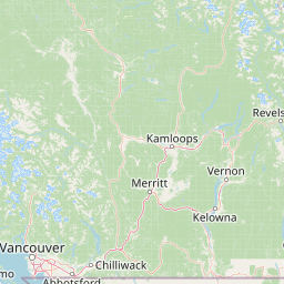


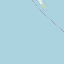


Leaflet | <a href="https://www.openstreetmap.org/copyright">© OpenStreetMap contributors</a>
Item
| Property | Value |
|---|---|
| id | 1435161 |
| downstream_mainstem_id | https://geoconnex.us/ref/mainstems/1427794 |
| encompassing_mainstem_basins | ['https://geoconnex.us/ref/mainstems/1427794', 'https://geoconnex.us/ref/mainstems/1423587'] |
| featuretype | ['https://www.opengis.net/def/schema/hy_features/hyf/HY_FlowPath', 'https://www.opengis.net/def/schema/hy_features/hyf/HY_WaterBody'] |
| fid | 29199 |
| head_2020huc12 | |
| head_nhdpv1_comid | 24384599 |
| head_nhdpv2_comid | https://geoconnex.us/nhdplusv2/comid/24384599 |
| head_nhdpv2huc12 | https://geoconnex.us/nhdplusv2/huc12/170200080301 |
| head_rf1id | 47409 |
| lengthkm | 80.6 |
| name_at_outlet | Chewuch River |
| name_at_outlet_gnis_id | 1517674 |
| new_mainstemid | |
| outlet_2020huc12 | |
| outlet_drainagearea_sqkm | 1359.6 |
| outlet_nhdpv1_comid | 24383027 |
| outlet_nhdpv2_comid | https://geoconnex.us/nhdplusv2/comid/24383027 |
| outlet_nhdpv2huc12 | https://geoconnex.us/nhdplusv2/huc12/170200080408 |
| outlet_rf1id | 47396 |
| superseded | False |
| uri | https://geoconnex.us/ref/mainstems/1435161 |
Graph Results
| monitoringLocation | https://sta.geoconnex.dev/collections/USGS/Things/items/'USGS-12448000' |
|---|---|
| siteName | USGS-12448000 |
| datasetDescription | Temperature air / USGS-12448000-a9895d5f826142eaa2a1a341232db9bc |
| type | Stream |
| url | https://waterdata.usgs.gov/monitoring-location/12448000/#parameterCode=00021 |
| variableMeasured | Temperature |
| variableUnit | degF |
| measurementTechnique | observation |
| temporalCoverage | 2024-08-30T09:15:00Z/2024-09-09T18:30:00Z |
| distributionName | USGS Instantaneous Values Service |
| distributionURL | https://waterservices.usgs.gov/nwis/iv/?sites=USGS:12448000¶meterCd=00021&format=rdb |
| distributionFormat | text/tab-separated-values |
| wkt | POINT (-120.186473412588 48.4770898239563) |
| monitoringLocation | https://sta.geoconnex.dev/collections/USGS/Things/items/'USGS-12448000' |
|---|---|
| siteName | USGS-12448000 |
| datasetDescription | Temperature air / USGS-12448000-a9895d5f826142eaa2a1a341232db9bc |
| type | Stream |
| url | https://waterdata.usgs.gov/monitoring-location/12448000/#parameterCode=00021 |
| variableMeasured | Temperature |
| variableUnit | degF |
| measurementTechnique | observation |
| temporalCoverage | 2024-08-30T09:15:00Z/2024-09-09T18:30:00Z |
| distributionName | USGS SensorThings API |
| distributionURL | https://labs.waterdata.usgs.gov/sta/v1.1/Datastreams('a9895d5f826142eaa2a1a341232db9bc')?$expand=Thing,Observations |
| distributionFormat | application/json |
| wkt | POINT (-120.186473412588 48.4770898239563) |
| monitoringLocation | https://sta.geoconnex.dev/collections/USGS/Things/items/'USGS-12448000' |
|---|---|
| siteName | USGS-12448000 |
| datasetDescription | Discharge / USGS-12448000-b13cc1bd592b473488f9deeceb9bc036 |
| type | Stream |
| url | https://waterdata.usgs.gov/monitoring-location/12448000/#parameterCode=00060 |
| variableMeasured | Discharge / USGS-12448000-b13cc1bd592b473488f9deeceb9bc036 |
| variableUnit | ft^3/s |
| measurementTechnique | observation |
| temporalCoverage | 2024-08-30T09:15:00Z/2024-09-09T18:30:00Z |
| distributionName | USGS Instantaneous Values Service |
| distributionURL | https://waterservices.usgs.gov/nwis/iv/?sites=USGS:12448000¶meterCd=00060&format=rdb |
| distributionFormat | text/tab-separated-values |
| wkt | POINT (-120.186473412588 48.4770898239563) |
| monitoringLocation | https://sta.geoconnex.dev/collections/USGS/Things/items/'USGS-12448000' |
|---|---|
| siteName | USGS-12448000 |
| datasetDescription | Discharge / USGS-12448000-b13cc1bd592b473488f9deeceb9bc036 |
| type | Stream |
| url | https://waterdata.usgs.gov/monitoring-location/12448000/#parameterCode=00060 |
| variableMeasured | Discharge / USGS-12448000-b13cc1bd592b473488f9deeceb9bc036 |
| variableUnit | ft^3/s |
| measurementTechnique | observation |
| temporalCoverage | 2024-08-30T09:15:00Z/2024-09-09T18:30:00Z |
| distributionName | USGS SensorThings API |
| distributionURL | https://labs.waterdata.usgs.gov/sta/v1.1/Datastreams('b13cc1bd592b473488f9deeceb9bc036')?$expand=Thing,Observations |
| distributionFormat | application/json |
| wkt | POINT (-120.186473412588 48.4770898239563) |
| monitoringLocation | https://sta.geoconnex.dev/collections/USGS/Things/items/'USGS-12448000' |
|---|---|
| siteName | USGS-12448000 |
| datasetDescription | Gage height / USGS-12448000-a4334d5081cb46d9a24b8c360bd160cb |
| type | Stream |
| url | https://waterdata.usgs.gov/monitoring-location/12448000/#parameterCode=00065 |
| variableMeasured | Gage height / USGS-12448000-a4334d5081cb46d9a24b8c360bd160cb |
| variableUnit | ft |
| measurementTechnique | observation |
| temporalCoverage | 2024-08-30T09:15:00Z/2024-09-09T18:30:00Z |
| distributionName | USGS Instantaneous Values Service |
| distributionURL | https://waterservices.usgs.gov/nwis/iv/?sites=USGS:12448000¶meterCd=00065&format=rdb |
| distributionFormat | text/tab-separated-values |
| wkt | POINT (-120.186473412588 48.4770898239563) |
| monitoringLocation | https://sta.geoconnex.dev/collections/USGS/Things/items/'USGS-12448000' |
|---|---|
| siteName | USGS-12448000 |
| datasetDescription | Gage height / USGS-12448000-a4334d5081cb46d9a24b8c360bd160cb |
| type | Stream |
| url | https://waterdata.usgs.gov/monitoring-location/12448000/#parameterCode=00065 |
| variableMeasured | Gage height / USGS-12448000-a4334d5081cb46d9a24b8c360bd160cb |
| variableUnit | ft |
| measurementTechnique | observation |
| temporalCoverage | 2024-08-30T09:15:00Z/2024-09-09T18:30:00Z |
| distributionName | USGS SensorThings API |
| distributionURL | https://labs.waterdata.usgs.gov/sta/v1.1/Datastreams('a4334d5081cb46d9a24b8c360bd160cb')?$expand=Thing,Observations |
| distributionFormat | application/json |
| wkt | POINT (-120.186473412588 48.4770898239563) |