South Fork Coeur d'Alene River
Map
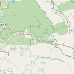
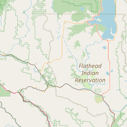
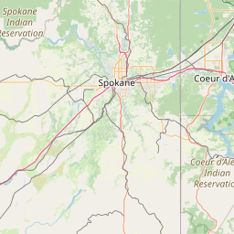
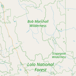

Leaflet | <a href="https://www.openstreetmap.org/copyright">© OpenStreetMap contributors</a>
Item
| Property | Value |
|---|---|
| id | 1436225 |
| downstream_mainstem_id | https://geoconnex.us/ref/mainstems/1430048 |
| encompassing_mainstem_basins | ['https://geoconnex.us/ref/mainstems/1430048', 'https://geoconnex.us/ref/mainstems/1427572', 'https://geoconnex.us/ref/mainstems/1423587'] |
| featuretype | ['https://www.opengis.net/def/schema/hy_features/hyf/HY_FlowPath', 'https://www.opengis.net/def/schema/hy_features/hyf/HY_WaterBody'] |
| fid | 28992 |
| head_2020huc12 | 170103020101 |
| head_nhdpv1_comid | 23002226 |
| head_nhdpv2_comid | https://geoconnex.us/nhdplusv2/comid/23002226 |
| head_nhdpv2huc12 | https://geoconnex.us/nhdplusv2/huc12/170103020101 |
| head_rf1id | 46837 |
| lengthkm | 56.7 |
| name_at_outlet | South Fork Coeur d'Alene River |
| name_at_outlet_gnis_id | 390910 |
| new_mainstemid | |
| outlet_2020huc12 | 170103020303 |
| outlet_drainagearea_sqkm | 774.4 |
| outlet_nhdpv1_comid | 23002024 |
| outlet_nhdpv2_comid | https://geoconnex.us/nhdplusv2/comid/23002024 |
| outlet_nhdpv2huc12 | https://geoconnex.us/nhdplusv2/huc12/170103020303 |
| outlet_rf1id | 46824 |
| superseded | False |
| uri | https://geoconnex.us/ref/mainstems/1436225 |
Graph Results
| monitoringLocation | https://sta.geoconnex.dev/collections/USGS/Things/items/'USGS-12413470' |
|---|---|
| siteName | USGS-12413470 |
| datasetDescription | Gage height / USGS-12413470-3f439271d86e43f9a61139ba9494252a |
| type | Stream |
| url | https://waterdata.usgs.gov/monitoring-location/12413470/#parameterCode=00065 |
| variableMeasured | Gage height / USGS-12413470-3f439271d86e43f9a61139ba9494252a |
| variableUnit | ft |
| measurementTechnique | observation |
| temporalCoverage | 2024-08-30T09:15:00Z/2024-09-09T17:45:00Z |
| distributionName | USGS Instantaneous Values Service |
| distributionURL | https://waterservices.usgs.gov/nwis/iv/?sites=USGS:12413470¶meterCd=00065&format=rdb |
| distributionFormat | text/tab-separated-values |
| wkt | POINT (-116.236291666667 47.5513111111111) |
| monitoringLocation | https://sta.geoconnex.dev/collections/USGS/Things/items/'USGS-12413470' |
|---|---|
| siteName | USGS-12413470 |
| datasetDescription | Gage height / USGS-12413470-3f439271d86e43f9a61139ba9494252a |
| type | Stream |
| url | https://waterdata.usgs.gov/monitoring-location/12413470/#parameterCode=00065 |
| variableMeasured | Gage height / USGS-12413470-3f439271d86e43f9a61139ba9494252a |
| variableUnit | ft |
| measurementTechnique | observation |
| temporalCoverage | 2024-08-30T09:15:00Z/2024-09-09T17:45:00Z |
| distributionName | USGS SensorThings API |
| distributionURL | https://labs.waterdata.usgs.gov/sta/v1.1/Datastreams('3f439271d86e43f9a61139ba9494252a')?$expand=Thing,Observations |
| distributionFormat | application/json |
| wkt | POINT (-116.236291666667 47.5513111111111) |
| monitoringLocation | https://sta.geoconnex.dev/collections/USGS/Things/items/'USGS-12413470' |
|---|---|
| siteName | USGS-12413470 |
| datasetDescription | Discharge cubic feet per second / USGS-12413470-ce9092d2562e4473b6d69e1db3c90b08 |
| type | Stream |
| url | https://waterdata.usgs.gov/monitoring-location/12413470/#parameterCode=00060 |
| variableMeasured | Discharge |
| variableUnit | ft^3/s |
| measurementTechnique | observation |
| temporalCoverage | 2024-08-30T09:15:00Z/2024-09-09T17:45:00Z |
| distributionName | USGS SensorThings API |
| distributionURL | https://labs.waterdata.usgs.gov/sta/v1.1/Datastreams('ce9092d2562e4473b6d69e1db3c90b08')?$expand=Thing,Observations |
| distributionFormat | application/json |
| wkt | POINT (-116.236291666667 47.5513111111111) |
| monitoringLocation | https://sta.geoconnex.dev/collections/USGS/Things/items/'USGS-12413470' |
|---|---|
| siteName | USGS-12413470 |
| datasetDescription | Discharge cubic feet per second / USGS-12413470-ce9092d2562e4473b6d69e1db3c90b08 |
| type | Stream |
| url | https://waterdata.usgs.gov/monitoring-location/12413470/#parameterCode=00060 |
| variableMeasured | Discharge |
| variableUnit | ft^3/s |
| measurementTechnique | observation |
| temporalCoverage | 2024-08-30T09:15:00Z/2024-09-09T17:45:00Z |
| distributionName | USGS Instantaneous Values Service |
| distributionURL | https://waterservices.usgs.gov/nwis/iv/?sites=USGS:12413470¶meterCd=00060&format=rdb |
| distributionFormat | text/tab-separated-values |
| wkt | POINT (-116.236291666667 47.5513111111111) |
| monitoringLocation | https://sta.geoconnex.dev/collections/USGS/Things/items/'USGS-12413131' |
|---|---|
| siteName | USGS-12413131 |
| datasetDescription | Discharge cubic feet per second / USGS-12413131-31f56c6ac6f64e5686596907d42f53d1 |
| type | Stream |
| url | https://waterdata.usgs.gov/monitoring-location/12413131/#parameterCode=00060 |
| variableMeasured | Discharge |
| variableUnit | ft^3/s |
| measurementTechnique | observation |
| temporalCoverage | 2024-08-30T09:15:00Z/2024-09-09T17:45:00Z |
| distributionName | USGS SensorThings API |
| distributionURL | https://labs.waterdata.usgs.gov/sta/v1.1/Datastreams('31f56c6ac6f64e5686596907d42f53d1')?$expand=Thing,Observations |
| distributionFormat | application/json |
| wkt | POINT (-115.928444444444 47.4751805555556) |
| monitoringLocation | https://sta.geoconnex.dev/collections/USGS/Things/items/'USGS-12413131' |
|---|---|
| siteName | USGS-12413131 |
| datasetDescription | Discharge cubic feet per second / USGS-12413131-31f56c6ac6f64e5686596907d42f53d1 |
| type | Stream |
| url | https://waterdata.usgs.gov/monitoring-location/12413131/#parameterCode=00060 |
| variableMeasured | Discharge |
| variableUnit | ft^3/s |
| measurementTechnique | observation |
| temporalCoverage | 2024-08-30T09:15:00Z/2024-09-09T17:45:00Z |
| distributionName | USGS Instantaneous Values Service |
| distributionURL | https://waterservices.usgs.gov/nwis/iv/?sites=USGS:12413131¶meterCd=00060&format=rdb |
| distributionFormat | text/tab-separated-values |
| wkt | POINT (-115.928444444444 47.4751805555556) |
| monitoringLocation | https://sta.geoconnex.dev/collections/USGS/Things/items/'USGS-12413131' |
|---|---|
| siteName | USGS-12413131 |
| datasetDescription | Gage height / USGS-12413131-502e389f6fd746d8b0defce4d768f584 |
| type | Stream |
| url | https://waterdata.usgs.gov/monitoring-location/12413131/#parameterCode=00065 |
| variableMeasured | Gage height / USGS-12413131-502e389f6fd746d8b0defce4d768f584 |
| variableUnit | ft |
| measurementTechnique | observation |
| temporalCoverage | 2024-08-30T09:15:00Z/2024-09-09T17:45:00Z |
| distributionName | USGS Instantaneous Values Service |
| distributionURL | https://waterservices.usgs.gov/nwis/iv/?sites=USGS:12413131¶meterCd=00065&format=rdb |
| distributionFormat | text/tab-separated-values |
| wkt | POINT (-115.928444444444 47.4751805555556) |
| monitoringLocation | https://sta.geoconnex.dev/collections/USGS/Things/items/'USGS-12413131' |
|---|---|
| siteName | USGS-12413131 |
| datasetDescription | Gage height / USGS-12413131-502e389f6fd746d8b0defce4d768f584 |
| type | Stream |
| url | https://waterdata.usgs.gov/monitoring-location/12413131/#parameterCode=00065 |
| variableMeasured | Gage height / USGS-12413131-502e389f6fd746d8b0defce4d768f584 |
| variableUnit | ft |
| measurementTechnique | observation |
| temporalCoverage | 2024-08-30T09:15:00Z/2024-09-09T17:45:00Z |
| distributionName | USGS SensorThings API |
| distributionURL | https://labs.waterdata.usgs.gov/sta/v1.1/Datastreams('502e389f6fd746d8b0defce4d768f584')?$expand=Thing,Observations |
| distributionFormat | application/json |
| wkt | POINT (-115.928444444444 47.4751805555556) |
| monitoringLocation | https://sta.geoconnex.dev/collections/USGS/Things/items/'USGS-12413210' |
|---|---|
| siteName | USGS-12413210 |
| datasetDescription | Gage height / USGS-12413210-ae5f7c53dceb4691883623a3a61d85c0 |
| type | Stream |
| url | https://waterdata.usgs.gov/monitoring-location/12413210/#parameterCode=00065 |
| variableMeasured | Gage height / USGS-12413210-ae5f7c53dceb4691883623a3a61d85c0 |
| variableUnit | ft |
| measurementTechnique | observation |
| temporalCoverage | 2024-08-30T09:15:00Z/2024-09-09T18:15:00Z |
| distributionName | USGS Instantaneous Values Service |
| distributionURL | https://waterservices.usgs.gov/nwis/iv/?sites=USGS:12413210¶meterCd=00065&format=rdb |
| distributionFormat | text/tab-separated-values |
| wkt | POINT (-116.0925 47.5313888888889) |
| monitoringLocation | https://sta.geoconnex.dev/collections/USGS/Things/items/'USGS-12413210' |
|---|---|
| siteName | USGS-12413210 |
| datasetDescription | Gage height / USGS-12413210-ae5f7c53dceb4691883623a3a61d85c0 |
| type | Stream |
| url | https://waterdata.usgs.gov/monitoring-location/12413210/#parameterCode=00065 |
| variableMeasured | Gage height / USGS-12413210-ae5f7c53dceb4691883623a3a61d85c0 |
| variableUnit | ft |
| measurementTechnique | observation |
| temporalCoverage | 2024-08-30T09:15:00Z/2024-09-09T18:15:00Z |
| distributionName | USGS SensorThings API |
| distributionURL | https://labs.waterdata.usgs.gov/sta/v1.1/Datastreams('ae5f7c53dceb4691883623a3a61d85c0')?$expand=Thing,Observations |
| distributionFormat | application/json |
| wkt | POINT (-116.0925 47.5313888888889) |
| monitoringLocation | https://sta.geoconnex.dev/collections/USGS/Things/items/'USGS-12413210' |
|---|---|
| siteName | USGS-12413210 |
| datasetDescription | Discharge / USGS-12413210-d7bc4793b53948ebb02c6a7d239cc902 |
| type | Stream |
| url | https://waterdata.usgs.gov/monitoring-location/12413210/#parameterCode=00060 |
| variableMeasured | Discharge / USGS-12413210-d7bc4793b53948ebb02c6a7d239cc902 |
| variableUnit | ft^3/s |
| measurementTechnique | observation |
| temporalCoverage | 2024-08-30T09:15:00Z/2024-09-09T18:15:00Z |
| distributionName | USGS Instantaneous Values Service |
| distributionURL | https://waterservices.usgs.gov/nwis/iv/?sites=USGS:12413210¶meterCd=00060&format=rdb |
| distributionFormat | text/tab-separated-values |
| wkt | POINT (-116.0925 47.5313888888889) |
| monitoringLocation | https://sta.geoconnex.dev/collections/USGS/Things/items/'USGS-12413210' |
|---|---|
| siteName | USGS-12413210 |
| datasetDescription | Discharge / USGS-12413210-d7bc4793b53948ebb02c6a7d239cc902 |
| type | Stream |
| url | https://waterdata.usgs.gov/monitoring-location/12413210/#parameterCode=00060 |
| variableMeasured | Discharge / USGS-12413210-d7bc4793b53948ebb02c6a7d239cc902 |
| variableUnit | ft^3/s |
| measurementTechnique | observation |
| temporalCoverage | 2024-08-30T09:15:00Z/2024-09-09T18:15:00Z |
| distributionName | USGS SensorThings API |
| distributionURL | https://labs.waterdata.usgs.gov/sta/v1.1/Datastreams('d7bc4793b53948ebb02c6a7d239cc902')?$expand=Thing,Observations |
| distributionFormat | application/json |
| wkt | POINT (-116.0925 47.5313888888889) |