Sand Hollow Creek
Map

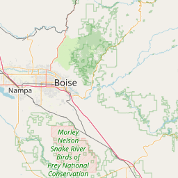
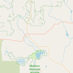
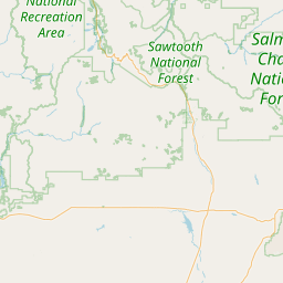
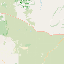
Leaflet | <a href="https://www.openstreetmap.org/copyright">© OpenStreetMap contributors</a>
Item
| Property | Value |
|---|---|
| id | 1440681 |
| downstream_mainstem_id | https://geoconnex.us/ref/mainstems/1423796 |
| encompassing_mainstem_basins | ['https://geoconnex.us/ref/mainstems/1423796', 'https://geoconnex.us/ref/mainstems/1423587'] |
| featuretype | ['https://www.opengis.net/def/schema/hy_features/hyf/HY_FlowPath', 'https://www.opengis.net/def/schema/hy_features/hyf/HY_WaterBody'] |
| fid | 29990 |
| head_2020huc12 | 170501140701 |
| head_nhdpv1_comid | 23400099 |
| head_nhdpv2_comid | https://geoconnex.us/nhdplusv2/comid/23400099 |
| head_nhdpv2huc12 | https://geoconnex.us/nhdplusv2/huc12/170501140701 |
| head_rf1id | None |
| lengthkm | 48.9 |
| name_at_outlet | Sand Hollow Creek |
| name_at_outlet_gnis_id | 400070 |
| new_mainstemid | |
| outlet_2020huc12 | 170501140704 |
| outlet_drainagearea_sqkm | 271.2 |
| outlet_nhdpv1_comid | 23410555 |
| outlet_nhdpv2_comid | https://geoconnex.us/nhdplusv2/comid/947050166 |
| outlet_nhdpv2huc12 | https://geoconnex.us/nhdplusv2/huc12/170501140704 |
| outlet_rf1id | None |
| superseded | False |
| uri | https://geoconnex.us/ref/mainstems/1440681 |
Graph Results
| monitoringLocation | https://sta.geoconnex.dev/collections/USGS/Things/items/'USGS-13213072' |
|---|---|
| siteName | USGS-13213072 |
| datasetDescription | Gage height feet / USGS-13213072-055fcd92f4814428bda5f07c519a0c3c |
| type | Stream |
| url | https://waterdata.usgs.gov/monitoring-location/13213072/#parameterCode=00065 |
| variableMeasured | Gage height |
| variableUnit | ft |
| measurementTechnique | observation |
| temporalCoverage | 2024-08-30T09:15:00Z/2024-09-09T18:30:00Z |
| distributionName | USGS SensorThings API |
| distributionURL | https://labs.waterdata.usgs.gov/sta/v1.1/Datastreams('055fcd92f4814428bda5f07c519a0c3c')?$expand=Thing,Observations |
| distributionFormat | application/json |
| wkt | POINT (-116.975711111111 43.7996055555556) |
| monitoringLocation | https://sta.geoconnex.dev/collections/USGS/Things/items/'USGS-13213072' |
|---|---|
| siteName | USGS-13213072 |
| datasetDescription | Gage height feet / USGS-13213072-055fcd92f4814428bda5f07c519a0c3c |
| type | Stream |
| url | https://waterdata.usgs.gov/monitoring-location/13213072/#parameterCode=00065 |
| variableMeasured | Gage height |
| variableUnit | ft |
| measurementTechnique | observation |
| temporalCoverage | 2024-08-30T09:15:00Z/2024-09-09T18:30:00Z |
| distributionName | USGS Instantaneous Values Service |
| distributionURL | https://waterservices.usgs.gov/nwis/iv/?sites=USGS:13213072¶meterCd=00065&format=rdb |
| distributionFormat | text/tab-separated-values |
| wkt | POINT (-116.975711111111 43.7996055555556) |
| monitoringLocation | https://sta.geoconnex.dev/collections/USGS/Things/items/'USGS-13213072' |
|---|---|
| siteName | USGS-13213072 |
| datasetDescription | Discharge / USGS-13213072-e6560bf648b440319d5650b16f7982cf |
| type | Stream |
| url | https://waterdata.usgs.gov/monitoring-location/13213072/#parameterCode=00060 |
| variableMeasured | Discharge / USGS-13213072-e6560bf648b440319d5650b16f7982cf |
| variableUnit | ft^3/s |
| measurementTechnique | observation |
| temporalCoverage | 2024-08-30T09:15:00Z/2024-09-09T18:30:00Z |
| distributionName | USGS SensorThings API |
| distributionURL | https://labs.waterdata.usgs.gov/sta/v1.1/Datastreams('e6560bf648b440319d5650b16f7982cf')?$expand=Thing,Observations |
| distributionFormat | application/json |
| wkt | POINT (-116.975711111111 43.7996055555556) |
| monitoringLocation | https://sta.geoconnex.dev/collections/USGS/Things/items/'USGS-13213072' |
|---|---|
| siteName | USGS-13213072 |
| datasetDescription | Discharge / USGS-13213072-e6560bf648b440319d5650b16f7982cf |
| type | Stream |
| url | https://waterdata.usgs.gov/monitoring-location/13213072/#parameterCode=00060 |
| variableMeasured | Discharge / USGS-13213072-e6560bf648b440319d5650b16f7982cf |
| variableUnit | ft^3/s |
| measurementTechnique | observation |
| temporalCoverage | 2024-08-30T09:15:00Z/2024-09-09T18:30:00Z |
| distributionName | USGS Instantaneous Values Service |
| distributionURL | https://waterservices.usgs.gov/nwis/iv/?sites=USGS:13213072¶meterCd=00060&format=rdb |
| distributionFormat | text/tab-separated-values |
| wkt | POINT (-116.975711111111 43.7996055555556) |