Warm Springs Creek
Map


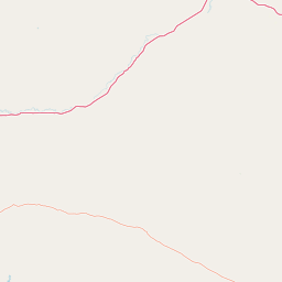
Leaflet | <a href="https://www.openstreetmap.org/copyright">© OpenStreetMap contributors</a>
Item
| Property | Value |
|---|---|
| id | 1445357 |
| downstream_mainstem_id | https://geoconnex.us/ref/mainstems/1423587 |
| encompassing_mainstem_basins | ['https://geoconnex.us/ref/mainstems/1423587'] |
| featuretype | ['https://www.opengis.net/def/schema/hy_features/hyf/HY_FlowPath', 'https://www.opengis.net/def/schema/hy_features/hyf/HY_WaterBody'] |
| fid | 28603 |
| head_2020huc12 | 170102010302 |
| head_nhdpv1_comid | 24296828 |
| head_nhdpv2_comid | https://geoconnex.us/nhdplusv2/comid/24296828 |
| head_nhdpv2huc12 | https://geoconnex.us/nhdplusv2/huc12/170102010302 |
| head_rf1id | 45755 |
| lengthkm | 55.8 |
| name_at_outlet | Warm Springs Creek |
| name_at_outlet_gnis_id | 792838 |
| new_mainstemid | |
| outlet_2020huc12 | 170102010305 |
| outlet_drainagearea_sqkm | 425.9 |
| outlet_nhdpv1_comid | 24293804 |
| outlet_nhdpv2_comid | https://geoconnex.us/nhdplusv2/comid/24293804 |
| outlet_nhdpv2huc12 | https://geoconnex.us/nhdplusv2/huc12/170102010305 |
| outlet_rf1id | 45755 |
| superseded | False |
| uri | https://geoconnex.us/ref/mainstems/1445357 |
Graph Results
| monitoringLocation | https://sta.geoconnex.dev/collections/USGS/Things/items/'USGS-12323760' |
|---|---|
| siteName | USGS-12323760 |
| datasetDescription | Gage height / USGS-12323760-072c369dfef9442eb018931cd39105f4 |
| type | Stream |
| url | https://waterdata.usgs.gov/monitoring-location/12323760/#parameterCode=00065 |
| variableMeasured | Gage height / USGS-12323760-072c369dfef9442eb018931cd39105f4 |
| variableUnit | ft |
| measurementTechnique | observation |
| temporalCoverage | 2024-08-30T09:15:00Z/2024-09-09T18:30:00Z |
| distributionName | USGS Instantaneous Values Service |
| distributionURL | https://waterservices.usgs.gov/nwis/iv/?sites=USGS:12323760¶meterCd=00065&format=rdb |
| distributionFormat | text/tab-separated-values |
| wkt | POINT (-112.903152777778 46.1336666666667) |
| monitoringLocation | https://sta.geoconnex.dev/collections/USGS/Things/items/'USGS-12323760' |
|---|---|
| siteName | USGS-12323760 |
| datasetDescription | Gage height / USGS-12323760-072c369dfef9442eb018931cd39105f4 |
| type | Stream |
| url | https://waterdata.usgs.gov/monitoring-location/12323760/#parameterCode=00065 |
| variableMeasured | Gage height / USGS-12323760-072c369dfef9442eb018931cd39105f4 |
| variableUnit | ft |
| measurementTechnique | observation |
| temporalCoverage | 2024-08-30T09:15:00Z/2024-09-09T18:30:00Z |
| distributionName | USGS SensorThings API |
| distributionURL | https://labs.waterdata.usgs.gov/sta/v1.1/Datastreams('072c369dfef9442eb018931cd39105f4')?$expand=Thing,Observations |
| distributionFormat | application/json |
| wkt | POINT (-112.903152777778 46.1336666666667) |
| monitoringLocation | https://sta.geoconnex.dev/collections/USGS/Things/items/'USGS-12323760' |
|---|---|
| siteName | USGS-12323760 |
| datasetDescription | Discharge, cubic feet per second / USGS-12323760-a1c8992646a448b5bfd543e4d77a38df |
| type | Stream |
| url | https://waterdata.usgs.gov/monitoring-location/12323760/#parameterCode=00060 |
| variableMeasured | Discharge |
| variableUnit | ft^3/s |
| measurementTechnique | observation |
| temporalCoverage | 2024-08-30T09:15:00Z/2024-09-09T18:30:00Z |
| distributionName | USGS Instantaneous Values Service |
| distributionURL | https://waterservices.usgs.gov/nwis/iv/?sites=USGS:12323760¶meterCd=00060&format=rdb |
| distributionFormat | text/tab-separated-values |
| wkt | POINT (-112.903152777778 46.1336666666667) |
| monitoringLocation | https://sta.geoconnex.dev/collections/USGS/Things/items/'USGS-12323760' |
|---|---|
| siteName | USGS-12323760 |
| datasetDescription | Discharge, cubic feet per second / USGS-12323760-a1c8992646a448b5bfd543e4d77a38df |
| type | Stream |
| url | https://waterdata.usgs.gov/monitoring-location/12323760/#parameterCode=00060 |
| variableMeasured | Discharge |
| variableUnit | ft^3/s |
| measurementTechnique | observation |
| temporalCoverage | 2024-08-30T09:15:00Z/2024-09-09T18:30:00Z |
| distributionName | USGS SensorThings API |
| distributionURL | https://labs.waterdata.usgs.gov/sta/v1.1/Datastreams('a1c8992646a448b5bfd543e4d77a38df')?$expand=Thing,Observations |
| distributionFormat | application/json |
| wkt | POINT (-112.903152777778 46.1336666666667) |