Wind River
Map


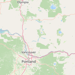

Leaflet | <a href="https://www.openstreetmap.org/copyright">© OpenStreetMap contributors</a>
Item
| Property | Value |
|---|---|
| id | 1447591 |
| downstream_mainstem_id | https://geoconnex.us/ref/mainstems/1424874 |
| encompassing_mainstem_basins | ['https://geoconnex.us/ref/mainstems/1424874', 'https://geoconnex.us/ref/mainstems/1423796', 'https://geoconnex.us/ref/mainstems/1423587'] |
| featuretype | ['https://www.opengis.net/def/schema/hy_features/hyf/HY_FlowPath', 'https://www.opengis.net/def/schema/hy_features/hyf/HY_WaterBody'] |
| fid | 30502 |
| head_2020huc12 | 170602071002 |
| head_nhdpv1_comid | 23541730 |
| head_nhdpv2_comid | https://geoconnex.us/nhdplusv2/comid/23541730 |
| head_nhdpv2huc12 | https://geoconnex.us/nhdplusv2/huc12/170602071002 |
| head_rf1id | 50910 |
| lengthkm | 22.5 |
| name_at_outlet | Wind River |
| name_at_outlet_gnis_id | 393566 |
| new_mainstemid | |
| outlet_2020huc12 | 170602071002 |
| outlet_drainagearea_sqkm | 168.0 |
| outlet_nhdpv1_comid | 23541700 |
| outlet_nhdpv2_comid | https://geoconnex.us/nhdplusv2/comid/23541700 |
| outlet_nhdpv2huc12 | https://geoconnex.us/nhdplusv2/huc12/170602071002 |
| outlet_rf1id | 50910 |
| superseded | False |
| uri | https://geoconnex.us/ref/mainstems/1447591 |