Andrews Creek
Map


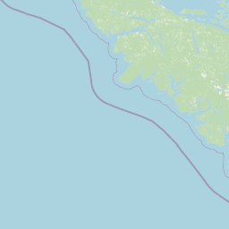


Leaflet | <a href="https://www.openstreetmap.org/copyright">© OpenStreetMap contributors</a>
Item
| Property | Value |
|---|---|
| id | 1457587 |
| downstream_mainstem_id | https://geoconnex.us/ref/mainstems/1435161 |
| encompassing_mainstem_basins | ['https://geoconnex.us/ref/mainstems/1435161', 'https://geoconnex.us/ref/mainstems/1427794', 'https://geoconnex.us/ref/mainstems/1423587'] |
| featuretype | ['https://www.opengis.net/def/schema/hy_features/hyf/HY_FlowPath', 'https://www.opengis.net/def/schema/hy_features/hyf/HY_WaterBody'] |
| fid | 29221 |
| head_2020huc12 | 170200080304 |
| head_nhdpv1_comid | 24384641 |
| head_nhdpv2_comid | https://geoconnex.us/nhdplusv2/comid/24384641 |
| head_nhdpv2huc12 | https://geoconnex.us/nhdplusv2/huc12/170200080304 |
| head_rf1id | None |
| lengthkm | 19.7 |
| name_at_outlet | Andrews Creek |
| name_at_outlet_gnis_id | 1515891 |
| new_mainstemid | |
| outlet_2020huc12 | 170200080304 |
| outlet_drainagearea_sqkm | 88.1 |
| outlet_nhdpv1_comid | 24385067 |
| outlet_nhdpv2_comid | https://geoconnex.us/nhdplusv2/comid/24385067 |
| outlet_nhdpv2huc12 | https://geoconnex.us/nhdplusv2/huc12/170200080304 |
| outlet_rf1id | None |
| superseded | False |
| uri | https://geoconnex.us/ref/mainstems/1457587 |
Graph Results
| monitoringLocation | https://sta.geoconnex.dev/collections/USGS/Things/items/'USGS-12447390' |
|---|---|
| siteName | USGS-12447390 |
| datasetDescription | Discharge / USGS-12447390-b03915f2185c4e82a22cbff2c64c92cb |
| type | Stream |
| url | https://waterdata.usgs.gov/monitoring-location/12447390/#parameterCode=00060 |
| variableMeasured | Discharge / USGS-12447390-b03915f2185c4e82a22cbff2c64c92cb |
| variableUnit | ft^3/s |
| measurementTechnique | observation |
| temporalCoverage | 2024-08-30T09:15:00Z/2024-09-09T18:45:00Z |
| distributionName | USGS Instantaneous Values Service |
| distributionURL | https://waterservices.usgs.gov/nwis/iv/?sites=USGS:12447390¶meterCd=00060&format=rdb |
| distributionFormat | text/tab-separated-values |
| wkt | POINT (-120.14590382169726 48.82287373387575) |
| monitoringLocation | https://sta.geoconnex.dev/collections/USGS/Things/items/'USGS-12447390' |
|---|---|
| siteName | USGS-12447390 |
| datasetDescription | Discharge / USGS-12447390-b03915f2185c4e82a22cbff2c64c92cb |
| type | Stream |
| url | https://waterdata.usgs.gov/monitoring-location/12447390/#parameterCode=00060 |
| variableMeasured | Discharge / USGS-12447390-b03915f2185c4e82a22cbff2c64c92cb |
| variableUnit | ft^3/s |
| measurementTechnique | observation |
| temporalCoverage | 2024-08-30T09:15:00Z/2024-09-09T18:45:00Z |
| distributionName | USGS SensorThings API |
| distributionURL | https://labs.waterdata.usgs.gov/sta/v1.1/Datastreams('b03915f2185c4e82a22cbff2c64c92cb')?$expand=Thing,Observations |
| distributionFormat | application/json |
| wkt | POINT (-120.14590382169726 48.82287373387575) |
| monitoringLocation | https://sta.geoconnex.dev/collections/USGS/Things/items/'USGS-12447390' |
|---|---|
| siteName | USGS-12447390 |
| datasetDescription | Temperature, water / USGS-12447390-0e69dab026d4495bb712cdf0b4bfa97e |
| type | Stream |
| url | https://waterdata.usgs.gov/monitoring-location/12447390/#parameterCode=00010 |
| variableMeasured | Temperature |
| variableUnit | degC |
| measurementTechnique | observation |
| temporalCoverage | 2024-08-30T09:15:00Z/2024-09-09T18:45:00Z |
| distributionName | USGS Instantaneous Values Service |
| distributionURL | https://waterservices.usgs.gov/nwis/iv/?sites=USGS:12447390¶meterCd=00010&format=rdb |
| distributionFormat | text/tab-separated-values |
| wkt | POINT (-120.14590382169726 48.82287373387575) |
| monitoringLocation | https://sta.geoconnex.dev/collections/USGS/Things/items/'USGS-12447390' |
|---|---|
| siteName | USGS-12447390 |
| datasetDescription | Temperature, water / USGS-12447390-0e69dab026d4495bb712cdf0b4bfa97e |
| type | Stream |
| url | https://waterdata.usgs.gov/monitoring-location/12447390/#parameterCode=00010 |
| variableMeasured | Temperature |
| variableUnit | degC |
| measurementTechnique | observation |
| temporalCoverage | 2024-08-30T09:15:00Z/2024-09-09T18:45:00Z |
| distributionName | USGS SensorThings API |
| distributionURL | https://labs.waterdata.usgs.gov/sta/v1.1/Datastreams('0e69dab026d4495bb712cdf0b4bfa97e')?$expand=Thing,Observations |
| distributionFormat | application/json |
| wkt | POINT (-120.14590382169726 48.82287373387575) |
| monitoringLocation | https://sta.geoconnex.dev/collections/USGS/Things/items/'USGS-12447390' |
|---|---|
| siteName | USGS-12447390 |
| datasetDescription | Gage height / USGS-12447390-5b4ba34fc8814d9a87e7290733e3b6c1 |
| type | Stream |
| url | https://waterdata.usgs.gov/monitoring-location/12447390/#parameterCode=00065 |
| variableMeasured | Gage height / USGS-12447390-5b4ba34fc8814d9a87e7290733e3b6c1 |
| variableUnit | ft |
| measurementTechnique | observation |
| temporalCoverage | 2024-08-30T09:15:00Z/2024-09-09T18:45:00Z |
| distributionName | USGS SensorThings API |
| distributionURL | https://labs.waterdata.usgs.gov/sta/v1.1/Datastreams('5b4ba34fc8814d9a87e7290733e3b6c1')?$expand=Thing,Observations |
| distributionFormat | application/json |
| wkt | POINT (-120.14590382169726 48.82287373387575) |
| monitoringLocation | https://sta.geoconnex.dev/collections/USGS/Things/items/'USGS-12447390' |
|---|---|
| siteName | USGS-12447390 |
| datasetDescription | Gage height / USGS-12447390-5b4ba34fc8814d9a87e7290733e3b6c1 |
| type | Stream |
| url | https://waterdata.usgs.gov/monitoring-location/12447390/#parameterCode=00065 |
| variableMeasured | Gage height / USGS-12447390-5b4ba34fc8814d9a87e7290733e3b6c1 |
| variableUnit | ft |
| measurementTechnique | observation |
| temporalCoverage | 2024-08-30T09:15:00Z/2024-09-09T18:45:00Z |
| distributionName | USGS Instantaneous Values Service |
| distributionURL | https://waterservices.usgs.gov/nwis/iv/?sites=USGS:12447390¶meterCd=00065&format=rdb |
| distributionFormat | text/tab-separated-values |
| wkt | POINT (-120.14590382169726 48.82287373387575) |