Tenmile Creek
Map
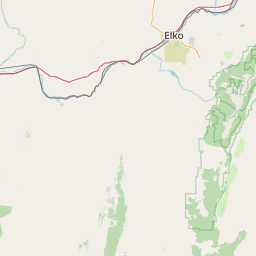
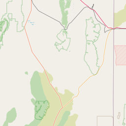
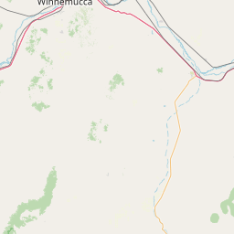
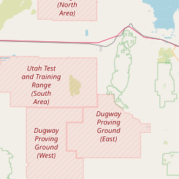
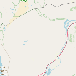
Leaflet | <a href="https://www.openstreetmap.org/copyright">© OpenStreetMap contributors</a>
Item
| Property | Value |
|---|---|
| id | 1935677 |
| downstream_mainstem_id | https://geoconnex.us/ref/mainstems/1935426 |
| encompassing_mainstem_basins | ['https://geoconnex.us/ref/mainstems/1935426', 'https://geoconnex.us/ref/mainstems/1934828'] |
| featuretype | ['https://www.opengis.net/def/schema/hy_features/hyf/HY_FlowPath', 'https://www.opengis.net/def/schema/hy_features/hyf/HY_WaterBody'] |
| fid | 28003 |
| head_2020huc12 | 160401030701 |
| head_nhdpv1_comid | 10750057 |
| head_nhdpv2_comid | https://geoconnex.us/nhdplusv2/comid/10750057 |
| head_nhdpv2huc12 | https://geoconnex.us/nhdplusv2/huc12/160401030701 |
| head_rf1id | 44950 |
| lengthkm | 39.6 |
| name_at_outlet | Tenmile Creek |
| name_at_outlet_gnis_id | 863086 |
| new_mainstemid | |
| outlet_2020huc12 | 160401030704 |
| outlet_drainagearea_sqkm | 385.6 |
| outlet_nhdpv1_comid | 10750105 |
| outlet_nhdpv2_comid | https://geoconnex.us/nhdplusv2/comid/10750105 |
| outlet_nhdpv2huc12 | https://geoconnex.us/nhdplusv2/huc12/160401030704 |
| outlet_rf1id | 44948 |
| superseded | False |
| uri | https://geoconnex.us/ref/mainstems/1935677 |