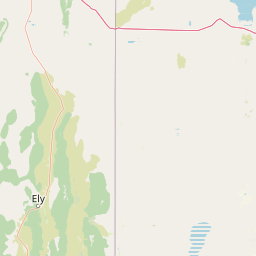
Coon Creek
Map
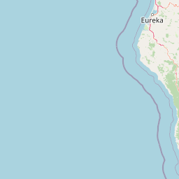


Leaflet | <a href="https://www.openstreetmap.org/copyright">© OpenStreetMap contributors</a>
Item
| Property | Value |
|---|---|
| id | 1942 |
| downstream_mainstem_id | https://geoconnex.us/ref/mainstems/1 |
| encompassing_mainstem_basins | ['https://geoconnex.us/ref/mainstems/1'] |
| featuretype | ['https://www.opengis.net/def/schema/hy_features/hyf/HY_FlowPath', 'https://www.opengis.net/def/schema/hy_features/hyf/HY_WaterBody'] |
| fid | 32627 |
| head_2020huc12 | 180201610201 |
| head_nhdpv1_comid | 15007185 |
| head_nhdpv2_comid | https://geoconnex.us/nhdplusv2/comid/15007185 |
| head_nhdpv2huc12 | https://geoconnex.us/nhdplusv2/huc12/180201610201 |
| head_rf1id | 57555 |
| lengthkm | 76.5 |
| name_at_outlet | Coon Creek |
| name_at_outlet_gnis_id | 221504 |
| new_mainstemid | |
| outlet_2020huc12 | 180201610303 |
| outlet_drainagearea_sqkm | 898.9 |
| outlet_nhdpv1_comid | 15039075 |
| outlet_nhdpv2_comid | https://geoconnex.us/nhdplusv2/comid/15039075 |
| outlet_nhdpv2huc12 | https://geoconnex.us/nhdplusv2/huc12/180201610303 |
| outlet_rf1id | 57370 |
| superseded | False |
| uri | https://geoconnex.us/ref/mainstems/1942 |
Graph Results
| monitoringLocation | https://geoconnex.us/iow/wqp/USGS-385801121055801 |
|---|---|
| siteName | USGS-385801121055801 |
| datasetDescription | Toluene-d8 at USGS-385801121055801 |
| type | Well |
| url | https://www.waterqualitydata.us/provider/NWIS/USGS-CA/USGS-385801121055801/ |
| variableMeasured | Toluene-d8 |
| variableUnit | percent |
| measurementTechnique | observation |
| temporalCoverage | 2017-01-01T00:00:00Z/2017-12-31T00:00:00Z |
| distributionName | Water Quality Portal |
| distributionURL | https://www.waterqualitydata.us/data/Result/search?siteid=USGS-385801121055801&CharacteristicName=Toluene-d8&mimeType=csv |
| distributionFormat | text/comma-separated-values |
| wkt | POINT (-121.0996667 38.9670833) |
| monitoringLocation | https://geoconnex.us/iow/wqp/USGS-385801121055801 |
|---|---|
| siteName | USGS-385801121055801 |
| datasetDescription | Sulfate at USGS-385801121055801 |
| type | Well |
| url | https://www.waterqualitydata.us/provider/NWIS/USGS-CA/USGS-385801121055801/ |
| variableMeasured | Sulfate |
| variableUnit | milligrams per liter |
| measurementTechnique | observation |
| temporalCoverage | 2017-01-01T00:00:00Z/2017-12-31T00:00:00Z |
| distributionName | Water Quality Portal |
| distributionURL | https://www.waterqualitydata.us/data/Result/search?siteid=USGS-385801121055801&CharacteristicName=Sulfate&mimeType=csv |
| distributionFormat | text/comma-separated-values |
| wkt | POINT (-121.0996667 38.9670833) |
| monitoringLocation | https://geoconnex.us/iow/wqp/USGS-385801121055801 |
|---|---|
| siteName | USGS-385801121055801 |
| datasetDescription | trans-Crotonaldehyde at USGS-385801121055801 |
| type | Well |
| url | https://www.waterqualitydata.us/provider/NWIS/USGS-CA/USGS-385801121055801/ |
| variableMeasured | trans-Crotonaldehyde |
| variableUnit | Unknown |
| measurementTechnique | observation |
| temporalCoverage | 2017-01-01T00:00:00Z/2017-12-31T00:00:00Z |
| distributionName | Water Quality Portal |
| distributionURL | https://www.waterqualitydata.us/data/Result/search?siteid=USGS-385801121055801&CharacteristicName=trans-Crotonaldehyde&mimeType=csv |
| distributionFormat | text/comma-separated-values |
| wkt | POINT (-121.0996667 38.9670833) |
| monitoringLocation | https://geoconnex.us/iow/wqp/USGS-385801121055801 |
|---|---|
| siteName | USGS-385801121055801 |
| datasetDescription | Acetonitrile at USGS-385801121055801 |
| type | Well |
| url | https://www.waterqualitydata.us/provider/NWIS/USGS-CA/USGS-385801121055801/ |
| variableMeasured | Acetonitrile |
| variableUnit | Unknown |
| measurementTechnique | observation |
| temporalCoverage | 2017-01-01T00:00:00Z/2017-12-31T00:00:00Z |
| distributionName | Water Quality Portal |
| distributionURL | https://www.waterqualitydata.us/data/Result/search?siteid=USGS-385801121055801&CharacteristicName=Acetonitrile&mimeType=csv |
| distributionFormat | text/comma-separated-values |
| wkt | POINT (-121.0996667 38.9670833) |
| monitoringLocation | https://geoconnex.us/iow/wqp/USGS-385801121055801 |
|---|---|
| siteName | USGS-385801121055801 |
| datasetDescription | Specific conductance at USGS-385801121055801 |
| type | Well |
| url | https://www.waterqualitydata.us/provider/NWIS/USGS-CA/USGS-385801121055801/ |
| variableMeasured | Specific conductance |
| variableUnit | microsiemens per centimeter |
| measurementTechnique | observation |
| temporalCoverage | 2017-01-01T00:00:00Z/2017-12-31T00:00:00Z |
| distributionName | Water Quality Portal |
| distributionURL | https://www.waterqualitydata.us/data/Result/search?siteid=USGS-385801121055801&CharacteristicName=Specific conductance&mimeType=csv |
| distributionFormat | text/comma-separated-values |
| wkt | POINT (-121.0996667 38.9670833) |
| monitoringLocation | https://geoconnex.us/iow/wqp/USGS-385801121055801 |
|---|---|
| siteName | USGS-385801121055801 |
| datasetDescription | Isopropanol at USGS-385801121055801 |
| type | Well |
| url | https://www.waterqualitydata.us/provider/NWIS/USGS-CA/USGS-385801121055801/ |
| variableMeasured | Isopropanol |
| variableUnit | Unknown |
| measurementTechnique | observation |
| temporalCoverage | 2017-01-01T00:00:00Z/2017-12-31T00:00:00Z |
| distributionName | Water Quality Portal |
| distributionURL | https://www.waterqualitydata.us/data/Result/search?siteid=USGS-385801121055801&CharacteristicName=Isopropanol&mimeType=csv |
| distributionFormat | text/comma-separated-values |
| wkt | POINT (-121.0996667 38.9670833) |
| monitoringLocation | https://geoconnex.us/iow/wqp/USGS-385801121055801 |
|---|---|
| siteName | USGS-385801121055801 |
| datasetDescription | Bromochloromethane at USGS-385801121055801 |
| type | Well |
| url | https://www.waterqualitydata.us/provider/NWIS/USGS-CA/USGS-385801121055801/ |
| variableMeasured | Bromochloromethane |
| variableUnit | Unknown |
| measurementTechnique | observation |
| temporalCoverage | 2017-01-01T00:00:00Z/2017-12-31T00:00:00Z |
| distributionName | Water Quality Portal |
| distributionURL | https://www.waterqualitydata.us/data/Result/search?siteid=USGS-385801121055801&CharacteristicName=Bromochloromethane&mimeType=csv |
| distributionFormat | text/comma-separated-values |
| wkt | POINT (-121.0996667 38.9670833) |
| monitoringLocation | https://geoconnex.us/iow/wqp/USGS-385801121055801 |
|---|---|
| siteName | USGS-385801121055801 |
| datasetDescription | Perchlorate at USGS-385801121055801 |
| type | Well |
| url | https://www.waterqualitydata.us/provider/NWIS/USGS-CA/USGS-385801121055801/ |
| variableMeasured | Perchlorate |
| variableUnit | micrograms per liter |
| measurementTechnique | observation |
| temporalCoverage | 2017-01-01T00:00:00Z/2017-12-31T00:00:00Z |
| distributionName | Water Quality Portal |
| distributionURL | https://www.waterqualitydata.us/data/Result/search?siteid=USGS-385801121055801&CharacteristicName=Perchlorate&mimeType=csv |
| distributionFormat | text/comma-separated-values |
| wkt | POINT (-121.0996667 38.9670833) |
| monitoringLocation | https://geoconnex.us/iow/wqp/USGS-385801121055801 |
|---|---|
| siteName | USGS-385801121055801 |
| datasetDescription | Carbon-13/Carbon-12 ratio at USGS-385801121055801 |
| type | Well |
| url | https://www.waterqualitydata.us/provider/NWIS/USGS-CA/USGS-385801121055801/ |
| variableMeasured | Carbon-13/Carbon-12 ratio |
| variableUnit | per thousand |
| measurementTechnique | observation |
| temporalCoverage | 2017-01-01T00:00:00Z/2017-12-31T00:00:00Z |
| distributionName | Water Quality Portal |
| distributionURL | https://www.waterqualitydata.us/data/Result/search?siteid=USGS-385801121055801&CharacteristicName=Carbon-13/Carbon-12 ratio&mimeType=csv |
| distributionFormat | text/comma-separated-values |
| wkt | POINT (-121.0996667 38.9670833) |
| monitoringLocation | https://geoconnex.us/iow/wqp/USGS-385801121055801 |
|---|---|
| siteName | USGS-385801121055801 |
| datasetDescription | Ethylbenzene at USGS-385801121055801 |
| type | Well |
| url | https://www.waterqualitydata.us/provider/NWIS/USGS-CA/USGS-385801121055801/ |
| variableMeasured | Ethylbenzene |
| variableUnit | Unknown |
| measurementTechnique | observation |
| temporalCoverage | 2017-01-01T00:00:00Z/2017-12-31T00:00:00Z |
| distributionName | Water Quality Portal |
| distributionURL | https://www.waterqualitydata.us/data/Result/search?siteid=USGS-385801121055801&CharacteristicName=Ethylbenzene&mimeType=csv |
| distributionFormat | text/comma-separated-values |
| wkt | POINT (-121.0996667 38.9670833) |
| monitoringLocation | https://geoconnex.us/iow/wqp/USGS-385801121055801 |
|---|---|
| siteName | USGS-385801121055801 |
| datasetDescription | Iron at USGS-385801121055801 |
| type | Well |
| url | https://www.waterqualitydata.us/provider/NWIS/USGS-CA/USGS-385801121055801/ |
| variableMeasured | Iron |
| variableUnit | percent |
| measurementTechnique | observation |
| temporalCoverage | 2017-01-01T00:00:00Z/2017-12-31T00:00:00Z |
| distributionName | Water Quality Portal |
| distributionURL | https://www.waterqualitydata.us/data/Result/search?siteid=USGS-385801121055801&CharacteristicName=Iron&mimeType=csv |
| distributionFormat | text/comma-separated-values |
| wkt | POINT (-121.0996667 38.9670833) |
| monitoringLocation | https://geoconnex.us/iow/wqp/USGS-385801121055801 |
|---|---|
| siteName | USGS-385801121055801 |
| datasetDescription | o-Dichlorobenzene at USGS-385801121055801 |
| type | Well |
| url | https://www.waterqualitydata.us/provider/NWIS/USGS-CA/USGS-385801121055801/ |
| variableMeasured | o-Dichlorobenzene |
| variableUnit | micrograms per liter |
| measurementTechnique | observation |
| temporalCoverage | 2017-01-01T00:00:00Z/2017-12-31T00:00:00Z |
| distributionName | Water Quality Portal |
| distributionURL | https://www.waterqualitydata.us/data/Result/search?siteid=USGS-385801121055801&CharacteristicName=o-Dichlorobenzene&mimeType=csv |
| distributionFormat | text/comma-separated-values |
| wkt | POINT (-121.0996667 38.9670833) |
| monitoringLocation | https://geoconnex.us/iow/wqp/USGS-385801121055801 |
|---|---|
| siteName | USGS-385801121055801 |
| datasetDescription | Tritium at USGS-385801121055801 |
| type | Well |
| url | https://www.waterqualitydata.us/provider/NWIS/USGS-CA/USGS-385801121055801/ |
| variableMeasured | Tritium |
| variableUnit | picocuries per liter |
| measurementTechnique | observation |
| temporalCoverage | 2017-01-01T00:00:00Z/2017-12-31T00:00:00Z |
| distributionName | Water Quality Portal |
| distributionURL | https://www.waterqualitydata.us/data/Result/search?siteid=USGS-385801121055801&CharacteristicName=Tritium&mimeType=csv |
| distributionFormat | text/comma-separated-values |
| wkt | POINT (-121.0996667 38.9670833) |
| monitoringLocation | https://geoconnex.us/iow/wqp/USGS-385801121055801 |
|---|---|
| siteName | USGS-385801121055801 |
| datasetDescription | Toluene at USGS-385801121055801 |
| type | Well |
| url | https://www.waterqualitydata.us/provider/NWIS/USGS-CA/USGS-385801121055801/ |
| variableMeasured | Toluene |
| variableUnit | Unknown |
| measurementTechnique | observation |
| temporalCoverage | 2017-01-01T00:00:00Z/2017-12-31T00:00:00Z |
| distributionName | Water Quality Portal |
| distributionURL | https://www.waterqualitydata.us/data/Result/search?siteid=USGS-385801121055801&CharacteristicName=Toluene&mimeType=csv |
| distributionFormat | text/comma-separated-values |
| wkt | POINT (-121.0996667 38.9670833) |
| monitoringLocation | https://geoconnex.us/iow/wqp/USGS-385801121055801 |
|---|---|
| siteName | USGS-385801121055801 |
| datasetDescription | Beryllium at USGS-385801121055801 |
| type | Well |
| url | https://www.waterqualitydata.us/provider/NWIS/USGS-CA/USGS-385801121055801/ |
| variableMeasured | Beryllium |
| variableUnit | parts per million |
| measurementTechnique | observation |
| temporalCoverage | 2017-01-01T00:00:00Z/2017-12-31T00:00:00Z |
| distributionName | Water Quality Portal |
| distributionURL | https://www.waterqualitydata.us/data/Result/search?siteid=USGS-385801121055801&CharacteristicName=Beryllium&mimeType=csv |
| distributionFormat | text/comma-separated-values |
| wkt | POINT (-121.0996667 38.9670833) |
| monitoringLocation | https://geoconnex.us/iow/wqp/USGS-385801121055801 |
|---|---|
| siteName | USGS-385801121055801 |
| datasetDescription | HFC-152a at USGS-385801121055801 |
| type | Well |
| url | https://www.waterqualitydata.us/provider/NWIS/USGS-CA/USGS-385801121055801/ |
| variableMeasured | HFC-152a |
| variableUnit | Unknown |
| measurementTechnique | observation |
| temporalCoverage | 2017-01-01T00:00:00Z/2017-12-31T00:00:00Z |
| distributionName | Water Quality Portal |
| distributionURL | https://www.waterqualitydata.us/data/Result/search?siteid=USGS-385801121055801&CharacteristicName=HFC-152a&mimeType=csv |
| distributionFormat | text/comma-separated-values |
| wkt | POINT (-121.0996667 38.9670833) |
| monitoringLocation | https://geoconnex.us/iow/wqp/USGS-385801121055801 |
|---|---|
| siteName | USGS-385801121055801 |
| datasetDescription | Chloropicrin at USGS-385801121055801 |
| type | Well |
| url | https://www.waterqualitydata.us/provider/NWIS/USGS-CA/USGS-385801121055801/ |
| variableMeasured | Chloropicrin |
| variableUnit | Unknown |
| measurementTechnique | observation |
| temporalCoverage | 2017-01-01T00:00:00Z/2017-12-31T00:00:00Z |
| distributionName | Water Quality Portal |
| distributionURL | https://www.waterqualitydata.us/data/Result/search?siteid=USGS-385801121055801&CharacteristicName=Chloropicrin&mimeType=csv |
| distributionFormat | text/comma-separated-values |
| wkt | POINT (-121.0996667 38.9670833) |
| monitoringLocation | https://geoconnex.us/iow/wqp/USGS-385801121055801 |
|---|---|
| siteName | USGS-385801121055801 |
| datasetDescription | 1,2-Dichloroethane-d4 at USGS-385801121055801 |
| type | Well |
| url | https://www.waterqualitydata.us/provider/NWIS/USGS-CA/USGS-385801121055801/ |
| variableMeasured | 1,2-Dichloroethane-d4 |
| variableUnit | percent |
| measurementTechnique | observation |
| temporalCoverage | 2017-01-01T00:00:00Z/2017-12-31T00:00:00Z |
| distributionName | Water Quality Portal |
| distributionURL | https://www.waterqualitydata.us/data/Result/search?siteid=USGS-385801121055801&CharacteristicName=1,2-Dichloroethane-d4&mimeType=csv |
| distributionFormat | text/comma-separated-values |
| wkt | POINT (-121.0996667 38.9670833) |
| monitoringLocation | https://geoconnex.us/iow/wqp/USGS-385801121055801 |
|---|---|
| siteName | USGS-385801121055801 |
| datasetDescription | Chlorodibromomethane at USGS-385801121055801 |
| type | Well |
| url | https://www.waterqualitydata.us/provider/NWIS/USGS-CA/USGS-385801121055801/ |
| variableMeasured | Chlorodibromomethane |
| variableUnit | micrograms per liter |
| measurementTechnique | observation |
| temporalCoverage | 2017-01-01T00:00:00Z/2017-12-31T00:00:00Z |
| distributionName | Water Quality Portal |
| distributionURL | https://www.waterqualitydata.us/data/Result/search?siteid=USGS-385801121055801&CharacteristicName=Chlorodibromomethane&mimeType=csv |
| distributionFormat | text/comma-separated-values |
| wkt | POINT (-121.0996667 38.9670833) |
| monitoringLocation | https://geoconnex.us/iow/wqp/USGS-385801121055801 |
|---|---|
| siteName | USGS-385801121055801 |
| datasetDescription | sec-Butylbenzene at USGS-385801121055801 |
| type | Well |
| url | https://www.waterqualitydata.us/provider/NWIS/USGS-CA/USGS-385801121055801/ |
| variableMeasured | sec-Butylbenzene |
| variableUnit | micrograms per liter |
| measurementTechnique | observation |
| temporalCoverage | 2017-01-01T00:00:00Z/2017-12-31T00:00:00Z |
| distributionName | Water Quality Portal |
| distributionURL | https://www.waterqualitydata.us/data/Result/search?siteid=USGS-385801121055801&CharacteristicName=sec-Butylbenzene&mimeType=csv |
| distributionFormat | text/comma-separated-values |
| wkt | POINT (-121.0996667 38.9670833) |
| monitoringLocation | https://geoconnex.us/iow/wqp/USGS-385801121055801 |
|---|---|
| siteName | USGS-385801121055801 |
| datasetDescription | Aluminum at USGS-385801121055801 |
| type | Well |
| url | https://www.waterqualitydata.us/provider/NWIS/USGS-CA/USGS-385801121055801/ |
| variableMeasured | Aluminum |
| variableUnit | Unknown |
| measurementTechnique | observation |
| temporalCoverage | 2017-01-01T00:00:00Z/2017-12-31T00:00:00Z |
| distributionName | Water Quality Portal |
| distributionURL | https://www.waterqualitydata.us/data/Result/search?siteid=USGS-385801121055801&CharacteristicName=Aluminum&mimeType=csv |
| distributionFormat | text/comma-separated-values |
| wkt | POINT (-121.0996667 38.9670833) |
| monitoringLocation | https://geoconnex.us/iow/wqp/USGS-385801121055801 |
|---|---|
| siteName | USGS-385801121055801 |
| datasetDescription | 2,6-Dimethyl-4-heptanone at USGS-385801121055801 |
| type | Well |
| url | https://www.waterqualitydata.us/provider/NWIS/USGS-CA/USGS-385801121055801/ |
| variableMeasured | 2,6-Dimethyl-4-heptanone |
| variableUnit | Unknown |
| measurementTechnique | observation |
| temporalCoverage | 2017-01-01T00:00:00Z/2017-12-31T00:00:00Z |
| distributionName | Water Quality Portal |
| distributionURL | https://www.waterqualitydata.us/data/Result/search?siteid=USGS-385801121055801&CharacteristicName=2,6-Dimethyl-4-heptanone&mimeType=csv |
| distributionFormat | text/comma-separated-values |
| wkt | POINT (-121.0996667 38.9670833) |
| monitoringLocation | https://geoconnex.us/iow/wqp/USGS-385801121055801 |
|---|---|
| siteName | USGS-385801121055801 |
| datasetDescription | tert-Butanol at USGS-385801121055801 |
| type | Well |
| url | https://www.waterqualitydata.us/provider/NWIS/USGS-CA/USGS-385801121055801/ |
| variableMeasured | tert-Butanol |
| variableUnit | micrograms per liter |
| measurementTechnique | observation |
| temporalCoverage | 2017-01-01T00:00:00Z/2017-12-31T00:00:00Z |
| distributionName | Water Quality Portal |
| distributionURL | https://www.waterqualitydata.us/data/Result/search?siteid=USGS-385801121055801&CharacteristicName=tert-Butanol&mimeType=csv |
| distributionFormat | text/comma-separated-values |
| wkt | POINT (-121.0996667 38.9670833) |
| monitoringLocation | https://geoconnex.us/iow/wqp/USGS-385801121055801 |
|---|---|
| siteName | USGS-385801121055801 |
| datasetDescription | HCFC-21 at USGS-385801121055801 |
| type | Well |
| url | https://www.waterqualitydata.us/provider/NWIS/USGS-CA/USGS-385801121055801/ |
| variableMeasured | HCFC-21 |
| variableUnit | Unknown |
| measurementTechnique | observation |
| temporalCoverage | 2017-01-01T00:00:00Z/2017-12-31T00:00:00Z |
| distributionName | Water Quality Portal |
| distributionURL | https://www.waterqualitydata.us/data/Result/search?siteid=USGS-385801121055801&CharacteristicName=HCFC-21&mimeType=csv |
| distributionFormat | text/comma-separated-values |
| wkt | POINT (-121.0996667 38.9670833) |
| monitoringLocation | https://geoconnex.us/iow/wqp/USGS-385801121055801 |
|---|---|
| siteName | USGS-385801121055801 |
| datasetDescription | Dichlorobromomethane at USGS-385801121055801 |
| type | Well |
| url | https://www.waterqualitydata.us/provider/NWIS/USGS-CA/USGS-385801121055801/ |
| variableMeasured | Dichlorobromomethane |
| variableUnit | micrograms per liter |
| measurementTechnique | observation |
| temporalCoverage | 2017-01-01T00:00:00Z/2017-12-31T00:00:00Z |
| distributionName | Water Quality Portal |
| distributionURL | https://www.waterqualitydata.us/data/Result/search?siteid=USGS-385801121055801&CharacteristicName=Dichlorobromomethane&mimeType=csv |
| distributionFormat | text/comma-separated-values |
| wkt | POINT (-121.0996667 38.9670833) |
| monitoringLocation | https://geoconnex.us/iow/wqp/USGS-385801121055801 |
|---|---|
| siteName | USGS-385801121055801 |
| datasetDescription | Potassium at USGS-385801121055801 |
| type | Well |
| url | https://www.waterqualitydata.us/provider/NWIS/USGS-CA/USGS-385801121055801/ |
| variableMeasured | Potassium |
| variableUnit | milligrams per liter |
| measurementTechnique | observation |
| temporalCoverage | 2017-01-01T00:00:00Z/2017-12-31T00:00:00Z |
| distributionName | Water Quality Portal |
| distributionURL | https://www.waterqualitydata.us/data/Result/search?siteid=USGS-385801121055801&CharacteristicName=Potassium&mimeType=csv |
| distributionFormat | text/comma-separated-values |
| wkt | POINT (-121.0996667 38.9670833) |
| monitoringLocation | https://geoconnex.us/iow/wqp/USGS-385801121055801 |
|---|---|
| siteName | USGS-385801121055801 |
| datasetDescription | Alpha particle at USGS-385801121055801 |
| type | Well |
| url | https://www.waterqualitydata.us/provider/NWIS/USGS-CA/USGS-385801121055801/ |
| variableMeasured | Alpha particle |
| variableUnit | micrograms per liter |
| measurementTechnique | observation |
| temporalCoverage | 2017-01-01T00:00:00Z/2017-12-31T00:00:00Z |
| distributionName | Water Quality Portal |
| distributionURL | https://www.waterqualitydata.us/data/Result/search?siteid=USGS-385801121055801&CharacteristicName=Alpha particle&mimeType=csv |
| distributionFormat | text/comma-separated-values |
| wkt | POINT (-121.0996667 38.9670833) |
| monitoringLocation | https://geoconnex.us/iow/wqp/USGS-385801121055801 |
|---|---|
| siteName | USGS-385801121055801 |
| datasetDescription | 1,2-Dichloroethane at USGS-385801121055801 |
| type | Well |
| url | https://www.waterqualitydata.us/provider/NWIS/USGS-CA/USGS-385801121055801/ |
| variableMeasured | 1,2-Dichloroethane |
| variableUnit | Unknown |
| measurementTechnique | observation |
| temporalCoverage | 2017-01-01T00:00:00Z/2017-12-31T00:00:00Z |
| distributionName | Water Quality Portal |
| distributionURL | https://www.waterqualitydata.us/data/Result/search?siteid=USGS-385801121055801&CharacteristicName=1,2-Dichloroethane&mimeType=csv |
| distributionFormat | text/comma-separated-values |
| wkt | POINT (-121.0996667 38.9670833) |
| monitoringLocation | https://geoconnex.us/iow/wqp/USGS-385801121055801 |
|---|---|
| siteName | USGS-385801121055801 |
| datasetDescription | Lithium at USGS-385801121055801 |
| type | Well |
| url | https://www.waterqualitydata.us/provider/NWIS/USGS-CA/USGS-385801121055801/ |
| variableMeasured | Lithium |
| variableUnit | micrograms per liter |
| measurementTechnique | observation |
| temporalCoverage | 2017-01-01T00:00:00Z/2017-12-31T00:00:00Z |
| distributionName | Water Quality Portal |
| distributionURL | https://www.waterqualitydata.us/data/Result/search?siteid=USGS-385801121055801&CharacteristicName=Lithium&mimeType=csv |
| distributionFormat | text/comma-separated-values |
| wkt | POINT (-121.0996667 38.9670833) |
| monitoringLocation | https://geoconnex.us/iow/wqp/USGS-385801121055801 |
|---|---|
| siteName | USGS-385801121055801 |
| datasetDescription | p-Dichlorobenzene at USGS-385801121055801 |
| type | Well |
| url | https://www.waterqualitydata.us/provider/NWIS/USGS-CA/USGS-385801121055801/ |
| variableMeasured | p-Dichlorobenzene |
| variableUnit | Unknown |
| measurementTechnique | observation |
| temporalCoverage | 2017-01-01T00:00:00Z/2017-12-31T00:00:00Z |
| distributionName | Water Quality Portal |
| distributionURL | https://www.waterqualitydata.us/data/Result/search?siteid=USGS-385801121055801&CharacteristicName=p-Dichlorobenzene&mimeType=csv |
| distributionFormat | text/comma-separated-values |
| wkt | POINT (-121.0996667 38.9670833) |
| monitoringLocation | https://geoconnex.us/iow/wqp/USGS-385801121055801 |
|---|---|
| siteName | USGS-385801121055801 |
| datasetDescription | 1,2-Dichloropropane at USGS-385801121055801 |
| type | Well |
| url | https://www.waterqualitydata.us/provider/NWIS/USGS-CA/USGS-385801121055801/ |
| variableMeasured | 1,2-Dichloropropane |
| variableUnit | micrograms per liter |
| measurementTechnique | observation |
| temporalCoverage | 2017-01-01T00:00:00Z/2017-12-31T00:00:00Z |
| distributionName | Water Quality Portal |
| distributionURL | https://www.waterqualitydata.us/data/Result/search?siteid=USGS-385801121055801&CharacteristicName=1,2-Dichloropropane&mimeType=csv |
| distributionFormat | text/comma-separated-values |
| wkt | POINT (-121.0996667 38.9670833) |
| monitoringLocation | https://geoconnex.us/iow/wqp/USGS-385801121055801 |
|---|---|
| siteName | USGS-385801121055801 |
| datasetDescription | 2-Nitropropane at USGS-385801121055801 |
| type | Well |
| url | https://www.waterqualitydata.us/provider/NWIS/USGS-CA/USGS-385801121055801/ |
| variableMeasured | 2-Nitropropane |
| variableUnit | Unknown |
| measurementTechnique | observation |
| temporalCoverage | 2017-01-01T00:00:00Z/2017-12-31T00:00:00Z |
| distributionName | Water Quality Portal |
| distributionURL | https://www.waterqualitydata.us/data/Result/search?siteid=USGS-385801121055801&CharacteristicName=2-Nitropropane&mimeType=csv |
| distributionFormat | text/comma-separated-values |
| wkt | POINT (-121.0996667 38.9670833) |
| monitoringLocation | https://geoconnex.us/iow/wqp/USGS-385801121055801 |
|---|---|
| siteName | USGS-385801121055801 |
| datasetDescription | Naphthalene at USGS-385801121055801 |
| type | Well |
| url | https://www.waterqualitydata.us/provider/NWIS/USGS-CA/USGS-385801121055801/ |
| variableMeasured | Naphthalene |
| variableUnit | micrograms per liter |
| measurementTechnique | observation |
| temporalCoverage | 2017-01-01T00:00:00Z/2017-12-31T00:00:00Z |
| distributionName | Water Quality Portal |
| distributionURL | https://www.waterqualitydata.us/data/Result/search?siteid=USGS-385801121055801&CharacteristicName=Naphthalene&mimeType=csv |
| distributionFormat | text/comma-separated-values |
| wkt | POINT (-121.0996667 38.9670833) |
| monitoringLocation | https://geoconnex.us/iow/wqp/USGS-385801121055801 |
|---|---|
| siteName | USGS-385801121055801 |
| datasetDescription | 1,2-Dibromo-3-chloropropane at USGS-385801121055801 |
| type | Well |
| url | https://www.waterqualitydata.us/provider/NWIS/USGS-CA/USGS-385801121055801/ |
| variableMeasured | 1,2-Dibromo-3-chloropropane |
| variableUnit | Unknown |
| measurementTechnique | observation |
| temporalCoverage | 2017-01-01T00:00:00Z/2017-12-31T00:00:00Z |
| distributionName | Water Quality Portal |
| distributionURL | https://www.waterqualitydata.us/data/Result/search?siteid=USGS-385801121055801&CharacteristicName=1,2-Dibromo-3-chloropropane&mimeType=csv |
| distributionFormat | text/comma-separated-values |
| wkt | POINT (-121.0996667 38.9670833) |
| monitoringLocation | https://geoconnex.us/iow/wqp/USGS-385801121055801 |
|---|---|
| siteName | USGS-385801121055801 |
| datasetDescription | Enterococcus at USGS-385801121055801 |
| type | Well |
| url | https://www.waterqualitydata.us/provider/NWIS/USGS-CA/USGS-385801121055801/ |
| variableMeasured | Enterococcus |
| variableUnit | number per 100 milliliters |
| measurementTechnique | observation |
| temporalCoverage | 2017-01-01T00:00:00Z/2017-12-31T00:00:00Z |
| distributionName | Water Quality Portal |
| distributionURL | https://www.waterqualitydata.us/data/Result/search?siteid=USGS-385801121055801&CharacteristicName=Enterococcus&mimeType=csv |
| distributionFormat | text/comma-separated-values |
| wkt | POINT (-121.0996667 38.9670833) |
| monitoringLocation | https://geoconnex.us/iow/wqp/USGS-385801121055801 |
|---|---|
| siteName | USGS-385801121055801 |
| datasetDescription | CFC-114 at USGS-385801121055801 |
| type | Well |
| url | https://www.waterqualitydata.us/provider/NWIS/USGS-CA/USGS-385801121055801/ |
| variableMeasured | CFC-114 |
| variableUnit | Unknown |
| measurementTechnique | observation |
| temporalCoverage | 2017-01-01T00:00:00Z/2017-12-31T00:00:00Z |
| distributionName | Water Quality Portal |
| distributionURL | https://www.waterqualitydata.us/data/Result/search?siteid=USGS-385801121055801&CharacteristicName=CFC-114&mimeType=csv |
| distributionFormat | text/comma-separated-values |
| wkt | POINT (-121.0996667 38.9670833) |
| monitoringLocation | https://geoconnex.us/iow/wqp/USGS-385801121055801 |
|---|---|
| siteName | USGS-385801121055801 |
| datasetDescription | 1,3-Dioxolane at USGS-385801121055801 |
| type | Well |
| url | https://www.waterqualitydata.us/provider/NWIS/USGS-CA/USGS-385801121055801/ |
| variableMeasured | 1,3-Dioxolane |
| variableUnit | Unknown |
| measurementTechnique | observation |
| temporalCoverage | 2017-01-01T00:00:00Z/2017-12-31T00:00:00Z |
| distributionName | Water Quality Portal |
| distributionURL | https://www.waterqualitydata.us/data/Result/search?siteid=USGS-385801121055801&CharacteristicName=1,3-Dioxolane&mimeType=csv |
| distributionFormat | text/comma-separated-values |
| wkt | POINT (-121.0996667 38.9670833) |
| monitoringLocation | https://geoconnex.us/iow/wqp/USGS-385801121055801 |
|---|---|
| siteName | USGS-385801121055801 |
| datasetDescription | Molybdenum at USGS-385801121055801 |
| type | Well |
| url | https://www.waterqualitydata.us/provider/NWIS/USGS-CA/USGS-385801121055801/ |
| variableMeasured | Molybdenum |
| variableUnit | parts per billion |
| measurementTechnique | observation |
| temporalCoverage | 2017-01-01T00:00:00Z/2017-12-31T00:00:00Z |
| distributionName | Water Quality Portal |
| distributionURL | https://www.waterqualitydata.us/data/Result/search?siteid=USGS-385801121055801&CharacteristicName=Molybdenum&mimeType=csv |
| distributionFormat | text/comma-separated-values |
| wkt | POINT (-121.0996667 38.9670833) |
| monitoringLocation | https://geoconnex.us/iow/wqp/USGS-385801121055801 |
|---|---|
| siteName | USGS-385801121055801 |
| datasetDescription | Sodium, percent total cations at USGS-385801121055801 |
| type | Well |
| url | https://www.waterqualitydata.us/provider/NWIS/USGS-CA/USGS-385801121055801/ |
| variableMeasured | Sodium, percent total cations |
| variableUnit | percent |
| measurementTechnique | observation |
| temporalCoverage | 2017-01-01T00:00:00Z/2017-12-31T00:00:00Z |
| distributionName | Water Quality Portal |
| distributionURL | https://www.waterqualitydata.us/data/Result/search?siteid=USGS-385801121055801&CharacteristicName=Sodium, percent total cations&mimeType=csv |
| distributionFormat | text/comma-separated-values |
| wkt | POINT (-121.0996667 38.9670833) |
| monitoringLocation | https://geoconnex.us/iow/wqp/USGS-385801121055801 |
|---|---|
| siteName | USGS-385801121055801 |
| datasetDescription | Cadmium at USGS-385801121055801 |
| type | Well |
| url | https://www.waterqualitydata.us/provider/NWIS/USGS-CA/USGS-385801121055801/ |
| variableMeasured | Cadmium |
| variableUnit | micrograms per liter |
| measurementTechnique | observation |
| temporalCoverage | 2017-01-01T00:00:00Z/2017-12-31T00:00:00Z |
| distributionName | Water Quality Portal |
| distributionURL | https://www.waterqualitydata.us/data/Result/search?siteid=USGS-385801121055801&CharacteristicName=Cadmium&mimeType=csv |
| distributionFormat | text/comma-separated-values |
| wkt | POINT (-121.0996667 38.9670833) |
| monitoringLocation | https://geoconnex.us/iow/wqp/USGS-385801121055801 |
|---|---|
| siteName | USGS-385801121055801 |
| datasetDescription | Butyraldehyde at USGS-385801121055801 |
| type | Well |
| url | https://www.waterqualitydata.us/provider/NWIS/USGS-CA/USGS-385801121055801/ |
| variableMeasured | Butyraldehyde |
| variableUnit | Unknown |
| measurementTechnique | observation |
| temporalCoverage | 2017-01-01T00:00:00Z/2017-12-31T00:00:00Z |
| distributionName | Water Quality Portal |
| distributionURL | https://www.waterqualitydata.us/data/Result/search?siteid=USGS-385801121055801&CharacteristicName=Butyraldehyde&mimeType=csv |
| distributionFormat | text/comma-separated-values |
| wkt | POINT (-121.0996667 38.9670833) |
| monitoringLocation | https://geoconnex.us/iow/wqp/USGS-385801121055801 |
|---|---|
| siteName | USGS-385801121055801 |
| datasetDescription | Propyl acetate at USGS-385801121055801 |
| type | Well |
| url | https://www.waterqualitydata.us/provider/NWIS/USGS-CA/USGS-385801121055801/ |
| variableMeasured | Propyl acetate |
| variableUnit | Unknown |
| measurementTechnique | observation |
| temporalCoverage | 2017-01-01T00:00:00Z/2017-12-31T00:00:00Z |
| distributionName | Water Quality Portal |
| distributionURL | https://www.waterqualitydata.us/data/Result/search?siteid=USGS-385801121055801&CharacteristicName=Propyl acetate&mimeType=csv |
| distributionFormat | text/comma-separated-values |
| wkt | POINT (-121.0996667 38.9670833) |
| monitoringLocation | https://geoconnex.us/iow/wqp/USGS-385801121055801 |
|---|---|
| siteName | USGS-385801121055801 |
| datasetDescription | Hardness, Ca, Mg at USGS-385801121055801 |
| type | Well |
| url | https://www.waterqualitydata.us/provider/NWIS/USGS-CA/USGS-385801121055801/ |
| variableMeasured | Hardness, Ca, Mg |
| variableUnit | milligrams per liter as calcium carbonate |
| measurementTechnique | observation |
| temporalCoverage | 2017-01-01T00:00:00Z/2017-12-31T00:00:00Z |
| distributionName | Water Quality Portal |
| distributionURL | https://www.waterqualitydata.us/data/Result/search?siteid=USGS-385801121055801&CharacteristicName=Hardness, Ca, Mg&mimeType=csv |
| distributionFormat | text/comma-separated-values |
| wkt | POINT (-121.0996667 38.9670833) |
| monitoringLocation | https://geoconnex.us/iow/wqp/USGS-385801121055801 |
|---|---|
| siteName | USGS-385801121055801 |
| datasetDescription | 1,2,3-Trichloropropane at USGS-385801121055801 |
| type | Well |
| url | https://www.waterqualitydata.us/provider/NWIS/USGS-CA/USGS-385801121055801/ |
| variableMeasured | 1,2,3-Trichloropropane |
| variableUnit | Unknown |
| measurementTechnique | observation |
| temporalCoverage | 2017-01-01T00:00:00Z/2017-12-31T00:00:00Z |
| distributionName | Water Quality Portal |
| distributionURL | https://www.waterqualitydata.us/data/Result/search?siteid=USGS-385801121055801&CharacteristicName=1,2,3-Trichloropropane&mimeType=csv |
| distributionFormat | text/comma-separated-values |
| wkt | POINT (-121.0996667 38.9670833) |
| monitoringLocation | https://geoconnex.us/iow/wqp/USGS-385801121055801 |
|---|---|
| siteName | USGS-385801121055801 |
| datasetDescription | Pentanal at USGS-385801121055801 |
| type | Well |
| url | https://www.waterqualitydata.us/provider/NWIS/USGS-CA/USGS-385801121055801/ |
| variableMeasured | Pentanal |
| variableUnit | Unknown |
| measurementTechnique | observation |
| temporalCoverage | 2017-01-01T00:00:00Z/2017-12-31T00:00:00Z |
| distributionName | Water Quality Portal |
| distributionURL | https://www.waterqualitydata.us/data/Result/search?siteid=USGS-385801121055801&CharacteristicName=Pentanal&mimeType=csv |
| distributionFormat | text/comma-separated-values |
| wkt | POINT (-121.0996667 38.9670833) |
| monitoringLocation | https://geoconnex.us/iow/wqp/USGS-385801121055801 |
|---|---|
| siteName | USGS-385801121055801 |
| datasetDescription | .alpha.-Terpineol at USGS-385801121055801 |
| type | Well |
| url | https://www.waterqualitydata.us/provider/NWIS/USGS-CA/USGS-385801121055801/ |
| variableMeasured | .alpha.-Terpineol |
| variableUnit | micrograms per kilogram |
| measurementTechnique | observation |
| temporalCoverage | 2017-01-01T00:00:00Z/2017-12-31T00:00:00Z |
| distributionName | Water Quality Portal |
| distributionURL | https://www.waterqualitydata.us/data/Result/search?siteid=USGS-385801121055801&CharacteristicName=.alpha.-Terpineol&mimeType=csv |
| distributionFormat | text/comma-separated-values |
| wkt | POINT (-121.0996667 38.9670833) |
| monitoringLocation | https://geoconnex.us/iow/wqp/USGS-385801121055801 |
|---|---|
| siteName | USGS-385801121055801 |
| datasetDescription | Magnesium at USGS-385801121055801 |
| type | Well |
| url | https://www.waterqualitydata.us/provider/NWIS/USGS-CA/USGS-385801121055801/ |
| variableMeasured | Magnesium |
| variableUnit | percent |
| measurementTechnique | observation |
| temporalCoverage | 2017-01-01T00:00:00Z/2017-12-31T00:00:00Z |
| distributionName | Water Quality Portal |
| distributionURL | https://www.waterqualitydata.us/data/Result/search?siteid=USGS-385801121055801&CharacteristicName=Magnesium&mimeType=csv |
| distributionFormat | text/comma-separated-values |
| wkt | POINT (-121.0996667 38.9670833) |
| monitoringLocation | https://geoconnex.us/iow/wqp/USGS-385801121055801 |
|---|---|
| siteName | USGS-385801121055801 |
| datasetDescription | Temperature, air at USGS-385801121055801 |
| type | Well |
| url | https://www.waterqualitydata.us/provider/NWIS/USGS-CA/USGS-385801121055801/ |
| variableMeasured | Temperature, air |
| variableUnit | degrees Celsius |
| measurementTechnique | observation |
| temporalCoverage | 2017-01-01T00:00:00Z/2017-12-31T00:00:00Z |
| distributionName | Water Quality Portal |
| distributionURL | https://www.waterqualitydata.us/data/Result/search?siteid=USGS-385801121055801&CharacteristicName=Temperature, air&mimeType=csv |
| distributionFormat | text/comma-separated-values |
| wkt | POINT (-121.0996667 38.9670833) |
| monitoringLocation | https://geoconnex.us/iow/wqp/USGS-385801121055801 |
|---|---|
| siteName | USGS-385801121055801 |
| datasetDescription | Escherichia coli at USGS-385801121055801 |
| type | Well |
| url | https://www.waterqualitydata.us/provider/NWIS/USGS-CA/USGS-385801121055801/ |
| variableMeasured | Escherichia coli |
| variableUnit | number per 100 milliliters |
| measurementTechnique | observation |
| temporalCoverage | 2017-01-01T00:00:00Z/2017-12-31T00:00:00Z |
| distributionName | Water Quality Portal |
| distributionURL | https://www.waterqualitydata.us/data/Result/search?siteid=USGS-385801121055801&CharacteristicName=Escherichia coli&mimeType=csv |
| distributionFormat | text/comma-separated-values |
| wkt | POINT (-121.0996667 38.9670833) |
| monitoringLocation | https://geoconnex.us/iow/wqp/USGS-385801121055801 |
|---|---|
| siteName | USGS-385801121055801 |
| datasetDescription | pH at USGS-385801121055801 |
| type | Well |
| url | https://www.waterqualitydata.us/provider/NWIS/USGS-CA/USGS-385801121055801/ |
| variableMeasured | pH |
| variableUnit | Unknown |
| measurementTechnique | observation |
| temporalCoverage | 2017-01-01T00:00:00Z/2017-12-31T00:00:00Z |
| distributionName | Water Quality Portal |
| distributionURL | https://www.waterqualitydata.us/data/Result/search?siteid=USGS-385801121055801&CharacteristicName=pH&mimeType=csv |
| distributionFormat | text/comma-separated-values |
| wkt | POINT (-121.0996667 38.9670833) |
| monitoringLocation | https://geoconnex.us/iow/wqp/USGS-385801121055801 |
|---|---|
| siteName | USGS-385801121055801 |
| datasetDescription | 1,2,4-Trichlorobenzene at USGS-385801121055801 |
| type | Well |
| url | https://www.waterqualitydata.us/provider/NWIS/USGS-CA/USGS-385801121055801/ |
| variableMeasured | 1,2,4-Trichlorobenzene |
| variableUnit | Unknown |
| measurementTechnique | observation |
| temporalCoverage | 2017-01-01T00:00:00Z/2017-12-31T00:00:00Z |
| distributionName | Water Quality Portal |
| distributionURL | https://www.waterqualitydata.us/data/Result/search?siteid=USGS-385801121055801&CharacteristicName=1,2,4-Trichlorobenzene&mimeType=csv |
| distributionFormat | text/comma-separated-values |
| wkt | POINT (-121.0996667 38.9670833) |
| monitoringLocation | https://geoconnex.us/iow/wqp/USGS-385801121055801 |
|---|---|
| siteName | USGS-385801121055801 |
| datasetDescription | Nitrite at USGS-385801121055801 |
| type | Well |
| url | https://www.waterqualitydata.us/provider/NWIS/USGS-CA/USGS-385801121055801/ |
| variableMeasured | Nitrite |
| variableUnit | milligrams per liter |
| measurementTechnique | observation |
| temporalCoverage | 2017-01-01T00:00:00Z/2017-12-31T00:00:00Z |
| distributionName | Water Quality Portal |
| distributionURL | https://www.waterqualitydata.us/data/Result/search?siteid=USGS-385801121055801&CharacteristicName=Nitrite&mimeType=csv |
| distributionFormat | text/comma-separated-values |
| wkt | POINT (-121.0996667 38.9670833) |
| monitoringLocation | https://geoconnex.us/iow/wqp/USGS-385801121055801 |
|---|---|
| siteName | USGS-385801121055801 |
| datasetDescription | Boron at USGS-385801121055801 |
| type | Well |
| url | https://www.waterqualitydata.us/provider/NWIS/USGS-CA/USGS-385801121055801/ |
| variableMeasured | Boron |
| variableUnit | Unknown |
| measurementTechnique | observation |
| temporalCoverage | 2017-01-01T00:00:00Z/2017-12-31T00:00:00Z |
| distributionName | Water Quality Portal |
| distributionURL | https://www.waterqualitydata.us/data/Result/search?siteid=USGS-385801121055801&CharacteristicName=Boron&mimeType=csv |
| distributionFormat | text/comma-separated-values |
| wkt | POINT (-121.0996667 38.9670833) |
| monitoringLocation | https://geoconnex.us/iow/wqp/USGS-385801121055801 |
|---|---|
| siteName | USGS-385801121055801 |
| datasetDescription | N-Nitrosodiethylamine at USGS-385801121055801 |
| type | Well |
| url | https://www.waterqualitydata.us/provider/NWIS/USGS-CA/USGS-385801121055801/ |
| variableMeasured | N-Nitrosodiethylamine |
| variableUnit | Unknown |
| measurementTechnique | observation |
| temporalCoverage | 2017-01-01T00:00:00Z/2017-12-31T00:00:00Z |
| distributionName | Water Quality Portal |
| distributionURL | https://www.waterqualitydata.us/data/Result/search?siteid=USGS-385801121055801&CharacteristicName=N-Nitrosodiethylamine&mimeType=csv |
| distributionFormat | text/comma-separated-values |
| wkt | POINT (-121.0996667 38.9670833) |
| monitoringLocation | https://geoconnex.us/iow/wqp/USGS-385801121055801 |
|---|---|
| siteName | USGS-385801121055801 |
| datasetDescription | Carbon tetrachloride at USGS-385801121055801 |
| type | Well |
| url | https://www.waterqualitydata.us/provider/NWIS/USGS-CA/USGS-385801121055801/ |
| variableMeasured | Carbon tetrachloride |
| variableUnit | parts per billion |
| measurementTechnique | observation |
| temporalCoverage | 2017-01-01T00:00:00Z/2017-12-31T00:00:00Z |
| distributionName | Water Quality Portal |
| distributionURL | https://www.waterqualitydata.us/data/Result/search?siteid=USGS-385801121055801&CharacteristicName=Carbon tetrachloride&mimeType=csv |
| distributionFormat | text/comma-separated-values |
| wkt | POINT (-121.0996667 38.9670833) |
| monitoringLocation | https://geoconnex.us/iow/wqp/USGS-385801121055801 |
|---|---|
| siteName | USGS-385801121055801 |
| datasetDescription | Bromide at USGS-385801121055801 |
| type | Well |
| url | https://www.waterqualitydata.us/provider/NWIS/USGS-CA/USGS-385801121055801/ |
| variableMeasured | Bromide |
| variableUnit | milligrams per liter |
| measurementTechnique | observation |
| temporalCoverage | 2017-01-01T00:00:00Z/2017-12-31T00:00:00Z |
| distributionName | Water Quality Portal |
| distributionURL | https://www.waterqualitydata.us/data/Result/search?siteid=USGS-385801121055801&CharacteristicName=Bromide&mimeType=csv |
| distributionFormat | text/comma-separated-values |
| wkt | POINT (-121.0996667 38.9670833) |
| monitoringLocation | https://geoconnex.us/iow/wqp/USGS-385801121055801 |
|---|---|
| siteName | USGS-385801121055801 |
| datasetDescription | 1,1,2-Trichloroethane at USGS-385801121055801 |
| type | Well |
| url | https://www.waterqualitydata.us/provider/NWIS/USGS-CA/USGS-385801121055801/ |
| variableMeasured | 1,1,2-Trichloroethane |
| variableUnit | Unknown |
| measurementTechnique | observation |
| temporalCoverage | 2017-01-01T00:00:00Z/2017-12-31T00:00:00Z |
| distributionName | Water Quality Portal |
| distributionURL | https://www.waterqualitydata.us/data/Result/search?siteid=USGS-385801121055801&CharacteristicName=1,1,2-Trichloroethane&mimeType=csv |
| distributionFormat | text/comma-separated-values |
| wkt | POINT (-121.0996667 38.9670833) |
| monitoringLocation | https://geoconnex.us/iow/wqp/USGS-385801121055801 |
|---|---|
| siteName | USGS-385801121055801 |
| datasetDescription | Alkalinity at USGS-385801121055801 |
| type | Well |
| url | https://www.waterqualitydata.us/provider/NWIS/USGS-CA/USGS-385801121055801/ |
| variableMeasured | Alkalinity |
| variableUnit | milligrams per liter as calcium carbonate |
| measurementTechnique | observation |
| temporalCoverage | 2017-01-01T00:00:00Z/2017-12-31T00:00:00Z |
| distributionName | Water Quality Portal |
| distributionURL | https://www.waterqualitydata.us/data/Result/search?siteid=USGS-385801121055801&CharacteristicName=Alkalinity&mimeType=csv |
| distributionFormat | text/comma-separated-values |
| wkt | POINT (-121.0996667 38.9670833) |
| monitoringLocation | https://geoconnex.us/iow/wqp/USGS-385801121055801 |
|---|---|
| siteName | USGS-385801121055801 |
| datasetDescription | 1,3-Butadiene at USGS-385801121055801 |
| type | Well |
| url | https://www.waterqualitydata.us/provider/NWIS/USGS-CA/USGS-385801121055801/ |
| variableMeasured | 1,3-Butadiene |
| variableUnit | Unknown |
| measurementTechnique | observation |
| temporalCoverage | 2017-01-01T00:00:00Z/2017-12-31T00:00:00Z |
| distributionName | Water Quality Portal |
| distributionURL | https://www.waterqualitydata.us/data/Result/search?siteid=USGS-385801121055801&CharacteristicName=1,3-Butadiene&mimeType=csv |
| distributionFormat | text/comma-separated-values |
| wkt | POINT (-121.0996667 38.9670833) |
| monitoringLocation | https://geoconnex.us/iow/wqp/USGS-385801121055801 |
|---|---|
| siteName | USGS-385801121055801 |
| datasetDescription | Flow rate, instantaneous at USGS-385801121055801 |
| type | Well |
| url | https://www.waterqualitydata.us/provider/NWIS/USGS-CA/USGS-385801121055801/ |
| variableMeasured | Flow rate, instantaneous |
| variableUnit | gallons per minute |
| measurementTechnique | observation |
| temporalCoverage | 2017-01-01T00:00:00Z/2017-12-31T00:00:00Z |
| distributionName | Water Quality Portal |
| distributionURL | https://www.waterqualitydata.us/data/Result/search?siteid=USGS-385801121055801&CharacteristicName=Flow rate, instantaneous&mimeType=csv |
| distributionFormat | text/comma-separated-values |
| wkt | POINT (-121.0996667 38.9670833) |
| monitoringLocation | https://geoconnex.us/iow/wqp/USGS-385801121055801 |
|---|---|
| siteName | USGS-385801121055801 |
| datasetDescription | 2-Propen-1-ol at USGS-385801121055801 |
| type | Well |
| url | https://www.waterqualitydata.us/provider/NWIS/USGS-CA/USGS-385801121055801/ |
| variableMeasured | 2-Propen-1-ol |
| variableUnit | Unknown |
| measurementTechnique | observation |
| temporalCoverage | 2017-01-01T00:00:00Z/2017-12-31T00:00:00Z |
| distributionName | Water Quality Portal |
| distributionURL | https://www.waterqualitydata.us/data/Result/search?siteid=USGS-385801121055801&CharacteristicName=2-Propen-1-ol&mimeType=csv |
| distributionFormat | text/comma-separated-values |
| wkt | POINT (-121.0996667 38.9670833) |
| monitoringLocation | https://geoconnex.us/iow/wqp/USGS-385801121055801 |
|---|---|
| siteName | USGS-385801121055801 |
| datasetDescription | Nitrobenzene at USGS-385801121055801 |
| type | Well |
| url | https://www.waterqualitydata.us/provider/NWIS/USGS-CA/USGS-385801121055801/ |
| variableMeasured | Nitrobenzene |
| variableUnit | Unknown |
| measurementTechnique | observation |
| temporalCoverage | 2017-01-01T00:00:00Z/2017-12-31T00:00:00Z |
| distributionName | Water Quality Portal |
| distributionURL | https://www.waterqualitydata.us/data/Result/search?siteid=USGS-385801121055801&CharacteristicName=Nitrobenzene&mimeType=csv |
| distributionFormat | text/comma-separated-values |
| wkt | POINT (-121.0996667 38.9670833) |
| monitoringLocation | https://geoconnex.us/iow/wqp/USGS-385801121055801 |
|---|---|
| siteName | USGS-385801121055801 |
| datasetDescription | Tribromomethane at USGS-385801121055801 |
| type | Well |
| url | https://www.waterqualitydata.us/provider/NWIS/USGS-CA/USGS-385801121055801/ |
| variableMeasured | Tribromomethane |
| variableUnit | Unknown |
| measurementTechnique | observation |
| temporalCoverage | 2017-01-01T00:00:00Z/2017-12-31T00:00:00Z |
| distributionName | Water Quality Portal |
| distributionURL | https://www.waterqualitydata.us/data/Result/search?siteid=USGS-385801121055801&CharacteristicName=Tribromomethane&mimeType=csv |
| distributionFormat | text/comma-separated-values |
| wkt | POINT (-121.0996667 38.9670833) |
| monitoringLocation | https://geoconnex.us/iow/wqp/USGS-385801121055801 |
|---|---|
| siteName | USGS-385801121055801 |
| datasetDescription | Tetrahydrofuran-d8 at USGS-385801121055801 |
| type | Well |
| url | https://www.waterqualitydata.us/provider/NWIS/USGS-CA/USGS-385801121055801/ |
| variableMeasured | Tetrahydrofuran-d8 |
| variableUnit | percent |
| measurementTechnique | observation |
| temporalCoverage | 2017-01-01T00:00:00Z/2017-12-31T00:00:00Z |
| distributionName | Water Quality Portal |
| distributionURL | https://www.waterqualitydata.us/data/Result/search?siteid=USGS-385801121055801&CharacteristicName=Tetrahydrofuran-d8&mimeType=csv |
| distributionFormat | text/comma-separated-values |
| wkt | POINT (-121.0996667 38.9670833) |
| monitoringLocation | https://geoconnex.us/iow/wqp/USGS-385801121055801 |
|---|---|
| siteName | USGS-385801121055801 |
| datasetDescription | Manganese at USGS-385801121055801 |
| type | Well |
| url | https://www.waterqualitydata.us/provider/NWIS/USGS-CA/USGS-385801121055801/ |
| variableMeasured | Manganese |
| variableUnit | micrograms per liter |
| measurementTechnique | observation |
| temporalCoverage | 2017-01-01T00:00:00Z/2017-12-31T00:00:00Z |
| distributionName | Water Quality Portal |
| distributionURL | https://www.waterqualitydata.us/data/Result/search?siteid=USGS-385801121055801&CharacteristicName=Manganese&mimeType=csv |
| distributionFormat | text/comma-separated-values |
| wkt | POINT (-121.0996667 38.9670833) |
| monitoringLocation | https://geoconnex.us/iow/wqp/USGS-385801121055801 |
|---|---|
| siteName | USGS-385801121055801 |
| datasetDescription | 1-Butanol at USGS-385801121055801 |
| type | Well |
| url | https://www.waterqualitydata.us/provider/NWIS/USGS-CA/USGS-385801121055801/ |
| variableMeasured | 1-Butanol |
| variableUnit | Unknown |
| measurementTechnique | observation |
| temporalCoverage | 2017-01-01T00:00:00Z/2017-12-31T00:00:00Z |
| distributionName | Water Quality Portal |
| distributionURL | https://www.waterqualitydata.us/data/Result/search?siteid=USGS-385801121055801&CharacteristicName=1-Butanol&mimeType=csv |
| distributionFormat | text/comma-separated-values |
| wkt | POINT (-121.0996667 38.9670833) |
| monitoringLocation | https://geoconnex.us/iow/wqp/USGS-385801121055801 |
|---|---|
| siteName | USGS-385801121055801 |
| datasetDescription | 4-Methyl-2-pentanol at USGS-385801121055801 |
| type | Well |
| url | https://www.waterqualitydata.us/provider/NWIS/USGS-CA/USGS-385801121055801/ |
| variableMeasured | 4-Methyl-2-pentanol |
| variableUnit | Unknown |
| measurementTechnique | observation |
| temporalCoverage | 2017-01-01T00:00:00Z/2017-12-31T00:00:00Z |
| distributionName | Water Quality Portal |
| distributionURL | https://www.waterqualitydata.us/data/Result/search?siteid=USGS-385801121055801&CharacteristicName=4-Methyl-2-pentanol&mimeType=csv |
| distributionFormat | text/comma-separated-values |
| wkt | POINT (-121.0996667 38.9670833) |
| monitoringLocation | https://geoconnex.us/iow/wqp/USGS-385801121055801 |
|---|---|
| siteName | USGS-385801121055801 |
| datasetDescription | Carbon dioxide at USGS-385801121055801 |
| type | Well |
| url | https://www.waterqualitydata.us/provider/NWIS/USGS-CA/USGS-385801121055801/ |
| variableMeasured | Carbon dioxide |
| variableUnit | milligrams per liter |
| measurementTechnique | observation |
| temporalCoverage | 2017-01-01T00:00:00Z/2017-12-31T00:00:00Z |
| distributionName | Water Quality Portal |
| distributionURL | https://www.waterqualitydata.us/data/Result/search?siteid=USGS-385801121055801&CharacteristicName=Carbon dioxide&mimeType=csv |
| distributionFormat | text/comma-separated-values |
| wkt | POINT (-121.0996667 38.9670833) |
| monitoringLocation | https://geoconnex.us/iow/wqp/USGS-385801121055801 |
|---|---|
| siteName | USGS-385801121055801 |
| datasetDescription | Isophorone at USGS-385801121055801 |
| type | Well |
| url | https://www.waterqualitydata.us/provider/NWIS/USGS-CA/USGS-385801121055801/ |
| variableMeasured | Isophorone |
| variableUnit | nanograms per liter |
| measurementTechnique | observation |
| temporalCoverage | 2017-01-01T00:00:00Z/2017-12-31T00:00:00Z |
| distributionName | Water Quality Portal |
| distributionURL | https://www.waterqualitydata.us/data/Result/search?siteid=USGS-385801121055801&CharacteristicName=Isophorone&mimeType=csv |
| distributionFormat | text/comma-separated-values |
| wkt | POINT (-121.0996667 38.9670833) |
| monitoringLocation | https://geoconnex.us/iow/wqp/USGS-385801121055801 |
|---|---|
| siteName | USGS-385801121055801 |
| datasetDescription | 1,1-Dichloroethane at USGS-385801121055801 |
| type | Well |
| url | https://www.waterqualitydata.us/provider/NWIS/USGS-CA/USGS-385801121055801/ |
| variableMeasured | 1,1-Dichloroethane |
| variableUnit | parts per billion |
| measurementTechnique | observation |
| temporalCoverage | 2017-01-01T00:00:00Z/2017-12-31T00:00:00Z |
| distributionName | Water Quality Portal |
| distributionURL | https://www.waterqualitydata.us/data/Result/search?siteid=USGS-385801121055801&CharacteristicName=1,1-Dichloroethane&mimeType=csv |
| distributionFormat | text/comma-separated-values |
| wkt | POINT (-121.0996667 38.9670833) |
| monitoringLocation | https://geoconnex.us/iow/wqp/USGS-385801121055801 |
|---|---|
| siteName | USGS-385801121055801 |
| datasetDescription | 1-Bromo-3-chloropropane-d6 at USGS-385801121055801 |
| type | Well |
| url | https://www.waterqualitydata.us/provider/NWIS/USGS-CA/USGS-385801121055801/ |
| variableMeasured | 1-Bromo-3-chloropropane-d6 |
| variableUnit | percent |
| measurementTechnique | observation |
| temporalCoverage | 2017-01-01T00:00:00Z/2017-12-31T00:00:00Z |
| distributionName | Water Quality Portal |
| distributionURL | https://www.waterqualitydata.us/data/Result/search?siteid=USGS-385801121055801&CharacteristicName=1-Bromo-3-chloropropane-d6&mimeType=csv |
| distributionFormat | text/comma-separated-values |
| wkt | POINT (-121.0996667 38.9670833) |
| monitoringLocation | https://geoconnex.us/iow/wqp/USGS-385801121055801 |
|---|---|
| siteName | USGS-385801121055801 |
| datasetDescription | Selenium at USGS-385801121055801 |
| type | Well |
| url | https://www.waterqualitydata.us/provider/NWIS/USGS-CA/USGS-385801121055801/ |
| variableMeasured | Selenium |
| variableUnit | micrograms per liter |
| measurementTechnique | observation |
| temporalCoverage | 2017-01-01T00:00:00Z/2017-12-31T00:00:00Z |
| distributionName | Water Quality Portal |
| distributionURL | https://www.waterqualitydata.us/data/Result/search?siteid=USGS-385801121055801&CharacteristicName=Selenium&mimeType=csv |
| distributionFormat | text/comma-separated-values |
| wkt | POINT (-121.0996667 38.9670833) |
| monitoringLocation | https://geoconnex.us/iow/wqp/USGS-385801121055801 |
|---|---|
| siteName | USGS-385801121055801 |
| datasetDescription | Chloride at USGS-385801121055801 |
| type | Well |
| url | https://www.waterqualitydata.us/provider/NWIS/USGS-CA/USGS-385801121055801/ |
| variableMeasured | Chloride |
| variableUnit | milligrams per liter |
| measurementTechnique | observation |
| temporalCoverage | 2017-01-01T00:00:00Z/2017-12-31T00:00:00Z |
| distributionName | Water Quality Portal |
| distributionURL | https://www.waterqualitydata.us/data/Result/search?siteid=USGS-385801121055801&CharacteristicName=Chloride&mimeType=csv |
| distributionFormat | text/comma-separated-values |
| wkt | POINT (-121.0996667 38.9670833) |
| monitoringLocation | https://geoconnex.us/iow/wqp/USGS-385801121055801 |
|---|---|
| siteName | USGS-385801121055801 |
| datasetDescription | Ethane, 1-chloro-1,1-difluoro- at USGS-385801121055801 |
| type | Well |
| url | https://www.waterqualitydata.us/provider/NWIS/USGS-CA/USGS-385801121055801/ |
| variableMeasured | Ethane, 1-chloro-1,1-difluoro- |
| variableUnit | Unknown |
| measurementTechnique | observation |
| temporalCoverage | 2017-01-01T00:00:00Z/2017-12-31T00:00:00Z |
| distributionName | Water Quality Portal |
| distributionURL | https://www.waterqualitydata.us/data/Result/search?siteid=USGS-385801121055801&CharacteristicName=Ethane, 1-chloro-1,1-difluoro-&mimeType=csv |
| distributionFormat | text/comma-separated-values |
| wkt | POINT (-121.0996667 38.9670833) |
| monitoringLocation | https://geoconnex.us/iow/wqp/USGS-385801121055801 |
|---|---|
| siteName | USGS-385801121055801 |
| datasetDescription | Mercury at USGS-385801121055801 |
| type | Well |
| url | https://www.waterqualitydata.us/provider/NWIS/USGS-CA/USGS-385801121055801/ |
| variableMeasured | Mercury |
| variableUnit | Unknown |
| measurementTechnique | observation |
| temporalCoverage | 2017-01-01T00:00:00Z/2017-12-31T00:00:00Z |
| distributionName | Water Quality Portal |
| distributionURL | https://www.waterqualitydata.us/data/Result/search?siteid=USGS-385801121055801&CharacteristicName=Mercury&mimeType=csv |
| distributionFormat | text/comma-separated-values |
| wkt | POINT (-121.0996667 38.9670833) |
| monitoringLocation | https://geoconnex.us/iow/wqp/USGS-385801121055801 |
|---|---|
| siteName | USGS-385801121055801 |
| datasetDescription | Nickel at USGS-385801121055801 |
| type | Well |
| url | https://www.waterqualitydata.us/provider/NWIS/USGS-CA/USGS-385801121055801/ |
| variableMeasured | Nickel |
| variableUnit | parts per million |
| measurementTechnique | observation |
| temporalCoverage | 2017-01-01T00:00:00Z/2017-12-31T00:00:00Z |
| distributionName | Water Quality Portal |
| distributionURL | https://www.waterqualitydata.us/data/Result/search?siteid=USGS-385801121055801&CharacteristicName=Nickel&mimeType=csv |
| distributionFormat | text/comma-separated-values |
| wkt | POINT (-121.0996667 38.9670833) |
| monitoringLocation | https://geoconnex.us/iow/wqp/USGS-385801121055801 |
|---|---|
| siteName | USGS-385801121055801 |
| datasetDescription | 1,1-Dichloroethene at USGS-385801121055801 |
| type | Well |
| url | https://www.waterqualitydata.us/provider/NWIS/USGS-CA/USGS-385801121055801/ |
| variableMeasured | 1,1-Dichloroethene |
| variableUnit | Unknown |
| measurementTechnique | observation |
| temporalCoverage | 2017-01-01T00:00:00Z/2017-12-31T00:00:00Z |
| distributionName | Water Quality Portal |
| distributionURL | https://www.waterqualitydata.us/data/Result/search?siteid=USGS-385801121055801&CharacteristicName=1,1-Dichloroethene&mimeType=csv |
| distributionFormat | text/comma-separated-values |
| wkt | POINT (-121.0996667 38.9670833) |
| monitoringLocation | https://geoconnex.us/iow/wqp/USGS-385801121055801 |
|---|---|
| siteName | USGS-385801121055801 |
| datasetDescription | Butane at USGS-385801121055801 |
| type | Well |
| url | https://www.waterqualitydata.us/provider/NWIS/USGS-CA/USGS-385801121055801/ |
| variableMeasured | Butane |
| variableUnit | Unknown |
| measurementTechnique | observation |
| temporalCoverage | 2017-01-01T00:00:00Z/2017-12-31T00:00:00Z |
| distributionName | Water Quality Portal |
| distributionURL | https://www.waterqualitydata.us/data/Result/search?siteid=USGS-385801121055801&CharacteristicName=Butane&mimeType=csv |
| distributionFormat | text/comma-separated-values |
| wkt | POINT (-121.0996667 38.9670833) |
| monitoringLocation | https://geoconnex.us/iow/wqp/USGS-385801121055801 |
|---|---|
| siteName | USGS-385801121055801 |
| datasetDescription | n-Propylbenzene at USGS-385801121055801 |
| type | Well |
| url | https://www.waterqualitydata.us/provider/NWIS/USGS-CA/USGS-385801121055801/ |
| variableMeasured | n-Propylbenzene |
| variableUnit | milligrams per liter |
| measurementTechnique | observation |
| temporalCoverage | 2017-01-01T00:00:00Z/2017-12-31T00:00:00Z |
| distributionName | Water Quality Portal |
| distributionURL | https://www.waterqualitydata.us/data/Result/search?siteid=USGS-385801121055801&CharacteristicName=n-Propylbenzene&mimeType=csv |
| distributionFormat | text/comma-separated-values |
| wkt | POINT (-121.0996667 38.9670833) |
| monitoringLocation | https://geoconnex.us/iow/wqp/USGS-385801121055801 |
|---|---|
| siteName | USGS-385801121055801 |
| datasetDescription | Hydrogen sulfide at USGS-385801121055801 |
| type | Well |
| url | https://www.waterqualitydata.us/provider/NWIS/USGS-CA/USGS-385801121055801/ |
| variableMeasured | Hydrogen sulfide |
| variableUnit | Unknown |
| measurementTechnique | observation |
| temporalCoverage | 2017-01-01T00:00:00Z/2017-12-31T00:00:00Z |
| distributionName | Water Quality Portal |
| distributionURL | https://www.waterqualitydata.us/data/Result/search?siteid=USGS-385801121055801&CharacteristicName=Hydrogen sulfide&mimeType=csv |
| distributionFormat | text/comma-separated-values |
| wkt | POINT (-121.0996667 38.9670833) |
| monitoringLocation | https://geoconnex.us/iow/wqp/USGS-385801121055801 |
|---|---|
| siteName | USGS-385801121055801 |
| datasetDescription | Calcium at USGS-385801121055801 |
| type | Well |
| url | https://www.waterqualitydata.us/provider/NWIS/USGS-CA/USGS-385801121055801/ |
| variableMeasured | Calcium |
| variableUnit | milligrams per liter |
| measurementTechnique | observation |
| temporalCoverage | 2017-01-01T00:00:00Z/2017-12-31T00:00:00Z |
| distributionName | Water Quality Portal |
| distributionURL | https://www.waterqualitydata.us/data/Result/search?siteid=USGS-385801121055801&CharacteristicName=Calcium&mimeType=csv |
| distributionFormat | text/comma-separated-values |
| wkt | POINT (-121.0996667 38.9670833) |
| monitoringLocation | https://geoconnex.us/iow/wqp/USGS-385801121055801 |
|---|---|
| siteName | USGS-385801121055801 |
| datasetDescription | Barometric pressure at USGS-385801121055801 |
| type | Well |
| url | https://www.waterqualitydata.us/provider/NWIS/USGS-CA/USGS-385801121055801/ |
| variableMeasured | Barometric pressure |
| variableUnit | millimeters of mercury |
| measurementTechnique | observation |
| temporalCoverage | 2017-01-01T00:00:00Z/2017-12-31T00:00:00Z |
| distributionName | Water Quality Portal |
| distributionURL | https://www.waterqualitydata.us/data/Result/search?siteid=USGS-385801121055801&CharacteristicName=Barometric pressure&mimeType=csv |
| distributionFormat | text/comma-separated-values |
| wkt | POINT (-121.0996667 38.9670833) |
| monitoringLocation | https://geoconnex.us/iow/wqp/USGS-385801121055801 |
|---|---|
| siteName | USGS-385801121055801 |
| datasetDescription | Nitrogen, mixed forms (NH3), (NH4), organic, (NO2) and (NO3) at USGS-385801121055801 |
| type | Well |
| url | https://www.waterqualitydata.us/provider/NWIS/USGS-CA/USGS-385801121055801/ |
| variableMeasured | Nitrogen, mixed forms (NH3), (NH4), organic, (NO2) and (NO3) |
| variableUnit | milligrams per liter |
| measurementTechnique | observation |
| temporalCoverage | 2017-01-01T00:00:00Z/2017-12-31T00:00:00Z |
| distributionName | Water Quality Portal |
| distributionURL | https://www.waterqualitydata.us/data/Result/search?siteid=USGS-385801121055801&CharacteristicName=Nitrogen, mixed forms (NH3), (NH4), organic, (NO2) and (NO3)&mimeType=csv |
| distributionFormat | text/comma-separated-values |
| wkt | POINT (-121.0996667 38.9670833) |
| monitoringLocation | https://geoconnex.us/iow/wqp/USGS-385801121055801 |
|---|---|
| siteName | USGS-385801121055801 |
| datasetDescription | Isobutyl acetate at USGS-385801121055801 |
| type | Well |
| url | https://www.waterqualitydata.us/provider/NWIS/USGS-CA/USGS-385801121055801/ |
| variableMeasured | Isobutyl acetate |
| variableUnit | Unknown |
| measurementTechnique | observation |
| temporalCoverage | 2017-01-01T00:00:00Z/2017-12-31T00:00:00Z |
| distributionName | Water Quality Portal |
| distributionURL | https://www.waterqualitydata.us/data/Result/search?siteid=USGS-385801121055801&CharacteristicName=Isobutyl acetate&mimeType=csv |
| distributionFormat | text/comma-separated-values |
| wkt | POINT (-121.0996667 38.9670833) |
| monitoringLocation | https://geoconnex.us/iow/wqp/USGS-385801121055801 |
|---|---|
| siteName | USGS-385801121055801 |
| datasetDescription | cis-1,3-Dichloropropene at USGS-385801121055801 |
| type | Well |
| url | https://www.waterqualitydata.us/provider/NWIS/USGS-CA/USGS-385801121055801/ |
| variableMeasured | cis-1,3-Dichloropropene |
| variableUnit | Unknown |
| measurementTechnique | observation |
| temporalCoverage | 2017-01-01T00:00:00Z/2017-12-31T00:00:00Z |
| distributionName | Water Quality Portal |
| distributionURL | https://www.waterqualitydata.us/data/Result/search?siteid=USGS-385801121055801&CharacteristicName=cis-1,3-Dichloropropene&mimeType=csv |
| distributionFormat | text/comma-separated-values |
| wkt | POINT (-121.0996667 38.9670833) |
| monitoringLocation | https://geoconnex.us/iow/wqp/USGS-385801121055801 |
|---|---|
| siteName | USGS-385801121055801 |
| datasetDescription | Strontium at USGS-385801121055801 |
| type | Well |
| url | https://www.waterqualitydata.us/provider/NWIS/USGS-CA/USGS-385801121055801/ |
| variableMeasured | Strontium |
| variableUnit | micrograms per liter |
| measurementTechnique | observation |
| temporalCoverage | 2017-01-01T00:00:00Z/2017-12-31T00:00:00Z |
| distributionName | Water Quality Portal |
| distributionURL | https://www.waterqualitydata.us/data/Result/search?siteid=USGS-385801121055801&CharacteristicName=Strontium&mimeType=csv |
| distributionFormat | text/comma-separated-values |
| wkt | POINT (-121.0996667 38.9670833) |
| monitoringLocation | https://geoconnex.us/iow/wqp/USGS-385801121055801 |
|---|---|
| siteName | USGS-385801121055801 |
| datasetDescription | 1,2,4-Trimethylbenzene at USGS-385801121055801 |
| type | Well |
| url | https://www.waterqualitydata.us/provider/NWIS/USGS-CA/USGS-385801121055801/ |
| variableMeasured | 1,2,4-Trimethylbenzene |
| variableUnit | Unknown |
| measurementTechnique | observation |
| temporalCoverage | 2017-01-01T00:00:00Z/2017-12-31T00:00:00Z |
| distributionName | Water Quality Portal |
| distributionURL | https://www.waterqualitydata.us/data/Result/search?siteid=USGS-385801121055801&CharacteristicName=1,2,4-Trimethylbenzene&mimeType=csv |
| distributionFormat | text/comma-separated-values |
| wkt | POINT (-121.0996667 38.9670833) |
| monitoringLocation | https://geoconnex.us/iow/wqp/USGS-385801121055801 |
|---|---|
| siteName | USGS-385801121055801 |
| datasetDescription | Silver at USGS-385801121055801 |
| type | Well |
| url | https://www.waterqualitydata.us/provider/NWIS/USGS-CA/USGS-385801121055801/ |
| variableMeasured | Silver |
| variableUnit | Unknown |
| measurementTechnique | observation |
| temporalCoverage | 2017-01-01T00:00:00Z/2017-12-31T00:00:00Z |
| distributionName | Water Quality Portal |
| distributionURL | https://www.waterqualitydata.us/data/Result/search?siteid=USGS-385801121055801&CharacteristicName=Silver&mimeType=csv |
| distributionFormat | text/comma-separated-values |
| wkt | POINT (-121.0996667 38.9670833) |
| monitoringLocation | https://geoconnex.us/iow/wqp/USGS-385801121055801 |
|---|---|
| siteName | USGS-385801121055801 |
| datasetDescription | Methyl acetate at USGS-385801121055801 |
| type | Well |
| url | https://www.waterqualitydata.us/provider/NWIS/USGS-CA/USGS-385801121055801/ |
| variableMeasured | Methyl acetate |
| variableUnit | Unknown |
| measurementTechnique | observation |
| temporalCoverage | 2017-01-01T00:00:00Z/2017-12-31T00:00:00Z |
| distributionName | Water Quality Portal |
| distributionURL | https://www.waterqualitydata.us/data/Result/search?siteid=USGS-385801121055801&CharacteristicName=Methyl acetate&mimeType=csv |
| distributionFormat | text/comma-separated-values |
| wkt | POINT (-121.0996667 38.9670833) |
| monitoringLocation | https://geoconnex.us/iow/wqp/USGS-385801121055801 |
|---|---|
| siteName | USGS-385801121055801 |
| datasetDescription | Chloroform at USGS-385801121055801 |
| type | Well |
| url | https://www.waterqualitydata.us/provider/NWIS/USGS-CA/USGS-385801121055801/ |
| variableMeasured | Chloroform |
| variableUnit | Unknown |
| measurementTechnique | observation |
| temporalCoverage | 2017-01-01T00:00:00Z/2017-12-31T00:00:00Z |
| distributionName | Water Quality Portal |
| distributionURL | https://www.waterqualitydata.us/data/Result/search?siteid=USGS-385801121055801&CharacteristicName=Chloroform&mimeType=csv |
| distributionFormat | text/comma-separated-values |
| wkt | POINT (-121.0996667 38.9670833) |
| monitoringLocation | https://geoconnex.us/iow/wqp/USGS-385801121055801 |
|---|---|
| siteName | USGS-385801121055801 |
| datasetDescription | 1,4-Dioxane at USGS-385801121055801 |
| type | Well |
| url | https://www.waterqualitydata.us/provider/NWIS/USGS-CA/USGS-385801121055801/ |
| variableMeasured | 1,4-Dioxane |
| variableUnit | Unknown |
| measurementTechnique | observation |
| temporalCoverage | 2017-01-01T00:00:00Z/2017-12-31T00:00:00Z |
| distributionName | Water Quality Portal |
| distributionURL | https://www.waterqualitydata.us/data/Result/search?siteid=USGS-385801121055801&CharacteristicName=1,4-Dioxane&mimeType=csv |
| distributionFormat | text/comma-separated-values |
| wkt | POINT (-121.0996667 38.9670833) |
| monitoringLocation | https://geoconnex.us/iow/wqp/USGS-385801121055801 |
|---|---|
| siteName | USGS-385801121055801 |
| datasetDescription | Ethylene glycol monoethyl ether acetate at USGS-385801121055801 |
| type | Well |
| url | https://www.waterqualitydata.us/provider/NWIS/USGS-CA/USGS-385801121055801/ |
| variableMeasured | Ethylene glycol monoethyl ether acetate |
| variableUnit | Unknown |
| measurementTechnique | observation |
| temporalCoverage | 2017-01-01T00:00:00Z/2017-12-31T00:00:00Z |
| distributionName | Water Quality Portal |
| distributionURL | https://www.waterqualitydata.us/data/Result/search?siteid=USGS-385801121055801&CharacteristicName=Ethylene glycol monoethyl ether acetate&mimeType=csv |
| distributionFormat | text/comma-separated-values |
| wkt | POINT (-121.0996667 38.9670833) |
| monitoringLocation | https://geoconnex.us/iow/wqp/USGS-385801121055801 |
|---|---|
| siteName | USGS-385801121055801 |
| datasetDescription | Vinyl chloride at USGS-385801121055801 |
| type | Well |
| url | https://www.waterqualitydata.us/provider/NWIS/USGS-CA/USGS-385801121055801/ |
| variableMeasured | Vinyl chloride |
| variableUnit | micrograms per liter |
| measurementTechnique | observation |
| temporalCoverage | 2017-01-01T00:00:00Z/2017-12-31T00:00:00Z |
| distributionName | Water Quality Portal |
| distributionURL | https://www.waterqualitydata.us/data/Result/search?siteid=USGS-385801121055801&CharacteristicName=Vinyl chloride&mimeType=csv |
| distributionFormat | text/comma-separated-values |
| wkt | POINT (-121.0996667 38.9670833) |
| monitoringLocation | https://geoconnex.us/iow/wqp/USGS-385801121055801 |
|---|---|
| siteName | USGS-385801121055801 |
| datasetDescription | Methyl bromide at USGS-385801121055801 |
| type | Well |
| url | https://www.waterqualitydata.us/provider/NWIS/USGS-CA/USGS-385801121055801/ |
| variableMeasured | Methyl bromide |
| variableUnit | Unknown |
| measurementTechnique | observation |
| temporalCoverage | 2017-01-01T00:00:00Z/2017-12-31T00:00:00Z |
| distributionName | Water Quality Portal |
| distributionURL | https://www.waterqualitydata.us/data/Result/search?siteid=USGS-385801121055801&CharacteristicName=Methyl bromide&mimeType=csv |
| distributionFormat | text/comma-separated-values |
| wkt | POINT (-121.0996667 38.9670833) |
| monitoringLocation | https://geoconnex.us/iow/wqp/USGS-385801121055801 |
|---|---|
| siteName | USGS-385801121055801 |
| datasetDescription | Cyclohexanone at USGS-385801121055801 |
| type | Well |
| url | https://www.waterqualitydata.us/provider/NWIS/USGS-CA/USGS-385801121055801/ |
| variableMeasured | Cyclohexanone |
| variableUnit | Unknown |
| measurementTechnique | observation |
| temporalCoverage | 2017-01-01T00:00:00Z/2017-12-31T00:00:00Z |
| distributionName | Water Quality Portal |
| distributionURL | https://www.waterqualitydata.us/data/Result/search?siteid=USGS-385801121055801&CharacteristicName=Cyclohexanone&mimeType=csv |
| distributionFormat | text/comma-separated-values |
| wkt | POINT (-121.0996667 38.9670833) |
| monitoringLocation | https://geoconnex.us/iow/wqp/USGS-385801121055801 |
|---|---|
| siteName | USGS-385801121055801 |
| datasetDescription | Organic Nitrogen at USGS-385801121055801 |
| type | Well |
| url | https://www.waterqualitydata.us/provider/NWIS/USGS-CA/USGS-385801121055801/ |
| variableMeasured | Organic Nitrogen |
| variableUnit | milligrams per liter |
| measurementTechnique | observation |
| temporalCoverage | 2017-01-01T00:00:00Z/2017-12-31T00:00:00Z |
| distributionName | Water Quality Portal |
| distributionURL | https://www.waterqualitydata.us/data/Result/search?siteid=USGS-385801121055801&CharacteristicName=Organic Nitrogen&mimeType=csv |
| distributionFormat | text/comma-separated-values |
| wkt | POINT (-121.0996667 38.9670833) |
| monitoringLocation | https://geoconnex.us/iow/wqp/USGS-385801121055801 |
|---|---|
| siteName | USGS-385801121055801 |
| datasetDescription | Oxygen at USGS-385801121055801 |
| type | Well |
| url | https://www.waterqualitydata.us/provider/NWIS/USGS-CA/USGS-385801121055801/ |
| variableMeasured | Oxygen |
| variableUnit | milligrams per liter |
| measurementTechnique | observation |
| temporalCoverage | 2017-01-01T00:00:00Z/2017-12-31T00:00:00Z |
| distributionName | Water Quality Portal |
| distributionURL | https://www.waterqualitydata.us/data/Result/search?siteid=USGS-385801121055801&CharacteristicName=Oxygen&mimeType=csv |
| distributionFormat | text/comma-separated-values |
| wkt | POINT (-121.0996667 38.9670833) |
| monitoringLocation | https://geoconnex.us/iow/wqp/USGS-385801121055801 |
|---|---|
| siteName | USGS-385801121055801 |
| datasetDescription | Total Coliform at USGS-385801121055801 |
| type | Well |
| url | https://www.waterqualitydata.us/provider/NWIS/USGS-CA/USGS-385801121055801/ |
| variableMeasured | Total Coliform |
| variableUnit | Unknown |
| measurementTechnique | observation |
| temporalCoverage | 2017-01-01T00:00:00Z/2017-12-31T00:00:00Z |
| distributionName | Water Quality Portal |
| distributionURL | https://www.waterqualitydata.us/data/Result/search?siteid=USGS-385801121055801&CharacteristicName=Total Coliform&mimeType=csv |
| distributionFormat | text/comma-separated-values |
| wkt | POINT (-121.0996667 38.9670833) |
| monitoringLocation | https://geoconnex.us/iow/wqp/USGS-385801121055801 |
|---|---|
| siteName | USGS-385801121055801 |
| datasetDescription | m,p-Xylene at USGS-385801121055801 |
| type | Well |
| url | https://www.waterqualitydata.us/provider/NWIS/USGS-CA/USGS-385801121055801/ |
| variableMeasured | m,p-Xylene |
| variableUnit | micrograms per liter |
| measurementTechnique | observation |
| temporalCoverage | 2017-01-01T00:00:00Z/2017-12-31T00:00:00Z |
| distributionName | Water Quality Portal |
| distributionURL | https://www.waterqualitydata.us/data/Result/search?siteid=USGS-385801121055801&CharacteristicName=m,p-Xylene&mimeType=csv |
| distributionFormat | text/comma-separated-values |
| wkt | POINT (-121.0996667 38.9670833) |
| monitoringLocation | https://geoconnex.us/iow/wqp/USGS-385801121055801 |
|---|---|
| siteName | USGS-385801121055801 |
| datasetDescription | HCFC-123 at USGS-385801121055801 |
| type | Well |
| url | https://www.waterqualitydata.us/provider/NWIS/USGS-CA/USGS-385801121055801/ |
| variableMeasured | HCFC-123 |
| variableUnit | Unknown |
| measurementTechnique | observation |
| temporalCoverage | 2017-01-01T00:00:00Z/2017-12-31T00:00:00Z |
| distributionName | Water Quality Portal |
| distributionURL | https://www.waterqualitydata.us/data/Result/search?siteid=USGS-385801121055801&CharacteristicName=HCFC-123&mimeType=csv |
| distributionFormat | text/comma-separated-values |
| wkt | POINT (-121.0996667 38.9670833) |