Lost Creek
Map
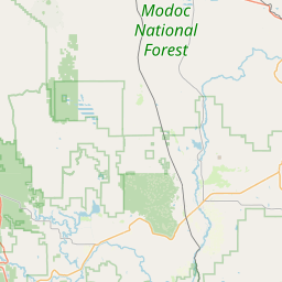
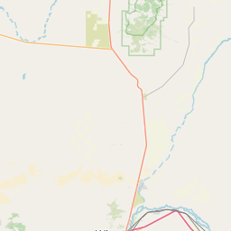
Leaflet | <a href="https://www.openstreetmap.org/copyright">© OpenStreetMap contributors</a>
Item
| Property | Value |
|---|---|
| id | 1955887 |
| downstream_mainstem_id | |
| encompassing_mainstem_basins | |
| featuretype | ['https://www.opengis.net/def/schema/hy_features/hyf/HY_FlowPath', 'https://www.opengis.net/def/schema/hy_features/hyf/HY_WaterBody'] |
| fid | 28169 |
| head_2020huc12 | 160402040607 |
| head_nhdpv1_comid | 9988329 |
| head_nhdpv2_comid | https://geoconnex.us/nhdplusv2/comid/9988329 |
| head_nhdpv2huc12 | https://geoconnex.us/nhdplusv2/huc12/160402040607 |
| head_rf1id | None |
| lengthkm | 27.1 |
| name_at_outlet | Lost Creek |
| name_at_outlet_gnis_id | 841835 |
| new_mainstemid | |
| outlet_2020huc12 | 160402040607 |
| outlet_drainagearea_sqkm | 79.3 |
| outlet_nhdpv1_comid | 25227988 |
| outlet_nhdpv2_comid | https://geoconnex.us/nhdplusv2/comid/25227988 |
| outlet_nhdpv2huc12 | https://geoconnex.us/nhdplusv2/huc12/160402040607 |
| outlet_rf1id | None |
| superseded | False |
| uri | https://geoconnex.us/ref/mainstems/1955887 |