Bald Eagle Creek
Map

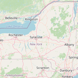


Leaflet | <a href="https://www.openstreetmap.org/copyright">© OpenStreetMap contributors</a>
Item
| Property | Value |
|---|---|
| id | 195650 |
| downstream_mainstem_id | https://geoconnex.us/ref/mainstems/194819 |
| encompassing_mainstem_basins | ['https://geoconnex.us/ref/mainstems/194819', 'https://geoconnex.us/ref/mainstems/194408'] |
| featuretype | ['https://www.opengis.net/def/schema/hy_features/hyf/HY_FlowPath', 'https://www.opengis.net/def/schema/hy_features/hyf/HY_WaterBody'] |
| fid | 1607 |
| head_2020huc12 | 020502040401 |
| head_nhdpv1_comid | 8140562 |
| head_nhdpv2_comid | https://geoconnex.us/nhdplusv2/comid/8140562 |
| head_nhdpv2huc12 | https://geoconnex.us/nhdplusv2/huc12/020502040401 |
| head_rf1id | 3285 |
| lengthkm | 87.4 |
| name_at_outlet | Bald Eagle Creek |
| name_at_outlet_gnis_id | 1168626 |
| new_mainstemid | |
| outlet_2020huc12 | 020502040407 |
| outlet_drainagearea_sqkm | 2002.7 |
| outlet_nhdpv1_comid | 8139692 |
| outlet_nhdpv2_comid | https://geoconnex.us/nhdplusv2/comid/8139692 |
| outlet_nhdpv2huc12 | https://geoconnex.us/nhdplusv2/huc12/020502040407 |
| outlet_rf1id | 3281 |
| superseded | False |
| uri | https://geoconnex.us/ref/mainstems/195650 |
Graph Results
| monitoringLocation | https://sta.geoconnex.dev/collections/USGS/Things/items/'USGS-01547200' |
|---|---|
| siteName | USGS-01547200 |
| datasetDescription | Stream water level elevation above NAVD 1988 in feet / USGS-01547200-348d53732c8b49b29e224103038887ad |
| type | Stream |
| url | https://waterdata.usgs.gov/monitoring-location/01547200/#parameterCode=63160 |
| variableMeasured | Stream water level elevation above NAVD 1988 |
| variableUnit | ft |
| measurementTechnique | observation |
| temporalCoverage | 2024-08-30T09:15:00Z/2024-09-09T18:31:35Z |
| distributionName | USGS Instantaneous Values Service |
| distributionURL | https://waterservices.usgs.gov/nwis/iv/?sites=USGS:01547200¶meterCd=63160&format=rdb |
| distributionFormat | text/tab-separated-values |
| wkt | POINT (-77.7863910870514 40.9431160270226) |
| monitoringLocation | https://sta.geoconnex.dev/collections/USGS/Things/items/'USGS-01547200' |
|---|---|
| siteName | USGS-01547200 |
| datasetDescription | Stream water level elevation above NAVD 1988 in feet / USGS-01547200-348d53732c8b49b29e224103038887ad |
| type | Stream |
| url | https://waterdata.usgs.gov/monitoring-location/01547200/#parameterCode=63160 |
| variableMeasured | Stream water level elevation above NAVD 1988 |
| variableUnit | ft |
| measurementTechnique | observation |
| temporalCoverage | 2024-08-30T09:15:00Z/2024-09-09T18:31:35Z |
| distributionName | USGS SensorThings API |
| distributionURL | https://labs.waterdata.usgs.gov/sta/v1.1/Datastreams('348d53732c8b49b29e224103038887ad')?$expand=Thing,Observations |
| distributionFormat | application/json |
| wkt | POINT (-77.7863910870514 40.9431160270226) |
| monitoringLocation | https://sta.geoconnex.dev/collections/USGS/Things/items/'USGS-01547200' |
|---|---|
| siteName | USGS-01547200 |
| datasetDescription | Gage height / USGS-01547200-97f7466b2d9b471fb1ca323ec28e2fbf |
| type | Stream |
| url | https://waterdata.usgs.gov/monitoring-location/01547200/#parameterCode=00065 |
| variableMeasured | Gage height / USGS-01547200-97f7466b2d9b471fb1ca323ec28e2fbf |
| variableUnit | ft |
| measurementTechnique | observation |
| temporalCoverage | 2024-08-30T09:15:00Z/2024-09-09T18:31:35Z |
| distributionName | USGS Instantaneous Values Service |
| distributionURL | https://waterservices.usgs.gov/nwis/iv/?sites=USGS:01547200¶meterCd=00065&format=rdb |
| distributionFormat | text/tab-separated-values |
| wkt | POINT (-77.7863910870514 40.9431160270226) |
| monitoringLocation | https://sta.geoconnex.dev/collections/USGS/Things/items/'USGS-01547200' |
|---|---|
| siteName | USGS-01547200 |
| datasetDescription | Gage height / USGS-01547200-97f7466b2d9b471fb1ca323ec28e2fbf |
| type | Stream |
| url | https://waterdata.usgs.gov/monitoring-location/01547200/#parameterCode=00065 |
| variableMeasured | Gage height / USGS-01547200-97f7466b2d9b471fb1ca323ec28e2fbf |
| variableUnit | ft |
| measurementTechnique | observation |
| temporalCoverage | 2024-08-30T09:15:00Z/2024-09-09T18:31:35Z |
| distributionName | USGS SensorThings API |
| distributionURL | https://labs.waterdata.usgs.gov/sta/v1.1/Datastreams('97f7466b2d9b471fb1ca323ec28e2fbf')?$expand=Thing,Observations |
| distributionFormat | application/json |
| wkt | POINT (-77.7863910870514 40.9431160270226) |
| monitoringLocation | https://sta.geoconnex.dev/collections/USGS/Things/items/'USGS-01547200' |
|---|---|
| siteName | USGS-01547200 |
| datasetDescription | Discharge / USGS-01547200-c57501b6de394266bba9b09aa5b9d885 |
| type | Stream |
| url | https://waterdata.usgs.gov/monitoring-location/01547200/#parameterCode=00060 |
| variableMeasured | Discharge / USGS-01547200-c57501b6de394266bba9b09aa5b9d885 |
| variableUnit | ft^3/s |
| measurementTechnique | observation |
| temporalCoverage | 2024-08-30T09:15:00Z/2024-09-09T18:31:35Z |
| distributionName | USGS Instantaneous Values Service |
| distributionURL | https://waterservices.usgs.gov/nwis/iv/?sites=USGS:01547200¶meterCd=00060&format=rdb |
| distributionFormat | text/tab-separated-values |
| wkt | POINT (-77.7863910870514 40.9431160270226) |
| monitoringLocation | https://sta.geoconnex.dev/collections/USGS/Things/items/'USGS-01547200' |
|---|---|
| siteName | USGS-01547200 |
| datasetDescription | Discharge / USGS-01547200-c57501b6de394266bba9b09aa5b9d885 |
| type | Stream |
| url | https://waterdata.usgs.gov/monitoring-location/01547200/#parameterCode=00060 |
| variableMeasured | Discharge / USGS-01547200-c57501b6de394266bba9b09aa5b9d885 |
| variableUnit | ft^3/s |
| measurementTechnique | observation |
| temporalCoverage | 2024-08-30T09:15:00Z/2024-09-09T18:31:35Z |
| distributionName | USGS SensorThings API |
| distributionURL | https://labs.waterdata.usgs.gov/sta/v1.1/Datastreams('c57501b6de394266bba9b09aa5b9d885')?$expand=Thing,Observations |
| distributionFormat | application/json |
| wkt | POINT (-77.7863910870514 40.9431160270226) |
| monitoringLocation | https://sta.geoconnex.dev/collections/USGS/Things/items/'USGS-01547500' |
|---|---|
| siteName | USGS-01547500 |
| datasetDescription | Gage height / USGS-01547500-4499f4e6c1c1435a8d50103df14afdbf |
| type | Stream |
| url | https://waterdata.usgs.gov/monitoring-location/01547500/#parameterCode=00065 |
| variableMeasured | Gage height / USGS-01547500-4499f4e6c1c1435a8d50103df14afdbf |
| variableUnit | ft |
| measurementTechnique | observation |
| temporalCoverage | 2024-08-30T09:15:00Z/2024-09-09T18:00:00Z |
| distributionName | USGS Instantaneous Values Service |
| distributionURL | https://waterservices.usgs.gov/nwis/iv/?sites=USGS:01547500¶meterCd=00065&format=rdb |
| distributionFormat | text/tab-separated-values |
| wkt | POINT (-77.604437898898 41.0517312678109) |
| monitoringLocation | https://sta.geoconnex.dev/collections/USGS/Things/items/'USGS-01547500' |
|---|---|
| siteName | USGS-01547500 |
| datasetDescription | Gage height / USGS-01547500-4499f4e6c1c1435a8d50103df14afdbf |
| type | Stream |
| url | https://waterdata.usgs.gov/monitoring-location/01547500/#parameterCode=00065 |
| variableMeasured | Gage height / USGS-01547500-4499f4e6c1c1435a8d50103df14afdbf |
| variableUnit | ft |
| measurementTechnique | observation |
| temporalCoverage | 2024-08-30T09:15:00Z/2024-09-09T18:00:00Z |
| distributionName | USGS SensorThings API |
| distributionURL | https://labs.waterdata.usgs.gov/sta/v1.1/Datastreams('4499f4e6c1c1435a8d50103df14afdbf')?$expand=Thing,Observations |
| distributionFormat | application/json |
| wkt | POINT (-77.604437898898 41.0517312678109) |
| monitoringLocation | https://sta.geoconnex.dev/collections/USGS/Things/items/'USGS-01547500' |
|---|---|
| siteName | USGS-01547500 |
| datasetDescription | Discharge / USGS-01547500-0839504c853c477ead6caee423f0ca62 |
| type | Stream |
| url | https://waterdata.usgs.gov/monitoring-location/01547500/#parameterCode=00060 |
| variableMeasured | Discharge / USGS-01547500-0839504c853c477ead6caee423f0ca62 |
| variableUnit | ft^3/s |
| measurementTechnique | observation |
| temporalCoverage | 2024-08-30T09:15:00Z/2024-09-09T18:00:00Z |
| distributionName | USGS Instantaneous Values Service |
| distributionURL | https://waterservices.usgs.gov/nwis/iv/?sites=USGS:01547500¶meterCd=00060&format=rdb |
| distributionFormat | text/tab-separated-values |
| wkt | POINT (-77.604437898898 41.0517312678109) |
| monitoringLocation | https://sta.geoconnex.dev/collections/USGS/Things/items/'USGS-01547500' |
|---|---|
| siteName | USGS-01547500 |
| datasetDescription | Discharge / USGS-01547500-0839504c853c477ead6caee423f0ca62 |
| type | Stream |
| url | https://waterdata.usgs.gov/monitoring-location/01547500/#parameterCode=00060 |
| variableMeasured | Discharge / USGS-01547500-0839504c853c477ead6caee423f0ca62 |
| variableUnit | ft^3/s |
| measurementTechnique | observation |
| temporalCoverage | 2024-08-30T09:15:00Z/2024-09-09T18:00:00Z |
| distributionName | USGS SensorThings API |
| distributionURL | https://labs.waterdata.usgs.gov/sta/v1.1/Datastreams('0839504c853c477ead6caee423f0ca62')?$expand=Thing,Observations |
| distributionFormat | application/json |
| wkt | POINT (-77.604437898898 41.0517312678109) |
| monitoringLocation | https://sta.geoconnex.dev/collections/USGS/Things/items/'USGS-01547500' |
|---|---|
| siteName | USGS-01547500 |
| datasetDescription | Temperature water / USGS-01547500-8e3e0670c6d2424dbc6add6c4b40a2b0 |
| type | Stream |
| url | https://waterdata.usgs.gov/monitoring-location/01547500/#parameterCode=00010 |
| variableMeasured | Temperature |
| variableUnit | degC |
| measurementTechnique | observation |
| temporalCoverage | 2024-08-30T09:15:00Z/2024-09-09T18:00:00Z |
| distributionName | USGS Instantaneous Values Service |
| distributionURL | https://waterservices.usgs.gov/nwis/iv/?sites=USGS:01547500¶meterCd=00010&format=rdb |
| distributionFormat | text/tab-separated-values |
| wkt | POINT (-77.604437898898 41.0517312678109) |
| monitoringLocation | https://sta.geoconnex.dev/collections/USGS/Things/items/'USGS-01547500' |
|---|---|
| siteName | USGS-01547500 |
| datasetDescription | Temperature water / USGS-01547500-8e3e0670c6d2424dbc6add6c4b40a2b0 |
| type | Stream |
| url | https://waterdata.usgs.gov/monitoring-location/01547500/#parameterCode=00010 |
| variableMeasured | Temperature |
| variableUnit | degC |
| measurementTechnique | observation |
| temporalCoverage | 2024-08-30T09:15:00Z/2024-09-09T18:00:00Z |
| distributionName | USGS SensorThings API |
| distributionURL | https://labs.waterdata.usgs.gov/sta/v1.1/Datastreams('8e3e0670c6d2424dbc6add6c4b40a2b0')?$expand=Thing,Observations |
| distributionFormat | application/json |
| wkt | POINT (-77.604437898898 41.0517312678109) |
| monitoringLocation | https://sta.geoconnex.dev/collections/USGS/Things/items/'USGS-01547500' |
|---|---|
| siteName | USGS-01547500 |
| datasetDescription | Stream water level elevation above NAVD 1988 in feet / USGS-01547500-6573cd1c9e384276ab43de6adb40f158 |
| type | Stream |
| url | https://waterdata.usgs.gov/monitoring-location/01547500/#parameterCode=63160 |
| variableMeasured | Stream water level elevation above NAVD 1988 |
| variableUnit | ft |
| measurementTechnique | observation |
| temporalCoverage | 2024-08-30T09:15:00Z/2024-09-09T18:00:00Z |
| distributionName | USGS SensorThings API |
| distributionURL | https://labs.waterdata.usgs.gov/sta/v1.1/Datastreams('6573cd1c9e384276ab43de6adb40f158')?$expand=Thing,Observations |
| distributionFormat | application/json |
| wkt | POINT (-77.604437898898 41.0517312678109) |
| monitoringLocation | https://sta.geoconnex.dev/collections/USGS/Things/items/'USGS-01547500' |
|---|---|
| siteName | USGS-01547500 |
| datasetDescription | Stream water level elevation above NAVD 1988 in feet / USGS-01547500-6573cd1c9e384276ab43de6adb40f158 |
| type | Stream |
| url | https://waterdata.usgs.gov/monitoring-location/01547500/#parameterCode=63160 |
| variableMeasured | Stream water level elevation above NAVD 1988 |
| variableUnit | ft |
| measurementTechnique | observation |
| temporalCoverage | 2024-08-30T09:15:00Z/2024-09-09T18:00:00Z |
| distributionName | USGS Instantaneous Values Service |
| distributionURL | https://waterservices.usgs.gov/nwis/iv/?sites=USGS:01547500¶meterCd=63160&format=rdb |
| distributionFormat | text/tab-separated-values |
| wkt | POINT (-77.604437898898 41.0517312678109) |
| monitoringLocation | https://sta.geoconnex.dev/collections/USGS/Things/items/'USGS-01548005' |
|---|---|
| siteName | USGS-01548005 |
| datasetDescription | Gage height / USGS-01548005-11a39b5b5bcd4a95a214ebdffa3a7c12 |
| type | Stream |
| url | https://waterdata.usgs.gov/monitoring-location/01548005/#parameterCode=00065 |
| variableMeasured | Gage height / USGS-01548005-11a39b5b5bcd4a95a214ebdffa3a7c12 |
| variableUnit | ft |
| measurementTechnique | observation |
| temporalCoverage | 2024-08-30T09:15:00Z/2024-09-09T18:30:00Z |
| distributionName | USGS Instantaneous Values Service |
| distributionURL | https://waterservices.usgs.gov/nwis/iv/?sites=USGS:01548005¶meterCd=00065&format=rdb |
| distributionFormat | text/tab-separated-values |
| wkt | POINT (-77.5494341880387 41.0808995326752) |
| monitoringLocation | https://sta.geoconnex.dev/collections/USGS/Things/items/'USGS-01548005' |
|---|---|
| siteName | USGS-01548005 |
| datasetDescription | Gage height / USGS-01548005-11a39b5b5bcd4a95a214ebdffa3a7c12 |
| type | Stream |
| url | https://waterdata.usgs.gov/monitoring-location/01548005/#parameterCode=00065 |
| variableMeasured | Gage height / USGS-01548005-11a39b5b5bcd4a95a214ebdffa3a7c12 |
| variableUnit | ft |
| measurementTechnique | observation |
| temporalCoverage | 2024-08-30T09:15:00Z/2024-09-09T18:30:00Z |
| distributionName | USGS SensorThings API |
| distributionURL | https://labs.waterdata.usgs.gov/sta/v1.1/Datastreams('11a39b5b5bcd4a95a214ebdffa3a7c12')?$expand=Thing,Observations |
| distributionFormat | application/json |
| wkt | POINT (-77.5494341880387 41.0808995326752) |
| monitoringLocation | https://sta.geoconnex.dev/collections/USGS/Things/items/'USGS-01548005' |
|---|---|
| siteName | USGS-01548005 |
| datasetDescription | Discharge / USGS-01548005-7723298e44f34178bc972824be99ea80 |
| type | Stream |
| url | https://waterdata.usgs.gov/monitoring-location/01548005/#parameterCode=00060 |
| variableMeasured | Discharge / USGS-01548005-7723298e44f34178bc972824be99ea80 |
| variableUnit | ft^3/s |
| measurementTechnique | observation |
| temporalCoverage | 2024-08-30T09:15:00Z/2024-09-09T18:30:00Z |
| distributionName | USGS Instantaneous Values Service |
| distributionURL | https://waterservices.usgs.gov/nwis/iv/?sites=USGS:01548005¶meterCd=00060&format=rdb |
| distributionFormat | text/tab-separated-values |
| wkt | POINT (-77.5494341880387 41.0808995326752) |
| monitoringLocation | https://sta.geoconnex.dev/collections/USGS/Things/items/'USGS-01548005' |
|---|---|
| siteName | USGS-01548005 |
| datasetDescription | Discharge / USGS-01548005-7723298e44f34178bc972824be99ea80 |
| type | Stream |
| url | https://waterdata.usgs.gov/monitoring-location/01548005/#parameterCode=00060 |
| variableMeasured | Discharge / USGS-01548005-7723298e44f34178bc972824be99ea80 |
| variableUnit | ft^3/s |
| measurementTechnique | observation |
| temporalCoverage | 2024-08-30T09:15:00Z/2024-09-09T18:30:00Z |
| distributionName | USGS SensorThings API |
| distributionURL | https://labs.waterdata.usgs.gov/sta/v1.1/Datastreams('7723298e44f34178bc972824be99ea80')?$expand=Thing,Observations |
| distributionFormat | application/json |
| wkt | POINT (-77.5494341880387 41.0808995326752) |
| monitoringLocation | https://sta.geoconnex.dev/collections/USGS/Things/items/'USGS-01548005' |
|---|---|
| siteName | USGS-01548005 |
| datasetDescription | Stream water level elevation above NAVD 1988 in feet / USGS-01548005-df29f77c4439484a90c821c76f7192f1 |
| type | Stream |
| url | https://waterdata.usgs.gov/monitoring-location/01548005/#parameterCode=63160 |
| variableMeasured | Stream water level elevation above NAVD 1988 |
| variableUnit | ft |
| measurementTechnique | observation |
| temporalCoverage | 2024-08-30T09:15:00Z/2024-09-09T18:30:00Z |
| distributionName | USGS SensorThings API |
| distributionURL | https://labs.waterdata.usgs.gov/sta/v1.1/Datastreams('df29f77c4439484a90c821c76f7192f1')?$expand=Thing,Observations |
| distributionFormat | application/json |
| wkt | POINT (-77.5494341880387 41.0808995326752) |
| monitoringLocation | https://sta.geoconnex.dev/collections/USGS/Things/items/'USGS-01548005' |
|---|---|
| siteName | USGS-01548005 |
| datasetDescription | Stream water level elevation above NAVD 1988 in feet / USGS-01548005-df29f77c4439484a90c821c76f7192f1 |
| type | Stream |
| url | https://waterdata.usgs.gov/monitoring-location/01548005/#parameterCode=63160 |
| variableMeasured | Stream water level elevation above NAVD 1988 |
| variableUnit | ft |
| measurementTechnique | observation |
| temporalCoverage | 2024-08-30T09:15:00Z/2024-09-09T18:30:00Z |
| distributionName | USGS Instantaneous Values Service |
| distributionURL | https://waterservices.usgs.gov/nwis/iv/?sites=USGS:01548005¶meterCd=63160&format=rdb |
| distributionFormat | text/tab-separated-values |
| wkt | POINT (-77.5494341880387 41.0808995326752) |