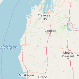
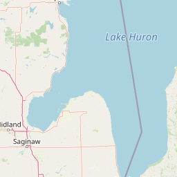
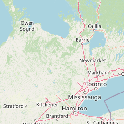
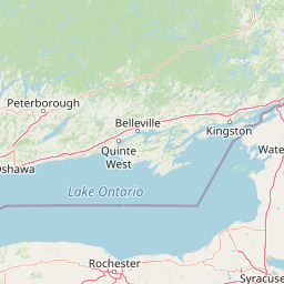
Little Muskegon River
Map


Leaflet | <a href="https://www.openstreetmap.org/copyright">© OpenStreetMap contributors</a>
Item
| Property | Value |
|---|---|
| id | 2038448 |
| downstream_mainstem_id | https://geoconnex.us/ref/mainstems/2038323 |
| encompassing_mainstem_basins | ['https://geoconnex.us/ref/mainstems/2038323'] |
| featuretype | ['https://www.opengis.net/def/schema/hy_features/hyf/HY_FlowPath', 'https://www.opengis.net/def/schema/hy_features/hyf/HY_WaterBody'] |
| fid | 6659 |
| head_2020huc12 | 040601020802 |
| head_nhdpv1_comid | 13040228 |
| head_nhdpv2_comid | https://geoconnex.us/nhdplusv2/comid/13040228 |
| head_nhdpv2huc12 | https://geoconnex.us/nhdplusv2/huc12/040601020802 |
| head_rf1id | 10915 |
| lengthkm | 89.4 |
| name_at_outlet | Little Muskegon River |
| name_at_outlet_gnis_id | 1620572 |
| new_mainstemid | |
| outlet_2020huc12 | 040601020810 |
| outlet_drainagearea_sqkm | 976.7 |
| outlet_nhdpv1_comid | 12134802 |
| outlet_nhdpv2_comid | https://geoconnex.us/nhdplusv2/comid/12134802 |
| outlet_nhdpv2huc12 | https://geoconnex.us/nhdplusv2/huc12/040601020810 |
| outlet_rf1id | 11849 |
| superseded | False |
| uri | https://geoconnex.us/ref/mainstems/2038448 |
Graph Results
| monitoringLocation | https://sta.geoconnex.dev/collections/USGS/Things/items/'USGS-04121944' |
|---|---|
| siteName | USGS-04121944 |
| datasetDescription | Gage height / USGS-04121944-1a477076f11a41128c14b20070dfbe31 |
| type | Stream |
| url | https://waterdata.usgs.gov/monitoring-location/04121944/#parameterCode=00065 |
| variableMeasured | Gage height / USGS-04121944-1a477076f11a41128c14b20070dfbe31 |
| variableUnit | ft |
| measurementTechnique | observation |
| temporalCoverage | 2024-08-30T09:15:00Z/2024-09-09T18:30:00Z |
| distributionName | USGS SensorThings API |
| distributionURL | https://labs.waterdata.usgs.gov/sta/v1.1/Datastreams('1a477076f11a41128c14b20070dfbe31')?$expand=Thing,Observations |
| distributionFormat | application/json |
| wkt | POINT (-85.5955988835488 43.4308581835875) |
| monitoringLocation | https://sta.geoconnex.dev/collections/USGS/Things/items/'USGS-04121944' |
|---|---|
| siteName | USGS-04121944 |
| datasetDescription | Gage height / USGS-04121944-1a477076f11a41128c14b20070dfbe31 |
| type | Stream |
| url | https://waterdata.usgs.gov/monitoring-location/04121944/#parameterCode=00065 |
| variableMeasured | Gage height / USGS-04121944-1a477076f11a41128c14b20070dfbe31 |
| variableUnit | ft |
| measurementTechnique | observation |
| temporalCoverage | 2024-08-30T09:15:00Z/2024-09-09T18:30:00Z |
| distributionName | USGS Instantaneous Values Service |
| distributionURL | https://waterservices.usgs.gov/nwis/iv/?sites=USGS:04121944¶meterCd=00065&format=rdb |
| distributionFormat | text/tab-separated-values |
| wkt | POINT (-85.5955988835488 43.4308581835875) |
| monitoringLocation | https://sta.geoconnex.dev/collections/USGS/Things/items/'USGS-04121944' |
|---|---|
| siteName | USGS-04121944 |
| datasetDescription | Stream water level elevation above NAVD 1988, in feet / USGS-04121944-567c642452194ca19ba2c5df31ef1c94 |
| type | Stream |
| url | https://waterdata.usgs.gov/monitoring-location/04121944/#parameterCode=63160 |
| variableMeasured | Stream water level elevation above NAVD 1988 |
| variableUnit | ft |
| measurementTechnique | observation |
| temporalCoverage | 2024-08-30T09:15:00Z/2024-09-09T18:15:00Z |
| distributionName | USGS Instantaneous Values Service |
| distributionURL | https://waterservices.usgs.gov/nwis/iv/?sites=USGS:04121944¶meterCd=63160&format=rdb |
| distributionFormat | text/tab-separated-values |
| wkt | POINT (-85.5955988835488 43.4308581835875) |
| monitoringLocation | https://sta.geoconnex.dev/collections/USGS/Things/items/'USGS-04121944' |
|---|---|
| siteName | USGS-04121944 |
| datasetDescription | Stream water level elevation above NAVD 1988, in feet / USGS-04121944-567c642452194ca19ba2c5df31ef1c94 |
| type | Stream |
| url | https://waterdata.usgs.gov/monitoring-location/04121944/#parameterCode=63160 |
| variableMeasured | Stream water level elevation above NAVD 1988 |
| variableUnit | ft |
| measurementTechnique | observation |
| temporalCoverage | 2024-08-30T09:15:00Z/2024-09-09T18:15:00Z |
| distributionName | USGS SensorThings API |
| distributionURL | https://labs.waterdata.usgs.gov/sta/v1.1/Datastreams('567c642452194ca19ba2c5df31ef1c94')?$expand=Thing,Observations |
| distributionFormat | application/json |
| wkt | POINT (-85.5955988835488 43.4308581835875) |
| monitoringLocation | https://sta.geoconnex.dev/collections/USGS/Things/items/'USGS-04121944' |
|---|---|
| siteName | USGS-04121944 |
| datasetDescription | Temperature, water / USGS-04121944-7c7dff3901f1495a9eccd16dd13893fa |
| type | Stream |
| url | https://waterdata.usgs.gov/monitoring-location/04121944/#parameterCode=00010 |
| variableMeasured | Temperature |
| variableUnit | degC |
| measurementTechnique | observation |
| temporalCoverage | 2024-08-30T09:15:00Z/2024-09-09T18:30:00Z |
| distributionName | USGS SensorThings API |
| distributionURL | https://labs.waterdata.usgs.gov/sta/v1.1/Datastreams('7c7dff3901f1495a9eccd16dd13893fa')?$expand=Thing,Observations |
| distributionFormat | application/json |
| wkt | POINT (-85.5955988835488 43.4308581835875) |
| monitoringLocation | https://sta.geoconnex.dev/collections/USGS/Things/items/'USGS-04121944' |
|---|---|
| siteName | USGS-04121944 |
| datasetDescription | Temperature, water / USGS-04121944-7c7dff3901f1495a9eccd16dd13893fa |
| type | Stream |
| url | https://waterdata.usgs.gov/monitoring-location/04121944/#parameterCode=00010 |
| variableMeasured | Temperature |
| variableUnit | degC |
| measurementTechnique | observation |
| temporalCoverage | 2024-08-30T09:15:00Z/2024-09-09T18:30:00Z |
| distributionName | USGS Instantaneous Values Service |
| distributionURL | https://waterservices.usgs.gov/nwis/iv/?sites=USGS:04121944¶meterCd=00010&format=rdb |
| distributionFormat | text/tab-separated-values |
| wkt | POINT (-85.5955988835488 43.4308581835875) |
| monitoringLocation | https://sta.geoconnex.dev/collections/USGS/Things/items/'USGS-04121944' |
|---|---|
| siteName | USGS-04121944 |
| datasetDescription | Discharge / USGS-04121944-a860adee1c1e4658a859caafc5aa160d |
| type | Stream |
| url | https://waterdata.usgs.gov/monitoring-location/04121944/#parameterCode=00060 |
| variableMeasured | Discharge / USGS-04121944-a860adee1c1e4658a859caafc5aa160d |
| variableUnit | ft^3/s |
| measurementTechnique | observation |
| temporalCoverage | 2024-08-30T09:15:00Z/2024-09-09T18:30:00Z |
| distributionName | USGS Instantaneous Values Service |
| distributionURL | https://waterservices.usgs.gov/nwis/iv/?sites=USGS:04121944¶meterCd=00060&format=rdb |
| distributionFormat | text/tab-separated-values |
| wkt | POINT (-85.5955988835488 43.4308581835875) |
| monitoringLocation | https://sta.geoconnex.dev/collections/USGS/Things/items/'USGS-04121944' |
|---|---|
| siteName | USGS-04121944 |
| datasetDescription | Discharge / USGS-04121944-a860adee1c1e4658a859caafc5aa160d |
| type | Stream |
| url | https://waterdata.usgs.gov/monitoring-location/04121944/#parameterCode=00060 |
| variableMeasured | Discharge / USGS-04121944-a860adee1c1e4658a859caafc5aa160d |
| variableUnit | ft^3/s |
| measurementTechnique | observation |
| temporalCoverage | 2024-08-30T09:15:00Z/2024-09-09T18:30:00Z |
| distributionName | USGS SensorThings API |
| distributionURL | https://labs.waterdata.usgs.gov/sta/v1.1/Datastreams('a860adee1c1e4658a859caafc5aa160d')?$expand=Thing,Observations |
| distributionFormat | application/json |
| wkt | POINT (-85.5955988835488 43.4308581835875) |
| monitoringLocation | https://sta.geoconnex.dev/collections/USGS/Things/items/'USGS-04121944' |
|---|---|
| siteName | USGS-04121944 |
| datasetDescription | Dissolved oxygen, water, unfiltered, milligrams per liter / USGS-04121944-d9ebeea8115340de848a1d85615bb1fa |
| type | Stream |
| url | https://waterdata.usgs.gov/monitoring-location/04121944/#parameterCode=00300 |
| variableMeasured | Dissolved oxygen |
| variableUnit | mg/l |
| measurementTechnique | observation |
| temporalCoverage | 2024-08-30T09:15:00Z/2024-09-09T18:30:00Z |
| distributionName | USGS Instantaneous Values Service |
| distributionURL | https://waterservices.usgs.gov/nwis/iv/?sites=USGS:04121944¶meterCd=00300&format=rdb |
| distributionFormat | text/tab-separated-values |
| wkt | POINT (-85.5955988835488 43.4308581835875) |
| monitoringLocation | https://sta.geoconnex.dev/collections/USGS/Things/items/'USGS-04121944' |
|---|---|
| siteName | USGS-04121944 |
| datasetDescription | Dissolved oxygen, water, unfiltered, milligrams per liter / USGS-04121944-d9ebeea8115340de848a1d85615bb1fa |
| type | Stream |
| url | https://waterdata.usgs.gov/monitoring-location/04121944/#parameterCode=00300 |
| variableMeasured | Dissolved oxygen |
| variableUnit | mg/l |
| measurementTechnique | observation |
| temporalCoverage | 2024-08-30T09:15:00Z/2024-09-09T18:30:00Z |
| distributionName | USGS SensorThings API |
| distributionURL | https://labs.waterdata.usgs.gov/sta/v1.1/Datastreams('d9ebeea8115340de848a1d85615bb1fa')?$expand=Thing,Observations |
| distributionFormat | application/json |
| wkt | POINT (-85.5955988835488 43.4308581835875) |