Clam River
Map
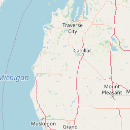


Leaflet | <a href="https://www.openstreetmap.org/copyright">© OpenStreetMap contributors</a>
Item
| Property | Value |
|---|---|
| id | 2038524 |
| downstream_mainstem_id | https://geoconnex.us/ref/mainstems/2038323 |
| encompassing_mainstem_basins | ['https://geoconnex.us/ref/mainstems/2038323'] |
| featuretype | ['https://www.opengis.net/def/schema/hy_features/hyf/HY_FlowPath', 'https://www.opengis.net/def/schema/hy_features/hyf/HY_WaterBody'] |
| fid | 6668 |
| head_2020huc12 | 040601020301 |
| head_nhdpv1_comid | 12130214 |
| head_nhdpv2_comid | https://geoconnex.us/nhdplusv2/comid/12130214 |
| head_nhdpv2huc12 | https://geoconnex.us/nhdplusv2/huc12/040601020301 |
| head_rf1id | 11781 |
| lengthkm | 87.8 |
| name_at_outlet | Clam River |
| name_at_outlet_gnis_id | 623331 |
| new_mainstemid | |
| outlet_2020huc12 | 040601020310 |
| outlet_drainagearea_sqkm | 873.0 |
| outlet_nhdpv1_comid | 12130346 |
| outlet_nhdpv2_comid | https://geoconnex.us/nhdplusv2/comid/12130346 |
| outlet_nhdpv2huc12 | https://geoconnex.us/nhdplusv2/huc12/040601020310 |
| outlet_rf1id | 10932 |
| superseded | False |
| uri | https://geoconnex.us/ref/mainstems/2038524 |
Graph Results
| monitoringLocation | https://sta.geoconnex.dev/collections/USGS/Things/items/'USGS-04121300' |
|---|---|
| siteName | USGS-04121300 |
| datasetDescription | Discharge, cubic feet per second / USGS-04121300-462ff158da604590ab04286b5c821717 |
| type | Stream |
| url | https://waterdata.usgs.gov/monitoring-location/04121300/#parameterCode=00060 |
| variableMeasured | Discharge |
| variableUnit | ft^3/s |
| measurementTechnique | observation |
| temporalCoverage | 2024-08-30T09:15:00Z/2024-09-09T18:15:00Z |
| distributionName | USGS SensorThings API |
| distributionURL | https://labs.waterdata.usgs.gov/sta/v1.1/Datastreams('462ff158da604590ab04286b5c821717')?$expand=Thing,Observations |
| distributionFormat | application/json |
| wkt | POINT (-85.0528147191002 44.2005692327937) |
| monitoringLocation | https://sta.geoconnex.dev/collections/USGS/Things/items/'USGS-04121300' |
|---|---|
| siteName | USGS-04121300 |
| datasetDescription | Discharge, cubic feet per second / USGS-04121300-462ff158da604590ab04286b5c821717 |
| type | Stream |
| url | https://waterdata.usgs.gov/monitoring-location/04121300/#parameterCode=00060 |
| variableMeasured | Discharge |
| variableUnit | ft^3/s |
| measurementTechnique | observation |
| temporalCoverage | 2024-08-30T09:15:00Z/2024-09-09T18:15:00Z |
| distributionName | USGS Instantaneous Values Service |
| distributionURL | https://waterservices.usgs.gov/nwis/iv/?sites=USGS:04121300¶meterCd=00060&format=rdb |
| distributionFormat | text/tab-separated-values |
| wkt | POINT (-85.0528147191002 44.2005692327937) |
| monitoringLocation | https://sta.geoconnex.dev/collections/USGS/Things/items/'USGS-04121300' |
|---|---|
| siteName | USGS-04121300 |
| datasetDescription | Stream water level elevation above NAVD 1988, in feet / USGS-04121300-7750dcfbc20c4c2c839c83360c60c4dd |
| type | Stream |
| url | https://waterdata.usgs.gov/monitoring-location/04121300/#parameterCode=63160 |
| variableMeasured | Stream water level elevation above NAVD 1988 |
| variableUnit | ft |
| measurementTechnique | observation |
| temporalCoverage | 2024-08-30T09:15:00Z/2024-09-09T18:15:00Z |
| distributionName | USGS Instantaneous Values Service |
| distributionURL | https://waterservices.usgs.gov/nwis/iv/?sites=USGS:04121300¶meterCd=63160&format=rdb |
| distributionFormat | text/tab-separated-values |
| wkt | POINT (-85.0528147191002 44.2005692327937) |
| monitoringLocation | https://sta.geoconnex.dev/collections/USGS/Things/items/'USGS-04121300' |
|---|---|
| siteName | USGS-04121300 |
| datasetDescription | Stream water level elevation above NAVD 1988, in feet / USGS-04121300-7750dcfbc20c4c2c839c83360c60c4dd |
| type | Stream |
| url | https://waterdata.usgs.gov/monitoring-location/04121300/#parameterCode=63160 |
| variableMeasured | Stream water level elevation above NAVD 1988 |
| variableUnit | ft |
| measurementTechnique | observation |
| temporalCoverage | 2024-08-30T09:15:00Z/2024-09-09T18:15:00Z |
| distributionName | USGS SensorThings API |
| distributionURL | https://labs.waterdata.usgs.gov/sta/v1.1/Datastreams('7750dcfbc20c4c2c839c83360c60c4dd')?$expand=Thing,Observations |
| distributionFormat | application/json |
| wkt | POINT (-85.0528147191002 44.2005692327937) |
| monitoringLocation | https://sta.geoconnex.dev/collections/USGS/Things/items/'USGS-04121300' |
|---|---|
| siteName | USGS-04121300 |
| datasetDescription | Gage height, feet / USGS-04121300-a8be4fd5142540b08b996efc4de9149e |
| type | Stream |
| url | https://waterdata.usgs.gov/monitoring-location/04121300/#parameterCode=00065 |
| variableMeasured | Gage height |
| variableUnit | ft |
| measurementTechnique | observation |
| temporalCoverage | 2024-08-30T09:15:00Z/2024-09-09T18:15:00Z |
| distributionName | USGS SensorThings API |
| distributionURL | https://labs.waterdata.usgs.gov/sta/v1.1/Datastreams('a8be4fd5142540b08b996efc4de9149e')?$expand=Thing,Observations |
| distributionFormat | application/json |
| wkt | POINT (-85.0528147191002 44.2005692327937) |
| monitoringLocation | https://sta.geoconnex.dev/collections/USGS/Things/items/'USGS-04121300' |
|---|---|
| siteName | USGS-04121300 |
| datasetDescription | Gage height, feet / USGS-04121300-a8be4fd5142540b08b996efc4de9149e |
| type | Stream |
| url | https://waterdata.usgs.gov/monitoring-location/04121300/#parameterCode=00065 |
| variableMeasured | Gage height |
| variableUnit | ft |
| measurementTechnique | observation |
| temporalCoverage | 2024-08-30T09:15:00Z/2024-09-09T18:15:00Z |
| distributionName | USGS Instantaneous Values Service |
| distributionURL | https://waterservices.usgs.gov/nwis/iv/?sites=USGS:04121300¶meterCd=00065&format=rdb |
| distributionFormat | text/tab-separated-values |
| wkt | POINT (-85.0528147191002 44.2005692327937) |