Cooper Brook
Map

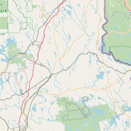
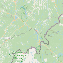
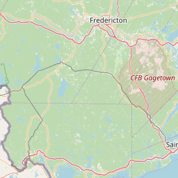
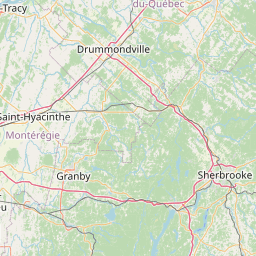

Leaflet | <a href="https://www.openstreetmap.org/copyright">© OpenStreetMap contributors</a>
Item
| Property | Value |
|---|---|
| id | 2245492 |
| downstream_mainstem_id | https://geoconnex.us/ref/mainstems/2245350 |
| encompassing_mainstem_basins | ['https://geoconnex.us/ref/mainstems/2245350', 'https://geoconnex.us/ref/mainstems/1815586'] |
| featuretype | ['https://www.opengis.net/def/schema/hy_features/hyf/HY_FlowPath', 'https://www.opengis.net/def/schema/hy_features/hyf/HY_WaterBody'] |
| fid | 141 |
| head_2020huc12 | 010200010802 |
| head_nhdpv1_comid | 1703046 |
| head_nhdpv2_comid | https://geoconnex.us/nhdplusv2/comid/1703046 |
| head_nhdpv2huc12 | https://geoconnex.us/nhdplusv2/huc12/010200010802 |
| head_rf1id | 2097 |
| lengthkm | 29.9 |
| name_at_outlet | Cooper Brook |
| name_at_outlet_gnis_id | 564342 |
| new_mainstemid | |
| outlet_2020huc12 | 010200010805 |
| outlet_drainagearea_sqkm | 225.3 |
| outlet_nhdpv1_comid | 1700618 |
| outlet_nhdpv2_comid | https://geoconnex.us/nhdplusv2/comid/1700618 |
| outlet_nhdpv2huc12 | https://geoconnex.us/nhdplusv2/huc12/010200010805 |
| outlet_rf1id | 2103 |
| superseded | False |
| uri | https://geoconnex.us/ref/mainstems/2245492 |