Royal River
Map
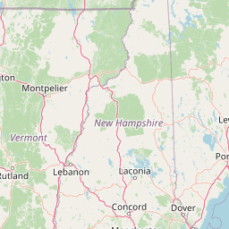
Leaflet | <a href="https://www.openstreetmap.org/copyright">© OpenStreetMap contributors</a>
Item
| Property | Value |
|---|---|
| id | 2265558 |
| downstream_mainstem_id | |
| encompassing_mainstem_basins | |
| featuretype | ['https://www.opengis.net/def/schema/hy_features/hyf/HY_FlowPath', 'https://www.opengis.net/def/schema/hy_features/hyf/HY_WaterBody'] |
| fid | 463 |
| head_2020huc12 | 010600010201 |
| head_nhdpv1_comid | 6720437 |
| head_nhdpv2_comid | https://geoconnex.us/nhdplusv2/comid/6720437 |
| head_nhdpv2huc12 | https://geoconnex.us/nhdplusv2/huc12/010600010201 |
| head_rf1id | None |
| lengthkm | 64.3 |
| name_at_outlet | Royal River |
| name_at_outlet_gnis_id | 574564 |
| new_mainstemid | |
| outlet_2020huc12 | 010600010206 |
| outlet_drainagearea_sqkm | 425.8 |
| outlet_nhdpv1_comid | 6724895 |
| outlet_nhdpv2_comid | https://geoconnex.us/nhdplusv2/comid/6724895 |
| outlet_nhdpv2huc12 | https://geoconnex.us/nhdplusv2/huc12/010600010206 |
| outlet_rf1id | None |
| superseded | False |
| uri | https://geoconnex.us/ref/mainstems/2265558 |
Graph Results
| monitoringLocation | https://sta.geoconnex.dev/collections/USGS/Things/items/'USGS-01060000' |
|---|---|
| siteName | USGS-01060000 |
| datasetDescription | Discharge / USGS-01060000-3b79c7bce7d34efc9a37e101f31755bf |
| type | Stream |
| url | https://waterdata.usgs.gov/monitoring-location/01060000/#parameterCode=00060 |
| variableMeasured | Discharge / USGS-01060000-3b79c7bce7d34efc9a37e101f31755bf |
| variableUnit | ft^3/s |
| measurementTechnique | observation |
| temporalCoverage | 2024-08-30T09:15:00Z/2024-09-09T17:30:00Z |
| distributionName | USGS SensorThings API |
| distributionURL | https://labs.waterdata.usgs.gov/sta/v1.1/Datastreams('3b79c7bce7d34efc9a37e101f31755bf')?$expand=Thing,Observations |
| distributionFormat | application/json |
| wkt | POINT (-70.1782694444445 43.79915) |
| monitoringLocation | https://sta.geoconnex.dev/collections/USGS/Things/items/'USGS-01060000' |
|---|---|
| siteName | USGS-01060000 |
| datasetDescription | Discharge / USGS-01060000-3b79c7bce7d34efc9a37e101f31755bf |
| type | Stream |
| url | https://waterdata.usgs.gov/monitoring-location/01060000/#parameterCode=00060 |
| variableMeasured | Discharge / USGS-01060000-3b79c7bce7d34efc9a37e101f31755bf |
| variableUnit | ft^3/s |
| measurementTechnique | observation |
| temporalCoverage | 2024-08-30T09:15:00Z/2024-09-09T17:30:00Z |
| distributionName | USGS Instantaneous Values Service |
| distributionURL | https://waterservices.usgs.gov/nwis/iv/?sites=USGS:01060000¶meterCd=00060&format=rdb |
| distributionFormat | text/tab-separated-values |
| wkt | POINT (-70.1782694444445 43.79915) |
| monitoringLocation | https://sta.geoconnex.dev/collections/USGS/Things/items/'USGS-01060000' |
|---|---|
| siteName | USGS-01060000 |
| datasetDescription | Gage height / USGS-01060000-ae0d7543db6a4a09870cbb6fd2f59183 |
| type | Stream |
| url | https://waterdata.usgs.gov/monitoring-location/01060000/#parameterCode=00065 |
| variableMeasured | Gage height / USGS-01060000-ae0d7543db6a4a09870cbb6fd2f59183 |
| variableUnit | ft |
| measurementTechnique | observation |
| temporalCoverage | 2024-08-30T09:15:00Z/2024-09-09T17:30:00Z |
| distributionName | USGS Instantaneous Values Service |
| distributionURL | https://waterservices.usgs.gov/nwis/iv/?sites=USGS:01060000¶meterCd=00065&format=rdb |
| distributionFormat | text/tab-separated-values |
| wkt | POINT (-70.1782694444445 43.79915) |
| monitoringLocation | https://sta.geoconnex.dev/collections/USGS/Things/items/'USGS-01060000' |
|---|---|
| siteName | USGS-01060000 |
| datasetDescription | Gage height / USGS-01060000-ae0d7543db6a4a09870cbb6fd2f59183 |
| type | Stream |
| url | https://waterdata.usgs.gov/monitoring-location/01060000/#parameterCode=00065 |
| variableMeasured | Gage height / USGS-01060000-ae0d7543db6a4a09870cbb6fd2f59183 |
| variableUnit | ft |
| measurementTechnique | observation |
| temporalCoverage | 2024-08-30T09:15:00Z/2024-09-09T17:30:00Z |
| distributionName | USGS SensorThings API |
| distributionURL | https://labs.waterdata.usgs.gov/sta/v1.1/Datastreams('ae0d7543db6a4a09870cbb6fd2f59183')?$expand=Thing,Observations |
| distributionFormat | application/json |
| wkt | POINT (-70.1782694444445 43.79915) |