Pawtuckaway River
Map
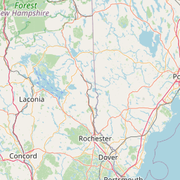
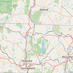
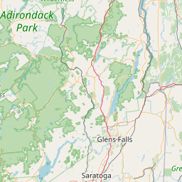

Leaflet | <a href="https://www.openstreetmap.org/copyright">© OpenStreetMap contributors</a>
Item
| Property | Value |
|---|---|
| id | 2268839 |
| downstream_mainstem_id | https://geoconnex.us/ref/mainstems/2268819 |
| encompassing_mainstem_basins | ['https://geoconnex.us/ref/mainstems/2268819'] |
| featuretype | ['https://www.opengis.net/def/schema/hy_features/hyf/HY_FlowPath', 'https://www.opengis.net/def/schema/hy_features/hyf/HY_WaterBody'] |
| fid | 523 |
| head_2020huc12 | 010600030701 |
| head_nhdpv1_comid | 5848398 |
| head_nhdpv2_comid | https://geoconnex.us/nhdplusv2/comid/5848398 |
| head_nhdpv2huc12 | |
| head_rf1id | None |
| lengthkm | 84.3 |
| name_at_outlet | Pawtuckaway River |
| name_at_outlet_gnis_id | 871286 |
| new_mainstemid | |
| outlet_2020huc12 | 010600030904 |
| outlet_drainagearea_sqkm | 1173.5 |
| outlet_nhdpv1_comid | 5846392 |
| outlet_nhdpv2_comid | https://geoconnex.us/nhdplusv2/comid/5846392 |
| outlet_nhdpv2huc12 | |
| outlet_rf1id | None |
| superseded | False |
| uri | https://geoconnex.us/ref/mainstems/2268839 |
Graph Results
| monitoringLocation | https://sta.geoconnex.dev/collections/USGS/Things/items/'USGS-01073500' |
|---|---|
| siteName | USGS-01073500 |
| datasetDescription | Discharge cubic feet per second / USGS-01073500-56654572f8d14698823b9c04878eccc2 |
| type | Stream |
| url | https://waterdata.usgs.gov/monitoring-location/01073500/#parameterCode=00060 |
| variableMeasured | Discharge |
| variableUnit | ft^3/s |
| measurementTechnique | observation |
| temporalCoverage | 2024-08-30T09:15:00Z/2024-09-09T18:15:00Z |
| distributionName | USGS Instantaneous Values Service |
| distributionURL | https://waterservices.usgs.gov/nwis/iv/?sites=USGS:01073500¶meterCd=00060&format=rdb |
| distributionFormat | text/tab-separated-values |
| wkt | POINT (-70.9525590002348 43.1025855772715) |
| monitoringLocation | https://sta.geoconnex.dev/collections/USGS/Things/items/'USGS-01073500' |
|---|---|
| siteName | USGS-01073500 |
| datasetDescription | Discharge cubic feet per second / USGS-01073500-56654572f8d14698823b9c04878eccc2 |
| type | Stream |
| url | https://waterdata.usgs.gov/monitoring-location/01073500/#parameterCode=00060 |
| variableMeasured | Discharge |
| variableUnit | ft^3/s |
| measurementTechnique | observation |
| temporalCoverage | 2024-08-30T09:15:00Z/2024-09-09T18:15:00Z |
| distributionName | USGS SensorThings API |
| distributionURL | https://labs.waterdata.usgs.gov/sta/v1.1/Datastreams('56654572f8d14698823b9c04878eccc2')?$expand=Thing,Observations |
| distributionFormat | application/json |
| wkt | POINT (-70.9525590002348 43.1025855772715) |
| monitoringLocation | https://sta.geoconnex.dev/collections/USGS/Things/items/'USGS-01073500' |
|---|---|
| siteName | USGS-01073500 |
| datasetDescription | Gage height / USGS-01073500-6035d029f26d4ac2ae3a2cce8074856d |
| type | Stream |
| url | https://waterdata.usgs.gov/monitoring-location/01073500/#parameterCode=00065 |
| variableMeasured | Gage height / USGS-01073500-6035d029f26d4ac2ae3a2cce8074856d |
| variableUnit | ft |
| measurementTechnique | observation |
| temporalCoverage | 2024-08-30T09:15:00Z/2024-09-09T18:15:00Z |
| distributionName | USGS Instantaneous Values Service |
| distributionURL | https://waterservices.usgs.gov/nwis/iv/?sites=USGS:01073500¶meterCd=00065&format=rdb |
| distributionFormat | text/tab-separated-values |
| wkt | POINT (-70.9525590002348 43.1025855772715) |
| monitoringLocation | https://sta.geoconnex.dev/collections/USGS/Things/items/'USGS-01073500' |
|---|---|
| siteName | USGS-01073500 |
| datasetDescription | Gage height / USGS-01073500-6035d029f26d4ac2ae3a2cce8074856d |
| type | Stream |
| url | https://waterdata.usgs.gov/monitoring-location/01073500/#parameterCode=00065 |
| variableMeasured | Gage height / USGS-01073500-6035d029f26d4ac2ae3a2cce8074856d |
| variableUnit | ft |
| measurementTechnique | observation |
| temporalCoverage | 2024-08-30T09:15:00Z/2024-09-09T18:15:00Z |
| distributionName | USGS SensorThings API |
| distributionURL | https://labs.waterdata.usgs.gov/sta/v1.1/Datastreams('6035d029f26d4ac2ae3a2cce8074856d')?$expand=Thing,Observations |
| distributionFormat | application/json |
| wkt | POINT (-70.9525590002348 43.1025855772715) |