Nashua River
Map
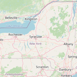
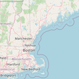


Leaflet | <a href="https://www.openstreetmap.org/copyright">© OpenStreetMap contributors</a>
Item
| Property | Value |
|---|---|
| id | 2270628 |
| downstream_mainstem_id | https://geoconnex.us/ref/mainstems/2270463 |
| encompassing_mainstem_basins | ['https://geoconnex.us/ref/mainstems/2270463'] |
| featuretype | ['https://www.opengis.net/def/schema/hy_features/hyf/HY_FlowPath', 'https://www.opengis.net/def/schema/hy_features/hyf/HY_WaterBody'] |
| fid | 571 |
| head_2020huc12 | 010700040101 |
| head_nhdpv1_comid | 6075597 |
| head_nhdpv2_comid | https://geoconnex.us/nhdplusv2/comid/6075597 |
| head_nhdpv2huc12 | https://geoconnex.us/nhdplusv2/huc12/010700040101 |
| head_rf1id | 1028 |
| lengthkm | 110.4 |
| name_at_outlet | Nashua River |
| name_at_outlet_gnis_id | 617989 |
| new_mainstemid | |
| outlet_2020huc12 | 010700040402 |
| outlet_drainagearea_sqkm | 1378.1 |
| outlet_nhdpv1_comid | 6076117 |
| outlet_nhdpv2_comid | https://geoconnex.us/nhdplusv2/comid/6076117 |
| outlet_nhdpv2huc12 | https://geoconnex.us/nhdplusv2/huc12/010700040402 |
| outlet_rf1id | 1022 |
| superseded | False |
| uri | https://geoconnex.us/ref/mainstems/2270628 |
Graph Results
| monitoringLocation | https://sta.geoconnex.dev/collections/USGS/Things/items/'USGS-01096500' |
|---|---|
| siteName | USGS-01096500 |
| datasetDescription | Gage height / USGS-01096500-63c5a68d3ff14446b87e7944210a7f54 |
| type | Stream |
| url | https://waterdata.usgs.gov/monitoring-location/01096500/#parameterCode=00065 |
| variableMeasured | Gage height / USGS-01096500-63c5a68d3ff14446b87e7944210a7f54 |
| variableUnit | ft |
| measurementTechnique | observation |
| temporalCoverage | 2024-08-30T09:15:00Z/2024-09-09T18:00:00Z |
| distributionName | USGS Instantaneous Values Service |
| distributionURL | https://waterservices.usgs.gov/nwis/iv/?sites=USGS:01096500¶meterCd=00065&format=rdb |
| distributionFormat | text/tab-separated-values |
| wkt | POINT (-71.5750680936367 42.6675894505044) |
| monitoringLocation | https://sta.geoconnex.dev/collections/USGS/Things/items/'USGS-01096500' |
|---|---|
| siteName | USGS-01096500 |
| datasetDescription | Gage height / USGS-01096500-63c5a68d3ff14446b87e7944210a7f54 |
| type | Stream |
| url | https://waterdata.usgs.gov/monitoring-location/01096500/#parameterCode=00065 |
| variableMeasured | Gage height / USGS-01096500-63c5a68d3ff14446b87e7944210a7f54 |
| variableUnit | ft |
| measurementTechnique | observation |
| temporalCoverage | 2024-08-30T09:15:00Z/2024-09-09T18:00:00Z |
| distributionName | USGS SensorThings API |
| distributionURL | https://labs.waterdata.usgs.gov/sta/v1.1/Datastreams('63c5a68d3ff14446b87e7944210a7f54')?$expand=Thing,Observations |
| distributionFormat | application/json |
| wkt | POINT (-71.5750680936367 42.6675894505044) |
| monitoringLocation | https://sta.geoconnex.dev/collections/USGS/Things/items/'USGS-01096500' |
|---|---|
| siteName | USGS-01096500 |
| datasetDescription | Discharge / USGS-01096500-e0111793fe4b4392acdf240f9b975cc3 |
| type | Stream |
| url | https://waterdata.usgs.gov/monitoring-location/01096500/#parameterCode=00060 |
| variableMeasured | Discharge / USGS-01096500-e0111793fe4b4392acdf240f9b975cc3 |
| variableUnit | ft^3/s |
| measurementTechnique | observation |
| temporalCoverage | 2024-08-30T09:15:00Z/2024-09-09T18:00:00Z |
| distributionName | USGS SensorThings API |
| distributionURL | https://labs.waterdata.usgs.gov/sta/v1.1/Datastreams('e0111793fe4b4392acdf240f9b975cc3')?$expand=Thing,Observations |
| distributionFormat | application/json |
| wkt | POINT (-71.5750680936367 42.6675894505044) |
| monitoringLocation | https://sta.geoconnex.dev/collections/USGS/Things/items/'USGS-01096500' |
|---|---|
| siteName | USGS-01096500 |
| datasetDescription | Discharge / USGS-01096500-e0111793fe4b4392acdf240f9b975cc3 |
| type | Stream |
| url | https://waterdata.usgs.gov/monitoring-location/01096500/#parameterCode=00060 |
| variableMeasured | Discharge / USGS-01096500-e0111793fe4b4392acdf240f9b975cc3 |
| variableUnit | ft^3/s |
| measurementTechnique | observation |
| temporalCoverage | 2024-08-30T09:15:00Z/2024-09-09T18:00:00Z |
| distributionName | USGS Instantaneous Values Service |
| distributionURL | https://waterservices.usgs.gov/nwis/iv/?sites=USGS:01096500¶meterCd=00060&format=rdb |
| distributionFormat | text/tab-separated-values |
| wkt | POINT (-71.5750680936367 42.6675894505044) |
| monitoringLocation | https://sta.geoconnex.dev/collections/USGS/Things/items/'USGS-01094500' |
|---|---|
| siteName | USGS-01094500 |
| datasetDescription | Discharge cubic feet per second / USGS-01094500-635cc307e50f41148479d5b7248c6944 |
| type | Stream |
| url | https://waterdata.usgs.gov/monitoring-location/01094500/#parameterCode=00060 |
| variableMeasured | Discharge |
| variableUnit | ft^3/s |
| measurementTechnique | observation |
| temporalCoverage | 2024-08-30T09:15:00Z/2024-09-09T18:15:00Z |
| distributionName | USGS Instantaneous Values Service |
| distributionURL | https://waterservices.usgs.gov/nwis/iv/?sites=USGS:01094500¶meterCd=00060&format=rdb |
| distributionFormat | text/tab-separated-values |
| wkt | POINT (-71.7219333333333 42.4950638888889) |
| monitoringLocation | https://sta.geoconnex.dev/collections/USGS/Things/items/'USGS-01094500' |
|---|---|
| siteName | USGS-01094500 |
| datasetDescription | Discharge cubic feet per second / USGS-01094500-635cc307e50f41148479d5b7248c6944 |
| type | Stream |
| url | https://waterdata.usgs.gov/monitoring-location/01094500/#parameterCode=00060 |
| variableMeasured | Discharge |
| variableUnit | ft^3/s |
| measurementTechnique | observation |
| temporalCoverage | 2024-08-30T09:15:00Z/2024-09-09T18:15:00Z |
| distributionName | USGS SensorThings API |
| distributionURL | https://labs.waterdata.usgs.gov/sta/v1.1/Datastreams('635cc307e50f41148479d5b7248c6944')?$expand=Thing,Observations |
| distributionFormat | application/json |
| wkt | POINT (-71.7219333333333 42.4950638888889) |
| monitoringLocation | https://sta.geoconnex.dev/collections/USGS/Things/items/'USGS-01094500' |
|---|---|
| siteName | USGS-01094500 |
| datasetDescription | Gage height feet / USGS-01094500-d9894404a5f944a6931a9374953f705c |
| type | Stream |
| url | https://waterdata.usgs.gov/monitoring-location/01094500/#parameterCode=00065 |
| variableMeasured | Gage height |
| variableUnit | ft |
| measurementTechnique | observation |
| temporalCoverage | 2024-08-30T09:15:00Z/2024-09-09T18:15:00Z |
| distributionName | USGS SensorThings API |
| distributionURL | https://labs.waterdata.usgs.gov/sta/v1.1/Datastreams('d9894404a5f944a6931a9374953f705c')?$expand=Thing,Observations |
| distributionFormat | application/json |
| wkt | POINT (-71.7219333333333 42.4950638888889) |
| monitoringLocation | https://sta.geoconnex.dev/collections/USGS/Things/items/'USGS-01094500' |
|---|---|
| siteName | USGS-01094500 |
| datasetDescription | Gage height feet / USGS-01094500-d9894404a5f944a6931a9374953f705c |
| type | Stream |
| url | https://waterdata.usgs.gov/monitoring-location/01094500/#parameterCode=00065 |
| variableMeasured | Gage height |
| variableUnit | ft |
| measurementTechnique | observation |
| temporalCoverage | 2024-08-30T09:15:00Z/2024-09-09T18:15:00Z |
| distributionName | USGS Instantaneous Values Service |
| distributionURL | https://waterservices.usgs.gov/nwis/iv/?sites=USGS:01094500¶meterCd=00065&format=rdb |
| distributionFormat | text/tab-separated-values |
| wkt | POINT (-71.7219333333333 42.4950638888889) |
| monitoringLocation | https://sta.geoconnex.dev/collections/USGS/Things/items/'USGS-01094400' |
|---|---|
| siteName | USGS-01094400 |
| datasetDescription | Discharge cubic feet per second / USGS-01094400-81832b54d7744d548b97d97e7c3e6de8 |
| type | Stream |
| url | https://waterdata.usgs.gov/monitoring-location/01094400/#parameterCode=00060 |
| variableMeasured | Discharge |
| variableUnit | ft^3/s |
| measurementTechnique | observation |
| temporalCoverage | 2024-08-30T09:15:00Z/2024-09-09T17:30:00Z |
| distributionName | USGS Instantaneous Values Service |
| distributionURL | https://waterservices.usgs.gov/nwis/iv/?sites=USGS:01094400¶meterCd=00060&format=rdb |
| distributionFormat | text/tab-separated-values |
| wkt | POINT (-71.7881285030758 42.5762007894114) |
| monitoringLocation | https://sta.geoconnex.dev/collections/USGS/Things/items/'USGS-01094400' |
|---|---|
| siteName | USGS-01094400 |
| datasetDescription | Discharge cubic feet per second / USGS-01094400-81832b54d7744d548b97d97e7c3e6de8 |
| type | Stream |
| url | https://waterdata.usgs.gov/monitoring-location/01094400/#parameterCode=00060 |
| variableMeasured | Discharge |
| variableUnit | ft^3/s |
| measurementTechnique | observation |
| temporalCoverage | 2024-08-30T09:15:00Z/2024-09-09T17:30:00Z |
| distributionName | USGS SensorThings API |
| distributionURL | https://labs.waterdata.usgs.gov/sta/v1.1/Datastreams('81832b54d7744d548b97d97e7c3e6de8')?$expand=Thing,Observations |
| distributionFormat | application/json |
| wkt | POINT (-71.7881285030758 42.5762007894114) |
| monitoringLocation | https://sta.geoconnex.dev/collections/USGS/Things/items/'USGS-01094400' |
|---|---|
| siteName | USGS-01094400 |
| datasetDescription | Gage height feet / USGS-01094400-c3c1ead21339411bbb8c7024df1cdc34 |
| type | Stream |
| url | https://waterdata.usgs.gov/monitoring-location/01094400/#parameterCode=00065 |
| variableMeasured | Gage height |
| variableUnit | ft |
| measurementTechnique | observation |
| temporalCoverage | 2024-08-30T09:15:00Z/2024-09-09T17:30:00Z |
| distributionName | USGS Instantaneous Values Service |
| distributionURL | https://waterservices.usgs.gov/nwis/iv/?sites=USGS:01094400¶meterCd=00065&format=rdb |
| distributionFormat | text/tab-separated-values |
| wkt | POINT (-71.7881285030758 42.5762007894114) |
| monitoringLocation | https://sta.geoconnex.dev/collections/USGS/Things/items/'USGS-01094400' |
|---|---|
| siteName | USGS-01094400 |
| datasetDescription | Gage height feet / USGS-01094400-c3c1ead21339411bbb8c7024df1cdc34 |
| type | Stream |
| url | https://waterdata.usgs.gov/monitoring-location/01094400/#parameterCode=00065 |
| variableMeasured | Gage height |
| variableUnit | ft |
| measurementTechnique | observation |
| temporalCoverage | 2024-08-30T09:15:00Z/2024-09-09T17:30:00Z |
| distributionName | USGS SensorThings API |
| distributionURL | https://labs.waterdata.usgs.gov/sta/v1.1/Datastreams('c3c1ead21339411bbb8c7024df1cdc34')?$expand=Thing,Observations |
| distributionFormat | application/json |
| wkt | POINT (-71.7881285030758 42.5762007894114) |