Blackwater River
Map
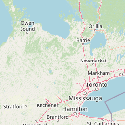
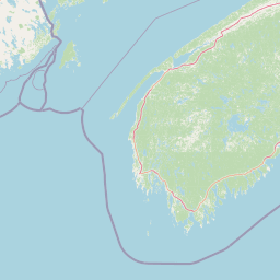
Leaflet | <a href="https://www.openstreetmap.org/copyright">© OpenStreetMap contributors</a>
Item
| Property | Value |
|---|---|
| id | 2270908 |
| downstream_mainstem_id | https://geoconnex.us/ref/mainstems/2270596 |
| encompassing_mainstem_basins | ['https://geoconnex.us/ref/mainstems/2270596', 'https://geoconnex.us/ref/mainstems/2270463'] |
| featuretype | ['https://www.opengis.net/def/schema/hy_features/hyf/HY_FlowPath', 'https://www.opengis.net/def/schema/hy_features/hyf/HY_WaterBody'] |
| fid | 561 |
| head_2020huc12 | 010700030501 |
| head_nhdpv1_comid | 6761702 |
| head_nhdpv2_comid | https://geoconnex.us/nhdplusv2/comid/6761702 |
| head_nhdpv2huc12 | https://geoconnex.us/nhdplusv2/huc12/010700030502 |
| head_rf1id | 1009 |
| lengthkm | 54.9 |
| name_at_outlet | Blackwater River |
| name_at_outlet_gnis_id | 865645 |
| new_mainstemid | |
| outlet_2020huc12 | 010700030504 |
| outlet_drainagearea_sqkm | 350.0 |
| outlet_nhdpv1_comid | 6761948 |
| outlet_nhdpv2_comid | https://geoconnex.us/nhdplusv2/comid/6761948 |
| outlet_nhdpv2huc12 | https://geoconnex.us/nhdplusv2/huc12/010700030504 |
| outlet_rf1id | 1009 |
| superseded | False |
| uri | https://geoconnex.us/ref/mainstems/2270908 |
Graph Results
| monitoringLocation | https://geoconnex.us/iow/wqp/11113300-04-BKW |
|---|---|
| siteName | 11113300-04-BKW |
| datasetDescription | Chloride at 11113300-04-BKW |
| type | River/Stream |
| url | https://www.waterqualitydata.us/provider/STORET/11113300/11113300-04-BKW/ |
| variableMeasured | Chloride |
| variableUnit | milligrams per liter |
| measurementTechnique | observation |
| temporalCoverage | 2009-01-01T00:00:00Z/2011-12-31T00:00:00Z |
| distributionName | Water Quality Portal |
| distributionURL | https://www.waterqualitydata.us/data/Result/search?siteid=11113300-04-BKW&CharacteristicName=Chloride&mimeType=csv |
| distributionFormat | text/comma-separated-values |
| wkt | POINT (-71.698233 43.301606) |
| monitoringLocation | https://geoconnex.us/iow/wqp/11113300-04-BKW |
|---|---|
| siteName | 11113300-04-BKW |
| datasetDescription | Dissolved oxygen saturation at 11113300-04-BKW |
| type | River/Stream |
| url | https://www.waterqualitydata.us/provider/STORET/11113300/11113300-04-BKW/ |
| variableMeasured | Dissolved oxygen saturation |
| variableUnit | percent |
| measurementTechnique | observation |
| temporalCoverage | 2007-01-01T00:00:00Z/2023-12-31T00:00:00Z |
| distributionName | Water Quality Portal |
| distributionURL | https://www.waterqualitydata.us/data/Result/search?siteid=11113300-04-BKW&CharacteristicName=Dissolved oxygen saturation&mimeType=csv |
| distributionFormat | text/comma-separated-values |
| wkt | POINT (-71.698233 43.301606) |
| monitoringLocation | https://geoconnex.us/iow/wqp/11113300-04-BKW |
|---|---|
| siteName | 11113300-04-BKW |
| datasetDescription | Specific conductance at 11113300-04-BKW |
| type | River/Stream |
| url | https://www.waterqualitydata.us/provider/STORET/11113300/11113300-04-BKW/ |
| variableMeasured | Specific conductance |
| variableUnit | microsiemens per centimeter |
| measurementTechnique | observation |
| temporalCoverage | 2007-01-01T00:00:00Z/2023-12-31T00:00:00Z |
| distributionName | Water Quality Portal |
| distributionURL | https://www.waterqualitydata.us/data/Result/search?siteid=11113300-04-BKW&CharacteristicName=Specific conductance&mimeType=csv |
| distributionFormat | text/comma-separated-values |
| wkt | POINT (-71.698233 43.301606) |
| monitoringLocation | https://geoconnex.us/iow/wqp/11113300-04-BKW |
|---|---|
| siteName | 11113300-04-BKW |
| datasetDescription | Dissolved oxygen (DO) at 11113300-04-BKW |
| type | River/Stream |
| url | https://www.waterqualitydata.us/provider/STORET/11113300/11113300-04-BKW/ |
| variableMeasured | Dissolved oxygen (DO) |
| variableUnit | milligrams per liter |
| measurementTechnique | observation |
| temporalCoverage | 2007-01-01T00:00:00Z/2023-12-31T00:00:00Z |
| distributionName | Water Quality Portal |
| distributionURL | https://www.waterqualitydata.us/data/Result/search?siteid=11113300-04-BKW&CharacteristicName=Dissolved oxygen (DO)&mimeType=csv |
| distributionFormat | text/comma-separated-values |
| wkt | POINT (-71.698233 43.301606) |
| monitoringLocation | https://geoconnex.us/iow/wqp/11113300-04-BKW |
|---|---|
| siteName | 11113300-04-BKW |
| datasetDescription | Temperature, water at 11113300-04-BKW |
| type | River/Stream |
| url | https://www.waterqualitydata.us/provider/STORET/11113300/11113300-04-BKW/ |
| variableMeasured | Temperature, water |
| variableUnit | degrees Celsius |
| measurementTechnique | observation |
| temporalCoverage | 2007-01-01T00:00:00Z/2023-12-31T00:00:00Z |
| distributionName | Water Quality Portal |
| distributionURL | https://www.waterqualitydata.us/data/Result/search?siteid=11113300-04-BKW&CharacteristicName=Temperature, water&mimeType=csv |
| distributionFormat | text/comma-separated-values |
| wkt | POINT (-71.698233 43.301606) |
| monitoringLocation | https://geoconnex.us/iow/wqp/11113300-04-BKW |
|---|---|
| siteName | 11113300-04-BKW |
| datasetDescription | Temperature, air at 11113300-04-BKW |
| type | River/Stream |
| url | https://www.waterqualitydata.us/provider/STORET/11113300/11113300-04-BKW/ |
| variableMeasured | Temperature, air |
| variableUnit | degrees Celsius |
| measurementTechnique | observation |
| temporalCoverage | 2007-01-01T00:00:00Z/2007-12-31T00:00:00Z |
| distributionName | Water Quality Portal |
| distributionURL | https://www.waterqualitydata.us/data/Result/search?siteid=11113300-04-BKW&CharacteristicName=Temperature, air&mimeType=csv |
| distributionFormat | text/comma-separated-values |
| wkt | POINT (-71.698233 43.301606) |
| monitoringLocation | https://geoconnex.us/iow/wqp/11113300-04-BKW |
|---|---|
| siteName | 11113300-04-BKW |
| datasetDescription | Turbidity at 11113300-04-BKW |
| type | River/Stream |
| url | https://www.waterqualitydata.us/provider/STORET/11113300/11113300-04-BKW/ |
| variableMeasured | Turbidity |
| variableUnit | Jackson turbidity units |
| measurementTechnique | observation |
| temporalCoverage | 2007-01-01T00:00:00Z/2023-12-31T00:00:00Z |
| distributionName | Water Quality Portal |
| distributionURL | https://www.waterqualitydata.us/data/Result/search?siteid=11113300-04-BKW&CharacteristicName=Turbidity&mimeType=csv |
| distributionFormat | text/comma-separated-values |
| wkt | POINT (-71.698233 43.301606) |
| monitoringLocation | https://geoconnex.us/iow/wqp/11113300-04-BKW |
|---|---|
| siteName | 11113300-04-BKW |
| datasetDescription | pH at 11113300-04-BKW |
| type | River/Stream |
| url | https://www.waterqualitydata.us/provider/STORET/11113300/11113300-04-BKW/ |
| variableMeasured | pH |
| variableUnit | Unknown |
| measurementTechnique | observation |
| temporalCoverage | 2007-01-01T00:00:00Z/2023-12-31T00:00:00Z |
| distributionName | Water Quality Portal |
| distributionURL | https://www.waterqualitydata.us/data/Result/search?siteid=11113300-04-BKW&CharacteristicName=pH&mimeType=csv |
| distributionFormat | text/comma-separated-values |
| wkt | POINT (-71.698233 43.301606) |
| monitoringLocation | https://geoconnex.us/iow/wqp/11113300-02-BKW |
|---|---|
| siteName | 11113300-02-BKW |
| datasetDescription | Temperature, water at 11113300-02-BKW |
| type | River/Stream |
| url | https://www.waterqualitydata.us/provider/STORET/11113300/11113300-02-BKW/ |
| variableMeasured | Temperature, water |
| variableUnit | degrees Celsius |
| measurementTechnique | observation |
| temporalCoverage | 2007-01-01T00:00:00Z/2018-12-31T00:00:00Z |
| distributionName | Water Quality Portal |
| distributionURL | https://www.waterqualitydata.us/data/Result/search?siteid=11113300-02-BKW&CharacteristicName=Temperature, water&mimeType=csv |
| distributionFormat | text/comma-separated-values |
| wkt | POINT (-71.698917 43.250144) |
| monitoringLocation | https://geoconnex.us/iow/wqp/11113300-02-BKW |
|---|---|
| siteName | 11113300-02-BKW |
| datasetDescription | Temperature, air at 11113300-02-BKW |
| type | River/Stream |
| url | https://www.waterqualitydata.us/provider/STORET/11113300/11113300-02-BKW/ |
| variableMeasured | Temperature, air |
| variableUnit | degrees Celsius |
| measurementTechnique | observation |
| temporalCoverage | 2007-01-01T00:00:00Z/2007-12-31T00:00:00Z |
| distributionName | Water Quality Portal |
| distributionURL | https://www.waterqualitydata.us/data/Result/search?siteid=11113300-02-BKW&CharacteristicName=Temperature, air&mimeType=csv |
| distributionFormat | text/comma-separated-values |
| wkt | POINT (-71.698917 43.250144) |
| monitoringLocation | https://geoconnex.us/iow/wqp/11113300-02-BKW |
|---|---|
| siteName | 11113300-02-BKW |
| datasetDescription | pH at 11113300-02-BKW |
| type | River/Stream |
| url | https://www.waterqualitydata.us/provider/STORET/11113300/11113300-02-BKW/ |
| variableMeasured | pH |
| variableUnit | Unknown |
| measurementTechnique | observation |
| temporalCoverage | 2007-01-01T00:00:00Z/2018-12-31T00:00:00Z |
| distributionName | Water Quality Portal |
| distributionURL | https://www.waterqualitydata.us/data/Result/search?siteid=11113300-02-BKW&CharacteristicName=pH&mimeType=csv |
| distributionFormat | text/comma-separated-values |
| wkt | POINT (-71.698917 43.250144) |
| monitoringLocation | https://geoconnex.us/iow/wqp/11113300-02-BKW |
|---|---|
| siteName | 11113300-02-BKW |
| datasetDescription | Turbidity at 11113300-02-BKW |
| type | River/Stream |
| url | https://www.waterqualitydata.us/provider/STORET/11113300/11113300-02-BKW/ |
| variableMeasured | Turbidity |
| variableUnit | Jackson turbidity units |
| measurementTechnique | observation |
| temporalCoverage | 2007-01-01T00:00:00Z/2018-12-31T00:00:00Z |
| distributionName | Water Quality Portal |
| distributionURL | https://www.waterqualitydata.us/data/Result/search?siteid=11113300-02-BKW&CharacteristicName=Turbidity&mimeType=csv |
| distributionFormat | text/comma-separated-values |
| wkt | POINT (-71.698917 43.250144) |
| monitoringLocation | https://geoconnex.us/iow/wqp/11113300-02-BKW |
|---|---|
| siteName | 11113300-02-BKW |
| datasetDescription | Dissolved oxygen (DO) at 11113300-02-BKW |
| type | River/Stream |
| url | https://www.waterqualitydata.us/provider/STORET/11113300/11113300-02-BKW/ |
| variableMeasured | Dissolved oxygen (DO) |
| variableUnit | milligrams per liter |
| measurementTechnique | observation |
| temporalCoverage | 2007-01-01T00:00:00Z/2018-12-31T00:00:00Z |
| distributionName | Water Quality Portal |
| distributionURL | https://www.waterqualitydata.us/data/Result/search?siteid=11113300-02-BKW&CharacteristicName=Dissolved oxygen (DO)&mimeType=csv |
| distributionFormat | text/comma-separated-values |
| wkt | POINT (-71.698917 43.250144) |
| monitoringLocation | https://geoconnex.us/iow/wqp/11113300-02-BKW |
|---|---|
| siteName | 11113300-02-BKW |
| datasetDescription | Dissolved oxygen saturation at 11113300-02-BKW |
| type | River/Stream |
| url | https://www.waterqualitydata.us/provider/STORET/11113300/11113300-02-BKW/ |
| variableMeasured | Dissolved oxygen saturation |
| variableUnit | percent |
| measurementTechnique | observation |
| temporalCoverage | 2007-01-01T00:00:00Z/2018-12-31T00:00:00Z |
| distributionName | Water Quality Portal |
| distributionURL | https://www.waterqualitydata.us/data/Result/search?siteid=11113300-02-BKW&CharacteristicName=Dissolved oxygen saturation&mimeType=csv |
| distributionFormat | text/comma-separated-values |
| wkt | POINT (-71.698917 43.250144) |
| monitoringLocation | https://geoconnex.us/iow/wqp/11113300-02-BKW |
|---|---|
| siteName | 11113300-02-BKW |
| datasetDescription | Chloride at 11113300-02-BKW |
| type | River/Stream |
| url | https://www.waterqualitydata.us/provider/STORET/11113300/11113300-02-BKW/ |
| variableMeasured | Chloride |
| variableUnit | milligrams per liter |
| measurementTechnique | observation |
| temporalCoverage | 2009-01-01T00:00:00Z/2011-12-31T00:00:00Z |
| distributionName | Water Quality Portal |
| distributionURL | https://www.waterqualitydata.us/data/Result/search?siteid=11113300-02-BKW&CharacteristicName=Chloride&mimeType=csv |
| distributionFormat | text/comma-separated-values |
| wkt | POINT (-71.698917 43.250144) |
| monitoringLocation | https://geoconnex.us/iow/wqp/11113300-02-BKW |
|---|---|
| siteName | 11113300-02-BKW |
| datasetDescription | Specific conductance at 11113300-02-BKW |
| type | River/Stream |
| url | https://www.waterqualitydata.us/provider/STORET/11113300/11113300-02-BKW/ |
| variableMeasured | Specific conductance |
| variableUnit | microsiemens per centimeter |
| measurementTechnique | observation |
| temporalCoverage | 2007-01-01T00:00:00Z/2018-12-31T00:00:00Z |
| distributionName | Water Quality Portal |
| distributionURL | https://www.waterqualitydata.us/data/Result/search?siteid=11113300-02-BKW&CharacteristicName=Specific conductance&mimeType=csv |
| distributionFormat | text/comma-separated-values |
| wkt | POINT (-71.698917 43.250144) |
| monitoringLocation | https://geoconnex.us/iow/wqp/USGS-432338071550201 |
|---|---|
| siteName | USGS-432338071550201 |
| datasetDescription | Sodium at USGS-432338071550201 |
| type | Well |
| url | https://www.waterqualitydata.us/provider/NWIS/USGS-NH/USGS-432338071550201/ |
| variableMeasured | Sodium |
| variableUnit | milligrams per liter |
| measurementTechnique | observation |
| temporalCoverage | 1991-01-01T00:00:00Z/1991-12-31T00:00:00Z |
| distributionName | Water Quality Portal |
| distributionURL | https://www.waterqualitydata.us/data/Result/search?siteid=USGS-432338071550201&CharacteristicName=Sodium&mimeType=csv |
| distributionFormat | text/comma-separated-values |
| wkt | POINT (-71.9167488 43.3939643) |
| monitoringLocation | https://geoconnex.us/iow/wqp/USGS-432338071550201 |
|---|---|
| siteName | USGS-432338071550201 |
| datasetDescription | Chloride at USGS-432338071550201 |
| type | Well |
| url | https://www.waterqualitydata.us/provider/NWIS/USGS-NH/USGS-432338071550201/ |
| variableMeasured | Chloride |
| variableUnit | milligrams per liter |
| measurementTechnique | observation |
| temporalCoverage | 1991-01-01T00:00:00Z/1991-12-31T00:00:00Z |
| distributionName | Water Quality Portal |
| distributionURL | https://www.waterqualitydata.us/data/Result/search?siteid=USGS-432338071550201&CharacteristicName=Chloride&mimeType=csv |
| distributionFormat | text/comma-separated-values |
| wkt | POINT (-71.9167488 43.3939643) |
| monitoringLocation | https://geoconnex.us/iow/wqp/USGS-432338071550201 |
|---|---|
| siteName | USGS-432338071550201 |
| datasetDescription | Depth at USGS-432338071550201 |
| type | Well |
| url | https://www.waterqualitydata.us/provider/NWIS/USGS-NH/USGS-432338071550201/ |
| variableMeasured | Depth |
| variableUnit | feet |
| measurementTechnique | observation |
| temporalCoverage | 1991-01-01T00:00:00Z/1991-12-31T00:00:00Z |
| distributionName | Water Quality Portal |
| distributionURL | https://www.waterqualitydata.us/data/Result/search?siteid=USGS-432338071550201&CharacteristicName=Depth&mimeType=csv |
| distributionFormat | text/comma-separated-values |
| wkt | POINT (-71.9167488 43.3939643) |
| monitoringLocation | https://geoconnex.us/iow/wqp/USGS-432338071550201 |
|---|---|
| siteName | USGS-432338071550201 |
| datasetDescription | Manganese at USGS-432338071550201 |
| type | Well |
| url | https://www.waterqualitydata.us/provider/NWIS/USGS-NH/USGS-432338071550201/ |
| variableMeasured | Manganese |
| variableUnit | micrograms per liter |
| measurementTechnique | observation |
| temporalCoverage | 1991-01-01T00:00:00Z/1991-12-31T00:00:00Z |
| distributionName | Water Quality Portal |
| distributionURL | https://www.waterqualitydata.us/data/Result/search?siteid=USGS-432338071550201&CharacteristicName=Manganese&mimeType=csv |
| distributionFormat | text/comma-separated-values |
| wkt | POINT (-71.9167488 43.3939643) |
| monitoringLocation | https://geoconnex.us/iow/wqp/USGS-432338071550201 |
|---|---|
| siteName | USGS-432338071550201 |
| datasetDescription | Iron at USGS-432338071550201 |
| type | Well |
| url | https://www.waterqualitydata.us/provider/NWIS/USGS-NH/USGS-432338071550201/ |
| variableMeasured | Iron |
| variableUnit | percent |
| measurementTechnique | observation |
| temporalCoverage | 1991-01-01T00:00:00Z/1991-12-31T00:00:00Z |
| distributionName | Water Quality Portal |
| distributionURL | https://www.waterqualitydata.us/data/Result/search?siteid=USGS-432338071550201&CharacteristicName=Iron&mimeType=csv |
| distributionFormat | text/comma-separated-values |
| wkt | POINT (-71.9167488 43.3939643) |
| monitoringLocation | https://geoconnex.us/iow/wqp/USGS-432338071550201 |
|---|---|
| siteName | USGS-432338071550201 |
| datasetDescription | Hardness, Ca, Mg at USGS-432338071550201 |
| type | Well |
| url | https://www.waterqualitydata.us/provider/NWIS/USGS-NH/USGS-432338071550201/ |
| variableMeasured | Hardness, Ca, Mg |
| variableUnit | milligrams per liter as calcium carbonate |
| measurementTechnique | observation |
| temporalCoverage | 1991-01-01T00:00:00Z/1991-12-31T00:00:00Z |
| distributionName | Water Quality Portal |
| distributionURL | https://www.waterqualitydata.us/data/Result/search?siteid=USGS-432338071550201&CharacteristicName=Hardness, Ca, Mg&mimeType=csv |
| distributionFormat | text/comma-separated-values |
| wkt | POINT (-71.9167488 43.3939643) |
| monitoringLocation | https://geoconnex.us/iow/wqp/USGS-432338071550201 |
|---|---|
| siteName | USGS-432338071550201 |
| datasetDescription | Flow rate at USGS-432338071550201 |
| type | Well |
| url | https://www.waterqualitydata.us/provider/NWIS/USGS-NH/USGS-432338071550201/ |
| variableMeasured | Flow rate |
| variableUnit | gallons per minute |
| measurementTechnique | observation |
| temporalCoverage | 1991-01-01T00:00:00Z/1991-12-31T00:00:00Z |
| distributionName | Water Quality Portal |
| distributionURL | https://www.waterqualitydata.us/data/Result/search?siteid=USGS-432338071550201&CharacteristicName=Flow rate&mimeType=csv |
| distributionFormat | text/comma-separated-values |
| wkt | POINT (-71.9167488 43.3939643) |
| monitoringLocation | https://geoconnex.us/iow/wqp/USGS-432338071550201 |
|---|---|
| siteName | USGS-432338071550201 |
| datasetDescription | Total Coliform at USGS-432338071550201 |
| type | Well |
| url | https://www.waterqualitydata.us/provider/NWIS/USGS-NH/USGS-432338071550201/ |
| variableMeasured | Total Coliform |
| variableUnit | Unknown |
| measurementTechnique | observation |
| temporalCoverage | 1991-01-01T00:00:00Z/1991-12-31T00:00:00Z |
| distributionName | Water Quality Portal |
| distributionURL | https://www.waterqualitydata.us/data/Result/search?siteid=USGS-432338071550201&CharacteristicName=Total Coliform&mimeType=csv |
| distributionFormat | text/comma-separated-values |
| wkt | POINT (-71.9167488 43.3939643) |
| monitoringLocation | https://geoconnex.us/iow/wqp/USGS-432338071550201 |
|---|---|
| siteName | USGS-432338071550201 |
| datasetDescription | pH at USGS-432338071550201 |
| type | Well |
| url | https://www.waterqualitydata.us/provider/NWIS/USGS-NH/USGS-432338071550201/ |
| variableMeasured | pH |
| variableUnit | Unknown |
| measurementTechnique | observation |
| temporalCoverage | 1991-01-01T00:00:00Z/1991-12-31T00:00:00Z |
| distributionName | Water Quality Portal |
| distributionURL | https://www.waterqualitydata.us/data/Result/search?siteid=USGS-432338071550201&CharacteristicName=pH&mimeType=csv |
| distributionFormat | text/comma-separated-values |
| wkt | POINT (-71.9167488 43.3939643) |
| monitoringLocation | https://geoconnex.us/iow/wqp/USGS-432338071550201 |
|---|---|
| siteName | USGS-432338071550201 |
| datasetDescription | Fluoride at USGS-432338071550201 |
| type | Well |
| url | https://www.waterqualitydata.us/provider/NWIS/USGS-NH/USGS-432338071550201/ |
| variableMeasured | Fluoride |
| variableUnit | milligrams per liter |
| measurementTechnique | observation |
| temporalCoverage | 1991-01-01T00:00:00Z/1991-12-31T00:00:00Z |
| distributionName | Water Quality Portal |
| distributionURL | https://www.waterqualitydata.us/data/Result/search?siteid=USGS-432338071550201&CharacteristicName=Fluoride&mimeType=csv |
| distributionFormat | text/comma-separated-values |
| wkt | POINT (-71.9167488 43.3939643) |
| monitoringLocation | https://geoconnex.us/iow/wqp/USGS-432338071550201 |
|---|---|
| siteName | USGS-432338071550201 |
| datasetDescription | Nitrate at USGS-432338071550201 |
| type | Well |
| url | https://www.waterqualitydata.us/provider/NWIS/USGS-NH/USGS-432338071550201/ |
| variableMeasured | Nitrate |
| variableUnit | milligrams per liter as nitrogen |
| measurementTechnique | observation |
| temporalCoverage | 1991-01-01T00:00:00Z/1991-12-31T00:00:00Z |
| distributionName | Water Quality Portal |
| distributionURL | https://www.waterqualitydata.us/data/Result/search?siteid=USGS-432338071550201&CharacteristicName=Nitrate&mimeType=csv |
| distributionFormat | text/comma-separated-values |
| wkt | POINT (-71.9167488 43.3939643) |
| monitoringLocation | https://geoconnex.us/iow/wqp/11113300-03-BKW |
|---|---|
| siteName | 11113300-03-BKW |
| datasetDescription | Ammonia-nitrogen at 11113300-03-BKW |
| type | River/Stream |
| url | https://www.waterqualitydata.us/provider/STORET/11113300/11113300-03-BKW/ |
| variableMeasured | Ammonia-nitrogen |
| variableUnit | milligrams per liter |
| measurementTechnique | observation |
| temporalCoverage | 1999-01-01T00:00:00Z/1999-12-31T00:00:00Z |
| distributionName | Water Quality Portal |
| distributionURL | https://www.waterqualitydata.us/data/Result/search?siteid=11113300-03-BKW&CharacteristicName=Ammonia-nitrogen&mimeType=csv |
| distributionFormat | text/comma-separated-values |
| wkt | POINT (-71.710944 43.286832) |
| monitoringLocation | https://geoconnex.us/iow/wqp/11113300-03-BKW |
|---|---|
| siteName | 11113300-03-BKW |
| datasetDescription | Nitrate at 11113300-03-BKW |
| type | River/Stream |
| url | https://www.waterqualitydata.us/provider/STORET/11113300/11113300-03-BKW/ |
| variableMeasured | Nitrate |
| variableUnit | milligrams per liter as nitrogen |
| measurementTechnique | observation |
| temporalCoverage | 1999-01-01T00:00:00Z/1999-12-31T00:00:00Z |
| distributionName | Water Quality Portal |
| distributionURL | https://www.waterqualitydata.us/data/Result/search?siteid=11113300-03-BKW&CharacteristicName=Nitrate&mimeType=csv |
| distributionFormat | text/comma-separated-values |
| wkt | POINT (-71.710944 43.286832) |
| monitoringLocation | https://geoconnex.us/iow/wqp/11113300-03-BKW |
|---|---|
| siteName | 11113300-03-BKW |
| datasetDescription | Calcium carbonate at 11113300-03-BKW |
| type | River/Stream |
| url | https://www.waterqualitydata.us/provider/STORET/11113300/11113300-03-BKW/ |
| variableMeasured | Calcium carbonate |
| variableUnit | milligrams per liter |
| measurementTechnique | observation |
| temporalCoverage | 1999-01-01T00:00:00Z/1999-12-31T00:00:00Z |
| distributionName | Water Quality Portal |
| distributionURL | https://www.waterqualitydata.us/data/Result/search?siteid=11113300-03-BKW&CharacteristicName=Calcium carbonate&mimeType=csv |
| distributionFormat | text/comma-separated-values |
| wkt | POINT (-71.710944 43.286832) |
| monitoringLocation | https://geoconnex.us/iow/wqp/11113300-03-BKW |
|---|---|
| siteName | 11113300-03-BKW |
| datasetDescription | pH at 11113300-03-BKW |
| type | River/Stream |
| url | https://www.waterqualitydata.us/provider/STORET/11113300/11113300-03-BKW/ |
| variableMeasured | pH |
| variableUnit | Unknown |
| measurementTechnique | observation |
| temporalCoverage | 1999-01-01T00:00:00Z/1999-12-31T00:00:00Z |
| distributionName | Water Quality Portal |
| distributionURL | https://www.waterqualitydata.us/data/Result/search?siteid=11113300-03-BKW&CharacteristicName=pH&mimeType=csv |
| distributionFormat | text/comma-separated-values |
| wkt | POINT (-71.710944 43.286832) |
| monitoringLocation | https://geoconnex.us/iow/wqp/11113300-03-BKW |
|---|---|
| siteName | 11113300-03-BKW |
| datasetDescription | Lead at 11113300-03-BKW |
| type | River/Stream |
| url | https://www.waterqualitydata.us/provider/STORET/11113300/11113300-03-BKW/ |
| variableMeasured | Lead |
| variableUnit | micrograms per liter |
| measurementTechnique | observation |
| temporalCoverage | 1999-01-01T00:00:00Z/1999-12-31T00:00:00Z |
| distributionName | Water Quality Portal |
| distributionURL | https://www.waterqualitydata.us/data/Result/search?siteid=11113300-03-BKW&CharacteristicName=Lead&mimeType=csv |
| distributionFormat | text/comma-separated-values |
| wkt | POINT (-71.710944 43.286832) |
| monitoringLocation | https://geoconnex.us/iow/wqp/11113300-03-BKW |
|---|---|
| siteName | 11113300-03-BKW |
| datasetDescription | Specific conductance at 11113300-03-BKW |
| type | River/Stream |
| url | https://www.waterqualitydata.us/provider/STORET/11113300/11113300-03-BKW/ |
| variableMeasured | Specific conductance |
| variableUnit | microsiemens per centimeter |
| measurementTechnique | observation |
| temporalCoverage | 1999-01-01T00:00:00Z/1999-12-31T00:00:00Z |
| distributionName | Water Quality Portal |
| distributionURL | https://www.waterqualitydata.us/data/Result/search?siteid=11113300-03-BKW&CharacteristicName=Specific conductance&mimeType=csv |
| distributionFormat | text/comma-separated-values |
| wkt | POINT (-71.710944 43.286832) |
| monitoringLocation | https://geoconnex.us/iow/wqp/11113300-03-BKW |
|---|---|
| siteName | 11113300-03-BKW |
| datasetDescription | Escherichia coli at 11113300-03-BKW |
| type | River/Stream |
| url | https://www.waterqualitydata.us/provider/STORET/11113300/11113300-03-BKW/ |
| variableMeasured | Escherichia coli |
| variableUnit | number per 100 milliliters |
| measurementTechnique | observation |
| temporalCoverage | 1999-01-01T00:00:00Z/1999-12-31T00:00:00Z |
| distributionName | Water Quality Portal |
| distributionURL | https://www.waterqualitydata.us/data/Result/search?siteid=11113300-03-BKW&CharacteristicName=Escherichia coli&mimeType=csv |
| distributionFormat | text/comma-separated-values |
| wkt | POINT (-71.710944 43.286832) |
| monitoringLocation | https://geoconnex.us/iow/wqp/11113300-03-BKW |
|---|---|
| siteName | 11113300-03-BKW |
| datasetDescription | Aluminum at 11113300-03-BKW |
| type | River/Stream |
| url | https://www.waterqualitydata.us/provider/STORET/11113300/11113300-03-BKW/ |
| variableMeasured | Aluminum |
| variableUnit | Unknown |
| measurementTechnique | observation |
| temporalCoverage | 1999-01-01T00:00:00Z/1999-12-31T00:00:00Z |
| distributionName | Water Quality Portal |
| distributionURL | https://www.waterqualitydata.us/data/Result/search?siteid=11113300-03-BKW&CharacteristicName=Aluminum&mimeType=csv |
| distributionFormat | text/comma-separated-values |
| wkt | POINT (-71.710944 43.286832) |
| monitoringLocation | https://geoconnex.us/iow/wqp/11113300-03-BKW |
|---|---|
| siteName | 11113300-03-BKW |
| datasetDescription | Zinc at 11113300-03-BKW |
| type | River/Stream |
| url | https://www.waterqualitydata.us/provider/STORET/11113300/11113300-03-BKW/ |
| variableMeasured | Zinc |
| variableUnit | Unknown |
| measurementTechnique | observation |
| temporalCoverage | 1999-01-01T00:00:00Z/1999-12-31T00:00:00Z |
| distributionName | Water Quality Portal |
| distributionURL | https://www.waterqualitydata.us/data/Result/search?siteid=11113300-03-BKW&CharacteristicName=Zinc&mimeType=csv |
| distributionFormat | text/comma-separated-values |
| wkt | POINT (-71.710944 43.286832) |
| monitoringLocation | https://geoconnex.us/iow/wqp/11113300-03-BKW |
|---|---|
| siteName | 11113300-03-BKW |
| datasetDescription | Phosphate-phosphorus at 11113300-03-BKW |
| type | River/Stream |
| url | https://www.waterqualitydata.us/provider/STORET/11113300/11113300-03-BKW/ |
| variableMeasured | Phosphate-phosphorus |
| variableUnit | milligrams per liter |
| measurementTechnique | observation |
| temporalCoverage | 1999-01-01T00:00:00Z/1999-12-31T00:00:00Z |
| distributionName | Water Quality Portal |
| distributionURL | https://www.waterqualitydata.us/data/Result/search?siteid=11113300-03-BKW&CharacteristicName=Phosphate-phosphorus&mimeType=csv |
| distributionFormat | text/comma-separated-values |
| wkt | POINT (-71.710944 43.286832) |
| monitoringLocation | https://geoconnex.us/iow/wqp/11113300-03-BKW |
|---|---|
| siteName | 11113300-03-BKW |
| datasetDescription | Count at 11113300-03-BKW |
| type | River/Stream |
| url | https://www.waterqualitydata.us/provider/STORET/11113300/11113300-03-BKW/ |
| variableMeasured | Count |
| variableUnit | count (no unit) |
| measurementTechnique | observation |
| temporalCoverage | 1999-01-01T00:00:00Z/1999-12-31T00:00:00Z |
| distributionName | Water Quality Portal |
| distributionURL | https://www.waterqualitydata.us/data/Result/search?siteid=11113300-03-BKW&CharacteristicName=Count&mimeType=csv |
| distributionFormat | text/comma-separated-values |
| wkt | POINT (-71.710944 43.286832) |
| monitoringLocation | https://geoconnex.us/iow/wqp/11113300-03-BKW |
|---|---|
| siteName | 11113300-03-BKW |
| datasetDescription | Copper at 11113300-03-BKW |
| type | River/Stream |
| url | https://www.waterqualitydata.us/provider/STORET/11113300/11113300-03-BKW/ |
| variableMeasured | Copper |
| variableUnit | Unknown |
| measurementTechnique | observation |
| temporalCoverage | 1999-01-01T00:00:00Z/1999-12-31T00:00:00Z |
| distributionName | Water Quality Portal |
| distributionURL | https://www.waterqualitydata.us/data/Result/search?siteid=11113300-03-BKW&CharacteristicName=Copper&mimeType=csv |
| distributionFormat | text/comma-separated-values |
| wkt | POINT (-71.710944 43.286832) |
| monitoringLocation | https://geoconnex.us/iow/wqp/11113300-03-BKW |
|---|---|
| siteName | 11113300-03-BKW |
| datasetDescription | Dissolved oxygen (DO) at 11113300-03-BKW |
| type | River/Stream |
| url | https://www.waterqualitydata.us/provider/STORET/11113300/11113300-03-BKW/ |
| variableMeasured | Dissolved oxygen (DO) |
| variableUnit | milligrams per liter |
| measurementTechnique | observation |
| temporalCoverage | 1999-01-01T00:00:00Z/1999-12-31T00:00:00Z |
| distributionName | Water Quality Portal |
| distributionURL | https://www.waterqualitydata.us/data/Result/search?siteid=11113300-03-BKW&CharacteristicName=Dissolved oxygen (DO)&mimeType=csv |
| distributionFormat | text/comma-separated-values |
| wkt | POINT (-71.710944 43.286832) |
| monitoringLocation | https://geoconnex.us/iow/wqp/11113300-03-BKW |
|---|---|
| siteName | 11113300-03-BKW |
| datasetDescription | Dissolved oxygen saturation at 11113300-03-BKW |
| type | River/Stream |
| url | https://www.waterqualitydata.us/provider/STORET/11113300/11113300-03-BKW/ |
| variableMeasured | Dissolved oxygen saturation |
| variableUnit | percent |
| measurementTechnique | observation |
| temporalCoverage | 1999-01-01T00:00:00Z/1999-12-31T00:00:00Z |
| distributionName | Water Quality Portal |
| distributionURL | https://www.waterqualitydata.us/data/Result/search?siteid=11113300-03-BKW&CharacteristicName=Dissolved oxygen saturation&mimeType=csv |
| distributionFormat | text/comma-separated-values |
| wkt | POINT (-71.710944 43.286832) |
| monitoringLocation | https://geoconnex.us/iow/wqp/11113300-03-BKW |
|---|---|
| siteName | 11113300-03-BKW |
| datasetDescription | Temperature, water at 11113300-03-BKW |
| type | River/Stream |
| url | https://www.waterqualitydata.us/provider/STORET/11113300/11113300-03-BKW/ |
| variableMeasured | Temperature, water |
| variableUnit | degrees Celsius |
| measurementTechnique | observation |
| temporalCoverage | 1999-01-01T00:00:00Z/1999-12-31T00:00:00Z |
| distributionName | Water Quality Portal |
| distributionURL | https://www.waterqualitydata.us/data/Result/search?siteid=11113300-03-BKW&CharacteristicName=Temperature, water&mimeType=csv |
| distributionFormat | text/comma-separated-values |
| wkt | POINT (-71.710944 43.286832) |
| monitoringLocation | https://geoconnex.us/iow/wqp/11113300-03-BKW |
|---|---|
| siteName | 11113300-03-BKW |
| datasetDescription | Kjeldahl nitrogen at 11113300-03-BKW |
| type | River/Stream |
| url | https://www.waterqualitydata.us/provider/STORET/11113300/11113300-03-BKW/ |
| variableMeasured | Kjeldahl nitrogen |
| variableUnit | milligrams per liter |
| measurementTechnique | observation |
| temporalCoverage | 1999-01-01T00:00:00Z/1999-12-31T00:00:00Z |
| distributionName | Water Quality Portal |
| distributionURL | https://www.waterqualitydata.us/data/Result/search?siteid=11113300-03-BKW&CharacteristicName=Kjeldahl nitrogen&mimeType=csv |
| distributionFormat | text/comma-separated-values |
| wkt | POINT (-71.710944 43.286832) |
| monitoringLocation | https://geoconnex.us/iow/wqp/11113300-03-BKW |
|---|---|
| siteName | 11113300-03-BKW |
| datasetDescription | Turbidity at 11113300-03-BKW |
| type | River/Stream |
| url | https://www.waterqualitydata.us/provider/STORET/11113300/11113300-03-BKW/ |
| variableMeasured | Turbidity |
| variableUnit | Jackson turbidity units |
| measurementTechnique | observation |
| temporalCoverage | 1999-01-01T00:00:00Z/1999-12-31T00:00:00Z |
| distributionName | Water Quality Portal |
| distributionURL | https://www.waterqualitydata.us/data/Result/search?siteid=11113300-03-BKW&CharacteristicName=Turbidity&mimeType=csv |
| distributionFormat | text/comma-separated-values |
| wkt | POINT (-71.710944 43.286832) |
| monitoringLocation | https://geoconnex.us/iow/wqp/11113300-03-BKW |
|---|---|
| siteName | 11113300-03-BKW |
| datasetDescription | Hardness, Ca, Mg at 11113300-03-BKW |
| type | River/Stream |
| url | https://www.waterqualitydata.us/provider/STORET/11113300/11113300-03-BKW/ |
| variableMeasured | Hardness, Ca, Mg |
| variableUnit | milligrams per liter as calcium carbonate |
| measurementTechnique | observation |
| temporalCoverage | 1999-01-01T00:00:00Z/1999-12-31T00:00:00Z |
| distributionName | Water Quality Portal |
| distributionURL | https://www.waterqualitydata.us/data/Result/search?siteid=11113300-03-BKW&CharacteristicName=Hardness, Ca, Mg&mimeType=csv |
| distributionFormat | text/comma-separated-values |
| wkt | POINT (-71.710944 43.286832) |
| monitoringLocation | https://geoconnex.us/iow/wqp/USGS-432611071474701 |
|---|---|
| siteName | USGS-432611071474701 |
| datasetDescription | Hardness, Ca, Mg at USGS-432611071474701 |
| type | Well |
| url | https://www.waterqualitydata.us/provider/NWIS/USGS-NH/USGS-432611071474701/ |
| variableMeasured | Hardness, Ca, Mg |
| variableUnit | milligrams per liter as calcium carbonate |
| measurementTechnique | observation |
| temporalCoverage | 1989-01-01T00:00:00Z/1992-12-31T00:00:00Z |
| distributionName | Water Quality Portal |
| distributionURL | https://www.waterqualitydata.us/data/Result/search?siteid=USGS-432611071474701&CharacteristicName=Hardness, Ca, Mg&mimeType=csv |
| distributionFormat | text/comma-separated-values |
| wkt | POINT (-71.79591317 43.4364644) |
| monitoringLocation | https://geoconnex.us/iow/wqp/USGS-432611071474701 |
|---|---|
| siteName | USGS-432611071474701 |
| datasetDescription | Depth at USGS-432611071474701 |
| type | Well |
| url | https://www.waterqualitydata.us/provider/NWIS/USGS-NH/USGS-432611071474701/ |
| variableMeasured | Depth |
| variableUnit | feet |
| measurementTechnique | observation |
| temporalCoverage | 1989-01-01T00:00:00Z/1992-12-31T00:00:00Z |
| distributionName | Water Quality Portal |
| distributionURL | https://www.waterqualitydata.us/data/Result/search?siteid=USGS-432611071474701&CharacteristicName=Depth&mimeType=csv |
| distributionFormat | text/comma-separated-values |
| wkt | POINT (-71.79591317 43.4364644) |
| monitoringLocation | https://geoconnex.us/iow/wqp/USGS-432611071474701 |
|---|---|
| siteName | USGS-432611071474701 |
| datasetDescription | Manganese at USGS-432611071474701 |
| type | Well |
| url | https://www.waterqualitydata.us/provider/NWIS/USGS-NH/USGS-432611071474701/ |
| variableMeasured | Manganese |
| variableUnit | micrograms per liter |
| measurementTechnique | observation |
| temporalCoverage | 1989-01-01T00:00:00Z/1992-12-31T00:00:00Z |
| distributionName | Water Quality Portal |
| distributionURL | https://www.waterqualitydata.us/data/Result/search?siteid=USGS-432611071474701&CharacteristicName=Manganese&mimeType=csv |
| distributionFormat | text/comma-separated-values |
| wkt | POINT (-71.79591317 43.4364644) |
| monitoringLocation | https://geoconnex.us/iow/wqp/USGS-432611071474701 |
|---|---|
| siteName | USGS-432611071474701 |
| datasetDescription | Sodium at USGS-432611071474701 |
| type | Well |
| url | https://www.waterqualitydata.us/provider/NWIS/USGS-NH/USGS-432611071474701/ |
| variableMeasured | Sodium |
| variableUnit | milligrams per liter |
| measurementTechnique | observation |
| temporalCoverage | 1989-01-01T00:00:00Z/1992-12-31T00:00:00Z |
| distributionName | Water Quality Portal |
| distributionURL | https://www.waterqualitydata.us/data/Result/search?siteid=USGS-432611071474701&CharacteristicName=Sodium&mimeType=csv |
| distributionFormat | text/comma-separated-values |
| wkt | POINT (-71.79591317 43.4364644) |
| monitoringLocation | https://geoconnex.us/iow/wqp/USGS-432611071474701 |
|---|---|
| siteName | USGS-432611071474701 |
| datasetDescription | Nitrate at USGS-432611071474701 |
| type | Well |
| url | https://www.waterqualitydata.us/provider/NWIS/USGS-NH/USGS-432611071474701/ |
| variableMeasured | Nitrate |
| variableUnit | milligrams per liter as nitrogen |
| measurementTechnique | observation |
| temporalCoverage | 1989-01-01T00:00:00Z/1989-12-31T00:00:00Z |
| distributionName | Water Quality Portal |
| distributionURL | https://www.waterqualitydata.us/data/Result/search?siteid=USGS-432611071474701&CharacteristicName=Nitrate&mimeType=csv |
| distributionFormat | text/comma-separated-values |
| wkt | POINT (-71.79591317 43.4364644) |
| monitoringLocation | https://geoconnex.us/iow/wqp/USGS-432611071474701 |
|---|---|
| siteName | USGS-432611071474701 |
| datasetDescription | Flow rate at USGS-432611071474701 |
| type | Well |
| url | https://www.waterqualitydata.us/provider/NWIS/USGS-NH/USGS-432611071474701/ |
| variableMeasured | Flow rate |
| variableUnit | gallons per minute |
| measurementTechnique | observation |
| temporalCoverage | 1989-01-01T00:00:00Z/1992-12-31T00:00:00Z |
| distributionName | Water Quality Portal |
| distributionURL | https://www.waterqualitydata.us/data/Result/search?siteid=USGS-432611071474701&CharacteristicName=Flow rate&mimeType=csv |
| distributionFormat | text/comma-separated-values |
| wkt | POINT (-71.79591317 43.4364644) |
| monitoringLocation | https://geoconnex.us/iow/wqp/USGS-432611071474701 |
|---|---|
| siteName | USGS-432611071474701 |
| datasetDescription | Inorganic nitrogen (nitrate and nitrite) at USGS-432611071474701 |
| type | Well |
| url | https://www.waterqualitydata.us/provider/NWIS/USGS-NH/USGS-432611071474701/ |
| variableMeasured | Inorganic nitrogen (nitrate and nitrite) |
| variableUnit | milligrams per liter as nitrogen |
| measurementTechnique | observation |
| temporalCoverage | 1992-01-01T00:00:00Z/1992-12-31T00:00:00Z |
| distributionName | Water Quality Portal |
| distributionURL | https://www.waterqualitydata.us/data/Result/search?siteid=USGS-432611071474701&CharacteristicName=Inorganic nitrogen (nitrate and nitrite)&mimeType=csv |
| distributionFormat | text/comma-separated-values |
| wkt | POINT (-71.79591317 43.4364644) |
| monitoringLocation | https://geoconnex.us/iow/wqp/USGS-432611071474701 |
|---|---|
| siteName | USGS-432611071474701 |
| datasetDescription | Total Coliform at USGS-432611071474701 |
| type | Well |
| url | https://www.waterqualitydata.us/provider/NWIS/USGS-NH/USGS-432611071474701/ |
| variableMeasured | Total Coliform |
| variableUnit | Unknown |
| measurementTechnique | observation |
| temporalCoverage | 1989-01-01T00:00:00Z/1989-12-31T00:00:00Z |
| distributionName | Water Quality Portal |
| distributionURL | https://www.waterqualitydata.us/data/Result/search?siteid=USGS-432611071474701&CharacteristicName=Total Coliform&mimeType=csv |
| distributionFormat | text/comma-separated-values |
| wkt | POINT (-71.79591317 43.4364644) |
| monitoringLocation | https://geoconnex.us/iow/wqp/USGS-432611071474701 |
|---|---|
| siteName | USGS-432611071474701 |
| datasetDescription | Chloride at USGS-432611071474701 |
| type | Well |
| url | https://www.waterqualitydata.us/provider/NWIS/USGS-NH/USGS-432611071474701/ |
| variableMeasured | Chloride |
| variableUnit | milligrams per liter |
| measurementTechnique | observation |
| temporalCoverage | 1989-01-01T00:00:00Z/1992-12-31T00:00:00Z |
| distributionName | Water Quality Portal |
| distributionURL | https://www.waterqualitydata.us/data/Result/search?siteid=USGS-432611071474701&CharacteristicName=Chloride&mimeType=csv |
| distributionFormat | text/comma-separated-values |
| wkt | POINT (-71.79591317 43.4364644) |
| monitoringLocation | https://geoconnex.us/iow/wqp/USGS-432611071474701 |
|---|---|
| siteName | USGS-432611071474701 |
| datasetDescription | Iron at USGS-432611071474701 |
| type | Well |
| url | https://www.waterqualitydata.us/provider/NWIS/USGS-NH/USGS-432611071474701/ |
| variableMeasured | Iron |
| variableUnit | percent |
| measurementTechnique | observation |
| temporalCoverage | 1989-01-01T00:00:00Z/1992-12-31T00:00:00Z |
| distributionName | Water Quality Portal |
| distributionURL | https://www.waterqualitydata.us/data/Result/search?siteid=USGS-432611071474701&CharacteristicName=Iron&mimeType=csv |
| distributionFormat | text/comma-separated-values |
| wkt | POINT (-71.79591317 43.4364644) |
| monitoringLocation | https://geoconnex.us/iow/wqp/USGS-432611071474701 |
|---|---|
| siteName | USGS-432611071474701 |
| datasetDescription | Fluoride at USGS-432611071474701 |
| type | Well |
| url | https://www.waterqualitydata.us/provider/NWIS/USGS-NH/USGS-432611071474701/ |
| variableMeasured | Fluoride |
| variableUnit | milligrams per liter |
| measurementTechnique | observation |
| temporalCoverage | 1989-01-01T00:00:00Z/1992-12-31T00:00:00Z |
| distributionName | Water Quality Portal |
| distributionURL | https://www.waterqualitydata.us/data/Result/search?siteid=USGS-432611071474701&CharacteristicName=Fluoride&mimeType=csv |
| distributionFormat | text/comma-separated-values |
| wkt | POINT (-71.79591317 43.4364644) |
| monitoringLocation | https://geoconnex.us/iow/wqp/USGS-432611071474701 |
|---|---|
| siteName | USGS-432611071474701 |
| datasetDescription | pH at USGS-432611071474701 |
| type | Well |
| url | https://www.waterqualitydata.us/provider/NWIS/USGS-NH/USGS-432611071474701/ |
| variableMeasured | pH |
| variableUnit | Unknown |
| measurementTechnique | observation |
| temporalCoverage | 1989-01-01T00:00:00Z/1992-12-31T00:00:00Z |
| distributionName | Water Quality Portal |
| distributionURL | https://www.waterqualitydata.us/data/Result/search?siteid=USGS-432611071474701&CharacteristicName=pH&mimeType=csv |
| distributionFormat | text/comma-separated-values |
| wkt | POINT (-71.79591317 43.4364644) |
| monitoringLocation | https://geoconnex.us/iow/wqp/USGS-431644071425401 |
|---|---|
| siteName | USGS-431644071425401 |
| datasetDescription | Alpha particle at USGS-431644071425401 |
| type | Well |
| url | https://www.waterqualitydata.us/provider/NWIS/USGS-NH/USGS-431644071425401/ |
| variableMeasured | Alpha particle |
| variableUnit | micrograms per liter |
| measurementTechnique | observation |
| temporalCoverage | 1989-01-01T00:00:00Z/1989-12-31T00:00:00Z |
| distributionName | Water Quality Portal |
| distributionURL | https://www.waterqualitydata.us/data/Result/search?siteid=USGS-431644071425401&CharacteristicName=Alpha particle&mimeType=csv |
| distributionFormat | text/comma-separated-values |
| wkt | POINT (-71.7145216 43.27896699) |
| monitoringLocation | https://geoconnex.us/iow/wqp/USGS-431644071425401 |
|---|---|
| siteName | USGS-431644071425401 |
| datasetDescription | Nitrate at USGS-431644071425401 |
| type | Well |
| url | https://www.waterqualitydata.us/provider/NWIS/USGS-NH/USGS-431644071425401/ |
| variableMeasured | Nitrate |
| variableUnit | milligrams per liter as nitrogen |
| measurementTechnique | observation |
| temporalCoverage | 1989-01-01T00:00:00Z/1989-12-31T00:00:00Z |
| distributionName | Water Quality Portal |
| distributionURL | https://www.waterqualitydata.us/data/Result/search?siteid=USGS-431644071425401&CharacteristicName=Nitrate&mimeType=csv |
| distributionFormat | text/comma-separated-values |
| wkt | POINT (-71.7145216 43.27896699) |
| monitoringLocation | https://geoconnex.us/iow/wqp/USGS-431644071425401 |
|---|---|
| siteName | USGS-431644071425401 |
| datasetDescription | Arsenic at USGS-431644071425401 |
| type | Well |
| url | https://www.waterqualitydata.us/provider/NWIS/USGS-NH/USGS-431644071425401/ |
| variableMeasured | Arsenic |
| variableUnit | parts per million |
| measurementTechnique | observation |
| temporalCoverage | 1989-01-01T00:00:00Z/1989-12-31T00:00:00Z |
| distributionName | Water Quality Portal |
| distributionURL | https://www.waterqualitydata.us/data/Result/search?siteid=USGS-431644071425401&CharacteristicName=Arsenic&mimeType=csv |
| distributionFormat | text/comma-separated-values |
| wkt | POINT (-71.7145216 43.27896699) |
| monitoringLocation | https://geoconnex.us/iow/wqp/USGS-431644071425401 |
|---|---|
| siteName | USGS-431644071425401 |
| datasetDescription | Total Coliform at USGS-431644071425401 |
| type | Well |
| url | https://www.waterqualitydata.us/provider/NWIS/USGS-NH/USGS-431644071425401/ |
| variableMeasured | Total Coliform |
| variableUnit | Unknown |
| measurementTechnique | observation |
| temporalCoverage | 1989-01-01T00:00:00Z/1989-12-31T00:00:00Z |
| distributionName | Water Quality Portal |
| distributionURL | https://www.waterqualitydata.us/data/Result/search?siteid=USGS-431644071425401&CharacteristicName=Total Coliform&mimeType=csv |
| distributionFormat | text/comma-separated-values |
| wkt | POINT (-71.7145216 43.27896699) |
| monitoringLocation | https://geoconnex.us/iow/wqp/USGS-431644071425401 |
|---|---|
| siteName | USGS-431644071425401 |
| datasetDescription | Manganese at USGS-431644071425401 |
| type | Well |
| url | https://www.waterqualitydata.us/provider/NWIS/USGS-NH/USGS-431644071425401/ |
| variableMeasured | Manganese |
| variableUnit | micrograms per liter |
| measurementTechnique | observation |
| temporalCoverage | 1989-01-01T00:00:00Z/1989-12-31T00:00:00Z |
| distributionName | Water Quality Portal |
| distributionURL | https://www.waterqualitydata.us/data/Result/search?siteid=USGS-431644071425401&CharacteristicName=Manganese&mimeType=csv |
| distributionFormat | text/comma-separated-values |
| wkt | POINT (-71.7145216 43.27896699) |
| monitoringLocation | https://geoconnex.us/iow/wqp/USGS-431644071425401 |
|---|---|
| siteName | USGS-431644071425401 |
| datasetDescription | Fluoride at USGS-431644071425401 |
| type | Well |
| url | https://www.waterqualitydata.us/provider/NWIS/USGS-NH/USGS-431644071425401/ |
| variableMeasured | Fluoride |
| variableUnit | milligrams per liter |
| measurementTechnique | observation |
| temporalCoverage | 1989-01-01T00:00:00Z/1989-12-31T00:00:00Z |
| distributionName | Water Quality Portal |
| distributionURL | https://www.waterqualitydata.us/data/Result/search?siteid=USGS-431644071425401&CharacteristicName=Fluoride&mimeType=csv |
| distributionFormat | text/comma-separated-values |
| wkt | POINT (-71.7145216 43.27896699) |
| monitoringLocation | https://geoconnex.us/iow/wqp/USGS-431644071425401 |
|---|---|
| siteName | USGS-431644071425401 |
| datasetDescription | pH at USGS-431644071425401 |
| type | Well |
| url | https://www.waterqualitydata.us/provider/NWIS/USGS-NH/USGS-431644071425401/ |
| variableMeasured | pH |
| variableUnit | Unknown |
| measurementTechnique | observation |
| temporalCoverage | 1989-01-01T00:00:00Z/1989-12-31T00:00:00Z |
| distributionName | Water Quality Portal |
| distributionURL | https://www.waterqualitydata.us/data/Result/search?siteid=USGS-431644071425401&CharacteristicName=pH&mimeType=csv |
| distributionFormat | text/comma-separated-values |
| wkt | POINT (-71.7145216 43.27896699) |
| monitoringLocation | https://geoconnex.us/iow/wqp/USGS-431644071425401 |
|---|---|
| siteName | USGS-431644071425401 |
| datasetDescription | Chloride at USGS-431644071425401 |
| type | Well |
| url | https://www.waterqualitydata.us/provider/NWIS/USGS-NH/USGS-431644071425401/ |
| variableMeasured | Chloride |
| variableUnit | milligrams per liter |
| measurementTechnique | observation |
| temporalCoverage | 1989-01-01T00:00:00Z/1989-12-31T00:00:00Z |
| distributionName | Water Quality Portal |
| distributionURL | https://www.waterqualitydata.us/data/Result/search?siteid=USGS-431644071425401&CharacteristicName=Chloride&mimeType=csv |
| distributionFormat | text/comma-separated-values |
| wkt | POINT (-71.7145216 43.27896699) |
| monitoringLocation | https://geoconnex.us/iow/wqp/USGS-431644071425401 |
|---|---|
| siteName | USGS-431644071425401 |
| datasetDescription | Hardness, Ca, Mg at USGS-431644071425401 |
| type | Well |
| url | https://www.waterqualitydata.us/provider/NWIS/USGS-NH/USGS-431644071425401/ |
| variableMeasured | Hardness, Ca, Mg |
| variableUnit | milligrams per liter as calcium carbonate |
| measurementTechnique | observation |
| temporalCoverage | 1989-01-01T00:00:00Z/1989-12-31T00:00:00Z |
| distributionName | Water Quality Portal |
| distributionURL | https://www.waterqualitydata.us/data/Result/search?siteid=USGS-431644071425401&CharacteristicName=Hardness, Ca, Mg&mimeType=csv |
| distributionFormat | text/comma-separated-values |
| wkt | POINT (-71.7145216 43.27896699) |
| monitoringLocation | https://geoconnex.us/iow/wqp/USGS-431644071425401 |
|---|---|
| siteName | USGS-431644071425401 |
| datasetDescription | Depth at USGS-431644071425401 |
| type | Well |
| url | https://www.waterqualitydata.us/provider/NWIS/USGS-NH/USGS-431644071425401/ |
| variableMeasured | Depth |
| variableUnit | feet |
| measurementTechnique | observation |
| temporalCoverage | 1989-01-01T00:00:00Z/1989-12-31T00:00:00Z |
| distributionName | Water Quality Portal |
| distributionURL | https://www.waterqualitydata.us/data/Result/search?siteid=USGS-431644071425401&CharacteristicName=Depth&mimeType=csv |
| distributionFormat | text/comma-separated-values |
| wkt | POINT (-71.7145216 43.27896699) |
| monitoringLocation | https://geoconnex.us/iow/wqp/USGS-431644071425401 |
|---|---|
| siteName | USGS-431644071425401 |
| datasetDescription | Sodium at USGS-431644071425401 |
| type | Well |
| url | https://www.waterqualitydata.us/provider/NWIS/USGS-NH/USGS-431644071425401/ |
| variableMeasured | Sodium |
| variableUnit | milligrams per liter |
| measurementTechnique | observation |
| temporalCoverage | 1989-01-01T00:00:00Z/1989-12-31T00:00:00Z |
| distributionName | Water Quality Portal |
| distributionURL | https://www.waterqualitydata.us/data/Result/search?siteid=USGS-431644071425401&CharacteristicName=Sodium&mimeType=csv |
| distributionFormat | text/comma-separated-values |
| wkt | POINT (-71.7145216 43.27896699) |
| monitoringLocation | https://geoconnex.us/iow/wqp/USGS-431644071425401 |
|---|---|
| siteName | USGS-431644071425401 |
| datasetDescription | Iron at USGS-431644071425401 |
| type | Well |
| url | https://www.waterqualitydata.us/provider/NWIS/USGS-NH/USGS-431644071425401/ |
| variableMeasured | Iron |
| variableUnit | percent |
| measurementTechnique | observation |
| temporalCoverage | 1989-01-01T00:00:00Z/1989-12-31T00:00:00Z |
| distributionName | Water Quality Portal |
| distributionURL | https://www.waterqualitydata.us/data/Result/search?siteid=USGS-431644071425401&CharacteristicName=Iron&mimeType=csv |
| distributionFormat | text/comma-separated-values |
| wkt | POINT (-71.7145216 43.27896699) |
| monitoringLocation | https://geoconnex.us/iow/wqp/USGS-431644071425401 |
|---|---|
| siteName | USGS-431644071425401 |
| datasetDescription | Flow rate at USGS-431644071425401 |
| type | Well |
| url | https://www.waterqualitydata.us/provider/NWIS/USGS-NH/USGS-431644071425401/ |
| variableMeasured | Flow rate |
| variableUnit | gallons per minute |
| measurementTechnique | observation |
| temporalCoverage | 1989-01-01T00:00:00Z/1989-12-31T00:00:00Z |
| distributionName | Water Quality Portal |
| distributionURL | https://www.waterqualitydata.us/data/Result/search?siteid=USGS-431644071425401&CharacteristicName=Flow rate&mimeType=csv |
| distributionFormat | text/comma-separated-values |
| wkt | POINT (-71.7145216 43.27896699) |
| monitoringLocation | https://geoconnex.us/iow/wqp/11113300-06-BKW |
|---|---|
| siteName | 11113300-06-BKW |
| datasetDescription | Phosphate-phosphorus at 11113300-06-BKW |
| type | River/Stream |
| url | https://www.waterqualitydata.us/provider/STORET/11113300/11113300-06-BKW/ |
| variableMeasured | Phosphate-phosphorus |
| variableUnit | milligrams per liter |
| measurementTechnique | observation |
| temporalCoverage | 2013-01-01T00:00:00Z/2013-12-31T00:00:00Z |
| distributionName | Water Quality Portal |
| distributionURL | https://www.waterqualitydata.us/data/Result/search?siteid=11113300-06-BKW&CharacteristicName=Phosphate-phosphorus&mimeType=csv |
| distributionFormat | text/comma-separated-values |
| wkt | POINT (-71.778933 43.359164) |
| monitoringLocation | https://geoconnex.us/iow/wqp/11113300-06-BKW |
|---|---|
| siteName | 11113300-06-BKW |
| datasetDescription | Temperature, water at 11113300-06-BKW |
| type | River/Stream |
| url | https://www.waterqualitydata.us/provider/STORET/11113300/11113300-06-BKW/ |
| variableMeasured | Temperature, water |
| variableUnit | degrees Celsius |
| measurementTechnique | observation |
| temporalCoverage | 2007-01-01T00:00:00Z/2022-12-31T00:00:00Z |
| distributionName | Water Quality Portal |
| distributionURL | https://www.waterqualitydata.us/data/Result/search?siteid=11113300-06-BKW&CharacteristicName=Temperature, water&mimeType=csv |
| distributionFormat | text/comma-separated-values |
| wkt | POINT (-71.778933 43.359164) |
| monitoringLocation | https://geoconnex.us/iow/wqp/11113300-06-BKW |
|---|---|
| siteName | 11113300-06-BKW |
| datasetDescription | Specific conductance at 11113300-06-BKW |
| type | River/Stream |
| url | https://www.waterqualitydata.us/provider/STORET/11113300/11113300-06-BKW/ |
| variableMeasured | Specific conductance |
| variableUnit | microsiemens per centimeter |
| measurementTechnique | observation |
| temporalCoverage | 2007-01-01T00:00:00Z/2022-12-31T00:00:00Z |
| distributionName | Water Quality Portal |
| distributionURL | https://www.waterqualitydata.us/data/Result/search?siteid=11113300-06-BKW&CharacteristicName=Specific conductance&mimeType=csv |
| distributionFormat | text/comma-separated-values |
| wkt | POINT (-71.778933 43.359164) |
| monitoringLocation | https://geoconnex.us/iow/wqp/11113300-06-BKW |
|---|---|
| siteName | 11113300-06-BKW |
| datasetDescription | Dissolved oxygen (DO) at 11113300-06-BKW |
| type | River/Stream |
| url | https://www.waterqualitydata.us/provider/STORET/11113300/11113300-06-BKW/ |
| variableMeasured | Dissolved oxygen (DO) |
| variableUnit | milligrams per liter |
| measurementTechnique | observation |
| temporalCoverage | 2007-01-01T00:00:00Z/2022-12-31T00:00:00Z |
| distributionName | Water Quality Portal |
| distributionURL | https://www.waterqualitydata.us/data/Result/search?siteid=11113300-06-BKW&CharacteristicName=Dissolved oxygen (DO)&mimeType=csv |
| distributionFormat | text/comma-separated-values |
| wkt | POINT (-71.778933 43.359164) |
| monitoringLocation | https://geoconnex.us/iow/wqp/11113300-06-BKW |
|---|---|
| siteName | 11113300-06-BKW |
| datasetDescription | Phosphorus at 11113300-06-BKW |
| type | River/Stream |
| url | https://www.waterqualitydata.us/provider/STORET/11113300/11113300-06-BKW/ |
| variableMeasured | Phosphorus |
| variableUnit | parts per billion |
| measurementTechnique | observation |
| temporalCoverage | 2018-01-01T00:00:00Z/2018-12-31T00:00:00Z |
| distributionName | Water Quality Portal |
| distributionURL | https://www.waterqualitydata.us/data/Result/search?siteid=11113300-06-BKW&CharacteristicName=Phosphorus&mimeType=csv |
| distributionFormat | text/comma-separated-values |
| wkt | POINT (-71.778933 43.359164) |
| monitoringLocation | https://geoconnex.us/iow/wqp/11113300-06-BKW |
|---|---|
| siteName | 11113300-06-BKW |
| datasetDescription | Chloride at 11113300-06-BKW |
| type | River/Stream |
| url | https://www.waterqualitydata.us/provider/STORET/11113300/11113300-06-BKW/ |
| variableMeasured | Chloride |
| variableUnit | milligrams per liter |
| measurementTechnique | observation |
| temporalCoverage | 2009-01-01T00:00:00Z/2018-12-31T00:00:00Z |
| distributionName | Water Quality Portal |
| distributionURL | https://www.waterqualitydata.us/data/Result/search?siteid=11113300-06-BKW&CharacteristicName=Chloride&mimeType=csv |
| distributionFormat | text/comma-separated-values |
| wkt | POINT (-71.778933 43.359164) |
| monitoringLocation | https://geoconnex.us/iow/wqp/11113300-06-BKW |
|---|---|
| siteName | 11113300-06-BKW |
| datasetDescription | Turbidity at 11113300-06-BKW |
| type | River/Stream |
| url | https://www.waterqualitydata.us/provider/STORET/11113300/11113300-06-BKW/ |
| variableMeasured | Turbidity |
| variableUnit | Jackson turbidity units |
| measurementTechnique | observation |
| temporalCoverage | 2007-01-01T00:00:00Z/2022-12-31T00:00:00Z |
| distributionName | Water Quality Portal |
| distributionURL | https://www.waterqualitydata.us/data/Result/search?siteid=11113300-06-BKW&CharacteristicName=Turbidity&mimeType=csv |
| distributionFormat | text/comma-separated-values |
| wkt | POINT (-71.778933 43.359164) |
| monitoringLocation | https://geoconnex.us/iow/wqp/11113300-06-BKW |
|---|---|
| siteName | 11113300-06-BKW |
| datasetDescription | pH at 11113300-06-BKW |
| type | River/Stream |
| url | https://www.waterqualitydata.us/provider/STORET/11113300/11113300-06-BKW/ |
| variableMeasured | pH |
| variableUnit | Unknown |
| measurementTechnique | observation |
| temporalCoverage | 2007-01-01T00:00:00Z/2022-12-31T00:00:00Z |
| distributionName | Water Quality Portal |
| distributionURL | https://www.waterqualitydata.us/data/Result/search?siteid=11113300-06-BKW&CharacteristicName=pH&mimeType=csv |
| distributionFormat | text/comma-separated-values |
| wkt | POINT (-71.778933 43.359164) |
| monitoringLocation | https://geoconnex.us/iow/wqp/11113300-06-BKW |
|---|---|
| siteName | 11113300-06-BKW |
| datasetDescription | Temperature, air at 11113300-06-BKW |
| type | River/Stream |
| url | https://www.waterqualitydata.us/provider/STORET/11113300/11113300-06-BKW/ |
| variableMeasured | Temperature, air |
| variableUnit | degrees Celsius |
| measurementTechnique | observation |
| temporalCoverage | 2007-01-01T00:00:00Z/2007-12-31T00:00:00Z |
| distributionName | Water Quality Portal |
| distributionURL | https://www.waterqualitydata.us/data/Result/search?siteid=11113300-06-BKW&CharacteristicName=Temperature, air&mimeType=csv |
| distributionFormat | text/comma-separated-values |
| wkt | POINT (-71.778933 43.359164) |
| monitoringLocation | https://geoconnex.us/iow/wqp/11113300-06-BKW |
|---|---|
| siteName | 11113300-06-BKW |
| datasetDescription | Dissolved oxygen saturation at 11113300-06-BKW |
| type | River/Stream |
| url | https://www.waterqualitydata.us/provider/STORET/11113300/11113300-06-BKW/ |
| variableMeasured | Dissolved oxygen saturation |
| variableUnit | percent |
| measurementTechnique | observation |
| temporalCoverage | 2007-01-01T00:00:00Z/2022-12-31T00:00:00Z |
| distributionName | Water Quality Portal |
| distributionURL | https://www.waterqualitydata.us/data/Result/search?siteid=11113300-06-BKW&CharacteristicName=Dissolved oxygen saturation&mimeType=csv |
| distributionFormat | text/comma-separated-values |
| wkt | POINT (-71.778933 43.359164) |
| monitoringLocation | https://geoconnex.us/iow/wqp/USGS-01087000 |
|---|---|
| siteName | USGS-01087000 |
| datasetDescription | Potassium at USGS-01087000 |
| type | Stream |
| url | https://www.waterqualitydata.us/provider/NWIS/USGS-NH/USGS-01087000/ |
| variableMeasured | Potassium |
| variableUnit | milligrams per liter |
| measurementTechnique | observation |
| temporalCoverage | 1956-01-01T00:00:00Z/1957-12-31T00:00:00Z |
| distributionName | Water Quality Portal |
| distributionURL | https://www.waterqualitydata.us/data/Result/search?siteid=USGS-01087000&CharacteristicName=Potassium&mimeType=csv |
| distributionFormat | text/comma-separated-values |
| wkt | POINT (-71.6945212 43.2970225) |
| monitoringLocation | https://geoconnex.us/iow/wqp/USGS-01087000 |
|---|---|
| siteName | USGS-01087000 |
| datasetDescription | Stream flow at USGS-01087000 |
| type | Stream |
| url | https://www.waterqualitydata.us/provider/NWIS/USGS-NH/USGS-01087000/ |
| variableMeasured | Stream flow |
| variableUnit | cubic feet per second |
| measurementTechnique | observation |
| temporalCoverage | 1956-01-01T00:00:00Z/1957-12-31T00:00:00Z |
| distributionName | Water Quality Portal |
| distributionURL | https://www.waterqualitydata.us/data/Result/search?siteid=USGS-01087000&CharacteristicName=Stream flow&mimeType=csv |
| distributionFormat | text/comma-separated-values |
| wkt | POINT (-71.6945212 43.2970225) |
| monitoringLocation | https://geoconnex.us/iow/wqp/USGS-01087000 |
|---|---|
| siteName | USGS-01087000 |
| datasetDescription | Nitrate at USGS-01087000 |
| type | Stream |
| url | https://www.waterqualitydata.us/provider/NWIS/USGS-NH/USGS-01087000/ |
| variableMeasured | Nitrate |
| variableUnit | milligrams per liter as nitrogen |
| measurementTechnique | observation |
| temporalCoverage | 1956-01-01T00:00:00Z/1957-12-31T00:00:00Z |
| distributionName | Water Quality Portal |
| distributionURL | https://www.waterqualitydata.us/data/Result/search?siteid=USGS-01087000&CharacteristicName=Nitrate&mimeType=csv |
| distributionFormat | text/comma-separated-values |
| wkt | POINT (-71.6945212 43.2970225) |
| monitoringLocation | https://geoconnex.us/iow/wqp/USGS-01087000 |
|---|---|
| siteName | USGS-01087000 |
| datasetDescription | Silica at USGS-01087000 |
| type | Stream |
| url | https://www.waterqualitydata.us/provider/NWIS/USGS-NH/USGS-01087000/ |
| variableMeasured | Silica |
| variableUnit | milligrams per liter |
| measurementTechnique | observation |
| temporalCoverage | 1956-01-01T00:00:00Z/1957-12-31T00:00:00Z |
| distributionName | Water Quality Portal |
| distributionURL | https://www.waterqualitydata.us/data/Result/search?siteid=USGS-01087000&CharacteristicName=Silica&mimeType=csv |
| distributionFormat | text/comma-separated-values |
| wkt | POINT (-71.6945212 43.2970225) |
| monitoringLocation | https://geoconnex.us/iow/wqp/USGS-01087000 |
|---|---|
| siteName | USGS-01087000 |
| datasetDescription | Sodium at USGS-01087000 |
| type | Stream |
| url | https://www.waterqualitydata.us/provider/NWIS/USGS-NH/USGS-01087000/ |
| variableMeasured | Sodium |
| variableUnit | milligrams per liter |
| measurementTechnique | observation |
| temporalCoverage | 1956-01-01T00:00:00Z/1957-12-31T00:00:00Z |
| distributionName | Water Quality Portal |
| distributionURL | https://www.waterqualitydata.us/data/Result/search?siteid=USGS-01087000&CharacteristicName=Sodium&mimeType=csv |
| distributionFormat | text/comma-separated-values |
| wkt | POINT (-71.6945212 43.2970225) |
| monitoringLocation | https://geoconnex.us/iow/wqp/USGS-01087000 |
|---|---|
| siteName | USGS-01087000 |
| datasetDescription | Hardness, Ca, Mg at USGS-01087000 |
| type | Stream |
| url | https://www.waterqualitydata.us/provider/NWIS/USGS-NH/USGS-01087000/ |
| variableMeasured | Hardness, Ca, Mg |
| variableUnit | milligrams per liter as calcium carbonate |
| measurementTechnique | observation |
| temporalCoverage | 1956-01-01T00:00:00Z/1957-12-31T00:00:00Z |
| distributionName | Water Quality Portal |
| distributionURL | https://www.waterqualitydata.us/data/Result/search?siteid=USGS-01087000&CharacteristicName=Hardness, Ca, Mg&mimeType=csv |
| distributionFormat | text/comma-separated-values |
| wkt | POINT (-71.6945212 43.2970225) |
| monitoringLocation | https://geoconnex.us/iow/wqp/USGS-01087000 |
|---|---|
| siteName | USGS-01087000 |
| datasetDescription | Fluoride at USGS-01087000 |
| type | Stream |
| url | https://www.waterqualitydata.us/provider/NWIS/USGS-NH/USGS-01087000/ |
| variableMeasured | Fluoride |
| variableUnit | milligrams per liter |
| measurementTechnique | observation |
| temporalCoverage | 1956-01-01T00:00:00Z/1957-12-31T00:00:00Z |
| distributionName | Water Quality Portal |
| distributionURL | https://www.waterqualitydata.us/data/Result/search?siteid=USGS-01087000&CharacteristicName=Fluoride&mimeType=csv |
| distributionFormat | text/comma-separated-values |
| wkt | POINT (-71.6945212 43.2970225) |
| monitoringLocation | https://geoconnex.us/iow/wqp/USGS-01087000 |
|---|---|
| siteName | USGS-01087000 |
| datasetDescription | Temperature, air at USGS-01087000 |
| type | Stream |
| url | https://www.waterqualitydata.us/provider/NWIS/USGS-NH/USGS-01087000/ |
| variableMeasured | Temperature, air |
| variableUnit | degrees Celsius |
| measurementTechnique | observation |
| temporalCoverage | 1989-01-01T00:00:00Z/1999-12-31T00:00:00Z |
| distributionName | Water Quality Portal |
| distributionURL | https://www.waterqualitydata.us/data/Result/search?siteid=USGS-01087000&CharacteristicName=Temperature, air&mimeType=csv |
| distributionFormat | text/comma-separated-values |
| wkt | POINT (-71.6945212 43.2970225) |
| monitoringLocation | https://geoconnex.us/iow/wqp/USGS-01087000 |
|---|---|
| siteName | USGS-01087000 |
| datasetDescription | Total volatile solids at USGS-01087000 |
| type | Stream |
| url | https://www.waterqualitydata.us/provider/NWIS/USGS-NH/USGS-01087000/ |
| variableMeasured | Total volatile solids |
| variableUnit | milligrams per liter |
| measurementTechnique | observation |
| temporalCoverage | 1956-01-01T00:00:00Z/1957-12-31T00:00:00Z |
| distributionName | Water Quality Portal |
| distributionURL | https://www.waterqualitydata.us/data/Result/search?siteid=USGS-01087000&CharacteristicName=Total volatile solids&mimeType=csv |
| distributionFormat | text/comma-separated-values |
| wkt | POINT (-71.6945212 43.2970225) |
| monitoringLocation | https://geoconnex.us/iow/wqp/USGS-01087000 |
|---|---|
| siteName | USGS-01087000 |
| datasetDescription | Hardness, non-carbonate at USGS-01087000 |
| type | Stream |
| url | https://www.waterqualitydata.us/provider/NWIS/USGS-NH/USGS-01087000/ |
| variableMeasured | Hardness, non-carbonate |
| variableUnit | milligrams per liter as calcium carbonate |
| measurementTechnique | observation |
| temporalCoverage | 1956-01-01T00:00:00Z/1957-12-31T00:00:00Z |
| distributionName | Water Quality Portal |
| distributionURL | https://www.waterqualitydata.us/data/Result/search?siteid=USGS-01087000&CharacteristicName=Hardness, non-carbonate&mimeType=csv |
| distributionFormat | text/comma-separated-values |
| wkt | POINT (-71.6945212 43.2970225) |
| monitoringLocation | https://geoconnex.us/iow/wqp/USGS-01087000 |
|---|---|
| siteName | USGS-01087000 |
| datasetDescription | Calcium at USGS-01087000 |
| type | Stream |
| url | https://www.waterqualitydata.us/provider/NWIS/USGS-NH/USGS-01087000/ |
| variableMeasured | Calcium |
| variableUnit | milligrams per liter |
| measurementTechnique | observation |
| temporalCoverage | 1956-01-01T00:00:00Z/1957-12-31T00:00:00Z |
| distributionName | Water Quality Portal |
| distributionURL | https://www.waterqualitydata.us/data/Result/search?siteid=USGS-01087000&CharacteristicName=Calcium&mimeType=csv |
| distributionFormat | text/comma-separated-values |
| wkt | POINT (-71.6945212 43.2970225) |
| monitoringLocation | https://geoconnex.us/iow/wqp/USGS-01087000 |
|---|---|
| siteName | USGS-01087000 |
| datasetDescription | Bicarbonate at USGS-01087000 |
| type | Stream |
| url | https://www.waterqualitydata.us/provider/NWIS/USGS-NH/USGS-01087000/ |
| variableMeasured | Bicarbonate |
| variableUnit | milligrams per liter |
| measurementTechnique | observation |
| temporalCoverage | 1956-01-01T00:00:00Z/1957-12-31T00:00:00Z |
| distributionName | Water Quality Portal |
| distributionURL | https://www.waterqualitydata.us/data/Result/search?siteid=USGS-01087000&CharacteristicName=Bicarbonate&mimeType=csv |
| distributionFormat | text/comma-separated-values |
| wkt | POINT (-71.6945212 43.2970225) |
| monitoringLocation | https://geoconnex.us/iow/wqp/USGS-01087000 |
|---|---|
| siteName | USGS-01087000 |
| datasetDescription | Iron at USGS-01087000 |
| type | Stream |
| url | https://www.waterqualitydata.us/provider/NWIS/USGS-NH/USGS-01087000/ |
| variableMeasured | Iron |
| variableUnit | percent |
| measurementTechnique | observation |
| temporalCoverage | 1956-01-01T00:00:00Z/1957-12-31T00:00:00Z |
| distributionName | Water Quality Portal |
| distributionURL | https://www.waterqualitydata.us/data/Result/search?siteid=USGS-01087000&CharacteristicName=Iron&mimeType=csv |
| distributionFormat | text/comma-separated-values |
| wkt | POINT (-71.6945212 43.2970225) |
| monitoringLocation | https://geoconnex.us/iow/wqp/USGS-01087000 |
|---|---|
| siteName | USGS-01087000 |
| datasetDescription | Carbonate at USGS-01087000 |
| type | Stream |
| url | https://www.waterqualitydata.us/provider/NWIS/USGS-NH/USGS-01087000/ |
| variableMeasured | Carbonate |
| variableUnit | milligrams per liter |
| measurementTechnique | observation |
| temporalCoverage | 1956-01-01T00:00:00Z/1957-12-31T00:00:00Z |
| distributionName | Water Quality Portal |
| distributionURL | https://www.waterqualitydata.us/data/Result/search?siteid=USGS-01087000&CharacteristicName=Carbonate&mimeType=csv |
| distributionFormat | text/comma-separated-values |
| wkt | POINT (-71.6945212 43.2970225) |
| monitoringLocation | https://geoconnex.us/iow/wqp/USGS-01087000 |
|---|---|
| siteName | USGS-01087000 |
| datasetDescription | Alkalinity at USGS-01087000 |
| type | Stream |
| url | https://www.waterqualitydata.us/provider/NWIS/USGS-NH/USGS-01087000/ |
| variableMeasured | Alkalinity |
| variableUnit | milligrams per liter as calcium carbonate |
| measurementTechnique | observation |
| temporalCoverage | 1956-01-01T00:00:00Z/1957-12-31T00:00:00Z |
| distributionName | Water Quality Portal |
| distributionURL | https://www.waterqualitydata.us/data/Result/search?siteid=USGS-01087000&CharacteristicName=Alkalinity&mimeType=csv |
| distributionFormat | text/comma-separated-values |
| wkt | POINT (-71.6945212 43.2970225) |
| monitoringLocation | https://geoconnex.us/iow/wqp/USGS-01087000 |
|---|---|
| siteName | USGS-01087000 |
| datasetDescription | Temperature, water at USGS-01087000 |
| type | Stream |
| url | https://www.waterqualitydata.us/provider/NWIS/USGS-NH/USGS-01087000/ |
| variableMeasured | Temperature, water |
| variableUnit | degrees Celsius |
| measurementTechnique | observation |
| temporalCoverage | 1956-01-01T00:00:00Z/1999-12-31T00:00:00Z |
| distributionName | Water Quality Portal |
| distributionURL | https://www.waterqualitydata.us/data/Result/search?siteid=USGS-01087000&CharacteristicName=Temperature, water&mimeType=csv |
| distributionFormat | text/comma-separated-values |
| wkt | POINT (-71.6945212 43.2970225) |
| monitoringLocation | https://geoconnex.us/iow/wqp/USGS-01087000 |
|---|---|
| siteName | USGS-01087000 |
| datasetDescription | Magnesium at USGS-01087000 |
| type | Stream |
| url | https://www.waterqualitydata.us/provider/NWIS/USGS-NH/USGS-01087000/ |
| variableMeasured | Magnesium |
| variableUnit | percent |
| measurementTechnique | observation |
| temporalCoverage | 1956-01-01T00:00:00Z/1957-12-31T00:00:00Z |
| distributionName | Water Quality Portal |
| distributionURL | https://www.waterqualitydata.us/data/Result/search?siteid=USGS-01087000&CharacteristicName=Magnesium&mimeType=csv |
| distributionFormat | text/comma-separated-values |
| wkt | POINT (-71.6945212 43.2970225) |
| monitoringLocation | https://geoconnex.us/iow/wqp/USGS-01087000 |
|---|---|
| siteName | USGS-01087000 |
| datasetDescription | Chloride at USGS-01087000 |
| type | Stream |
| url | https://www.waterqualitydata.us/provider/NWIS/USGS-NH/USGS-01087000/ |
| variableMeasured | Chloride |
| variableUnit | milligrams per liter |
| measurementTechnique | observation |
| temporalCoverage | 1956-01-01T00:00:00Z/1957-12-31T00:00:00Z |
| distributionName | Water Quality Portal |
| distributionURL | https://www.waterqualitydata.us/data/Result/search?siteid=USGS-01087000&CharacteristicName=Chloride&mimeType=csv |
| distributionFormat | text/comma-separated-values |
| wkt | POINT (-71.6945212 43.2970225) |
| monitoringLocation | https://geoconnex.us/iow/wqp/USGS-01087000 |
|---|---|
| siteName | USGS-01087000 |
| datasetDescription | Sulfate at USGS-01087000 |
| type | Stream |
| url | https://www.waterqualitydata.us/provider/NWIS/USGS-NH/USGS-01087000/ |
| variableMeasured | Sulfate |
| variableUnit | milligrams per liter |
| measurementTechnique | observation |
| temporalCoverage | 1956-01-01T00:00:00Z/1957-12-31T00:00:00Z |
| distributionName | Water Quality Portal |
| distributionURL | https://www.waterqualitydata.us/data/Result/search?siteid=USGS-01087000&CharacteristicName=Sulfate&mimeType=csv |
| distributionFormat | text/comma-separated-values |
| wkt | POINT (-71.6945212 43.2970225) |
| monitoringLocation | https://geoconnex.us/iow/wqp/USGS-01087000 |
|---|---|
| siteName | USGS-01087000 |
| datasetDescription | Manganese at USGS-01087000 |
| type | Stream |
| url | https://www.waterqualitydata.us/provider/NWIS/USGS-NH/USGS-01087000/ |
| variableMeasured | Manganese |
| variableUnit | micrograms per liter |
| measurementTechnique | observation |
| temporalCoverage | 1956-01-01T00:00:00Z/1957-12-31T00:00:00Z |
| distributionName | Water Quality Portal |
| distributionURL | https://www.waterqualitydata.us/data/Result/search?siteid=USGS-01087000&CharacteristicName=Manganese&mimeType=csv |
| distributionFormat | text/comma-separated-values |
| wkt | POINT (-71.6945212 43.2970225) |