Newfound River
Map
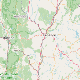
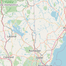
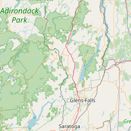
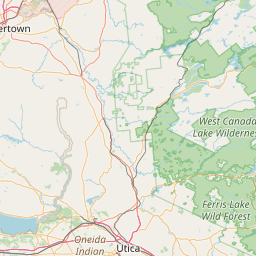
Leaflet | <a href="https://www.openstreetmap.org/copyright">© OpenStreetMap contributors</a>
Item
| Property | Value |
|---|---|
| id | 2271342 |
| downstream_mainstem_id | https://geoconnex.us/ref/mainstems/2270463 |
| encompassing_mainstem_basins | ['https://geoconnex.us/ref/mainstems/2270463'] |
| featuretype | ['https://www.opengis.net/def/schema/hy_features/hyf/HY_FlowPath', 'https://www.opengis.net/def/schema/hy_features/hyf/HY_WaterBody'] |
| fid | 543 |
| head_2020huc12 | 010700010601 |
| head_nhdpv1_comid | 6730459 |
| head_nhdpv2_comid | https://geoconnex.us/nhdplusv2/comid/6730459 |
| head_nhdpv2huc12 | https://geoconnex.us/nhdplusv2/huc12/010700010601 |
| head_rf1id | None |
| lengthkm | 28.5 |
| name_at_outlet | Newfound River |
| name_at_outlet_gnis_id | 868727 |
| new_mainstemid | |
| outlet_2020huc12 | 010700010603 |
| outlet_drainagearea_sqkm | 255.6 |
| outlet_nhdpv1_comid | 6731615 |
| outlet_nhdpv2_comid | https://geoconnex.us/nhdplusv2/comid/6731615 |
| outlet_nhdpv2huc12 | https://geoconnex.us/nhdplusv2/huc12/010700010603 |
| outlet_rf1id | None |
| superseded | False |
| uri | https://geoconnex.us/ref/mainstems/2271342 |
Graph Results
| monitoringLocation | https://sta.geoconnex.dev/collections/USGS/Things/items/'USGS-01077400' |
|---|---|
| siteName | USGS-01077400 |
| datasetDescription | Gage height / USGS-01077400-877e7ad3907740ed9e80f4467e8a5239 |
| type | Stream |
| url | https://waterdata.usgs.gov/monitoring-location/01077400/#parameterCode=00065 |
| variableMeasured | Gage height / USGS-01077400-877e7ad3907740ed9e80f4467e8a5239 |
| variableUnit | ft |
| measurementTechnique | observation |
| temporalCoverage | 2024-08-30T09:05:00Z/2024-09-09T18:00:00Z |
| distributionName | USGS Instantaneous Values Service |
| distributionURL | https://waterservices.usgs.gov/nwis/iv/?sites=USGS:01077400¶meterCd=00065&format=rdb |
| distributionFormat | text/tab-separated-values |
| wkt | POINT (-71.8333333333333 43.7038888888889) |
| monitoringLocation | https://sta.geoconnex.dev/collections/USGS/Things/items/'USGS-01077400' |
|---|---|
| siteName | USGS-01077400 |
| datasetDescription | Gage height / USGS-01077400-877e7ad3907740ed9e80f4467e8a5239 |
| type | Stream |
| url | https://waterdata.usgs.gov/monitoring-location/01077400/#parameterCode=00065 |
| variableMeasured | Gage height / USGS-01077400-877e7ad3907740ed9e80f4467e8a5239 |
| variableUnit | ft |
| measurementTechnique | observation |
| temporalCoverage | 2024-08-30T09:05:00Z/2024-09-09T18:00:00Z |
| distributionName | USGS SensorThings API |
| distributionURL | https://labs.waterdata.usgs.gov/sta/v1.1/Datastreams('877e7ad3907740ed9e80f4467e8a5239')?$expand=Thing,Observations |
| distributionFormat | application/json |
| wkt | POINT (-71.8333333333333 43.7038888888889) |
| monitoringLocation | https://sta.geoconnex.dev/collections/USGS/Things/items/'USGS-01077400' |
|---|---|
| siteName | USGS-01077400 |
| datasetDescription | Discharge / USGS-01077400-e88842d5f7eb49409ac83835ef9f52d9 |
| type | Stream |
| url | https://waterdata.usgs.gov/monitoring-location/01077400/#parameterCode=00060 |
| variableMeasured | Discharge / USGS-01077400-e88842d5f7eb49409ac83835ef9f52d9 |
| variableUnit | ft^3/s |
| measurementTechnique | observation |
| temporalCoverage | 2024-08-30T09:05:00Z/2024-09-09T18:00:00Z |
| distributionName | USGS Instantaneous Values Service |
| distributionURL | https://waterservices.usgs.gov/nwis/iv/?sites=USGS:01077400¶meterCd=00060&format=rdb |
| distributionFormat | text/tab-separated-values |
| wkt | POINT (-71.8333333333333 43.7038888888889) |
| monitoringLocation | https://sta.geoconnex.dev/collections/USGS/Things/items/'USGS-01077400' |
|---|---|
| siteName | USGS-01077400 |
| datasetDescription | Discharge / USGS-01077400-e88842d5f7eb49409ac83835ef9f52d9 |
| type | Stream |
| url | https://waterdata.usgs.gov/monitoring-location/01077400/#parameterCode=00060 |
| variableMeasured | Discharge / USGS-01077400-e88842d5f7eb49409ac83835ef9f52d9 |
| variableUnit | ft^3/s |
| measurementTechnique | observation |
| temporalCoverage | 2024-08-30T09:05:00Z/2024-09-09T18:00:00Z |
| distributionName | USGS SensorThings API |
| distributionURL | https://labs.waterdata.usgs.gov/sta/v1.1/Datastreams('e88842d5f7eb49409ac83835ef9f52d9')?$expand=Thing,Observations |
| distributionFormat | application/json |
| wkt | POINT (-71.8333333333333 43.7038888888889) |