Eightmile River
Map
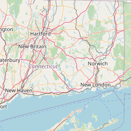
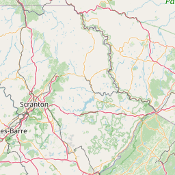

Leaflet | <a href="https://www.openstreetmap.org/copyright">© OpenStreetMap contributors</a>
Item
| Property | Value |
|---|---|
| id | 2279213 |
| downstream_mainstem_id | https://geoconnex.us/ref/mainstems/2277751 |
| encompassing_mainstem_basins | ['https://geoconnex.us/ref/mainstems/2277751'] |
| featuretype | ['https://www.opengis.net/def/schema/hy_features/hyf/HY_FlowPath', 'https://www.opengis.net/def/schema/hy_features/hyf/HY_WaterBody'] |
| fid | 744 |
| head_2020huc12 | 010802050903 |
| head_nhdpv1_comid | 7701364 |
| head_nhdpv2_comid | https://geoconnex.us/nhdplusv2/comid/7701364 |
| head_nhdpv2huc12 | https://geoconnex.us/nhdplusv2/huc12/010802050903 |
| head_rf1id | 1330 |
| lengthkm | 21.9 |
| name_at_outlet | Eightmile River |
| name_at_outlet_gnis_id | 206912 |
| new_mainstemid | |
| outlet_2020huc12 | 010802050903 |
| outlet_drainagearea_sqkm | 162.6 |
| outlet_nhdpv1_comid | 7704890 |
| outlet_nhdpv2_comid | https://geoconnex.us/nhdplusv2/comid/7704890 |
| outlet_nhdpv2huc12 | https://geoconnex.us/nhdplusv2/huc12/010802050903 |
| outlet_rf1id | 1330 |
| superseded | False |
| uri | https://geoconnex.us/ref/mainstems/2279213 |
Graph Results
| monitoringLocation | https://geoconnex.us/iow/wqp/USGS-412226072213601 |
|---|---|
| siteName | USGS-412226072213601 |
| datasetDescription | Alkalinity at USGS-412226072213601 |
| type | Well |
| url | https://www.waterqualitydata.us/provider/NWIS/USGS-CT/USGS-412226072213601/ |
| variableMeasured | Alkalinity |
| variableUnit | milligrams per liter as calcium carbonate |
| measurementTechnique | observation |
| temporalCoverage | 1972-01-01T00:00:00Z/1972-12-31T00:00:00Z |
| distributionName | Water Quality Portal |
| distributionURL | https://www.waterqualitydata.us/data/Result/search?siteid=USGS-412226072213601&CharacteristicName=Alkalinity&mimeType=csv |
| distributionFormat | text/comma-separated-values |
| wkt | POINT (-72.35952829 41.37398738) |
| monitoringLocation | https://geoconnex.us/iow/wqp/USGS-412226072213601 |
|---|---|
| siteName | USGS-412226072213601 |
| datasetDescription | Hardness, Ca, Mg at USGS-412226072213601 |
| type | Well |
| url | https://www.waterqualitydata.us/provider/NWIS/USGS-CT/USGS-412226072213601/ |
| variableMeasured | Hardness, Ca, Mg |
| variableUnit | milligrams per liter as calcium carbonate |
| measurementTechnique | observation |
| temporalCoverage | 1972-01-01T00:00:00Z/1972-12-31T00:00:00Z |
| distributionName | Water Quality Portal |
| distributionURL | https://www.waterqualitydata.us/data/Result/search?siteid=USGS-412226072213601&CharacteristicName=Hardness, Ca, Mg&mimeType=csv |
| distributionFormat | text/comma-separated-values |
| wkt | POINT (-72.35952829 41.37398738) |
| monitoringLocation | https://geoconnex.us/iow/wqp/USGS-412226072213601 |
|---|---|
| siteName | USGS-412226072213601 |
| datasetDescription | pH at USGS-412226072213601 |
| type | Well |
| url | https://www.waterqualitydata.us/provider/NWIS/USGS-CT/USGS-412226072213601/ |
| variableMeasured | pH |
| variableUnit | Unknown |
| measurementTechnique | observation |
| temporalCoverage | 1972-01-01T00:00:00Z/1972-12-31T00:00:00Z |
| distributionName | Water Quality Portal |
| distributionURL | https://www.waterqualitydata.us/data/Result/search?siteid=USGS-412226072213601&CharacteristicName=pH&mimeType=csv |
| distributionFormat | text/comma-separated-values |
| wkt | POINT (-72.35952829 41.37398738) |
| monitoringLocation | https://geoconnex.us/iow/wqp/USGS-412226072213601 |
|---|---|
| siteName | USGS-412226072213601 |
| datasetDescription | Sulfate at USGS-412226072213601 |
| type | Well |
| url | https://www.waterqualitydata.us/provider/NWIS/USGS-CT/USGS-412226072213601/ |
| variableMeasured | Sulfate |
| variableUnit | milligrams per liter |
| measurementTechnique | observation |
| temporalCoverage | 1972-01-01T00:00:00Z/1972-12-31T00:00:00Z |
| distributionName | Water Quality Portal |
| distributionURL | https://www.waterqualitydata.us/data/Result/search?siteid=USGS-412226072213601&CharacteristicName=Sulfate&mimeType=csv |
| distributionFormat | text/comma-separated-values |
| wkt | POINT (-72.35952829 41.37398738) |
| monitoringLocation | https://geoconnex.us/iow/wqp/USGS-412226072213601 |
|---|---|
| siteName | USGS-412226072213601 |
| datasetDescription | Potassium at USGS-412226072213601 |
| type | Well |
| url | https://www.waterqualitydata.us/provider/NWIS/USGS-CT/USGS-412226072213601/ |
| variableMeasured | Potassium |
| variableUnit | milligrams per liter |
| measurementTechnique | observation |
| temporalCoverage | 1972-01-01T00:00:00Z/1972-12-31T00:00:00Z |
| distributionName | Water Quality Portal |
| distributionURL | https://www.waterqualitydata.us/data/Result/search?siteid=USGS-412226072213601&CharacteristicName=Potassium&mimeType=csv |
| distributionFormat | text/comma-separated-values |
| wkt | POINT (-72.35952829 41.37398738) |
| monitoringLocation | https://geoconnex.us/iow/wqp/USGS-412226072213601 |
|---|---|
| siteName | USGS-412226072213601 |
| datasetDescription | Sodium at USGS-412226072213601 |
| type | Well |
| url | https://www.waterqualitydata.us/provider/NWIS/USGS-CT/USGS-412226072213601/ |
| variableMeasured | Sodium |
| variableUnit | milligrams per liter |
| measurementTechnique | observation |
| temporalCoverage | 1972-01-01T00:00:00Z/1972-12-31T00:00:00Z |
| distributionName | Water Quality Portal |
| distributionURL | https://www.waterqualitydata.us/data/Result/search?siteid=USGS-412226072213601&CharacteristicName=Sodium&mimeType=csv |
| distributionFormat | text/comma-separated-values |
| wkt | POINT (-72.35952829 41.37398738) |
| monitoringLocation | https://geoconnex.us/iow/wqp/USGS-412226072213601 |
|---|---|
| siteName | USGS-412226072213601 |
| datasetDescription | Manganese at USGS-412226072213601 |
| type | Well |
| url | https://www.waterqualitydata.us/provider/NWIS/USGS-CT/USGS-412226072213601/ |
| variableMeasured | Manganese |
| variableUnit | micrograms per liter |
| measurementTechnique | observation |
| temporalCoverage | 1972-01-01T00:00:00Z/1972-12-31T00:00:00Z |
| distributionName | Water Quality Portal |
| distributionURL | https://www.waterqualitydata.us/data/Result/search?siteid=USGS-412226072213601&CharacteristicName=Manganese&mimeType=csv |
| distributionFormat | text/comma-separated-values |
| wkt | POINT (-72.35952829 41.37398738) |
| monitoringLocation | https://geoconnex.us/iow/wqp/USGS-412226072213601 |
|---|---|
| siteName | USGS-412226072213601 |
| datasetDescription | Hardness, non-carbonate at USGS-412226072213601 |
| type | Well |
| url | https://www.waterqualitydata.us/provider/NWIS/USGS-CT/USGS-412226072213601/ |
| variableMeasured | Hardness, non-carbonate |
| variableUnit | milligrams per liter as calcium carbonate |
| measurementTechnique | observation |
| temporalCoverage | 1972-01-01T00:00:00Z/1972-12-31T00:00:00Z |
| distributionName | Water Quality Portal |
| distributionURL | https://www.waterqualitydata.us/data/Result/search?siteid=USGS-412226072213601&CharacteristicName=Hardness, non-carbonate&mimeType=csv |
| distributionFormat | text/comma-separated-values |
| wkt | POINT (-72.35952829 41.37398738) |
| monitoringLocation | https://geoconnex.us/iow/wqp/USGS-412226072213601 |
|---|---|
| siteName | USGS-412226072213601 |
| datasetDescription | Temperature, water at USGS-412226072213601 |
| type | Well |
| url | https://www.waterqualitydata.us/provider/NWIS/USGS-CT/USGS-412226072213601/ |
| variableMeasured | Temperature, water |
| variableUnit | degrees Celsius |
| measurementTechnique | observation |
| temporalCoverage | 1972-01-01T00:00:00Z/1972-12-31T00:00:00Z |
| distributionName | Water Quality Portal |
| distributionURL | https://www.waterqualitydata.us/data/Result/search?siteid=USGS-412226072213601&CharacteristicName=Temperature, water&mimeType=csv |
| distributionFormat | text/comma-separated-values |
| wkt | POINT (-72.35952829 41.37398738) |
| monitoringLocation | https://geoconnex.us/iow/wqp/USGS-412226072213601 |
|---|---|
| siteName | USGS-412226072213601 |
| datasetDescription | Calcium at USGS-412226072213601 |
| type | Well |
| url | https://www.waterqualitydata.us/provider/NWIS/USGS-CT/USGS-412226072213601/ |
| variableMeasured | Calcium |
| variableUnit | milligrams per liter |
| measurementTechnique | observation |
| temporalCoverage | 1972-01-01T00:00:00Z/1972-12-31T00:00:00Z |
| distributionName | Water Quality Portal |
| distributionURL | https://www.waterqualitydata.us/data/Result/search?siteid=USGS-412226072213601&CharacteristicName=Calcium&mimeType=csv |
| distributionFormat | text/comma-separated-values |
| wkt | POINT (-72.35952829 41.37398738) |
| monitoringLocation | https://geoconnex.us/iow/wqp/USGS-412226072213601 |
|---|---|
| siteName | USGS-412226072213601 |
| datasetDescription | Carbonate at USGS-412226072213601 |
| type | Well |
| url | https://www.waterqualitydata.us/provider/NWIS/USGS-CT/USGS-412226072213601/ |
| variableMeasured | Carbonate |
| variableUnit | milligrams per liter |
| measurementTechnique | observation |
| temporalCoverage | 1972-01-01T00:00:00Z/1972-12-31T00:00:00Z |
| distributionName | Water Quality Portal |
| distributionURL | https://www.waterqualitydata.us/data/Result/search?siteid=USGS-412226072213601&CharacteristicName=Carbonate&mimeType=csv |
| distributionFormat | text/comma-separated-values |
| wkt | POINT (-72.35952829 41.37398738) |
| monitoringLocation | https://geoconnex.us/iow/wqp/USGS-412226072213601 |
|---|---|
| siteName | USGS-412226072213601 |
| datasetDescription | Nitrate at USGS-412226072213601 |
| type | Well |
| url | https://www.waterqualitydata.us/provider/NWIS/USGS-CT/USGS-412226072213601/ |
| variableMeasured | Nitrate |
| variableUnit | milligrams per liter as nitrogen |
| measurementTechnique | observation |
| temporalCoverage | 1972-01-01T00:00:00Z/1972-12-31T00:00:00Z |
| distributionName | Water Quality Portal |
| distributionURL | https://www.waterqualitydata.us/data/Result/search?siteid=USGS-412226072213601&CharacteristicName=Nitrate&mimeType=csv |
| distributionFormat | text/comma-separated-values |
| wkt | POINT (-72.35952829 41.37398738) |
| monitoringLocation | https://geoconnex.us/iow/wqp/USGS-412226072213601 |
|---|---|
| siteName | USGS-412226072213601 |
| datasetDescription | Carbon dioxide at USGS-412226072213601 |
| type | Well |
| url | https://www.waterqualitydata.us/provider/NWIS/USGS-CT/USGS-412226072213601/ |
| variableMeasured | Carbon dioxide |
| variableUnit | milligrams per liter |
| measurementTechnique | observation |
| temporalCoverage | 1972-01-01T00:00:00Z/1972-12-31T00:00:00Z |
| distributionName | Water Quality Portal |
| distributionURL | https://www.waterqualitydata.us/data/Result/search?siteid=USGS-412226072213601&CharacteristicName=Carbon dioxide&mimeType=csv |
| distributionFormat | text/comma-separated-values |
| wkt | POINT (-72.35952829 41.37398738) |
| monitoringLocation | https://geoconnex.us/iow/wqp/USGS-412226072213601 |
|---|---|
| siteName | USGS-412226072213601 |
| datasetDescription | Flow rate at USGS-412226072213601 |
| type | Well |
| url | https://www.waterqualitydata.us/provider/NWIS/USGS-CT/USGS-412226072213601/ |
| variableMeasured | Flow rate |
| variableUnit | gallons per minute |
| measurementTechnique | observation |
| temporalCoverage | 1972-01-01T00:00:00Z/1972-12-31T00:00:00Z |
| distributionName | Water Quality Portal |
| distributionURL | https://www.waterqualitydata.us/data/Result/search?siteid=USGS-412226072213601&CharacteristicName=Flow rate&mimeType=csv |
| distributionFormat | text/comma-separated-values |
| wkt | POINT (-72.35952829 41.37398738) |
| monitoringLocation | https://geoconnex.us/iow/wqp/USGS-412226072213601 |
|---|---|
| siteName | USGS-412226072213601 |
| datasetDescription | Bicarbonate at USGS-412226072213601 |
| type | Well |
| url | https://www.waterqualitydata.us/provider/NWIS/USGS-CT/USGS-412226072213601/ |
| variableMeasured | Bicarbonate |
| variableUnit | milligrams per liter |
| measurementTechnique | observation |
| temporalCoverage | 1972-01-01T00:00:00Z/1972-12-31T00:00:00Z |
| distributionName | Water Quality Portal |
| distributionURL | https://www.waterqualitydata.us/data/Result/search?siteid=USGS-412226072213601&CharacteristicName=Bicarbonate&mimeType=csv |
| distributionFormat | text/comma-separated-values |
| wkt | POINT (-72.35952829 41.37398738) |
| monitoringLocation | https://geoconnex.us/iow/wqp/USGS-412226072213601 |
|---|---|
| siteName | USGS-412226072213601 |
| datasetDescription | Depth at USGS-412226072213601 |
| type | Well |
| url | https://www.waterqualitydata.us/provider/NWIS/USGS-CT/USGS-412226072213601/ |
| variableMeasured | Depth |
| variableUnit | feet |
| measurementTechnique | observation |
| temporalCoverage | 1972-01-01T00:00:00Z/1972-12-31T00:00:00Z |
| distributionName | Water Quality Portal |
| distributionURL | https://www.waterqualitydata.us/data/Result/search?siteid=USGS-412226072213601&CharacteristicName=Depth&mimeType=csv |
| distributionFormat | text/comma-separated-values |
| wkt | POINT (-72.35952829 41.37398738) |
| monitoringLocation | https://geoconnex.us/iow/wqp/USGS-412226072213601 |
|---|---|
| siteName | USGS-412226072213601 |
| datasetDescription | Magnesium at USGS-412226072213601 |
| type | Well |
| url | https://www.waterqualitydata.us/provider/NWIS/USGS-CT/USGS-412226072213601/ |
| variableMeasured | Magnesium |
| variableUnit | percent |
| measurementTechnique | observation |
| temporalCoverage | 1972-01-01T00:00:00Z/1972-12-31T00:00:00Z |
| distributionName | Water Quality Portal |
| distributionURL | https://www.waterqualitydata.us/data/Result/search?siteid=USGS-412226072213601&CharacteristicName=Magnesium&mimeType=csv |
| distributionFormat | text/comma-separated-values |
| wkt | POINT (-72.35952829 41.37398738) |
| monitoringLocation | https://geoconnex.us/iow/wqp/USGS-412226072213601 |
|---|---|
| siteName | USGS-412226072213601 |
| datasetDescription | Chloride at USGS-412226072213601 |
| type | Well |
| url | https://www.waterqualitydata.us/provider/NWIS/USGS-CT/USGS-412226072213601/ |
| variableMeasured | Chloride |
| variableUnit | milligrams per liter |
| measurementTechnique | observation |
| temporalCoverage | 1972-01-01T00:00:00Z/1972-12-31T00:00:00Z |
| distributionName | Water Quality Portal |
| distributionURL | https://www.waterqualitydata.us/data/Result/search?siteid=USGS-412226072213601&CharacteristicName=Chloride&mimeType=csv |
| distributionFormat | text/comma-separated-values |
| wkt | POINT (-72.35952829 41.37398738) |
| monitoringLocation | https://geoconnex.us/iow/wqp/USGS-412226072213601 |
|---|---|
| siteName | USGS-412226072213601 |
| datasetDescription | Specific conductance at USGS-412226072213601 |
| type | Well |
| url | https://www.waterqualitydata.us/provider/NWIS/USGS-CT/USGS-412226072213601/ |
| variableMeasured | Specific conductance |
| variableUnit | microsiemens per centimeter |
| measurementTechnique | observation |
| temporalCoverage | 1972-01-01T00:00:00Z/1972-12-31T00:00:00Z |
| distributionName | Water Quality Portal |
| distributionURL | https://www.waterqualitydata.us/data/Result/search?siteid=USGS-412226072213601&CharacteristicName=Specific conductance&mimeType=csv |
| distributionFormat | text/comma-separated-values |
| wkt | POINT (-72.35952829 41.37398738) |
| monitoringLocation | https://geoconnex.us/iow/wqp/USGS-412226072213601 |
|---|---|
| siteName | USGS-412226072213601 |
| datasetDescription | Fluoride at USGS-412226072213601 |
| type | Well |
| url | https://www.waterqualitydata.us/provider/NWIS/USGS-CT/USGS-412226072213601/ |
| variableMeasured | Fluoride |
| variableUnit | milligrams per liter |
| measurementTechnique | observation |
| temporalCoverage | 1972-01-01T00:00:00Z/1972-12-31T00:00:00Z |
| distributionName | Water Quality Portal |
| distributionURL | https://www.waterqualitydata.us/data/Result/search?siteid=USGS-412226072213601&CharacteristicName=Fluoride&mimeType=csv |
| distributionFormat | text/comma-separated-values |
| wkt | POINT (-72.35952829 41.37398738) |
| monitoringLocation | https://geoconnex.us/iow/wqp/USGS-412226072213601 |
|---|---|
| siteName | USGS-412226072213601 |
| datasetDescription | Total dissolved solids at USGS-412226072213601 |
| type | Well |
| url | https://www.waterqualitydata.us/provider/NWIS/USGS-CT/USGS-412226072213601/ |
| variableMeasured | Total dissolved solids |
| variableUnit | milligrams per liter |
| measurementTechnique | observation |
| temporalCoverage | 1972-01-01T00:00:00Z/1972-12-31T00:00:00Z |
| distributionName | Water Quality Portal |
| distributionURL | https://www.waterqualitydata.us/data/Result/search?siteid=USGS-412226072213601&CharacteristicName=Total dissolved solids&mimeType=csv |
| distributionFormat | text/comma-separated-values |
| wkt | POINT (-72.35952829 41.37398738) |
| monitoringLocation | https://geoconnex.us/iow/wqp/USGS-412226072213601 |
|---|---|
| siteName | USGS-412226072213601 |
| datasetDescription | Iron at USGS-412226072213601 |
| type | Well |
| url | https://www.waterqualitydata.us/provider/NWIS/USGS-CT/USGS-412226072213601/ |
| variableMeasured | Iron |
| variableUnit | percent |
| measurementTechnique | observation |
| temporalCoverage | 1972-01-01T00:00:00Z/1972-12-31T00:00:00Z |
| distributionName | Water Quality Portal |
| distributionURL | https://www.waterqualitydata.us/data/Result/search?siteid=USGS-412226072213601&CharacteristicName=Iron&mimeType=csv |
| distributionFormat | text/comma-separated-values |
| wkt | POINT (-72.35952829 41.37398738) |
| monitoringLocation | https://geoconnex.us/iow/wqp/USGS-412226072213601 |
|---|---|
| siteName | USGS-412226072213601 |
| datasetDescription | Silica at USGS-412226072213601 |
| type | Well |
| url | https://www.waterqualitydata.us/provider/NWIS/USGS-CT/USGS-412226072213601/ |
| variableMeasured | Silica |
| variableUnit | milligrams per liter |
| measurementTechnique | observation |
| temporalCoverage | 1972-01-01T00:00:00Z/1972-12-31T00:00:00Z |
| distributionName | Water Quality Portal |
| distributionURL | https://www.waterqualitydata.us/data/Result/search?siteid=USGS-412226072213601&CharacteristicName=Silica&mimeType=csv |
| distributionFormat | text/comma-separated-values |
| wkt | POINT (-72.35952829 41.37398738) |
| monitoringLocation | https://geoconnex.us/iow/wqp/USGS-412226072213601 |
|---|---|
| siteName | USGS-412226072213601 |
| datasetDescription | Sodium, percent total cations at USGS-412226072213601 |
| type | Well |
| url | https://www.waterqualitydata.us/provider/NWIS/USGS-CT/USGS-412226072213601/ |
| variableMeasured | Sodium, percent total cations |
| variableUnit | percent |
| measurementTechnique | observation |
| temporalCoverage | 1972-01-01T00:00:00Z/1972-12-31T00:00:00Z |
| distributionName | Water Quality Portal |
| distributionURL | https://www.waterqualitydata.us/data/Result/search?siteid=USGS-412226072213601&CharacteristicName=Sodium, percent total cations&mimeType=csv |
| distributionFormat | text/comma-separated-values |
| wkt | POINT (-72.35952829 41.37398738) |
| monitoringLocation | https://geoconnex.us/iow/wqp/NARS_WQX-CTLS-1047 |
|---|---|
| siteName | NARS_WQX-CTLS-1047 |
| datasetDescription | Sodium at NARS_WQX-CTLS-1047 |
| type | River/Stream |
| url | https://www.waterqualitydata.us/provider/STORET/NARS_WQX/NARS_WQX-CTLS-1047/ |
| variableMeasured | Sodium |
| variableUnit | milligrams per liter |
| measurementTechnique | observation |
| temporalCoverage | 2014-01-01T00:00:00Z/2014-12-31T00:00:00Z |
| distributionName | Water Quality Portal |
| distributionURL | https://www.waterqualitydata.us/data/Result/search?siteid=NARS_WQX-CTLS-1047&CharacteristicName=Sodium&mimeType=csv |
| distributionFormat | text/comma-separated-values |
| wkt | POINT (-72.34804 41.39519) |
| monitoringLocation | https://geoconnex.us/iow/wqp/NARS_WQX-CTLS-1047 |
|---|---|
| siteName | NARS_WQX-CTLS-1047 |
| datasetDescription | True color at NARS_WQX-CTLS-1047 |
| type | River/Stream |
| url | https://www.waterqualitydata.us/provider/STORET/NARS_WQX/NARS_WQX-CTLS-1047/ |
| variableMeasured | True color |
| variableUnit | platinum-cobalt units |
| measurementTechnique | observation |
| temporalCoverage | 2014-01-01T00:00:00Z/2014-12-31T00:00:00Z |
| distributionName | Water Quality Portal |
| distributionURL | https://www.waterqualitydata.us/data/Result/search?siteid=NARS_WQX-CTLS-1047&CharacteristicName=True color&mimeType=csv |
| distributionFormat | text/comma-separated-values |
| wkt | POINT (-72.34804 41.39519) |
| monitoringLocation | https://geoconnex.us/iow/wqp/NARS_WQX-CTLS-1047 |
|---|---|
| siteName | NARS_WQX-CTLS-1047 |
| datasetDescription | Total suspended solids at NARS_WQX-CTLS-1047 |
| type | River/Stream |
| url | https://www.waterqualitydata.us/provider/STORET/NARS_WQX/NARS_WQX-CTLS-1047/ |
| variableMeasured | Total suspended solids |
| variableUnit | milligrams per liter |
| measurementTechnique | observation |
| temporalCoverage | 2014-01-01T00:00:00Z/2014-12-31T00:00:00Z |
| distributionName | Water Quality Portal |
| distributionURL | https://www.waterqualitydata.us/data/Result/search?siteid=NARS_WQX-CTLS-1047&CharacteristicName=Total suspended solids&mimeType=csv |
| distributionFormat | text/comma-separated-values |
| wkt | POINT (-72.34804 41.39519) |
| monitoringLocation | https://geoconnex.us/iow/wqp/NARS_WQX-CTLS-1047 |
|---|---|
| siteName | NARS_WQX-CTLS-1047 |
| datasetDescription | Gran acid neutralizing capacity at NARS_WQX-CTLS-1047 |
| type | River/Stream |
| url | https://www.waterqualitydata.us/provider/STORET/NARS_WQX/NARS_WQX-CTLS-1047/ |
| variableMeasured | Gran acid neutralizing capacity |
| variableUnit | microequivalents per liter |
| measurementTechnique | observation |
| temporalCoverage | 2014-01-01T00:00:00Z/2014-12-31T00:00:00Z |
| distributionName | Water Quality Portal |
| distributionURL | https://www.waterqualitydata.us/data/Result/search?siteid=NARS_WQX-CTLS-1047&CharacteristicName=Gran acid neutralizing capacity&mimeType=csv |
| distributionFormat | text/comma-separated-values |
| wkt | POINT (-72.34804 41.39519) |
| monitoringLocation | https://geoconnex.us/iow/wqp/NARS_WQX-CTLS-1047 |
|---|---|
| siteName | NARS_WQX-CTLS-1047 |
| datasetDescription | Sulfate at NARS_WQX-CTLS-1047 |
| type | River/Stream |
| url | https://www.waterqualitydata.us/provider/STORET/NARS_WQX/NARS_WQX-CTLS-1047/ |
| variableMeasured | Sulfate |
| variableUnit | milligrams per liter |
| measurementTechnique | observation |
| temporalCoverage | 2014-01-01T00:00:00Z/2014-12-31T00:00:00Z |
| distributionName | Water Quality Portal |
| distributionURL | https://www.waterqualitydata.us/data/Result/search?siteid=NARS_WQX-CTLS-1047&CharacteristicName=Sulfate&mimeType=csv |
| distributionFormat | text/comma-separated-values |
| wkt | POINT (-72.34804 41.39519) |
| monitoringLocation | https://geoconnex.us/iow/wqp/NARS_WQX-CTLS-1047 |
|---|---|
| siteName | NARS_WQX-CTLS-1047 |
| datasetDescription | Magnesium at NARS_WQX-CTLS-1047 |
| type | River/Stream |
| url | https://www.waterqualitydata.us/provider/STORET/NARS_WQX/NARS_WQX-CTLS-1047/ |
| variableMeasured | Magnesium |
| variableUnit | percent |
| measurementTechnique | observation |
| temporalCoverage | 2014-01-01T00:00:00Z/2014-12-31T00:00:00Z |
| distributionName | Water Quality Portal |
| distributionURL | https://www.waterqualitydata.us/data/Result/search?siteid=NARS_WQX-CTLS-1047&CharacteristicName=Magnesium&mimeType=csv |
| distributionFormat | text/comma-separated-values |
| wkt | POINT (-72.34804 41.39519) |
| monitoringLocation | https://geoconnex.us/iow/wqp/NARS_WQX-CTLS-1047 |
|---|---|
| siteName | NARS_WQX-CTLS-1047 |
| datasetDescription | Potassium at NARS_WQX-CTLS-1047 |
| type | River/Stream |
| url | https://www.waterqualitydata.us/provider/STORET/NARS_WQX/NARS_WQX-CTLS-1047/ |
| variableMeasured | Potassium |
| variableUnit | milligrams per liter |
| measurementTechnique | observation |
| temporalCoverage | 2014-01-01T00:00:00Z/2014-12-31T00:00:00Z |
| distributionName | Water Quality Portal |
| distributionURL | https://www.waterqualitydata.us/data/Result/search?siteid=NARS_WQX-CTLS-1047&CharacteristicName=Potassium&mimeType=csv |
| distributionFormat | text/comma-separated-values |
| wkt | POINT (-72.34804 41.39519) |
| monitoringLocation | https://geoconnex.us/iow/wqp/NARS_WQX-CTLS-1047 |
|---|---|
| siteName | NARS_WQX-CTLS-1047 |
| datasetDescription | Chlorophyll a at NARS_WQX-CTLS-1047 |
| type | River/Stream |
| url | https://www.waterqualitydata.us/provider/STORET/NARS_WQX/NARS_WQX-CTLS-1047/ |
| variableMeasured | Chlorophyll a |
| variableUnit | micrograms per liter |
| measurementTechnique | observation |
| temporalCoverage | 2014-01-01T00:00:00Z/2014-12-31T00:00:00Z |
| distributionName | Water Quality Portal |
| distributionURL | https://www.waterqualitydata.us/data/Result/search?siteid=NARS_WQX-CTLS-1047&CharacteristicName=Chlorophyll a&mimeType=csv |
| distributionFormat | text/comma-separated-values |
| wkt | POINT (-72.34804 41.39519) |
| monitoringLocation | https://geoconnex.us/iow/wqp/NARS_WQX-CTLS-1047 |
|---|---|
| siteName | NARS_WQX-CTLS-1047 |
| datasetDescription | Specific conductance at NARS_WQX-CTLS-1047 |
| type | River/Stream |
| url | https://www.waterqualitydata.us/provider/STORET/NARS_WQX/NARS_WQX-CTLS-1047/ |
| variableMeasured | Specific conductance |
| variableUnit | microsiemens per centimeter |
| measurementTechnique | observation |
| temporalCoverage | 2014-01-01T00:00:00Z/2014-12-31T00:00:00Z |
| distributionName | Water Quality Portal |
| distributionURL | https://www.waterqualitydata.us/data/Result/search?siteid=NARS_WQX-CTLS-1047&CharacteristicName=Specific conductance&mimeType=csv |
| distributionFormat | text/comma-separated-values |
| wkt | POINT (-72.34804 41.39519) |
| monitoringLocation | https://geoconnex.us/iow/wqp/NARS_WQX-CTLS-1047 |
|---|---|
| siteName | NARS_WQX-CTLS-1047 |
| datasetDescription | Turbidity at NARS_WQX-CTLS-1047 |
| type | River/Stream |
| url | https://www.waterqualitydata.us/provider/STORET/NARS_WQX/NARS_WQX-CTLS-1047/ |
| variableMeasured | Turbidity |
| variableUnit | Jackson turbidity units |
| measurementTechnique | observation |
| temporalCoverage | 2014-01-01T00:00:00Z/2014-12-31T00:00:00Z |
| distributionName | Water Quality Portal |
| distributionURL | https://www.waterqualitydata.us/data/Result/search?siteid=NARS_WQX-CTLS-1047&CharacteristicName=Turbidity&mimeType=csv |
| distributionFormat | text/comma-separated-values |
| wkt | POINT (-72.34804 41.39519) |
| monitoringLocation | https://geoconnex.us/iow/wqp/NARS_WQX-CTLS-1047 |
|---|---|
| siteName | NARS_WQX-CTLS-1047 |
| datasetDescription | pH at NARS_WQX-CTLS-1047 |
| type | River/Stream |
| url | https://www.waterqualitydata.us/provider/STORET/NARS_WQX/NARS_WQX-CTLS-1047/ |
| variableMeasured | pH |
| variableUnit | Unknown |
| measurementTechnique | observation |
| temporalCoverage | 2014-01-01T00:00:00Z/2014-12-31T00:00:00Z |
| distributionName | Water Quality Portal |
| distributionURL | https://www.waterqualitydata.us/data/Result/search?siteid=NARS_WQX-CTLS-1047&CharacteristicName=pH&mimeType=csv |
| distributionFormat | text/comma-separated-values |
| wkt | POINT (-72.34804 41.39519) |
| monitoringLocation | https://geoconnex.us/iow/wqp/NARS_WQX-CTLS-1047 |
|---|---|
| siteName | NARS_WQX-CTLS-1047 |
| datasetDescription | Calcium at NARS_WQX-CTLS-1047 |
| type | River/Stream |
| url | https://www.waterqualitydata.us/provider/STORET/NARS_WQX/NARS_WQX-CTLS-1047/ |
| variableMeasured | Calcium |
| variableUnit | milligrams per liter |
| measurementTechnique | observation |
| temporalCoverage | 2014-01-01T00:00:00Z/2014-12-31T00:00:00Z |
| distributionName | Water Quality Portal |
| distributionURL | https://www.waterqualitydata.us/data/Result/search?siteid=NARS_WQX-CTLS-1047&CharacteristicName=Calcium&mimeType=csv |
| distributionFormat | text/comma-separated-values |
| wkt | POINT (-72.34804 41.39519) |
| monitoringLocation | https://geoconnex.us/iow/wqp/NARS_WQX-CTLS-1047 |
|---|---|
| siteName | NARS_WQX-CTLS-1047 |
| datasetDescription | Organic carbon at NARS_WQX-CTLS-1047 |
| type | River/Stream |
| url | https://www.waterqualitydata.us/provider/STORET/NARS_WQX/NARS_WQX-CTLS-1047/ |
| variableMeasured | Organic carbon |
| variableUnit | milligrams per liter |
| measurementTechnique | observation |
| temporalCoverage | 2014-01-01T00:00:00Z/2014-12-31T00:00:00Z |
| distributionName | Water Quality Portal |
| distributionURL | https://www.waterqualitydata.us/data/Result/search?siteid=NARS_WQX-CTLS-1047&CharacteristicName=Organic carbon&mimeType=csv |
| distributionFormat | text/comma-separated-values |
| wkt | POINT (-72.34804 41.39519) |
| monitoringLocation | https://geoconnex.us/iow/wqp/NARS_WQX-CTLS-1047 |
|---|---|
| siteName | NARS_WQX-CTLS-1047 |
| datasetDescription | Temperature, water at NARS_WQX-CTLS-1047 |
| type | River/Stream |
| url | https://www.waterqualitydata.us/provider/STORET/NARS_WQX/NARS_WQX-CTLS-1047/ |
| variableMeasured | Temperature, water |
| variableUnit | degrees Celsius |
| measurementTechnique | observation |
| temporalCoverage | 2014-01-01T00:00:00Z/2014-12-31T00:00:00Z |
| distributionName | Water Quality Portal |
| distributionURL | https://www.waterqualitydata.us/data/Result/search?siteid=NARS_WQX-CTLS-1047&CharacteristicName=Temperature, water&mimeType=csv |
| distributionFormat | text/comma-separated-values |
| wkt | POINT (-72.34804 41.39519) |
| monitoringLocation | https://geoconnex.us/iow/wqp/NARS_WQX-CTLS-1047 |
|---|---|
| siteName | NARS_WQX-CTLS-1047 |
| datasetDescription | Count at NARS_WQX-CTLS-1047 |
| type | River/Stream |
| url | https://www.waterqualitydata.us/provider/STORET/NARS_WQX/NARS_WQX-CTLS-1047/ |
| variableMeasured | Count |
| variableUnit | count (no unit) |
| measurementTechnique | observation |
| temporalCoverage | 2013-01-01T00:00:00Z/2014-12-31T00:00:00Z |
| distributionName | Water Quality Portal |
| distributionURL | https://www.waterqualitydata.us/data/Result/search?siteid=NARS_WQX-CTLS-1047&CharacteristicName=Count&mimeType=csv |
| distributionFormat | text/comma-separated-values |
| wkt | POINT (-72.34804 41.39519) |
| monitoringLocation | https://geoconnex.us/iow/wqp/NARS_WQX-CTLS-1047 |
|---|---|
| siteName | NARS_WQX-CTLS-1047 |
| datasetDescription | Silica at NARS_WQX-CTLS-1047 |
| type | River/Stream |
| url | https://www.waterqualitydata.us/provider/STORET/NARS_WQX/NARS_WQX-CTLS-1047/ |
| variableMeasured | Silica |
| variableUnit | milligrams per liter |
| measurementTechnique | observation |
| temporalCoverage | 2014-01-01T00:00:00Z/2014-12-31T00:00:00Z |
| distributionName | Water Quality Portal |
| distributionURL | https://www.waterqualitydata.us/data/Result/search?siteid=NARS_WQX-CTLS-1047&CharacteristicName=Silica&mimeType=csv |
| distributionFormat | text/comma-separated-values |
| wkt | POINT (-72.34804 41.39519) |
| monitoringLocation | https://geoconnex.us/iow/wqp/NARS_WQX-CTLS-1047 |
|---|---|
| siteName | NARS_WQX-CTLS-1047 |
| datasetDescription | Nitrite at NARS_WQX-CTLS-1047 |
| type | River/Stream |
| url | https://www.waterqualitydata.us/provider/STORET/NARS_WQX/NARS_WQX-CTLS-1047/ |
| variableMeasured | Nitrite |
| variableUnit | milligrams per liter |
| measurementTechnique | observation |
| temporalCoverage | 2014-01-01T00:00:00Z/2014-12-31T00:00:00Z |
| distributionName | Water Quality Portal |
| distributionURL | https://www.waterqualitydata.us/data/Result/search?siteid=NARS_WQX-CTLS-1047&CharacteristicName=Nitrite&mimeType=csv |
| distributionFormat | text/comma-separated-values |
| wkt | POINT (-72.34804 41.39519) |
| monitoringLocation | https://geoconnex.us/iow/wqp/NARS_WQX-CTLS-1047 |
|---|---|
| siteName | NARS_WQX-CTLS-1047 |
| datasetDescription | Conductivity at NARS_WQX-CTLS-1047 |
| type | River/Stream |
| url | https://www.waterqualitydata.us/provider/STORET/NARS_WQX/NARS_WQX-CTLS-1047/ |
| variableMeasured | Conductivity |
| variableUnit | microsiemens per centimeter |
| measurementTechnique | observation |
| temporalCoverage | 2014-01-01T00:00:00Z/2014-12-31T00:00:00Z |
| distributionName | Water Quality Portal |
| distributionURL | https://www.waterqualitydata.us/data/Result/search?siteid=NARS_WQX-CTLS-1047&CharacteristicName=Conductivity&mimeType=csv |
| distributionFormat | text/comma-separated-values |
| wkt | POINT (-72.34804 41.39519) |
| monitoringLocation | https://geoconnex.us/iow/wqp/NARS_WQX-CTLS-1047 |
|---|---|
| siteName | NARS_WQX-CTLS-1047 |
| datasetDescription | Dissolved oxygen (DO) at NARS_WQX-CTLS-1047 |
| type | River/Stream |
| url | https://www.waterqualitydata.us/provider/STORET/NARS_WQX/NARS_WQX-CTLS-1047/ |
| variableMeasured | Dissolved oxygen (DO) |
| variableUnit | milligrams per liter |
| measurementTechnique | observation |
| temporalCoverage | 2014-01-01T00:00:00Z/2014-12-31T00:00:00Z |
| distributionName | Water Quality Portal |
| distributionURL | https://www.waterqualitydata.us/data/Result/search?siteid=NARS_WQX-CTLS-1047&CharacteristicName=Dissolved oxygen (DO)&mimeType=csv |
| distributionFormat | text/comma-separated-values |
| wkt | POINT (-72.34804 41.39519) |
| monitoringLocation | https://geoconnex.us/iow/wqp/NARS_WQX-CTLS-1047 |
|---|---|
| siteName | NARS_WQX-CTLS-1047 |
| datasetDescription | Ammonia at NARS_WQX-CTLS-1047 |
| type | River/Stream |
| url | https://www.waterqualitydata.us/provider/STORET/NARS_WQX/NARS_WQX-CTLS-1047/ |
| variableMeasured | Ammonia |
| variableUnit | milligrams per liter |
| measurementTechnique | observation |
| temporalCoverage | 2014-01-01T00:00:00Z/2014-12-31T00:00:00Z |
| distributionName | Water Quality Portal |
| distributionURL | https://www.waterqualitydata.us/data/Result/search?siteid=NARS_WQX-CTLS-1047&CharacteristicName=Ammonia&mimeType=csv |
| distributionFormat | text/comma-separated-values |
| wkt | POINT (-72.34804 41.39519) |
| monitoringLocation | https://geoconnex.us/iow/wqp/NARS_WQX-CTLS-1047 |
|---|---|
| siteName | NARS_WQX-CTLS-1047 |
| datasetDescription | Chloride at NARS_WQX-CTLS-1047 |
| type | River/Stream |
| url | https://www.waterqualitydata.us/provider/STORET/NARS_WQX/NARS_WQX-CTLS-1047/ |
| variableMeasured | Chloride |
| variableUnit | milligrams per liter |
| measurementTechnique | observation |
| temporalCoverage | 2014-01-01T00:00:00Z/2014-12-31T00:00:00Z |
| distributionName | Water Quality Portal |
| distributionURL | https://www.waterqualitydata.us/data/Result/search?siteid=NARS_WQX-CTLS-1047&CharacteristicName=Chloride&mimeType=csv |
| distributionFormat | text/comma-separated-values |
| wkt | POINT (-72.34804 41.39519) |
| monitoringLocation | https://geoconnex.us/iow/wqp/NARS_WQX-CTLS-1047 |
|---|---|
| siteName | NARS_WQX-CTLS-1047 |
| datasetDescription | Nitrate at NARS_WQX-CTLS-1047 |
| type | River/Stream |
| url | https://www.waterqualitydata.us/provider/STORET/NARS_WQX/NARS_WQX-CTLS-1047/ |
| variableMeasured | Nitrate |
| variableUnit | milligrams per liter as nitrogen |
| measurementTechnique | observation |
| temporalCoverage | 2014-01-01T00:00:00Z/2014-12-31T00:00:00Z |
| distributionName | Water Quality Portal |
| distributionURL | https://www.waterqualitydata.us/data/Result/search?siteid=NARS_WQX-CTLS-1047&CharacteristicName=Nitrate&mimeType=csv |
| distributionFormat | text/comma-separated-values |
| wkt | POINT (-72.34804 41.39519) |
| monitoringLocation | https://geoconnex.us/iow/wqp/USGS-01193880 |
|---|---|
| siteName | USGS-01193880 |
| datasetDescription | Iron at USGS-01193880 |
| type | Stream |
| url | https://www.waterqualitydata.us/provider/NWIS/USGS-CT/USGS-01193880/ |
| variableMeasured | Iron |
| variableUnit | percent |
| measurementTechnique | observation |
| temporalCoverage | 1971-01-01T00:00:00Z/1971-12-31T00:00:00Z |
| distributionName | Water Quality Portal |
| distributionURL | https://www.waterqualitydata.us/data/Result/search?siteid=USGS-01193880&CharacteristicName=Iron&mimeType=csv |
| distributionFormat | text/comma-separated-values |
| wkt | POINT (-72.37008417 41.50787649) |
| monitoringLocation | https://geoconnex.us/iow/wqp/USGS-01193880 |
|---|---|
| siteName | USGS-01193880 |
| datasetDescription | Silica at USGS-01193880 |
| type | Stream |
| url | https://www.waterqualitydata.us/provider/NWIS/USGS-CT/USGS-01193880/ |
| variableMeasured | Silica |
| variableUnit | milligrams per liter |
| measurementTechnique | observation |
| temporalCoverage | 1971-01-01T00:00:00Z/1971-12-31T00:00:00Z |
| distributionName | Water Quality Portal |
| distributionURL | https://www.waterqualitydata.us/data/Result/search?siteid=USGS-01193880&CharacteristicName=Silica&mimeType=csv |
| distributionFormat | text/comma-separated-values |
| wkt | POINT (-72.37008417 41.50787649) |
| monitoringLocation | https://geoconnex.us/iow/wqp/USGS-01193880 |
|---|---|
| siteName | USGS-01193880 |
| datasetDescription | Potassium at USGS-01193880 |
| type | Stream |
| url | https://www.waterqualitydata.us/provider/NWIS/USGS-CT/USGS-01193880/ |
| variableMeasured | Potassium |
| variableUnit | milligrams per liter |
| measurementTechnique | observation |
| temporalCoverage | 1971-01-01T00:00:00Z/1971-12-31T00:00:00Z |
| distributionName | Water Quality Portal |
| distributionURL | https://www.waterqualitydata.us/data/Result/search?siteid=USGS-01193880&CharacteristicName=Potassium&mimeType=csv |
| distributionFormat | text/comma-separated-values |
| wkt | POINT (-72.37008417 41.50787649) |
| monitoringLocation | https://geoconnex.us/iow/wqp/USGS-01193880 |
|---|---|
| siteName | USGS-01193880 |
| datasetDescription | Total volatile solids at USGS-01193880 |
| type | Stream |
| url | https://www.waterqualitydata.us/provider/NWIS/USGS-CT/USGS-01193880/ |
| variableMeasured | Total volatile solids |
| variableUnit | milligrams per liter |
| measurementTechnique | observation |
| temporalCoverage | 1971-01-01T00:00:00Z/1971-12-31T00:00:00Z |
| distributionName | Water Quality Portal |
| distributionURL | https://www.waterqualitydata.us/data/Result/search?siteid=USGS-01193880&CharacteristicName=Total volatile solids&mimeType=csv |
| distributionFormat | text/comma-separated-values |
| wkt | POINT (-72.37008417 41.50787649) |
| monitoringLocation | https://geoconnex.us/iow/wqp/USGS-01193880 |
|---|---|
| siteName | USGS-01193880 |
| datasetDescription | Alkalinity at USGS-01193880 |
| type | Stream |
| url | https://www.waterqualitydata.us/provider/NWIS/USGS-CT/USGS-01193880/ |
| variableMeasured | Alkalinity |
| variableUnit | milligrams per liter as calcium carbonate |
| measurementTechnique | observation |
| temporalCoverage | 1971-01-01T00:00:00Z/1971-12-31T00:00:00Z |
| distributionName | Water Quality Portal |
| distributionURL | https://www.waterqualitydata.us/data/Result/search?siteid=USGS-01193880&CharacteristicName=Alkalinity&mimeType=csv |
| distributionFormat | text/comma-separated-values |
| wkt | POINT (-72.37008417 41.50787649) |
| monitoringLocation | https://geoconnex.us/iow/wqp/USGS-01193880 |
|---|---|
| siteName | USGS-01193880 |
| datasetDescription | Sodium at USGS-01193880 |
| type | Stream |
| url | https://www.waterqualitydata.us/provider/NWIS/USGS-CT/USGS-01193880/ |
| variableMeasured | Sodium |
| variableUnit | milligrams per liter |
| measurementTechnique | observation |
| temporalCoverage | 1971-01-01T00:00:00Z/1971-12-31T00:00:00Z |
| distributionName | Water Quality Portal |
| distributionURL | https://www.waterqualitydata.us/data/Result/search?siteid=USGS-01193880&CharacteristicName=Sodium&mimeType=csv |
| distributionFormat | text/comma-separated-values |
| wkt | POINT (-72.37008417 41.50787649) |
| monitoringLocation | https://geoconnex.us/iow/wqp/USGS-01193880 |
|---|---|
| siteName | USGS-01193880 |
| datasetDescription | pH at USGS-01193880 |
| type | Stream |
| url | https://www.waterqualitydata.us/provider/NWIS/USGS-CT/USGS-01193880/ |
| variableMeasured | pH |
| variableUnit | Unknown |
| measurementTechnique | observation |
| temporalCoverage | 1971-01-01T00:00:00Z/1971-12-31T00:00:00Z |
| distributionName | Water Quality Portal |
| distributionURL | https://www.waterqualitydata.us/data/Result/search?siteid=USGS-01193880&CharacteristicName=pH&mimeType=csv |
| distributionFormat | text/comma-separated-values |
| wkt | POINT (-72.37008417 41.50787649) |
| monitoringLocation | https://geoconnex.us/iow/wqp/USGS-01193880 |
|---|---|
| siteName | USGS-01193880 |
| datasetDescription | Color at USGS-01193880 |
| type | Stream |
| url | https://www.waterqualitydata.us/provider/NWIS/USGS-CT/USGS-01193880/ |
| variableMeasured | Color |
| variableUnit | platinum-cobalt units |
| measurementTechnique | observation |
| temporalCoverage | 1971-01-01T00:00:00Z/1971-12-31T00:00:00Z |
| distributionName | Water Quality Portal |
| distributionURL | https://www.waterqualitydata.us/data/Result/search?siteid=USGS-01193880&CharacteristicName=Color&mimeType=csv |
| distributionFormat | text/comma-separated-values |
| wkt | POINT (-72.37008417 41.50787649) |
| monitoringLocation | https://geoconnex.us/iow/wqp/USGS-01193880 |
|---|---|
| siteName | USGS-01193880 |
| datasetDescription | Carbonate at USGS-01193880 |
| type | Stream |
| url | https://www.waterqualitydata.us/provider/NWIS/USGS-CT/USGS-01193880/ |
| variableMeasured | Carbonate |
| variableUnit | milligrams per liter |
| measurementTechnique | observation |
| temporalCoverage | 1971-01-01T00:00:00Z/1971-12-31T00:00:00Z |
| distributionName | Water Quality Portal |
| distributionURL | https://www.waterqualitydata.us/data/Result/search?siteid=USGS-01193880&CharacteristicName=Carbonate&mimeType=csv |
| distributionFormat | text/comma-separated-values |
| wkt | POINT (-72.37008417 41.50787649) |
| monitoringLocation | https://geoconnex.us/iow/wqp/USGS-01193880 |
|---|---|
| siteName | USGS-01193880 |
| datasetDescription | Hardness, Ca, Mg at USGS-01193880 |
| type | Stream |
| url | https://www.waterqualitydata.us/provider/NWIS/USGS-CT/USGS-01193880/ |
| variableMeasured | Hardness, Ca, Mg |
| variableUnit | milligrams per liter as calcium carbonate |
| measurementTechnique | observation |
| temporalCoverage | 1971-01-01T00:00:00Z/1971-12-31T00:00:00Z |
| distributionName | Water Quality Portal |
| distributionURL | https://www.waterqualitydata.us/data/Result/search?siteid=USGS-01193880&CharacteristicName=Hardness, Ca, Mg&mimeType=csv |
| distributionFormat | text/comma-separated-values |
| wkt | POINT (-72.37008417 41.50787649) |
| monitoringLocation | https://geoconnex.us/iow/wqp/USGS-01193880 |
|---|---|
| siteName | USGS-01193880 |
| datasetDescription | Sodium, percent total cations at USGS-01193880 |
| type | Stream |
| url | https://www.waterqualitydata.us/provider/NWIS/USGS-CT/USGS-01193880/ |
| variableMeasured | Sodium, percent total cations |
| variableUnit | percent |
| measurementTechnique | observation |
| temporalCoverage | 1971-01-01T00:00:00Z/1971-12-31T00:00:00Z |
| distributionName | Water Quality Portal |
| distributionURL | https://www.waterqualitydata.us/data/Result/search?siteid=USGS-01193880&CharacteristicName=Sodium, percent total cations&mimeType=csv |
| distributionFormat | text/comma-separated-values |
| wkt | POINT (-72.37008417 41.50787649) |
| monitoringLocation | https://geoconnex.us/iow/wqp/USGS-01193880 |
|---|---|
| siteName | USGS-01193880 |
| datasetDescription | Hardness, non-carbonate at USGS-01193880 |
| type | Stream |
| url | https://www.waterqualitydata.us/provider/NWIS/USGS-CT/USGS-01193880/ |
| variableMeasured | Hardness, non-carbonate |
| variableUnit | milligrams per liter as calcium carbonate |
| measurementTechnique | observation |
| temporalCoverage | 1971-01-01T00:00:00Z/1971-12-31T00:00:00Z |
| distributionName | Water Quality Portal |
| distributionURL | https://www.waterqualitydata.us/data/Result/search?siteid=USGS-01193880&CharacteristicName=Hardness, non-carbonate&mimeType=csv |
| distributionFormat | text/comma-separated-values |
| wkt | POINT (-72.37008417 41.50787649) |
| monitoringLocation | https://geoconnex.us/iow/wqp/USGS-01193880 |
|---|---|
| siteName | USGS-01193880 |
| datasetDescription | Carbon dioxide at USGS-01193880 |
| type | Stream |
| url | https://www.waterqualitydata.us/provider/NWIS/USGS-CT/USGS-01193880/ |
| variableMeasured | Carbon dioxide |
| variableUnit | milligrams per liter |
| measurementTechnique | observation |
| temporalCoverage | 1971-01-01T00:00:00Z/1971-12-31T00:00:00Z |
| distributionName | Water Quality Portal |
| distributionURL | https://www.waterqualitydata.us/data/Result/search?siteid=USGS-01193880&CharacteristicName=Carbon dioxide&mimeType=csv |
| distributionFormat | text/comma-separated-values |
| wkt | POINT (-72.37008417 41.50787649) |
| monitoringLocation | https://geoconnex.us/iow/wqp/USGS-01193880 |
|---|---|
| siteName | USGS-01193880 |
| datasetDescription | Fluoride at USGS-01193880 |
| type | Stream |
| url | https://www.waterqualitydata.us/provider/NWIS/USGS-CT/USGS-01193880/ |
| variableMeasured | Fluoride |
| variableUnit | milligrams per liter |
| measurementTechnique | observation |
| temporalCoverage | 1971-01-01T00:00:00Z/1971-12-31T00:00:00Z |
| distributionName | Water Quality Portal |
| distributionURL | https://www.waterqualitydata.us/data/Result/search?siteid=USGS-01193880&CharacteristicName=Fluoride&mimeType=csv |
| distributionFormat | text/comma-separated-values |
| wkt | POINT (-72.37008417 41.50787649) |
| monitoringLocation | https://geoconnex.us/iow/wqp/USGS-01193880 |
|---|---|
| siteName | USGS-01193880 |
| datasetDescription | Phosphorus at USGS-01193880 |
| type | Stream |
| url | https://www.waterqualitydata.us/provider/NWIS/USGS-CT/USGS-01193880/ |
| variableMeasured | Phosphorus |
| variableUnit | parts per billion |
| measurementTechnique | observation |
| temporalCoverage | 1971-01-01T00:00:00Z/1971-12-31T00:00:00Z |
| distributionName | Water Quality Portal |
| distributionURL | https://www.waterqualitydata.us/data/Result/search?siteid=USGS-01193880&CharacteristicName=Phosphorus&mimeType=csv |
| distributionFormat | text/comma-separated-values |
| wkt | POINT (-72.37008417 41.50787649) |
| monitoringLocation | https://geoconnex.us/iow/wqp/USGS-01193880 |
|---|---|
| siteName | USGS-01193880 |
| datasetDescription | Nitrate at USGS-01193880 |
| type | Stream |
| url | https://www.waterqualitydata.us/provider/NWIS/USGS-CT/USGS-01193880/ |
| variableMeasured | Nitrate |
| variableUnit | milligrams per liter as nitrogen |
| measurementTechnique | observation |
| temporalCoverage | 1971-01-01T00:00:00Z/1971-12-31T00:00:00Z |
| distributionName | Water Quality Portal |
| distributionURL | https://www.waterqualitydata.us/data/Result/search?siteid=USGS-01193880&CharacteristicName=Nitrate&mimeType=csv |
| distributionFormat | text/comma-separated-values |
| wkt | POINT (-72.37008417 41.50787649) |
| monitoringLocation | https://geoconnex.us/iow/wqp/USGS-01193880 |
|---|---|
| siteName | USGS-01193880 |
| datasetDescription | Specific conductance at USGS-01193880 |
| type | Stream |
| url | https://www.waterqualitydata.us/provider/NWIS/USGS-CT/USGS-01193880/ |
| variableMeasured | Specific conductance |
| variableUnit | microsiemens per centimeter |
| measurementTechnique | observation |
| temporalCoverage | 1971-01-01T00:00:00Z/1971-12-31T00:00:00Z |
| distributionName | Water Quality Portal |
| distributionURL | https://www.waterqualitydata.us/data/Result/search?siteid=USGS-01193880&CharacteristicName=Specific conductance&mimeType=csv |
| distributionFormat | text/comma-separated-values |
| wkt | POINT (-72.37008417 41.50787649) |
| monitoringLocation | https://geoconnex.us/iow/wqp/USGS-01193880 |
|---|---|
| siteName | USGS-01193880 |
| datasetDescription | Total dissolved solids at USGS-01193880 |
| type | Stream |
| url | https://www.waterqualitydata.us/provider/NWIS/USGS-CT/USGS-01193880/ |
| variableMeasured | Total dissolved solids |
| variableUnit | milligrams per liter |
| measurementTechnique | observation |
| temporalCoverage | 1971-01-01T00:00:00Z/1971-12-31T00:00:00Z |
| distributionName | Water Quality Portal |
| distributionURL | https://www.waterqualitydata.us/data/Result/search?siteid=USGS-01193880&CharacteristicName=Total dissolved solids&mimeType=csv |
| distributionFormat | text/comma-separated-values |
| wkt | POINT (-72.37008417 41.50787649) |
| monitoringLocation | https://geoconnex.us/iow/wqp/USGS-01193880 |
|---|---|
| siteName | USGS-01193880 |
| datasetDescription | Sulfate at USGS-01193880 |
| type | Stream |
| url | https://www.waterqualitydata.us/provider/NWIS/USGS-CT/USGS-01193880/ |
| variableMeasured | Sulfate |
| variableUnit | milligrams per liter |
| measurementTechnique | observation |
| temporalCoverage | 1971-01-01T00:00:00Z/1971-12-31T00:00:00Z |
| distributionName | Water Quality Portal |
| distributionURL | https://www.waterqualitydata.us/data/Result/search?siteid=USGS-01193880&CharacteristicName=Sulfate&mimeType=csv |
| distributionFormat | text/comma-separated-values |
| wkt | POINT (-72.37008417 41.50787649) |
| monitoringLocation | https://geoconnex.us/iow/wqp/USGS-01193880 |
|---|---|
| siteName | USGS-01193880 |
| datasetDescription | Calcium at USGS-01193880 |
| type | Stream |
| url | https://www.waterqualitydata.us/provider/NWIS/USGS-CT/USGS-01193880/ |
| variableMeasured | Calcium |
| variableUnit | milligrams per liter |
| measurementTechnique | observation |
| temporalCoverage | 1971-01-01T00:00:00Z/1971-12-31T00:00:00Z |
| distributionName | Water Quality Portal |
| distributionURL | https://www.waterqualitydata.us/data/Result/search?siteid=USGS-01193880&CharacteristicName=Calcium&mimeType=csv |
| distributionFormat | text/comma-separated-values |
| wkt | POINT (-72.37008417 41.50787649) |
| monitoringLocation | https://geoconnex.us/iow/wqp/USGS-01193880 |
|---|---|
| siteName | USGS-01193880 |
| datasetDescription | Bicarbonate at USGS-01193880 |
| type | Stream |
| url | https://www.waterqualitydata.us/provider/NWIS/USGS-CT/USGS-01193880/ |
| variableMeasured | Bicarbonate |
| variableUnit | milligrams per liter |
| measurementTechnique | observation |
| temporalCoverage | 1971-01-01T00:00:00Z/1971-12-31T00:00:00Z |
| distributionName | Water Quality Portal |
| distributionURL | https://www.waterqualitydata.us/data/Result/search?siteid=USGS-01193880&CharacteristicName=Bicarbonate&mimeType=csv |
| distributionFormat | text/comma-separated-values |
| wkt | POINT (-72.37008417 41.50787649) |
| monitoringLocation | https://geoconnex.us/iow/wqp/USGS-01193880 |
|---|---|
| siteName | USGS-01193880 |
| datasetDescription | Magnesium at USGS-01193880 |
| type | Stream |
| url | https://www.waterqualitydata.us/provider/NWIS/USGS-CT/USGS-01193880/ |
| variableMeasured | Magnesium |
| variableUnit | percent |
| measurementTechnique | observation |
| temporalCoverage | 1971-01-01T00:00:00Z/1971-12-31T00:00:00Z |
| distributionName | Water Quality Portal |
| distributionURL | https://www.waterqualitydata.us/data/Result/search?siteid=USGS-01193880&CharacteristicName=Magnesium&mimeType=csv |
| distributionFormat | text/comma-separated-values |
| wkt | POINT (-72.37008417 41.50787649) |
| monitoringLocation | https://geoconnex.us/iow/wqp/USGS-01193880 |
|---|---|
| siteName | USGS-01193880 |
| datasetDescription | Turbidity at USGS-01193880 |
| type | Stream |
| url | https://www.waterqualitydata.us/provider/NWIS/USGS-CT/USGS-01193880/ |
| variableMeasured | Turbidity |
| variableUnit | Jackson turbidity units |
| measurementTechnique | observation |
| temporalCoverage | 1971-01-01T00:00:00Z/1971-12-31T00:00:00Z |
| distributionName | Water Quality Portal |
| distributionURL | https://www.waterqualitydata.us/data/Result/search?siteid=USGS-01193880&CharacteristicName=Turbidity&mimeType=csv |
| distributionFormat | text/comma-separated-values |
| wkt | POINT (-72.37008417 41.50787649) |
| monitoringLocation | https://geoconnex.us/iow/wqp/USGS-01193880 |
|---|---|
| siteName | USGS-01193880 |
| datasetDescription | Manganese at USGS-01193880 |
| type | Stream |
| url | https://www.waterqualitydata.us/provider/NWIS/USGS-CT/USGS-01193880/ |
| variableMeasured | Manganese |
| variableUnit | micrograms per liter |
| measurementTechnique | observation |
| temporalCoverage | 1971-01-01T00:00:00Z/1971-12-31T00:00:00Z |
| distributionName | Water Quality Portal |
| distributionURL | https://www.waterqualitydata.us/data/Result/search?siteid=USGS-01193880&CharacteristicName=Manganese&mimeType=csv |
| distributionFormat | text/comma-separated-values |
| wkt | POINT (-72.37008417 41.50787649) |
| monitoringLocation | https://geoconnex.us/iow/wqp/USGS-01193880 |
|---|---|
| siteName | USGS-01193880 |
| datasetDescription | Chloride at USGS-01193880 |
| type | Stream |
| url | https://www.waterqualitydata.us/provider/NWIS/USGS-CT/USGS-01193880/ |
| variableMeasured | Chloride |
| variableUnit | milligrams per liter |
| measurementTechnique | observation |
| temporalCoverage | 1971-01-01T00:00:00Z/1971-12-31T00:00:00Z |
| distributionName | Water Quality Portal |
| distributionURL | https://www.waterqualitydata.us/data/Result/search?siteid=USGS-01193880&CharacteristicName=Chloride&mimeType=csv |
| distributionFormat | text/comma-separated-values |
| wkt | POINT (-72.37008417 41.50787649) |
| monitoringLocation | https://geoconnex.us/iow/wqp/CT_DEP01_WQX-CONN5 |
|---|---|
| siteName | CT_DEP01_WQX-CONN5 |
| datasetDescription | Dissolved oxygen (DO) at CT_DEP01_WQX-CONN5 |
| type | River/Stream |
| url | https://www.waterqualitydata.us/provider/STORET/CT_DEP01_WQX/CT_DEP01_WQX-CONN5/ |
| variableMeasured | Dissolved oxygen (DO) |
| variableUnit | milligrams per liter |
| measurementTechnique | observation |
| temporalCoverage | 2001-01-01T00:00:00Z/2001-12-31T00:00:00Z |
| distributionName | Water Quality Portal |
| distributionURL | https://www.waterqualitydata.us/data/Result/search?siteid=CT_DEP01_WQX-CONN5&CharacteristicName=Dissolved oxygen (DO)&mimeType=csv |
| distributionFormat | text/comma-separated-values |
| wkt | POINT (-72.365999 41.373999) |
| monitoringLocation | https://geoconnex.us/iow/wqp/CT_DEP01_WQX-CONN5 |
|---|---|
| siteName | CT_DEP01_WQX-CONN5 |
| datasetDescription | Chlorophyll a at CT_DEP01_WQX-CONN5 |
| type | River/Stream |
| url | https://www.waterqualitydata.us/provider/STORET/CT_DEP01_WQX/CT_DEP01_WQX-CONN5/ |
| variableMeasured | Chlorophyll a |
| variableUnit | micrograms per liter |
| measurementTechnique | observation |
| temporalCoverage | 2001-01-01T00:00:00Z/2001-12-31T00:00:00Z |
| distributionName | Water Quality Portal |
| distributionURL | https://www.waterqualitydata.us/data/Result/search?siteid=CT_DEP01_WQX-CONN5&CharacteristicName=Chlorophyll a&mimeType=csv |
| distributionFormat | text/comma-separated-values |
| wkt | POINT (-72.365999 41.373999) |
| monitoringLocation | https://geoconnex.us/iow/wqp/CT_DEP01_WQX-CONN5 |
|---|---|
| siteName | CT_DEP01_WQX-CONN5 |
| datasetDescription | Cloud cover at CT_DEP01_WQX-CONN5 |
| type | River/Stream |
| url | https://www.waterqualitydata.us/provider/STORET/CT_DEP01_WQX/CT_DEP01_WQX-CONN5/ |
| variableMeasured | Cloud cover |
| variableUnit | percent |
| measurementTechnique | observation |
| temporalCoverage | 2001-01-01T00:00:00Z/2001-12-31T00:00:00Z |
| distributionName | Water Quality Portal |
| distributionURL | https://www.waterqualitydata.us/data/Result/search?siteid=CT_DEP01_WQX-CONN5&CharacteristicName=Cloud cover&mimeType=csv |
| distributionFormat | text/comma-separated-values |
| wkt | POINT (-72.365999 41.373999) |
| monitoringLocation | https://geoconnex.us/iow/wqp/CT_DEP01_WQX-CONN5 |
|---|---|
| siteName | CT_DEP01_WQX-CONN5 |
| datasetDescription | Biogenic Silica at CT_DEP01_WQX-CONN5 |
| type | River/Stream |
| url | https://www.waterqualitydata.us/provider/STORET/CT_DEP01_WQX/CT_DEP01_WQX-CONN5/ |
| variableMeasured | Biogenic Silica |
| variableUnit | Unknown |
| measurementTechnique | observation |
| temporalCoverage | 2001-01-01T00:00:00Z/2001-12-31T00:00:00Z |
| distributionName | Water Quality Portal |
| distributionURL | https://www.waterqualitydata.us/data/Result/search?siteid=CT_DEP01_WQX-CONN5&CharacteristicName=Biogenic Silica&mimeType=csv |
| distributionFormat | text/comma-separated-values |
| wkt | POINT (-72.365999 41.373999) |
| monitoringLocation | https://geoconnex.us/iow/wqp/CT_DEP01_WQX-CONN5 |
|---|---|
| siteName | CT_DEP01_WQX-CONN5 |
| datasetDescription | Nitrogen at CT_DEP01_WQX-CONN5 |
| type | River/Stream |
| url | https://www.waterqualitydata.us/provider/STORET/CT_DEP01_WQX/CT_DEP01_WQX-CONN5/ |
| variableMeasured | Nitrogen |
| variableUnit | milligrams per liter |
| measurementTechnique | observation |
| temporalCoverage | 2001-01-01T00:00:00Z/2001-12-31T00:00:00Z |
| distributionName | Water Quality Portal |
| distributionURL | https://www.waterqualitydata.us/data/Result/search?siteid=CT_DEP01_WQX-CONN5&CharacteristicName=Nitrogen&mimeType=csv |
| distributionFormat | text/comma-separated-values |
| wkt | POINT (-72.365999 41.373999) |
| monitoringLocation | https://geoconnex.us/iow/wqp/CT_DEP01_WQX-CONN5 |
|---|---|
| siteName | CT_DEP01_WQX-CONN5 |
| datasetDescription | Depth, bottom at CT_DEP01_WQX-CONN5 |
| type | River/Stream |
| url | https://www.waterqualitydata.us/provider/STORET/CT_DEP01_WQX/CT_DEP01_WQX-CONN5/ |
| variableMeasured | Depth, bottom |
| variableUnit | feet |
| measurementTechnique | observation |
| temporalCoverage | 2001-01-01T00:00:00Z/2001-12-31T00:00:00Z |
| distributionName | Water Quality Portal |
| distributionURL | https://www.waterqualitydata.us/data/Result/search?siteid=CT_DEP01_WQX-CONN5&CharacteristicName=Depth, bottom&mimeType=csv |
| distributionFormat | text/comma-separated-values |
| wkt | POINT (-72.365999 41.373999) |
| monitoringLocation | https://geoconnex.us/iow/wqp/CT_DEP01_WQX-CONN5 |
|---|---|
| siteName | CT_DEP01_WQX-CONN5 |
| datasetDescription | Depth, Secchi disk depth at CT_DEP01_WQX-CONN5 |
| type | River/Stream |
| url | https://www.waterqualitydata.us/provider/STORET/CT_DEP01_WQX/CT_DEP01_WQX-CONN5/ |
| variableMeasured | Depth, Secchi disk depth |
| variableUnit | meters |
| measurementTechnique | observation |
| temporalCoverage | 2001-01-01T00:00:00Z/2001-12-31T00:00:00Z |
| distributionName | Water Quality Portal |
| distributionURL | https://www.waterqualitydata.us/data/Result/search?siteid=CT_DEP01_WQX-CONN5&CharacteristicName=Depth, Secchi disk depth&mimeType=csv |
| distributionFormat | text/comma-separated-values |
| wkt | POINT (-72.365999 41.373999) |
| monitoringLocation | https://geoconnex.us/iow/wqp/CT_DEP01_WQX-CONN5 |
|---|---|
| siteName | CT_DEP01_WQX-CONN5 |
| datasetDescription | Temperature, water at CT_DEP01_WQX-CONN5 |
| type | River/Stream |
| url | https://www.waterqualitydata.us/provider/STORET/CT_DEP01_WQX/CT_DEP01_WQX-CONN5/ |
| variableMeasured | Temperature, water |
| variableUnit | degrees Celsius |
| measurementTechnique | observation |
| temporalCoverage | 2001-01-01T00:00:00Z/2001-12-31T00:00:00Z |
| distributionName | Water Quality Portal |
| distributionURL | https://www.waterqualitydata.us/data/Result/search?siteid=CT_DEP01_WQX-CONN5&CharacteristicName=Temperature, water&mimeType=csv |
| distributionFormat | text/comma-separated-values |
| wkt | POINT (-72.365999 41.373999) |
| monitoringLocation | https://geoconnex.us/iow/wqp/CT_DEP01_WQX-CONN5 |
|---|---|
| siteName | CT_DEP01_WQX-CONN5 |
| datasetDescription | Pressure at CT_DEP01_WQX-CONN5 |
| type | River/Stream |
| url | https://www.waterqualitydata.us/provider/STORET/CT_DEP01_WQX/CT_DEP01_WQX-CONN5/ |
| variableMeasured | Pressure |
| variableUnit | millimeters of mercury |
| measurementTechnique | observation |
| temporalCoverage | 2001-01-01T00:00:00Z/2001-12-31T00:00:00Z |
| distributionName | Water Quality Portal |
| distributionURL | https://www.waterqualitydata.us/data/Result/search?siteid=CT_DEP01_WQX-CONN5&CharacteristicName=Pressure&mimeType=csv |
| distributionFormat | text/comma-separated-values |
| wkt | POINT (-72.365999 41.373999) |
| monitoringLocation | https://geoconnex.us/iow/wqp/CT_DEP01_WQX-CONN5 |
|---|---|
| siteName | CT_DEP01_WQX-CONN5 |
| datasetDescription | Silica at CT_DEP01_WQX-CONN5 |
| type | River/Stream |
| url | https://www.waterqualitydata.us/provider/STORET/CT_DEP01_WQX/CT_DEP01_WQX-CONN5/ |
| variableMeasured | Silica |
| variableUnit | milligrams per liter |
| measurementTechnique | observation |
| temporalCoverage | 2001-01-01T00:00:00Z/2001-12-31T00:00:00Z |
| distributionName | Water Quality Portal |
| distributionURL | https://www.waterqualitydata.us/data/Result/search?siteid=CT_DEP01_WQX-CONN5&CharacteristicName=Silica&mimeType=csv |
| distributionFormat | text/comma-separated-values |
| wkt | POINT (-72.365999 41.373999) |
| monitoringLocation | https://geoconnex.us/iow/wqp/CT_DEP01_WQX-CONN5 |
|---|---|
| siteName | CT_DEP01_WQX-CONN5 |
| datasetDescription | Organic carbon at CT_DEP01_WQX-CONN5 |
| type | River/Stream |
| url | https://www.waterqualitydata.us/provider/STORET/CT_DEP01_WQX/CT_DEP01_WQX-CONN5/ |
| variableMeasured | Organic carbon |
| variableUnit | milligrams per liter |
| measurementTechnique | observation |
| temporalCoverage | 2001-01-01T00:00:00Z/2001-12-31T00:00:00Z |
| distributionName | Water Quality Portal |
| distributionURL | https://www.waterqualitydata.us/data/Result/search?siteid=CT_DEP01_WQX-CONN5&CharacteristicName=Organic carbon&mimeType=csv |
| distributionFormat | text/comma-separated-values |
| wkt | POINT (-72.365999 41.373999) |
| monitoringLocation | https://geoconnex.us/iow/wqp/CT_DEP01_WQX-CONN5 |
|---|---|
| siteName | CT_DEP01_WQX-CONN5 |
| datasetDescription | Orthophosphate at CT_DEP01_WQX-CONN5 |
| type | River/Stream |
| url | https://www.waterqualitydata.us/provider/STORET/CT_DEP01_WQX/CT_DEP01_WQX-CONN5/ |
| variableMeasured | Orthophosphate |
| variableUnit | milligrams per liter as phosphate |
| measurementTechnique | observation |
| temporalCoverage | 2001-01-01T00:00:00Z/2001-12-31T00:00:00Z |
| distributionName | Water Quality Portal |
| distributionURL | https://www.waterqualitydata.us/data/Result/search?siteid=CT_DEP01_WQX-CONN5&CharacteristicName=Orthophosphate&mimeType=csv |
| distributionFormat | text/comma-separated-values |
| wkt | POINT (-72.365999 41.373999) |
| monitoringLocation | https://geoconnex.us/iow/wqp/CT_DEP01_WQX-CONN5 |
|---|---|
| siteName | CT_DEP01_WQX-CONN5 |
| datasetDescription | Total suspended solids at CT_DEP01_WQX-CONN5 |
| type | River/Stream |
| url | https://www.waterqualitydata.us/provider/STORET/CT_DEP01_WQX/CT_DEP01_WQX-CONN5/ |
| variableMeasured | Total suspended solids |
| variableUnit | milligrams per liter |
| measurementTechnique | observation |
| temporalCoverage | 2001-01-01T00:00:00Z/2001-12-31T00:00:00Z |
| distributionName | Water Quality Portal |
| distributionURL | https://www.waterqualitydata.us/data/Result/search?siteid=CT_DEP01_WQX-CONN5&CharacteristicName=Total suspended solids&mimeType=csv |
| distributionFormat | text/comma-separated-values |
| wkt | POINT (-72.365999 41.373999) |
| monitoringLocation | https://geoconnex.us/iow/wqp/CT_DEP01_WQX-CONN5 |
|---|---|
| siteName | CT_DEP01_WQX-CONN5 |
| datasetDescription | Ammonia at CT_DEP01_WQX-CONN5 |
| type | River/Stream |
| url | https://www.waterqualitydata.us/provider/STORET/CT_DEP01_WQX/CT_DEP01_WQX-CONN5/ |
| variableMeasured | Ammonia |
| variableUnit | milligrams per liter |
| measurementTechnique | observation |
| temporalCoverage | 2001-01-01T00:00:00Z/2001-12-31T00:00:00Z |
| distributionName | Water Quality Portal |
| distributionURL | https://www.waterqualitydata.us/data/Result/search?siteid=CT_DEP01_WQX-CONN5&CharacteristicName=Ammonia&mimeType=csv |
| distributionFormat | text/comma-separated-values |
| wkt | POINT (-72.365999 41.373999) |
| monitoringLocation | https://geoconnex.us/iow/wqp/CT_DEP01_WQX-CONN5 |
|---|---|
| siteName | CT_DEP01_WQX-CONN5 |
| datasetDescription | Dissolved oxygen saturation at CT_DEP01_WQX-CONN5 |
| type | River/Stream |
| url | https://www.waterqualitydata.us/provider/STORET/CT_DEP01_WQX/CT_DEP01_WQX-CONN5/ |
| variableMeasured | Dissolved oxygen saturation |
| variableUnit | percent |
| measurementTechnique | observation |
| temporalCoverage | 2001-01-01T00:00:00Z/2001-12-31T00:00:00Z |
| distributionName | Water Quality Portal |
| distributionURL | https://www.waterqualitydata.us/data/Result/search?siteid=CT_DEP01_WQX-CONN5&CharacteristicName=Dissolved oxygen saturation&mimeType=csv |
| distributionFormat | text/comma-separated-values |
| wkt | POINT (-72.365999 41.373999) |
| monitoringLocation | https://geoconnex.us/iow/wqp/CT_DEP01_WQX-CONN5 |
|---|---|
| siteName | CT_DEP01_WQX-CONN5 |
| datasetDescription | Conductivity at CT_DEP01_WQX-CONN5 |
| type | River/Stream |
| url | https://www.waterqualitydata.us/provider/STORET/CT_DEP01_WQX/CT_DEP01_WQX-CONN5/ |
| variableMeasured | Conductivity |
| variableUnit | microsiemens per centimeter |
| measurementTechnique | observation |
| temporalCoverage | 2001-01-01T00:00:00Z/2001-12-31T00:00:00Z |
| distributionName | Water Quality Portal |
| distributionURL | https://www.waterqualitydata.us/data/Result/search?siteid=CT_DEP01_WQX-CONN5&CharacteristicName=Conductivity&mimeType=csv |
| distributionFormat | text/comma-separated-values |
| wkt | POINT (-72.365999 41.373999) |
| monitoringLocation | https://geoconnex.us/iow/wqp/CT_DEP01_WQX-CONN5 |
|---|---|
| siteName | CT_DEP01_WQX-CONN5 |
| datasetDescription | Density at CT_DEP01_WQX-CONN5 |
| type | River/Stream |
| url | https://www.waterqualitydata.us/provider/STORET/CT_DEP01_WQX/CT_DEP01_WQX-CONN5/ |
| variableMeasured | Density |
| variableUnit | number per square foot |
| measurementTechnique | observation |
| temporalCoverage | 2001-01-01T00:00:00Z/2001-12-31T00:00:00Z |
| distributionName | Water Quality Portal |
| distributionURL | https://www.waterqualitydata.us/data/Result/search?siteid=CT_DEP01_WQX-CONN5&CharacteristicName=Density&mimeType=csv |
| distributionFormat | text/comma-separated-values |
| wkt | POINT (-72.365999 41.373999) |
| monitoringLocation | https://geoconnex.us/iow/wqp/CT_DEP01_WQX-CONN5 |
|---|---|
| siteName | CT_DEP01_WQX-CONN5 |
| datasetDescription | Chlorophyll a (probe relative fluorescence) at CT_DEP01_WQX-CONN5 |
| type | River/Stream |
| url | https://www.waterqualitydata.us/provider/STORET/CT_DEP01_WQX/CT_DEP01_WQX-CONN5/ |
| variableMeasured | Chlorophyll a (probe relative fluorescence) |
| variableUnit | relative fluorescent units |
| measurementTechnique | observation |
| temporalCoverage | 2001-01-01T00:00:00Z/2001-12-31T00:00:00Z |
| distributionName | Water Quality Portal |
| distributionURL | https://www.waterqualitydata.us/data/Result/search?siteid=CT_DEP01_WQX-CONN5&CharacteristicName=Chlorophyll a (probe relative fluorescence)&mimeType=csv |
| distributionFormat | text/comma-separated-values |
| wkt | POINT (-72.365999 41.373999) |
| monitoringLocation | https://geoconnex.us/iow/wqp/CT_DEP01_WQX-CONN5 |
|---|---|
| siteName | CT_DEP01_WQX-CONN5 |
| datasetDescription | Salinity at CT_DEP01_WQX-CONN5 |
| type | River/Stream |
| url | https://www.waterqualitydata.us/provider/STORET/CT_DEP01_WQX/CT_DEP01_WQX-CONN5/ |
| variableMeasured | Salinity |
| variableUnit | parts per thousand |
| measurementTechnique | observation |
| temporalCoverage | 2001-01-01T00:00:00Z/2001-12-31T00:00:00Z |
| distributionName | Water Quality Portal |
| distributionURL | https://www.waterqualitydata.us/data/Result/search?siteid=CT_DEP01_WQX-CONN5&CharacteristicName=Salinity&mimeType=csv |
| distributionFormat | text/comma-separated-values |
| wkt | POINT (-72.365999 41.373999) |
| monitoringLocation | https://geoconnex.us/iow/wqp/CT_DEP01_WQX-CONN5 |
|---|---|
| siteName | CT_DEP01_WQX-CONN5 |
| datasetDescription | Weather comments (text) at CT_DEP01_WQX-CONN5 |
| type | River/Stream |
| url | https://www.waterqualitydata.us/provider/STORET/CT_DEP01_WQX/CT_DEP01_WQX-CONN5/ |
| variableMeasured | Weather comments (text) |
| variableUnit | Unknown |
| measurementTechnique | observation |
| temporalCoverage | 2001-01-01T00:00:00Z/2001-12-31T00:00:00Z |
| distributionName | Water Quality Portal |
| distributionURL | https://www.waterqualitydata.us/data/Result/search?siteid=CT_DEP01_WQX-CONN5&CharacteristicName=Weather comments (text)&mimeType=csv |
| distributionFormat | text/comma-separated-values |
| wkt | POINT (-72.365999 41.373999) |
| monitoringLocation | https://geoconnex.us/iow/wqp/CT_DEP01_WQX-CONN5 |
|---|---|
| siteName | CT_DEP01_WQX-CONN5 |
| datasetDescription | Phosphorus at CT_DEP01_WQX-CONN5 |
| type | River/Stream |
| url | https://www.waterqualitydata.us/provider/STORET/CT_DEP01_WQX/CT_DEP01_WQX-CONN5/ |
| variableMeasured | Phosphorus |
| variableUnit | parts per billion |
| measurementTechnique | observation |
| temporalCoverage | 2001-01-01T00:00:00Z/2001-12-31T00:00:00Z |
| distributionName | Water Quality Portal |
| distributionURL | https://www.waterqualitydata.us/data/Result/search?siteid=CT_DEP01_WQX-CONN5&CharacteristicName=Phosphorus&mimeType=csv |
| distributionFormat | text/comma-separated-values |
| wkt | POINT (-72.365999 41.373999) |
| monitoringLocation | https://geoconnex.us/iow/wqp/CT_DEP01_WQX-CONN5 |
|---|---|
| siteName | CT_DEP01_WQX-CONN5 |
| datasetDescription | Light, photosynthetic active radiation (PAR) at CT_DEP01_WQX-CONN5 |
| type | River/Stream |
| url | https://www.waterqualitydata.us/provider/STORET/CT_DEP01_WQX/CT_DEP01_WQX-CONN5/ |
| variableMeasured | Light, photosynthetic active radiation (PAR) |
| variableUnit | micromoles per square meter per second |
| measurementTechnique | observation |
| temporalCoverage | 2001-01-01T00:00:00Z/2001-12-31T00:00:00Z |
| distributionName | Water Quality Portal |
| distributionURL | https://www.waterqualitydata.us/data/Result/search?siteid=CT_DEP01_WQX-CONN5&CharacteristicName=Light, photosynthetic active radiation (PAR)&mimeType=csv |
| distributionFormat | text/comma-separated-values |
| wkt | POINT (-72.365999 41.373999) |
| monitoringLocation | https://geoconnex.us/iow/wqp/CT_DEP01_WQX-CONN5 |
|---|---|
| siteName | CT_DEP01_WQX-CONN5 |
| datasetDescription | Water appearance (text) at CT_DEP01_WQX-CONN5 |
| type | River/Stream |
| url | https://www.waterqualitydata.us/provider/STORET/CT_DEP01_WQX/CT_DEP01_WQX-CONN5/ |
| variableMeasured | Water appearance (text) |
| variableUnit | Unknown |
| measurementTechnique | observation |
| temporalCoverage | 2001-01-01T00:00:00Z/2001-12-31T00:00:00Z |
| distributionName | Water Quality Portal |
| distributionURL | https://www.waterqualitydata.us/data/Result/search?siteid=CT_DEP01_WQX-CONN5&CharacteristicName=Water appearance (text)&mimeType=csv |
| distributionFormat | text/comma-separated-values |
| wkt | POINT (-72.365999 41.373999) |
| monitoringLocation | https://geoconnex.us/iow/wqp/EMAP_CS-CT02-0213-A |
|---|---|
| siteName | EMAP_CS-CT02-0213-A |
| datasetDescription | Nickel at EMAP_CS-CT02-0213-A |
| type | Estuary |
| url | https://www.waterqualitydata.us/provider/STORET/EMAP_CS/EMAP_CS-CT02-0213-A/ |
| variableMeasured | Nickel |
| variableUnit | parts per million |
| measurementTechnique | observation |
| temporalCoverage | 2002-01-01T00:00:00Z/2002-12-31T00:00:00Z |
| distributionName | Water Quality Portal |
| distributionURL | https://www.waterqualitydata.us/data/Result/search?siteid=EMAP_CS-CT02-0213-A&CharacteristicName=Nickel&mimeType=csv |
| distributionFormat | text/comma-separated-values |
| wkt | POINT (-72.3547 41.3834) |
| monitoringLocation | https://geoconnex.us/iow/wqp/EMAP_CS-CT02-0213-A |
|---|---|
| siteName | EMAP_CS-CT02-0213-A |
| datasetDescription | Endosulfan at EMAP_CS-CT02-0213-A |
| type | Estuary |
| url | https://www.waterqualitydata.us/provider/STORET/EMAP_CS/EMAP_CS-CT02-0213-A/ |
| variableMeasured | Endosulfan |
| variableUnit | Unknown |
| measurementTechnique | observation |
| temporalCoverage | 2002-01-01T00:00:00Z/2002-12-31T00:00:00Z |
| distributionName | Water Quality Portal |
| distributionURL | https://www.waterqualitydata.us/data/Result/search?siteid=EMAP_CS-CT02-0213-A&CharacteristicName=Endosulfan&mimeType=csv |
| distributionFormat | text/comma-separated-values |
| wkt | POINT (-72.3547 41.3834) |
| monitoringLocation | https://geoconnex.us/iow/wqp/EMAP_CS-CT02-0213-A |
|---|---|
| siteName | EMAP_CS-CT02-0213-A |
| datasetDescription | 2,2',3,3',4,4'-Hexachlorobiphenyl at EMAP_CS-CT02-0213-A |
| type | Estuary |
| url | https://www.waterqualitydata.us/provider/STORET/EMAP_CS/EMAP_CS-CT02-0213-A/ |
| variableMeasured | 2,2',3,3',4,4'-Hexachlorobiphenyl |
| variableUnit | nanograms per gram |
| measurementTechnique | observation |
| temporalCoverage | 2002-01-01T00:00:00Z/2002-12-31T00:00:00Z |
| distributionName | Water Quality Portal |
| distributionURL | https://www.waterqualitydata.us/data/Result/search?siteid=EMAP_CS-CT02-0213-A&CharacteristicName=2,2',3,3',4,4'-Hexachlorobiphenyl&mimeType=csv |
| distributionFormat | text/comma-separated-values |
| wkt | POINT (-72.3547 41.3834) |
| monitoringLocation | https://geoconnex.us/iow/wqp/EMAP_CS-CT02-0213-A |
|---|---|
| siteName | EMAP_CS-CT02-0213-A |
| datasetDescription | Dieldrin at EMAP_CS-CT02-0213-A |
| type | Estuary |
| url | https://www.waterqualitydata.us/provider/STORET/EMAP_CS/EMAP_CS-CT02-0213-A/ |
| variableMeasured | Dieldrin |
| variableUnit | Unknown |
| measurementTechnique | observation |
| temporalCoverage | 2002-01-01T00:00:00Z/2002-12-31T00:00:00Z |
| distributionName | Water Quality Portal |
| distributionURL | https://www.waterqualitydata.us/data/Result/search?siteid=EMAP_CS-CT02-0213-A&CharacteristicName=Dieldrin&mimeType=csv |
| distributionFormat | text/comma-separated-values |
| wkt | POINT (-72.3547 41.3834) |
| monitoringLocation | https://geoconnex.us/iow/wqp/EMAP_CS-CT02-0213-A |
|---|---|
| siteName | EMAP_CS-CT02-0213-A |
| datasetDescription | 2,2',4,5,5'-Pentachlorobiphenyl at EMAP_CS-CT02-0213-A |
| type | Estuary |
| url | https://www.waterqualitydata.us/provider/STORET/EMAP_CS/EMAP_CS-CT02-0213-A/ |
| variableMeasured | 2,2',4,5,5'-Pentachlorobiphenyl |
| variableUnit | Unknown |
| measurementTechnique | observation |
| temporalCoverage | 2002-01-01T00:00:00Z/2002-12-31T00:00:00Z |
| distributionName | Water Quality Portal |
| distributionURL | https://www.waterqualitydata.us/data/Result/search?siteid=EMAP_CS-CT02-0213-A&CharacteristicName=2,2',4,5,5'-Pentachlorobiphenyl&mimeType=csv |
| distributionFormat | text/comma-separated-values |
| wkt | POINT (-72.3547 41.3834) |
| monitoringLocation | https://geoconnex.us/iow/wqp/EMAP_CS-CT02-0213-A |
|---|---|
| siteName | EMAP_CS-CT02-0213-A |
| datasetDescription | 2,2',3,5'-Tetrachlorobiphenyl at EMAP_CS-CT02-0213-A |
| type | Estuary |
| url | https://www.waterqualitydata.us/provider/STORET/EMAP_CS/EMAP_CS-CT02-0213-A/ |
| variableMeasured | 2,2',3,5'-Tetrachlorobiphenyl |
| variableUnit | nanograms per gram |
| measurementTechnique | observation |
| temporalCoverage | 2002-01-01T00:00:00Z/2002-12-31T00:00:00Z |
| distributionName | Water Quality Portal |
| distributionURL | https://www.waterqualitydata.us/data/Result/search?siteid=EMAP_CS-CT02-0213-A&CharacteristicName=2,2',3,5'-Tetrachlorobiphenyl&mimeType=csv |
| distributionFormat | text/comma-separated-values |
| wkt | POINT (-72.3547 41.3834) |