Pootatuck River
Map
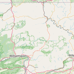
Leaflet | <a href="https://www.openstreetmap.org/copyright">© OpenStreetMap contributors</a>
Item
| Property | Value |
|---|---|
| id | 2299938 |
| downstream_mainstem_id | https://geoconnex.us/ref/mainstems/2299653 |
| encompassing_mainstem_basins | ['https://geoconnex.us/ref/mainstems/2299653'] |
| featuretype | ['https://www.opengis.net/def/schema/hy_features/hyf/HY_FlowPath', 'https://www.opengis.net/def/schema/hy_features/hyf/HY_WaterBody'] |
| fid | 874 |
| head_2020huc12 | 011000051001 |
| head_nhdpv1_comid | 7717538 |
| head_nhdpv2_comid | https://geoconnex.us/nhdplusv2/comid/7717538 |
| head_nhdpv2huc12 | https://geoconnex.us/nhdplusv2/huc12/011000051001 |
| head_rf1id | 1573 |
| lengthkm | 15.9 |
| name_at_outlet | Pootatuck River |
| name_at_outlet_gnis_id | 209925 |
| new_mainstemid | |
| outlet_2020huc12 | 011000051001 |
| outlet_drainagearea_sqkm | 68.1 |
| outlet_nhdpv1_comid | 7718180 |
| outlet_nhdpv2_comid | https://geoconnex.us/nhdplusv2/comid/7718180 |
| outlet_nhdpv2huc12 | https://geoconnex.us/nhdplusv2/huc12/011000051001 |
| outlet_rf1id | 1573 |
| superseded | False |
| uri | https://geoconnex.us/ref/mainstems/2299938 |
Graph Results
| monitoringLocation | https://sta.geoconnex.dev/collections/USGS/Things/items/'USGS-012035055' |
|---|---|
| siteName | USGS-012035055 |
| datasetDescription | Gage height / USGS-012035055-eb8e9318e3f04ca4afb69701c364e6ab |
| type | Stream |
| url | https://waterdata.usgs.gov/monitoring-location/012035055/#parameterCode=00065 |
| variableMeasured | Gage height / USGS-012035055-eb8e9318e3f04ca4afb69701c364e6ab |
| variableUnit | ft |
| measurementTechnique | observation |
| temporalCoverage | 2024-08-30T09:15:00Z/2024-09-09T18:30:00Z |
| distributionName | USGS Instantaneous Values Service |
| distributionURL | https://waterservices.usgs.gov/nwis/iv/?sites=USGS:012035055¶meterCd=00065&format=rdb |
| distributionFormat | text/tab-separated-values |
| wkt | POINT (-73.2731833333333 41.4065472222222) |
| monitoringLocation | https://sta.geoconnex.dev/collections/USGS/Things/items/'USGS-012035055' |
|---|---|
| siteName | USGS-012035055 |
| datasetDescription | Gage height / USGS-012035055-eb8e9318e3f04ca4afb69701c364e6ab |
| type | Stream |
| url | https://waterdata.usgs.gov/monitoring-location/012035055/#parameterCode=00065 |
| variableMeasured | Gage height / USGS-012035055-eb8e9318e3f04ca4afb69701c364e6ab |
| variableUnit | ft |
| measurementTechnique | observation |
| temporalCoverage | 2024-08-30T09:15:00Z/2024-09-09T18:30:00Z |
| distributionName | USGS SensorThings API |
| distributionURL | https://labs.waterdata.usgs.gov/sta/v1.1/Datastreams('eb8e9318e3f04ca4afb69701c364e6ab')?$expand=Thing,Observations |
| distributionFormat | application/json |
| wkt | POINT (-73.2731833333333 41.4065472222222) |
| monitoringLocation | https://sta.geoconnex.dev/collections/USGS/Things/items/'USGS-012035055' |
|---|---|
| siteName | USGS-012035055 |
| datasetDescription | Discharge / USGS-012035055-3c011c0d5f6343a0b8a1eb692df2dadf |
| type | Stream |
| url | https://waterdata.usgs.gov/monitoring-location/012035055/#parameterCode=00060 |
| variableMeasured | Discharge / USGS-012035055-3c011c0d5f6343a0b8a1eb692df2dadf |
| variableUnit | ft^3/s |
| measurementTechnique | observation |
| temporalCoverage | 2024-08-30T09:15:00Z/2024-09-09T18:30:00Z |
| distributionName | USGS Instantaneous Values Service |
| distributionURL | https://waterservices.usgs.gov/nwis/iv/?sites=USGS:012035055¶meterCd=00060&format=rdb |
| distributionFormat | text/tab-separated-values |
| wkt | POINT (-73.2731833333333 41.4065472222222) |
| monitoringLocation | https://sta.geoconnex.dev/collections/USGS/Things/items/'USGS-012035055' |
|---|---|
| siteName | USGS-012035055 |
| datasetDescription | Discharge / USGS-012035055-3c011c0d5f6343a0b8a1eb692df2dadf |
| type | Stream |
| url | https://waterdata.usgs.gov/monitoring-location/012035055/#parameterCode=00060 |
| variableMeasured | Discharge / USGS-012035055-3c011c0d5f6343a0b8a1eb692df2dadf |
| variableUnit | ft^3/s |
| measurementTechnique | observation |
| temporalCoverage | 2024-08-30T09:15:00Z/2024-09-09T18:30:00Z |
| distributionName | USGS SensorThings API |
| distributionURL | https://labs.waterdata.usgs.gov/sta/v1.1/Datastreams('3c011c0d5f6343a0b8a1eb692df2dadf')?$expand=Thing,Observations |
| distributionFormat | application/json |
| wkt | POINT (-73.2731833333333 41.4065472222222) |