Clyde River
Map
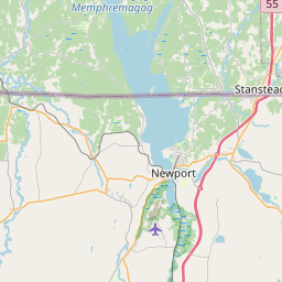
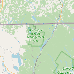
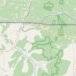
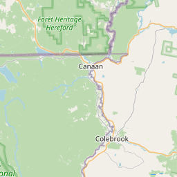
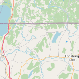
Leaflet | <a href="https://www.openstreetmap.org/copyright">© OpenStreetMap contributors</a>
Item
| Property | Value |
|---|---|
| id | 2303971 |
| downstream_mainstem_id | https://geoconnex.us/ref/mainstems/2303968 |
| encompassing_mainstem_basins | ['https://geoconnex.us/ref/mainstems/2303968'] |
| featuretype | ['https://www.opengis.net/def/schema/hy_features/hyf/HY_FlowPath', 'https://www.opengis.net/def/schema/hy_features/hyf/HY_WaterBody'] |
| fid | 904 |
| head_2020huc12 | 041505000301 |
| head_nhdpv1_comid | 4599357 |
| head_nhdpv2_comid | https://geoconnex.us/nhdplusv2/comid/4599357 |
| head_nhdpv2huc12 | https://geoconnex.us/nhdplusv2/huc12/041505000301 |
| head_rf1id | 1594 |
| lengthkm | 56.6 |
| name_at_outlet | Clyde River |
| name_at_outlet_gnis_id | 1456930 |
| new_mainstemid | |
| outlet_2020huc12 | 041505000303 |
| outlet_drainagearea_sqkm | 374.8 |
| outlet_nhdpv1_comid | 4600031 |
| outlet_nhdpv2_comid | https://geoconnex.us/nhdplusv2/comid/4600031 |
| outlet_nhdpv2huc12 | https://geoconnex.us/nhdplusv2/huc12/041505000303 |
| outlet_rf1id | 61529 |
| superseded | False |
| uri | https://geoconnex.us/ref/mainstems/2303971 |
Graph Results
| monitoringLocation | https://sta.geoconnex.dev/collections/USGS/Things/items/'USGS-04296500' |
|---|---|
| siteName | USGS-04296500 |
| datasetDescription | Discharge / USGS-04296500-1dc521e4c3904aa2b4dff6fd5bfd2e46 |
| type | Stream |
| url | https://waterdata.usgs.gov/monitoring-location/04296500/#parameterCode=00060 |
| variableMeasured | Discharge / USGS-04296500-1dc521e4c3904aa2b4dff6fd5bfd2e46 |
| variableUnit | ft^3/s |
| measurementTechnique | observation |
| temporalCoverage | 2024-08-30T09:15:00Z/2024-09-09T18:30:00Z |
| distributionName | USGS Instantaneous Values Service |
| distributionURL | https://waterservices.usgs.gov/nwis/iv/?sites=USGS:04296500¶meterCd=00060&format=rdb |
| distributionFormat | text/tab-separated-values |
| wkt | POINT (-72.1892683635315 44.9403244941333) |
| monitoringLocation | https://sta.geoconnex.dev/collections/USGS/Things/items/'USGS-04296500' |
|---|---|
| siteName | USGS-04296500 |
| datasetDescription | Discharge / USGS-04296500-1dc521e4c3904aa2b4dff6fd5bfd2e46 |
| type | Stream |
| url | https://waterdata.usgs.gov/monitoring-location/04296500/#parameterCode=00060 |
| variableMeasured | Discharge / USGS-04296500-1dc521e4c3904aa2b4dff6fd5bfd2e46 |
| variableUnit | ft^3/s |
| measurementTechnique | observation |
| temporalCoverage | 2024-08-30T09:15:00Z/2024-09-09T18:30:00Z |
| distributionName | USGS SensorThings API |
| distributionURL | https://labs.waterdata.usgs.gov/sta/v1.1/Datastreams('1dc521e4c3904aa2b4dff6fd5bfd2e46')?$expand=Thing,Observations |
| distributionFormat | application/json |
| wkt | POINT (-72.1892683635315 44.9403244941333) |
| monitoringLocation | https://sta.geoconnex.dev/collections/USGS/Things/items/'USGS-04296500' |
|---|---|
| siteName | USGS-04296500 |
| datasetDescription | Gage height feet / USGS-04296500-1de780b0dc3f46cfbca12735554686e0 |
| type | Stream |
| url | https://waterdata.usgs.gov/monitoring-location/04296500/#parameterCode=00065 |
| variableMeasured | Gage height |
| variableUnit | ft |
| measurementTechnique | observation |
| temporalCoverage | 2024-08-30T09:15:00Z/2024-09-09T18:30:00Z |
| distributionName | USGS Instantaneous Values Service |
| distributionURL | https://waterservices.usgs.gov/nwis/iv/?sites=USGS:04296500¶meterCd=00065&format=rdb |
| distributionFormat | text/tab-separated-values |
| wkt | POINT (-72.1892683635315 44.9403244941333) |
| monitoringLocation | https://sta.geoconnex.dev/collections/USGS/Things/items/'USGS-04296500' |
|---|---|
| siteName | USGS-04296500 |
| datasetDescription | Gage height feet / USGS-04296500-1de780b0dc3f46cfbca12735554686e0 |
| type | Stream |
| url | https://waterdata.usgs.gov/monitoring-location/04296500/#parameterCode=00065 |
| variableMeasured | Gage height |
| variableUnit | ft |
| measurementTechnique | observation |
| temporalCoverage | 2024-08-30T09:15:00Z/2024-09-09T18:30:00Z |
| distributionName | USGS SensorThings API |
| distributionURL | https://labs.waterdata.usgs.gov/sta/v1.1/Datastreams('1de780b0dc3f46cfbca12735554686e0')?$expand=Thing,Observations |
| distributionFormat | application/json |
| wkt | POINT (-72.1892683635315 44.9403244941333) |