Kisatchie Bayou
Map
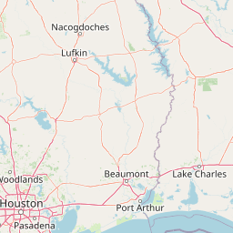
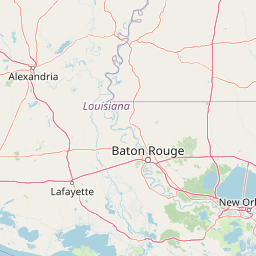
Leaflet | <a href="https://www.openstreetmap.org/copyright">© OpenStreetMap contributors</a>
Item
| Property | Value |
|---|---|
| id | 233515 |
| downstream_mainstem_id | https://geoconnex.us/ref/mainstems/231570 |
| encompassing_mainstem_basins | ['https://geoconnex.us/ref/mainstems/231570', 'https://geoconnex.us/ref/mainstems/225074'] |
| featuretype | ['https://www.opengis.net/def/schema/hy_features/hyf/HY_FlowPath', 'https://www.opengis.net/def/schema/hy_features/hyf/HY_WaterBody'] |
| fid | 22406 |
| head_2020huc12 | |
| head_nhdpv1_comid | 19919636 |
| head_nhdpv2_comid | https://geoconnex.us/nhdplusv2/comid/19919636 |
| head_nhdpv2huc12 | |
| head_rf1id | 36732 |
| lengthkm | 84.2 |
| name_at_outlet | Kisatchie Bayou |
| name_at_outlet_gnis_id | 554938 |
| new_mainstemid | |
| outlet_2020huc12 | |
| outlet_drainagearea_sqkm | 955.5 |
| outlet_nhdpv1_comid | 19916688 |
| outlet_nhdpv2_comid | https://geoconnex.us/nhdplusv2/comid/19916688 |
| outlet_nhdpv2huc12 | |
| outlet_rf1id | 36732 |
| superseded | False |
| uri | https://geoconnex.us/ref/mainstems/233515 |
Graph Results
| monitoringLocation | https://sta.geoconnex.dev/collections/USGS/Things/items/'USGS-07353990' |
|---|---|
| siteName | USGS-07353990 |
| datasetDescription | Gage height feet / USGS-07353990-9fb1b15ea05a4cf6b2aeaddaa320cd12 |
| type | Stream |
| url | https://waterdata.usgs.gov/monitoring-location/07353990/#parameterCode=00065 |
| variableMeasured | Gage height |
| variableUnit | ft |
| measurementTechnique | observation |
| temporalCoverage | 2024-08-30T09:15:00Z/2024-09-09T18:15:00Z |
| distributionName | USGS Instantaneous Values Service |
| distributionURL | https://waterservices.usgs.gov/nwis/iv/?sites=USGS:07353990¶meterCd=00065&format=rdb |
| distributionFormat | text/tab-separated-values |
| wkt | POINT (-93.17083333333333 31.4225) |
| monitoringLocation | https://sta.geoconnex.dev/collections/USGS/Things/items/'USGS-07353990' |
|---|---|
| siteName | USGS-07353990 |
| datasetDescription | Gage height feet / USGS-07353990-9fb1b15ea05a4cf6b2aeaddaa320cd12 |
| type | Stream |
| url | https://waterdata.usgs.gov/monitoring-location/07353990/#parameterCode=00065 |
| variableMeasured | Gage height |
| variableUnit | ft |
| measurementTechnique | observation |
| temporalCoverage | 2024-08-30T09:15:00Z/2024-09-09T18:15:00Z |
| distributionName | USGS SensorThings API |
| distributionURL | https://labs.waterdata.usgs.gov/sta/v1.1/Datastreams('9fb1b15ea05a4cf6b2aeaddaa320cd12')?$expand=Thing,Observations |
| distributionFormat | application/json |
| wkt | POINT (-93.17083333333333 31.4225) |
| monitoringLocation | https://sta.geoconnex.dev/collections/USGS/Things/items/'USGS-07354100' |
|---|---|
| siteName | USGS-07354100 |
| datasetDescription | Stream water level elevation above NAVD 1988 in feet / USGS-07354100-700bbe1260e141749925ebf644fe52a0 |
| type | Stream |
| url | https://waterdata.usgs.gov/monitoring-location/07354100/#parameterCode=63160 |
| variableMeasured | Stream water level elevation above NAVD 1988 |
| variableUnit | ft |
| measurementTechnique | observation |
| temporalCoverage | 2024-08-30T09:15:00Z/2024-09-09T18:00:00Z |
| distributionName | USGS Instantaneous Values Service |
| distributionURL | https://waterservices.usgs.gov/nwis/iv/?sites=USGS:07354100¶meterCd=63160&format=rdb |
| distributionFormat | text/tab-separated-values |
| wkt | POINT (-93.13878680042644 31.48462775839668) |
| monitoringLocation | https://sta.geoconnex.dev/collections/USGS/Things/items/'USGS-07354100' |
|---|---|
| siteName | USGS-07354100 |
| datasetDescription | Stream water level elevation above NAVD 1988 in feet / USGS-07354100-700bbe1260e141749925ebf644fe52a0 |
| type | Stream |
| url | https://waterdata.usgs.gov/monitoring-location/07354100/#parameterCode=63160 |
| variableMeasured | Stream water level elevation above NAVD 1988 |
| variableUnit | ft |
| measurementTechnique | observation |
| temporalCoverage | 2024-08-30T09:15:00Z/2024-09-09T18:00:00Z |
| distributionName | USGS SensorThings API |
| distributionURL | https://labs.waterdata.usgs.gov/sta/v1.1/Datastreams('700bbe1260e141749925ebf644fe52a0')?$expand=Thing,Observations |
| distributionFormat | application/json |
| wkt | POINT (-93.13878680042644 31.48462775839668) |
| monitoringLocation | https://sta.geoconnex.dev/collections/USGS/Things/items/'USGS-07354100' |
|---|---|
| siteName | USGS-07354100 |
| datasetDescription | Gage height feet / USGS-07354100-fb84c3969a734e89bba2301c6a285e25 |
| type | Stream |
| url | https://waterdata.usgs.gov/monitoring-location/07354100/#parameterCode=00065 |
| variableMeasured | Gage height |
| variableUnit | ft |
| measurementTechnique | observation |
| temporalCoverage | 2024-08-30T09:15:00Z/2024-09-09T18:00:00Z |
| distributionName | USGS SensorThings API |
| distributionURL | https://labs.waterdata.usgs.gov/sta/v1.1/Datastreams('fb84c3969a734e89bba2301c6a285e25')?$expand=Thing,Observations |
| distributionFormat | application/json |
| wkt | POINT (-93.13878680042644 31.48462775839668) |
| monitoringLocation | https://sta.geoconnex.dev/collections/USGS/Things/items/'USGS-07354100' |
|---|---|
| siteName | USGS-07354100 |
| datasetDescription | Gage height feet / USGS-07354100-fb84c3969a734e89bba2301c6a285e25 |
| type | Stream |
| url | https://waterdata.usgs.gov/monitoring-location/07354100/#parameterCode=00065 |
| variableMeasured | Gage height |
| variableUnit | ft |
| measurementTechnique | observation |
| temporalCoverage | 2024-08-30T09:15:00Z/2024-09-09T18:00:00Z |
| distributionName | USGS Instantaneous Values Service |
| distributionURL | https://waterservices.usgs.gov/nwis/iv/?sites=USGS:07354100¶meterCd=00065&format=rdb |
| distributionFormat | text/tab-separated-values |
| wkt | POINT (-93.13878680042644 31.48462775839668) |