Cross Bayou
Map
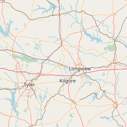
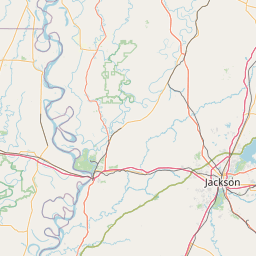
Leaflet | <a href="https://www.openstreetmap.org/copyright">© OpenStreetMap contributors</a>
Item
| Property | Value |
|---|---|
| id | 235785 |
| downstream_mainstem_id | https://geoconnex.us/ref/mainstems/228773 |
| encompassing_mainstem_basins | ['https://geoconnex.us/ref/mainstems/228773', 'https://geoconnex.us/ref/mainstems/225074'] |
| featuretype | ['https://www.opengis.net/def/schema/hy_features/hyf/HY_FlowPath', 'https://www.opengis.net/def/schema/hy_features/hyf/HY_WaterBody'] |
| fid | 22511 |
| head_2020huc12 | 111403040502 |
| head_nhdpv1_comid | 1139094 |
| head_nhdpv2_comid | https://geoconnex.us/nhdplusv2/comid/1139094 |
| head_nhdpv2huc12 | https://geoconnex.us/nhdplusv2/huc12/111403040502 |
| head_rf1id | 37027 |
| lengthkm | 47.8 |
| name_at_outlet | Cross Bayou |
| name_at_outlet_gnis_id | 534281 |
| new_mainstemid | |
| outlet_2020huc12 | 111403040504 |
| outlet_drainagearea_sqkm | 666.9 |
| outlet_nhdpv1_comid | 1136252 |
| outlet_nhdpv2_comid | https://geoconnex.us/nhdplusv2/comid/1136252 |
| outlet_nhdpv2huc12 | https://geoconnex.us/nhdplusv2/huc12/111403040504 |
| outlet_rf1id | 36839 |
| superseded | False |
| uri | https://geoconnex.us/ref/mainstems/235785 |
Graph Results
| monitoringLocation | https://sta.geoconnex.dev/collections/USGS/Things/items/'USGS-07344425' |
|---|---|
| siteName | USGS-07344425 |
| datasetDescription | Gage height feet / USGS-07344425-8a1bf8b6b7364a50b08db32497728e1d |
| type | Stream |
| url | https://waterdata.usgs.gov/monitoring-location/07344425/#parameterCode=00065 |
| variableMeasured | Gage height |
| variableUnit | ft |
| measurementTechnique | observation |
| temporalCoverage | 2024-08-30T09:30:00Z/2024-09-09T18:00:00Z |
| distributionName | USGS Instantaneous Values Service |
| distributionURL | https://waterservices.usgs.gov/nwis/iv/?sites=USGS:07344425¶meterCd=00065&format=rdb |
| distributionFormat | text/tab-separated-values |
| wkt | POINT (-94.01464771230059 32.45598955577143) |
| monitoringLocation | https://sta.geoconnex.dev/collections/USGS/Things/items/'USGS-07344425' |
|---|---|
| siteName | USGS-07344425 |
| datasetDescription | Gage height feet / USGS-07344425-8a1bf8b6b7364a50b08db32497728e1d |
| type | Stream |
| url | https://waterdata.usgs.gov/monitoring-location/07344425/#parameterCode=00065 |
| variableMeasured | Gage height |
| variableUnit | ft |
| measurementTechnique | observation |
| temporalCoverage | 2024-08-30T09:30:00Z/2024-09-09T18:00:00Z |
| distributionName | USGS SensorThings API |
| distributionURL | https://labs.waterdata.usgs.gov/sta/v1.1/Datastreams('8a1bf8b6b7364a50b08db32497728e1d')?$expand=Thing,Observations |
| distributionFormat | application/json |
| wkt | POINT (-94.01464771230059 32.45598955577143) |
| monitoringLocation | https://sta.geoconnex.dev/collections/USGS/Things/items/'USGS-07344425' |
|---|---|
| siteName | USGS-07344425 |
| datasetDescription | Stream water level elevation above NAVD 1988 in feet / USGS-07344425-fc9bcb74a7f8417eaf91232d5f1f3d9d |
| type | Stream |
| url | https://waterdata.usgs.gov/monitoring-location/07344425/#parameterCode=63160 |
| variableMeasured | Stream water level elevation above NAVD 1988 |
| variableUnit | ft |
| measurementTechnique | observation |
| temporalCoverage | 2024-08-30T09:30:00Z/2024-09-09T18:00:00Z |
| distributionName | USGS Instantaneous Values Service |
| distributionURL | https://waterservices.usgs.gov/nwis/iv/?sites=USGS:07344425¶meterCd=63160&format=rdb |
| distributionFormat | text/tab-separated-values |
| wkt | POINT (-94.01464771230059 32.45598955577143) |
| monitoringLocation | https://sta.geoconnex.dev/collections/USGS/Things/items/'USGS-07344425' |
|---|---|
| siteName | USGS-07344425 |
| datasetDescription | Stream water level elevation above NAVD 1988 in feet / USGS-07344425-fc9bcb74a7f8417eaf91232d5f1f3d9d |
| type | Stream |
| url | https://waterdata.usgs.gov/monitoring-location/07344425/#parameterCode=63160 |
| variableMeasured | Stream water level elevation above NAVD 1988 |
| variableUnit | ft |
| measurementTechnique | observation |
| temporalCoverage | 2024-08-30T09:30:00Z/2024-09-09T18:00:00Z |
| distributionName | USGS SensorThings API |
| distributionURL | https://labs.waterdata.usgs.gov/sta/v1.1/Datastreams('fc9bcb74a7f8417eaf91232d5f1f3d9d')?$expand=Thing,Observations |
| distributionFormat | application/json |
| wkt | POINT (-94.01464771230059 32.45598955577143) |