Holliday Creek
Map
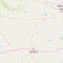


Leaflet | <a href="https://www.openstreetmap.org/copyright">© OpenStreetMap contributors</a>
Item
| Property | Value |
|---|---|
| id | 236706 |
| downstream_mainstem_id | https://geoconnex.us/ref/mainstems/228116 |
| encompassing_mainstem_basins | ['https://geoconnex.us/ref/mainstems/228116', 'https://geoconnex.us/ref/mainstems/225074'] |
| featuretype | ['https://www.opengis.net/def/schema/hy_features/hyf/HY_FlowPath', 'https://www.opengis.net/def/schema/hy_features/hyf/HY_WaterBody'] |
| fid | 21980 |
| head_2020huc12 | 111302060302 |
| head_nhdpv1_comid | 13734042 |
| head_nhdpv2_comid | https://geoconnex.us/nhdplusv2/comid/13734042 |
| head_nhdpv2huc12 | https://geoconnex.us/nhdplusv2/huc12/111302060302 |
| head_rf1id | 37173 |
| lengthkm | 72.4 |
| name_at_outlet | Holliday Creek |
| name_at_outlet_gnis_id | 1359422 |
| new_mainstemid | |
| outlet_2020huc12 | 111302060304 |
| outlet_drainagearea_sqkm | 402.0 |
| outlet_nhdpv1_comid | 13734154 |
| outlet_nhdpv2_comid | https://geoconnex.us/nhdplusv2/comid/13734154 |
| outlet_nhdpv2huc12 | https://geoconnex.us/nhdplusv2/huc12/111302060304 |
| outlet_rf1id | 36331 |
| superseded | False |
| uri | https://geoconnex.us/ref/mainstems/236706 |
Graph Results
| monitoringLocation | https://sta.geoconnex.dev/collections/USGS/Things/items/'USGS-07312610' |
|---|---|
| siteName | USGS-07312610 |
| datasetDescription | Discharge cubic feet per second / USGS-07312610-226f98d731be40e59ff772be159e4c78 |
| type | Stream |
| url | https://waterdata.usgs.gov/monitoring-location/07312610/#parameterCode=00060 |
| variableMeasured | Discharge |
| variableUnit | ft^3/s |
| measurementTechnique | observation |
| temporalCoverage | 2024-08-30T09:15:00Z/2024-09-09T18:45:00Z |
| distributionName | USGS Instantaneous Values Service |
| distributionURL | https://waterservices.usgs.gov/nwis/iv/?sites=USGS:07312610¶meterCd=00060&format=rdb |
| distributionFormat | text/tab-separated-values |
| wkt | POINT (-98.4988888888889 33.8844444444444) |
| monitoringLocation | https://sta.geoconnex.dev/collections/USGS/Things/items/'USGS-07312610' |
|---|---|
| siteName | USGS-07312610 |
| datasetDescription | Discharge cubic feet per second / USGS-07312610-226f98d731be40e59ff772be159e4c78 |
| type | Stream |
| url | https://waterdata.usgs.gov/monitoring-location/07312610/#parameterCode=00060 |
| variableMeasured | Discharge |
| variableUnit | ft^3/s |
| measurementTechnique | observation |
| temporalCoverage | 2024-08-30T09:15:00Z/2024-09-09T18:45:00Z |
| distributionName | USGS SensorThings API |
| distributionURL | https://labs.waterdata.usgs.gov/sta/v1.1/Datastreams('226f98d731be40e59ff772be159e4c78')?$expand=Thing,Observations |
| distributionFormat | application/json |
| wkt | POINT (-98.4988888888889 33.8844444444444) |
| monitoringLocation | https://sta.geoconnex.dev/collections/USGS/Things/items/'USGS-07312610' |
|---|---|
| siteName | USGS-07312610 |
| datasetDescription | Gage height / USGS-07312610-a562f11cf76341688aece4c2921c2088 |
| type | Stream |
| url | https://waterdata.usgs.gov/monitoring-location/07312610/#parameterCode=00065 |
| variableMeasured | Gage height / USGS-07312610-a562f11cf76341688aece4c2921c2088 |
| variableUnit | ft |
| measurementTechnique | observation |
| temporalCoverage | 2024-08-30T09:15:00Z/2024-09-09T18:45:00Z |
| distributionName | USGS Instantaneous Values Service |
| distributionURL | https://waterservices.usgs.gov/nwis/iv/?sites=USGS:07312610¶meterCd=00065&format=rdb |
| distributionFormat | text/tab-separated-values |
| wkt | POINT (-98.4988888888889 33.8844444444444) |
| monitoringLocation | https://sta.geoconnex.dev/collections/USGS/Things/items/'USGS-07312610' |
|---|---|
| siteName | USGS-07312610 |
| datasetDescription | Gage height / USGS-07312610-a562f11cf76341688aece4c2921c2088 |
| type | Stream |
| url | https://waterdata.usgs.gov/monitoring-location/07312610/#parameterCode=00065 |
| variableMeasured | Gage height / USGS-07312610-a562f11cf76341688aece4c2921c2088 |
| variableUnit | ft |
| measurementTechnique | observation |
| temporalCoverage | 2024-08-30T09:15:00Z/2024-09-09T18:45:00Z |
| distributionName | USGS SensorThings API |
| distributionURL | https://labs.waterdata.usgs.gov/sta/v1.1/Datastreams('a562f11cf76341688aece4c2921c2088')?$expand=Thing,Observations |
| distributionFormat | application/json |
| wkt | POINT (-98.4988888888889 33.8844444444444) |