Gray Creek
Map

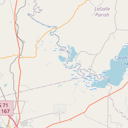
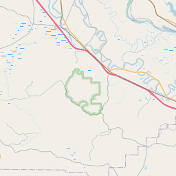
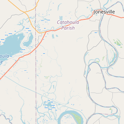
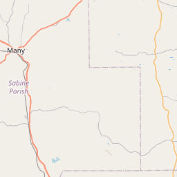
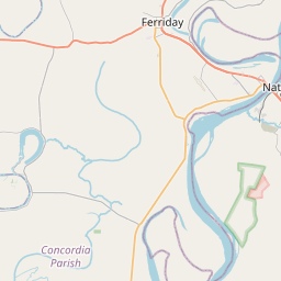
Leaflet | <a href="https://www.openstreetmap.org/copyright">© OpenStreetMap contributors</a>
Item
| Property | Value |
|---|---|
| id | 240667 |
| downstream_mainstem_id | https://geoconnex.us/ref/mainstems/231319 |
| encompassing_mainstem_basins | ['https://geoconnex.us/ref/mainstems/231319', 'https://geoconnex.us/ref/mainstems/225074'] |
| featuretype | ['https://www.opengis.net/def/schema/hy_features/hyf/HY_FlowPath', 'https://www.opengis.net/def/schema/hy_features/hyf/HY_WaterBody'] |
| fid | 22412 |
| head_2020huc12 | 111402070901 |
| head_nhdpv1_comid | 19919170 |
| head_nhdpv2_comid | https://geoconnex.us/nhdplusv2/comid/19919170 |
| head_nhdpv2huc12 | https://geoconnex.us/nhdplusv2/huc12/111402070901 |
| head_rf1id | None |
| lengthkm | 14.5 |
| name_at_outlet | Gray Creek |
| name_at_outlet_gnis_id | 554601 |
| new_mainstemid | |
| outlet_2020huc12 | 111402070901 |
| outlet_drainagearea_sqkm | 78.0 |
| outlet_nhdpv1_comid | 19918370 |
| outlet_nhdpv2_comid | https://geoconnex.us/nhdplusv2/comid/19918370 |
| outlet_nhdpv2huc12 | https://geoconnex.us/nhdplusv2/huc12/111402070901 |
| outlet_rf1id | None |
| superseded | False |
| uri | https://geoconnex.us/ref/mainstems/240667 |