Bayou Dupont
Map
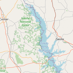
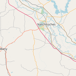
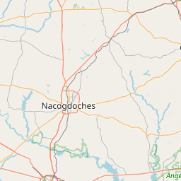
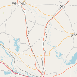
Leaflet | <a href="https://www.openstreetmap.org/copyright">© OpenStreetMap contributors</a>
Item
| Property | Value |
|---|---|
| id | 240676 |
| downstream_mainstem_id | https://geoconnex.us/ref/mainstems/237640 |
| encompassing_mainstem_basins | ['https://geoconnex.us/ref/mainstems/237640', 'https://geoconnex.us/ref/mainstems/230946', 'https://geoconnex.us/ref/mainstems/225074'] |
| featuretype | ['https://www.opengis.net/def/schema/hy_features/hyf/HY_FlowPath', 'https://www.opengis.net/def/schema/hy_features/hyf/HY_WaterBody'] |
| fid | 22392 |
| head_2020huc12 | 111402060504 |
| head_nhdpv1_comid | 8344107 |
| head_nhdpv2_comid | https://geoconnex.us/nhdplusv2/comid/8344107 |
| head_nhdpv2huc12 | https://geoconnex.us/nhdplusv2/huc12/111402060504 |
| head_rf1id | None |
| lengthkm | 27.1 |
| name_at_outlet | Bayou Dupont |
| name_at_outlet_gnis_id | 559642 |
| new_mainstemid | |
| outlet_2020huc12 | 111402060504 |
| outlet_drainagearea_sqkm | 213.5 |
| outlet_nhdpv1_comid | 8344083 |
| outlet_nhdpv2_comid | https://geoconnex.us/nhdplusv2/comid/8344083 |
| outlet_nhdpv2huc12 | https://geoconnex.us/nhdplusv2/huc12/111402060504 |
| outlet_rf1id | None |
| superseded | False |
| uri | https://geoconnex.us/ref/mainstems/240676 |
Graph Results
| monitoringLocation | https://sta.geoconnex.dev/collections/USGS/Things/items/'USGS-07351900' |
|---|---|
| siteName | USGS-07351900 |
| datasetDescription | Gage height feet / USGS-07351900-742032d2216247a1aab0392654ff2cc7 |
| type | Stream |
| url | https://waterdata.usgs.gov/monitoring-location/07351900/#parameterCode=00065 |
| variableMeasured | Gage height |
| variableUnit | ft |
| measurementTechnique | observation |
| temporalCoverage | 2024-08-30T09:15:00Z/2024-09-09T18:15:00Z |
| distributionName | USGS Instantaneous Values Service |
| distributionURL | https://waterservices.usgs.gov/nwis/iv/?sites=USGS:07351900¶meterCd=00065&format=rdb |
| distributionFormat | text/tab-separated-values |
| wkt | POINT (-93.32740382145475 31.70434374726477) |
| monitoringLocation | https://sta.geoconnex.dev/collections/USGS/Things/items/'USGS-07351900' |
|---|---|
| siteName | USGS-07351900 |
| datasetDescription | Gage height feet / USGS-07351900-742032d2216247a1aab0392654ff2cc7 |
| type | Stream |
| url | https://waterdata.usgs.gov/monitoring-location/07351900/#parameterCode=00065 |
| variableMeasured | Gage height |
| variableUnit | ft |
| measurementTechnique | observation |
| temporalCoverage | 2024-08-30T09:15:00Z/2024-09-09T18:15:00Z |
| distributionName | USGS SensorThings API |
| distributionURL | https://labs.waterdata.usgs.gov/sta/v1.1/Datastreams('742032d2216247a1aab0392654ff2cc7')?$expand=Thing,Observations |
| distributionFormat | application/json |
| wkt | POINT (-93.32740382145475 31.70434374726477) |
| monitoringLocation | https://sta.geoconnex.dev/collections/USGS/Things/items/'USGS-07351900' |
|---|---|
| siteName | USGS-07351900 |
| datasetDescription | Stream water level elevation above NAVD 1988 in feet / USGS-07351900-8fafe9042e994c6f9a8216f3ef9cdd27 |
| type | Stream |
| url | https://waterdata.usgs.gov/monitoring-location/07351900/#parameterCode=63160 |
| variableMeasured | Stream water level elevation above NAVD 1988 |
| variableUnit | ft |
| measurementTechnique | observation |
| temporalCoverage | 2024-08-30T09:15:00Z/2024-09-09T18:15:00Z |
| distributionName | USGS Instantaneous Values Service |
| distributionURL | https://waterservices.usgs.gov/nwis/iv/?sites=USGS:07351900¶meterCd=63160&format=rdb |
| distributionFormat | text/tab-separated-values |
| wkt | POINT (-93.32740382145475 31.70434374726477) |
| monitoringLocation | https://sta.geoconnex.dev/collections/USGS/Things/items/'USGS-07351900' |
|---|---|
| siteName | USGS-07351900 |
| datasetDescription | Stream water level elevation above NAVD 1988 in feet / USGS-07351900-8fafe9042e994c6f9a8216f3ef9cdd27 |
| type | Stream |
| url | https://waterdata.usgs.gov/monitoring-location/07351900/#parameterCode=63160 |
| variableMeasured | Stream water level elevation above NAVD 1988 |
| variableUnit | ft |
| measurementTechnique | observation |
| temporalCoverage | 2024-08-30T09:15:00Z/2024-09-09T18:15:00Z |
| distributionName | USGS SensorThings API |
| distributionURL | https://labs.waterdata.usgs.gov/sta/v1.1/Datastreams('8fafe9042e994c6f9a8216f3ef9cdd27')?$expand=Thing,Observations |
| distributionFormat | application/json |
| wkt | POINT (-93.32740382145475 31.70434374726477) |