Little River
Map
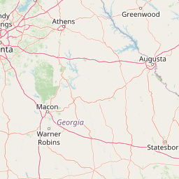
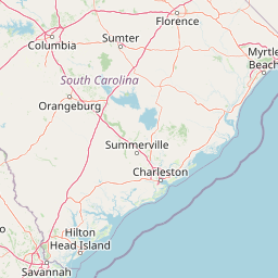


Leaflet | <a href="https://www.openstreetmap.org/copyright">© OpenStreetMap contributors</a>
Item
| Property | Value |
|---|---|
| id | 2454970 |
| downstream_mainstem_id | https://geoconnex.us/ref/mainstems/2454434 |
| encompassing_mainstem_basins | ['https://geoconnex.us/ref/mainstems/2454434'] |
| featuretype | ['https://www.opengis.net/def/schema/hy_features/hyf/HY_FlowPath', 'https://www.opengis.net/def/schema/hy_features/hyf/HY_WaterBody'] |
| fid | 3689 |
| head_2020huc12 | 030601050101 |
| head_nhdpv1_comid | 6290621 |
| head_nhdpv2_comid | https://geoconnex.us/nhdplusv2/comid/6290621 |
| head_nhdpv2huc12 | https://geoconnex.us/nhdplusv2/huc12/030601050101 |
| head_rf1id | 6255 |
| lengthkm | 135.0 |
| name_at_outlet | Little River |
| name_at_outlet_gnis_id | 317163 |
| new_mainstemid | |
| outlet_2020huc12 | 030601050404 |
| outlet_drainagearea_sqkm | 1934.2 |
| outlet_nhdpv1_comid | 6290159 |
| outlet_nhdpv2_comid | https://geoconnex.us/nhdplusv2/comid/6290159 |
| outlet_nhdpv2huc12 | https://geoconnex.us/nhdplusv2/huc12/030601050404 |
| outlet_rf1id | 10013 |
| superseded | False |
| uri | https://geoconnex.us/ref/mainstems/2454970 |
Graph Results
| monitoringLocation | https://sta.geoconnex.dev/collections/USGS/Things/items/'USGS-02193500' |
|---|---|
| siteName | USGS-02193500 |
| datasetDescription | Gage height feet / USGS-02193500-416c3f6f0b72407d99f7b305c433911d |
| type | Stream |
| url | https://waterdata.usgs.gov/monitoring-location/02193500/#parameterCode=00065 |
| variableMeasured | Gage height |
| variableUnit | ft |
| measurementTechnique | observation |
| temporalCoverage | 2024-08-30T09:15:00Z/2024-09-09T18:00:00Z |
| distributionName | USGS SensorThings API |
| distributionURL | https://labs.waterdata.usgs.gov/sta/v1.1/Datastreams('416c3f6f0b72407d99f7b305c433911d')?$expand=Thing,Observations |
| distributionFormat | application/json |
| wkt | POINT (-82.7425 33.6127777777778) |
| monitoringLocation | https://sta.geoconnex.dev/collections/USGS/Things/items/'USGS-02193500' |
|---|---|
| siteName | USGS-02193500 |
| datasetDescription | Gage height feet / USGS-02193500-416c3f6f0b72407d99f7b305c433911d |
| type | Stream |
| url | https://waterdata.usgs.gov/monitoring-location/02193500/#parameterCode=00065 |
| variableMeasured | Gage height |
| variableUnit | ft |
| measurementTechnique | observation |
| temporalCoverage | 2024-08-30T09:15:00Z/2024-09-09T18:00:00Z |
| distributionName | USGS Instantaneous Values Service |
| distributionURL | https://waterservices.usgs.gov/nwis/iv/?sites=USGS:02193500¶meterCd=00065&format=rdb |
| distributionFormat | text/tab-separated-values |
| wkt | POINT (-82.7425 33.6127777777778) |
| monitoringLocation | https://sta.geoconnex.dev/collections/USGS/Things/items/'USGS-02193500' |
|---|---|
| siteName | USGS-02193500 |
| datasetDescription | Discharge / USGS-02193500-f290c8aa39344adf9204cbcb26521365 |
| type | Stream |
| url | https://waterdata.usgs.gov/monitoring-location/02193500/#parameterCode=00060 |
| variableMeasured | Discharge / USGS-02193500-f290c8aa39344adf9204cbcb26521365 |
| variableUnit | ft^3/s |
| measurementTechnique | observation |
| temporalCoverage | 2024-08-30T09:15:00Z/2024-09-09T18:00:00Z |
| distributionName | USGS SensorThings API |
| distributionURL | https://labs.waterdata.usgs.gov/sta/v1.1/Datastreams('f290c8aa39344adf9204cbcb26521365')?$expand=Thing,Observations |
| distributionFormat | application/json |
| wkt | POINT (-82.7425 33.6127777777778) |
| monitoringLocation | https://sta.geoconnex.dev/collections/USGS/Things/items/'USGS-02193500' |
|---|---|
| siteName | USGS-02193500 |
| datasetDescription | Discharge / USGS-02193500-f290c8aa39344adf9204cbcb26521365 |
| type | Stream |
| url | https://waterdata.usgs.gov/monitoring-location/02193500/#parameterCode=00060 |
| variableMeasured | Discharge / USGS-02193500-f290c8aa39344adf9204cbcb26521365 |
| variableUnit | ft^3/s |
| measurementTechnique | observation |
| temporalCoverage | 2024-08-30T09:15:00Z/2024-09-09T18:00:00Z |
| distributionName | USGS Instantaneous Values Service |
| distributionURL | https://waterservices.usgs.gov/nwis/iv/?sites=USGS:02193500¶meterCd=00060&format=rdb |
| distributionFormat | text/tab-separated-values |
| wkt | POINT (-82.7425 33.6127777777778) |