Big Creek
Map
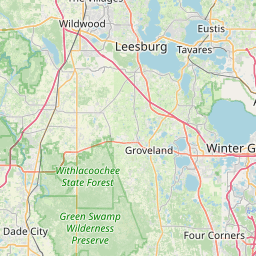


Leaflet | <a href="https://www.openstreetmap.org/copyright">© OpenStreetMap contributors</a>
Item
| Property | Value |
|---|---|
| id | 2504906 |
| downstream_mainstem_id | https://geoconnex.us/ref/mainstems/2501757 |
| encompassing_mainstem_basins | ['https://geoconnex.us/ref/mainstems/2501757', 'https://geoconnex.us/ref/mainstems/2501419'] |
| featuretype | ['https://www.opengis.net/def/schema/hy_features/hyf/HY_FlowPath', 'https://www.opengis.net/def/schema/hy_features/hyf/HY_WaterBody'] |
| fid | 4202 |
| head_2020huc12 | 030801020101 |
| head_nhdpv1_comid | None |
| head_nhdpv2_comid | https://geoconnex.us/nhdplusv2/comid/16644086 |
| head_nhdpv2huc12 | https://geoconnex.us/nhdplusv2/huc12/030801020101 |
| head_rf1id | None |
| lengthkm | 6.5 |
| name_at_outlet | Big Creek |
| name_at_outlet_gnis_id | 278657 |
| new_mainstemid | |
| outlet_2020huc12 | 030801020103 |
| outlet_drainagearea_sqkm | 190.1 |
| outlet_nhdpv1_comid | None |
| outlet_nhdpv2_comid | https://geoconnex.us/nhdplusv2/comid/933080183 |
| outlet_nhdpv2huc12 | https://geoconnex.us/nhdplusv2/huc12/030801020103 |
| outlet_rf1id | None |
| superseded | False |
| uri | https://geoconnex.us/ref/mainstems/2504906 |
Graph Results
| monitoringLocation | https://sta.geoconnex.dev/collections/USGS/Things/items/'USGS-02236500' |
|---|---|
| siteName | USGS-02236500 |
| datasetDescription | Gage height / USGS-02236500-809a311fc6724543a0dffd5d7b83321e |
| type | Stream |
| url | https://waterdata.usgs.gov/monitoring-location/02236500/#parameterCode=00065 |
| variableMeasured | Gage height / USGS-02236500-809a311fc6724543a0dffd5d7b83321e |
| variableUnit | ft |
| measurementTechnique | observation |
| temporalCoverage | 2024-08-30T09:15:00Z/2024-09-09T18:15:00Z |
| distributionName | USGS Instantaneous Values Service |
| distributionURL | https://waterservices.usgs.gov/nwis/iv/?sites=USGS:02236500¶meterCd=00065&format=rdb |
| distributionFormat | text/tab-separated-values |
| wkt | POINT (-81.7400759872204 28.4477822904522) |
| monitoringLocation | https://sta.geoconnex.dev/collections/USGS/Things/items/'USGS-02236500' |
|---|---|
| siteName | USGS-02236500 |
| datasetDescription | Gage height / USGS-02236500-809a311fc6724543a0dffd5d7b83321e |
| type | Stream |
| url | https://waterdata.usgs.gov/monitoring-location/02236500/#parameterCode=00065 |
| variableMeasured | Gage height / USGS-02236500-809a311fc6724543a0dffd5d7b83321e |
| variableUnit | ft |
| measurementTechnique | observation |
| temporalCoverage | 2024-08-30T09:15:00Z/2024-09-09T18:15:00Z |
| distributionName | USGS SensorThings API |
| distributionURL | https://labs.waterdata.usgs.gov/sta/v1.1/Datastreams('809a311fc6724543a0dffd5d7b83321e')?$expand=Thing,Observations |
| distributionFormat | application/json |
| wkt | POINT (-81.7400759872204 28.4477822904522) |
| monitoringLocation | https://sta.geoconnex.dev/collections/USGS/Things/items/'USGS-02236500' |
|---|---|
| siteName | USGS-02236500 |
| datasetDescription | Discharge / USGS-02236500-4a5cbe4c2e754c35b0f799c92c376eea |
| type | Stream |
| url | https://waterdata.usgs.gov/monitoring-location/02236500/#parameterCode=00060 |
| variableMeasured | Discharge / USGS-02236500-4a5cbe4c2e754c35b0f799c92c376eea |
| variableUnit | ft^3/s |
| measurementTechnique | observation |
| temporalCoverage | 2024-08-30T09:15:00Z/2024-09-09T18:15:00Z |
| distributionName | USGS Instantaneous Values Service |
| distributionURL | https://waterservices.usgs.gov/nwis/iv/?sites=USGS:02236500¶meterCd=00060&format=rdb |
| distributionFormat | text/tab-separated-values |
| wkt | POINT (-81.7400759872204 28.4477822904522) |
| monitoringLocation | https://sta.geoconnex.dev/collections/USGS/Things/items/'USGS-02236500' |
|---|---|
| siteName | USGS-02236500 |
| datasetDescription | Discharge / USGS-02236500-4a5cbe4c2e754c35b0f799c92c376eea |
| type | Stream |
| url | https://waterdata.usgs.gov/monitoring-location/02236500/#parameterCode=00060 |
| variableMeasured | Discharge / USGS-02236500-4a5cbe4c2e754c35b0f799c92c376eea |
| variableUnit | ft^3/s |
| measurementTechnique | observation |
| temporalCoverage | 2024-08-30T09:15:00Z/2024-09-09T18:15:00Z |
| distributionName | USGS SensorThings API |
| distributionURL | https://labs.waterdata.usgs.gov/sta/v1.1/Datastreams('4a5cbe4c2e754c35b0f799c92c376eea')?$expand=Thing,Observations |
| distributionFormat | application/json |
| wkt | POINT (-81.7400759872204 28.4477822904522) |
| monitoringLocation | https://sta.geoconnex.dev/collections/USGS/Things/items/'USGS-02236500' |
|---|---|
| siteName | USGS-02236500 |
| datasetDescription | Stream water level elevation above NAVD 1988, in feet / USGS-02236500-b2ff75ddfaf04910b8bb7d85d3b2c2ba |
| type | Stream |
| url | https://waterdata.usgs.gov/monitoring-location/02236500/#parameterCode=63160 |
| variableMeasured | Stream water level elevation above NAVD 1988 |
| variableUnit | ft |
| measurementTechnique | observation |
| temporalCoverage | 2024-08-30T09:15:00Z/2024-09-09T18:15:00Z |
| distributionName | USGS Instantaneous Values Service |
| distributionURL | https://waterservices.usgs.gov/nwis/iv/?sites=USGS:02236500¶meterCd=63160&format=rdb |
| distributionFormat | text/tab-separated-values |
| wkt | POINT (-81.7400759872204 28.4477822904522) |
| monitoringLocation | https://sta.geoconnex.dev/collections/USGS/Things/items/'USGS-02236500' |
|---|---|
| siteName | USGS-02236500 |
| datasetDescription | Stream water level elevation above NAVD 1988, in feet / USGS-02236500-b2ff75ddfaf04910b8bb7d85d3b2c2ba |
| type | Stream |
| url | https://waterdata.usgs.gov/monitoring-location/02236500/#parameterCode=63160 |
| variableMeasured | Stream water level elevation above NAVD 1988 |
| variableUnit | ft |
| measurementTechnique | observation |
| temporalCoverage | 2024-08-30T09:15:00Z/2024-09-09T18:15:00Z |
| distributionName | USGS SensorThings API |
| distributionURL | https://labs.waterdata.usgs.gov/sta/v1.1/Datastreams('b2ff75ddfaf04910b8bb7d85d3b2c2ba')?$expand=Thing,Observations |
| distributionFormat | application/json |
| wkt | POINT (-81.7400759872204 28.4477822904522) |