Fish River
Map
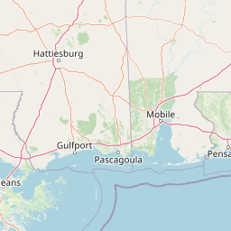
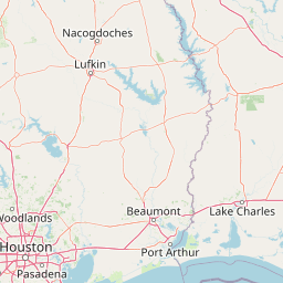
Leaflet | <a href="https://www.openstreetmap.org/copyright">© OpenStreetMap contributors</a>
Item
| Property | Value |
|---|---|
| id | 2552969 |
| downstream_mainstem_id | |
| encompassing_mainstem_basins | |
| featuretype | ['https://www.opengis.net/def/schema/hy_features/hyf/HY_FlowPath', 'https://www.opengis.net/def/schema/hy_features/hyf/HY_WaterBody'] |
| fid | 5805 |
| head_2020huc12 | 031602050201 |
| head_nhdpv1_comid | 18514748 |
| head_nhdpv2_comid | https://geoconnex.us/nhdplusv2/comid/18514748 |
| head_nhdpv2huc12 | https://geoconnex.us/nhdplusv2/huc12/031602050201 |
| head_rf1id | 9274 |
| lengthkm | 46.4 |
| name_at_outlet | Fish River |
| name_at_outlet_gnis_id | 155068 |
| new_mainstemid | |
| outlet_2020huc12 | 031602050204 |
| outlet_drainagearea_sqkm | 394.9 |
| outlet_nhdpv1_comid | 18516172 |
| outlet_nhdpv2_comid | https://geoconnex.us/nhdplusv2/comid/18516172 |
| outlet_nhdpv2huc12 | https://geoconnex.us/nhdplusv2/huc12/031602050204 |
| outlet_rf1id | 9271 |
| superseded | False |
| uri | https://geoconnex.us/ref/mainstems/2552969 |
Graph Results
| monitoringLocation | https://sta.geoconnex.dev/collections/USGS/Things/items/'USGS-02378500' |
|---|---|
| siteName | USGS-02378500 |
| datasetDescription | Gage height / USGS-02378500-1629504fe84843ed8c6313542966f1fe |
| type | Stream |
| url | https://waterdata.usgs.gov/monitoring-location/02378500/#parameterCode=00065 |
| variableMeasured | Gage height / USGS-02378500-1629504fe84843ed8c6313542966f1fe |
| variableUnit | ft |
| measurementTechnique | observation |
| temporalCoverage | 2024-08-30T09:15:00Z/2024-09-09T18:30:00Z |
| distributionName | USGS Instantaneous Values Service |
| distributionURL | https://waterservices.usgs.gov/nwis/iv/?sites=USGS:02378500¶meterCd=00065&format=rdb |
| distributionFormat | text/tab-separated-values |
| wkt | POINT (-87.7986014907923 30.5454714564048) |
| monitoringLocation | https://sta.geoconnex.dev/collections/USGS/Things/items/'USGS-02378500' |
|---|---|
| siteName | USGS-02378500 |
| datasetDescription | Gage height / USGS-02378500-1629504fe84843ed8c6313542966f1fe |
| type | Stream |
| url | https://waterdata.usgs.gov/monitoring-location/02378500/#parameterCode=00065 |
| variableMeasured | Gage height / USGS-02378500-1629504fe84843ed8c6313542966f1fe |
| variableUnit | ft |
| measurementTechnique | observation |
| temporalCoverage | 2024-08-30T09:15:00Z/2024-09-09T18:30:00Z |
| distributionName | USGS SensorThings API |
| distributionURL | https://labs.waterdata.usgs.gov/sta/v1.1/Datastreams('1629504fe84843ed8c6313542966f1fe')?$expand=Thing,Observations |
| distributionFormat | application/json |
| wkt | POINT (-87.7986014907923 30.5454714564048) |
| monitoringLocation | https://sta.geoconnex.dev/collections/USGS/Things/items/'USGS-02378500' |
|---|---|
| siteName | USGS-02378500 |
| datasetDescription | Discharge, cubic feet per second / USGS-02378500-3457b9e1f2be4f9d98226bb392ce9b98 |
| type | Stream |
| url | https://waterdata.usgs.gov/monitoring-location/02378500/#parameterCode=00060 |
| variableMeasured | Discharge |
| variableUnit | ft^3/s |
| measurementTechnique | observation |
| temporalCoverage | 2024-08-30T09:15:00Z/2024-09-09T18:30:00Z |
| distributionName | USGS Instantaneous Values Service |
| distributionURL | https://waterservices.usgs.gov/nwis/iv/?sites=USGS:02378500¶meterCd=00060&format=rdb |
| distributionFormat | text/tab-separated-values |
| wkt | POINT (-87.7986014907923 30.5454714564048) |
| monitoringLocation | https://sta.geoconnex.dev/collections/USGS/Things/items/'USGS-02378500' |
|---|---|
| siteName | USGS-02378500 |
| datasetDescription | Discharge, cubic feet per second / USGS-02378500-3457b9e1f2be4f9d98226bb392ce9b98 |
| type | Stream |
| url | https://waterdata.usgs.gov/monitoring-location/02378500/#parameterCode=00060 |
| variableMeasured | Discharge |
| variableUnit | ft^3/s |
| measurementTechnique | observation |
| temporalCoverage | 2024-08-30T09:15:00Z/2024-09-09T18:30:00Z |
| distributionName | USGS SensorThings API |
| distributionURL | https://labs.waterdata.usgs.gov/sta/v1.1/Datastreams('3457b9e1f2be4f9d98226bb392ce9b98')?$expand=Thing,Observations |
| distributionFormat | application/json |
| wkt | POINT (-87.7986014907923 30.5454714564048) |
| monitoringLocation | https://sta.geoconnex.dev/collections/USGS/Things/items/'USGS-02378500' |
|---|---|
| siteName | USGS-02378500 |
| datasetDescription | None / USGS-02378500-60f60676d8bd47e29e502499257004e7 |
| type | Stream |
| url | https://waterdata.usgs.gov/monitoring-location/02378500/#parameterCode=00045 |
| variableMeasured | None / USGS-02378500-60f60676d8bd47e29e502499257004e7 |
| variableUnit | in |
| measurementTechnique | observation |
| temporalCoverage | 2024-08-30T09:15:00Z/2024-09-09T18:30:00Z |
| distributionName | USGS SensorThings API |
| distributionURL | https://labs.waterdata.usgs.gov/sta/v1.1/Datastreams('60f60676d8bd47e29e502499257004e7')?$expand=Thing,Observations |
| distributionFormat | application/json |
| wkt | POINT (-87.7986014907923 30.5454714564048) |
| monitoringLocation | https://sta.geoconnex.dev/collections/USGS/Things/items/'USGS-02378500' |
|---|---|
| siteName | USGS-02378500 |
| datasetDescription | None / USGS-02378500-60f60676d8bd47e29e502499257004e7 |
| type | Stream |
| url | https://waterdata.usgs.gov/monitoring-location/02378500/#parameterCode=00045 |
| variableMeasured | None / USGS-02378500-60f60676d8bd47e29e502499257004e7 |
| variableUnit | in |
| measurementTechnique | observation |
| temporalCoverage | 2024-08-30T09:15:00Z/2024-09-09T18:30:00Z |
| distributionName | USGS Instantaneous Values Service |
| distributionURL | https://waterservices.usgs.gov/nwis/iv/?sites=USGS:02378500¶meterCd=00045&format=rdb |
| distributionFormat | text/tab-separated-values |
| wkt | POINT (-87.7986014907923 30.5454714564048) |
| monitoringLocation | https://sta.geoconnex.dev/collections/USGS/Things/items/'USGS-0237854520' |
|---|---|
| siteName | USGS-0237854520 |
| datasetDescription | Mean water velocity for discharge computation, feet per second / USGS-0237854520-7d1b20533cf34584b088b42877b05b24 |
| type | Stream |
| url | https://waterdata.usgs.gov/monitoring-location/0237854520/#parameterCode=72255 |
| variableMeasured | Mean water velocity for discharge computation |
| variableUnit | ft/s |
| measurementTechnique | observation |
| temporalCoverage | 2024-08-30T09:15:00Z/2024-09-09T17:30:00Z |
| distributionName | USGS Instantaneous Values Service |
| distributionURL | https://waterservices.usgs.gov/nwis/iv/?sites=USGS:0237854520¶meterCd=72255&format=rdb |
| distributionFormat | text/tab-separated-values |
| wkt | POINT (-87.8026444444444 30.4746694444444) |
| monitoringLocation | https://sta.geoconnex.dev/collections/USGS/Things/items/'USGS-0237854520' |
|---|---|
| siteName | USGS-0237854520 |
| datasetDescription | Mean water velocity for discharge computation, feet per second / USGS-0237854520-7d1b20533cf34584b088b42877b05b24 |
| type | Stream |
| url | https://waterdata.usgs.gov/monitoring-location/0237854520/#parameterCode=72255 |
| variableMeasured | Mean water velocity for discharge computation |
| variableUnit | ft/s |
| measurementTechnique | observation |
| temporalCoverage | 2024-08-30T09:15:00Z/2024-09-09T17:30:00Z |
| distributionName | USGS SensorThings API |
| distributionURL | https://labs.waterdata.usgs.gov/sta/v1.1/Datastreams('7d1b20533cf34584b088b42877b05b24')?$expand=Thing,Observations |
| distributionFormat | application/json |
| wkt | POINT (-87.8026444444444 30.4746694444444) |
| monitoringLocation | https://sta.geoconnex.dev/collections/USGS/Things/items/'USGS-0237854520' |
|---|---|
| siteName | USGS-0237854520 |
| datasetDescription | Discharge, tidally filtered, cubic feet per second / USGS-0237854520-4b560b859c5d4f32a97798b6382e3bf0 |
| type | Stream |
| url | https://waterdata.usgs.gov/monitoring-location/0237854520/#parameterCode=72137 |
| variableMeasured | Discharge |
| variableUnit | ft^3/s |
| measurementTechnique | observation |
| temporalCoverage | 2024-08-30T09:15:00Z/2024-09-08T08:45:00Z |
| distributionName | USGS SensorThings API |
| distributionURL | https://labs.waterdata.usgs.gov/sta/v1.1/Datastreams('4b560b859c5d4f32a97798b6382e3bf0')?$expand=Thing,Observations |
| distributionFormat | application/json |
| wkt | POINT (-87.8026444444444 30.4746694444444) |
| monitoringLocation | https://sta.geoconnex.dev/collections/USGS/Things/items/'USGS-0237854520' |
|---|---|
| siteName | USGS-0237854520 |
| datasetDescription | Discharge, tidally filtered, cubic feet per second / USGS-0237854520-4b560b859c5d4f32a97798b6382e3bf0 |
| type | Stream |
| url | https://waterdata.usgs.gov/monitoring-location/0237854520/#parameterCode=72137 |
| variableMeasured | Discharge |
| variableUnit | ft^3/s |
| measurementTechnique | observation |
| temporalCoverage | 2024-08-30T09:15:00Z/2024-09-08T08:45:00Z |
| distributionName | USGS Instantaneous Values Service |
| distributionURL | https://waterservices.usgs.gov/nwis/iv/?sites=USGS:0237854520¶meterCd=72137&format=rdb |
| distributionFormat | text/tab-separated-values |
| wkt | POINT (-87.8026444444444 30.4746694444444) |
| monitoringLocation | https://sta.geoconnex.dev/collections/USGS/Things/items/'USGS-0237854520' |
|---|---|
| siteName | USGS-0237854520 |
| datasetDescription | Water velocity reading from field sensor, feet per second / USGS-0237854520-6b71b197f92849c9bb74d0e2c5031ac8 |
| type | Stream |
| url | https://waterdata.usgs.gov/monitoring-location/0237854520/#parameterCode=72254 |
| variableMeasured | Water velocity reading from field sensor |
| variableUnit | ft/s |
| measurementTechnique | observation |
| temporalCoverage | 2024-08-30T09:15:00Z/2024-09-09T17:30:00Z |
| distributionName | USGS SensorThings API |
| distributionURL | https://labs.waterdata.usgs.gov/sta/v1.1/Datastreams('6b71b197f92849c9bb74d0e2c5031ac8')?$expand=Thing,Observations |
| distributionFormat | application/json |
| wkt | POINT (-87.8026444444444 30.4746694444444) |
| monitoringLocation | https://sta.geoconnex.dev/collections/USGS/Things/items/'USGS-0237854520' |
|---|---|
| siteName | USGS-0237854520 |
| datasetDescription | Water velocity reading from field sensor, feet per second / USGS-0237854520-6b71b197f92849c9bb74d0e2c5031ac8 |
| type | Stream |
| url | https://waterdata.usgs.gov/monitoring-location/0237854520/#parameterCode=72254 |
| variableMeasured | Water velocity reading from field sensor |
| variableUnit | ft/s |
| measurementTechnique | observation |
| temporalCoverage | 2024-08-30T09:15:00Z/2024-09-09T17:30:00Z |
| distributionName | USGS Instantaneous Values Service |
| distributionURL | https://waterservices.usgs.gov/nwis/iv/?sites=USGS:0237854520¶meterCd=72254&format=rdb |
| distributionFormat | text/tab-separated-values |
| wkt | POINT (-87.8026444444444 30.4746694444444) |
| monitoringLocation | https://sta.geoconnex.dev/collections/USGS/Things/items/'USGS-0237854520' |
|---|---|
| siteName | USGS-0237854520 |
| datasetDescription | Gage height, feet / USGS-0237854520-738e738aed8d4551ac2351b4a099b97c |
| type | Stream |
| url | https://waterdata.usgs.gov/monitoring-location/0237854520/#parameterCode=00065 |
| variableMeasured | Gage height |
| variableUnit | ft |
| measurementTechnique | observation |
| temporalCoverage | 2024-08-30T09:15:00Z/2024-09-09T17:30:00Z |
| distributionName | USGS SensorThings API |
| distributionURL | https://labs.waterdata.usgs.gov/sta/v1.1/Datastreams('738e738aed8d4551ac2351b4a099b97c')?$expand=Thing,Observations |
| distributionFormat | application/json |
| wkt | POINT (-87.8026444444444 30.4746694444444) |
| monitoringLocation | https://sta.geoconnex.dev/collections/USGS/Things/items/'USGS-0237854520' |
|---|---|
| siteName | USGS-0237854520 |
| datasetDescription | Gage height, feet / USGS-0237854520-738e738aed8d4551ac2351b4a099b97c |
| type | Stream |
| url | https://waterdata.usgs.gov/monitoring-location/0237854520/#parameterCode=00065 |
| variableMeasured | Gage height |
| variableUnit | ft |
| measurementTechnique | observation |
| temporalCoverage | 2024-08-30T09:15:00Z/2024-09-09T17:30:00Z |
| distributionName | USGS Instantaneous Values Service |
| distributionURL | https://waterservices.usgs.gov/nwis/iv/?sites=USGS:0237854520¶meterCd=00065&format=rdb |
| distributionFormat | text/tab-separated-values |
| wkt | POINT (-87.8026444444444 30.4746694444444) |
| monitoringLocation | https://sta.geoconnex.dev/collections/USGS/Things/items/'USGS-0237854520' |
|---|---|
| siteName | USGS-0237854520 |
| datasetDescription | Discharge, cubic feet per second / USGS-0237854520-de0744fb1fb446fd85cd2aebf91d1d25 |
| type | Stream |
| url | https://waterdata.usgs.gov/monitoring-location/0237854520/#parameterCode=00060 |
| variableMeasured | Discharge |
| variableUnit | ft^3/s |
| measurementTechnique | observation |
| temporalCoverage | 2024-08-30T09:15:00Z/2024-09-09T17:30:00Z |
| distributionName | USGS SensorThings API |
| distributionURL | https://labs.waterdata.usgs.gov/sta/v1.1/Datastreams('de0744fb1fb446fd85cd2aebf91d1d25')?$expand=Thing,Observations |
| distributionFormat | application/json |
| wkt | POINT (-87.8026444444444 30.4746694444444) |
| monitoringLocation | https://sta.geoconnex.dev/collections/USGS/Things/items/'USGS-0237854520' |
|---|---|
| siteName | USGS-0237854520 |
| datasetDescription | Discharge, cubic feet per second / USGS-0237854520-de0744fb1fb446fd85cd2aebf91d1d25 |
| type | Stream |
| url | https://waterdata.usgs.gov/monitoring-location/0237854520/#parameterCode=00060 |
| variableMeasured | Discharge |
| variableUnit | ft^3/s |
| measurementTechnique | observation |
| temporalCoverage | 2024-08-30T09:15:00Z/2024-09-09T17:30:00Z |
| distributionName | USGS Instantaneous Values Service |
| distributionURL | https://waterservices.usgs.gov/nwis/iv/?sites=USGS:0237854520¶meterCd=00060&format=rdb |
| distributionFormat | text/tab-separated-values |
| wkt | POINT (-87.8026444444444 30.4746694444444) |