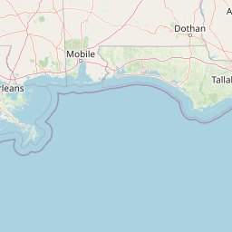
Red Creek
Map


Leaflet | <a href="https://www.openstreetmap.org/copyright">© OpenStreetMap contributors</a>
Item
| Property | Value |
|---|---|
| id | 2553737 |
| downstream_mainstem_id | https://geoconnex.us/ref/mainstems/2553614 |
| encompassing_mainstem_basins | ['https://geoconnex.us/ref/mainstems/2553614', 'https://geoconnex.us/ref/mainstems/2553350'] |
| featuretype | ['https://www.opengis.net/def/schema/hy_features/hyf/HY_FlowPath', 'https://www.opengis.net/def/schema/hy_features/hyf/HY_WaterBody'] |
| fid | 5905 |
| head_2020huc12 | |
| head_nhdpv1_comid | 18104958 |
| head_nhdpv2_comid | https://geoconnex.us/nhdplusv2/comid/18104958 |
| head_nhdpv2huc12 | |
| head_rf1id | 9443 |
| lengthkm | 138.3 |
| name_at_outlet | Red Creek |
| name_at_outlet_gnis_id | 694527 |
| new_mainstemid | |
| outlet_2020huc12 | |
| outlet_drainagearea_sqkm | 1270.8 |
| outlet_nhdpv1_comid | 18106996 |
| outlet_nhdpv2_comid | https://geoconnex.us/nhdplusv2/comid/18106996 |
| outlet_nhdpv2huc12 | |
| outlet_rf1id | 9435 |
| superseded | False |
| uri | https://geoconnex.us/ref/mainstems/2553737 |
Graph Results
| monitoringLocation | https://sta.geoconnex.dev/collections/USGS/Things/items/'USGS-02479300' |
|---|---|
| siteName | USGS-02479300 |
| datasetDescription | Discharge / USGS-02479300-64d1a94e67d54fbdad74eba726bcaa5d |
| type | Stream |
| url | https://waterdata.usgs.gov/monitoring-location/02479300/#parameterCode=00060 |
| variableMeasured | Discharge / USGS-02479300-64d1a94e67d54fbdad74eba726bcaa5d |
| variableUnit | ft^3/s |
| measurementTechnique | observation |
| temporalCoverage | 2024-08-30T09:15:00Z/2024-09-09T17:45:00Z |
| distributionName | USGS SensorThings API |
| distributionURL | https://labs.waterdata.usgs.gov/sta/v1.1/Datastreams('64d1a94e67d54fbdad74eba726bcaa5d')?$expand=Thing,Observations |
| distributionFormat | application/json |
| wkt | POINT (-88.7811111111111 30.7361111111111) |
| monitoringLocation | https://sta.geoconnex.dev/collections/USGS/Things/items/'USGS-02479300' |
|---|---|
| siteName | USGS-02479300 |
| datasetDescription | Discharge / USGS-02479300-64d1a94e67d54fbdad74eba726bcaa5d |
| type | Stream |
| url | https://waterdata.usgs.gov/monitoring-location/02479300/#parameterCode=00060 |
| variableMeasured | Discharge / USGS-02479300-64d1a94e67d54fbdad74eba726bcaa5d |
| variableUnit | ft^3/s |
| measurementTechnique | observation |
| temporalCoverage | 2024-08-30T09:15:00Z/2024-09-09T17:45:00Z |
| distributionName | USGS Instantaneous Values Service |
| distributionURL | https://waterservices.usgs.gov/nwis/iv/?sites=USGS:02479300¶meterCd=00060&format=rdb |
| distributionFormat | text/tab-separated-values |
| wkt | POINT (-88.7811111111111 30.7361111111111) |
| monitoringLocation | https://sta.geoconnex.dev/collections/USGS/Things/items/'USGS-02479300' |
|---|---|
| siteName | USGS-02479300 |
| datasetDescription | Gage height / USGS-02479300-f3fc26e4873e444491093ce6815177bb |
| type | Stream |
| url | https://waterdata.usgs.gov/monitoring-location/02479300/#parameterCode=00065 |
| variableMeasured | Gage height / USGS-02479300-f3fc26e4873e444491093ce6815177bb |
| variableUnit | ft |
| measurementTechnique | observation |
| temporalCoverage | 2024-08-30T09:15:00Z/2024-09-09T17:45:00Z |
| distributionName | USGS Instantaneous Values Service |
| distributionURL | https://waterservices.usgs.gov/nwis/iv/?sites=USGS:02479300¶meterCd=00065&format=rdb |
| distributionFormat | text/tab-separated-values |
| wkt | POINT (-88.7811111111111 30.7361111111111) |
| monitoringLocation | https://sta.geoconnex.dev/collections/USGS/Things/items/'USGS-02479300' |
|---|---|
| siteName | USGS-02479300 |
| datasetDescription | Gage height / USGS-02479300-f3fc26e4873e444491093ce6815177bb |
| type | Stream |
| url | https://waterdata.usgs.gov/monitoring-location/02479300/#parameterCode=00065 |
| variableMeasured | Gage height / USGS-02479300-f3fc26e4873e444491093ce6815177bb |
| variableUnit | ft |
| measurementTechnique | observation |
| temporalCoverage | 2024-08-30T09:15:00Z/2024-09-09T17:45:00Z |
| distributionName | USGS SensorThings API |
| distributionURL | https://labs.waterdata.usgs.gov/sta/v1.1/Datastreams('f3fc26e4873e444491093ce6815177bb')?$expand=Thing,Observations |
| distributionFormat | application/json |
| wkt | POINT (-88.7811111111111 30.7361111111111) |