East Sandy Creek
Map
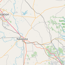
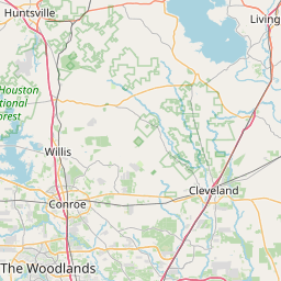
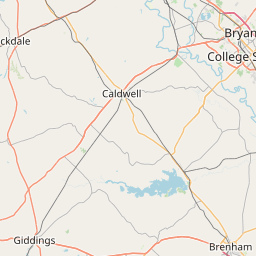
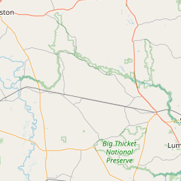
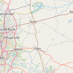
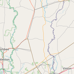
Leaflet | <a href="https://www.openstreetmap.org/copyright">© OpenStreetMap contributors</a>
Item
| Property | Value |
|---|---|
| id | 2600684 |
| downstream_mainstem_id | https://geoconnex.us/ref/mainstems/2600466 |
| encompassing_mainstem_basins | ['https://geoconnex.us/ref/mainstems/2600466', 'https://geoconnex.us/ref/mainstems/2600464'] |
| featuretype | ['https://www.opengis.net/def/schema/hy_features/hyf/HY_FlowPath', 'https://www.opengis.net/def/schema/hy_features/hyf/HY_WaterBody'] |
| fid | 23115 |
| head_2020huc12 | 120401010201 |
| head_nhdpv1_comid | 1466322 |
| head_nhdpv2_comid | https://geoconnex.us/nhdplusv2/comid/1466322 |
| head_nhdpv2huc12 | https://geoconnex.us/nhdplusv2/huc12/120401010201 |
| head_rf1id | 40146 |
| lengthkm | 19.2 |
| name_at_outlet | East Sandy Creek |
| name_at_outlet_gnis_id | 1381829 |
| new_mainstemid | |
| outlet_2020huc12 | 120401010201 |
| outlet_drainagearea_sqkm | 122.2 |
| outlet_nhdpv1_comid | 1466382 |
| outlet_nhdpv2_comid | https://geoconnex.us/nhdplusv2/comid/1466382 |
| outlet_nhdpv2huc12 | https://geoconnex.us/nhdplusv2/huc12/120401010201 |
| outlet_rf1id | 40152 |
| superseded | False |
| uri | https://geoconnex.us/ref/mainstems/2600684 |
Graph Results
| monitoringLocation | https://sta.geoconnex.dev/collections/USGS/Things/items/'USGS-08067555' |
|---|---|
| siteName | USGS-08067555 |
| datasetDescription | Discharge cubic feet per second / USGS-08067555-299c4d7993f24b55ae5c8f004aa3643d |
| type | Stream |
| url | https://waterdata.usgs.gov/monitoring-location/08067555/#parameterCode=00060 |
| variableMeasured | Discharge |
| variableUnit | ft^3/s |
| measurementTechnique | observation |
| temporalCoverage | 2024-08-30T09:15:00Z/2024-09-09T18:00:00Z |
| distributionName | USGS Instantaneous Values Service |
| distributionURL | https://waterservices.usgs.gov/nwis/iv/?sites=USGS:08067555¶meterCd=00060&format=rdb |
| distributionFormat | text/tab-separated-values |
| wkt | POINT (-95.5662611111111 30.58396388888889) |
| monitoringLocation | https://sta.geoconnex.dev/collections/USGS/Things/items/'USGS-08067555' |
|---|---|
| siteName | USGS-08067555 |
| datasetDescription | Discharge cubic feet per second / USGS-08067555-299c4d7993f24b55ae5c8f004aa3643d |
| type | Stream |
| url | https://waterdata.usgs.gov/monitoring-location/08067555/#parameterCode=00060 |
| variableMeasured | Discharge |
| variableUnit | ft^3/s |
| measurementTechnique | observation |
| temporalCoverage | 2024-08-30T09:15:00Z/2024-09-09T18:00:00Z |
| distributionName | USGS SensorThings API |
| distributionURL | https://labs.waterdata.usgs.gov/sta/v1.1/Datastreams('299c4d7993f24b55ae5c8f004aa3643d')?$expand=Thing,Observations |
| distributionFormat | application/json |
| wkt | POINT (-95.5662611111111 30.58396388888889) |
| monitoringLocation | https://sta.geoconnex.dev/collections/USGS/Things/items/'USGS-08067555' |
|---|---|
| siteName | USGS-08067555 |
| datasetDescription | None / USGS-08067555-305e139d621f425c931f7fc0f895bb1a |
| type | Stream |
| url | https://waterdata.usgs.gov/monitoring-location/08067555/#parameterCode=00065 |
| variableMeasured | None / USGS-08067555-305e139d621f425c931f7fc0f895bb1a |
| variableUnit | ft |
| measurementTechnique | observation |
| temporalCoverage | 2024-08-30T09:15:00Z/2024-09-09T18:00:00Z |
| distributionName | USGS SensorThings API |
| distributionURL | https://labs.waterdata.usgs.gov/sta/v1.1/Datastreams('305e139d621f425c931f7fc0f895bb1a')?$expand=Thing,Observations |
| distributionFormat | application/json |
| wkt | POINT (-95.5662611111111 30.58396388888889) |
| monitoringLocation | https://sta.geoconnex.dev/collections/USGS/Things/items/'USGS-08067555' |
|---|---|
| siteName | USGS-08067555 |
| datasetDescription | None / USGS-08067555-305e139d621f425c931f7fc0f895bb1a |
| type | Stream |
| url | https://waterdata.usgs.gov/monitoring-location/08067555/#parameterCode=00065 |
| variableMeasured | None / USGS-08067555-305e139d621f425c931f7fc0f895bb1a |
| variableUnit | ft |
| measurementTechnique | observation |
| temporalCoverage | 2024-08-30T09:15:00Z/2024-09-09T18:00:00Z |
| distributionName | USGS Instantaneous Values Service |
| distributionURL | https://waterservices.usgs.gov/nwis/iv/?sites=USGS:08067555¶meterCd=00065&format=rdb |
| distributionFormat | text/tab-separated-values |
| wkt | POINT (-95.5662611111111 30.58396388888889) |