Langham Creek
Map
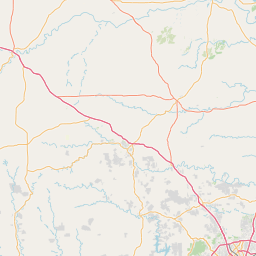
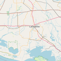
Leaflet | <a href="https://www.openstreetmap.org/copyright">© OpenStreetMap contributors</a>
Item
| Property | Value |
|---|---|
| id | 2600911 |
| downstream_mainstem_id | https://geoconnex.us/ref/mainstems/2600874 |
| encompassing_mainstem_basins | ['https://geoconnex.us/ref/mainstems/2600874', 'https://geoconnex.us/ref/mainstems/2600829', 'https://geoconnex.us/ref/mainstems/2600464'] |
| featuretype | ['https://www.opengis.net/def/schema/hy_features/hyf/HY_FlowPath', 'https://www.opengis.net/def/schema/hy_features/hyf/HY_WaterBody'] |
| fid | 23154 |
| head_2020huc12 | 120401040201 |
| head_nhdpv1_comid | 1438375 |
| head_nhdpv2_comid | https://geoconnex.us/nhdplusv2/comid/1438375 |
| head_nhdpv2huc12 | https://geoconnex.us/nhdplusv2/huc12/120401040201 |
| head_rf1id | None |
| lengthkm | 24.8 |
| name_at_outlet | Langham Creek |
| name_at_outlet_gnis_id | 1374467 |
| new_mainstemid | |
| outlet_2020huc12 | 120401040201 |
| outlet_drainagearea_sqkm | 142.4 |
| outlet_nhdpv1_comid | 1439023 |
| outlet_nhdpv2_comid | https://geoconnex.us/nhdplusv2/comid/1439023 |
| outlet_nhdpv2huc12 | https://geoconnex.us/nhdplusv2/huc12/120401040201 |
| outlet_rf1id | None |
| superseded | False |
| uri | https://geoconnex.us/ref/mainstems/2600911 |
Graph Results
| monitoringLocation | https://sta.geoconnex.dev/collections/USGS/Things/items/'USGS-08072760' |
|---|---|
| siteName | USGS-08072760 |
| datasetDescription | Discharge / USGS-08072760-763f168656c0465c8805ac57a5fe4004 |
| type | Stream |
| url | https://waterdata.usgs.gov/monitoring-location/08072760/#parameterCode=00060 |
| variableMeasured | Discharge / USGS-08072760-763f168656c0465c8805ac57a5fe4004 |
| variableUnit | ft^3/s |
| measurementTechnique | observation |
| temporalCoverage | 2024-08-30T09:15:00Z/2024-09-09T18:30:00Z |
| distributionName | USGS SensorThings API |
| distributionURL | https://labs.waterdata.usgs.gov/sta/v1.1/Datastreams('763f168656c0465c8805ac57a5fe4004')?$expand=Thing,Observations |
| distributionFormat | application/json |
| wkt | POINT (-95.6466120881207 29.8671703540598) |
| monitoringLocation | https://sta.geoconnex.dev/collections/USGS/Things/items/'USGS-08072760' |
|---|---|
| siteName | USGS-08072760 |
| datasetDescription | Discharge / USGS-08072760-763f168656c0465c8805ac57a5fe4004 |
| type | Stream |
| url | https://waterdata.usgs.gov/monitoring-location/08072760/#parameterCode=00060 |
| variableMeasured | Discharge / USGS-08072760-763f168656c0465c8805ac57a5fe4004 |
| variableUnit | ft^3/s |
| measurementTechnique | observation |
| temporalCoverage | 2024-08-30T09:15:00Z/2024-09-09T18:30:00Z |
| distributionName | USGS Instantaneous Values Service |
| distributionURL | https://waterservices.usgs.gov/nwis/iv/?sites=USGS:08072760¶meterCd=00060&format=rdb |
| distributionFormat | text/tab-separated-values |
| wkt | POINT (-95.6466120881207 29.8671703540598) |
| monitoringLocation | https://sta.geoconnex.dev/collections/USGS/Things/items/'USGS-08072760' |
|---|---|
| siteName | USGS-08072760 |
| datasetDescription | None / USGS-08072760-388b977017e245feab5fac140ee6f0d4 |
| type | Stream |
| url | https://waterdata.usgs.gov/monitoring-location/08072760/#parameterCode=00045 |
| variableMeasured | None / USGS-08072760-388b977017e245feab5fac140ee6f0d4 |
| variableUnit | in |
| measurementTechnique | observation |
| temporalCoverage | 2024-08-30T09:15:00Z/2024-09-09T18:30:00Z |
| distributionName | USGS Instantaneous Values Service |
| distributionURL | https://waterservices.usgs.gov/nwis/iv/?sites=USGS:08072760¶meterCd=00045&format=rdb |
| distributionFormat | text/tab-separated-values |
| wkt | POINT (-95.6466120881207 29.8671703540598) |
| monitoringLocation | https://sta.geoconnex.dev/collections/USGS/Things/items/'USGS-08072760' |
|---|---|
| siteName | USGS-08072760 |
| datasetDescription | None / USGS-08072760-388b977017e245feab5fac140ee6f0d4 |
| type | Stream |
| url | https://waterdata.usgs.gov/monitoring-location/08072760/#parameterCode=00045 |
| variableMeasured | None / USGS-08072760-388b977017e245feab5fac140ee6f0d4 |
| variableUnit | in |
| measurementTechnique | observation |
| temporalCoverage | 2024-08-30T09:15:00Z/2024-09-09T18:30:00Z |
| distributionName | USGS SensorThings API |
| distributionURL | https://labs.waterdata.usgs.gov/sta/v1.1/Datastreams('388b977017e245feab5fac140ee6f0d4')?$expand=Thing,Observations |
| distributionFormat | application/json |
| wkt | POINT (-95.6466120881207 29.8671703540598) |
| monitoringLocation | https://sta.geoconnex.dev/collections/USGS/Things/items/'USGS-08072760' |
|---|---|
| siteName | USGS-08072760 |
| datasetDescription | Gage height / USGS-08072760-55845b3550e84ab18eaff25b8d8a5f7a |
| type | Stream |
| url | https://waterdata.usgs.gov/monitoring-location/08072760/#parameterCode=00065 |
| variableMeasured | Gage height / USGS-08072760-55845b3550e84ab18eaff25b8d8a5f7a |
| variableUnit | ft |
| measurementTechnique | observation |
| temporalCoverage | 2024-08-30T09:15:00Z/2024-09-09T18:30:00Z |
| distributionName | USGS Instantaneous Values Service |
| distributionURL | https://waterservices.usgs.gov/nwis/iv/?sites=USGS:08072760¶meterCd=00065&format=rdb |
| distributionFormat | text/tab-separated-values |
| wkt | POINT (-95.6466120881207 29.8671703540598) |
| monitoringLocation | https://sta.geoconnex.dev/collections/USGS/Things/items/'USGS-08072760' |
|---|---|
| siteName | USGS-08072760 |
| datasetDescription | Gage height / USGS-08072760-55845b3550e84ab18eaff25b8d8a5f7a |
| type | Stream |
| url | https://waterdata.usgs.gov/monitoring-location/08072760/#parameterCode=00065 |
| variableMeasured | Gage height / USGS-08072760-55845b3550e84ab18eaff25b8d8a5f7a |
| variableUnit | ft |
| measurementTechnique | observation |
| temporalCoverage | 2024-08-30T09:15:00Z/2024-09-09T18:30:00Z |
| distributionName | USGS SensorThings API |
| distributionURL | https://labs.waterdata.usgs.gov/sta/v1.1/Datastreams('55845b3550e84ab18eaff25b8d8a5f7a')?$expand=Thing,Observations |
| distributionFormat | application/json |
| wkt | POINT (-95.6466120881207 29.8671703540598) |