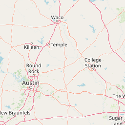
Mill Creek
Map
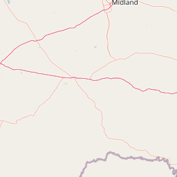
Leaflet | <a href="https://www.openstreetmap.org/copyright">© OpenStreetMap contributors</a>
Item
| Property | Value |
|---|---|
| id | 2601017 |
| downstream_mainstem_id | https://geoconnex.us/ref/mainstems/2600538 |
| encompassing_mainstem_basins | ['https://geoconnex.us/ref/mainstems/2600538', 'https://geoconnex.us/ref/mainstems/2600466', 'https://geoconnex.us/ref/mainstems/2600464'] |
| featuretype | ['https://www.opengis.net/def/schema/hy_features/hyf/HY_FlowPath', 'https://www.opengis.net/def/schema/hy_features/hyf/HY_WaterBody'] |
| fid | 23130 |
| head_2020huc12 | 120401020206 |
| head_nhdpv1_comid | 1507931 |
| head_nhdpv2_comid | https://geoconnex.us/nhdplusv2/comid/1507931 |
| head_nhdpv2huc12 | https://geoconnex.us/nhdplusv2/huc12/120401020206 |
| head_rf1id | 38451 |
| lengthkm | 55.1 |
| name_at_outlet | Mill Creek |
| name_at_outlet_gnis_id | 1341622 |
| new_mainstemid | |
| outlet_2020huc12 | 120401020208 |
| outlet_drainagearea_sqkm | 194.8 |
| outlet_nhdpv1_comid | 1508007 |
| outlet_nhdpv2_comid | https://geoconnex.us/nhdplusv2/comid/1508007 |
| outlet_nhdpv2huc12 | https://geoconnex.us/nhdplusv2/huc12/120401020208 |
| outlet_rf1id | 38451 |
| superseded | False |
| uri | https://geoconnex.us/ref/mainstems/2601017 |