Willow Slough
Map
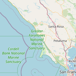
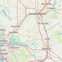
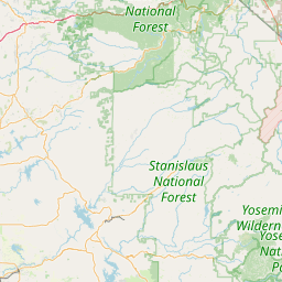

Leaflet | <a href="https://www.openstreetmap.org/copyright">© OpenStreetMap contributors</a>
Item
| Property | Value |
|---|---|
| id | 2935 |
| downstream_mainstem_id | https://geoconnex.us/ref/mainstems/425 |
| encompassing_mainstem_basins | ['https://geoconnex.us/ref/mainstems/425', 'https://geoconnex.us/ref/mainstems/1'] |
| featuretype | ['https://www.opengis.net/def/schema/hy_features/hyf/HY_FlowPath', 'https://www.opengis.net/def/schema/hy_features/hyf/HY_WaterBody'] |
| fid | 32646 |
| head_2020huc12 | |
| head_nhdpv1_comid | None |
| head_nhdpv2_comid | https://geoconnex.us/nhdplusv2/comid/15032873 |
| head_nhdpv2huc12 | |
| head_rf1id | None |
| lengthkm | 48.3 |
| name_at_outlet | Willow Slough |
| name_at_outlet_gnis_id | 237932 |
| new_mainstemid | |
| outlet_2020huc12 | |
| outlet_drainagearea_sqkm | 370.5 |
| outlet_nhdpv1_comid | None |
| outlet_nhdpv2_comid | https://geoconnex.us/nhdplusv2/comid/15035291 |
| outlet_nhdpv2huc12 | |
| outlet_rf1id | None |
| superseded | False |
| uri | https://geoconnex.us/ref/mainstems/2935 |
Graph Results
| monitoringLocation | https://geoconnex.us/iow/wqp/USGS-384013121585201 |
|---|---|
| siteName | USGS-384013121585201 |
| datasetDescription | Sodium, percent total cations at USGS-384013121585201 |
| type | Well |
| url | https://www.waterqualitydata.us/provider/NWIS/USGS-CA/USGS-384013121585201/ |
| variableMeasured | Sodium, percent total cations |
| variableUnit | percent |
| measurementTechnique | observation |
| temporalCoverage | 1979-01-01T00:00:00Z/1979-12-31T00:00:00Z |
| distributionName | Water Quality Portal |
| distributionURL | https://www.waterqualitydata.us/data/Result/search?siteid=USGS-384013121585201&CharacteristicName=Sodium, percent total cations&mimeType=csv |
| distributionFormat | text/comma-separated-values |
| wkt | POINT (-121.9821915 38.67018175) |
| monitoringLocation | https://geoconnex.us/iow/wqp/USGS-384013121585201 |
|---|---|
| siteName | USGS-384013121585201 |
| datasetDescription | Inorganic nitrogen (nitrate and nitrite) at USGS-384013121585201 |
| type | Well |
| url | https://www.waterqualitydata.us/provider/NWIS/USGS-CA/USGS-384013121585201/ |
| variableMeasured | Inorganic nitrogen (nitrate and nitrite) |
| variableUnit | milligrams per liter as nitrogen |
| measurementTechnique | observation |
| temporalCoverage | 1979-01-01T00:00:00Z/1979-12-31T00:00:00Z |
| distributionName | Water Quality Portal |
| distributionURL | https://www.waterqualitydata.us/data/Result/search?siteid=USGS-384013121585201&CharacteristicName=Inorganic nitrogen (nitrate and nitrite)&mimeType=csv |
| distributionFormat | text/comma-separated-values |
| wkt | POINT (-121.9821915 38.67018175) |
| monitoringLocation | https://geoconnex.us/iow/wqp/USGS-384013121585201 |
|---|---|
| siteName | USGS-384013121585201 |
| datasetDescription | Orthophosphate at USGS-384013121585201 |
| type | Well |
| url | https://www.waterqualitydata.us/provider/NWIS/USGS-CA/USGS-384013121585201/ |
| variableMeasured | Orthophosphate |
| variableUnit | milligrams per liter as phosphate |
| measurementTechnique | observation |
| temporalCoverage | 1979-01-01T00:00:00Z/1979-12-31T00:00:00Z |
| distributionName | Water Quality Portal |
| distributionURL | https://www.waterqualitydata.us/data/Result/search?siteid=USGS-384013121585201&CharacteristicName=Orthophosphate&mimeType=csv |
| distributionFormat | text/comma-separated-values |
| wkt | POINT (-121.9821915 38.67018175) |
| monitoringLocation | https://geoconnex.us/iow/wqp/USGS-384013121585201 |
|---|---|
| siteName | USGS-384013121585201 |
| datasetDescription | Sodium at USGS-384013121585201 |
| type | Well |
| url | https://www.waterqualitydata.us/provider/NWIS/USGS-CA/USGS-384013121585201/ |
| variableMeasured | Sodium |
| variableUnit | milligrams per liter |
| measurementTechnique | observation |
| temporalCoverage | 1979-01-01T00:00:00Z/1979-12-31T00:00:00Z |
| distributionName | Water Quality Portal |
| distributionURL | https://www.waterqualitydata.us/data/Result/search?siteid=USGS-384013121585201&CharacteristicName=Sodium&mimeType=csv |
| distributionFormat | text/comma-separated-values |
| wkt | POINT (-121.9821915 38.67018175) |
| monitoringLocation | https://geoconnex.us/iow/wqp/USGS-384013121585201 |
|---|---|
| siteName | USGS-384013121585201 |
| datasetDescription | Manganese at USGS-384013121585201 |
| type | Well |
| url | https://www.waterqualitydata.us/provider/NWIS/USGS-CA/USGS-384013121585201/ |
| variableMeasured | Manganese |
| variableUnit | micrograms per liter |
| measurementTechnique | observation |
| temporalCoverage | 1979-01-01T00:00:00Z/1979-12-31T00:00:00Z |
| distributionName | Water Quality Portal |
| distributionURL | https://www.waterqualitydata.us/data/Result/search?siteid=USGS-384013121585201&CharacteristicName=Manganese&mimeType=csv |
| distributionFormat | text/comma-separated-values |
| wkt | POINT (-121.9821915 38.67018175) |
| monitoringLocation | https://geoconnex.us/iow/wqp/USGS-384013121585201 |
|---|---|
| siteName | USGS-384013121585201 |
| datasetDescription | Hardness, Ca, Mg at USGS-384013121585201 |
| type | Well |
| url | https://www.waterqualitydata.us/provider/NWIS/USGS-CA/USGS-384013121585201/ |
| variableMeasured | Hardness, Ca, Mg |
| variableUnit | milligrams per liter as calcium carbonate |
| measurementTechnique | observation |
| temporalCoverage | 1979-01-01T00:00:00Z/1979-12-31T00:00:00Z |
| distributionName | Water Quality Portal |
| distributionURL | https://www.waterqualitydata.us/data/Result/search?siteid=USGS-384013121585201&CharacteristicName=Hardness, Ca, Mg&mimeType=csv |
| distributionFormat | text/comma-separated-values |
| wkt | POINT (-121.9821915 38.67018175) |
| monitoringLocation | https://geoconnex.us/iow/wqp/USGS-384013121585201 |
|---|---|
| siteName | USGS-384013121585201 |
| datasetDescription | Magnesium at USGS-384013121585201 |
| type | Well |
| url | https://www.waterqualitydata.us/provider/NWIS/USGS-CA/USGS-384013121585201/ |
| variableMeasured | Magnesium |
| variableUnit | percent |
| measurementTechnique | observation |
| temporalCoverage | 1979-01-01T00:00:00Z/1979-12-31T00:00:00Z |
| distributionName | Water Quality Portal |
| distributionURL | https://www.waterqualitydata.us/data/Result/search?siteid=USGS-384013121585201&CharacteristicName=Magnesium&mimeType=csv |
| distributionFormat | text/comma-separated-values |
| wkt | POINT (-121.9821915 38.67018175) |
| monitoringLocation | https://geoconnex.us/iow/wqp/USGS-384013121585201 |
|---|---|
| siteName | USGS-384013121585201 |
| datasetDescription | Sulfate at USGS-384013121585201 |
| type | Well |
| url | https://www.waterqualitydata.us/provider/NWIS/USGS-CA/USGS-384013121585201/ |
| variableMeasured | Sulfate |
| variableUnit | milligrams per liter |
| measurementTechnique | observation |
| temporalCoverage | 1979-01-01T00:00:00Z/1979-12-31T00:00:00Z |
| distributionName | Water Quality Portal |
| distributionURL | https://www.waterqualitydata.us/data/Result/search?siteid=USGS-384013121585201&CharacteristicName=Sulfate&mimeType=csv |
| distributionFormat | text/comma-separated-values |
| wkt | POINT (-121.9821915 38.67018175) |
| monitoringLocation | https://geoconnex.us/iow/wqp/USGS-384013121585201 |
|---|---|
| siteName | USGS-384013121585201 |
| datasetDescription | Calcium at USGS-384013121585201 |
| type | Well |
| url | https://www.waterqualitydata.us/provider/NWIS/USGS-CA/USGS-384013121585201/ |
| variableMeasured | Calcium |
| variableUnit | milligrams per liter |
| measurementTechnique | observation |
| temporalCoverage | 1979-01-01T00:00:00Z/1979-12-31T00:00:00Z |
| distributionName | Water Quality Portal |
| distributionURL | https://www.waterqualitydata.us/data/Result/search?siteid=USGS-384013121585201&CharacteristicName=Calcium&mimeType=csv |
| distributionFormat | text/comma-separated-values |
| wkt | POINT (-121.9821915 38.67018175) |
| monitoringLocation | https://geoconnex.us/iow/wqp/USGS-384013121585201 |
|---|---|
| siteName | USGS-384013121585201 |
| datasetDescription | Hardness, non-carbonate at USGS-384013121585201 |
| type | Well |
| url | https://www.waterqualitydata.us/provider/NWIS/USGS-CA/USGS-384013121585201/ |
| variableMeasured | Hardness, non-carbonate |
| variableUnit | milligrams per liter as calcium carbonate |
| measurementTechnique | observation |
| temporalCoverage | 1979-01-01T00:00:00Z/1979-12-31T00:00:00Z |
| distributionName | Water Quality Portal |
| distributionURL | https://www.waterqualitydata.us/data/Result/search?siteid=USGS-384013121585201&CharacteristicName=Hardness, non-carbonate&mimeType=csv |
| distributionFormat | text/comma-separated-values |
| wkt | POINT (-121.9821915 38.67018175) |
| monitoringLocation | https://geoconnex.us/iow/wqp/USGS-384013121585201 |
|---|---|
| siteName | USGS-384013121585201 |
| datasetDescription | Carbon dioxide at USGS-384013121585201 |
| type | Well |
| url | https://www.waterqualitydata.us/provider/NWIS/USGS-CA/USGS-384013121585201/ |
| variableMeasured | Carbon dioxide |
| variableUnit | milligrams per liter |
| measurementTechnique | observation |
| temporalCoverage | 1979-01-01T00:00:00Z/1979-12-31T00:00:00Z |
| distributionName | Water Quality Portal |
| distributionURL | https://www.waterqualitydata.us/data/Result/search?siteid=USGS-384013121585201&CharacteristicName=Carbon dioxide&mimeType=csv |
| distributionFormat | text/comma-separated-values |
| wkt | POINT (-121.9821915 38.67018175) |
| monitoringLocation | https://geoconnex.us/iow/wqp/USGS-384013121585201 |
|---|---|
| siteName | USGS-384013121585201 |
| datasetDescription | Total dissolved solids at USGS-384013121585201 |
| type | Well |
| url | https://www.waterqualitydata.us/provider/NWIS/USGS-CA/USGS-384013121585201/ |
| variableMeasured | Total dissolved solids |
| variableUnit | milligrams per liter |
| measurementTechnique | observation |
| temporalCoverage | 1979-01-01T00:00:00Z/1979-12-31T00:00:00Z |
| distributionName | Water Quality Portal |
| distributionURL | https://www.waterqualitydata.us/data/Result/search?siteid=USGS-384013121585201&CharacteristicName=Total dissolved solids&mimeType=csv |
| distributionFormat | text/comma-separated-values |
| wkt | POINT (-121.9821915 38.67018175) |
| monitoringLocation | https://geoconnex.us/iow/wqp/USGS-384013121585201 |
|---|---|
| siteName | USGS-384013121585201 |
| datasetDescription | Fluoride at USGS-384013121585201 |
| type | Well |
| url | https://www.waterqualitydata.us/provider/NWIS/USGS-CA/USGS-384013121585201/ |
| variableMeasured | Fluoride |
| variableUnit | milligrams per liter |
| measurementTechnique | observation |
| temporalCoverage | 1979-01-01T00:00:00Z/1979-12-31T00:00:00Z |
| distributionName | Water Quality Portal |
| distributionURL | https://www.waterqualitydata.us/data/Result/search?siteid=USGS-384013121585201&CharacteristicName=Fluoride&mimeType=csv |
| distributionFormat | text/comma-separated-values |
| wkt | POINT (-121.9821915 38.67018175) |
| monitoringLocation | https://geoconnex.us/iow/wqp/USGS-384013121585201 |
|---|---|
| siteName | USGS-384013121585201 |
| datasetDescription | Nitrate at USGS-384013121585201 |
| type | Well |
| url | https://www.waterqualitydata.us/provider/NWIS/USGS-CA/USGS-384013121585201/ |
| variableMeasured | Nitrate |
| variableUnit | milligrams per liter as nitrogen |
| measurementTechnique | observation |
| temporalCoverage | 1979-01-01T00:00:00Z/1979-12-31T00:00:00Z |
| distributionName | Water Quality Portal |
| distributionURL | https://www.waterqualitydata.us/data/Result/search?siteid=USGS-384013121585201&CharacteristicName=Nitrate&mimeType=csv |
| distributionFormat | text/comma-separated-values |
| wkt | POINT (-121.9821915 38.67018175) |
| monitoringLocation | https://geoconnex.us/iow/wqp/USGS-384013121585201 |
|---|---|
| siteName | USGS-384013121585201 |
| datasetDescription | Iron at USGS-384013121585201 |
| type | Well |
| url | https://www.waterqualitydata.us/provider/NWIS/USGS-CA/USGS-384013121585201/ |
| variableMeasured | Iron |
| variableUnit | percent |
| measurementTechnique | observation |
| temporalCoverage | 1979-01-01T00:00:00Z/1979-12-31T00:00:00Z |
| distributionName | Water Quality Portal |
| distributionURL | https://www.waterqualitydata.us/data/Result/search?siteid=USGS-384013121585201&CharacteristicName=Iron&mimeType=csv |
| distributionFormat | text/comma-separated-values |
| wkt | POINT (-121.9821915 38.67018175) |
| monitoringLocation | https://geoconnex.us/iow/wqp/USGS-384013121585201 |
|---|---|
| siteName | USGS-384013121585201 |
| datasetDescription | Aluminum at USGS-384013121585201 |
| type | Well |
| url | https://www.waterqualitydata.us/provider/NWIS/USGS-CA/USGS-384013121585201/ |
| variableMeasured | Aluminum |
| variableUnit | Unknown |
| measurementTechnique | observation |
| temporalCoverage | 1979-01-01T00:00:00Z/1979-12-31T00:00:00Z |
| distributionName | Water Quality Portal |
| distributionURL | https://www.waterqualitydata.us/data/Result/search?siteid=USGS-384013121585201&CharacteristicName=Aluminum&mimeType=csv |
| distributionFormat | text/comma-separated-values |
| wkt | POINT (-121.9821915 38.67018175) |
| monitoringLocation | https://geoconnex.us/iow/wqp/USGS-384013121585201 |
|---|---|
| siteName | USGS-384013121585201 |
| datasetDescription | Bicarbonate at USGS-384013121585201 |
| type | Well |
| url | https://www.waterqualitydata.us/provider/NWIS/USGS-CA/USGS-384013121585201/ |
| variableMeasured | Bicarbonate |
| variableUnit | milligrams per liter |
| measurementTechnique | observation |
| temporalCoverage | 1979-01-01T00:00:00Z/1979-12-31T00:00:00Z |
| distributionName | Water Quality Portal |
| distributionURL | https://www.waterqualitydata.us/data/Result/search?siteid=USGS-384013121585201&CharacteristicName=Bicarbonate&mimeType=csv |
| distributionFormat | text/comma-separated-values |
| wkt | POINT (-121.9821915 38.67018175) |
| monitoringLocation | https://geoconnex.us/iow/wqp/USGS-384013121585201 |
|---|---|
| siteName | USGS-384013121585201 |
| datasetDescription | Temperature, water at USGS-384013121585201 |
| type | Well |
| url | https://www.waterqualitydata.us/provider/NWIS/USGS-CA/USGS-384013121585201/ |
| variableMeasured | Temperature, water |
| variableUnit | degrees Celsius |
| measurementTechnique | observation |
| temporalCoverage | 1979-01-01T00:00:00Z/1979-12-31T00:00:00Z |
| distributionName | Water Quality Portal |
| distributionURL | https://www.waterqualitydata.us/data/Result/search?siteid=USGS-384013121585201&CharacteristicName=Temperature, water&mimeType=csv |
| distributionFormat | text/comma-separated-values |
| wkt | POINT (-121.9821915 38.67018175) |
| monitoringLocation | https://geoconnex.us/iow/wqp/USGS-384013121585201 |
|---|---|
| siteName | USGS-384013121585201 |
| datasetDescription | Phosphorus at USGS-384013121585201 |
| type | Well |
| url | https://www.waterqualitydata.us/provider/NWIS/USGS-CA/USGS-384013121585201/ |
| variableMeasured | Phosphorus |
| variableUnit | parts per billion |
| measurementTechnique | observation |
| temporalCoverage | 1979-01-01T00:00:00Z/1979-12-31T00:00:00Z |
| distributionName | Water Quality Portal |
| distributionURL | https://www.waterqualitydata.us/data/Result/search?siteid=USGS-384013121585201&CharacteristicName=Phosphorus&mimeType=csv |
| distributionFormat | text/comma-separated-values |
| wkt | POINT (-121.9821915 38.67018175) |
| monitoringLocation | https://geoconnex.us/iow/wqp/USGS-384013121585201 |
|---|---|
| siteName | USGS-384013121585201 |
| datasetDescription | Boron at USGS-384013121585201 |
| type | Well |
| url | https://www.waterqualitydata.us/provider/NWIS/USGS-CA/USGS-384013121585201/ |
| variableMeasured | Boron |
| variableUnit | Unknown |
| measurementTechnique | observation |
| temporalCoverage | 1979-01-01T00:00:00Z/1979-12-31T00:00:00Z |
| distributionName | Water Quality Portal |
| distributionURL | https://www.waterqualitydata.us/data/Result/search?siteid=USGS-384013121585201&CharacteristicName=Boron&mimeType=csv |
| distributionFormat | text/comma-separated-values |
| wkt | POINT (-121.9821915 38.67018175) |
| monitoringLocation | https://geoconnex.us/iow/wqp/USGS-384013121585201 |
|---|---|
| siteName | USGS-384013121585201 |
| datasetDescription | Chloride at USGS-384013121585201 |
| type | Well |
| url | https://www.waterqualitydata.us/provider/NWIS/USGS-CA/USGS-384013121585201/ |
| variableMeasured | Chloride |
| variableUnit | milligrams per liter |
| measurementTechnique | observation |
| temporalCoverage | 1979-01-01T00:00:00Z/1979-12-31T00:00:00Z |
| distributionName | Water Quality Portal |
| distributionURL | https://www.waterqualitydata.us/data/Result/search?siteid=USGS-384013121585201&CharacteristicName=Chloride&mimeType=csv |
| distributionFormat | text/comma-separated-values |
| wkt | POINT (-121.9821915 38.67018175) |
| monitoringLocation | https://geoconnex.us/iow/wqp/USGS-384013121585201 |
|---|---|
| siteName | USGS-384013121585201 |
| datasetDescription | Sodium plus potassium at USGS-384013121585201 |
| type | Well |
| url | https://www.waterqualitydata.us/provider/NWIS/USGS-CA/USGS-384013121585201/ |
| variableMeasured | Sodium plus potassium |
| variableUnit | milligrams per liter as sodium |
| measurementTechnique | observation |
| temporalCoverage | 1979-01-01T00:00:00Z/1979-12-31T00:00:00Z |
| distributionName | Water Quality Portal |
| distributionURL | https://www.waterqualitydata.us/data/Result/search?siteid=USGS-384013121585201&CharacteristicName=Sodium plus potassium&mimeType=csv |
| distributionFormat | text/comma-separated-values |
| wkt | POINT (-121.9821915 38.67018175) |
| monitoringLocation | https://geoconnex.us/iow/wqp/USGS-384013121585201 |
|---|---|
| siteName | USGS-384013121585201 |
| datasetDescription | Alkalinity at USGS-384013121585201 |
| type | Well |
| url | https://www.waterqualitydata.us/provider/NWIS/USGS-CA/USGS-384013121585201/ |
| variableMeasured | Alkalinity |
| variableUnit | milligrams per liter as calcium carbonate |
| measurementTechnique | observation |
| temporalCoverage | 1979-01-01T00:00:00Z/1979-12-31T00:00:00Z |
| distributionName | Water Quality Portal |
| distributionURL | https://www.waterqualitydata.us/data/Result/search?siteid=USGS-384013121585201&CharacteristicName=Alkalinity&mimeType=csv |
| distributionFormat | text/comma-separated-values |
| wkt | POINT (-121.9821915 38.67018175) |
| monitoringLocation | https://geoconnex.us/iow/wqp/USGS-384013121585201 |
|---|---|
| siteName | USGS-384013121585201 |
| datasetDescription | pH at USGS-384013121585201 |
| type | Well |
| url | https://www.waterqualitydata.us/provider/NWIS/USGS-CA/USGS-384013121585201/ |
| variableMeasured | pH |
| variableUnit | Unknown |
| measurementTechnique | observation |
| temporalCoverage | 1979-01-01T00:00:00Z/1979-12-31T00:00:00Z |
| distributionName | Water Quality Portal |
| distributionURL | https://www.waterqualitydata.us/data/Result/search?siteid=USGS-384013121585201&CharacteristicName=pH&mimeType=csv |
| distributionFormat | text/comma-separated-values |
| wkt | POINT (-121.9821915 38.67018175) |
| monitoringLocation | https://geoconnex.us/iow/wqp/USGS-384013121585201 |
|---|---|
| siteName | USGS-384013121585201 |
| datasetDescription | Specific conductance at USGS-384013121585201 |
| type | Well |
| url | https://www.waterqualitydata.us/provider/NWIS/USGS-CA/USGS-384013121585201/ |
| variableMeasured | Specific conductance |
| variableUnit | microsiemens per centimeter |
| measurementTechnique | observation |
| temporalCoverage | 1979-01-01T00:00:00Z/1979-12-31T00:00:00Z |
| distributionName | Water Quality Portal |
| distributionURL | https://www.waterqualitydata.us/data/Result/search?siteid=USGS-384013121585201&CharacteristicName=Specific conductance&mimeType=csv |
| distributionFormat | text/comma-separated-values |
| wkt | POINT (-121.9821915 38.67018175) |
| monitoringLocation | https://geoconnex.us/iow/wqp/USGS-384013121585201 |
|---|---|
| siteName | USGS-384013121585201 |
| datasetDescription | Potassium at USGS-384013121585201 |
| type | Well |
| url | https://www.waterqualitydata.us/provider/NWIS/USGS-CA/USGS-384013121585201/ |
| variableMeasured | Potassium |
| variableUnit | milligrams per liter |
| measurementTechnique | observation |
| temporalCoverage | 1979-01-01T00:00:00Z/1979-12-31T00:00:00Z |
| distributionName | Water Quality Portal |
| distributionURL | https://www.waterqualitydata.us/data/Result/search?siteid=USGS-384013121585201&CharacteristicName=Potassium&mimeType=csv |
| distributionFormat | text/comma-separated-values |
| wkt | POINT (-121.9821915 38.67018175) |
| monitoringLocation | https://geoconnex.us/iow/wqp/USGS-384013121585201 |
|---|---|
| siteName | USGS-384013121585201 |
| datasetDescription | Silica at USGS-384013121585201 |
| type | Well |
| url | https://www.waterqualitydata.us/provider/NWIS/USGS-CA/USGS-384013121585201/ |
| variableMeasured | Silica |
| variableUnit | milligrams per liter |
| measurementTechnique | observation |
| temporalCoverage | 1979-01-01T00:00:00Z/1979-12-31T00:00:00Z |
| distributionName | Water Quality Portal |
| distributionURL | https://www.waterqualitydata.us/data/Result/search?siteid=USGS-384013121585201&CharacteristicName=Silica&mimeType=csv |
| distributionFormat | text/comma-separated-values |
| wkt | POINT (-121.9821915 38.67018175) |
| monitoringLocation | https://geoconnex.us/iow/wqp/USGS-383709121455701 |
|---|---|
| siteName | USGS-383709121455701 |
| datasetDescription | Iron at USGS-383709121455701 |
| type | Well |
| url | https://www.waterqualitydata.us/provider/NWIS/USGS-CA/USGS-383709121455701/ |
| variableMeasured | Iron |
| variableUnit | percent |
| measurementTechnique | observation |
| temporalCoverage | 1981-01-01T00:00:00Z/1981-12-31T00:00:00Z |
| distributionName | Water Quality Portal |
| distributionURL | https://www.waterqualitydata.us/data/Result/search?siteid=USGS-383709121455701&CharacteristicName=Iron&mimeType=csv |
| distributionFormat | text/comma-separated-values |
| wkt | POINT (-121.7669073 38.61907215) |
| monitoringLocation | https://geoconnex.us/iow/wqp/USGS-383709121455701 |
|---|---|
| siteName | USGS-383709121455701 |
| datasetDescription | Silica at USGS-383709121455701 |
| type | Well |
| url | https://www.waterqualitydata.us/provider/NWIS/USGS-CA/USGS-383709121455701/ |
| variableMeasured | Silica |
| variableUnit | milligrams per liter |
| measurementTechnique | observation |
| temporalCoverage | 1981-01-01T00:00:00Z/1981-12-31T00:00:00Z |
| distributionName | Water Quality Portal |
| distributionURL | https://www.waterqualitydata.us/data/Result/search?siteid=USGS-383709121455701&CharacteristicName=Silica&mimeType=csv |
| distributionFormat | text/comma-separated-values |
| wkt | POINT (-121.7669073 38.61907215) |
| monitoringLocation | https://geoconnex.us/iow/wqp/USGS-383709121455701 |
|---|---|
| siteName | USGS-383709121455701 |
| datasetDescription | Inorganic nitrogen (nitrate and nitrite) at USGS-383709121455701 |
| type | Well |
| url | https://www.waterqualitydata.us/provider/NWIS/USGS-CA/USGS-383709121455701/ |
| variableMeasured | Inorganic nitrogen (nitrate and nitrite) |
| variableUnit | milligrams per liter as nitrogen |
| measurementTechnique | observation |
| temporalCoverage | 1981-01-01T00:00:00Z/1981-12-31T00:00:00Z |
| distributionName | Water Quality Portal |
| distributionURL | https://www.waterqualitydata.us/data/Result/search?siteid=USGS-383709121455701&CharacteristicName=Inorganic nitrogen (nitrate and nitrite)&mimeType=csv |
| distributionFormat | text/comma-separated-values |
| wkt | POINT (-121.7669073 38.61907215) |
| monitoringLocation | https://geoconnex.us/iow/wqp/USGS-383709121455701 |
|---|---|
| siteName | USGS-383709121455701 |
| datasetDescription | Sodium at USGS-383709121455701 |
| type | Well |
| url | https://www.waterqualitydata.us/provider/NWIS/USGS-CA/USGS-383709121455701/ |
| variableMeasured | Sodium |
| variableUnit | milligrams per liter |
| measurementTechnique | observation |
| temporalCoverage | 1981-01-01T00:00:00Z/1981-12-31T00:00:00Z |
| distributionName | Water Quality Portal |
| distributionURL | https://www.waterqualitydata.us/data/Result/search?siteid=USGS-383709121455701&CharacteristicName=Sodium&mimeType=csv |
| distributionFormat | text/comma-separated-values |
| wkt | POINT (-121.7669073 38.61907215) |
| monitoringLocation | https://geoconnex.us/iow/wqp/USGS-383709121455701 |
|---|---|
| siteName | USGS-383709121455701 |
| datasetDescription | Aluminum at USGS-383709121455701 |
| type | Well |
| url | https://www.waterqualitydata.us/provider/NWIS/USGS-CA/USGS-383709121455701/ |
| variableMeasured | Aluminum |
| variableUnit | Unknown |
| measurementTechnique | observation |
| temporalCoverage | 1981-01-01T00:00:00Z/1981-12-31T00:00:00Z |
| distributionName | Water Quality Portal |
| distributionURL | https://www.waterqualitydata.us/data/Result/search?siteid=USGS-383709121455701&CharacteristicName=Aluminum&mimeType=csv |
| distributionFormat | text/comma-separated-values |
| wkt | POINT (-121.7669073 38.61907215) |
| monitoringLocation | https://geoconnex.us/iow/wqp/USGS-383709121455701 |
|---|---|
| siteName | USGS-383709121455701 |
| datasetDescription | Hardness, non-carbonate at USGS-383709121455701 |
| type | Well |
| url | https://www.waterqualitydata.us/provider/NWIS/USGS-CA/USGS-383709121455701/ |
| variableMeasured | Hardness, non-carbonate |
| variableUnit | milligrams per liter as calcium carbonate |
| measurementTechnique | observation |
| temporalCoverage | 1981-01-01T00:00:00Z/1981-12-31T00:00:00Z |
| distributionName | Water Quality Portal |
| distributionURL | https://www.waterqualitydata.us/data/Result/search?siteid=USGS-383709121455701&CharacteristicName=Hardness, non-carbonate&mimeType=csv |
| distributionFormat | text/comma-separated-values |
| wkt | POINT (-121.7669073 38.61907215) |
| monitoringLocation | https://geoconnex.us/iow/wqp/USGS-383709121455701 |
|---|---|
| siteName | USGS-383709121455701 |
| datasetDescription | pH at USGS-383709121455701 |
| type | Well |
| url | https://www.waterqualitydata.us/provider/NWIS/USGS-CA/USGS-383709121455701/ |
| variableMeasured | pH |
| variableUnit | Unknown |
| measurementTechnique | observation |
| temporalCoverage | 1981-01-01T00:00:00Z/1981-12-31T00:00:00Z |
| distributionName | Water Quality Portal |
| distributionURL | https://www.waterqualitydata.us/data/Result/search?siteid=USGS-383709121455701&CharacteristicName=pH&mimeType=csv |
| distributionFormat | text/comma-separated-values |
| wkt | POINT (-121.7669073 38.61907215) |
| monitoringLocation | https://geoconnex.us/iow/wqp/USGS-383709121455701 |
|---|---|
| siteName | USGS-383709121455701 |
| datasetDescription | Orthophosphate at USGS-383709121455701 |
| type | Well |
| url | https://www.waterqualitydata.us/provider/NWIS/USGS-CA/USGS-383709121455701/ |
| variableMeasured | Orthophosphate |
| variableUnit | milligrams per liter as phosphate |
| measurementTechnique | observation |
| temporalCoverage | 1981-01-01T00:00:00Z/1981-12-31T00:00:00Z |
| distributionName | Water Quality Portal |
| distributionURL | https://www.waterqualitydata.us/data/Result/search?siteid=USGS-383709121455701&CharacteristicName=Orthophosphate&mimeType=csv |
| distributionFormat | text/comma-separated-values |
| wkt | POINT (-121.7669073 38.61907215) |
| monitoringLocation | https://geoconnex.us/iow/wqp/USGS-383709121455701 |
|---|---|
| siteName | USGS-383709121455701 |
| datasetDescription | Potassium at USGS-383709121455701 |
| type | Well |
| url | https://www.waterqualitydata.us/provider/NWIS/USGS-CA/USGS-383709121455701/ |
| variableMeasured | Potassium |
| variableUnit | milligrams per liter |
| measurementTechnique | observation |
| temporalCoverage | 1981-01-01T00:00:00Z/1981-12-31T00:00:00Z |
| distributionName | Water Quality Portal |
| distributionURL | https://www.waterqualitydata.us/data/Result/search?siteid=USGS-383709121455701&CharacteristicName=Potassium&mimeType=csv |
| distributionFormat | text/comma-separated-values |
| wkt | POINT (-121.7669073 38.61907215) |
| monitoringLocation | https://geoconnex.us/iow/wqp/USGS-383709121455701 |
|---|---|
| siteName | USGS-383709121455701 |
| datasetDescription | Alkalinity at USGS-383709121455701 |
| type | Well |
| url | https://www.waterqualitydata.us/provider/NWIS/USGS-CA/USGS-383709121455701/ |
| variableMeasured | Alkalinity |
| variableUnit | milligrams per liter as calcium carbonate |
| measurementTechnique | observation |
| temporalCoverage | 1981-01-01T00:00:00Z/1981-12-31T00:00:00Z |
| distributionName | Water Quality Portal |
| distributionURL | https://www.waterqualitydata.us/data/Result/search?siteid=USGS-383709121455701&CharacteristicName=Alkalinity&mimeType=csv |
| distributionFormat | text/comma-separated-values |
| wkt | POINT (-121.7669073 38.61907215) |
| monitoringLocation | https://geoconnex.us/iow/wqp/USGS-383709121455701 |
|---|---|
| siteName | USGS-383709121455701 |
| datasetDescription | Sodium, percent total cations at USGS-383709121455701 |
| type | Well |
| url | https://www.waterqualitydata.us/provider/NWIS/USGS-CA/USGS-383709121455701/ |
| variableMeasured | Sodium, percent total cations |
| variableUnit | percent |
| measurementTechnique | observation |
| temporalCoverage | 1981-01-01T00:00:00Z/1981-12-31T00:00:00Z |
| distributionName | Water Quality Portal |
| distributionURL | https://www.waterqualitydata.us/data/Result/search?siteid=USGS-383709121455701&CharacteristicName=Sodium, percent total cations&mimeType=csv |
| distributionFormat | text/comma-separated-values |
| wkt | POINT (-121.7669073 38.61907215) |
| monitoringLocation | https://geoconnex.us/iow/wqp/USGS-383709121455701 |
|---|---|
| siteName | USGS-383709121455701 |
| datasetDescription | Carbon dioxide at USGS-383709121455701 |
| type | Well |
| url | https://www.waterqualitydata.us/provider/NWIS/USGS-CA/USGS-383709121455701/ |
| variableMeasured | Carbon dioxide |
| variableUnit | milligrams per liter |
| measurementTechnique | observation |
| temporalCoverage | 1981-01-01T00:00:00Z/1981-12-31T00:00:00Z |
| distributionName | Water Quality Portal |
| distributionURL | https://www.waterqualitydata.us/data/Result/search?siteid=USGS-383709121455701&CharacteristicName=Carbon dioxide&mimeType=csv |
| distributionFormat | text/comma-separated-values |
| wkt | POINT (-121.7669073 38.61907215) |
| monitoringLocation | https://geoconnex.us/iow/wqp/USGS-383709121455701 |
|---|---|
| siteName | USGS-383709121455701 |
| datasetDescription | Chloride at USGS-383709121455701 |
| type | Well |
| url | https://www.waterqualitydata.us/provider/NWIS/USGS-CA/USGS-383709121455701/ |
| variableMeasured | Chloride |
| variableUnit | milligrams per liter |
| measurementTechnique | observation |
| temporalCoverage | 1981-01-01T00:00:00Z/1981-12-31T00:00:00Z |
| distributionName | Water Quality Portal |
| distributionURL | https://www.waterqualitydata.us/data/Result/search?siteid=USGS-383709121455701&CharacteristicName=Chloride&mimeType=csv |
| distributionFormat | text/comma-separated-values |
| wkt | POINT (-121.7669073 38.61907215) |
| monitoringLocation | https://geoconnex.us/iow/wqp/USGS-383709121455701 |
|---|---|
| siteName | USGS-383709121455701 |
| datasetDescription | Total dissolved solids at USGS-383709121455701 |
| type | Well |
| url | https://www.waterqualitydata.us/provider/NWIS/USGS-CA/USGS-383709121455701/ |
| variableMeasured | Total dissolved solids |
| variableUnit | milligrams per liter |
| measurementTechnique | observation |
| temporalCoverage | 1981-01-01T00:00:00Z/1981-12-31T00:00:00Z |
| distributionName | Water Quality Portal |
| distributionURL | https://www.waterqualitydata.us/data/Result/search?siteid=USGS-383709121455701&CharacteristicName=Total dissolved solids&mimeType=csv |
| distributionFormat | text/comma-separated-values |
| wkt | POINT (-121.7669073 38.61907215) |
| monitoringLocation | https://geoconnex.us/iow/wqp/USGS-383709121455701 |
|---|---|
| siteName | USGS-383709121455701 |
| datasetDescription | Temperature, water at USGS-383709121455701 |
| type | Well |
| url | https://www.waterqualitydata.us/provider/NWIS/USGS-CA/USGS-383709121455701/ |
| variableMeasured | Temperature, water |
| variableUnit | degrees Celsius |
| measurementTechnique | observation |
| temporalCoverage | 1981-01-01T00:00:00Z/1981-12-31T00:00:00Z |
| distributionName | Water Quality Portal |
| distributionURL | https://www.waterqualitydata.us/data/Result/search?siteid=USGS-383709121455701&CharacteristicName=Temperature, water&mimeType=csv |
| distributionFormat | text/comma-separated-values |
| wkt | POINT (-121.7669073 38.61907215) |
| monitoringLocation | https://geoconnex.us/iow/wqp/USGS-383709121455701 |
|---|---|
| siteName | USGS-383709121455701 |
| datasetDescription | Calcium at USGS-383709121455701 |
| type | Well |
| url | https://www.waterqualitydata.us/provider/NWIS/USGS-CA/USGS-383709121455701/ |
| variableMeasured | Calcium |
| variableUnit | milligrams per liter |
| measurementTechnique | observation |
| temporalCoverage | 1981-01-01T00:00:00Z/1981-12-31T00:00:00Z |
| distributionName | Water Quality Portal |
| distributionURL | https://www.waterqualitydata.us/data/Result/search?siteid=USGS-383709121455701&CharacteristicName=Calcium&mimeType=csv |
| distributionFormat | text/comma-separated-values |
| wkt | POINT (-121.7669073 38.61907215) |
| monitoringLocation | https://geoconnex.us/iow/wqp/USGS-383709121455701 |
|---|---|
| siteName | USGS-383709121455701 |
| datasetDescription | Magnesium at USGS-383709121455701 |
| type | Well |
| url | https://www.waterqualitydata.us/provider/NWIS/USGS-CA/USGS-383709121455701/ |
| variableMeasured | Magnesium |
| variableUnit | percent |
| measurementTechnique | observation |
| temporalCoverage | 1981-01-01T00:00:00Z/1981-12-31T00:00:00Z |
| distributionName | Water Quality Portal |
| distributionURL | https://www.waterqualitydata.us/data/Result/search?siteid=USGS-383709121455701&CharacteristicName=Magnesium&mimeType=csv |
| distributionFormat | text/comma-separated-values |
| wkt | POINT (-121.7669073 38.61907215) |
| monitoringLocation | https://geoconnex.us/iow/wqp/USGS-383709121455701 |
|---|---|
| siteName | USGS-383709121455701 |
| datasetDescription | Boron at USGS-383709121455701 |
| type | Well |
| url | https://www.waterqualitydata.us/provider/NWIS/USGS-CA/USGS-383709121455701/ |
| variableMeasured | Boron |
| variableUnit | Unknown |
| measurementTechnique | observation |
| temporalCoverage | 1981-01-01T00:00:00Z/1981-12-31T00:00:00Z |
| distributionName | Water Quality Portal |
| distributionURL | https://www.waterqualitydata.us/data/Result/search?siteid=USGS-383709121455701&CharacteristicName=Boron&mimeType=csv |
| distributionFormat | text/comma-separated-values |
| wkt | POINT (-121.7669073 38.61907215) |
| monitoringLocation | https://geoconnex.us/iow/wqp/USGS-383709121455701 |
|---|---|
| siteName | USGS-383709121455701 |
| datasetDescription | Sulfate at USGS-383709121455701 |
| type | Well |
| url | https://www.waterqualitydata.us/provider/NWIS/USGS-CA/USGS-383709121455701/ |
| variableMeasured | Sulfate |
| variableUnit | milligrams per liter |
| measurementTechnique | observation |
| temporalCoverage | 1981-01-01T00:00:00Z/1981-12-31T00:00:00Z |
| distributionName | Water Quality Portal |
| distributionURL | https://www.waterqualitydata.us/data/Result/search?siteid=USGS-383709121455701&CharacteristicName=Sulfate&mimeType=csv |
| distributionFormat | text/comma-separated-values |
| wkt | POINT (-121.7669073 38.61907215) |
| monitoringLocation | https://geoconnex.us/iow/wqp/USGS-383709121455701 |
|---|---|
| siteName | USGS-383709121455701 |
| datasetDescription | Arsenic at USGS-383709121455701 |
| type | Well |
| url | https://www.waterqualitydata.us/provider/NWIS/USGS-CA/USGS-383709121455701/ |
| variableMeasured | Arsenic |
| variableUnit | parts per million |
| measurementTechnique | observation |
| temporalCoverage | 1981-01-01T00:00:00Z/1981-12-31T00:00:00Z |
| distributionName | Water Quality Portal |
| distributionURL | https://www.waterqualitydata.us/data/Result/search?siteid=USGS-383709121455701&CharacteristicName=Arsenic&mimeType=csv |
| distributionFormat | text/comma-separated-values |
| wkt | POINT (-121.7669073 38.61907215) |
| monitoringLocation | https://geoconnex.us/iow/wqp/USGS-383709121455701 |
|---|---|
| siteName | USGS-383709121455701 |
| datasetDescription | Manganese at USGS-383709121455701 |
| type | Well |
| url | https://www.waterqualitydata.us/provider/NWIS/USGS-CA/USGS-383709121455701/ |
| variableMeasured | Manganese |
| variableUnit | micrograms per liter |
| measurementTechnique | observation |
| temporalCoverage | 1981-01-01T00:00:00Z/1981-12-31T00:00:00Z |
| distributionName | Water Quality Portal |
| distributionURL | https://www.waterqualitydata.us/data/Result/search?siteid=USGS-383709121455701&CharacteristicName=Manganese&mimeType=csv |
| distributionFormat | text/comma-separated-values |
| wkt | POINT (-121.7669073 38.61907215) |
| monitoringLocation | https://geoconnex.us/iow/wqp/USGS-383709121455701 |
|---|---|
| siteName | USGS-383709121455701 |
| datasetDescription | Fluoride at USGS-383709121455701 |
| type | Well |
| url | https://www.waterqualitydata.us/provider/NWIS/USGS-CA/USGS-383709121455701/ |
| variableMeasured | Fluoride |
| variableUnit | milligrams per liter |
| measurementTechnique | observation |
| temporalCoverage | 1981-01-01T00:00:00Z/1981-12-31T00:00:00Z |
| distributionName | Water Quality Portal |
| distributionURL | https://www.waterqualitydata.us/data/Result/search?siteid=USGS-383709121455701&CharacteristicName=Fluoride&mimeType=csv |
| distributionFormat | text/comma-separated-values |
| wkt | POINT (-121.7669073 38.61907215) |
| monitoringLocation | https://geoconnex.us/iow/wqp/USGS-383709121455701 |
|---|---|
| siteName | USGS-383709121455701 |
| datasetDescription | Specific conductance at USGS-383709121455701 |
| type | Well |
| url | https://www.waterqualitydata.us/provider/NWIS/USGS-CA/USGS-383709121455701/ |
| variableMeasured | Specific conductance |
| variableUnit | microsiemens per centimeter |
| measurementTechnique | observation |
| temporalCoverage | 1981-01-01T00:00:00Z/1981-12-31T00:00:00Z |
| distributionName | Water Quality Portal |
| distributionURL | https://www.waterqualitydata.us/data/Result/search?siteid=USGS-383709121455701&CharacteristicName=Specific conductance&mimeType=csv |
| distributionFormat | text/comma-separated-values |
| wkt | POINT (-121.7669073 38.61907215) |
| monitoringLocation | https://geoconnex.us/iow/wqp/USGS-383709121455701 |
|---|---|
| siteName | USGS-383709121455701 |
| datasetDescription | Hardness, Ca, Mg at USGS-383709121455701 |
| type | Well |
| url | https://www.waterqualitydata.us/provider/NWIS/USGS-CA/USGS-383709121455701/ |
| variableMeasured | Hardness, Ca, Mg |
| variableUnit | milligrams per liter as calcium carbonate |
| measurementTechnique | observation |
| temporalCoverage | 1981-01-01T00:00:00Z/1981-12-31T00:00:00Z |
| distributionName | Water Quality Portal |
| distributionURL | https://www.waterqualitydata.us/data/Result/search?siteid=USGS-383709121455701&CharacteristicName=Hardness, Ca, Mg&mimeType=csv |
| distributionFormat | text/comma-separated-values |
| wkt | POINT (-121.7669073 38.61907215) |
| monitoringLocation | https://geoconnex.us/iow/wqp/CEDEN-511XXSS06 |
|---|---|
| siteName | CEDEN-511XXSS06 |
| datasetDescription | Simazine at CEDEN-511XXSS06 |
| type | Other-Surface Water |
| url | https://www.waterqualitydata.us/provider/STORET/CEDEN/CEDEN-511XXSS06/ |
| variableMeasured | Simazine |
| variableUnit | Unknown |
| measurementTechnique | observation |
| temporalCoverage | 2005-01-01T00:00:00Z/2005-12-31T00:00:00Z |
| distributionName | Water Quality Portal |
| distributionURL | https://www.waterqualitydata.us/data/Result/search?siteid=CEDEN-511XXSS06&CharacteristicName=Simazine&mimeType=csv |
| distributionFormat | text/comma-separated-values |
| wkt | POINT (-122.016 38.6637) |
| monitoringLocation | https://geoconnex.us/iow/wqp/CEDEN-511XXSS06 |
|---|---|
| siteName | CEDEN-511XXSS06 |
| datasetDescription | Precipitation 24hr prior to monitoring event (choice list) at CEDEN-511XXSS06 |
| type | Other-Surface Water |
| url | https://www.waterqualitydata.us/provider/STORET/CEDEN/CEDEN-511XXSS06/ |
| variableMeasured | Precipitation 24hr prior to monitoring event (choice list) |
| variableUnit | Unknown |
| measurementTechnique | observation |
| temporalCoverage | 2005-01-01T00:00:00Z/2005-12-31T00:00:00Z |
| distributionName | Water Quality Portal |
| distributionURL | https://www.waterqualitydata.us/data/Result/search?siteid=CEDEN-511XXSS06&CharacteristicName=Precipitation 24hr prior to monitoring event (choice list)&mimeType=csv |
| distributionFormat | text/comma-separated-values |
| wkt | POINT (-122.016 38.6637) |
| monitoringLocation | https://geoconnex.us/iow/wqp/CEDEN-511XXSS06 |
|---|---|
| siteName | CEDEN-511XXSS06 |
| datasetDescription | Ammonia at CEDEN-511XXSS06 |
| type | Other-Surface Water |
| url | https://www.waterqualitydata.us/provider/STORET/CEDEN/CEDEN-511XXSS06/ |
| variableMeasured | Ammonia |
| variableUnit | milligrams per liter |
| measurementTechnique | observation |
| temporalCoverage | 2005-01-01T00:00:00Z/2005-12-31T00:00:00Z |
| distributionName | Water Quality Portal |
| distributionURL | https://www.waterqualitydata.us/data/Result/search?siteid=CEDEN-511XXSS06&CharacteristicName=Ammonia&mimeType=csv |
| distributionFormat | text/comma-separated-values |
| wkt | POINT (-122.016 38.6637) |
| monitoringLocation | https://geoconnex.us/iow/wqp/CEDEN-511XXSS06 |
|---|---|
| siteName | CEDEN-511XXSS06 |
| datasetDescription | Survival at CEDEN-511XXSS06 |
| type | Other-Surface Water |
| url | https://www.waterqualitydata.us/provider/STORET/CEDEN/CEDEN-511XXSS06/ |
| variableMeasured | Survival |
| variableUnit | percent |
| measurementTechnique | observation |
| temporalCoverage | 2005-01-01T00:00:00Z/2005-12-31T00:00:00Z |
| distributionName | Water Quality Portal |
| distributionURL | https://www.waterqualitydata.us/data/Result/search?siteid=CEDEN-511XXSS06&CharacteristicName=Survival&mimeType=csv |
| distributionFormat | text/comma-separated-values |
| wkt | POINT (-122.016 38.6637) |
| monitoringLocation | https://geoconnex.us/iow/wqp/CEDEN-511XXSS06 |
|---|---|
| siteName | CEDEN-511XXSS06 |
| datasetDescription | 4,4'-Dibromo-2,2',3,3',5,5',6,6'-octafluorobiphenyl at CEDEN-511XXSS06 |
| type | Other-Surface Water |
| url | https://www.waterqualitydata.us/provider/STORET/CEDEN/CEDEN-511XXSS06/ |
| variableMeasured | 4,4'-Dibromo-2,2',3,3',5,5',6,6'-octafluorobiphenyl |
| variableUnit | percent |
| measurementTechnique | observation |
| temporalCoverage | 2005-01-01T00:00:00Z/2005-12-31T00:00:00Z |
| distributionName | Water Quality Portal |
| distributionURL | https://www.waterqualitydata.us/data/Result/search?siteid=CEDEN-511XXSS06&CharacteristicName=4,4'-Dibromo-2,2',3,3',5,5',6,6'-octafluorobiphenyl&mimeType=csv |
| distributionFormat | text/comma-separated-values |
| wkt | POINT (-122.016 38.6637) |
| monitoringLocation | https://geoconnex.us/iow/wqp/CEDEN-511XXSS06 |
|---|---|
| siteName | CEDEN-511XXSS06 |
| datasetDescription | Sand at CEDEN-511XXSS06 |
| type | Other-Surface Water |
| url | https://www.waterqualitydata.us/provider/STORET/CEDEN/CEDEN-511XXSS06/ |
| variableMeasured | Sand |
| variableUnit | percent |
| measurementTechnique | observation |
| temporalCoverage | 2005-01-01T00:00:00Z/2005-12-31T00:00:00Z |
| distributionName | Water Quality Portal |
| distributionURL | https://www.waterqualitydata.us/data/Result/search?siteid=CEDEN-511XXSS06&CharacteristicName=Sand&mimeType=csv |
| distributionFormat | text/comma-separated-values |
| wkt | POINT (-122.016 38.6637) |
| monitoringLocation | https://geoconnex.us/iow/wqp/CEDEN-511XXSS06 |
|---|---|
| siteName | CEDEN-511XXSS06 |
| datasetDescription | pH at CEDEN-511XXSS06 |
| type | Other-Surface Water |
| url | https://www.waterqualitydata.us/provider/STORET/CEDEN/CEDEN-511XXSS06/ |
| variableMeasured | pH |
| variableUnit | Unknown |
| measurementTechnique | observation |
| temporalCoverage | 2005-01-01T00:00:00Z/2005-12-31T00:00:00Z |
| distributionName | Water Quality Portal |
| distributionURL | https://www.waterqualitydata.us/data/Result/search?siteid=CEDEN-511XXSS06&CharacteristicName=pH&mimeType=csv |
| distributionFormat | text/comma-separated-values |
| wkt | POINT (-122.016 38.6637) |
| monitoringLocation | https://geoconnex.us/iow/wqp/CEDEN-511XXSS06 |
|---|---|
| siteName | CEDEN-511XXSS06 |
| datasetDescription | Dissolved oxygen (DO) at CEDEN-511XXSS06 |
| type | Other-Surface Water |
| url | https://www.waterqualitydata.us/provider/STORET/CEDEN/CEDEN-511XXSS06/ |
| variableMeasured | Dissolved oxygen (DO) |
| variableUnit | milligrams per liter |
| measurementTechnique | observation |
| temporalCoverage | 2005-01-01T00:00:00Z/2005-12-31T00:00:00Z |
| distributionName | Water Quality Portal |
| distributionURL | https://www.waterqualitydata.us/data/Result/search?siteid=CEDEN-511XXSS06&CharacteristicName=Dissolved oxygen (DO)&mimeType=csv |
| distributionFormat | text/comma-separated-values |
| wkt | POINT (-122.016 38.6637) |
| monitoringLocation | https://geoconnex.us/iow/wqp/CEDEN-511XXSS06 |
|---|---|
| siteName | CEDEN-511XXSS06 |
| datasetDescription | Alkalinity, total at CEDEN-511XXSS06 |
| type | Other-Surface Water |
| url | https://www.waterqualitydata.us/provider/STORET/CEDEN/CEDEN-511XXSS06/ |
| variableMeasured | Alkalinity, total |
| variableUnit | milligrams per liter |
| measurementTechnique | observation |
| temporalCoverage | 2005-01-01T00:00:00Z/2005-12-31T00:00:00Z |
| distributionName | Water Quality Portal |
| distributionURL | https://www.waterqualitydata.us/data/Result/search?siteid=CEDEN-511XXSS06&CharacteristicName=Alkalinity, total&mimeType=csv |
| distributionFormat | text/comma-separated-values |
| wkt | POINT (-122.016 38.6637) |
| monitoringLocation | https://geoconnex.us/iow/wqp/CEDEN-511XXSS06 |
|---|---|
| siteName | CEDEN-511XXSS06 |
| datasetDescription | Chlorpyrifos at CEDEN-511XXSS06 |
| type | Other-Surface Water |
| url | https://www.waterqualitydata.us/provider/STORET/CEDEN/CEDEN-511XXSS06/ |
| variableMeasured | Chlorpyrifos |
| variableUnit | Unknown |
| measurementTechnique | observation |
| temporalCoverage | 2005-01-01T00:00:00Z/2005-12-31T00:00:00Z |
| distributionName | Water Quality Portal |
| distributionURL | https://www.waterqualitydata.us/data/Result/search?siteid=CEDEN-511XXSS06&CharacteristicName=Chlorpyrifos&mimeType=csv |
| distributionFormat | text/comma-separated-values |
| wkt | POINT (-122.016 38.6637) |
| monitoringLocation | https://geoconnex.us/iow/wqp/CEDEN-511XXSS06 |
|---|---|
| siteName | CEDEN-511XXSS06 |
| datasetDescription | Triphenyl phosphate at CEDEN-511XXSS06 |
| type | Other-Surface Water |
| url | https://www.waterqualitydata.us/provider/STORET/CEDEN/CEDEN-511XXSS06/ |
| variableMeasured | Triphenyl phosphate |
| variableUnit | Unknown |
| measurementTechnique | observation |
| temporalCoverage | 2005-01-01T00:00:00Z/2005-12-31T00:00:00Z |
| distributionName | Water Quality Portal |
| distributionURL | https://www.waterqualitydata.us/data/Result/search?siteid=CEDEN-511XXSS06&CharacteristicName=Triphenyl phosphate&mimeType=csv |
| distributionFormat | text/comma-separated-values |
| wkt | POINT (-122.016 38.6637) |
| monitoringLocation | https://geoconnex.us/iow/wqp/CEDEN-511XXSS06 |
|---|---|
| siteName | CEDEN-511XXSS06 |
| datasetDescription | Diazinon at CEDEN-511XXSS06 |
| type | Other-Surface Water |
| url | https://www.waterqualitydata.us/provider/STORET/CEDEN/CEDEN-511XXSS06/ |
| variableMeasured | Diazinon |
| variableUnit | Unknown |
| measurementTechnique | observation |
| temporalCoverage | 2005-01-01T00:00:00Z/2005-12-31T00:00:00Z |
| distributionName | Water Quality Portal |
| distributionURL | https://www.waterqualitydata.us/data/Result/search?siteid=CEDEN-511XXSS06&CharacteristicName=Diazinon&mimeType=csv |
| distributionFormat | text/comma-separated-values |
| wkt | POINT (-122.016 38.6637) |
| monitoringLocation | https://geoconnex.us/iow/wqp/CEDEN-511XXSS06 |
|---|---|
| siteName | CEDEN-511XXSS06 |
| datasetDescription | Conductivity at CEDEN-511XXSS06 |
| type | Other-Surface Water |
| url | https://www.waterqualitydata.us/provider/STORET/CEDEN/CEDEN-511XXSS06/ |
| variableMeasured | Conductivity |
| variableUnit | microsiemens per centimeter |
| measurementTechnique | observation |
| temporalCoverage | 2005-01-01T00:00:00Z/2005-12-31T00:00:00Z |
| distributionName | Water Quality Portal |
| distributionURL | https://www.waterqualitydata.us/data/Result/search?siteid=CEDEN-511XXSS06&CharacteristicName=Conductivity&mimeType=csv |
| distributionFormat | text/comma-separated-values |
| wkt | POINT (-122.016 38.6637) |
| monitoringLocation | https://geoconnex.us/iow/wqp/CALWR_WQX-09N03E08C002M |
|---|---|
| siteName | CALWR_WQX-09N03E08C002M |
| datasetDescription | Total dissolved solids at CALWR_WQX-09N03E08C002M |
| type | Other-Surface Water |
| url | https://www.waterqualitydata.us/provider/STORET/CALWR_WQX/CALWR_WQX-09N03E08C002M/ |
| variableMeasured | Total dissolved solids |
| variableUnit | milligrams per liter |
| measurementTechnique | observation |
| temporalCoverage | 2005-01-01T00:00:00Z/2005-12-31T00:00:00Z |
| distributionName | Water Quality Portal |
| distributionURL | https://www.waterqualitydata.us/data/Result/search?siteid=CALWR_WQX-09N03E08C002M&CharacteristicName=Total dissolved solids&mimeType=csv |
| distributionFormat | text/comma-separated-values |
| wkt | POINT (-121.6675 38.6462) |
| monitoringLocation | https://geoconnex.us/iow/wqp/CALWR_WQX-09N03E08C002M |
|---|---|
| siteName | CALWR_WQX-09N03E08C002M |
| datasetDescription | Calcium at CALWR_WQX-09N03E08C002M |
| type | Other-Surface Water |
| url | https://www.waterqualitydata.us/provider/STORET/CALWR_WQX/CALWR_WQX-09N03E08C002M/ |
| variableMeasured | Calcium |
| variableUnit | milligrams per liter |
| measurementTechnique | observation |
| temporalCoverage | 2005-01-01T00:00:00Z/2005-12-31T00:00:00Z |
| distributionName | Water Quality Portal |
| distributionURL | https://www.waterqualitydata.us/data/Result/search?siteid=CALWR_WQX-09N03E08C002M&CharacteristicName=Calcium&mimeType=csv |
| distributionFormat | text/comma-separated-values |
| wkt | POINT (-121.6675 38.6462) |
| monitoringLocation | https://geoconnex.us/iow/wqp/CALWR_WQX-09N03E08C002M |
|---|---|
| siteName | CALWR_WQX-09N03E08C002M |
| datasetDescription | Nitrate at CALWR_WQX-09N03E08C002M |
| type | Other-Surface Water |
| url | https://www.waterqualitydata.us/provider/STORET/CALWR_WQX/CALWR_WQX-09N03E08C002M/ |
| variableMeasured | Nitrate |
| variableUnit | milligrams per liter as nitrogen |
| measurementTechnique | observation |
| temporalCoverage | 2005-01-01T00:00:00Z/2005-12-31T00:00:00Z |
| distributionName | Water Quality Portal |
| distributionURL | https://www.waterqualitydata.us/data/Result/search?siteid=CALWR_WQX-09N03E08C002M&CharacteristicName=Nitrate&mimeType=csv |
| distributionFormat | text/comma-separated-values |
| wkt | POINT (-121.6675 38.6462) |
| monitoringLocation | https://geoconnex.us/iow/wqp/CALWR_WQX-09N03E08C002M |
|---|---|
| siteName | CALWR_WQX-09N03E08C002M |
| datasetDescription | Cadmium at CALWR_WQX-09N03E08C002M |
| type | Other-Surface Water |
| url | https://www.waterqualitydata.us/provider/STORET/CALWR_WQX/CALWR_WQX-09N03E08C002M/ |
| variableMeasured | Cadmium |
| variableUnit | micrograms per liter |
| measurementTechnique | observation |
| temporalCoverage | 2005-01-01T00:00:00Z/2005-12-31T00:00:00Z |
| distributionName | Water Quality Portal |
| distributionURL | https://www.waterqualitydata.us/data/Result/search?siteid=CALWR_WQX-09N03E08C002M&CharacteristicName=Cadmium&mimeType=csv |
| distributionFormat | text/comma-separated-values |
| wkt | POINT (-121.6675 38.6462) |
| monitoringLocation | https://geoconnex.us/iow/wqp/CALWR_WQX-09N03E08C002M |
|---|---|
| siteName | CALWR_WQX-09N03E08C002M |
| datasetDescription | Hardness, carbonate at CALWR_WQX-09N03E08C002M |
| type | Other-Surface Water |
| url | https://www.waterqualitydata.us/provider/STORET/CALWR_WQX/CALWR_WQX-09N03E08C002M/ |
| variableMeasured | Hardness, carbonate |
| variableUnit | milligrams per liter |
| measurementTechnique | observation |
| temporalCoverage | 2005-01-01T00:00:00Z/2005-12-31T00:00:00Z |
| distributionName | Water Quality Portal |
| distributionURL | https://www.waterqualitydata.us/data/Result/search?siteid=CALWR_WQX-09N03E08C002M&CharacteristicName=Hardness, carbonate&mimeType=csv |
| distributionFormat | text/comma-separated-values |
| wkt | POINT (-121.6675 38.6462) |
| monitoringLocation | https://geoconnex.us/iow/wqp/CALWR_WQX-09N03E08C002M |
|---|---|
| siteName | CALWR_WQX-09N03E08C002M |
| datasetDescription | Copper at CALWR_WQX-09N03E08C002M |
| type | Other-Surface Water |
| url | https://www.waterqualitydata.us/provider/STORET/CALWR_WQX/CALWR_WQX-09N03E08C002M/ |
| variableMeasured | Copper |
| variableUnit | Unknown |
| measurementTechnique | observation |
| temporalCoverage | 2005-01-01T00:00:00Z/2005-12-31T00:00:00Z |
| distributionName | Water Quality Portal |
| distributionURL | https://www.waterqualitydata.us/data/Result/search?siteid=CALWR_WQX-09N03E08C002M&CharacteristicName=Copper&mimeType=csv |
| distributionFormat | text/comma-separated-values |
| wkt | POINT (-121.6675 38.6462) |
| monitoringLocation | https://geoconnex.us/iow/wqp/CALWR_WQX-09N03E08C002M |
|---|---|
| siteName | CALWR_WQX-09N03E08C002M |
| datasetDescription | pH at CALWR_WQX-09N03E08C002M |
| type | Other-Surface Water |
| url | https://www.waterqualitydata.us/provider/STORET/CALWR_WQX/CALWR_WQX-09N03E08C002M/ |
| variableMeasured | pH |
| variableUnit | Unknown |
| measurementTechnique | observation |
| temporalCoverage | 2005-01-01T00:00:00Z/2005-12-31T00:00:00Z |
| distributionName | Water Quality Portal |
| distributionURL | https://www.waterqualitydata.us/data/Result/search?siteid=CALWR_WQX-09N03E08C002M&CharacteristicName=pH&mimeType=csv |
| distributionFormat | text/comma-separated-values |
| wkt | POINT (-121.6675 38.6462) |
| monitoringLocation | https://geoconnex.us/iow/wqp/CALWR_WQX-09N03E08C002M |
|---|---|
| siteName | CALWR_WQX-09N03E08C002M |
| datasetDescription | Temperature, water at CALWR_WQX-09N03E08C002M |
| type | Other-Surface Water |
| url | https://www.waterqualitydata.us/provider/STORET/CALWR_WQX/CALWR_WQX-09N03E08C002M/ |
| variableMeasured | Temperature, water |
| variableUnit | degrees Celsius |
| measurementTechnique | observation |
| temporalCoverage | 2005-01-01T00:00:00Z/2005-12-31T00:00:00Z |
| distributionName | Water Quality Portal |
| distributionURL | https://www.waterqualitydata.us/data/Result/search?siteid=CALWR_WQX-09N03E08C002M&CharacteristicName=Temperature, water&mimeType=csv |
| distributionFormat | text/comma-separated-values |
| wkt | POINT (-121.6675 38.6462) |
| monitoringLocation | https://geoconnex.us/iow/wqp/CALWR_WQX-09N03E08C002M |
|---|---|
| siteName | CALWR_WQX-09N03E08C002M |
| datasetDescription | Chromium at CALWR_WQX-09N03E08C002M |
| type | Other-Surface Water |
| url | https://www.waterqualitydata.us/provider/STORET/CALWR_WQX/CALWR_WQX-09N03E08C002M/ |
| variableMeasured | Chromium |
| variableUnit | parts per billion |
| measurementTechnique | observation |
| temporalCoverage | 2005-01-01T00:00:00Z/2005-12-31T00:00:00Z |
| distributionName | Water Quality Portal |
| distributionURL | https://www.waterqualitydata.us/data/Result/search?siteid=CALWR_WQX-09N03E08C002M&CharacteristicName=Chromium&mimeType=csv |
| distributionFormat | text/comma-separated-values |
| wkt | POINT (-121.6675 38.6462) |
| monitoringLocation | https://geoconnex.us/iow/wqp/CALWR_WQX-09N03E08C002M |
|---|---|
| siteName | CALWR_WQX-09N03E08C002M |
| datasetDescription | Nickel at CALWR_WQX-09N03E08C002M |
| type | Other-Surface Water |
| url | https://www.waterqualitydata.us/provider/STORET/CALWR_WQX/CALWR_WQX-09N03E08C002M/ |
| variableMeasured | Nickel |
| variableUnit | parts per million |
| measurementTechnique | observation |
| temporalCoverage | 2005-01-01T00:00:00Z/2005-12-31T00:00:00Z |
| distributionName | Water Quality Portal |
| distributionURL | https://www.waterqualitydata.us/data/Result/search?siteid=CALWR_WQX-09N03E08C002M&CharacteristicName=Nickel&mimeType=csv |
| distributionFormat | text/comma-separated-values |
| wkt | POINT (-121.6675 38.6462) |
| monitoringLocation | https://geoconnex.us/iow/wqp/CALWR_WQX-09N03E08C002M |
|---|---|
| siteName | CALWR_WQX-09N03E08C002M |
| datasetDescription | Manganese at CALWR_WQX-09N03E08C002M |
| type | Other-Surface Water |
| url | https://www.waterqualitydata.us/provider/STORET/CALWR_WQX/CALWR_WQX-09N03E08C002M/ |
| variableMeasured | Manganese |
| variableUnit | micrograms per liter |
| measurementTechnique | observation |
| temporalCoverage | 2005-01-01T00:00:00Z/2005-12-31T00:00:00Z |
| distributionName | Water Quality Portal |
| distributionURL | https://www.waterqualitydata.us/data/Result/search?siteid=CALWR_WQX-09N03E08C002M&CharacteristicName=Manganese&mimeType=csv |
| distributionFormat | text/comma-separated-values |
| wkt | POINT (-121.6675 38.6462) |
| monitoringLocation | https://geoconnex.us/iow/wqp/CALWR_WQX-09N03E08C002M |
|---|---|
| siteName | CALWR_WQX-09N03E08C002M |
| datasetDescription | Magnesium at CALWR_WQX-09N03E08C002M |
| type | Other-Surface Water |
| url | https://www.waterqualitydata.us/provider/STORET/CALWR_WQX/CALWR_WQX-09N03E08C002M/ |
| variableMeasured | Magnesium |
| variableUnit | percent |
| measurementTechnique | observation |
| temporalCoverage | 2005-01-01T00:00:00Z/2005-12-31T00:00:00Z |
| distributionName | Water Quality Portal |
| distributionURL | https://www.waterqualitydata.us/data/Result/search?siteid=CALWR_WQX-09N03E08C002M&CharacteristicName=Magnesium&mimeType=csv |
| distributionFormat | text/comma-separated-values |
| wkt | POINT (-121.6675 38.6462) |
| monitoringLocation | https://geoconnex.us/iow/wqp/CALWR_WQX-09N03E08C002M |
|---|---|
| siteName | CALWR_WQX-09N03E08C002M |
| datasetDescription | Aluminum at CALWR_WQX-09N03E08C002M |
| type | Other-Surface Water |
| url | https://www.waterqualitydata.us/provider/STORET/CALWR_WQX/CALWR_WQX-09N03E08C002M/ |
| variableMeasured | Aluminum |
| variableUnit | Unknown |
| measurementTechnique | observation |
| temporalCoverage | 2005-01-01T00:00:00Z/2005-12-31T00:00:00Z |
| distributionName | Water Quality Portal |
| distributionURL | https://www.waterqualitydata.us/data/Result/search?siteid=CALWR_WQX-09N03E08C002M&CharacteristicName=Aluminum&mimeType=csv |
| distributionFormat | text/comma-separated-values |
| wkt | POINT (-121.6675 38.6462) |
| monitoringLocation | https://geoconnex.us/iow/wqp/CALWR_WQX-09N03E08C002M |
|---|---|
| siteName | CALWR_WQX-09N03E08C002M |
| datasetDescription | Arsenic at CALWR_WQX-09N03E08C002M |
| type | Other-Surface Water |
| url | https://www.waterqualitydata.us/provider/STORET/CALWR_WQX/CALWR_WQX-09N03E08C002M/ |
| variableMeasured | Arsenic |
| variableUnit | parts per million |
| measurementTechnique | observation |
| temporalCoverage | 2005-01-01T00:00:00Z/2005-12-31T00:00:00Z |
| distributionName | Water Quality Portal |
| distributionURL | https://www.waterqualitydata.us/data/Result/search?siteid=CALWR_WQX-09N03E08C002M&CharacteristicName=Arsenic&mimeType=csv |
| distributionFormat | text/comma-separated-values |
| wkt | POINT (-121.6675 38.6462) |
| monitoringLocation | https://geoconnex.us/iow/wqp/CALWR_WQX-09N03E08C002M |
|---|---|
| siteName | CALWR_WQX-09N03E08C002M |
| datasetDescription | Lead at CALWR_WQX-09N03E08C002M |
| type | Other-Surface Water |
| url | https://www.waterqualitydata.us/provider/STORET/CALWR_WQX/CALWR_WQX-09N03E08C002M/ |
| variableMeasured | Lead |
| variableUnit | micrograms per liter |
| measurementTechnique | observation |
| temporalCoverage | 2005-01-01T00:00:00Z/2005-12-31T00:00:00Z |
| distributionName | Water Quality Portal |
| distributionURL | https://www.waterqualitydata.us/data/Result/search?siteid=CALWR_WQX-09N03E08C002M&CharacteristicName=Lead&mimeType=csv |
| distributionFormat | text/comma-separated-values |
| wkt | POINT (-121.6675 38.6462) |
| monitoringLocation | https://geoconnex.us/iow/wqp/CALWR_WQX-09N03E08C002M |
|---|---|
| siteName | CALWR_WQX-09N03E08C002M |
| datasetDescription | Mercury at CALWR_WQX-09N03E08C002M |
| type | Other-Surface Water |
| url | https://www.waterqualitydata.us/provider/STORET/CALWR_WQX/CALWR_WQX-09N03E08C002M/ |
| variableMeasured | Mercury |
| variableUnit | Unknown |
| measurementTechnique | observation |
| temporalCoverage | 2005-01-01T00:00:00Z/2005-12-31T00:00:00Z |
| distributionName | Water Quality Portal |
| distributionURL | https://www.waterqualitydata.us/data/Result/search?siteid=CALWR_WQX-09N03E08C002M&CharacteristicName=Mercury&mimeType=csv |
| distributionFormat | text/comma-separated-values |
| wkt | POINT (-121.6675 38.6462) |
| monitoringLocation | https://geoconnex.us/iow/wqp/CALWR_WQX-09N03E08C002M |
|---|---|
| siteName | CALWR_WQX-09N03E08C002M |
| datasetDescription | Alkalinity, total at CALWR_WQX-09N03E08C002M |
| type | Other-Surface Water |
| url | https://www.waterqualitydata.us/provider/STORET/CALWR_WQX/CALWR_WQX-09N03E08C002M/ |
| variableMeasured | Alkalinity, total |
| variableUnit | milligrams per liter |
| measurementTechnique | observation |
| temporalCoverage | 2005-01-01T00:00:00Z/2005-12-31T00:00:00Z |
| distributionName | Water Quality Portal |
| distributionURL | https://www.waterqualitydata.us/data/Result/search?siteid=CALWR_WQX-09N03E08C002M&CharacteristicName=Alkalinity, total&mimeType=csv |
| distributionFormat | text/comma-separated-values |
| wkt | POINT (-121.6675 38.6462) |
| monitoringLocation | https://geoconnex.us/iow/wqp/CALWR_WQX-09N03E08C002M |
|---|---|
| siteName | CALWR_WQX-09N03E08C002M |
| datasetDescription | Beryllium at CALWR_WQX-09N03E08C002M |
| type | Other-Surface Water |
| url | https://www.waterqualitydata.us/provider/STORET/CALWR_WQX/CALWR_WQX-09N03E08C002M/ |
| variableMeasured | Beryllium |
| variableUnit | parts per million |
| measurementTechnique | observation |
| temporalCoverage | 2005-01-01T00:00:00Z/2005-12-31T00:00:00Z |
| distributionName | Water Quality Portal |
| distributionURL | https://www.waterqualitydata.us/data/Result/search?siteid=CALWR_WQX-09N03E08C002M&CharacteristicName=Beryllium&mimeType=csv |
| distributionFormat | text/comma-separated-values |
| wkt | POINT (-121.6675 38.6462) |
| monitoringLocation | https://geoconnex.us/iow/wqp/CALWR_WQX-09N03E08C002M |
|---|---|
| siteName | CALWR_WQX-09N03E08C002M |
| datasetDescription | Potassium at CALWR_WQX-09N03E08C002M |
| type | Other-Surface Water |
| url | https://www.waterqualitydata.us/provider/STORET/CALWR_WQX/CALWR_WQX-09N03E08C002M/ |
| variableMeasured | Potassium |
| variableUnit | milligrams per liter |
| measurementTechnique | observation |
| temporalCoverage | 2005-01-01T00:00:00Z/2005-12-31T00:00:00Z |
| distributionName | Water Quality Portal |
| distributionURL | https://www.waterqualitydata.us/data/Result/search?siteid=CALWR_WQX-09N03E08C002M&CharacteristicName=Potassium&mimeType=csv |
| distributionFormat | text/comma-separated-values |
| wkt | POINT (-121.6675 38.6462) |
| monitoringLocation | https://geoconnex.us/iow/wqp/CALWR_WQX-09N03E08C002M |
|---|---|
| siteName | CALWR_WQX-09N03E08C002M |
| datasetDescription | Iron at CALWR_WQX-09N03E08C002M |
| type | Other-Surface Water |
| url | https://www.waterqualitydata.us/provider/STORET/CALWR_WQX/CALWR_WQX-09N03E08C002M/ |
| variableMeasured | Iron |
| variableUnit | percent |
| measurementTechnique | observation |
| temporalCoverage | 2005-01-01T00:00:00Z/2005-12-31T00:00:00Z |
| distributionName | Water Quality Portal |
| distributionURL | https://www.waterqualitydata.us/data/Result/search?siteid=CALWR_WQX-09N03E08C002M&CharacteristicName=Iron&mimeType=csv |
| distributionFormat | text/comma-separated-values |
| wkt | POINT (-121.6675 38.6462) |
| monitoringLocation | https://geoconnex.us/iow/wqp/CALWR_WQX-09N03E08C002M |
|---|---|
| siteName | CALWR_WQX-09N03E08C002M |
| datasetDescription | Sulfate at CALWR_WQX-09N03E08C002M |
| type | Other-Surface Water |
| url | https://www.waterqualitydata.us/provider/STORET/CALWR_WQX/CALWR_WQX-09N03E08C002M/ |
| variableMeasured | Sulfate |
| variableUnit | milligrams per liter |
| measurementTechnique | observation |
| temporalCoverage | 2005-01-01T00:00:00Z/2005-12-31T00:00:00Z |
| distributionName | Water Quality Portal |
| distributionURL | https://www.waterqualitydata.us/data/Result/search?siteid=CALWR_WQX-09N03E08C002M&CharacteristicName=Sulfate&mimeType=csv |
| distributionFormat | text/comma-separated-values |
| wkt | POINT (-121.6675 38.6462) |
| monitoringLocation | https://geoconnex.us/iow/wqp/CALWR_WQX-09N03E08C002M |
|---|---|
| siteName | CALWR_WQX-09N03E08C002M |
| datasetDescription | Specific conductance at CALWR_WQX-09N03E08C002M |
| type | Other-Surface Water |
| url | https://www.waterqualitydata.us/provider/STORET/CALWR_WQX/CALWR_WQX-09N03E08C002M/ |
| variableMeasured | Specific conductance |
| variableUnit | microsiemens per centimeter |
| measurementTechnique | observation |
| temporalCoverage | 2005-01-01T00:00:00Z/2005-12-31T00:00:00Z |
| distributionName | Water Quality Portal |
| distributionURL | https://www.waterqualitydata.us/data/Result/search?siteid=CALWR_WQX-09N03E08C002M&CharacteristicName=Specific conductance&mimeType=csv |
| distributionFormat | text/comma-separated-values |
| wkt | POINT (-121.6675 38.6462) |
| monitoringLocation | https://geoconnex.us/iow/wqp/CALWR_WQX-09N03E08C002M |
|---|---|
| siteName | CALWR_WQX-09N03E08C002M |
| datasetDescription | Chloride at CALWR_WQX-09N03E08C002M |
| type | Other-Surface Water |
| url | https://www.waterqualitydata.us/provider/STORET/CALWR_WQX/CALWR_WQX-09N03E08C002M/ |
| variableMeasured | Chloride |
| variableUnit | milligrams per liter |
| measurementTechnique | observation |
| temporalCoverage | 2005-01-01T00:00:00Z/2005-12-31T00:00:00Z |
| distributionName | Water Quality Portal |
| distributionURL | https://www.waterqualitydata.us/data/Result/search?siteid=CALWR_WQX-09N03E08C002M&CharacteristicName=Chloride&mimeType=csv |
| distributionFormat | text/comma-separated-values |
| wkt | POINT (-121.6675 38.6462) |
| monitoringLocation | https://geoconnex.us/iow/wqp/CALWR_WQX-09N03E08C002M |
|---|---|
| siteName | CALWR_WQX-09N03E08C002M |
| datasetDescription | Boron at CALWR_WQX-09N03E08C002M |
| type | Other-Surface Water |
| url | https://www.waterqualitydata.us/provider/STORET/CALWR_WQX/CALWR_WQX-09N03E08C002M/ |
| variableMeasured | Boron |
| variableUnit | Unknown |
| measurementTechnique | observation |
| temporalCoverage | 2005-01-01T00:00:00Z/2005-12-31T00:00:00Z |
| distributionName | Water Quality Portal |
| distributionURL | https://www.waterqualitydata.us/data/Result/search?siteid=CALWR_WQX-09N03E08C002M&CharacteristicName=Boron&mimeType=csv |
| distributionFormat | text/comma-separated-values |
| wkt | POINT (-121.6675 38.6462) |
| monitoringLocation | https://geoconnex.us/iow/wqp/CALWR_WQX-09N03E08C002M |
|---|---|
| siteName | CALWR_WQX-09N03E08C002M |
| datasetDescription | Silver at CALWR_WQX-09N03E08C002M |
| type | Other-Surface Water |
| url | https://www.waterqualitydata.us/provider/STORET/CALWR_WQX/CALWR_WQX-09N03E08C002M/ |
| variableMeasured | Silver |
| variableUnit | Unknown |
| measurementTechnique | observation |
| temporalCoverage | 2005-01-01T00:00:00Z/2005-12-31T00:00:00Z |
| distributionName | Water Quality Portal |
| distributionURL | https://www.waterqualitydata.us/data/Result/search?siteid=CALWR_WQX-09N03E08C002M&CharacteristicName=Silver&mimeType=csv |
| distributionFormat | text/comma-separated-values |
| wkt | POINT (-121.6675 38.6462) |
| monitoringLocation | https://geoconnex.us/iow/wqp/CALWR_WQX-09N03E08C002M |
|---|---|
| siteName | CALWR_WQX-09N03E08C002M |
| datasetDescription | Sodium at CALWR_WQX-09N03E08C002M |
| type | Other-Surface Water |
| url | https://www.waterqualitydata.us/provider/STORET/CALWR_WQX/CALWR_WQX-09N03E08C002M/ |
| variableMeasured | Sodium |
| variableUnit | milligrams per liter |
| measurementTechnique | observation |
| temporalCoverage | 2005-01-01T00:00:00Z/2005-12-31T00:00:00Z |
| distributionName | Water Quality Portal |
| distributionURL | https://www.waterqualitydata.us/data/Result/search?siteid=CALWR_WQX-09N03E08C002M&CharacteristicName=Sodium&mimeType=csv |
| distributionFormat | text/comma-separated-values |
| wkt | POINT (-121.6675 38.6462) |
| monitoringLocation | https://geoconnex.us/iow/wqp/CALWR_WQX-09N03E08C002M |
|---|---|
| siteName | CALWR_WQX-09N03E08C002M |
| datasetDescription | Antimony at CALWR_WQX-09N03E08C002M |
| type | Other-Surface Water |
| url | https://www.waterqualitydata.us/provider/STORET/CALWR_WQX/CALWR_WQX-09N03E08C002M/ |
| variableMeasured | Antimony |
| variableUnit | parts per million |
| measurementTechnique | observation |
| temporalCoverage | 2005-01-01T00:00:00Z/2005-12-31T00:00:00Z |
| distributionName | Water Quality Portal |
| distributionURL | https://www.waterqualitydata.us/data/Result/search?siteid=CALWR_WQX-09N03E08C002M&CharacteristicName=Antimony&mimeType=csv |
| distributionFormat | text/comma-separated-values |
| wkt | POINT (-121.6675 38.6462) |
| monitoringLocation | https://geoconnex.us/iow/wqp/CALWR_WQX-09N03E08C002M |
|---|---|
| siteName | CALWR_WQX-09N03E08C002M |
| datasetDescription | Barium at CALWR_WQX-09N03E08C002M |
| type | Other-Surface Water |
| url | https://www.waterqualitydata.us/provider/STORET/CALWR_WQX/CALWR_WQX-09N03E08C002M/ |
| variableMeasured | Barium |
| variableUnit | micrograms per liter |
| measurementTechnique | observation |
| temporalCoverage | 2005-01-01T00:00:00Z/2005-12-31T00:00:00Z |
| distributionName | Water Quality Portal |
| distributionURL | https://www.waterqualitydata.us/data/Result/search?siteid=CALWR_WQX-09N03E08C002M&CharacteristicName=Barium&mimeType=csv |
| distributionFormat | text/comma-separated-values |
| wkt | POINT (-121.6675 38.6462) |
| monitoringLocation | https://geoconnex.us/iow/wqp/CALWR_WQX-09N03E08C002M |
|---|---|
| siteName | CALWR_WQX-09N03E08C002M |
| datasetDescription | Turbidity at CALWR_WQX-09N03E08C002M |
| type | Other-Surface Water |
| url | https://www.waterqualitydata.us/provider/STORET/CALWR_WQX/CALWR_WQX-09N03E08C002M/ |
| variableMeasured | Turbidity |
| variableUnit | Jackson turbidity units |
| measurementTechnique | observation |
| temporalCoverage | 2005-01-01T00:00:00Z/2005-12-31T00:00:00Z |
| distributionName | Water Quality Portal |
| distributionURL | https://www.waterqualitydata.us/data/Result/search?siteid=CALWR_WQX-09N03E08C002M&CharacteristicName=Turbidity&mimeType=csv |
| distributionFormat | text/comma-separated-values |
| wkt | POINT (-121.6675 38.6462) |
| monitoringLocation | https://geoconnex.us/iow/wqp/CALWR_WQX-09N03E08C002M |
|---|---|
| siteName | CALWR_WQX-09N03E08C002M |
| datasetDescription | Zinc at CALWR_WQX-09N03E08C002M |
| type | Other-Surface Water |
| url | https://www.waterqualitydata.us/provider/STORET/CALWR_WQX/CALWR_WQX-09N03E08C002M/ |
| variableMeasured | Zinc |
| variableUnit | Unknown |
| measurementTechnique | observation |
| temporalCoverage | 2005-01-01T00:00:00Z/2005-12-31T00:00:00Z |
| distributionName | Water Quality Portal |
| distributionURL | https://www.waterqualitydata.us/data/Result/search?siteid=CALWR_WQX-09N03E08C002M&CharacteristicName=Zinc&mimeType=csv |
| distributionFormat | text/comma-separated-values |
| wkt | POINT (-121.6675 38.6462) |
| monitoringLocation | https://geoconnex.us/iow/wqp/CALWR_WQX-09N03E08C002M |
|---|---|
| siteName | CALWR_WQX-09N03E08C002M |
| datasetDescription | Fluoride at CALWR_WQX-09N03E08C002M |
| type | Other-Surface Water |
| url | https://www.waterqualitydata.us/provider/STORET/CALWR_WQX/CALWR_WQX-09N03E08C002M/ |
| variableMeasured | Fluoride |
| variableUnit | milligrams per liter |
| measurementTechnique | observation |
| temporalCoverage | 2005-01-01T00:00:00Z/2005-12-31T00:00:00Z |
| distributionName | Water Quality Portal |
| distributionURL | https://www.waterqualitydata.us/data/Result/search?siteid=CALWR_WQX-09N03E08C002M&CharacteristicName=Fluoride&mimeType=csv |
| distributionFormat | text/comma-separated-values |
| wkt | POINT (-121.6675 38.6462) |
| monitoringLocation | https://geoconnex.us/iow/wqp/CALWR_WQX-09N03E08C002M |
|---|---|
| siteName | CALWR_WQX-09N03E08C002M |
| datasetDescription | Selenium at CALWR_WQX-09N03E08C002M |
| type | Other-Surface Water |
| url | https://www.waterqualitydata.us/provider/STORET/CALWR_WQX/CALWR_WQX-09N03E08C002M/ |
| variableMeasured | Selenium |
| variableUnit | micrograms per liter |
| measurementTechnique | observation |
| temporalCoverage | 2005-01-01T00:00:00Z/2005-12-31T00:00:00Z |
| distributionName | Water Quality Portal |
| distributionURL | https://www.waterqualitydata.us/data/Result/search?siteid=CALWR_WQX-09N03E08C002M&CharacteristicName=Selenium&mimeType=csv |
| distributionFormat | text/comma-separated-values |
| wkt | POINT (-121.6675 38.6462) |
| monitoringLocation | https://geoconnex.us/iow/wqp/CALWR_WQX-09N03E08C002M |
|---|---|
| siteName | CALWR_WQX-09N03E08C002M |
| datasetDescription | Bromide at CALWR_WQX-09N03E08C002M |
| type | Other-Surface Water |
| url | https://www.waterqualitydata.us/provider/STORET/CALWR_WQX/CALWR_WQX-09N03E08C002M/ |
| variableMeasured | Bromide |
| variableUnit | milligrams per liter |
| measurementTechnique | observation |
| temporalCoverage | 2005-01-01T00:00:00Z/2005-12-31T00:00:00Z |
| distributionName | Water Quality Portal |
| distributionURL | https://www.waterqualitydata.us/data/Result/search?siteid=CALWR_WQX-09N03E08C002M&CharacteristicName=Bromide&mimeType=csv |
| distributionFormat | text/comma-separated-values |
| wkt | POINT (-121.6675 38.6462) |
| monitoringLocation | https://geoconnex.us/iow/wqp/USGS-383600121480001 |
|---|---|
| siteName | USGS-383600121480001 |
| datasetDescription | Trihalomethanes at USGS-383600121480001 |
| type | Well |
| url | https://www.waterqualitydata.us/provider/NWIS/USGS-CA/USGS-383600121480001/ |
| variableMeasured | Trihalomethanes |
| variableUnit | Unknown |
| measurementTechnique | observation |
| temporalCoverage | 2005-01-01T00:00:00Z/2005-12-31T00:00:00Z |
| distributionName | Water Quality Portal |
| distributionURL | https://www.waterqualitydata.us/data/Result/search?siteid=USGS-383600121480001&CharacteristicName=Trihalomethanes&mimeType=csv |
| distributionFormat | text/comma-separated-values |
| wkt | POINT (-121.8075833 38.6060833) |
| monitoringLocation | https://geoconnex.us/iow/wqp/USGS-383600121480001 |
|---|---|
| siteName | USGS-383600121480001 |
| datasetDescription | 1,2,3-Trichloropropane at USGS-383600121480001 |
| type | Well |
| url | https://www.waterqualitydata.us/provider/NWIS/USGS-CA/USGS-383600121480001/ |
| variableMeasured | 1,2,3-Trichloropropane |
| variableUnit | Unknown |
| measurementTechnique | observation |
| temporalCoverage | 2005-01-01T00:00:00Z/2005-12-31T00:00:00Z |
| distributionName | Water Quality Portal |
| distributionURL | https://www.waterqualitydata.us/data/Result/search?siteid=USGS-383600121480001&CharacteristicName=1,2,3-Trichloropropane&mimeType=csv |
| distributionFormat | text/comma-separated-values |
| wkt | POINT (-121.8075833 38.6060833) |
| monitoringLocation | https://geoconnex.us/iow/wqp/USGS-383600121480001 |
|---|---|
| siteName | USGS-383600121480001 |
| datasetDescription | cis-1,2-Dichloroethylene at USGS-383600121480001 |
| type | Well |
| url | https://www.waterqualitydata.us/provider/NWIS/USGS-CA/USGS-383600121480001/ |
| variableMeasured | cis-1,2-Dichloroethylene |
| variableUnit | Unknown |
| measurementTechnique | observation |
| temporalCoverage | 2005-01-01T00:00:00Z/2005-12-31T00:00:00Z |
| distributionName | Water Quality Portal |
| distributionURL | https://www.waterqualitydata.us/data/Result/search?siteid=USGS-383600121480001&CharacteristicName=cis-1,2-Dichloroethylene&mimeType=csv |
| distributionFormat | text/comma-separated-values |
| wkt | POINT (-121.8075833 38.6060833) |