English River
Map
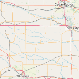

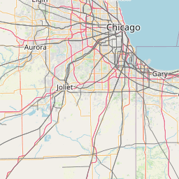
Leaflet | <a href="https://www.openstreetmap.org/copyright">© OpenStreetMap contributors</a>
Item
| Property | Value |
|---|---|
| id | 351553 |
| downstream_mainstem_id | https://geoconnex.us/ref/mainstems/324976 |
| encompassing_mainstem_basins | ['https://geoconnex.us/ref/mainstems/324976', 'https://geoconnex.us/ref/mainstems/312091'] |
| featuretype | ['https://www.opengis.net/def/schema/hy_features/hyf/HY_FlowPath', 'https://www.opengis.net/def/schema/hy_features/hyf/HY_WaterBody'] |
| fid | 11672 |
| head_2020huc12 | 070802090502 |
| head_nhdpv1_comid | 11917409 |
| head_nhdpv2_comid | https://geoconnex.us/nhdplusv2/comid/11917409 |
| head_nhdpv2huc12 | https://geoconnex.us/nhdplusv2/huc12/070802090502 |
| head_rf1id | 19128 |
| lengthkm | 127.9 |
| name_at_outlet | English River |
| name_at_outlet_gnis_id | 456379 |
| new_mainstemid | |
| outlet_2020huc12 | 070802090606 |
| outlet_drainagearea_sqkm | 1657.0 |
| outlet_nhdpv1_comid | 11919883 |
| outlet_nhdpv2_comid | https://geoconnex.us/nhdplusv2/comid/11919883 |
| outlet_nhdpv2huc12 | https://geoconnex.us/nhdplusv2/huc12/070802090606 |
| outlet_rf1id | 19120 |
| superseded | False |
| uri | https://geoconnex.us/ref/mainstems/351553 |
Graph Results
| monitoringLocation | https://sta.geoconnex.dev/collections/USGS/Things/items/'USGS-05455500' |
|---|---|
| siteName | USGS-05455500 |
| datasetDescription | Discharge cubic feet per second / USGS-05455500-29e11d9e26b44af0bac90c755c24819b |
| type | Stream |
| url | https://waterdata.usgs.gov/monitoring-location/05455500/#parameterCode=00060 |
| variableMeasured | Discharge |
| variableUnit | ft^3/s |
| measurementTechnique | observation |
| temporalCoverage | 2024-08-30T09:15:00Z/2024-09-09T18:00:00Z |
| distributionName | USGS Instantaneous Values Service |
| distributionURL | https://waterservices.usgs.gov/nwis/iv/?sites=USGS:05455500¶meterCd=00060&format=rdb |
| distributionFormat | text/tab-separated-values |
| wkt | POINT (-91.7146129287325 41.4697387242571) |
| monitoringLocation | https://sta.geoconnex.dev/collections/USGS/Things/items/'USGS-05455500' |
|---|---|
| siteName | USGS-05455500 |
| datasetDescription | Discharge cubic feet per second / USGS-05455500-29e11d9e26b44af0bac90c755c24819b |
| type | Stream |
| url | https://waterdata.usgs.gov/monitoring-location/05455500/#parameterCode=00060 |
| variableMeasured | Discharge |
| variableUnit | ft^3/s |
| measurementTechnique | observation |
| temporalCoverage | 2024-08-30T09:15:00Z/2024-09-09T18:00:00Z |
| distributionName | USGS SensorThings API |
| distributionURL | https://labs.waterdata.usgs.gov/sta/v1.1/Datastreams('29e11d9e26b44af0bac90c755c24819b')?$expand=Thing,Observations |
| distributionFormat | application/json |
| wkt | POINT (-91.7146129287325 41.4697387242571) |
| monitoringLocation | https://sta.geoconnex.dev/collections/USGS/Things/items/'USGS-05455500' |
|---|---|
| siteName | USGS-05455500 |
| datasetDescription | Gage height / USGS-05455500-56d8667b7d8348ed8c628fe292a2c5f7 |
| type | Stream |
| url | https://waterdata.usgs.gov/monitoring-location/05455500/#parameterCode=00065 |
| variableMeasured | Gage height / USGS-05455500-56d8667b7d8348ed8c628fe292a2c5f7 |
| variableUnit | ft |
| measurementTechnique | observation |
| temporalCoverage | 2024-08-30T09:15:00Z/2024-09-09T18:00:00Z |
| distributionName | USGS Instantaneous Values Service |
| distributionURL | https://waterservices.usgs.gov/nwis/iv/?sites=USGS:05455500¶meterCd=00065&format=rdb |
| distributionFormat | text/tab-separated-values |
| wkt | POINT (-91.7146129287325 41.4697387242571) |
| monitoringLocation | https://sta.geoconnex.dev/collections/USGS/Things/items/'USGS-05455500' |
|---|---|
| siteName | USGS-05455500 |
| datasetDescription | Gage height / USGS-05455500-56d8667b7d8348ed8c628fe292a2c5f7 |
| type | Stream |
| url | https://waterdata.usgs.gov/monitoring-location/05455500/#parameterCode=00065 |
| variableMeasured | Gage height / USGS-05455500-56d8667b7d8348ed8c628fe292a2c5f7 |
| variableUnit | ft |
| measurementTechnique | observation |
| temporalCoverage | 2024-08-30T09:15:00Z/2024-09-09T18:00:00Z |
| distributionName | USGS SensorThings API |
| distributionURL | https://labs.waterdata.usgs.gov/sta/v1.1/Datastreams('56d8667b7d8348ed8c628fe292a2c5f7')?$expand=Thing,Observations |
| distributionFormat | application/json |
| wkt | POINT (-91.7146129287325 41.4697387242571) |