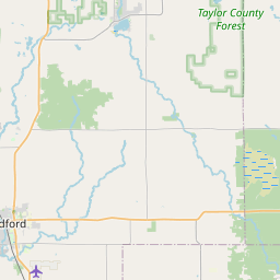
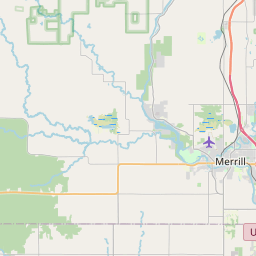
Big Rib River
Map
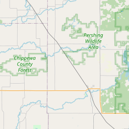
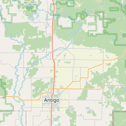
Leaflet | <a href="https://www.openstreetmap.org/copyright">© OpenStreetMap contributors</a>
Item
| Property | Value |
|---|---|
| id | 364683 |
| downstream_mainstem_id | https://geoconnex.us/ref/mainstems/323742 |
| encompassing_mainstem_basins | ['https://geoconnex.us/ref/mainstems/323742', 'https://geoconnex.us/ref/mainstems/312091'] |
| featuretype | ['https://www.opengis.net/def/schema/hy_features/hyf/HY_FlowPath', 'https://www.opengis.net/def/schema/hy_features/hyf/HY_WaterBody'] |
| fid | 11289 |
| head_2020huc12 | 070700020803 |
| head_nhdpv1_comid | 14729366 |
| head_nhdpv2_comid | https://geoconnex.us/nhdplusv2/comid/14729366 |
| head_nhdpv2huc12 | https://geoconnex.us/nhdplusv2/huc12/070700020803 |
| head_rf1id | 18568 |
| lengthkm | 97.1 |
| name_at_outlet | Big Rib River |
| name_at_outlet_gnis_id | 1561756 |
| new_mainstemid | |
| outlet_2020huc12 | 070700021003 |
| outlet_drainagearea_sqkm | 1281.9 |
| outlet_nhdpv1_comid | 14732316 |
| outlet_nhdpv2_comid | https://geoconnex.us/nhdplusv2/comid/14732316 |
| outlet_nhdpv2huc12 | https://geoconnex.us/nhdplusv2/huc12/070700021003 |
| outlet_rf1id | 18557 |
| superseded | False |
| uri | https://geoconnex.us/ref/mainstems/364683 |
Graph Results
| monitoringLocation | https://sta.geoconnex.dev/collections/USGS/Things/items/'USGS-05396000' |
|---|---|
| siteName | USGS-05396000 |
| datasetDescription | Stream water level elevation above NAVD 1988 in feet / USGS-05396000-1f83f6770b1a4afd96be9422ba746e6d |
| type | Stream |
| url | https://waterdata.usgs.gov/monitoring-location/05396000/#parameterCode=63160 |
| variableMeasured | Stream water level elevation above NAVD 1988 |
| variableUnit | ft |
| measurementTechnique | observation |
| temporalCoverage | 2024-08-30T09:15:00Z/2024-09-09T18:00:00Z |
| distributionName | USGS Instantaneous Values Service |
| distributionURL | https://waterservices.usgs.gov/nwis/iv/?sites=USGS:05396000¶meterCd=63160&format=rdb |
| distributionFormat | text/tab-separated-values |
| wkt | POINT (-89.9052777777778 44.9725) |
| monitoringLocation | https://sta.geoconnex.dev/collections/USGS/Things/items/'USGS-05396000' |
|---|---|
| siteName | USGS-05396000 |
| datasetDescription | Stream water level elevation above NAVD 1988 in feet / USGS-05396000-1f83f6770b1a4afd96be9422ba746e6d |
| type | Stream |
| url | https://waterdata.usgs.gov/monitoring-location/05396000/#parameterCode=63160 |
| variableMeasured | Stream water level elevation above NAVD 1988 |
| variableUnit | ft |
| measurementTechnique | observation |
| temporalCoverage | 2024-08-30T09:15:00Z/2024-09-09T18:00:00Z |
| distributionName | USGS SensorThings API |
| distributionURL | https://labs.waterdata.usgs.gov/sta/v1.1/Datastreams('1f83f6770b1a4afd96be9422ba746e6d')?$expand=Thing,Observations |
| distributionFormat | application/json |
| wkt | POINT (-89.9052777777778 44.9725) |
| monitoringLocation | https://sta.geoconnex.dev/collections/USGS/Things/items/'USGS-05396000' |
|---|---|
| siteName | USGS-05396000 |
| datasetDescription | Discharge / USGS-05396000-63eaa5264c4d43aa8ead8c7b5dd3661c |
| type | Stream |
| url | https://waterdata.usgs.gov/monitoring-location/05396000/#parameterCode=00060 |
| variableMeasured | Discharge / USGS-05396000-63eaa5264c4d43aa8ead8c7b5dd3661c |
| variableUnit | ft^3/s |
| measurementTechnique | observation |
| temporalCoverage | 2024-08-30T09:15:00Z/2024-09-09T18:00:00Z |
| distributionName | USGS Instantaneous Values Service |
| distributionURL | https://waterservices.usgs.gov/nwis/iv/?sites=USGS:05396000¶meterCd=00060&format=rdb |
| distributionFormat | text/tab-separated-values |
| wkt | POINT (-89.9052777777778 44.9725) |
| monitoringLocation | https://sta.geoconnex.dev/collections/USGS/Things/items/'USGS-05396000' |
|---|---|
| siteName | USGS-05396000 |
| datasetDescription | Discharge / USGS-05396000-63eaa5264c4d43aa8ead8c7b5dd3661c |
| type | Stream |
| url | https://waterdata.usgs.gov/monitoring-location/05396000/#parameterCode=00060 |
| variableMeasured | Discharge / USGS-05396000-63eaa5264c4d43aa8ead8c7b5dd3661c |
| variableUnit | ft^3/s |
| measurementTechnique | observation |
| temporalCoverage | 2024-08-30T09:15:00Z/2024-09-09T18:00:00Z |
| distributionName | USGS SensorThings API |
| distributionURL | https://labs.waterdata.usgs.gov/sta/v1.1/Datastreams('63eaa5264c4d43aa8ead8c7b5dd3661c')?$expand=Thing,Observations |
| distributionFormat | application/json |
| wkt | POINT (-89.9052777777778 44.9725) |
| monitoringLocation | https://sta.geoconnex.dev/collections/USGS/Things/items/'USGS-05396000' |
|---|---|
| siteName | USGS-05396000 |
| datasetDescription | Gage height / USGS-05396000-7e7826715d634f7996d5f8b8973e2582 |
| type | Stream |
| url | https://waterdata.usgs.gov/monitoring-location/05396000/#parameterCode=00065 |
| variableMeasured | Gage height / USGS-05396000-7e7826715d634f7996d5f8b8973e2582 |
| variableUnit | ft |
| measurementTechnique | observation |
| temporalCoverage | 2024-08-30T09:15:00Z/2024-09-09T18:00:00Z |
| distributionName | USGS Instantaneous Values Service |
| distributionURL | https://waterservices.usgs.gov/nwis/iv/?sites=USGS:05396000¶meterCd=00065&format=rdb |
| distributionFormat | text/tab-separated-values |
| wkt | POINT (-89.9052777777778 44.9725) |
| monitoringLocation | https://sta.geoconnex.dev/collections/USGS/Things/items/'USGS-05396000' |
|---|---|
| siteName | USGS-05396000 |
| datasetDescription | Gage height / USGS-05396000-7e7826715d634f7996d5f8b8973e2582 |
| type | Stream |
| url | https://waterdata.usgs.gov/monitoring-location/05396000/#parameterCode=00065 |
| variableMeasured | Gage height / USGS-05396000-7e7826715d634f7996d5f8b8973e2582 |
| variableUnit | ft |
| measurementTechnique | observation |
| temporalCoverage | 2024-08-30T09:15:00Z/2024-09-09T18:00:00Z |
| distributionName | USGS SensorThings API |
| distributionURL | https://labs.waterdata.usgs.gov/sta/v1.1/Datastreams('7e7826715d634f7996d5f8b8973e2582')?$expand=Thing,Observations |
| distributionFormat | application/json |
| wkt | POINT (-89.9052777777778 44.9725) |