Hughes River
Map
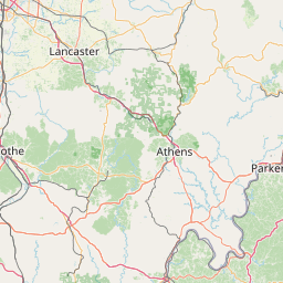
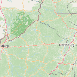
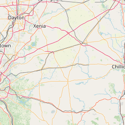
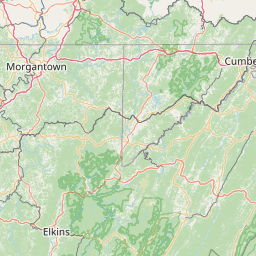
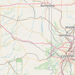
Leaflet | <a href="https://www.openstreetmap.org/copyright">© OpenStreetMap contributors</a>
Item
| Property | Value |
|---|---|
| id | 374519 |
| downstream_mainstem_id | https://geoconnex.us/ref/mainstems/345565 |
| encompassing_mainstem_basins | ['https://geoconnex.us/ref/mainstems/345565', 'https://geoconnex.us/ref/mainstems/314849', 'https://geoconnex.us/ref/mainstems/312091'] |
| featuretype | ['https://www.opengis.net/def/schema/hy_features/hyf/HY_FlowPath', 'https://www.opengis.net/def/schema/hy_features/hyf/HY_WaterBody'] |
| fid | 7977 |
| head_2020huc12 | 050302031002 |
| head_nhdpv1_comid | 19413557 |
| head_nhdpv2_comid | https://geoconnex.us/nhdplusv2/comid/19413557 |
| head_nhdpv2huc12 | https://geoconnex.us/nhdplusv2/huc12/050302031002 |
| head_rf1id | 12638 |
| lengthkm | 112.4 |
| name_at_outlet | Hughes River |
| name_at_outlet_gnis_id | 1540572 |
| new_mainstemid | |
| outlet_2020huc12 | 050302031103 |
| outlet_drainagearea_sqkm | 1369.5 |
| outlet_nhdpv1_comid | 19425033 |
| outlet_nhdpv2_comid | https://geoconnex.us/nhdplusv2/comid/19425033 |
| outlet_nhdpv2huc12 | https://geoconnex.us/nhdplusv2/huc12/050302031103 |
| outlet_rf1id | 12626 |
| superseded | False |
| uri | https://geoconnex.us/ref/mainstems/374519 |
Graph Results
| monitoringLocation | https://sta.geoconnex.dev/collections/USGS/Things/items/'USGS-03155220' |
|---|---|
| siteName | USGS-03155220 |
| datasetDescription | Gage height / USGS-03155220-a7562cff8ef74cb8ac0386e77350b9e7 |
| type | Stream |
| url | https://waterdata.usgs.gov/monitoring-location/03155220/#parameterCode=00065 |
| variableMeasured | Gage height / USGS-03155220-a7562cff8ef74cb8ac0386e77350b9e7 |
| variableUnit | ft |
| measurementTechnique | observation |
| temporalCoverage | 2024-08-30T09:15:00Z/2024-09-09T18:15:00Z |
| distributionName | USGS Instantaneous Values Service |
| distributionURL | https://waterservices.usgs.gov/nwis/iv/?sites=USGS:03155220¶meterCd=00065&format=rdb |
| distributionFormat | text/tab-separated-values |
| wkt | POINT (-81.2123373399011 39.0789690510255) |
| monitoringLocation | https://sta.geoconnex.dev/collections/USGS/Things/items/'USGS-03155220' |
|---|---|
| siteName | USGS-03155220 |
| datasetDescription | Gage height / USGS-03155220-a7562cff8ef74cb8ac0386e77350b9e7 |
| type | Stream |
| url | https://waterdata.usgs.gov/monitoring-location/03155220/#parameterCode=00065 |
| variableMeasured | Gage height / USGS-03155220-a7562cff8ef74cb8ac0386e77350b9e7 |
| variableUnit | ft |
| measurementTechnique | observation |
| temporalCoverage | 2024-08-30T09:15:00Z/2024-09-09T18:15:00Z |
| distributionName | USGS SensorThings API |
| distributionURL | https://labs.waterdata.usgs.gov/sta/v1.1/Datastreams('a7562cff8ef74cb8ac0386e77350b9e7')?$expand=Thing,Observations |
| distributionFormat | application/json |
| wkt | POINT (-81.2123373399011 39.0789690510255) |
| monitoringLocation | https://sta.geoconnex.dev/collections/USGS/Things/items/'USGS-03155220' |
|---|---|
| siteName | USGS-03155220 |
| datasetDescription | Discharge / USGS-03155220-c1cd842d00f14f748256dba162bc8b0d |
| type | Stream |
| url | https://waterdata.usgs.gov/monitoring-location/03155220/#parameterCode=00060 |
| variableMeasured | Discharge / USGS-03155220-c1cd842d00f14f748256dba162bc8b0d |
| variableUnit | ft^3/s |
| measurementTechnique | observation |
| temporalCoverage | 2024-08-30T09:15:00Z/2024-09-09T18:15:00Z |
| distributionName | USGS SensorThings API |
| distributionURL | https://labs.waterdata.usgs.gov/sta/v1.1/Datastreams('c1cd842d00f14f748256dba162bc8b0d')?$expand=Thing,Observations |
| distributionFormat | application/json |
| wkt | POINT (-81.2123373399011 39.0789690510255) |
| monitoringLocation | https://sta.geoconnex.dev/collections/USGS/Things/items/'USGS-03155220' |
|---|---|
| siteName | USGS-03155220 |
| datasetDescription | Discharge / USGS-03155220-c1cd842d00f14f748256dba162bc8b0d |
| type | Stream |
| url | https://waterdata.usgs.gov/monitoring-location/03155220/#parameterCode=00060 |
| variableMeasured | Discharge / USGS-03155220-c1cd842d00f14f748256dba162bc8b0d |
| variableUnit | ft^3/s |
| measurementTechnique | observation |
| temporalCoverage | 2024-08-30T09:15:00Z/2024-09-09T18:15:00Z |
| distributionName | USGS Instantaneous Values Service |
| distributionURL | https://waterservices.usgs.gov/nwis/iv/?sites=USGS:03155220¶meterCd=00060&format=rdb |
| distributionFormat | text/tab-separated-values |
| wkt | POINT (-81.2123373399011 39.0789690510255) |