South Fork Flambeau River
Map

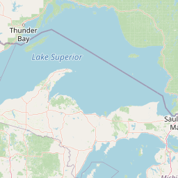


Leaflet | <a href="https://www.openstreetmap.org/copyright">© OpenStreetMap contributors</a>
Item
| Property | Value |
|---|---|
| id | 377750 |
| downstream_mainstem_id | https://geoconnex.us/ref/mainstems/348803 |
| encompassing_mainstem_basins | ['https://geoconnex.us/ref/mainstems/348803', 'https://geoconnex.us/ref/mainstems/333963', 'https://geoconnex.us/ref/mainstems/312091'] |
| featuretype | ['https://www.opengis.net/def/schema/hy_features/hyf/HY_FlowPath', 'https://www.opengis.net/def/schema/hy_features/hyf/HY_WaterBody'] |
| fid | 11011 |
| head_2020huc12 | 070500030202 |
| head_nhdpv1_comid | 12992595 |
| head_nhdpv2_comid | https://geoconnex.us/nhdplusv2/comid/12992595 |
| head_nhdpv2huc12 | https://geoconnex.us/nhdplusv2/huc12/070500030202 |
| head_rf1id | 20490 |
| lengthkm | 132.3 |
| name_at_outlet | South Fork Flambeau River |
| name_at_outlet_gnis_id | 1580457 |
| new_mainstemid | |
| outlet_2020huc12 | 070500030304 |
| outlet_drainagearea_sqkm | 1915.1 |
| outlet_nhdpv1_comid | 12993001 |
| outlet_nhdpv2_comid | https://geoconnex.us/nhdplusv2/comid/12993001 |
| outlet_nhdpv2huc12 | https://geoconnex.us/nhdplusv2/huc12/070500030304 |
| outlet_rf1id | 18219 |
| superseded | False |
| uri | https://geoconnex.us/ref/mainstems/377750 |
Graph Results
| monitoringLocation | https://sta.geoconnex.dev/collections/USGS/Things/items/'USGS-05359500' |
|---|---|
| siteName | USGS-05359500 |
| datasetDescription | Discharge cubic feet per second / USGS-05359500-7f6d106d91b245e58c5415f46e8a7ade |
| type | Stream |
| url | https://waterdata.usgs.gov/monitoring-location/05359500/#parameterCode=00060 |
| variableMeasured | Discharge |
| variableUnit | ft^3/s |
| measurementTechnique | observation |
| temporalCoverage | 2024-08-30T09:15:00Z/2024-09-09T17:45:00Z |
| distributionName | USGS Instantaneous Values Service |
| distributionURL | https://waterservices.usgs.gov/nwis/iv/?sites=USGS:05359500¶meterCd=00060&format=rdb |
| distributionFormat | text/tab-separated-values |
| wkt | POINT (-90.6155555555555 45.7033333333333) |
| monitoringLocation | https://sta.geoconnex.dev/collections/USGS/Things/items/'USGS-05359500' |
|---|---|
| siteName | USGS-05359500 |
| datasetDescription | Discharge cubic feet per second / USGS-05359500-7f6d106d91b245e58c5415f46e8a7ade |
| type | Stream |
| url | https://waterdata.usgs.gov/monitoring-location/05359500/#parameterCode=00060 |
| variableMeasured | Discharge |
| variableUnit | ft^3/s |
| measurementTechnique | observation |
| temporalCoverage | 2024-08-30T09:15:00Z/2024-09-09T17:45:00Z |
| distributionName | USGS SensorThings API |
| distributionURL | https://labs.waterdata.usgs.gov/sta/v1.1/Datastreams('7f6d106d91b245e58c5415f46e8a7ade')?$expand=Thing,Observations |
| distributionFormat | application/json |
| wkt | POINT (-90.6155555555555 45.7033333333333) |
| monitoringLocation | https://sta.geoconnex.dev/collections/USGS/Things/items/'USGS-05359500' |
|---|---|
| siteName | USGS-05359500 |
| datasetDescription | Stream water level elevation above NAVD 1988 in feet / USGS-05359500-f300afde5e2b4a3386c882a2786973f1 |
| type | Stream |
| url | https://waterdata.usgs.gov/monitoring-location/05359500/#parameterCode=63160 |
| variableMeasured | Stream water level elevation above NAVD 1988 |
| variableUnit | ft |
| measurementTechnique | observation |
| temporalCoverage | 2024-08-30T09:15:00Z/2024-09-09T17:45:00Z |
| distributionName | USGS Instantaneous Values Service |
| distributionURL | https://waterservices.usgs.gov/nwis/iv/?sites=USGS:05359500¶meterCd=63160&format=rdb |
| distributionFormat | text/tab-separated-values |
| wkt | POINT (-90.6155555555555 45.7033333333333) |
| monitoringLocation | https://sta.geoconnex.dev/collections/USGS/Things/items/'USGS-05359500' |
|---|---|
| siteName | USGS-05359500 |
| datasetDescription | Stream water level elevation above NAVD 1988 in feet / USGS-05359500-f300afde5e2b4a3386c882a2786973f1 |
| type | Stream |
| url | https://waterdata.usgs.gov/monitoring-location/05359500/#parameterCode=63160 |
| variableMeasured | Stream water level elevation above NAVD 1988 |
| variableUnit | ft |
| measurementTechnique | observation |
| temporalCoverage | 2024-08-30T09:15:00Z/2024-09-09T17:45:00Z |
| distributionName | USGS SensorThings API |
| distributionURL | https://labs.waterdata.usgs.gov/sta/v1.1/Datastreams('f300afde5e2b4a3386c882a2786973f1')?$expand=Thing,Observations |
| distributionFormat | application/json |
| wkt | POINT (-90.6155555555555 45.7033333333333) |
| monitoringLocation | https://sta.geoconnex.dev/collections/USGS/Things/items/'USGS-05359500' |
|---|---|
| siteName | USGS-05359500 |
| datasetDescription | Gage height feet / USGS-05359500-c151c7217a564a32aaff0f6753d5d5fa |
| type | Stream |
| url | https://waterdata.usgs.gov/monitoring-location/05359500/#parameterCode=00065 |
| variableMeasured | Gage height |
| variableUnit | ft |
| measurementTechnique | observation |
| temporalCoverage | 2024-08-30T09:15:00Z/2024-09-09T17:45:00Z |
| distributionName | USGS Instantaneous Values Service |
| distributionURL | https://waterservices.usgs.gov/nwis/iv/?sites=USGS:05359500¶meterCd=00065&format=rdb |
| distributionFormat | text/tab-separated-values |
| wkt | POINT (-90.6155555555555 45.7033333333333) |
| monitoringLocation | https://sta.geoconnex.dev/collections/USGS/Things/items/'USGS-05359500' |
|---|---|
| siteName | USGS-05359500 |
| datasetDescription | Gage height feet / USGS-05359500-c151c7217a564a32aaff0f6753d5d5fa |
| type | Stream |
| url | https://waterdata.usgs.gov/monitoring-location/05359500/#parameterCode=00065 |
| variableMeasured | Gage height |
| variableUnit | ft |
| measurementTechnique | observation |
| temporalCoverage | 2024-08-30T09:15:00Z/2024-09-09T17:45:00Z |
| distributionName | USGS SensorThings API |
| distributionURL | https://labs.waterdata.usgs.gov/sta/v1.1/Datastreams('c151c7217a564a32aaff0f6753d5d5fa')?$expand=Thing,Observations |
| distributionFormat | application/json |
| wkt | POINT (-90.6155555555555 45.7033333333333) |