Black Horse Butte Creek
Map
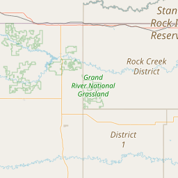
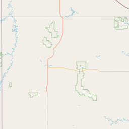
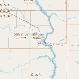
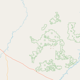
Leaflet | <a href="https://www.openstreetmap.org/copyright">© OpenStreetMap contributors</a>
Item
| Property | Value |
|---|---|
| id | 378066 |
| downstream_mainstem_id | https://geoconnex.us/ref/mainstems/333604 |
| encompassing_mainstem_basins | ['https://geoconnex.us/ref/mainstems/333604', 'https://geoconnex.us/ref/mainstems/312532', 'https://geoconnex.us/ref/mainstems/312091'] |
| featuretype | ['https://www.opengis.net/def/schema/hy_features/hyf/HY_FlowPath', 'https://www.opengis.net/def/schema/hy_features/hyf/HY_WaterBody'] |
| fid | 17040 |
| head_2020huc12 | 101303030501 |
| head_nhdpv1_comid | 21829227 |
| head_nhdpv2_comid | https://geoconnex.us/nhdplusv2/comid/21829227 |
| head_nhdpv2huc12 | https://geoconnex.us/nhdplusv2/huc12/101303030501 |
| head_rf1id | 26820 |
| lengthkm | 98.7 |
| name_at_outlet | Black Horse Butte Creek |
| name_at_outlet_gnis_id | 1261287 |
| new_mainstemid | |
| outlet_2020huc12 | 101303030606 |
| outlet_drainagearea_sqkm | 804.3 |
| outlet_nhdpv1_comid | 21831713 |
| outlet_nhdpv2_comid | https://geoconnex.us/nhdplusv2/comid/21831713 |
| outlet_nhdpv2huc12 | https://geoconnex.us/nhdplusv2/huc12/101303030606 |
| outlet_rf1id | 26818 |
| superseded | False |
| uri | https://geoconnex.us/ref/mainstems/378066 |
Graph Results
| monitoringLocation | https://geoconnex.us/iow/wqp/SRSTEPA-SW-GR-2016-01 |
|---|---|
| siteName | SRSTEPA-SW-GR-2016-01 |
| datasetDescription | Temperature, air at SRSTEPA-SW-GR-2016-01 |
| type | River/Stream |
| url | https://www.waterqualitydata.us/provider/STORET/SRSTEPA/SRSTEPA-SW-GR-2016-01/ |
| variableMeasured | Temperature, air |
| variableUnit | degrees Celsius |
| measurementTechnique | observation |
| temporalCoverage | 2016-01-01T00:00:00Z/2016-12-31T00:00:00Z |
| distributionName | Water Quality Portal |
| distributionURL | https://www.waterqualitydata.us/data/Result/search?siteid=SRSTEPA-SW-GR-2016-01&CharacteristicName=Temperature, air&mimeType=csv |
| distributionFormat | text/comma-separated-values |
| wkt | POINT (-101.882239 45.54504) |
| monitoringLocation | https://geoconnex.us/iow/wqp/SRSTEPA-SW-GR-2016-01 |
|---|---|
| siteName | SRSTEPA-SW-GR-2016-01 |
| datasetDescription | Sulfate at SRSTEPA-SW-GR-2016-01 |
| type | River/Stream |
| url | https://www.waterqualitydata.us/provider/STORET/SRSTEPA/SRSTEPA-SW-GR-2016-01/ |
| variableMeasured | Sulfate |
| variableUnit | milligrams per liter |
| measurementTechnique | observation |
| temporalCoverage | 2016-01-01T00:00:00Z/2016-12-31T00:00:00Z |
| distributionName | Water Quality Portal |
| distributionURL | https://www.waterqualitydata.us/data/Result/search?siteid=SRSTEPA-SW-GR-2016-01&CharacteristicName=Sulfate&mimeType=csv |
| distributionFormat | text/comma-separated-values |
| wkt | POINT (-101.882239 45.54504) |
| monitoringLocation | https://geoconnex.us/iow/wqp/SRSTEPA-SW-GR-2016-01 |
|---|---|
| siteName | SRSTEPA-SW-GR-2016-01 |
| datasetDescription | Turbidity at SRSTEPA-SW-GR-2016-01 |
| type | River/Stream |
| url | https://www.waterqualitydata.us/provider/STORET/SRSTEPA/SRSTEPA-SW-GR-2016-01/ |
| variableMeasured | Turbidity |
| variableUnit | Jackson turbidity units |
| measurementTechnique | observation |
| temporalCoverage | 2016-01-01T00:00:00Z/2021-12-31T00:00:00Z |
| distributionName | Water Quality Portal |
| distributionURL | https://www.waterqualitydata.us/data/Result/search?siteid=SRSTEPA-SW-GR-2016-01&CharacteristicName=Turbidity&mimeType=csv |
| distributionFormat | text/comma-separated-values |
| wkt | POINT (-101.882239 45.54504) |
| monitoringLocation | https://geoconnex.us/iow/wqp/SRSTEPA-SW-GR-2016-01 |
|---|---|
| siteName | SRSTEPA-SW-GR-2016-01 |
| datasetDescription | Hydroxide at SRSTEPA-SW-GR-2016-01 |
| type | River/Stream |
| url | https://www.waterqualitydata.us/provider/STORET/SRSTEPA/SRSTEPA-SW-GR-2016-01/ |
| variableMeasured | Hydroxide |
| variableUnit | milligrams per liter |
| measurementTechnique | observation |
| temporalCoverage | 2016-01-01T00:00:00Z/2016-12-31T00:00:00Z |
| distributionName | Water Quality Portal |
| distributionURL | https://www.waterqualitydata.us/data/Result/search?siteid=SRSTEPA-SW-GR-2016-01&CharacteristicName=Hydroxide&mimeType=csv |
| distributionFormat | text/comma-separated-values |
| wkt | POINT (-101.882239 45.54504) |
| monitoringLocation | https://geoconnex.us/iow/wqp/SRSTEPA-SW-GR-2016-01 |
|---|---|
| siteName | SRSTEPA-SW-GR-2016-01 |
| datasetDescription | Chloride at SRSTEPA-SW-GR-2016-01 |
| type | River/Stream |
| url | https://www.waterqualitydata.us/provider/STORET/SRSTEPA/SRSTEPA-SW-GR-2016-01/ |
| variableMeasured | Chloride |
| variableUnit | milligrams per liter |
| measurementTechnique | observation |
| temporalCoverage | 2016-01-01T00:00:00Z/2016-12-31T00:00:00Z |
| distributionName | Water Quality Portal |
| distributionURL | https://www.waterqualitydata.us/data/Result/search?siteid=SRSTEPA-SW-GR-2016-01&CharacteristicName=Chloride&mimeType=csv |
| distributionFormat | text/comma-separated-values |
| wkt | POINT (-101.882239 45.54504) |
| monitoringLocation | https://geoconnex.us/iow/wqp/SRSTEPA-SW-GR-2016-01 |
|---|---|
| siteName | SRSTEPA-SW-GR-2016-01 |
| datasetDescription | Depth at SRSTEPA-SW-GR-2016-01 |
| type | River/Stream |
| url | https://www.waterqualitydata.us/provider/STORET/SRSTEPA/SRSTEPA-SW-GR-2016-01/ |
| variableMeasured | Depth |
| variableUnit | feet |
| measurementTechnique | observation |
| temporalCoverage | 2016-01-01T00:00:00Z/2016-12-31T00:00:00Z |
| distributionName | Water Quality Portal |
| distributionURL | https://www.waterqualitydata.us/data/Result/search?siteid=SRSTEPA-SW-GR-2016-01&CharacteristicName=Depth&mimeType=csv |
| distributionFormat | text/comma-separated-values |
| wkt | POINT (-101.882239 45.54504) |
| monitoringLocation | https://geoconnex.us/iow/wqp/SRSTEPA-SW-GR-2016-01 |
|---|---|
| siteName | SRSTEPA-SW-GR-2016-01 |
| datasetDescription | Density at SRSTEPA-SW-GR-2016-01 |
| type | River/Stream |
| url | https://www.waterqualitydata.us/provider/STORET/SRSTEPA/SRSTEPA-SW-GR-2016-01/ |
| variableMeasured | Density |
| variableUnit | number per square foot |
| measurementTechnique | observation |
| temporalCoverage | 2020-01-01T00:00:00Z/2021-12-31T00:00:00Z |
| distributionName | Water Quality Portal |
| distributionURL | https://www.waterqualitydata.us/data/Result/search?siteid=SRSTEPA-SW-GR-2016-01&CharacteristicName=Density&mimeType=csv |
| distributionFormat | text/comma-separated-values |
| wkt | POINT (-101.882239 45.54504) |
| monitoringLocation | https://geoconnex.us/iow/wqp/SRSTEPA-SW-GR-2016-01 |
|---|---|
| siteName | SRSTEPA-SW-GR-2016-01 |
| datasetDescription | Specific conductance at SRSTEPA-SW-GR-2016-01 |
| type | River/Stream |
| url | https://www.waterqualitydata.us/provider/STORET/SRSTEPA/SRSTEPA-SW-GR-2016-01/ |
| variableMeasured | Specific conductance |
| variableUnit | microsiemens per centimeter |
| measurementTechnique | observation |
| temporalCoverage | 2016-01-01T00:00:00Z/2021-12-31T00:00:00Z |
| distributionName | Water Quality Portal |
| distributionURL | https://www.waterqualitydata.us/data/Result/search?siteid=SRSTEPA-SW-GR-2016-01&CharacteristicName=Specific conductance&mimeType=csv |
| distributionFormat | text/comma-separated-values |
| wkt | POINT (-101.882239 45.54504) |
| monitoringLocation | https://geoconnex.us/iow/wqp/SRSTEPA-SW-GR-2016-01 |
|---|---|
| siteName | SRSTEPA-SW-GR-2016-01 |
| datasetDescription | Total hardness at SRSTEPA-SW-GR-2016-01 |
| type | River/Stream |
| url | https://www.waterqualitydata.us/provider/STORET/SRSTEPA/SRSTEPA-SW-GR-2016-01/ |
| variableMeasured | Total hardness |
| variableUnit | milligrams per liter |
| measurementTechnique | observation |
| temporalCoverage | 2016-01-01T00:00:00Z/2019-12-31T00:00:00Z |
| distributionName | Water Quality Portal |
| distributionURL | https://www.waterqualitydata.us/data/Result/search?siteid=SRSTEPA-SW-GR-2016-01&CharacteristicName=Total hardness&mimeType=csv |
| distributionFormat | text/comma-separated-values |
| wkt | POINT (-101.882239 45.54504) |
| monitoringLocation | https://geoconnex.us/iow/wqp/SRSTEPA-SW-GR-2016-01 |
|---|---|
| siteName | SRSTEPA-SW-GR-2016-01 |
| datasetDescription | Potassium at SRSTEPA-SW-GR-2016-01 |
| type | River/Stream |
| url | https://www.waterqualitydata.us/provider/STORET/SRSTEPA/SRSTEPA-SW-GR-2016-01/ |
| variableMeasured | Potassium |
| variableUnit | milligrams per liter |
| measurementTechnique | observation |
| temporalCoverage | 2016-01-01T00:00:00Z/2019-12-31T00:00:00Z |
| distributionName | Water Quality Portal |
| distributionURL | https://www.waterqualitydata.us/data/Result/search?siteid=SRSTEPA-SW-GR-2016-01&CharacteristicName=Potassium&mimeType=csv |
| distributionFormat | text/comma-separated-values |
| wkt | POINT (-101.882239 45.54504) |
| monitoringLocation | https://geoconnex.us/iow/wqp/SRSTEPA-SW-GR-2016-01 |
|---|---|
| siteName | SRSTEPA-SW-GR-2016-01 |
| datasetDescription | Total suspended solids at SRSTEPA-SW-GR-2016-01 |
| type | River/Stream |
| url | https://www.waterqualitydata.us/provider/STORET/SRSTEPA/SRSTEPA-SW-GR-2016-01/ |
| variableMeasured | Total suspended solids |
| variableUnit | milligrams per liter |
| measurementTechnique | observation |
| temporalCoverage | 2016-01-01T00:00:00Z/2016-12-31T00:00:00Z |
| distributionName | Water Quality Portal |
| distributionURL | https://www.waterqualitydata.us/data/Result/search?siteid=SRSTEPA-SW-GR-2016-01&CharacteristicName=Total suspended solids&mimeType=csv |
| distributionFormat | text/comma-separated-values |
| wkt | POINT (-101.882239 45.54504) |
| monitoringLocation | https://geoconnex.us/iow/wqp/SRSTEPA-SW-GR-2016-01 |
|---|---|
| siteName | SRSTEPA-SW-GR-2016-01 |
| datasetDescription | Escherichia coli at SRSTEPA-SW-GR-2016-01 |
| type | River/Stream |
| url | https://www.waterqualitydata.us/provider/STORET/SRSTEPA/SRSTEPA-SW-GR-2016-01/ |
| variableMeasured | Escherichia coli |
| variableUnit | number per 100 milliliters |
| measurementTechnique | observation |
| temporalCoverage | 2016-01-01T00:00:00Z/2020-12-31T00:00:00Z |
| distributionName | Water Quality Portal |
| distributionURL | https://www.waterqualitydata.us/data/Result/search?siteid=SRSTEPA-SW-GR-2016-01&CharacteristicName=Escherichia coli&mimeType=csv |
| distributionFormat | text/comma-separated-values |
| wkt | POINT (-101.882239 45.54504) |
| monitoringLocation | https://geoconnex.us/iow/wqp/SRSTEPA-SW-GR-2016-01 |
|---|---|
| siteName | SRSTEPA-SW-GR-2016-01 |
| datasetDescription | Sum of cations at SRSTEPA-SW-GR-2016-01 |
| type | River/Stream |
| url | https://www.waterqualitydata.us/provider/STORET/SRSTEPA/SRSTEPA-SW-GR-2016-01/ |
| variableMeasured | Sum of cations |
| variableUnit | milligrams per liter |
| measurementTechnique | observation |
| temporalCoverage | 2016-01-01T00:00:00Z/2019-12-31T00:00:00Z |
| distributionName | Water Quality Portal |
| distributionURL | https://www.waterqualitydata.us/data/Result/search?siteid=SRSTEPA-SW-GR-2016-01&CharacteristicName=Sum of cations&mimeType=csv |
| distributionFormat | text/comma-separated-values |
| wkt | POINT (-101.882239 45.54504) |
| monitoringLocation | https://geoconnex.us/iow/wqp/SRSTEPA-SW-GR-2016-01 |
|---|---|
| siteName | SRSTEPA-SW-GR-2016-01 |
| datasetDescription | Ammonia at SRSTEPA-SW-GR-2016-01 |
| type | River/Stream |
| url | https://www.waterqualitydata.us/provider/STORET/SRSTEPA/SRSTEPA-SW-GR-2016-01/ |
| variableMeasured | Ammonia |
| variableUnit | milligrams per liter |
| measurementTechnique | observation |
| temporalCoverage | 2016-01-01T00:00:00Z/2016-12-31T00:00:00Z |
| distributionName | Water Quality Portal |
| distributionURL | https://www.waterqualitydata.us/data/Result/search?siteid=SRSTEPA-SW-GR-2016-01&CharacteristicName=Ammonia&mimeType=csv |
| distributionFormat | text/comma-separated-values |
| wkt | POINT (-101.882239 45.54504) |
| monitoringLocation | https://geoconnex.us/iow/wqp/SRSTEPA-SW-GR-2016-01 |
|---|---|
| siteName | SRSTEPA-SW-GR-2016-01 |
| datasetDescription | pH at SRSTEPA-SW-GR-2016-01 |
| type | River/Stream |
| url | https://www.waterqualitydata.us/provider/STORET/SRSTEPA/SRSTEPA-SW-GR-2016-01/ |
| variableMeasured | pH |
| variableUnit | Unknown |
| measurementTechnique | observation |
| temporalCoverage | 2016-01-01T00:00:00Z/2021-12-31T00:00:00Z |
| distributionName | Water Quality Portal |
| distributionURL | https://www.waterqualitydata.us/data/Result/search?siteid=SRSTEPA-SW-GR-2016-01&CharacteristicName=pH&mimeType=csv |
| distributionFormat | text/comma-separated-values |
| wkt | POINT (-101.882239 45.54504) |
| monitoringLocation | https://geoconnex.us/iow/wqp/SRSTEPA-SW-GR-2016-01 |
|---|---|
| siteName | SRSTEPA-SW-GR-2016-01 |
| datasetDescription | Dissolved oxygen saturation at SRSTEPA-SW-GR-2016-01 |
| type | River/Stream |
| url | https://www.waterqualitydata.us/provider/STORET/SRSTEPA/SRSTEPA-SW-GR-2016-01/ |
| variableMeasured | Dissolved oxygen saturation |
| variableUnit | percent |
| measurementTechnique | observation |
| temporalCoverage | 2016-01-01T00:00:00Z/2021-12-31T00:00:00Z |
| distributionName | Water Quality Portal |
| distributionURL | https://www.waterqualitydata.us/data/Result/search?siteid=SRSTEPA-SW-GR-2016-01&CharacteristicName=Dissolved oxygen saturation&mimeType=csv |
| distributionFormat | text/comma-separated-values |
| wkt | POINT (-101.882239 45.54504) |
| monitoringLocation | https://geoconnex.us/iow/wqp/SRSTEPA-SW-GR-2016-01 |
|---|---|
| siteName | SRSTEPA-SW-GR-2016-01 |
| datasetDescription | Temperature, water at SRSTEPA-SW-GR-2016-01 |
| type | River/Stream |
| url | https://www.waterqualitydata.us/provider/STORET/SRSTEPA/SRSTEPA-SW-GR-2016-01/ |
| variableMeasured | Temperature, water |
| variableUnit | degrees Celsius |
| measurementTechnique | observation |
| temporalCoverage | 2016-01-01T00:00:00Z/2021-12-31T00:00:00Z |
| distributionName | Water Quality Portal |
| distributionURL | https://www.waterqualitydata.us/data/Result/search?siteid=SRSTEPA-SW-GR-2016-01&CharacteristicName=Temperature, water&mimeType=csv |
| distributionFormat | text/comma-separated-values |
| wkt | POINT (-101.882239 45.54504) |
| monitoringLocation | https://geoconnex.us/iow/wqp/SRSTEPA-SW-GR-2016-01 |
|---|---|
| siteName | SRSTEPA-SW-GR-2016-01 |
| datasetDescription | Lead at SRSTEPA-SW-GR-2016-01 |
| type | River/Stream |
| url | https://www.waterqualitydata.us/provider/STORET/SRSTEPA/SRSTEPA-SW-GR-2016-01/ |
| variableMeasured | Lead |
| variableUnit | micrograms per liter |
| measurementTechnique | observation |
| temporalCoverage | 2016-01-01T00:00:00Z/2020-12-31T00:00:00Z |
| distributionName | Water Quality Portal |
| distributionURL | https://www.waterqualitydata.us/data/Result/search?siteid=SRSTEPA-SW-GR-2016-01&CharacteristicName=Lead&mimeType=csv |
| distributionFormat | text/comma-separated-values |
| wkt | POINT (-101.882239 45.54504) |
| monitoringLocation | https://geoconnex.us/iow/wqp/SRSTEPA-SW-GR-2016-01 |
|---|---|
| siteName | SRSTEPA-SW-GR-2016-01 |
| datasetDescription | Salinity at SRSTEPA-SW-GR-2016-01 |
| type | River/Stream |
| url | https://www.waterqualitydata.us/provider/STORET/SRSTEPA/SRSTEPA-SW-GR-2016-01/ |
| variableMeasured | Salinity |
| variableUnit | parts per thousand |
| measurementTechnique | observation |
| temporalCoverage | 2016-01-01T00:00:00Z/2021-12-31T00:00:00Z |
| distributionName | Water Quality Portal |
| distributionURL | https://www.waterqualitydata.us/data/Result/search?siteid=SRSTEPA-SW-GR-2016-01&CharacteristicName=Salinity&mimeType=csv |
| distributionFormat | text/comma-separated-values |
| wkt | POINT (-101.882239 45.54504) |
| monitoringLocation | https://geoconnex.us/iow/wqp/SRSTEPA-SW-GR-2016-01 |
|---|---|
| siteName | SRSTEPA-SW-GR-2016-01 |
| datasetDescription | Oxidation reduction potential (ORP) at SRSTEPA-SW-GR-2016-01 |
| type | River/Stream |
| url | https://www.waterqualitydata.us/provider/STORET/SRSTEPA/SRSTEPA-SW-GR-2016-01/ |
| variableMeasured | Oxidation reduction potential (ORP) |
| variableUnit | millivolts |
| measurementTechnique | observation |
| temporalCoverage | 2020-01-01T00:00:00Z/2021-12-31T00:00:00Z |
| distributionName | Water Quality Portal |
| distributionURL | https://www.waterqualitydata.us/data/Result/search?siteid=SRSTEPA-SW-GR-2016-01&CharacteristicName=Oxidation reduction potential (ORP)&mimeType=csv |
| distributionFormat | text/comma-separated-values |
| wkt | POINT (-101.882239 45.54504) |
| monitoringLocation | https://geoconnex.us/iow/wqp/SRSTEPA-SW-GR-2016-01 |
|---|---|
| siteName | SRSTEPA-SW-GR-2016-01 |
| datasetDescription | Alkalinity, total at SRSTEPA-SW-GR-2016-01 |
| type | River/Stream |
| url | https://www.waterqualitydata.us/provider/STORET/SRSTEPA/SRSTEPA-SW-GR-2016-01/ |
| variableMeasured | Alkalinity, total |
| variableUnit | milligrams per liter |
| measurementTechnique | observation |
| temporalCoverage | 2016-01-01T00:00:00Z/2016-12-31T00:00:00Z |
| distributionName | Water Quality Portal |
| distributionURL | https://www.waterqualitydata.us/data/Result/search?siteid=SRSTEPA-SW-GR-2016-01&CharacteristicName=Alkalinity, total&mimeType=csv |
| distributionFormat | text/comma-separated-values |
| wkt | POINT (-101.882239 45.54504) |
| monitoringLocation | https://geoconnex.us/iow/wqp/SRSTEPA-SW-GR-2016-01 |
|---|---|
| siteName | SRSTEPA-SW-GR-2016-01 |
| datasetDescription | Arsenic at SRSTEPA-SW-GR-2016-01 |
| type | River/Stream |
| url | https://www.waterqualitydata.us/provider/STORET/SRSTEPA/SRSTEPA-SW-GR-2016-01/ |
| variableMeasured | Arsenic |
| variableUnit | parts per million |
| measurementTechnique | observation |
| temporalCoverage | 2016-01-01T00:00:00Z/2020-12-31T00:00:00Z |
| distributionName | Water Quality Portal |
| distributionURL | https://www.waterqualitydata.us/data/Result/search?siteid=SRSTEPA-SW-GR-2016-01&CharacteristicName=Arsenic&mimeType=csv |
| distributionFormat | text/comma-separated-values |
| wkt | POINT (-101.882239 45.54504) |
| monitoringLocation | https://geoconnex.us/iow/wqp/SRSTEPA-SW-GR-2016-01 |
|---|---|
| siteName | SRSTEPA-SW-GR-2016-01 |
| datasetDescription | Iron at SRSTEPA-SW-GR-2016-01 |
| type | River/Stream |
| url | https://www.waterqualitydata.us/provider/STORET/SRSTEPA/SRSTEPA-SW-GR-2016-01/ |
| variableMeasured | Iron |
| variableUnit | percent |
| measurementTechnique | observation |
| temporalCoverage | 2016-01-01T00:00:00Z/2020-12-31T00:00:00Z |
| distributionName | Water Quality Portal |
| distributionURL | https://www.waterqualitydata.us/data/Result/search?siteid=SRSTEPA-SW-GR-2016-01&CharacteristicName=Iron&mimeType=csv |
| distributionFormat | text/comma-separated-values |
| wkt | POINT (-101.882239 45.54504) |
| monitoringLocation | https://geoconnex.us/iow/wqp/SRSTEPA-SW-GR-2016-01 |
|---|---|
| siteName | SRSTEPA-SW-GR-2016-01 |
| datasetDescription | Bicarbonate at SRSTEPA-SW-GR-2016-01 |
| type | River/Stream |
| url | https://www.waterqualitydata.us/provider/STORET/SRSTEPA/SRSTEPA-SW-GR-2016-01/ |
| variableMeasured | Bicarbonate |
| variableUnit | milligrams per liter |
| measurementTechnique | observation |
| temporalCoverage | 2016-01-01T00:00:00Z/2016-12-31T00:00:00Z |
| distributionName | Water Quality Portal |
| distributionURL | https://www.waterqualitydata.us/data/Result/search?siteid=SRSTEPA-SW-GR-2016-01&CharacteristicName=Bicarbonate&mimeType=csv |
| distributionFormat | text/comma-separated-values |
| wkt | POINT (-101.882239 45.54504) |
| monitoringLocation | https://geoconnex.us/iow/wqp/SRSTEPA-SW-GR-2016-01 |
|---|---|
| siteName | SRSTEPA-SW-GR-2016-01 |
| datasetDescription | Sodium at SRSTEPA-SW-GR-2016-01 |
| type | River/Stream |
| url | https://www.waterqualitydata.us/provider/STORET/SRSTEPA/SRSTEPA-SW-GR-2016-01/ |
| variableMeasured | Sodium |
| variableUnit | milligrams per liter |
| measurementTechnique | observation |
| temporalCoverage | 2016-01-01T00:00:00Z/2019-12-31T00:00:00Z |
| distributionName | Water Quality Portal |
| distributionURL | https://www.waterqualitydata.us/data/Result/search?siteid=SRSTEPA-SW-GR-2016-01&CharacteristicName=Sodium&mimeType=csv |
| distributionFormat | text/comma-separated-values |
| wkt | POINT (-101.882239 45.54504) |
| monitoringLocation | https://geoconnex.us/iow/wqp/SRSTEPA-SW-GR-2016-01 |
|---|---|
| siteName | SRSTEPA-SW-GR-2016-01 |
| datasetDescription | Selenium at SRSTEPA-SW-GR-2016-01 |
| type | River/Stream |
| url | https://www.waterqualitydata.us/provider/STORET/SRSTEPA/SRSTEPA-SW-GR-2016-01/ |
| variableMeasured | Selenium |
| variableUnit | micrograms per liter |
| measurementTechnique | observation |
| temporalCoverage | 2016-01-01T00:00:00Z/2020-12-31T00:00:00Z |
| distributionName | Water Quality Portal |
| distributionURL | https://www.waterqualitydata.us/data/Result/search?siteid=SRSTEPA-SW-GR-2016-01&CharacteristicName=Selenium&mimeType=csv |
| distributionFormat | text/comma-separated-values |
| wkt | POINT (-101.882239 45.54504) |
| monitoringLocation | https://geoconnex.us/iow/wqp/SRSTEPA-SW-GR-2016-01 |
|---|---|
| siteName | SRSTEPA-SW-GR-2016-01 |
| datasetDescription | Anion/cation ratio at SRSTEPA-SW-GR-2016-01 |
| type | River/Stream |
| url | https://www.waterqualitydata.us/provider/STORET/SRSTEPA/SRSTEPA-SW-GR-2016-01/ |
| variableMeasured | Anion/cation ratio |
| variableUnit | Unknown |
| measurementTechnique | observation |
| temporalCoverage | 2016-01-01T00:00:00Z/2019-12-31T00:00:00Z |
| distributionName | Water Quality Portal |
| distributionURL | https://www.waterqualitydata.us/data/Result/search?siteid=SRSTEPA-SW-GR-2016-01&CharacteristicName=Anion/cation ratio&mimeType=csv |
| distributionFormat | text/comma-separated-values |
| wkt | POINT (-101.882239 45.54504) |
| monitoringLocation | https://geoconnex.us/iow/wqp/SRSTEPA-SW-GR-2016-01 |
|---|---|
| siteName | SRSTEPA-SW-GR-2016-01 |
| datasetDescription | Magnesium at SRSTEPA-SW-GR-2016-01 |
| type | River/Stream |
| url | https://www.waterqualitydata.us/provider/STORET/SRSTEPA/SRSTEPA-SW-GR-2016-01/ |
| variableMeasured | Magnesium |
| variableUnit | percent |
| measurementTechnique | observation |
| temporalCoverage | 2016-01-01T00:00:00Z/2019-12-31T00:00:00Z |
| distributionName | Water Quality Portal |
| distributionURL | https://www.waterqualitydata.us/data/Result/search?siteid=SRSTEPA-SW-GR-2016-01&CharacteristicName=Magnesium&mimeType=csv |
| distributionFormat | text/comma-separated-values |
| wkt | POINT (-101.882239 45.54504) |
| monitoringLocation | https://geoconnex.us/iow/wqp/SRSTEPA-SW-GR-2016-01 |
|---|---|
| siteName | SRSTEPA-SW-GR-2016-01 |
| datasetDescription | Manganese at SRSTEPA-SW-GR-2016-01 |
| type | River/Stream |
| url | https://www.waterqualitydata.us/provider/STORET/SRSTEPA/SRSTEPA-SW-GR-2016-01/ |
| variableMeasured | Manganese |
| variableUnit | micrograms per liter |
| measurementTechnique | observation |
| temporalCoverage | 2016-01-01T00:00:00Z/2020-12-31T00:00:00Z |
| distributionName | Water Quality Portal |
| distributionURL | https://www.waterqualitydata.us/data/Result/search?siteid=SRSTEPA-SW-GR-2016-01&CharacteristicName=Manganese&mimeType=csv |
| distributionFormat | text/comma-separated-values |
| wkt | POINT (-101.882239 45.54504) |
| monitoringLocation | https://geoconnex.us/iow/wqp/SRSTEPA-SW-GR-2016-01 |
|---|---|
| siteName | SRSTEPA-SW-GR-2016-01 |
| datasetDescription | Barometric pressure at SRSTEPA-SW-GR-2016-01 |
| type | River/Stream |
| url | https://www.waterqualitydata.us/provider/STORET/SRSTEPA/SRSTEPA-SW-GR-2016-01/ |
| variableMeasured | Barometric pressure |
| variableUnit | millimeters of mercury |
| measurementTechnique | observation |
| temporalCoverage | 2016-01-01T00:00:00Z/2021-12-31T00:00:00Z |
| distributionName | Water Quality Portal |
| distributionURL | https://www.waterqualitydata.us/data/Result/search?siteid=SRSTEPA-SW-GR-2016-01&CharacteristicName=Barometric pressure&mimeType=csv |
| distributionFormat | text/comma-separated-values |
| wkt | POINT (-101.882239 45.54504) |
| monitoringLocation | https://geoconnex.us/iow/wqp/SRSTEPA-SW-GR-2016-01 |
|---|---|
| siteName | SRSTEPA-SW-GR-2016-01 |
| datasetDescription | Calcium at SRSTEPA-SW-GR-2016-01 |
| type | River/Stream |
| url | https://www.waterqualitydata.us/provider/STORET/SRSTEPA/SRSTEPA-SW-GR-2016-01/ |
| variableMeasured | Calcium |
| variableUnit | milligrams per liter |
| measurementTechnique | observation |
| temporalCoverage | 2016-01-01T00:00:00Z/2019-12-31T00:00:00Z |
| distributionName | Water Quality Portal |
| distributionURL | https://www.waterqualitydata.us/data/Result/search?siteid=SRSTEPA-SW-GR-2016-01&CharacteristicName=Calcium&mimeType=csv |
| distributionFormat | text/comma-separated-values |
| wkt | POINT (-101.882239 45.54504) |
| monitoringLocation | https://geoconnex.us/iow/wqp/SRSTEPA-SW-GR-2016-01 |
|---|---|
| siteName | SRSTEPA-SW-GR-2016-01 |
| datasetDescription | Total dissolved solids at SRSTEPA-SW-GR-2016-01 |
| type | River/Stream |
| url | https://www.waterqualitydata.us/provider/STORET/SRSTEPA/SRSTEPA-SW-GR-2016-01/ |
| variableMeasured | Total dissolved solids |
| variableUnit | milligrams per liter |
| measurementTechnique | observation |
| temporalCoverage | 2016-01-01T00:00:00Z/2021-12-31T00:00:00Z |
| distributionName | Water Quality Portal |
| distributionURL | https://www.waterqualitydata.us/data/Result/search?siteid=SRSTEPA-SW-GR-2016-01&CharacteristicName=Total dissolved solids&mimeType=csv |
| distributionFormat | text/comma-separated-values |
| wkt | POINT (-101.882239 45.54504) |
| monitoringLocation | https://geoconnex.us/iow/wqp/SRSTEPA-SW-GR-2016-01 |
|---|---|
| siteName | SRSTEPA-SW-GR-2016-01 |
| datasetDescription | Conductivity at SRSTEPA-SW-GR-2016-01 |
| type | River/Stream |
| url | https://www.waterqualitydata.us/provider/STORET/SRSTEPA/SRSTEPA-SW-GR-2016-01/ |
| variableMeasured | Conductivity |
| variableUnit | microsiemens per centimeter |
| measurementTechnique | observation |
| temporalCoverage | 2016-01-01T00:00:00Z/2021-12-31T00:00:00Z |
| distributionName | Water Quality Portal |
| distributionURL | https://www.waterqualitydata.us/data/Result/search?siteid=SRSTEPA-SW-GR-2016-01&CharacteristicName=Conductivity&mimeType=csv |
| distributionFormat | text/comma-separated-values |
| wkt | POINT (-101.882239 45.54504) |
| monitoringLocation | https://geoconnex.us/iow/wqp/SRSTEPA-SW-GR-2016-01 |
|---|---|
| siteName | SRSTEPA-SW-GR-2016-01 |
| datasetDescription | Sum of anions at SRSTEPA-SW-GR-2016-01 |
| type | River/Stream |
| url | https://www.waterqualitydata.us/provider/STORET/SRSTEPA/SRSTEPA-SW-GR-2016-01/ |
| variableMeasured | Sum of anions |
| variableUnit | milliequivalents per liter |
| measurementTechnique | observation |
| temporalCoverage | 2016-01-01T00:00:00Z/2016-12-31T00:00:00Z |
| distributionName | Water Quality Portal |
| distributionURL | https://www.waterqualitydata.us/data/Result/search?siteid=SRSTEPA-SW-GR-2016-01&CharacteristicName=Sum of anions&mimeType=csv |
| distributionFormat | text/comma-separated-values |
| wkt | POINT (-101.882239 45.54504) |
| monitoringLocation | https://geoconnex.us/iow/wqp/SRSTEPA-SW-GR-2016-01 |
|---|---|
| siteName | SRSTEPA-SW-GR-2016-01 |
| datasetDescription | Dissolved oxygen (DO) at SRSTEPA-SW-GR-2016-01 |
| type | River/Stream |
| url | https://www.waterqualitydata.us/provider/STORET/SRSTEPA/SRSTEPA-SW-GR-2016-01/ |
| variableMeasured | Dissolved oxygen (DO) |
| variableUnit | milligrams per liter |
| measurementTechnique | observation |
| temporalCoverage | 2016-01-01T00:00:00Z/2021-12-31T00:00:00Z |
| distributionName | Water Quality Portal |
| distributionURL | https://www.waterqualitydata.us/data/Result/search?siteid=SRSTEPA-SW-GR-2016-01&CharacteristicName=Dissolved oxygen (DO)&mimeType=csv |
| distributionFormat | text/comma-separated-values |
| wkt | POINT (-101.882239 45.54504) |
| monitoringLocation | https://geoconnex.us/iow/wqp/SRSTEPA-SW-GR-2016-01 |
|---|---|
| siteName | SRSTEPA-SW-GR-2016-01 |
| datasetDescription | Carbonate at SRSTEPA-SW-GR-2016-01 |
| type | River/Stream |
| url | https://www.waterqualitydata.us/provider/STORET/SRSTEPA/SRSTEPA-SW-GR-2016-01/ |
| variableMeasured | Carbonate |
| variableUnit | milligrams per liter |
| measurementTechnique | observation |
| temporalCoverage | 2016-01-01T00:00:00Z/2016-12-31T00:00:00Z |
| distributionName | Water Quality Portal |
| distributionURL | https://www.waterqualitydata.us/data/Result/search?siteid=SRSTEPA-SW-GR-2016-01&CharacteristicName=Carbonate&mimeType=csv |
| distributionFormat | text/comma-separated-values |
| wkt | POINT (-101.882239 45.54504) |
| monitoringLocation | https://geoconnex.us/iow/wqp/SRSTEPA-SW-GR-2016-01 |
|---|---|
| siteName | SRSTEPA-SW-GR-2016-01 |
| datasetDescription | Total Coliform at SRSTEPA-SW-GR-2016-01 |
| type | River/Stream |
| url | https://www.waterqualitydata.us/provider/STORET/SRSTEPA/SRSTEPA-SW-GR-2016-01/ |
| variableMeasured | Total Coliform |
| variableUnit | Unknown |
| measurementTechnique | observation |
| temporalCoverage | 2016-01-01T00:00:00Z/2020-12-31T00:00:00Z |
| distributionName | Water Quality Portal |
| distributionURL | https://www.waterqualitydata.us/data/Result/search?siteid=SRSTEPA-SW-GR-2016-01&CharacteristicName=Total Coliform&mimeType=csv |
| distributionFormat | text/comma-separated-values |
| wkt | POINT (-101.882239 45.54504) |
| monitoringLocation | https://geoconnex.us/iow/wqp/SRSTEPA-SW-GR-2016-01 |
|---|---|
| siteName | SRSTEPA-SW-GR-2016-01 |
| datasetDescription | Fluoride at SRSTEPA-SW-GR-2016-01 |
| type | River/Stream |
| url | https://www.waterqualitydata.us/provider/STORET/SRSTEPA/SRSTEPA-SW-GR-2016-01/ |
| variableMeasured | Fluoride |
| variableUnit | milligrams per liter |
| measurementTechnique | observation |
| temporalCoverage | 2016-01-01T00:00:00Z/2016-12-31T00:00:00Z |
| distributionName | Water Quality Portal |
| distributionURL | https://www.waterqualitydata.us/data/Result/search?siteid=SRSTEPA-SW-GR-2016-01&CharacteristicName=Fluoride&mimeType=csv |
| distributionFormat | text/comma-separated-values |
| wkt | POINT (-101.882239 45.54504) |
| monitoringLocation | https://geoconnex.us/iow/wqp/USGS-453303101522201 |
|---|---|
| siteName | USGS-453303101522201 |
| datasetDescription | Methane at USGS-453303101522201 |
| type | Well |
| url | https://www.waterqualitydata.us/provider/NWIS/USGS-ND/USGS-453303101522201/ |
| variableMeasured | Methane |
| variableUnit | micrograms per liter |
| measurementTechnique | observation |
| temporalCoverage | 2015-01-01T00:00:00Z/2015-12-31T00:00:00Z |
| distributionName | Water Quality Portal |
| distributionURL | https://www.waterqualitydata.us/data/Result/search?siteid=USGS-453303101522201&CharacteristicName=Methane&mimeType=csv |
| distributionFormat | text/comma-separated-values |
| wkt | POINT (-101.8726611 45.55078056) |
| monitoringLocation | https://geoconnex.us/iow/wqp/USGS-453303101522201 |
|---|---|
| siteName | USGS-453303101522201 |
| datasetDescription | Cadmium at USGS-453303101522201 |
| type | Well |
| url | https://www.waterqualitydata.us/provider/NWIS/USGS-ND/USGS-453303101522201/ |
| variableMeasured | Cadmium |
| variableUnit | micrograms per liter |
| measurementTechnique | observation |
| temporalCoverage | 2015-01-01T00:00:00Z/2015-12-31T00:00:00Z |
| distributionName | Water Quality Portal |
| distributionURL | https://www.waterqualitydata.us/data/Result/search?siteid=USGS-453303101522201&CharacteristicName=Cadmium&mimeType=csv |
| distributionFormat | text/comma-separated-values |
| wkt | POINT (-101.8726611 45.55078056) |
| monitoringLocation | https://geoconnex.us/iow/wqp/USGS-453303101522201 |
|---|---|
| siteName | USGS-453303101522201 |
| datasetDescription | Methyl tert-butyl ether at USGS-453303101522201 |
| type | Well |
| url | https://www.waterqualitydata.us/provider/NWIS/USGS-ND/USGS-453303101522201/ |
| variableMeasured | Methyl tert-butyl ether |
| variableUnit | micrograms per liter |
| measurementTechnique | observation |
| temporalCoverage | 2015-01-01T00:00:00Z/2015-12-31T00:00:00Z |
| distributionName | Water Quality Portal |
| distributionURL | https://www.waterqualitydata.us/data/Result/search?siteid=USGS-453303101522201&CharacteristicName=Methyl tert-butyl ether&mimeType=csv |
| distributionFormat | text/comma-separated-values |
| wkt | POINT (-101.8726611 45.55078056) |
| monitoringLocation | https://geoconnex.us/iow/wqp/USGS-453303101522201 |
|---|---|
| siteName | USGS-453303101522201 |
| datasetDescription | Calcium at USGS-453303101522201 |
| type | Well |
| url | https://www.waterqualitydata.us/provider/NWIS/USGS-ND/USGS-453303101522201/ |
| variableMeasured | Calcium |
| variableUnit | milligrams per liter |
| measurementTechnique | observation |
| temporalCoverage | 2015-01-01T00:00:00Z/2015-12-31T00:00:00Z |
| distributionName | Water Quality Portal |
| distributionURL | https://www.waterqualitydata.us/data/Result/search?siteid=USGS-453303101522201&CharacteristicName=Calcium&mimeType=csv |
| distributionFormat | text/comma-separated-values |
| wkt | POINT (-101.8726611 45.55078056) |
| monitoringLocation | https://geoconnex.us/iow/wqp/USGS-453303101522201 |
|---|---|
| siteName | USGS-453303101522201 |
| datasetDescription | Sodium at USGS-453303101522201 |
| type | Well |
| url | https://www.waterqualitydata.us/provider/NWIS/USGS-ND/USGS-453303101522201/ |
| variableMeasured | Sodium |
| variableUnit | milligrams per liter |
| measurementTechnique | observation |
| temporalCoverage | 2015-01-01T00:00:00Z/2015-12-31T00:00:00Z |
| distributionName | Water Quality Portal |
| distributionURL | https://www.waterqualitydata.us/data/Result/search?siteid=USGS-453303101522201&CharacteristicName=Sodium&mimeType=csv |
| distributionFormat | text/comma-separated-values |
| wkt | POINT (-101.8726611 45.55078056) |
| monitoringLocation | https://geoconnex.us/iow/wqp/USGS-453303101522201 |
|---|---|
| siteName | USGS-453303101522201 |
| datasetDescription | 1,2-Dichloroethane-d4 at USGS-453303101522201 |
| type | Well |
| url | https://www.waterqualitydata.us/provider/NWIS/USGS-ND/USGS-453303101522201/ |
| variableMeasured | 1,2-Dichloroethane-d4 |
| variableUnit | percent |
| measurementTechnique | observation |
| temporalCoverage | 2015-01-01T00:00:00Z/2015-12-31T00:00:00Z |
| distributionName | Water Quality Portal |
| distributionURL | https://www.waterqualitydata.us/data/Result/search?siteid=USGS-453303101522201&CharacteristicName=1,2-Dichloroethane-d4&mimeType=csv |
| distributionFormat | text/comma-separated-values |
| wkt | POINT (-101.8726611 45.55078056) |
| monitoringLocation | https://geoconnex.us/iow/wqp/USGS-453303101522201 |
|---|---|
| siteName | USGS-453303101522201 |
| datasetDescription | Temperature, water at USGS-453303101522201 |
| type | Well |
| url | https://www.waterqualitydata.us/provider/NWIS/USGS-ND/USGS-453303101522201/ |
| variableMeasured | Temperature, water |
| variableUnit | degrees Celsius |
| measurementTechnique | observation |
| temporalCoverage | 2015-01-01T00:00:00Z/2015-12-31T00:00:00Z |
| distributionName | Water Quality Portal |
| distributionURL | https://www.waterqualitydata.us/data/Result/search?siteid=USGS-453303101522201&CharacteristicName=Temperature, water&mimeType=csv |
| distributionFormat | text/comma-separated-values |
| wkt | POINT (-101.8726611 45.55078056) |
| monitoringLocation | https://geoconnex.us/iow/wqp/USGS-453303101522201 |
|---|---|
| siteName | USGS-453303101522201 |
| datasetDescription | Antimony at USGS-453303101522201 |
| type | Well |
| url | https://www.waterqualitydata.us/provider/NWIS/USGS-ND/USGS-453303101522201/ |
| variableMeasured | Antimony |
| variableUnit | parts per million |
| measurementTechnique | observation |
| temporalCoverage | 2015-01-01T00:00:00Z/2015-12-31T00:00:00Z |
| distributionName | Water Quality Portal |
| distributionURL | https://www.waterqualitydata.us/data/Result/search?siteid=USGS-453303101522201&CharacteristicName=Antimony&mimeType=csv |
| distributionFormat | text/comma-separated-values |
| wkt | POINT (-101.8726611 45.55078056) |
| monitoringLocation | https://geoconnex.us/iow/wqp/USGS-453303101522201 |
|---|---|
| siteName | USGS-453303101522201 |
| datasetDescription | Uranium at USGS-453303101522201 |
| type | Well |
| url | https://www.waterqualitydata.us/provider/NWIS/USGS-ND/USGS-453303101522201/ |
| variableMeasured | Uranium |
| variableUnit | micrograms per liter |
| measurementTechnique | observation |
| temporalCoverage | 2015-01-01T00:00:00Z/2015-12-31T00:00:00Z |
| distributionName | Water Quality Portal |
| distributionURL | https://www.waterqualitydata.us/data/Result/search?siteid=USGS-453303101522201&CharacteristicName=Uranium&mimeType=csv |
| distributionFormat | text/comma-separated-values |
| wkt | POINT (-101.8726611 45.55078056) |
| monitoringLocation | https://geoconnex.us/iow/wqp/USGS-453303101522201 |
|---|---|
| siteName | USGS-453303101522201 |
| datasetDescription | Boron at USGS-453303101522201 |
| type | Well |
| url | https://www.waterqualitydata.us/provider/NWIS/USGS-ND/USGS-453303101522201/ |
| variableMeasured | Boron |
| variableUnit | Unknown |
| measurementTechnique | observation |
| temporalCoverage | 2015-01-01T00:00:00Z/2015-12-31T00:00:00Z |
| distributionName | Water Quality Portal |
| distributionURL | https://www.waterqualitydata.us/data/Result/search?siteid=USGS-453303101522201&CharacteristicName=Boron&mimeType=csv |
| distributionFormat | text/comma-separated-values |
| wkt | POINT (-101.8726611 45.55078056) |
| monitoringLocation | https://geoconnex.us/iow/wqp/USGS-453303101522201 |
|---|---|
| siteName | USGS-453303101522201 |
| datasetDescription | Cumene at USGS-453303101522201 |
| type | Well |
| url | https://www.waterqualitydata.us/provider/NWIS/USGS-ND/USGS-453303101522201/ |
| variableMeasured | Cumene |
| variableUnit | micrograms per kilogram |
| measurementTechnique | observation |
| temporalCoverage | 2015-01-01T00:00:00Z/2015-12-31T00:00:00Z |
| distributionName | Water Quality Portal |
| distributionURL | https://www.waterqualitydata.us/data/Result/search?siteid=USGS-453303101522201&CharacteristicName=Cumene&mimeType=csv |
| distributionFormat | text/comma-separated-values |
| wkt | POINT (-101.8726611 45.55078056) |
| monitoringLocation | https://geoconnex.us/iow/wqp/USGS-453303101522201 |
|---|---|
| siteName | USGS-453303101522201 |
| datasetDescription | 1,2,3-Trimethylbenzene at USGS-453303101522201 |
| type | Well |
| url | https://www.waterqualitydata.us/provider/NWIS/USGS-ND/USGS-453303101522201/ |
| variableMeasured | 1,2,3-Trimethylbenzene |
| variableUnit | Unknown |
| measurementTechnique | observation |
| temporalCoverage | 2015-01-01T00:00:00Z/2015-12-31T00:00:00Z |
| distributionName | Water Quality Portal |
| distributionURL | https://www.waterqualitydata.us/data/Result/search?siteid=USGS-453303101522201&CharacteristicName=1,2,3-Trimethylbenzene&mimeType=csv |
| distributionFormat | text/comma-separated-values |
| wkt | POINT (-101.8726611 45.55078056) |
| monitoringLocation | https://geoconnex.us/iow/wqp/USGS-453303101522201 |
|---|---|
| siteName | USGS-453303101522201 |
| datasetDescription | Iron at USGS-453303101522201 |
| type | Well |
| url | https://www.waterqualitydata.us/provider/NWIS/USGS-ND/USGS-453303101522201/ |
| variableMeasured | Iron |
| variableUnit | percent |
| measurementTechnique | observation |
| temporalCoverage | 2015-01-01T00:00:00Z/2015-12-31T00:00:00Z |
| distributionName | Water Quality Portal |
| distributionURL | https://www.waterqualitydata.us/data/Result/search?siteid=USGS-453303101522201&CharacteristicName=Iron&mimeType=csv |
| distributionFormat | text/comma-separated-values |
| wkt | POINT (-101.8726611 45.55078056) |
| monitoringLocation | https://geoconnex.us/iow/wqp/USGS-453303101522201 |
|---|---|
| siteName | USGS-453303101522201 |
| datasetDescription | Bicarbonate at USGS-453303101522201 |
| type | Well |
| url | https://www.waterqualitydata.us/provider/NWIS/USGS-ND/USGS-453303101522201/ |
| variableMeasured | Bicarbonate |
| variableUnit | milligrams per liter |
| measurementTechnique | observation |
| temporalCoverage | 2015-01-01T00:00:00Z/2015-12-31T00:00:00Z |
| distributionName | Water Quality Portal |
| distributionURL | https://www.waterqualitydata.us/data/Result/search?siteid=USGS-453303101522201&CharacteristicName=Bicarbonate&mimeType=csv |
| distributionFormat | text/comma-separated-values |
| wkt | POINT (-101.8726611 45.55078056) |
| monitoringLocation | https://geoconnex.us/iow/wqp/USGS-453303101522201 |
|---|---|
| siteName | USGS-453303101522201 |
| datasetDescription | Sodium, percent total cations at USGS-453303101522201 |
| type | Well |
| url | https://www.waterqualitydata.us/provider/NWIS/USGS-ND/USGS-453303101522201/ |
| variableMeasured | Sodium, percent total cations |
| variableUnit | percent |
| measurementTechnique | observation |
| temporalCoverage | 2015-01-01T00:00:00Z/2015-12-31T00:00:00Z |
| distributionName | Water Quality Portal |
| distributionURL | https://www.waterqualitydata.us/data/Result/search?siteid=USGS-453303101522201&CharacteristicName=Sodium, percent total cations&mimeType=csv |
| distributionFormat | text/comma-separated-values |
| wkt | POINT (-101.8726611 45.55078056) |
| monitoringLocation | https://geoconnex.us/iow/wqp/USGS-453303101522201 |
|---|---|
| siteName | USGS-453303101522201 |
| datasetDescription | Nitrate at USGS-453303101522201 |
| type | Well |
| url | https://www.waterqualitydata.us/provider/NWIS/USGS-ND/USGS-453303101522201/ |
| variableMeasured | Nitrate |
| variableUnit | milligrams per liter as nitrogen |
| measurementTechnique | observation |
| temporalCoverage | 2015-01-01T00:00:00Z/2015-12-31T00:00:00Z |
| distributionName | Water Quality Portal |
| distributionURL | https://www.waterqualitydata.us/data/Result/search?siteid=USGS-453303101522201&CharacteristicName=Nitrate&mimeType=csv |
| distributionFormat | text/comma-separated-values |
| wkt | POINT (-101.8726611 45.55078056) |
| monitoringLocation | https://geoconnex.us/iow/wqp/USGS-453303101522201 |
|---|---|
| siteName | USGS-453303101522201 |
| datasetDescription | Inorganic nitrogen (nitrate and nitrite) at USGS-453303101522201 |
| type | Well |
| url | https://www.waterqualitydata.us/provider/NWIS/USGS-ND/USGS-453303101522201/ |
| variableMeasured | Inorganic nitrogen (nitrate and nitrite) |
| variableUnit | milligrams per liter as nitrogen |
| measurementTechnique | observation |
| temporalCoverage | 2015-01-01T00:00:00Z/2015-12-31T00:00:00Z |
| distributionName | Water Quality Portal |
| distributionURL | https://www.waterqualitydata.us/data/Result/search?siteid=USGS-453303101522201&CharacteristicName=Inorganic nitrogen (nitrate and nitrite)&mimeType=csv |
| distributionFormat | text/comma-separated-values |
| wkt | POINT (-101.8726611 45.55078056) |
| monitoringLocation | https://geoconnex.us/iow/wqp/USGS-453303101522201 |
|---|---|
| siteName | USGS-453303101522201 |
| datasetDescription | 1,2,3,5-Tetramethylbenzene at USGS-453303101522201 |
| type | Well |
| url | https://www.waterqualitydata.us/provider/NWIS/USGS-ND/USGS-453303101522201/ |
| variableMeasured | 1,2,3,5-Tetramethylbenzene |
| variableUnit | Unknown |
| measurementTechnique | observation |
| temporalCoverage | 2015-01-01T00:00:00Z/2015-12-31T00:00:00Z |
| distributionName | Water Quality Portal |
| distributionURL | https://www.waterqualitydata.us/data/Result/search?siteid=USGS-453303101522201&CharacteristicName=1,2,3,5-Tetramethylbenzene&mimeType=csv |
| distributionFormat | text/comma-separated-values |
| wkt | POINT (-101.8726611 45.55078056) |
| monitoringLocation | https://geoconnex.us/iow/wqp/USGS-453303101522201 |
|---|---|
| siteName | USGS-453303101522201 |
| datasetDescription | Bromide at USGS-453303101522201 |
| type | Well |
| url | https://www.waterqualitydata.us/provider/NWIS/USGS-ND/USGS-453303101522201/ |
| variableMeasured | Bromide |
| variableUnit | milligrams per liter |
| measurementTechnique | observation |
| temporalCoverage | 2015-01-01T00:00:00Z/2015-12-31T00:00:00Z |
| distributionName | Water Quality Portal |
| distributionURL | https://www.waterqualitydata.us/data/Result/search?siteid=USGS-453303101522201&CharacteristicName=Bromide&mimeType=csv |
| distributionFormat | text/comma-separated-values |
| wkt | POINT (-101.8726611 45.55078056) |
| monitoringLocation | https://geoconnex.us/iow/wqp/USGS-453303101522201 |
|---|---|
| siteName | USGS-453303101522201 |
| datasetDescription | Zinc at USGS-453303101522201 |
| type | Well |
| url | https://www.waterqualitydata.us/provider/NWIS/USGS-ND/USGS-453303101522201/ |
| variableMeasured | Zinc |
| variableUnit | Unknown |
| measurementTechnique | observation |
| temporalCoverage | 2015-01-01T00:00:00Z/2015-12-31T00:00:00Z |
| distributionName | Water Quality Portal |
| distributionURL | https://www.waterqualitydata.us/data/Result/search?siteid=USGS-453303101522201&CharacteristicName=Zinc&mimeType=csv |
| distributionFormat | text/comma-separated-values |
| wkt | POINT (-101.8726611 45.55078056) |
| monitoringLocation | https://geoconnex.us/iow/wqp/USGS-453303101522201 |
|---|---|
| siteName | USGS-453303101522201 |
| datasetDescription | Specific conductance at USGS-453303101522201 |
| type | Well |
| url | https://www.waterqualitydata.us/provider/NWIS/USGS-ND/USGS-453303101522201/ |
| variableMeasured | Specific conductance |
| variableUnit | microsiemens per centimeter |
| measurementTechnique | observation |
| temporalCoverage | 2015-01-01T00:00:00Z/2015-12-31T00:00:00Z |
| distributionName | Water Quality Portal |
| distributionURL | https://www.waterqualitydata.us/data/Result/search?siteid=USGS-453303101522201&CharacteristicName=Specific conductance&mimeType=csv |
| distributionFormat | text/comma-separated-values |
| wkt | POINT (-101.8726611 45.55078056) |
| monitoringLocation | https://geoconnex.us/iow/wqp/USGS-453303101522201 |
|---|---|
| siteName | USGS-453303101522201 |
| datasetDescription | Toluene at USGS-453303101522201 |
| type | Well |
| url | https://www.waterqualitydata.us/provider/NWIS/USGS-ND/USGS-453303101522201/ |
| variableMeasured | Toluene |
| variableUnit | Unknown |
| measurementTechnique | observation |
| temporalCoverage | 2015-01-01T00:00:00Z/2015-12-31T00:00:00Z |
| distributionName | Water Quality Portal |
| distributionURL | https://www.waterqualitydata.us/data/Result/search?siteid=USGS-453303101522201&CharacteristicName=Toluene&mimeType=csv |
| distributionFormat | text/comma-separated-values |
| wkt | POINT (-101.8726611 45.55078056) |
| monitoringLocation | https://geoconnex.us/iow/wqp/USGS-453303101522201 |
|---|---|
| siteName | USGS-453303101522201 |
| datasetDescription | m,p-Xylene at USGS-453303101522201 |
| type | Well |
| url | https://www.waterqualitydata.us/provider/NWIS/USGS-ND/USGS-453303101522201/ |
| variableMeasured | m,p-Xylene |
| variableUnit | micrograms per liter |
| measurementTechnique | observation |
| temporalCoverage | 2015-01-01T00:00:00Z/2015-12-31T00:00:00Z |
| distributionName | Water Quality Portal |
| distributionURL | https://www.waterqualitydata.us/data/Result/search?siteid=USGS-453303101522201&CharacteristicName=m,p-Xylene&mimeType=csv |
| distributionFormat | text/comma-separated-values |
| wkt | POINT (-101.8726611 45.55078056) |
| monitoringLocation | https://geoconnex.us/iow/wqp/USGS-453303101522201 |
|---|---|
| siteName | USGS-453303101522201 |
| datasetDescription | Cobalt at USGS-453303101522201 |
| type | Well |
| url | https://www.waterqualitydata.us/provider/NWIS/USGS-ND/USGS-453303101522201/ |
| variableMeasured | Cobalt |
| variableUnit | milligrams per liter |
| measurementTechnique | observation |
| temporalCoverage | 2015-01-01T00:00:00Z/2015-12-31T00:00:00Z |
| distributionName | Water Quality Portal |
| distributionURL | https://www.waterqualitydata.us/data/Result/search?siteid=USGS-453303101522201&CharacteristicName=Cobalt&mimeType=csv |
| distributionFormat | text/comma-separated-values |
| wkt | POINT (-101.8726611 45.55078056) |
| monitoringLocation | https://geoconnex.us/iow/wqp/USGS-453303101522201 |
|---|---|
| siteName | USGS-453303101522201 |
| datasetDescription | Squalene at USGS-453303101522201 |
| type | Well |
| url | https://www.waterqualitydata.us/provider/NWIS/USGS-ND/USGS-453303101522201/ |
| variableMeasured | Squalene |
| variableUnit | micrograms per liter |
| measurementTechnique | observation |
| temporalCoverage | 2015-01-01T00:00:00Z/2015-12-31T00:00:00Z |
| distributionName | Water Quality Portal |
| distributionURL | https://www.waterqualitydata.us/data/Result/search?siteid=USGS-453303101522201&CharacteristicName=Squalene&mimeType=csv |
| distributionFormat | text/comma-separated-values |
| wkt | POINT (-101.8726611 45.55078056) |
| monitoringLocation | https://geoconnex.us/iow/wqp/USGS-453303101522201 |
|---|---|
| siteName | USGS-453303101522201 |
| datasetDescription | Organic Nitrogen at USGS-453303101522201 |
| type | Well |
| url | https://www.waterqualitydata.us/provider/NWIS/USGS-ND/USGS-453303101522201/ |
| variableMeasured | Organic Nitrogen |
| variableUnit | milligrams per liter |
| measurementTechnique | observation |
| temporalCoverage | 2015-01-01T00:00:00Z/2015-12-31T00:00:00Z |
| distributionName | Water Quality Portal |
| distributionURL | https://www.waterqualitydata.us/data/Result/search?siteid=USGS-453303101522201&CharacteristicName=Organic Nitrogen&mimeType=csv |
| distributionFormat | text/comma-separated-values |
| wkt | POINT (-101.8726611 45.55078056) |
| monitoringLocation | https://geoconnex.us/iow/wqp/USGS-453303101522201 |
|---|---|
| siteName | USGS-453303101522201 |
| datasetDescription | Acetone at USGS-453303101522201 |
| type | Well |
| url | https://www.waterqualitydata.us/provider/NWIS/USGS-ND/USGS-453303101522201/ |
| variableMeasured | Acetone |
| variableUnit | micrograms per kilogram |
| measurementTechnique | observation |
| temporalCoverage | 2015-01-01T00:00:00Z/2015-12-31T00:00:00Z |
| distributionName | Water Quality Portal |
| distributionURL | https://www.waterqualitydata.us/data/Result/search?siteid=USGS-453303101522201&CharacteristicName=Acetone&mimeType=csv |
| distributionFormat | text/comma-separated-values |
| wkt | POINT (-101.8726611 45.55078056) |
| monitoringLocation | https://geoconnex.us/iow/wqp/USGS-453303101522201 |
|---|---|
| siteName | USGS-453303101522201 |
| datasetDescription | Lithium at USGS-453303101522201 |
| type | Well |
| url | https://www.waterqualitydata.us/provider/NWIS/USGS-ND/USGS-453303101522201/ |
| variableMeasured | Lithium |
| variableUnit | micrograms per liter |
| measurementTechnique | observation |
| temporalCoverage | 2015-01-01T00:00:00Z/2015-12-31T00:00:00Z |
| distributionName | Water Quality Portal |
| distributionURL | https://www.waterqualitydata.us/data/Result/search?siteid=USGS-453303101522201&CharacteristicName=Lithium&mimeType=csv |
| distributionFormat | text/comma-separated-values |
| wkt | POINT (-101.8726611 45.55078056) |
| monitoringLocation | https://geoconnex.us/iow/wqp/USGS-453303101522201 |
|---|---|
| siteName | USGS-453303101522201 |
| datasetDescription | Methyl ethyl ketone at USGS-453303101522201 |
| type | Well |
| url | https://www.waterqualitydata.us/provider/NWIS/USGS-ND/USGS-453303101522201/ |
| variableMeasured | Methyl ethyl ketone |
| variableUnit | Unknown |
| measurementTechnique | observation |
| temporalCoverage | 2015-01-01T00:00:00Z/2015-12-31T00:00:00Z |
| distributionName | Water Quality Portal |
| distributionURL | https://www.waterqualitydata.us/data/Result/search?siteid=USGS-453303101522201&CharacteristicName=Methyl ethyl ketone&mimeType=csv |
| distributionFormat | text/comma-separated-values |
| wkt | POINT (-101.8726611 45.55078056) |
| monitoringLocation | https://geoconnex.us/iow/wqp/USGS-453303101522201 |
|---|---|
| siteName | USGS-453303101522201 |
| datasetDescription | sec-Butylbenzene at USGS-453303101522201 |
| type | Well |
| url | https://www.waterqualitydata.us/provider/NWIS/USGS-ND/USGS-453303101522201/ |
| variableMeasured | sec-Butylbenzene |
| variableUnit | micrograms per liter |
| measurementTechnique | observation |
| temporalCoverage | 2015-01-01T00:00:00Z/2015-12-31T00:00:00Z |
| distributionName | Water Quality Portal |
| distributionURL | https://www.waterqualitydata.us/data/Result/search?siteid=USGS-453303101522201&CharacteristicName=sec-Butylbenzene&mimeType=csv |
| distributionFormat | text/comma-separated-values |
| wkt | POINT (-101.8726611 45.55078056) |
| monitoringLocation | https://geoconnex.us/iow/wqp/USGS-453303101522201 |
|---|---|
| siteName | USGS-453303101522201 |
| datasetDescription | Lead at USGS-453303101522201 |
| type | Well |
| url | https://www.waterqualitydata.us/provider/NWIS/USGS-ND/USGS-453303101522201/ |
| variableMeasured | Lead |
| variableUnit | micrograms per liter |
| measurementTechnique | observation |
| temporalCoverage | 2015-01-01T00:00:00Z/2015-12-31T00:00:00Z |
| distributionName | Water Quality Portal |
| distributionURL | https://www.waterqualitydata.us/data/Result/search?siteid=USGS-453303101522201&CharacteristicName=Lead&mimeType=csv |
| distributionFormat | text/comma-separated-values |
| wkt | POINT (-101.8726611 45.55078056) |
| monitoringLocation | https://geoconnex.us/iow/wqp/USGS-453303101522201 |
|---|---|
| siteName | USGS-453303101522201 |
| datasetDescription | Eicosane at USGS-453303101522201 |
| type | Well |
| url | https://www.waterqualitydata.us/provider/NWIS/USGS-ND/USGS-453303101522201/ |
| variableMeasured | Eicosane |
| variableUnit | micrograms per kilogram |
| measurementTechnique | observation |
| temporalCoverage | 2015-01-01T00:00:00Z/2015-12-31T00:00:00Z |
| distributionName | Water Quality Portal |
| distributionURL | https://www.waterqualitydata.us/data/Result/search?siteid=USGS-453303101522201&CharacteristicName=Eicosane&mimeType=csv |
| distributionFormat | text/comma-separated-values |
| wkt | POINT (-101.8726611 45.55078056) |
| monitoringLocation | https://geoconnex.us/iow/wqp/USGS-453303101522201 |
|---|---|
| siteName | USGS-453303101522201 |
| datasetDescription | Nitrogen, mixed forms (NH3), (NH4), organic, (NO2) and (NO3) at USGS-453303101522201 |
| type | Well |
| url | https://www.waterqualitydata.us/provider/NWIS/USGS-ND/USGS-453303101522201/ |
| variableMeasured | Nitrogen, mixed forms (NH3), (NH4), organic, (NO2) and (NO3) |
| variableUnit | milligrams per liter |
| measurementTechnique | observation |
| temporalCoverage | 2015-01-01T00:00:00Z/2015-12-31T00:00:00Z |
| distributionName | Water Quality Portal |
| distributionURL | https://www.waterqualitydata.us/data/Result/search?siteid=USGS-453303101522201&CharacteristicName=Nitrogen, mixed forms (NH3), (NH4), organic, (NO2) and (NO3)&mimeType=csv |
| distributionFormat | text/comma-separated-values |
| wkt | POINT (-101.8726611 45.55078056) |
| monitoringLocation | https://geoconnex.us/iow/wqp/USGS-453303101522201 |
|---|---|
| siteName | USGS-453303101522201 |
| datasetDescription | Ethylbenzene at USGS-453303101522201 |
| type | Well |
| url | https://www.waterqualitydata.us/provider/NWIS/USGS-ND/USGS-453303101522201/ |
| variableMeasured | Ethylbenzene |
| variableUnit | Unknown |
| measurementTechnique | observation |
| temporalCoverage | 2015-01-01T00:00:00Z/2015-12-31T00:00:00Z |
| distributionName | Water Quality Portal |
| distributionURL | https://www.waterqualitydata.us/data/Result/search?siteid=USGS-453303101522201&CharacteristicName=Ethylbenzene&mimeType=csv |
| distributionFormat | text/comma-separated-values |
| wkt | POINT (-101.8726611 45.55078056) |
| monitoringLocation | https://geoconnex.us/iow/wqp/USGS-453303101522201 |
|---|---|
| siteName | USGS-453303101522201 |
| datasetDescription | Hardness, Ca, Mg at USGS-453303101522201 |
| type | Well |
| url | https://www.waterqualitydata.us/provider/NWIS/USGS-ND/USGS-453303101522201/ |
| variableMeasured | Hardness, Ca, Mg |
| variableUnit | milligrams per liter as calcium carbonate |
| measurementTechnique | observation |
| temporalCoverage | 2015-01-01T00:00:00Z/2015-12-31T00:00:00Z |
| distributionName | Water Quality Portal |
| distributionURL | https://www.waterqualitydata.us/data/Result/search?siteid=USGS-453303101522201&CharacteristicName=Hardness, Ca, Mg&mimeType=csv |
| distributionFormat | text/comma-separated-values |
| wkt | POINT (-101.8726611 45.55078056) |
| monitoringLocation | https://geoconnex.us/iow/wqp/USGS-453303101522201 |
|---|---|
| siteName | USGS-453303101522201 |
| datasetDescription | Silver at USGS-453303101522201 |
| type | Well |
| url | https://www.waterqualitydata.us/provider/NWIS/USGS-ND/USGS-453303101522201/ |
| variableMeasured | Silver |
| variableUnit | Unknown |
| measurementTechnique | observation |
| temporalCoverage | 2015-01-01T00:00:00Z/2015-12-31T00:00:00Z |
| distributionName | Water Quality Portal |
| distributionURL | https://www.waterqualitydata.us/data/Result/search?siteid=USGS-453303101522201&CharacteristicName=Silver&mimeType=csv |
| distributionFormat | text/comma-separated-values |
| wkt | POINT (-101.8726611 45.55078056) |
| monitoringLocation | https://geoconnex.us/iow/wqp/USGS-453303101522201 |
|---|---|
| siteName | USGS-453303101522201 |
| datasetDescription | p-Bromofluorobenzene at USGS-453303101522201 |
| type | Well |
| url | https://www.waterqualitydata.us/provider/NWIS/USGS-ND/USGS-453303101522201/ |
| variableMeasured | p-Bromofluorobenzene |
| variableUnit | percent |
| measurementTechnique | observation |
| temporalCoverage | 2015-01-01T00:00:00Z/2015-12-31T00:00:00Z |
| distributionName | Water Quality Portal |
| distributionURL | https://www.waterqualitydata.us/data/Result/search?siteid=USGS-453303101522201&CharacteristicName=p-Bromofluorobenzene&mimeType=csv |
| distributionFormat | text/comma-separated-values |
| wkt | POINT (-101.8726611 45.55078056) |
| monitoringLocation | https://geoconnex.us/iow/wqp/USGS-453303101522201 |
|---|---|
| siteName | USGS-453303101522201 |
| datasetDescription | Turbidity at USGS-453303101522201 |
| type | Well |
| url | https://www.waterqualitydata.us/provider/NWIS/USGS-ND/USGS-453303101522201/ |
| variableMeasured | Turbidity |
| variableUnit | Jackson turbidity units |
| measurementTechnique | observation |
| temporalCoverage | 2015-01-01T00:00:00Z/2015-12-31T00:00:00Z |
| distributionName | Water Quality Portal |
| distributionURL | https://www.waterqualitydata.us/data/Result/search?siteid=USGS-453303101522201&CharacteristicName=Turbidity&mimeType=csv |
| distributionFormat | text/comma-separated-values |
| wkt | POINT (-101.8726611 45.55078056) |
| monitoringLocation | https://geoconnex.us/iow/wqp/USGS-453303101522201 |
|---|---|
| siteName | USGS-453303101522201 |
| datasetDescription | Silica at USGS-453303101522201 |
| type | Well |
| url | https://www.waterqualitydata.us/provider/NWIS/USGS-ND/USGS-453303101522201/ |
| variableMeasured | Silica |
| variableUnit | milligrams per liter |
| measurementTechnique | observation |
| temporalCoverage | 2015-01-01T00:00:00Z/2015-12-31T00:00:00Z |
| distributionName | Water Quality Portal |
| distributionURL | https://www.waterqualitydata.us/data/Result/search?siteid=USGS-453303101522201&CharacteristicName=Silica&mimeType=csv |
| distributionFormat | text/comma-separated-values |
| wkt | POINT (-101.8726611 45.55078056) |
| monitoringLocation | https://geoconnex.us/iow/wqp/USGS-453303101522201 |
|---|---|
| siteName | USGS-453303101522201 |
| datasetDescription | Arsenic at USGS-453303101522201 |
| type | Well |
| url | https://www.waterqualitydata.us/provider/NWIS/USGS-ND/USGS-453303101522201/ |
| variableMeasured | Arsenic |
| variableUnit | parts per million |
| measurementTechnique | observation |
| temporalCoverage | 2015-01-01T00:00:00Z/2015-12-31T00:00:00Z |
| distributionName | Water Quality Portal |
| distributionURL | https://www.waterqualitydata.us/data/Result/search?siteid=USGS-453303101522201&CharacteristicName=Arsenic&mimeType=csv |
| distributionFormat | text/comma-separated-values |
| wkt | POINT (-101.8726611 45.55078056) |
| monitoringLocation | https://geoconnex.us/iow/wqp/USGS-453303101522201 |
|---|---|
| siteName | USGS-453303101522201 |
| datasetDescription | Selenium at USGS-453303101522201 |
| type | Well |
| url | https://www.waterqualitydata.us/provider/NWIS/USGS-ND/USGS-453303101522201/ |
| variableMeasured | Selenium |
| variableUnit | micrograms per liter |
| measurementTechnique | observation |
| temporalCoverage | 2015-01-01T00:00:00Z/2015-12-31T00:00:00Z |
| distributionName | Water Quality Portal |
| distributionURL | https://www.waterqualitydata.us/data/Result/search?siteid=USGS-453303101522201&CharacteristicName=Selenium&mimeType=csv |
| distributionFormat | text/comma-separated-values |
| wkt | POINT (-101.8726611 45.55078056) |
| monitoringLocation | https://geoconnex.us/iow/wqp/USGS-453303101522201 |
|---|---|
| siteName | USGS-453303101522201 |
| datasetDescription | Barometric pressure at USGS-453303101522201 |
| type | Well |
| url | https://www.waterqualitydata.us/provider/NWIS/USGS-ND/USGS-453303101522201/ |
| variableMeasured | Barometric pressure |
| variableUnit | millimeters of mercury |
| measurementTechnique | observation |
| temporalCoverage | 2015-01-01T00:00:00Z/2015-12-31T00:00:00Z |
| distributionName | Water Quality Portal |
| distributionURL | https://www.waterqualitydata.us/data/Result/search?siteid=USGS-453303101522201&CharacteristicName=Barometric pressure&mimeType=csv |
| distributionFormat | text/comma-separated-values |
| wkt | POINT (-101.8726611 45.55078056) |
| monitoringLocation | https://geoconnex.us/iow/wqp/USGS-453303101522201 |
|---|---|
| siteName | USGS-453303101522201 |
| datasetDescription | Toluene-d8 at USGS-453303101522201 |
| type | Well |
| url | https://www.waterqualitydata.us/provider/NWIS/USGS-ND/USGS-453303101522201/ |
| variableMeasured | Toluene-d8 |
| variableUnit | percent |
| measurementTechnique | observation |
| temporalCoverage | 2015-01-01T00:00:00Z/2015-12-31T00:00:00Z |
| distributionName | Water Quality Portal |
| distributionURL | https://www.waterqualitydata.us/data/Result/search?siteid=USGS-453303101522201&CharacteristicName=Toluene-d8&mimeType=csv |
| distributionFormat | text/comma-separated-values |
| wkt | POINT (-101.8726611 45.55078056) |
| monitoringLocation | https://geoconnex.us/iow/wqp/USGS-453303101522201 |
|---|---|
| siteName | USGS-453303101522201 |
| datasetDescription | Carbon dioxide at USGS-453303101522201 |
| type | Well |
| url | https://www.waterqualitydata.us/provider/NWIS/USGS-ND/USGS-453303101522201/ |
| variableMeasured | Carbon dioxide |
| variableUnit | milligrams per liter |
| measurementTechnique | observation |
| temporalCoverage | 2015-01-01T00:00:00Z/2015-12-31T00:00:00Z |
| distributionName | Water Quality Portal |
| distributionURL | https://www.waterqualitydata.us/data/Result/search?siteid=USGS-453303101522201&CharacteristicName=Carbon dioxide&mimeType=csv |
| distributionFormat | text/comma-separated-values |
| wkt | POINT (-101.8726611 45.55078056) |
| monitoringLocation | https://geoconnex.us/iow/wqp/USGS-453303101522201 |
|---|---|
| siteName | USGS-453303101522201 |
| datasetDescription | Molybdenum at USGS-453303101522201 |
| type | Well |
| url | https://www.waterqualitydata.us/provider/NWIS/USGS-ND/USGS-453303101522201/ |
| variableMeasured | Molybdenum |
| variableUnit | parts per billion |
| measurementTechnique | observation |
| temporalCoverage | 2015-01-01T00:00:00Z/2015-12-31T00:00:00Z |
| distributionName | Water Quality Portal |
| distributionURL | https://www.waterqualitydata.us/data/Result/search?siteid=USGS-453303101522201&CharacteristicName=Molybdenum&mimeType=csv |
| distributionFormat | text/comma-separated-values |
| wkt | POINT (-101.8726611 45.55078056) |
| monitoringLocation | https://geoconnex.us/iow/wqp/USGS-453303101522201 |
|---|---|
| siteName | USGS-453303101522201 |
| datasetDescription | Organic carbon at USGS-453303101522201 |
| type | Well |
| url | https://www.waterqualitydata.us/provider/NWIS/USGS-ND/USGS-453303101522201/ |
| variableMeasured | Organic carbon |
| variableUnit | milligrams per liter |
| measurementTechnique | observation |
| temporalCoverage | 2015-01-01T00:00:00Z/2015-12-31T00:00:00Z |
| distributionName | Water Quality Portal |
| distributionURL | https://www.waterqualitydata.us/data/Result/search?siteid=USGS-453303101522201&CharacteristicName=Organic carbon&mimeType=csv |
| distributionFormat | text/comma-separated-values |
| wkt | POINT (-101.8726611 45.55078056) |
| monitoringLocation | https://geoconnex.us/iow/wqp/USGS-453303101522201 |
|---|---|
| siteName | USGS-453303101522201 |
| datasetDescription | Gasoline range organics at USGS-453303101522201 |
| type | Well |
| url | https://www.waterqualitydata.us/provider/NWIS/USGS-ND/USGS-453303101522201/ |
| variableMeasured | Gasoline range organics |
| variableUnit | Unknown |
| measurementTechnique | observation |
| temporalCoverage | 2015-01-01T00:00:00Z/2015-12-31T00:00:00Z |
| distributionName | Water Quality Portal |
| distributionURL | https://www.waterqualitydata.us/data/Result/search?siteid=USGS-453303101522201&CharacteristicName=Gasoline range organics&mimeType=csv |
| distributionFormat | text/comma-separated-values |
| wkt | POINT (-101.8726611 45.55078056) |
| monitoringLocation | https://geoconnex.us/iow/wqp/USGS-453303101522201 |
|---|---|
| siteName | USGS-453303101522201 |
| datasetDescription | Styrene at USGS-453303101522201 |
| type | Well |
| url | https://www.waterqualitydata.us/provider/NWIS/USGS-ND/USGS-453303101522201/ |
| variableMeasured | Styrene |
| variableUnit | Unknown |
| measurementTechnique | observation |
| temporalCoverage | 2015-01-01T00:00:00Z/2015-12-31T00:00:00Z |
| distributionName | Water Quality Portal |
| distributionURL | https://www.waterqualitydata.us/data/Result/search?siteid=USGS-453303101522201&CharacteristicName=Styrene&mimeType=csv |
| distributionFormat | text/comma-separated-values |
| wkt | POINT (-101.8726611 45.55078056) |
| monitoringLocation | https://geoconnex.us/iow/wqp/USGS-453303101522201 |
|---|---|
| siteName | USGS-453303101522201 |
| datasetDescription | n-Propylbenzene at USGS-453303101522201 |
| type | Well |
| url | https://www.waterqualitydata.us/provider/NWIS/USGS-ND/USGS-453303101522201/ |
| variableMeasured | n-Propylbenzene |
| variableUnit | milligrams per liter |
| measurementTechnique | observation |
| temporalCoverage | 2015-01-01T00:00:00Z/2015-12-31T00:00:00Z |
| distributionName | Water Quality Portal |
| distributionURL | https://www.waterqualitydata.us/data/Result/search?siteid=USGS-453303101522201&CharacteristicName=n-Propylbenzene&mimeType=csv |
| distributionFormat | text/comma-separated-values |
| wkt | POINT (-101.8726611 45.55078056) |
| monitoringLocation | https://geoconnex.us/iow/wqp/USGS-453303101522201 |
|---|---|
| siteName | USGS-453303101522201 |
| datasetDescription | Benzene at USGS-453303101522201 |
| type | Well |
| url | https://www.waterqualitydata.us/provider/NWIS/USGS-ND/USGS-453303101522201/ |
| variableMeasured | Benzene |
| variableUnit | Unknown |
| measurementTechnique | observation |
| temporalCoverage | 2015-01-01T00:00:00Z/2015-12-31T00:00:00Z |
| distributionName | Water Quality Portal |
| distributionURL | https://www.waterqualitydata.us/data/Result/search?siteid=USGS-453303101522201&CharacteristicName=Benzene&mimeType=csv |
| distributionFormat | text/comma-separated-values |
| wkt | POINT (-101.8726611 45.55078056) |
| monitoringLocation | https://geoconnex.us/iow/wqp/USGS-453303101522201 |
|---|---|
| siteName | USGS-453303101522201 |
| datasetDescription | Potassium at USGS-453303101522201 |
| type | Well |
| url | https://www.waterqualitydata.us/provider/NWIS/USGS-ND/USGS-453303101522201/ |
| variableMeasured | Potassium |
| variableUnit | milligrams per liter |
| measurementTechnique | observation |
| temporalCoverage | 2015-01-01T00:00:00Z/2015-12-31T00:00:00Z |
| distributionName | Water Quality Portal |
| distributionURL | https://www.waterqualitydata.us/data/Result/search?siteid=USGS-453303101522201&CharacteristicName=Potassium&mimeType=csv |
| distributionFormat | text/comma-separated-values |
| wkt | POINT (-101.8726611 45.55078056) |
| monitoringLocation | https://geoconnex.us/iow/wqp/USGS-453303101522201 |
|---|---|
| siteName | USGS-453303101522201 |
| datasetDescription | Oxygen at USGS-453303101522201 |
| type | Well |
| url | https://www.waterqualitydata.us/provider/NWIS/USGS-ND/USGS-453303101522201/ |
| variableMeasured | Oxygen |
| variableUnit | milligrams per liter |
| measurementTechnique | observation |
| temporalCoverage | 2015-01-01T00:00:00Z/2015-12-31T00:00:00Z |
| distributionName | Water Quality Portal |
| distributionURL | https://www.waterqualitydata.us/data/Result/search?siteid=USGS-453303101522201&CharacteristicName=Oxygen&mimeType=csv |
| distributionFormat | text/comma-separated-values |
| wkt | POINT (-101.8726611 45.55078056) |
| monitoringLocation | https://geoconnex.us/iow/wqp/USGS-453303101522201 |
|---|---|
| siteName | USGS-453303101522201 |
| datasetDescription | Nickel at USGS-453303101522201 |
| type | Well |
| url | https://www.waterqualitydata.us/provider/NWIS/USGS-ND/USGS-453303101522201/ |
| variableMeasured | Nickel |
| variableUnit | parts per million |
| measurementTechnique | observation |
| temporalCoverage | 2015-01-01T00:00:00Z/2015-12-31T00:00:00Z |
| distributionName | Water Quality Portal |
| distributionURL | https://www.waterqualitydata.us/data/Result/search?siteid=USGS-453303101522201&CharacteristicName=Nickel&mimeType=csv |
| distributionFormat | text/comma-separated-values |
| wkt | POINT (-101.8726611 45.55078056) |
| monitoringLocation | https://geoconnex.us/iow/wqp/USGS-453303101522201 |
|---|---|
| siteName | USGS-453303101522201 |
| datasetDescription | pH at USGS-453303101522201 |
| type | Well |
| url | https://www.waterqualitydata.us/provider/NWIS/USGS-ND/USGS-453303101522201/ |
| variableMeasured | pH |
| variableUnit | Unknown |
| measurementTechnique | observation |
| temporalCoverage | 2015-01-01T00:00:00Z/2015-12-31T00:00:00Z |
| distributionName | Water Quality Portal |
| distributionURL | https://www.waterqualitydata.us/data/Result/search?siteid=USGS-453303101522201&CharacteristicName=pH&mimeType=csv |
| distributionFormat | text/comma-separated-values |
| wkt | POINT (-101.8726611 45.55078056) |
| monitoringLocation | https://geoconnex.us/iow/wqp/USGS-453303101522201 |
|---|---|
| siteName | USGS-453303101522201 |
| datasetDescription | Aluminum at USGS-453303101522201 |
| type | Well |
| url | https://www.waterqualitydata.us/provider/NWIS/USGS-ND/USGS-453303101522201/ |
| variableMeasured | Aluminum |
| variableUnit | Unknown |
| measurementTechnique | observation |
| temporalCoverage | 2015-01-01T00:00:00Z/2015-12-31T00:00:00Z |
| distributionName | Water Quality Portal |
| distributionURL | https://www.waterqualitydata.us/data/Result/search?siteid=USGS-453303101522201&CharacteristicName=Aluminum&mimeType=csv |
| distributionFormat | text/comma-separated-values |
| wkt | POINT (-101.8726611 45.55078056) |
| monitoringLocation | https://geoconnex.us/iow/wqp/USGS-453303101522201 |
|---|---|
| siteName | USGS-453303101522201 |
| datasetDescription | o-Ethyltoluene at USGS-453303101522201 |
| type | Well |
| url | https://www.waterqualitydata.us/provider/NWIS/USGS-ND/USGS-453303101522201/ |
| variableMeasured | o-Ethyltoluene |
| variableUnit | Unknown |
| measurementTechnique | observation |
| temporalCoverage | 2015-01-01T00:00:00Z/2015-12-31T00:00:00Z |
| distributionName | Water Quality Portal |
| distributionURL | https://www.waterqualitydata.us/data/Result/search?siteid=USGS-453303101522201&CharacteristicName=o-Ethyltoluene&mimeType=csv |
| distributionFormat | text/comma-separated-values |
| wkt | POINT (-101.8726611 45.55078056) |
| monitoringLocation | https://geoconnex.us/iow/wqp/USGS-453303101522201 |
|---|---|
| siteName | USGS-453303101522201 |
| datasetDescription | Fluoride at USGS-453303101522201 |
| type | Well |
| url | https://www.waterqualitydata.us/provider/NWIS/USGS-ND/USGS-453303101522201/ |
| variableMeasured | Fluoride |
| variableUnit | milligrams per liter |
| measurementTechnique | observation |
| temporalCoverage | 2015-01-01T00:00:00Z/2015-12-31T00:00:00Z |
| distributionName | Water Quality Portal |
| distributionURL | https://www.waterqualitydata.us/data/Result/search?siteid=USGS-453303101522201&CharacteristicName=Fluoride&mimeType=csv |
| distributionFormat | text/comma-separated-values |
| wkt | POINT (-101.8726611 45.55078056) |
| monitoringLocation | https://geoconnex.us/iow/wqp/USGS-453303101522201 |
|---|---|
| siteName | USGS-453303101522201 |
| datasetDescription | 1,2-Dichloroethane at USGS-453303101522201 |
| type | Well |
| url | https://www.waterqualitydata.us/provider/NWIS/USGS-ND/USGS-453303101522201/ |
| variableMeasured | 1,2-Dichloroethane |
| variableUnit | Unknown |
| measurementTechnique | observation |
| temporalCoverage | 2015-01-01T00:00:00Z/2015-12-31T00:00:00Z |
| distributionName | Water Quality Portal |
| distributionURL | https://www.waterqualitydata.us/data/Result/search?siteid=USGS-453303101522201&CharacteristicName=1,2-Dichloroethane&mimeType=csv |
| distributionFormat | text/comma-separated-values |
| wkt | POINT (-101.8726611 45.55078056) |
| monitoringLocation | https://geoconnex.us/iow/wqp/USGS-453303101522201 |
|---|---|
| siteName | USGS-453303101522201 |
| datasetDescription | Chloride at USGS-453303101522201 |
| type | Well |
| url | https://www.waterqualitydata.us/provider/NWIS/USGS-ND/USGS-453303101522201/ |
| variableMeasured | Chloride |
| variableUnit | milligrams per liter |
| measurementTechnique | observation |
| temporalCoverage | 2015-01-01T00:00:00Z/2015-12-31T00:00:00Z |
| distributionName | Water Quality Portal |
| distributionURL | https://www.waterqualitydata.us/data/Result/search?siteid=USGS-453303101522201&CharacteristicName=Chloride&mimeType=csv |
| distributionFormat | text/comma-separated-values |
| wkt | POINT (-101.8726611 45.55078056) |
| monitoringLocation | https://geoconnex.us/iow/wqp/USGS-453303101522201 |
|---|---|
| siteName | USGS-453303101522201 |
| datasetDescription | Sulfate at USGS-453303101522201 |
| type | Well |
| url | https://www.waterqualitydata.us/provider/NWIS/USGS-ND/USGS-453303101522201/ |
| variableMeasured | Sulfate |
| variableUnit | milligrams per liter |
| measurementTechnique | observation |
| temporalCoverage | 2015-01-01T00:00:00Z/2015-12-31T00:00:00Z |
| distributionName | Water Quality Portal |
| distributionURL | https://www.waterqualitydata.us/data/Result/search?siteid=USGS-453303101522201&CharacteristicName=Sulfate&mimeType=csv |
| distributionFormat | text/comma-separated-values |
| wkt | POINT (-101.8726611 45.55078056) |
| monitoringLocation | https://geoconnex.us/iow/wqp/USGS-453303101522201 |
|---|---|
| siteName | USGS-453303101522201 |
| datasetDescription | Diesel range organics at USGS-453303101522201 |
| type | Well |
| url | https://www.waterqualitydata.us/provider/NWIS/USGS-ND/USGS-453303101522201/ |
| variableMeasured | Diesel range organics |
| variableUnit | milligrams per kilogram |
| measurementTechnique | observation |
| temporalCoverage | 2015-01-01T00:00:00Z/2015-12-31T00:00:00Z |
| distributionName | Water Quality Portal |
| distributionURL | https://www.waterqualitydata.us/data/Result/search?siteid=USGS-453303101522201&CharacteristicName=Diesel range organics&mimeType=csv |
| distributionFormat | text/comma-separated-values |
| wkt | POINT (-101.8726611 45.55078056) |
| monitoringLocation | https://geoconnex.us/iow/wqp/USGS-453303101522201 |
|---|---|
| siteName | USGS-453303101522201 |
| datasetDescription | 1,2,3,4-Tetramethylbenzene at USGS-453303101522201 |
| type | Well |
| url | https://www.waterqualitydata.us/provider/NWIS/USGS-ND/USGS-453303101522201/ |
| variableMeasured | 1,2,3,4-Tetramethylbenzene |
| variableUnit | Unknown |
| measurementTechnique | observation |
| temporalCoverage | 2015-01-01T00:00:00Z/2015-12-31T00:00:00Z |
| distributionName | Water Quality Portal |
| distributionURL | https://www.waterqualitydata.us/data/Result/search?siteid=USGS-453303101522201&CharacteristicName=1,2,3,4-Tetramethylbenzene&mimeType=csv |
| distributionFormat | text/comma-separated-values |
| wkt | POINT (-101.8726611 45.55078056) |