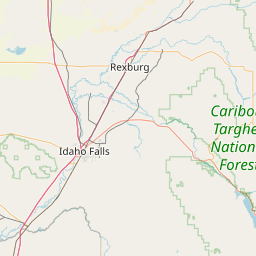
Cottonwood Creek
Map
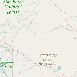
Leaflet | <a href="https://www.openstreetmap.org/copyright">© OpenStreetMap contributors</a>
Item
| Property | Value |
|---|---|
| id | 383729 |
| downstream_mainstem_id | https://geoconnex.us/ref/mainstems/319070 |
| encompassing_mainstem_basins | ['https://geoconnex.us/ref/mainstems/319070', 'https://geoconnex.us/ref/mainstems/315571', 'https://geoconnex.us/ref/mainstems/312532', 'https://geoconnex.us/ref/mainstems/312091'] |
| featuretype | ['https://www.opengis.net/def/schema/hy_features/hyf/HY_FlowPath', 'https://www.opengis.net/def/schema/hy_features/hyf/HY_WaterBody'] |
| fid | 15706 |
| head_2020huc12 | 100800070501 |
| head_nhdpv1_comid | 12840896 |
| head_nhdpv2_comid | https://geoconnex.us/nhdplusv2/comid/12840896 |
| head_nhdpv2huc12 | https://geoconnex.us/nhdplusv2/huc12/100800070601 |
| head_rf1id | None |
| lengthkm | 112.7 |
| name_at_outlet | Cottonwood Creek |
| name_at_outlet_gnis_id | 1596797 |
| new_mainstemid | |
| outlet_2020huc12 | 100800070509 |
| outlet_drainagearea_sqkm | 1084.9 |
| outlet_nhdpv1_comid | 12845510 |
| outlet_nhdpv2_comid | https://geoconnex.us/nhdplusv2/comid/12845510 |
| outlet_nhdpv2huc12 | https://geoconnex.us/nhdplusv2/huc12/100800070609 |
| outlet_rf1id | None |
| superseded | False |
| uri | https://geoconnex.us/ref/mainstems/383729 |
Graph Results
| monitoringLocation | https://geoconnex.us/iow/wqp/USGS-06265500 |
|---|---|
| siteName | USGS-06265500 |
| datasetDescription | Iron at USGS-06265500 |
| type | Stream |
| url | https://www.waterqualitydata.us/provider/NWIS/USGS-WY/USGS-06265500/ |
| variableMeasured | Iron |
| variableUnit | % |
| measurementTechnique | observation |
| temporalCoverage | 1977-01-01T00:00:00Z/1978-12-31T00:00:00Z |
| distributionName | Water Quality Portal |
| distributionURL | https://www.waterqualitydata.us/data/Result/search?siteid=USGS-06265500&CharacteristicName=Iron&mimeType=csv |
| distributionFormat | text/comma-separated-values |
| wkt | POINT (-108.153432 43.86245556) |
| monitoringLocation | https://geoconnex.us/iow/wqp/USGS-06265500 |
|---|---|
| siteName | USGS-06265500 |
| datasetDescription | Boron at USGS-06265500 |
| type | Stream |
| url | https://www.waterqualitydata.us/provider/NWIS/USGS-WY/USGS-06265500/ |
| variableMeasured | Boron |
| variableUnit | Unknown |
| measurementTechnique | observation |
| temporalCoverage | 1977-01-01T00:00:00Z/1978-12-31T00:00:00Z |
| distributionName | Water Quality Portal |
| distributionURL | https://www.waterqualitydata.us/data/Result/search?siteid=USGS-06265500&CharacteristicName=Boron&mimeType=csv |
| distributionFormat | text/comma-separated-values |
| wkt | POINT (-108.153432 43.86245556) |
| monitoringLocation | https://geoconnex.us/iow/wqp/USGS-06265500 |
|---|---|
| siteName | USGS-06265500 |
| datasetDescription | Fluoride at USGS-06265500 |
| type | Stream |
| url | https://www.waterqualitydata.us/provider/NWIS/USGS-WY/USGS-06265500/ |
| variableMeasured | Fluoride |
| variableUnit | mg/l |
| measurementTechnique | observation |
| temporalCoverage | 1977-01-01T00:00:00Z/1978-12-31T00:00:00Z |
| distributionName | Water Quality Portal |
| distributionURL | https://www.waterqualitydata.us/data/Result/search?siteid=USGS-06265500&CharacteristicName=Fluoride&mimeType=csv |
| distributionFormat | text/comma-separated-values |
| wkt | POINT (-108.153432 43.86245556) |
| monitoringLocation | https://geoconnex.us/iow/wqp/USGS-06265500 |
|---|---|
| siteName | USGS-06265500 |
| datasetDescription | Hardness, Ca, Mg at USGS-06265500 |
| type | Stream |
| url | https://www.waterqualitydata.us/provider/NWIS/USGS-WY/USGS-06265500/ |
| variableMeasured | Hardness, Ca, Mg |
| variableUnit | mg/l CaCO3 |
| measurementTechnique | observation |
| temporalCoverage | 1977-01-01T00:00:00Z/1978-12-31T00:00:00Z |
| distributionName | Water Quality Portal |
| distributionURL | https://www.waterqualitydata.us/data/Result/search?siteid=USGS-06265500&CharacteristicName=Hardness, Ca, Mg&mimeType=csv |
| distributionFormat | text/comma-separated-values |
| wkt | POINT (-108.153432 43.86245556) |
| monitoringLocation | https://geoconnex.us/iow/wqp/USGS-06265500 |
|---|---|
| siteName | USGS-06265500 |
| datasetDescription | Turbidity at USGS-06265500 |
| type | Stream |
| url | https://www.waterqualitydata.us/provider/NWIS/USGS-WY/USGS-06265500/ |
| variableMeasured | Turbidity |
| variableUnit | JTU |
| measurementTechnique | observation |
| temporalCoverage | 1977-01-01T00:00:00Z/1978-12-31T00:00:00Z |
| distributionName | Water Quality Portal |
| distributionURL | https://www.waterqualitydata.us/data/Result/search?siteid=USGS-06265500&CharacteristicName=Turbidity&mimeType=csv |
| distributionFormat | text/comma-separated-values |
| wkt | POINT (-108.153432 43.86245556) |
| monitoringLocation | https://geoconnex.us/iow/wqp/USGS-06265500 |
|---|---|
| siteName | USGS-06265500 |
| datasetDescription | Suspended Sediment Discharge at USGS-06265500 |
| type | Stream |
| url | https://www.waterqualitydata.us/provider/NWIS/USGS-WY/USGS-06265500/ |
| variableMeasured | Suspended Sediment Discharge |
| variableUnit | tons/day |
| measurementTechnique | observation |
| temporalCoverage | 1965-01-01T00:00:00Z/1978-12-31T00:00:00Z |
| distributionName | Water Quality Portal |
| distributionURL | https://www.waterqualitydata.us/data/Result/search?siteid=USGS-06265500&CharacteristicName=Suspended Sediment Discharge&mimeType=csv |
| distributionFormat | text/comma-separated-values |
| wkt | POINT (-108.153432 43.86245556) |
| monitoringLocation | https://geoconnex.us/iow/wqp/USGS-06265500 |
|---|---|
| siteName | USGS-06265500 |
| datasetDescription | Hardness, non-carbonate at USGS-06265500 |
| type | Stream |
| url | https://www.waterqualitydata.us/provider/NWIS/USGS-WY/USGS-06265500/ |
| variableMeasured | Hardness, non-carbonate |
| variableUnit | mg/l CaCO3 |
| measurementTechnique | observation |
| temporalCoverage | 1977-01-01T00:00:00Z/1978-12-31T00:00:00Z |
| distributionName | Water Quality Portal |
| distributionURL | https://www.waterqualitydata.us/data/Result/search?siteid=USGS-06265500&CharacteristicName=Hardness, non-carbonate&mimeType=csv |
| distributionFormat | text/comma-separated-values |
| wkt | POINT (-108.153432 43.86245556) |
| monitoringLocation | https://geoconnex.us/iow/wqp/USGS-06265500 |
|---|---|
| siteName | USGS-06265500 |
| datasetDescription | Alkalinity at USGS-06265500 |
| type | Stream |
| url | https://www.waterqualitydata.us/provider/NWIS/USGS-WY/USGS-06265500/ |
| variableMeasured | Alkalinity |
| variableUnit | mg/l CaCO3 |
| measurementTechnique | observation |
| temporalCoverage | 1977-01-01T00:00:00Z/1978-12-31T00:00:00Z |
| distributionName | Water Quality Portal |
| distributionURL | https://www.waterqualitydata.us/data/Result/search?siteid=USGS-06265500&CharacteristicName=Alkalinity&mimeType=csv |
| distributionFormat | text/comma-separated-values |
| wkt | POINT (-108.153432 43.86245556) |
| monitoringLocation | https://geoconnex.us/iow/wqp/USGS-06265500 |
|---|---|
| siteName | USGS-06265500 |
| datasetDescription | Sodium, percent total cations at USGS-06265500 |
| type | Stream |
| url | https://www.waterqualitydata.us/provider/NWIS/USGS-WY/USGS-06265500/ |
| variableMeasured | Sodium, percent total cations |
| variableUnit | % |
| measurementTechnique | observation |
| temporalCoverage | 1977-01-01T00:00:00Z/1978-12-31T00:00:00Z |
| distributionName | Water Quality Portal |
| distributionURL | https://www.waterqualitydata.us/data/Result/search?siteid=USGS-06265500&CharacteristicName=Sodium, percent total cations&mimeType=csv |
| distributionFormat | text/comma-separated-values |
| wkt | POINT (-108.153432 43.86245556) |
| monitoringLocation | https://geoconnex.us/iow/wqp/USGS-06265500 |
|---|---|
| siteName | USGS-06265500 |
| datasetDescription | Stream flow at USGS-06265500 |
| type | Stream |
| url | https://www.waterqualitydata.us/provider/NWIS/USGS-WY/USGS-06265500/ |
| variableMeasured | Stream flow |
| variableUnit | ft3/s |
| measurementTechnique | observation |
| temporalCoverage | 1965-01-01T00:00:00Z/1966-12-31T00:00:00Z |
| distributionName | Water Quality Portal |
| distributionURL | https://www.waterqualitydata.us/data/Result/search?siteid=USGS-06265500&CharacteristicName=Stream flow&mimeType=csv |
| distributionFormat | text/comma-separated-values |
| wkt | POINT (-108.153432 43.86245556) |
| monitoringLocation | https://geoconnex.us/iow/wqp/USGS-06265500 |
|---|---|
| siteName | USGS-06265500 |
| datasetDescription | Calcium at USGS-06265500 |
| type | Stream |
| url | https://www.waterqualitydata.us/provider/NWIS/USGS-WY/USGS-06265500/ |
| variableMeasured | Calcium |
| variableUnit | mg/L |
| measurementTechnique | observation |
| temporalCoverage | 1977-01-01T00:00:00Z/1978-12-31T00:00:00Z |
| distributionName | Water Quality Portal |
| distributionURL | https://www.waterqualitydata.us/data/Result/search?siteid=USGS-06265500&CharacteristicName=Calcium&mimeType=csv |
| distributionFormat | text/comma-separated-values |
| wkt | POINT (-108.153432 43.86245556) |
| monitoringLocation | https://geoconnex.us/iow/wqp/USGS-06265500 |
|---|---|
| siteName | USGS-06265500 |
| datasetDescription | Magnesium at USGS-06265500 |
| type | Stream |
| url | https://www.waterqualitydata.us/provider/NWIS/USGS-WY/USGS-06265500/ |
| variableMeasured | Magnesium |
| variableUnit | % |
| measurementTechnique | observation |
| temporalCoverage | 1977-01-01T00:00:00Z/1978-12-31T00:00:00Z |
| distributionName | Water Quality Portal |
| distributionURL | https://www.waterqualitydata.us/data/Result/search?siteid=USGS-06265500&CharacteristicName=Magnesium&mimeType=csv |
| distributionFormat | text/comma-separated-values |
| wkt | POINT (-108.153432 43.86245556) |
| monitoringLocation | https://geoconnex.us/iow/wqp/USGS-06265500 |
|---|---|
| siteName | USGS-06265500 |
| datasetDescription | Sulfate at USGS-06265500 |
| type | Stream |
| url | https://www.waterqualitydata.us/provider/NWIS/USGS-WY/USGS-06265500/ |
| variableMeasured | Sulfate |
| variableUnit | mg/l |
| measurementTechnique | observation |
| temporalCoverage | 1977-01-01T00:00:00Z/1978-12-31T00:00:00Z |
| distributionName | Water Quality Portal |
| distributionURL | https://www.waterqualitydata.us/data/Result/search?siteid=USGS-06265500&CharacteristicName=Sulfate&mimeType=csv |
| distributionFormat | text/comma-separated-values |
| wkt | POINT (-108.153432 43.86245556) |
| monitoringLocation | https://geoconnex.us/iow/wqp/USGS-06265500 |
|---|---|
| siteName | USGS-06265500 |
| datasetDescription | Bicarbonate at USGS-06265500 |
| type | Stream |
| url | https://www.waterqualitydata.us/provider/NWIS/USGS-WY/USGS-06265500/ |
| variableMeasured | Bicarbonate |
| variableUnit | mg/l |
| measurementTechnique | observation |
| temporalCoverage | 1977-01-01T00:00:00Z/1978-12-31T00:00:00Z |
| distributionName | Water Quality Portal |
| distributionURL | https://www.waterqualitydata.us/data/Result/search?siteid=USGS-06265500&CharacteristicName=Bicarbonate&mimeType=csv |
| distributionFormat | text/comma-separated-values |
| wkt | POINT (-108.153432 43.86245556) |
| monitoringLocation | https://geoconnex.us/iow/wqp/USGS-06265500 |
|---|---|
| siteName | USGS-06265500 |
| datasetDescription | Suspended Sediment Concentration (SSC) at USGS-06265500 |
| type | Stream |
| url | https://www.waterqualitydata.us/provider/NWIS/USGS-WY/USGS-06265500/ |
| variableMeasured | Suspended Sediment Concentration (SSC) |
| variableUnit | mg/l |
| measurementTechnique | observation |
| temporalCoverage | 1965-01-01T00:00:00Z/1978-12-31T00:00:00Z |
| distributionName | Water Quality Portal |
| distributionURL | https://www.waterqualitydata.us/data/Result/search?siteid=USGS-06265500&CharacteristicName=Suspended Sediment Concentration (SSC)&mimeType=csv |
| distributionFormat | text/comma-separated-values |
| wkt | POINT (-108.153432 43.86245556) |
| monitoringLocation | https://geoconnex.us/iow/wqp/USGS-06265500 |
|---|---|
| siteName | USGS-06265500 |
| datasetDescription | Sodium at USGS-06265500 |
| type | Stream |
| url | https://www.waterqualitydata.us/provider/NWIS/USGS-WY/USGS-06265500/ |
| variableMeasured | Sodium |
| variableUnit | mg/l |
| measurementTechnique | observation |
| temporalCoverage | 1977-01-01T00:00:00Z/1978-12-31T00:00:00Z |
| distributionName | Water Quality Portal |
| distributionURL | https://www.waterqualitydata.us/data/Result/search?siteid=USGS-06265500&CharacteristicName=Sodium&mimeType=csv |
| distributionFormat | text/comma-separated-values |
| wkt | POINT (-108.153432 43.86245556) |
| monitoringLocation | https://geoconnex.us/iow/wqp/USGS-06265500 |
|---|---|
| siteName | USGS-06265500 |
| datasetDescription | Potassium at USGS-06265500 |
| type | Stream |
| url | https://www.waterqualitydata.us/provider/NWIS/USGS-WY/USGS-06265500/ |
| variableMeasured | Potassium |
| variableUnit | mg/l |
| measurementTechnique | observation |
| temporalCoverage | 1977-01-01T00:00:00Z/1978-12-31T00:00:00Z |
| distributionName | Water Quality Portal |
| distributionURL | https://www.waterqualitydata.us/data/Result/search?siteid=USGS-06265500&CharacteristicName=Potassium&mimeType=csv |
| distributionFormat | text/comma-separated-values |
| wkt | POINT (-108.153432 43.86245556) |
| monitoringLocation | https://geoconnex.us/iow/wqp/USGS-06265500 |
|---|---|
| siteName | USGS-06265500 |
| datasetDescription | Temperature, water at USGS-06265500 |
| type | Stream |
| url | https://www.waterqualitydata.us/provider/NWIS/USGS-WY/USGS-06265500/ |
| variableMeasured | Temperature, water |
| variableUnit | deg C |
| measurementTechnique | observation |
| temporalCoverage | 1965-01-01T00:00:00Z/1978-12-31T00:00:00Z |
| distributionName | Water Quality Portal |
| distributionURL | https://www.waterqualitydata.us/data/Result/search?siteid=USGS-06265500&CharacteristicName=Temperature, water&mimeType=csv |
| distributionFormat | text/comma-separated-values |
| wkt | POINT (-108.153432 43.86245556) |
| monitoringLocation | https://geoconnex.us/iow/wqp/USGS-06265500 |
|---|---|
| siteName | USGS-06265500 |
| datasetDescription | Oxygen at USGS-06265500 |
| type | Stream |
| url | https://www.waterqualitydata.us/provider/NWIS/USGS-WY/USGS-06265500/ |
| variableMeasured | Oxygen |
| variableUnit | mg/l |
| measurementTechnique | observation |
| temporalCoverage | 1977-01-01T00:00:00Z/1978-12-31T00:00:00Z |
| distributionName | Water Quality Portal |
| distributionURL | https://www.waterqualitydata.us/data/Result/search?siteid=USGS-06265500&CharacteristicName=Oxygen&mimeType=csv |
| distributionFormat | text/comma-separated-values |
| wkt | POINT (-108.153432 43.86245556) |
| monitoringLocation | https://geoconnex.us/iow/wqp/USGS-06265500 |
|---|---|
| siteName | USGS-06265500 |
| datasetDescription | Fecal Coliform at USGS-06265500 |
| type | Stream |
| url | https://www.waterqualitydata.us/provider/NWIS/USGS-WY/USGS-06265500/ |
| variableMeasured | Fecal Coliform |
| variableUnit | Unknown |
| measurementTechnique | observation |
| temporalCoverage | 1977-01-01T00:00:00Z/1978-12-31T00:00:00Z |
| distributionName | Water Quality Portal |
| distributionURL | https://www.waterqualitydata.us/data/Result/search?siteid=USGS-06265500&CharacteristicName=Fecal Coliform&mimeType=csv |
| distributionFormat | text/comma-separated-values |
| wkt | POINT (-108.153432 43.86245556) |
| monitoringLocation | https://geoconnex.us/iow/wqp/USGS-06265500 |
|---|---|
| siteName | USGS-06265500 |
| datasetDescription | Chloride at USGS-06265500 |
| type | Stream |
| url | https://www.waterqualitydata.us/provider/NWIS/USGS-WY/USGS-06265500/ |
| variableMeasured | Chloride |
| variableUnit | mg/l |
| measurementTechnique | observation |
| temporalCoverage | 1977-01-01T00:00:00Z/1978-12-31T00:00:00Z |
| distributionName | Water Quality Portal |
| distributionURL | https://www.waterqualitydata.us/data/Result/search?siteid=USGS-06265500&CharacteristicName=Chloride&mimeType=csv |
| distributionFormat | text/comma-separated-values |
| wkt | POINT (-108.153432 43.86245556) |
| monitoringLocation | https://geoconnex.us/iow/wqp/USGS-06265500 |
|---|---|
| siteName | USGS-06265500 |
| datasetDescription | Specific conductance at USGS-06265500 |
| type | Stream |
| url | https://www.waterqualitydata.us/provider/NWIS/USGS-WY/USGS-06265500/ |
| variableMeasured | Specific conductance |
| variableUnit | umho/cm |
| measurementTechnique | observation |
| temporalCoverage | 1977-01-01T00:00:00Z/1978-12-31T00:00:00Z |
| distributionName | Water Quality Portal |
| distributionURL | https://www.waterqualitydata.us/data/Result/search?siteid=USGS-06265500&CharacteristicName=Specific conductance&mimeType=csv |
| distributionFormat | text/comma-separated-values |
| wkt | POINT (-108.153432 43.86245556) |
| monitoringLocation | https://geoconnex.us/iow/wqp/USGS-06265500 |
|---|---|
| siteName | USGS-06265500 |
| datasetDescription | Stream flow, instantaneous at USGS-06265500 |
| type | Stream |
| url | https://www.waterqualitydata.us/provider/NWIS/USGS-WY/USGS-06265500/ |
| variableMeasured | Stream flow, instantaneous |
| variableUnit | ft3/s |
| measurementTechnique | observation |
| temporalCoverage | 1977-01-01T00:00:00Z/1978-12-31T00:00:00Z |
| distributionName | Water Quality Portal |
| distributionURL | https://www.waterqualitydata.us/data/Result/search?siteid=USGS-06265500&CharacteristicName=Stream flow, instantaneous&mimeType=csv |
| distributionFormat | text/comma-separated-values |
| wkt | POINT (-108.153432 43.86245556) |
| monitoringLocation | https://geoconnex.us/iow/wqp/USGS-06265500 |
|---|---|
| siteName | USGS-06265500 |
| datasetDescription | Silica at USGS-06265500 |
| type | Stream |
| url | https://www.waterqualitydata.us/provider/NWIS/USGS-WY/USGS-06265500/ |
| variableMeasured | Silica |
| variableUnit | mg/l |
| measurementTechnique | observation |
| temporalCoverage | 1977-01-01T00:00:00Z/1978-12-31T00:00:00Z |
| distributionName | Water Quality Portal |
| distributionURL | https://www.waterqualitydata.us/data/Result/search?siteid=USGS-06265500&CharacteristicName=Silica&mimeType=csv |
| distributionFormat | text/comma-separated-values |
| wkt | POINT (-108.153432 43.86245556) |
| monitoringLocation | https://geoconnex.us/iow/wqp/USGS-06265500 |
|---|---|
| siteName | USGS-06265500 |
| datasetDescription | Inorganic nitrogen (nitrate and nitrite) at USGS-06265500 |
| type | Stream |
| url | https://www.waterqualitydata.us/provider/NWIS/USGS-WY/USGS-06265500/ |
| variableMeasured | Inorganic nitrogen (nitrate and nitrite) |
| variableUnit | mg/l as N |
| measurementTechnique | observation |
| temporalCoverage | 1977-01-01T00:00:00Z/1978-12-31T00:00:00Z |
| distributionName | Water Quality Portal |
| distributionURL | https://www.waterqualitydata.us/data/Result/search?siteid=USGS-06265500&CharacteristicName=Inorganic nitrogen (nitrate and nitrite)&mimeType=csv |
| distributionFormat | text/comma-separated-values |
| wkt | POINT (-108.153432 43.86245556) |
| monitoringLocation | https://geoconnex.us/iow/wqp/USGS-06265500 |
|---|---|
| siteName | USGS-06265500 |
| datasetDescription | Total dissolved solids at USGS-06265500 |
| type | Stream |
| url | https://www.waterqualitydata.us/provider/NWIS/USGS-WY/USGS-06265500/ |
| variableMeasured | Total dissolved solids |
| variableUnit | mg/l |
| measurementTechnique | observation |
| temporalCoverage | 1977-01-01T00:00:00Z/1978-12-31T00:00:00Z |
| distributionName | Water Quality Portal |
| distributionURL | https://www.waterqualitydata.us/data/Result/search?siteid=USGS-06265500&CharacteristicName=Total dissolved solids&mimeType=csv |
| distributionFormat | text/comma-separated-values |
| wkt | POINT (-108.153432 43.86245556) |
| monitoringLocation | https://geoconnex.us/iow/wqp/WYDEQ_WATERSHED-WB150 |
|---|---|
| siteName | WYDEQ_WATERSHED-WB150 |
| datasetDescription | pH at WYDEQ_WATERSHED-WB150 |
| type | River/Stream |
| url | https://www.waterqualitydata.us/provider/STORET/WYDEQ_WATERSHED/WYDEQ_WATERSHED-WB150/ |
| variableMeasured | pH |
| variableUnit | None |
| measurementTechnique | observation |
| temporalCoverage | 2001-01-01T00:00:00Z/2001-12-31T00:00:00Z |
| distributionName | Water Quality Portal |
| distributionURL | https://www.waterqualitydata.us/data/Result/search?siteid=WYDEQ_WATERSHED-WB150&CharacteristicName=pH&mimeType=csv |
| distributionFormat | text/comma-separated-values |
| wkt | POINT (-108.510675 43.828225) |
| monitoringLocation | https://geoconnex.us/iow/wqp/WYDEQ_WATERSHED-WB150 |
|---|---|
| siteName | WYDEQ_WATERSHED-WB150 |
| datasetDescription | Alkalinity, total at WYDEQ_WATERSHED-WB150 |
| type | River/Stream |
| url | https://www.waterqualitydata.us/provider/STORET/WYDEQ_WATERSHED/WYDEQ_WATERSHED-WB150/ |
| variableMeasured | Alkalinity, total |
| variableUnit | mg/l |
| measurementTechnique | observation |
| temporalCoverage | 2001-01-01T00:00:00Z/2001-12-31T00:00:00Z |
| distributionName | Water Quality Portal |
| distributionURL | https://www.waterqualitydata.us/data/Result/search?siteid=WYDEQ_WATERSHED-WB150&CharacteristicName=Alkalinity, total&mimeType=csv |
| distributionFormat | text/comma-separated-values |
| wkt | POINT (-108.510675 43.828225) |
| monitoringLocation | https://geoconnex.us/iow/wqp/WYDEQ_WATERSHED-WB150 |
|---|---|
| siteName | WYDEQ_WATERSHED-WB150 |
| datasetDescription | Specific conductance at WYDEQ_WATERSHED-WB150 |
| type | River/Stream |
| url | https://www.waterqualitydata.us/provider/STORET/WYDEQ_WATERSHED/WYDEQ_WATERSHED-WB150/ |
| variableMeasured | Specific conductance |
| variableUnit | umho/cm |
| measurementTechnique | observation |
| temporalCoverage | 2001-01-01T00:00:00Z/2001-12-31T00:00:00Z |
| distributionName | Water Quality Portal |
| distributionURL | https://www.waterqualitydata.us/data/Result/search?siteid=WYDEQ_WATERSHED-WB150&CharacteristicName=Specific conductance&mimeType=csv |
| distributionFormat | text/comma-separated-values |
| wkt | POINT (-108.510675 43.828225) |
| monitoringLocation | https://geoconnex.us/iow/wqp/WYDEQ_WATERSHED-WB150 |
|---|---|
| siteName | WYDEQ_WATERSHED-WB150 |
| datasetDescription | Apparent color at WYDEQ_WATERSHED-WB150 |
| type | River/Stream |
| url | https://www.waterqualitydata.us/provider/STORET/WYDEQ_WATERSHED/WYDEQ_WATERSHED-WB150/ |
| variableMeasured | Apparent color |
| variableUnit | PCU |
| measurementTechnique | observation |
| temporalCoverage | 2001-01-01T00:00:00Z/2001-12-31T00:00:00Z |
| distributionName | Water Quality Portal |
| distributionURL | https://www.waterqualitydata.us/data/Result/search?siteid=WYDEQ_WATERSHED-WB150&CharacteristicName=Apparent color&mimeType=csv |
| distributionFormat | text/comma-separated-values |
| wkt | POINT (-108.510675 43.828225) |
| monitoringLocation | https://geoconnex.us/iow/wqp/WYDEQ_WATERSHED-WB150 |
|---|---|
| siteName | WYDEQ_WATERSHED-WB150 |
| datasetDescription | Chloride at WYDEQ_WATERSHED-WB150 |
| type | River/Stream |
| url | https://www.waterqualitydata.us/provider/STORET/WYDEQ_WATERSHED/WYDEQ_WATERSHED-WB150/ |
| variableMeasured | Chloride |
| variableUnit | mg/l |
| measurementTechnique | observation |
| temporalCoverage | 2001-01-01T00:00:00Z/2001-12-31T00:00:00Z |
| distributionName | Water Quality Portal |
| distributionURL | https://www.waterqualitydata.us/data/Result/search?siteid=WYDEQ_WATERSHED-WB150&CharacteristicName=Chloride&mimeType=csv |
| distributionFormat | text/comma-separated-values |
| wkt | POINT (-108.510675 43.828225) |
| monitoringLocation | https://geoconnex.us/iow/wqp/WYDEQ_WATERSHED-WB150 |
|---|---|
| siteName | WYDEQ_WATERSHED-WB150 |
| datasetDescription | Dissolved oxygen (DO) at WYDEQ_WATERSHED-WB150 |
| type | River/Stream |
| url | https://www.waterqualitydata.us/provider/STORET/WYDEQ_WATERSHED/WYDEQ_WATERSHED-WB150/ |
| variableMeasured | Dissolved oxygen (DO) |
| variableUnit | mg/L |
| measurementTechnique | observation |
| temporalCoverage | 2001-01-01T00:00:00Z/2001-12-31T00:00:00Z |
| distributionName | Water Quality Portal |
| distributionURL | https://www.waterqualitydata.us/data/Result/search?siteid=WYDEQ_WATERSHED-WB150&CharacteristicName=Dissolved oxygen (DO)&mimeType=csv |
| distributionFormat | text/comma-separated-values |
| wkt | POINT (-108.510675 43.828225) |
| monitoringLocation | https://geoconnex.us/iow/wqp/WYDEQ_WATERSHED-WB150 |
|---|---|
| siteName | WYDEQ_WATERSHED-WB150 |
| datasetDescription | Sulfate at WYDEQ_WATERSHED-WB150 |
| type | River/Stream |
| url | https://www.waterqualitydata.us/provider/STORET/WYDEQ_WATERSHED/WYDEQ_WATERSHED-WB150/ |
| variableMeasured | Sulfate |
| variableUnit | mg/l |
| measurementTechnique | observation |
| temporalCoverage | 2001-01-01T00:00:00Z/2001-12-31T00:00:00Z |
| distributionName | Water Quality Portal |
| distributionURL | https://www.waterqualitydata.us/data/Result/search?siteid=WYDEQ_WATERSHED-WB150&CharacteristicName=Sulfate&mimeType=csv |
| distributionFormat | text/comma-separated-values |
| wkt | POINT (-108.510675 43.828225) |
| monitoringLocation | https://geoconnex.us/iow/wqp/WYDEQ_WATERSHED-WB150 |
|---|---|
| siteName | WYDEQ_WATERSHED-WB150 |
| datasetDescription | Total suspended solids at WYDEQ_WATERSHED-WB150 |
| type | River/Stream |
| url | https://www.waterqualitydata.us/provider/STORET/WYDEQ_WATERSHED/WYDEQ_WATERSHED-WB150/ |
| variableMeasured | Total suspended solids |
| variableUnit | mg/L |
| measurementTechnique | observation |
| temporalCoverage | 2001-01-01T00:00:00Z/2001-12-31T00:00:00Z |
| distributionName | Water Quality Portal |
| distributionURL | https://www.waterqualitydata.us/data/Result/search?siteid=WYDEQ_WATERSHED-WB150&CharacteristicName=Total suspended solids&mimeType=csv |
| distributionFormat | text/comma-separated-values |
| wkt | POINT (-108.510675 43.828225) |
| monitoringLocation | https://geoconnex.us/iow/wqp/WYDEQ_WATERSHED-WB150 |
|---|---|
| siteName | WYDEQ_WATERSHED-WB150 |
| datasetDescription | Hardness, carbonate at WYDEQ_WATERSHED-WB150 |
| type | River/Stream |
| url | https://www.waterqualitydata.us/provider/STORET/WYDEQ_WATERSHED/WYDEQ_WATERSHED-WB150/ |
| variableMeasured | Hardness, carbonate |
| variableUnit | mg/L |
| measurementTechnique | observation |
| temporalCoverage | 2001-01-01T00:00:00Z/2001-12-31T00:00:00Z |
| distributionName | Water Quality Portal |
| distributionURL | https://www.waterqualitydata.us/data/Result/search?siteid=WYDEQ_WATERSHED-WB150&CharacteristicName=Hardness, carbonate&mimeType=csv |
| distributionFormat | text/comma-separated-values |
| wkt | POINT (-108.510675 43.828225) |
| monitoringLocation | https://geoconnex.us/iow/wqp/WYDEQ_WATERSHED-WB150 |
|---|---|
| siteName | WYDEQ_WATERSHED-WB150 |
| datasetDescription | Turbidity at WYDEQ_WATERSHED-WB150 |
| type | River/Stream |
| url | https://www.waterqualitydata.us/provider/STORET/WYDEQ_WATERSHED/WYDEQ_WATERSHED-WB150/ |
| variableMeasured | Turbidity |
| variableUnit | JTU |
| measurementTechnique | observation |
| temporalCoverage | 2001-01-01T00:00:00Z/2001-12-31T00:00:00Z |
| distributionName | Water Quality Portal |
| distributionURL | https://www.waterqualitydata.us/data/Result/search?siteid=WYDEQ_WATERSHED-WB150&CharacteristicName=Turbidity&mimeType=csv |
| distributionFormat | text/comma-separated-values |
| wkt | POINT (-108.510675 43.828225) |
| monitoringLocation | https://geoconnex.us/iow/wqp/WYDEQ_WATERSHED-WB150 |
|---|---|
| siteName | WYDEQ_WATERSHED-WB150 |
| datasetDescription | Temperature, water at WYDEQ_WATERSHED-WB150 |
| type | River/Stream |
| url | https://www.waterqualitydata.us/provider/STORET/WYDEQ_WATERSHED/WYDEQ_WATERSHED-WB150/ |
| variableMeasured | Temperature, water |
| variableUnit | deg C |
| measurementTechnique | observation |
| temporalCoverage | 2001-01-01T00:00:00Z/2001-12-31T00:00:00Z |
| distributionName | Water Quality Portal |
| distributionURL | https://www.waterqualitydata.us/data/Result/search?siteid=WYDEQ_WATERSHED-WB150&CharacteristicName=Temperature, water&mimeType=csv |
| distributionFormat | text/comma-separated-values |
| wkt | POINT (-108.510675 43.828225) |
| monitoringLocation | https://geoconnex.us/iow/wqp/WYDEQ_WATERSHED-WB150 |
|---|---|
| siteName | WYDEQ_WATERSHED-WB150 |
| datasetDescription | Phosphate-phosphorus at WYDEQ_WATERSHED-WB150 |
| type | River/Stream |
| url | https://www.waterqualitydata.us/provider/STORET/WYDEQ_WATERSHED/WYDEQ_WATERSHED-WB150/ |
| variableMeasured | Phosphate-phosphorus |
| variableUnit | mg/L |
| measurementTechnique | observation |
| temporalCoverage | 2001-01-01T00:00:00Z/2001-12-31T00:00:00Z |
| distributionName | Water Quality Portal |
| distributionURL | https://www.waterqualitydata.us/data/Result/search?siteid=WYDEQ_WATERSHED-WB150&CharacteristicName=Phosphate-phosphorus&mimeType=csv |
| distributionFormat | text/comma-separated-values |
| wkt | POINT (-108.510675 43.828225) |
| monitoringLocation | https://geoconnex.us/iow/wqp/WYDEQ_WQX-WB150 |
|---|---|
| siteName | WYDEQ_WQX-WB150 |
| datasetDescription | Specific conductance at WYDEQ_WQX-WB150 |
| type | River/Stream |
| url | https://www.waterqualitydata.us/provider/STORET/WYDEQ_WQX/WYDEQ_WQX-WB150/ |
| variableMeasured | Specific conductance |
| variableUnit | umho/cm |
| measurementTechnique | observation |
| temporalCoverage | 2001-01-01T00:00:00Z/2001-12-31T00:00:00Z |
| distributionName | Water Quality Portal |
| distributionURL | https://www.waterqualitydata.us/data/Result/search?siteid=WYDEQ_WQX-WB150&CharacteristicName=Specific conductance&mimeType=csv |
| distributionFormat | text/comma-separated-values |
| wkt | POINT (-108.510675 43.828225) |
| monitoringLocation | https://geoconnex.us/iow/wqp/WYDEQ_WQX-WB150 |
|---|---|
| siteName | WYDEQ_WQX-WB150 |
| datasetDescription | Chloride at WYDEQ_WQX-WB150 |
| type | River/Stream |
| url | https://www.waterqualitydata.us/provider/STORET/WYDEQ_WQX/WYDEQ_WQX-WB150/ |
| variableMeasured | Chloride |
| variableUnit | mg/l |
| measurementTechnique | observation |
| temporalCoverage | 2001-01-01T00:00:00Z/2001-12-31T00:00:00Z |
| distributionName | Water Quality Portal |
| distributionURL | https://www.waterqualitydata.us/data/Result/search?siteid=WYDEQ_WQX-WB150&CharacteristicName=Chloride&mimeType=csv |
| distributionFormat | text/comma-separated-values |
| wkt | POINT (-108.510675 43.828225) |
| monitoringLocation | https://geoconnex.us/iow/wqp/WYDEQ_WQX-WB150 |
|---|---|
| siteName | WYDEQ_WQX-WB150 |
| datasetDescription | Phosphorus at WYDEQ_WQX-WB150 |
| type | River/Stream |
| url | https://www.waterqualitydata.us/provider/STORET/WYDEQ_WQX/WYDEQ_WQX-WB150/ |
| variableMeasured | Phosphorus |
| variableUnit | ppb |
| measurementTechnique | observation |
| temporalCoverage | 2001-01-01T00:00:00Z/2001-12-31T00:00:00Z |
| distributionName | Water Quality Portal |
| distributionURL | https://www.waterqualitydata.us/data/Result/search?siteid=WYDEQ_WQX-WB150&CharacteristicName=Phosphorus&mimeType=csv |
| distributionFormat | text/comma-separated-values |
| wkt | POINT (-108.510675 43.828225) |
| monitoringLocation | https://geoconnex.us/iow/wqp/WYDEQ_WQX-WB150 |
|---|---|
| siteName | WYDEQ_WQX-WB150 |
| datasetDescription | Apparent color at WYDEQ_WQX-WB150 |
| type | River/Stream |
| url | https://www.waterqualitydata.us/provider/STORET/WYDEQ_WQX/WYDEQ_WQX-WB150/ |
| variableMeasured | Apparent color |
| variableUnit | PCU |
| measurementTechnique | observation |
| temporalCoverage | 2001-01-01T00:00:00Z/2001-12-31T00:00:00Z |
| distributionName | Water Quality Portal |
| distributionURL | https://www.waterqualitydata.us/data/Result/search?siteid=WYDEQ_WQX-WB150&CharacteristicName=Apparent color&mimeType=csv |
| distributionFormat | text/comma-separated-values |
| wkt | POINT (-108.510675 43.828225) |
| monitoringLocation | https://geoconnex.us/iow/wqp/WYDEQ_WQX-WB150 |
|---|---|
| siteName | WYDEQ_WQX-WB150 |
| datasetDescription | Radium-226 at WYDEQ_WQX-WB150 |
| type | River/Stream |
| url | https://www.waterqualitydata.us/provider/STORET/WYDEQ_WQX/WYDEQ_WQX-WB150/ |
| variableMeasured | Radium-226 |
| variableUnit | pCi/L |
| measurementTechnique | observation |
| temporalCoverage | 2001-01-01T00:00:00Z/2001-12-31T00:00:00Z |
| distributionName | Water Quality Portal |
| distributionURL | https://www.waterqualitydata.us/data/Result/search?siteid=WYDEQ_WQX-WB150&CharacteristicName=Radium-226&mimeType=csv |
| distributionFormat | text/comma-separated-values |
| wkt | POINT (-108.510675 43.828225) |
| monitoringLocation | https://geoconnex.us/iow/wqp/WYDEQ_WQX-WB150 |
|---|---|
| siteName | WYDEQ_WQX-WB150 |
| datasetDescription | Count at WYDEQ_WQX-WB150 |
| type | River/Stream |
| url | https://www.waterqualitydata.us/provider/STORET/WYDEQ_WQX/WYDEQ_WQX-WB150/ |
| variableMeasured | Count |
| variableUnit | count |
| measurementTechnique | observation |
| temporalCoverage | 2001-01-01T00:00:00Z/2001-12-31T00:00:00Z |
| distributionName | Water Quality Portal |
| distributionURL | https://www.waterqualitydata.us/data/Result/search?siteid=WYDEQ_WQX-WB150&CharacteristicName=Count&mimeType=csv |
| distributionFormat | text/comma-separated-values |
| wkt | POINT (-108.510675 43.828225) |
| monitoringLocation | https://geoconnex.us/iow/wqp/WYDEQ_WQX-WB150 |
|---|---|
| siteName | WYDEQ_WQX-WB150 |
| datasetDescription | Alkalinity, total at WYDEQ_WQX-WB150 |
| type | River/Stream |
| url | https://www.waterqualitydata.us/provider/STORET/WYDEQ_WQX/WYDEQ_WQX-WB150/ |
| variableMeasured | Alkalinity, total |
| variableUnit | mg/l |
| measurementTechnique | observation |
| temporalCoverage | 2001-01-01T00:00:00Z/2001-12-31T00:00:00Z |
| distributionName | Water Quality Portal |
| distributionURL | https://www.waterqualitydata.us/data/Result/search?siteid=WYDEQ_WQX-WB150&CharacteristicName=Alkalinity, total&mimeType=csv |
| distributionFormat | text/comma-separated-values |
| wkt | POINT (-108.510675 43.828225) |
| monitoringLocation | https://geoconnex.us/iow/wqp/WYDEQ_WQX-WB150 |
|---|---|
| siteName | WYDEQ_WQX-WB150 |
| datasetDescription | pH at WYDEQ_WQX-WB150 |
| type | River/Stream |
| url | https://www.waterqualitydata.us/provider/STORET/WYDEQ_WQX/WYDEQ_WQX-WB150/ |
| variableMeasured | pH |
| variableUnit | None |
| measurementTechnique | observation |
| temporalCoverage | 2001-01-01T00:00:00Z/2001-12-31T00:00:00Z |
| distributionName | Water Quality Portal |
| distributionURL | https://www.waterqualitydata.us/data/Result/search?siteid=WYDEQ_WQX-WB150&CharacteristicName=pH&mimeType=csv |
| distributionFormat | text/comma-separated-values |
| wkt | POINT (-108.510675 43.828225) |
| monitoringLocation | https://geoconnex.us/iow/wqp/WYDEQ_WQX-WB150 |
|---|---|
| siteName | WYDEQ_WQX-WB150 |
| datasetDescription | Sulfate at WYDEQ_WQX-WB150 |
| type | River/Stream |
| url | https://www.waterqualitydata.us/provider/STORET/WYDEQ_WQX/WYDEQ_WQX-WB150/ |
| variableMeasured | Sulfate |
| variableUnit | mg/l |
| measurementTechnique | observation |
| temporalCoverage | 2001-01-01T00:00:00Z/2001-12-31T00:00:00Z |
| distributionName | Water Quality Portal |
| distributionURL | https://www.waterqualitydata.us/data/Result/search?siteid=WYDEQ_WQX-WB150&CharacteristicName=Sulfate&mimeType=csv |
| distributionFormat | text/comma-separated-values |
| wkt | POINT (-108.510675 43.828225) |
| monitoringLocation | https://geoconnex.us/iow/wqp/WYDEQ_WQX-WB150 |
|---|---|
| siteName | WYDEQ_WQX-WB150 |
| datasetDescription | Dissolved oxygen (DO) at WYDEQ_WQX-WB150 |
| type | River/Stream |
| url | https://www.waterqualitydata.us/provider/STORET/WYDEQ_WQX/WYDEQ_WQX-WB150/ |
| variableMeasured | Dissolved oxygen (DO) |
| variableUnit | mg/L |
| measurementTechnique | observation |
| temporalCoverage | 2001-01-01T00:00:00Z/2001-12-31T00:00:00Z |
| distributionName | Water Quality Portal |
| distributionURL | https://www.waterqualitydata.us/data/Result/search?siteid=WYDEQ_WQX-WB150&CharacteristicName=Dissolved oxygen (DO)&mimeType=csv |
| distributionFormat | text/comma-separated-values |
| wkt | POINT (-108.510675 43.828225) |
| monitoringLocation | https://geoconnex.us/iow/wqp/WYDEQ_WQX-WB150 |
|---|---|
| siteName | WYDEQ_WQX-WB150 |
| datasetDescription | Total suspended solids at WYDEQ_WQX-WB150 |
| type | River/Stream |
| url | https://www.waterqualitydata.us/provider/STORET/WYDEQ_WQX/WYDEQ_WQX-WB150/ |
| variableMeasured | Total suspended solids |
| variableUnit | mg/L |
| measurementTechnique | observation |
| temporalCoverage | 2001-01-01T00:00:00Z/2001-12-31T00:00:00Z |
| distributionName | Water Quality Portal |
| distributionURL | https://www.waterqualitydata.us/data/Result/search?siteid=WYDEQ_WQX-WB150&CharacteristicName=Total suspended solids&mimeType=csv |
| distributionFormat | text/comma-separated-values |
| wkt | POINT (-108.510675 43.828225) |
| monitoringLocation | https://geoconnex.us/iow/wqp/WYDEQ_WQX-WB150 |
|---|---|
| siteName | WYDEQ_WQX-WB150 |
| datasetDescription | Temperature, water at WYDEQ_WQX-WB150 |
| type | River/Stream |
| url | https://www.waterqualitydata.us/provider/STORET/WYDEQ_WQX/WYDEQ_WQX-WB150/ |
| variableMeasured | Temperature, water |
| variableUnit | deg C |
| measurementTechnique | observation |
| temporalCoverage | 2001-01-01T00:00:00Z/2001-12-31T00:00:00Z |
| distributionName | Water Quality Portal |
| distributionURL | https://www.waterqualitydata.us/data/Result/search?siteid=WYDEQ_WQX-WB150&CharacteristicName=Temperature, water&mimeType=csv |
| distributionFormat | text/comma-separated-values |
| wkt | POINT (-108.510675 43.828225) |
| monitoringLocation | https://geoconnex.us/iow/wqp/WYDEQ_WQX-WB150 |
|---|---|
| siteName | WYDEQ_WQX-WB150 |
| datasetDescription | Flow at WYDEQ_WQX-WB150 |
| type | River/Stream |
| url | https://www.waterqualitydata.us/provider/STORET/WYDEQ_WQX/WYDEQ_WQX-WB150/ |
| variableMeasured | Flow |
| variableUnit | ft3/sec |
| measurementTechnique | observation |
| temporalCoverage | 2001-01-01T00:00:00Z/2001-12-31T00:00:00Z |
| distributionName | Water Quality Portal |
| distributionURL | https://www.waterqualitydata.us/data/Result/search?siteid=WYDEQ_WQX-WB150&CharacteristicName=Flow&mimeType=csv |
| distributionFormat | text/comma-separated-values |
| wkt | POINT (-108.510675 43.828225) |
| monitoringLocation | https://geoconnex.us/iow/wqp/WYDEQ_WQX-WB150 |
|---|---|
| siteName | WYDEQ_WQX-WB150 |
| datasetDescription | Hardness, carbonate at WYDEQ_WQX-WB150 |
| type | River/Stream |
| url | https://www.waterqualitydata.us/provider/STORET/WYDEQ_WQX/WYDEQ_WQX-WB150/ |
| variableMeasured | Hardness, carbonate |
| variableUnit | mg/L |
| measurementTechnique | observation |
| temporalCoverage | 2001-01-01T00:00:00Z/2001-12-31T00:00:00Z |
| distributionName | Water Quality Portal |
| distributionURL | https://www.waterqualitydata.us/data/Result/search?siteid=WYDEQ_WQX-WB150&CharacteristicName=Hardness, carbonate&mimeType=csv |
| distributionFormat | text/comma-separated-values |
| wkt | POINT (-108.510675 43.828225) |
| monitoringLocation | https://geoconnex.us/iow/wqp/WYDEQ_WQX-WB150 |
|---|---|
| siteName | WYDEQ_WQX-WB150 |
| datasetDescription | Turbidity at WYDEQ_WQX-WB150 |
| type | River/Stream |
| url | https://www.waterqualitydata.us/provider/STORET/WYDEQ_WQX/WYDEQ_WQX-WB150/ |
| variableMeasured | Turbidity |
| variableUnit | JTU |
| measurementTechnique | observation |
| temporalCoverage | 2001-01-01T00:00:00Z/2001-12-31T00:00:00Z |
| distributionName | Water Quality Portal |
| distributionURL | https://www.waterqualitydata.us/data/Result/search?siteid=WYDEQ_WQX-WB150&CharacteristicName=Turbidity&mimeType=csv |
| distributionFormat | text/comma-separated-values |
| wkt | POINT (-108.510675 43.828225) |
| monitoringLocation | https://geoconnex.us/iow/wqp/WYDEQ_WQX-WB151 |
|---|---|
| siteName | WYDEQ_WQX-WB151 |
| datasetDescription | Hardness, carbonate at WYDEQ_WQX-WB151 |
| type | River/Stream |
| url | https://www.waterqualitydata.us/provider/STORET/WYDEQ_WQX/WYDEQ_WQX-WB151/ |
| variableMeasured | Hardness, carbonate |
| variableUnit | mg/L |
| measurementTechnique | observation |
| temporalCoverage | 2001-01-01T00:00:00Z/2001-12-31T00:00:00Z |
| distributionName | Water Quality Portal |
| distributionURL | https://www.waterqualitydata.us/data/Result/search?siteid=WYDEQ_WQX-WB151&CharacteristicName=Hardness, carbonate&mimeType=csv |
| distributionFormat | text/comma-separated-values |
| wkt | POINT (-108.81085 43.7488) |
| monitoringLocation | https://geoconnex.us/iow/wqp/WYDEQ_WQX-WB151 |
|---|---|
| siteName | WYDEQ_WQX-WB151 |
| datasetDescription | Dissolved oxygen (DO) at WYDEQ_WQX-WB151 |
| type | River/Stream |
| url | https://www.waterqualitydata.us/provider/STORET/WYDEQ_WQX/WYDEQ_WQX-WB151/ |
| variableMeasured | Dissolved oxygen (DO) |
| variableUnit | mg/L |
| measurementTechnique | observation |
| temporalCoverage | 2001-01-01T00:00:00Z/2001-12-31T00:00:00Z |
| distributionName | Water Quality Portal |
| distributionURL | https://www.waterqualitydata.us/data/Result/search?siteid=WYDEQ_WQX-WB151&CharacteristicName=Dissolved oxygen (DO)&mimeType=csv |
| distributionFormat | text/comma-separated-values |
| wkt | POINT (-108.81085 43.7488) |
| monitoringLocation | https://geoconnex.us/iow/wqp/WYDEQ_WQX-WB151 |
|---|---|
| siteName | WYDEQ_WQX-WB151 |
| datasetDescription | Apparent color at WYDEQ_WQX-WB151 |
| type | River/Stream |
| url | https://www.waterqualitydata.us/provider/STORET/WYDEQ_WQX/WYDEQ_WQX-WB151/ |
| variableMeasured | Apparent color |
| variableUnit | PCU |
| measurementTechnique | observation |
| temporalCoverage | 2001-01-01T00:00:00Z/2001-12-31T00:00:00Z |
| distributionName | Water Quality Portal |
| distributionURL | https://www.waterqualitydata.us/data/Result/search?siteid=WYDEQ_WQX-WB151&CharacteristicName=Apparent color&mimeType=csv |
| distributionFormat | text/comma-separated-values |
| wkt | POINT (-108.81085 43.7488) |
| monitoringLocation | https://geoconnex.us/iow/wqp/WYDEQ_WQX-WB151 |
|---|---|
| siteName | WYDEQ_WQX-WB151 |
| datasetDescription | Chloride at WYDEQ_WQX-WB151 |
| type | River/Stream |
| url | https://www.waterqualitydata.us/provider/STORET/WYDEQ_WQX/WYDEQ_WQX-WB151/ |
| variableMeasured | Chloride |
| variableUnit | mg/l |
| measurementTechnique | observation |
| temporalCoverage | 2001-01-01T00:00:00Z/2001-12-31T00:00:00Z |
| distributionName | Water Quality Portal |
| distributionURL | https://www.waterqualitydata.us/data/Result/search?siteid=WYDEQ_WQX-WB151&CharacteristicName=Chloride&mimeType=csv |
| distributionFormat | text/comma-separated-values |
| wkt | POINT (-108.81085 43.7488) |
| monitoringLocation | https://geoconnex.us/iow/wqp/WYDEQ_WQX-WB151 |
|---|---|
| siteName | WYDEQ_WQX-WB151 |
| datasetDescription | Total suspended solids at WYDEQ_WQX-WB151 |
| type | River/Stream |
| url | https://www.waterqualitydata.us/provider/STORET/WYDEQ_WQX/WYDEQ_WQX-WB151/ |
| variableMeasured | Total suspended solids |
| variableUnit | mg/L |
| measurementTechnique | observation |
| temporalCoverage | 2001-01-01T00:00:00Z/2001-12-31T00:00:00Z |
| distributionName | Water Quality Portal |
| distributionURL | https://www.waterqualitydata.us/data/Result/search?siteid=WYDEQ_WQX-WB151&CharacteristicName=Total suspended solids&mimeType=csv |
| distributionFormat | text/comma-separated-values |
| wkt | POINT (-108.81085 43.7488) |
| monitoringLocation | https://geoconnex.us/iow/wqp/WYDEQ_WQX-WB151 |
|---|---|
| siteName | WYDEQ_WQX-WB151 |
| datasetDescription | Phosphorus at WYDEQ_WQX-WB151 |
| type | River/Stream |
| url | https://www.waterqualitydata.us/provider/STORET/WYDEQ_WQX/WYDEQ_WQX-WB151/ |
| variableMeasured | Phosphorus |
| variableUnit | ppb |
| measurementTechnique | observation |
| temporalCoverage | 2001-01-01T00:00:00Z/2001-12-31T00:00:00Z |
| distributionName | Water Quality Portal |
| distributionURL | https://www.waterqualitydata.us/data/Result/search?siteid=WYDEQ_WQX-WB151&CharacteristicName=Phosphorus&mimeType=csv |
| distributionFormat | text/comma-separated-values |
| wkt | POINT (-108.81085 43.7488) |
| monitoringLocation | https://geoconnex.us/iow/wqp/WYDEQ_WQX-WB151 |
|---|---|
| siteName | WYDEQ_WQX-WB151 |
| datasetDescription | pH at WYDEQ_WQX-WB151 |
| type | River/Stream |
| url | https://www.waterqualitydata.us/provider/STORET/WYDEQ_WQX/WYDEQ_WQX-WB151/ |
| variableMeasured | pH |
| variableUnit | None |
| measurementTechnique | observation |
| temporalCoverage | 2001-01-01T00:00:00Z/2001-12-31T00:00:00Z |
| distributionName | Water Quality Portal |
| distributionURL | https://www.waterqualitydata.us/data/Result/search?siteid=WYDEQ_WQX-WB151&CharacteristicName=pH&mimeType=csv |
| distributionFormat | text/comma-separated-values |
| wkt | POINT (-108.81085 43.7488) |
| monitoringLocation | https://geoconnex.us/iow/wqp/WYDEQ_WQX-WB151 |
|---|---|
| siteName | WYDEQ_WQX-WB151 |
| datasetDescription | Count at WYDEQ_WQX-WB151 |
| type | River/Stream |
| url | https://www.waterqualitydata.us/provider/STORET/WYDEQ_WQX/WYDEQ_WQX-WB151/ |
| variableMeasured | Count |
| variableUnit | count |
| measurementTechnique | observation |
| temporalCoverage | 2001-01-01T00:00:00Z/2001-12-31T00:00:00Z |
| distributionName | Water Quality Portal |
| distributionURL | https://www.waterqualitydata.us/data/Result/search?siteid=WYDEQ_WQX-WB151&CharacteristicName=Count&mimeType=csv |
| distributionFormat | text/comma-separated-values |
| wkt | POINT (-108.81085 43.7488) |
| monitoringLocation | https://geoconnex.us/iow/wqp/WYDEQ_WQX-WB151 |
|---|---|
| siteName | WYDEQ_WQX-WB151 |
| datasetDescription | Flow at WYDEQ_WQX-WB151 |
| type | River/Stream |
| url | https://www.waterqualitydata.us/provider/STORET/WYDEQ_WQX/WYDEQ_WQX-WB151/ |
| variableMeasured | Flow |
| variableUnit | ft3/sec |
| measurementTechnique | observation |
| temporalCoverage | 2001-01-01T00:00:00Z/2001-12-31T00:00:00Z |
| distributionName | Water Quality Portal |
| distributionURL | https://www.waterqualitydata.us/data/Result/search?siteid=WYDEQ_WQX-WB151&CharacteristicName=Flow&mimeType=csv |
| distributionFormat | text/comma-separated-values |
| wkt | POINT (-108.81085 43.7488) |
| monitoringLocation | https://geoconnex.us/iow/wqp/WYDEQ_WQX-WB151 |
|---|---|
| siteName | WYDEQ_WQX-WB151 |
| datasetDescription | Sulfate at WYDEQ_WQX-WB151 |
| type | River/Stream |
| url | https://www.waterqualitydata.us/provider/STORET/WYDEQ_WQX/WYDEQ_WQX-WB151/ |
| variableMeasured | Sulfate |
| variableUnit | mg/l |
| measurementTechnique | observation |
| temporalCoverage | 2001-01-01T00:00:00Z/2001-12-31T00:00:00Z |
| distributionName | Water Quality Portal |
| distributionURL | https://www.waterqualitydata.us/data/Result/search?siteid=WYDEQ_WQX-WB151&CharacteristicName=Sulfate&mimeType=csv |
| distributionFormat | text/comma-separated-values |
| wkt | POINT (-108.81085 43.7488) |
| monitoringLocation | https://geoconnex.us/iow/wqp/WYDEQ_WQX-WB151 |
|---|---|
| siteName | WYDEQ_WQX-WB151 |
| datasetDescription | Specific conductance at WYDEQ_WQX-WB151 |
| type | River/Stream |
| url | https://www.waterqualitydata.us/provider/STORET/WYDEQ_WQX/WYDEQ_WQX-WB151/ |
| variableMeasured | Specific conductance |
| variableUnit | umho/cm |
| measurementTechnique | observation |
| temporalCoverage | 2001-01-01T00:00:00Z/2001-12-31T00:00:00Z |
| distributionName | Water Quality Portal |
| distributionURL | https://www.waterqualitydata.us/data/Result/search?siteid=WYDEQ_WQX-WB151&CharacteristicName=Specific conductance&mimeType=csv |
| distributionFormat | text/comma-separated-values |
| wkt | POINT (-108.81085 43.7488) |
| monitoringLocation | https://geoconnex.us/iow/wqp/WYDEQ_WQX-WB151 |
|---|---|
| siteName | WYDEQ_WQX-WB151 |
| datasetDescription | Temperature, water at WYDEQ_WQX-WB151 |
| type | River/Stream |
| url | https://www.waterqualitydata.us/provider/STORET/WYDEQ_WQX/WYDEQ_WQX-WB151/ |
| variableMeasured | Temperature, water |
| variableUnit | deg C |
| measurementTechnique | observation |
| temporalCoverage | 2001-01-01T00:00:00Z/2001-12-31T00:00:00Z |
| distributionName | Water Quality Portal |
| distributionURL | https://www.waterqualitydata.us/data/Result/search?siteid=WYDEQ_WQX-WB151&CharacteristicName=Temperature, water&mimeType=csv |
| distributionFormat | text/comma-separated-values |
| wkt | POINT (-108.81085 43.7488) |
| monitoringLocation | https://geoconnex.us/iow/wqp/WYDEQ_WQX-WB151 |
|---|---|
| siteName | WYDEQ_WQX-WB151 |
| datasetDescription | Turbidity at WYDEQ_WQX-WB151 |
| type | River/Stream |
| url | https://www.waterqualitydata.us/provider/STORET/WYDEQ_WQX/WYDEQ_WQX-WB151/ |
| variableMeasured | Turbidity |
| variableUnit | JTU |
| measurementTechnique | observation |
| temporalCoverage | 2001-01-01T00:00:00Z/2001-12-31T00:00:00Z |
| distributionName | Water Quality Portal |
| distributionURL | https://www.waterqualitydata.us/data/Result/search?siteid=WYDEQ_WQX-WB151&CharacteristicName=Turbidity&mimeType=csv |
| distributionFormat | text/comma-separated-values |
| wkt | POINT (-108.81085 43.7488) |
| monitoringLocation | https://geoconnex.us/iow/wqp/WYDEQ_WQX-WB151 |
|---|---|
| siteName | WYDEQ_WQX-WB151 |
| datasetDescription | Alkalinity, total at WYDEQ_WQX-WB151 |
| type | River/Stream |
| url | https://www.waterqualitydata.us/provider/STORET/WYDEQ_WQX/WYDEQ_WQX-WB151/ |
| variableMeasured | Alkalinity, total |
| variableUnit | mg/l |
| measurementTechnique | observation |
| temporalCoverage | 2001-01-01T00:00:00Z/2001-12-31T00:00:00Z |
| distributionName | Water Quality Portal |
| distributionURL | https://www.waterqualitydata.us/data/Result/search?siteid=WYDEQ_WQX-WB151&CharacteristicName=Alkalinity, total&mimeType=csv |
| distributionFormat | text/comma-separated-values |
| wkt | POINT (-108.81085 43.7488) |
| monitoringLocation | https://geoconnex.us/iow/wqp/WYDEQ_WQX-WB0197 |
|---|---|
| siteName | WYDEQ_WQX-WB0197 |
| datasetDescription | Chloride at WYDEQ_WQX-WB0197 |
| type | River/Stream |
| url | https://www.waterqualitydata.us/provider/STORET/WYDEQ_WQX/WYDEQ_WQX-WB0197/ |
| variableMeasured | Chloride |
| variableUnit | mg/l |
| measurementTechnique | observation |
| temporalCoverage | 2002-01-01T00:00:00Z/2002-12-31T00:00:00Z |
| distributionName | Water Quality Portal |
| distributionURL | https://www.waterqualitydata.us/data/Result/search?siteid=WYDEQ_WQX-WB0197&CharacteristicName=Chloride&mimeType=csv |
| distributionFormat | text/comma-separated-values |
| wkt | POINT (-108.2262917 43.8897583) |
| monitoringLocation | https://geoconnex.us/iow/wqp/WYDEQ_WQX-WB0197 |
|---|---|
| siteName | WYDEQ_WQX-WB0197 |
| datasetDescription | Temperature, water at WYDEQ_WQX-WB0197 |
| type | River/Stream |
| url | https://www.waterqualitydata.us/provider/STORET/WYDEQ_WQX/WYDEQ_WQX-WB0197/ |
| variableMeasured | Temperature, water |
| variableUnit | deg C |
| measurementTechnique | observation |
| temporalCoverage | 2002-01-01T00:00:00Z/2002-12-31T00:00:00Z |
| distributionName | Water Quality Portal |
| distributionURL | https://www.waterqualitydata.us/data/Result/search?siteid=WYDEQ_WQX-WB0197&CharacteristicName=Temperature, water&mimeType=csv |
| distributionFormat | text/comma-separated-values |
| wkt | POINT (-108.2262917 43.8897583) |
| monitoringLocation | https://geoconnex.us/iow/wqp/WYDEQ_WQX-WB0197 |
|---|---|
| siteName | WYDEQ_WQX-WB0197 |
| datasetDescription | Dissolved oxygen (DO) at WYDEQ_WQX-WB0197 |
| type | River/Stream |
| url | https://www.waterqualitydata.us/provider/STORET/WYDEQ_WQX/WYDEQ_WQX-WB0197/ |
| variableMeasured | Dissolved oxygen (DO) |
| variableUnit | mg/L |
| measurementTechnique | observation |
| temporalCoverage | 2002-01-01T00:00:00Z/2002-12-31T00:00:00Z |
| distributionName | Water Quality Portal |
| distributionURL | https://www.waterqualitydata.us/data/Result/search?siteid=WYDEQ_WQX-WB0197&CharacteristicName=Dissolved oxygen (DO)&mimeType=csv |
| distributionFormat | text/comma-separated-values |
| wkt | POINT (-108.2262917 43.8897583) |
| monitoringLocation | https://geoconnex.us/iow/wqp/WYDEQ_WQX-WB0197 |
|---|---|
| siteName | WYDEQ_WQX-WB0197 |
| datasetDescription | Specific conductance at WYDEQ_WQX-WB0197 |
| type | River/Stream |
| url | https://www.waterqualitydata.us/provider/STORET/WYDEQ_WQX/WYDEQ_WQX-WB0197/ |
| variableMeasured | Specific conductance |
| variableUnit | umho/cm |
| measurementTechnique | observation |
| temporalCoverage | 2002-01-01T00:00:00Z/2002-12-31T00:00:00Z |
| distributionName | Water Quality Portal |
| distributionURL | https://www.waterqualitydata.us/data/Result/search?siteid=WYDEQ_WQX-WB0197&CharacteristicName=Specific conductance&mimeType=csv |
| distributionFormat | text/comma-separated-values |
| wkt | POINT (-108.2262917 43.8897583) |
| monitoringLocation | https://geoconnex.us/iow/wqp/WYDEQ_WQX-WB0197 |
|---|---|
| siteName | WYDEQ_WQX-WB0197 |
| datasetDescription | Selenium at WYDEQ_WQX-WB0197 |
| type | River/Stream |
| url | https://www.waterqualitydata.us/provider/STORET/WYDEQ_WQX/WYDEQ_WQX-WB0197/ |
| variableMeasured | Selenium |
| variableUnit | ug/l |
| measurementTechnique | observation |
| temporalCoverage | 2002-01-01T00:00:00Z/2002-12-31T00:00:00Z |
| distributionName | Water Quality Portal |
| distributionURL | https://www.waterqualitydata.us/data/Result/search?siteid=WYDEQ_WQX-WB0197&CharacteristicName=Selenium&mimeType=csv |
| distributionFormat | text/comma-separated-values |
| wkt | POINT (-108.2262917 43.8897583) |
| monitoringLocation | https://geoconnex.us/iow/wqp/WYDEQ_WQX-WB0197 |
|---|---|
| siteName | WYDEQ_WQX-WB0197 |
| datasetDescription | Turbidity at WYDEQ_WQX-WB0197 |
| type | River/Stream |
| url | https://www.waterqualitydata.us/provider/STORET/WYDEQ_WQX/WYDEQ_WQX-WB0197/ |
| variableMeasured | Turbidity |
| variableUnit | JTU |
| measurementTechnique | observation |
| temporalCoverage | 2002-01-01T00:00:00Z/2002-12-31T00:00:00Z |
| distributionName | Water Quality Portal |
| distributionURL | https://www.waterqualitydata.us/data/Result/search?siteid=WYDEQ_WQX-WB0197&CharacteristicName=Turbidity&mimeType=csv |
| distributionFormat | text/comma-separated-values |
| wkt | POINT (-108.2262917 43.8897583) |
| monitoringLocation | https://geoconnex.us/iow/wqp/WYDEQ_WQX-WB0197 |
|---|---|
| siteName | WYDEQ_WQX-WB0197 |
| datasetDescription | Total suspended solids at WYDEQ_WQX-WB0197 |
| type | River/Stream |
| url | https://www.waterqualitydata.us/provider/STORET/WYDEQ_WQX/WYDEQ_WQX-WB0197/ |
| variableMeasured | Total suspended solids |
| variableUnit | mg/L |
| measurementTechnique | observation |
| temporalCoverage | 2002-01-01T00:00:00Z/2002-12-31T00:00:00Z |
| distributionName | Water Quality Portal |
| distributionURL | https://www.waterqualitydata.us/data/Result/search?siteid=WYDEQ_WQX-WB0197&CharacteristicName=Total suspended solids&mimeType=csv |
| distributionFormat | text/comma-separated-values |
| wkt | POINT (-108.2262917 43.8897583) |
| monitoringLocation | https://geoconnex.us/iow/wqp/WYDEQ_WQX-WB0197 |
|---|---|
| siteName | WYDEQ_WQX-WB0197 |
| datasetDescription | Alkalinity, total at WYDEQ_WQX-WB0197 |
| type | River/Stream |
| url | https://www.waterqualitydata.us/provider/STORET/WYDEQ_WQX/WYDEQ_WQX-WB0197/ |
| variableMeasured | Alkalinity, total |
| variableUnit | mg/l |
| measurementTechnique | observation |
| temporalCoverage | 2002-01-01T00:00:00Z/2002-12-31T00:00:00Z |
| distributionName | Water Quality Portal |
| distributionURL | https://www.waterqualitydata.us/data/Result/search?siteid=WYDEQ_WQX-WB0197&CharacteristicName=Alkalinity, total&mimeType=csv |
| distributionFormat | text/comma-separated-values |
| wkt | POINT (-108.2262917 43.8897583) |
| monitoringLocation | https://geoconnex.us/iow/wqp/WYDEQ_WQX-WB0197 |
|---|---|
| siteName | WYDEQ_WQX-WB0197 |
| datasetDescription | pH at WYDEQ_WQX-WB0197 |
| type | River/Stream |
| url | https://www.waterqualitydata.us/provider/STORET/WYDEQ_WQX/WYDEQ_WQX-WB0197/ |
| variableMeasured | pH |
| variableUnit | None |
| measurementTechnique | observation |
| temporalCoverage | 2002-01-01T00:00:00Z/2002-12-31T00:00:00Z |
| distributionName | Water Quality Portal |
| distributionURL | https://www.waterqualitydata.us/data/Result/search?siteid=WYDEQ_WQX-WB0197&CharacteristicName=pH&mimeType=csv |
| distributionFormat | text/comma-separated-values |
| wkt | POINT (-108.2262917 43.8897583) |
| monitoringLocation | https://geoconnex.us/iow/wqp/WYDEQ_WQX-WB0197 |
|---|---|
| siteName | WYDEQ_WQX-WB0197 |
| datasetDescription | Sulfate at WYDEQ_WQX-WB0197 |
| type | River/Stream |
| url | https://www.waterqualitydata.us/provider/STORET/WYDEQ_WQX/WYDEQ_WQX-WB0197/ |
| variableMeasured | Sulfate |
| variableUnit | mg/l |
| measurementTechnique | observation |
| temporalCoverage | 2002-01-01T00:00:00Z/2002-12-31T00:00:00Z |
| distributionName | Water Quality Portal |
| distributionURL | https://www.waterqualitydata.us/data/Result/search?siteid=WYDEQ_WQX-WB0197&CharacteristicName=Sulfate&mimeType=csv |
| distributionFormat | text/comma-separated-values |
| wkt | POINT (-108.2262917 43.8897583) |
| monitoringLocation | https://geoconnex.us/iow/wqp/USGS-434707108383101 |
|---|---|
| siteName | USGS-434707108383101 |
| datasetDescription | Inorganic nitrogen (nitrate and nitrite) at USGS-434707108383101 |
| type | Well |
| url | https://www.waterqualitydata.us/provider/NWIS/USGS-WY/USGS-434707108383101/ |
| variableMeasured | Inorganic nitrogen (nitrate and nitrite) |
| variableUnit | mg/l as N |
| measurementTechnique | observation |
| temporalCoverage | 1990-01-01T00:00:00Z/1990-12-31T00:00:00Z |
| distributionName | Water Quality Portal |
| distributionURL | https://www.waterqualitydata.us/data/Result/search?siteid=USGS-434707108383101&CharacteristicName=Inorganic nitrogen (nitrate and nitrite)&mimeType=csv |
| distributionFormat | text/comma-separated-values |
| wkt | POINT (-108.6426157 43.78523308) |
| monitoringLocation | https://geoconnex.us/iow/wqp/USGS-434707108383101 |
|---|---|
| siteName | USGS-434707108383101 |
| datasetDescription | Hardness, Ca, Mg at USGS-434707108383101 |
| type | Well |
| url | https://www.waterqualitydata.us/provider/NWIS/USGS-WY/USGS-434707108383101/ |
| variableMeasured | Hardness, Ca, Mg |
| variableUnit | mg/l CaCO3 |
| measurementTechnique | observation |
| temporalCoverage | 1990-01-01T00:00:00Z/1990-12-31T00:00:00Z |
| distributionName | Water Quality Portal |
| distributionURL | https://www.waterqualitydata.us/data/Result/search?siteid=USGS-434707108383101&CharacteristicName=Hardness, Ca, Mg&mimeType=csv |
| distributionFormat | text/comma-separated-values |
| wkt | POINT (-108.6426157 43.78523308) |
| monitoringLocation | https://geoconnex.us/iow/wqp/USGS-434707108383101 |
|---|---|
| siteName | USGS-434707108383101 |
| datasetDescription | Temperature, water at USGS-434707108383101 |
| type | Well |
| url | https://www.waterqualitydata.us/provider/NWIS/USGS-WY/USGS-434707108383101/ |
| variableMeasured | Temperature, water |
| variableUnit | deg C |
| measurementTechnique | observation |
| temporalCoverage | 1990-01-01T00:00:00Z/1990-12-31T00:00:00Z |
| distributionName | Water Quality Portal |
| distributionURL | https://www.waterqualitydata.us/data/Result/search?siteid=USGS-434707108383101&CharacteristicName=Temperature, water&mimeType=csv |
| distributionFormat | text/comma-separated-values |
| wkt | POINT (-108.6426157 43.78523308) |
| monitoringLocation | https://geoconnex.us/iow/wqp/USGS-434707108383101 |
|---|---|
| siteName | USGS-434707108383101 |
| datasetDescription | Sodium at USGS-434707108383101 |
| type | Well |
| url | https://www.waterqualitydata.us/provider/NWIS/USGS-WY/USGS-434707108383101/ |
| variableMeasured | Sodium |
| variableUnit | mg/l |
| measurementTechnique | observation |
| temporalCoverage | 1990-01-01T00:00:00Z/1990-12-31T00:00:00Z |
| distributionName | Water Quality Portal |
| distributionURL | https://www.waterqualitydata.us/data/Result/search?siteid=USGS-434707108383101&CharacteristicName=Sodium&mimeType=csv |
| distributionFormat | text/comma-separated-values |
| wkt | POINT (-108.6426157 43.78523308) |
| monitoringLocation | https://geoconnex.us/iow/wqp/USGS-434707108383101 |
|---|---|
| siteName | USGS-434707108383101 |
| datasetDescription | Carbon dioxide at USGS-434707108383101 |
| type | Well |
| url | https://www.waterqualitydata.us/provider/NWIS/USGS-WY/USGS-434707108383101/ |
| variableMeasured | Carbon dioxide |
| variableUnit | mg/l |
| measurementTechnique | observation |
| temporalCoverage | 1990-01-01T00:00:00Z/1990-12-31T00:00:00Z |
| distributionName | Water Quality Portal |
| distributionURL | https://www.waterqualitydata.us/data/Result/search?siteid=USGS-434707108383101&CharacteristicName=Carbon dioxide&mimeType=csv |
| distributionFormat | text/comma-separated-values |
| wkt | POINT (-108.6426157 43.78523308) |
| monitoringLocation | https://geoconnex.us/iow/wqp/USGS-434707108383101 |
|---|---|
| siteName | USGS-434707108383101 |
| datasetDescription | Magnesium at USGS-434707108383101 |
| type | Well |
| url | https://www.waterqualitydata.us/provider/NWIS/USGS-WY/USGS-434707108383101/ |
| variableMeasured | Magnesium |
| variableUnit | % |
| measurementTechnique | observation |
| temporalCoverage | 1990-01-01T00:00:00Z/1990-12-31T00:00:00Z |
| distributionName | Water Quality Portal |
| distributionURL | https://www.waterqualitydata.us/data/Result/search?siteid=USGS-434707108383101&CharacteristicName=Magnesium&mimeType=csv |
| distributionFormat | text/comma-separated-values |
| wkt | POINT (-108.6426157 43.78523308) |
| monitoringLocation | https://geoconnex.us/iow/wqp/USGS-434707108383101 |
|---|---|
| siteName | USGS-434707108383101 |
| datasetDescription | Selenium at USGS-434707108383101 |
| type | Well |
| url | https://www.waterqualitydata.us/provider/NWIS/USGS-WY/USGS-434707108383101/ |
| variableMeasured | Selenium |
| variableUnit | ug/l |
| measurementTechnique | observation |
| temporalCoverage | 1990-01-01T00:00:00Z/1990-12-31T00:00:00Z |
| distributionName | Water Quality Portal |
| distributionURL | https://www.waterqualitydata.us/data/Result/search?siteid=USGS-434707108383101&CharacteristicName=Selenium&mimeType=csv |
| distributionFormat | text/comma-separated-values |
| wkt | POINT (-108.6426157 43.78523308) |
| monitoringLocation | https://geoconnex.us/iow/wqp/USGS-434707108383101 |
|---|---|
| siteName | USGS-434707108383101 |
| datasetDescription | Total dissolved solids at USGS-434707108383101 |
| type | Well |
| url | https://www.waterqualitydata.us/provider/NWIS/USGS-WY/USGS-434707108383101/ |
| variableMeasured | Total dissolved solids |
| variableUnit | mg/l |
| measurementTechnique | observation |
| temporalCoverage | 1990-01-01T00:00:00Z/1990-12-31T00:00:00Z |
| distributionName | Water Quality Portal |
| distributionURL | https://www.waterqualitydata.us/data/Result/search?siteid=USGS-434707108383101&CharacteristicName=Total dissolved solids&mimeType=csv |
| distributionFormat | text/comma-separated-values |
| wkt | POINT (-108.6426157 43.78523308) |
| monitoringLocation | https://geoconnex.us/iow/wqp/USGS-434707108383101 |
|---|---|
| siteName | USGS-434707108383101 |
| datasetDescription | Flow rate at USGS-434707108383101 |
| type | Well |
| url | https://www.waterqualitydata.us/provider/NWIS/USGS-WY/USGS-434707108383101/ |
| variableMeasured | Flow rate |
| variableUnit | gal/min |
| measurementTechnique | observation |
| temporalCoverage | 1990-01-01T00:00:00Z/1990-12-31T00:00:00Z |
| distributionName | Water Quality Portal |
| distributionURL | https://www.waterqualitydata.us/data/Result/search?siteid=USGS-434707108383101&CharacteristicName=Flow rate&mimeType=csv |
| distributionFormat | text/comma-separated-values |
| wkt | POINT (-108.6426157 43.78523308) |
| monitoringLocation | https://geoconnex.us/iow/wqp/USGS-434707108383101 |
|---|---|
| siteName | USGS-434707108383101 |
| datasetDescription | Sulfate at USGS-434707108383101 |
| type | Well |
| url | https://www.waterqualitydata.us/provider/NWIS/USGS-WY/USGS-434707108383101/ |
| variableMeasured | Sulfate |
| variableUnit | mg/l |
| measurementTechnique | observation |
| temporalCoverage | 1990-01-01T00:00:00Z/1990-12-31T00:00:00Z |
| distributionName | Water Quality Portal |
| distributionURL | https://www.waterqualitydata.us/data/Result/search?siteid=USGS-434707108383101&CharacteristicName=Sulfate&mimeType=csv |
| distributionFormat | text/comma-separated-values |
| wkt | POINT (-108.6426157 43.78523308) |
| monitoringLocation | https://geoconnex.us/iow/wqp/USGS-434707108383101 |
|---|---|
| siteName | USGS-434707108383101 |
| datasetDescription | Iron at USGS-434707108383101 |
| type | Well |
| url | https://www.waterqualitydata.us/provider/NWIS/USGS-WY/USGS-434707108383101/ |
| variableMeasured | Iron |
| variableUnit | % |
| measurementTechnique | observation |
| temporalCoverage | 1990-01-01T00:00:00Z/1990-12-31T00:00:00Z |
| distributionName | Water Quality Portal |
| distributionURL | https://www.waterqualitydata.us/data/Result/search?siteid=USGS-434707108383101&CharacteristicName=Iron&mimeType=csv |
| distributionFormat | text/comma-separated-values |
| wkt | POINT (-108.6426157 43.78523308) |
| monitoringLocation | https://geoconnex.us/iow/wqp/USGS-434707108383101 |
|---|---|
| siteName | USGS-434707108383101 |
| datasetDescription | Sodium, percent total cations at USGS-434707108383101 |
| type | Well |
| url | https://www.waterqualitydata.us/provider/NWIS/USGS-WY/USGS-434707108383101/ |
| variableMeasured | Sodium, percent total cations |
| variableUnit | % |
| measurementTechnique | observation |
| temporalCoverage | 1990-01-01T00:00:00Z/1990-12-31T00:00:00Z |
| distributionName | Water Quality Portal |
| distributionURL | https://www.waterqualitydata.us/data/Result/search?siteid=USGS-434707108383101&CharacteristicName=Sodium, percent total cations&mimeType=csv |
| distributionFormat | text/comma-separated-values |
| wkt | POINT (-108.6426157 43.78523308) |
| monitoringLocation | https://geoconnex.us/iow/wqp/USGS-434707108383101 |
|---|---|
| siteName | USGS-434707108383101 |
| datasetDescription | Chloride at USGS-434707108383101 |
| type | Well |
| url | https://www.waterqualitydata.us/provider/NWIS/USGS-WY/USGS-434707108383101/ |
| variableMeasured | Chloride |
| variableUnit | mg/l |
| measurementTechnique | observation |
| temporalCoverage | 1990-01-01T00:00:00Z/1990-12-31T00:00:00Z |
| distributionName | Water Quality Portal |
| distributionURL | https://www.waterqualitydata.us/data/Result/search?siteid=USGS-434707108383101&CharacteristicName=Chloride&mimeType=csv |
| distributionFormat | text/comma-separated-values |
| wkt | POINT (-108.6426157 43.78523308) |
| monitoringLocation | https://geoconnex.us/iow/wqp/USGS-434707108383101 |
|---|---|
| siteName | USGS-434707108383101 |
| datasetDescription | Phosphorus at USGS-434707108383101 |
| type | Well |
| url | https://www.waterqualitydata.us/provider/NWIS/USGS-WY/USGS-434707108383101/ |
| variableMeasured | Phosphorus |
| variableUnit | ppb |
| measurementTechnique | observation |
| temporalCoverage | 1990-01-01T00:00:00Z/1990-12-31T00:00:00Z |
| distributionName | Water Quality Portal |
| distributionURL | https://www.waterqualitydata.us/data/Result/search?siteid=USGS-434707108383101&CharacteristicName=Phosphorus&mimeType=csv |
| distributionFormat | text/comma-separated-values |
| wkt | POINT (-108.6426157 43.78523308) |
| monitoringLocation | https://geoconnex.us/iow/wqp/USGS-434707108383101 |
|---|---|
| siteName | USGS-434707108383101 |
| datasetDescription | pH at USGS-434707108383101 |
| type | Well |
| url | https://www.waterqualitydata.us/provider/NWIS/USGS-WY/USGS-434707108383101/ |
| variableMeasured | pH |
| variableUnit | None |
| measurementTechnique | observation |
| temporalCoverage | 1990-01-01T00:00:00Z/1990-12-31T00:00:00Z |
| distributionName | Water Quality Portal |
| distributionURL | https://www.waterqualitydata.us/data/Result/search?siteid=USGS-434707108383101&CharacteristicName=pH&mimeType=csv |
| distributionFormat | text/comma-separated-values |
| wkt | POINT (-108.6426157 43.78523308) |
| monitoringLocation | https://geoconnex.us/iow/wqp/USGS-434707108383101 |
|---|---|
| siteName | USGS-434707108383101 |
| datasetDescription | Manganese at USGS-434707108383101 |
| type | Well |
| url | https://www.waterqualitydata.us/provider/NWIS/USGS-WY/USGS-434707108383101/ |
| variableMeasured | Manganese |
| variableUnit | ug/l |
| measurementTechnique | observation |
| temporalCoverage | 1990-01-01T00:00:00Z/1990-12-31T00:00:00Z |
| distributionName | Water Quality Portal |
| distributionURL | https://www.waterqualitydata.us/data/Result/search?siteid=USGS-434707108383101&CharacteristicName=Manganese&mimeType=csv |
| distributionFormat | text/comma-separated-values |
| wkt | POINT (-108.6426157 43.78523308) |
| monitoringLocation | https://geoconnex.us/iow/wqp/USGS-434707108383101 |
|---|---|
| siteName | USGS-434707108383101 |
| datasetDescription | Specific conductance at USGS-434707108383101 |
| type | Well |
| url | https://www.waterqualitydata.us/provider/NWIS/USGS-WY/USGS-434707108383101/ |
| variableMeasured | Specific conductance |
| variableUnit | umho/cm |
| measurementTechnique | observation |
| temporalCoverage | 1990-01-01T00:00:00Z/1990-12-31T00:00:00Z |
| distributionName | Water Quality Portal |
| distributionURL | https://www.waterqualitydata.us/data/Result/search?siteid=USGS-434707108383101&CharacteristicName=Specific conductance&mimeType=csv |
| distributionFormat | text/comma-separated-values |
| wkt | POINT (-108.6426157 43.78523308) |
| monitoringLocation | https://geoconnex.us/iow/wqp/USGS-434707108383101 |
|---|---|
| siteName | USGS-434707108383101 |
| datasetDescription | Depth to water level below land surface at USGS-434707108383101 |
| type | Well |
| url | https://www.waterqualitydata.us/provider/NWIS/USGS-WY/USGS-434707108383101/ |
| variableMeasured | Depth to water level below land surface |
| variableUnit | m |
| measurementTechnique | observation |
| temporalCoverage | 1990-01-01T00:00:00Z/1990-12-31T00:00:00Z |
| distributionName | Water Quality Portal |
| distributionURL | https://www.waterqualitydata.us/data/Result/search?siteid=USGS-434707108383101&CharacteristicName=Depth to water level below land surface&mimeType=csv |
| distributionFormat | text/comma-separated-values |
| wkt | POINT (-108.6426157 43.78523308) |
| monitoringLocation | https://geoconnex.us/iow/wqp/USGS-434707108383101 |
|---|---|
| siteName | USGS-434707108383101 |
| datasetDescription | Silica at USGS-434707108383101 |
| type | Well |
| url | https://www.waterqualitydata.us/provider/NWIS/USGS-WY/USGS-434707108383101/ |
| variableMeasured | Silica |
| variableUnit | mg/l |
| measurementTechnique | observation |
| temporalCoverage | 1990-01-01T00:00:00Z/1990-12-31T00:00:00Z |
| distributionName | Water Quality Portal |
| distributionURL | https://www.waterqualitydata.us/data/Result/search?siteid=USGS-434707108383101&CharacteristicName=Silica&mimeType=csv |
| distributionFormat | text/comma-separated-values |
| wkt | POINT (-108.6426157 43.78523308) |
| monitoringLocation | https://geoconnex.us/iow/wqp/USGS-434707108383101 |
|---|---|
| siteName | USGS-434707108383101 |
| datasetDescription | Potassium at USGS-434707108383101 |
| type | Well |
| url | https://www.waterqualitydata.us/provider/NWIS/USGS-WY/USGS-434707108383101/ |
| variableMeasured | Potassium |
| variableUnit | mg/l |
| measurementTechnique | observation |
| temporalCoverage | 1990-01-01T00:00:00Z/1990-12-31T00:00:00Z |
| distributionName | Water Quality Portal |
| distributionURL | https://www.waterqualitydata.us/data/Result/search?siteid=USGS-434707108383101&CharacteristicName=Potassium&mimeType=csv |
| distributionFormat | text/comma-separated-values |
| wkt | POINT (-108.6426157 43.78523308) |
| monitoringLocation | https://geoconnex.us/iow/wqp/USGS-434707108383101 |
|---|---|
| siteName | USGS-434707108383101 |
| datasetDescription | Fluoride at USGS-434707108383101 |
| type | Well |
| url | https://www.waterqualitydata.us/provider/NWIS/USGS-WY/USGS-434707108383101/ |
| variableMeasured | Fluoride |
| variableUnit | mg/l |
| measurementTechnique | observation |
| temporalCoverage | 1990-01-01T00:00:00Z/1990-12-31T00:00:00Z |
| distributionName | Water Quality Portal |
| distributionURL | https://www.waterqualitydata.us/data/Result/search?siteid=USGS-434707108383101&CharacteristicName=Fluoride&mimeType=csv |
| distributionFormat | text/comma-separated-values |
| wkt | POINT (-108.6426157 43.78523308) |
| monitoringLocation | https://geoconnex.us/iow/wqp/USGS-434707108383101 |
|---|---|
| siteName | USGS-434707108383101 |
| datasetDescription | Calcium at USGS-434707108383101 |
| type | Well |
| url | https://www.waterqualitydata.us/provider/NWIS/USGS-WY/USGS-434707108383101/ |
| variableMeasured | Calcium |
| variableUnit | mg/L |
| measurementTechnique | observation |
| temporalCoverage | 1990-01-01T00:00:00Z/1990-12-31T00:00:00Z |
| distributionName | Water Quality Portal |
| distributionURL | https://www.waterqualitydata.us/data/Result/search?siteid=USGS-434707108383101&CharacteristicName=Calcium&mimeType=csv |
| distributionFormat | text/comma-separated-values |
| wkt | POINT (-108.6426157 43.78523308) |
| monitoringLocation | https://geoconnex.us/iow/wqp/USGS-434707108383101 |
|---|---|
| siteName | USGS-434707108383101 |
| datasetDescription | Alkalinity at USGS-434707108383101 |
| type | Well |
| url | https://www.waterqualitydata.us/provider/NWIS/USGS-WY/USGS-434707108383101/ |
| variableMeasured | Alkalinity |
| variableUnit | mg/l CaCO3 |
| measurementTechnique | observation |
| temporalCoverage | 1990-01-01T00:00:00Z/1990-12-31T00:00:00Z |
| distributionName | Water Quality Portal |
| distributionURL | https://www.waterqualitydata.us/data/Result/search?siteid=USGS-434707108383101&CharacteristicName=Alkalinity&mimeType=csv |
| distributionFormat | text/comma-separated-values |
| wkt | POINT (-108.6426157 43.78523308) |