South Wea Creek
Map
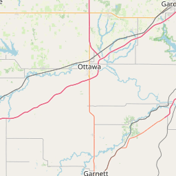
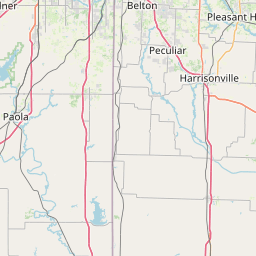
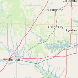
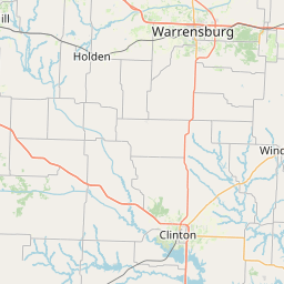
Leaflet | <a href="https://www.openstreetmap.org/copyright">© OpenStreetMap contributors</a>
Item
| Property | Value |
|---|---|
| id | 383817 |
| downstream_mainstem_id | https://geoconnex.us/ref/mainstems/379711 |
| encompassing_mainstem_basins | ['https://geoconnex.us/ref/mainstems/379711', 'https://geoconnex.us/ref/mainstems/324362', 'https://geoconnex.us/ref/mainstems/312532', 'https://geoconnex.us/ref/mainstems/312091'] |
| featuretype | ['https://www.opengis.net/def/schema/hy_features/hyf/HY_FlowPath', 'https://www.opengis.net/def/schema/hy_features/hyf/HY_WaterBody'] |
| fid | 19371 |
| head_2020huc12 | 102901020106 |
| head_nhdpv1_comid | 2993290 |
| head_nhdpv2_comid | https://geoconnex.us/nhdplusv2/comid/2993290 |
| head_nhdpv2huc12 | https://geoconnex.us/nhdplusv2/huc12/102901020106 |
| head_rf1id | 25181 |
| lengthkm | 40.3 |
| name_at_outlet | South Wea Creek |
| name_at_outlet_gnis_id | 479726 |
| new_mainstemid | |
| outlet_2020huc12 | 102901020107 |
| outlet_drainagearea_sqkm | 293.6 |
| outlet_nhdpv1_comid | 2993304 |
| outlet_nhdpv2_comid | https://geoconnex.us/nhdplusv2/comid/2993304 |
| outlet_nhdpv2huc12 | https://geoconnex.us/nhdplusv2/huc12/102901020107 |
| outlet_rf1id | 25179 |
| superseded | False |
| uri | https://geoconnex.us/ref/mainstems/383817 |