East Branch Rock River
Map

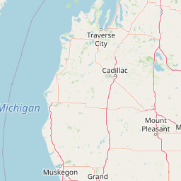

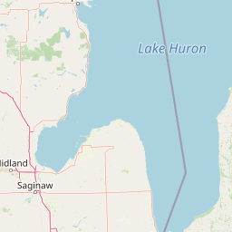

Leaflet | <a href="https://www.openstreetmap.org/copyright">© OpenStreetMap contributors</a>
Item
| Property | Value |
|---|---|
| id | 384092 |
| downstream_mainstem_id | https://geoconnex.us/ref/mainstems/327078 |
| encompassing_mainstem_basins | ['https://geoconnex.us/ref/mainstems/327078', 'https://geoconnex.us/ref/mainstems/312091'] |
| featuretype | ['https://www.opengis.net/def/schema/hy_features/hyf/HY_FlowPath', 'https://www.opengis.net/def/schema/hy_features/hyf/HY_WaterBody'] |
| fid | 11696 |
| head_2020huc12 | 070900010105 |
| head_nhdpv1_comid | 13292234 |
| head_nhdpv2_comid | https://geoconnex.us/nhdplusv2/comid/13292234 |
| head_nhdpv2huc12 | https://geoconnex.us/nhdplusv2/huc12/070900010105 |
| head_rf1id | 19163 |
| lengthkm | 68.7 |
| name_at_outlet | East Branch Rock River |
| name_at_outlet_gnis_id | 1564299 |
| new_mainstemid | |
| outlet_2020huc12 | 070900010107 |
| outlet_drainagearea_sqkm | 528.2 |
| outlet_nhdpv1_comid | 13291114 |
| outlet_nhdpv2_comid | https://geoconnex.us/nhdplusv2/comid/13291114 |
| outlet_nhdpv2huc12 | https://geoconnex.us/nhdplusv2/huc12/070900010107 |
| outlet_rf1id | 19162 |
| superseded | False |
| uri | https://geoconnex.us/ref/mainstems/384092 |