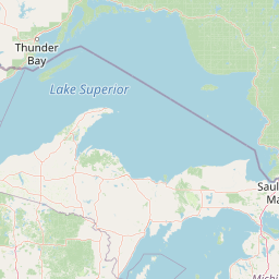
Pine River
Map


Leaflet | <a href="https://www.openstreetmap.org/copyright">© OpenStreetMap contributors</a>
Item
| Property | Value |
|---|---|
| id | 391149 |
| downstream_mainstem_id | https://geoconnex.us/ref/mainstems/312091 |
| encompassing_mainstem_basins | ['https://geoconnex.us/ref/mainstems/312091'] |
| featuretype | ['https://www.opengis.net/def/schema/hy_features/hyf/HY_FlowPath', 'https://www.opengis.net/def/schema/hy_features/hyf/HY_WaterBody'] |
| fid | 10463 |
| head_2020huc12 | 070101050101 |
| head_nhdpv1_comid | 4621922 |
| head_nhdpv2_comid | https://geoconnex.us/nhdplusv2/comid/4621922 |
| head_nhdpv2huc12 | https://geoconnex.us/nhdplusv2/huc12/070101050101 |
| head_rf1id | 17508 |
| lengthkm | 111.6 |
| name_at_outlet | Pine River |
| name_at_outlet_gnis_id | 659997 |
| new_mainstemid | |
| outlet_2020huc12 | 070101050604 |
| outlet_drainagearea_sqkm | 2024.3 |
| outlet_nhdpv1_comid | 4623070 |
| outlet_nhdpv2_comid | https://geoconnex.us/nhdplusv2/comid/4623070 |
| outlet_nhdpv2huc12 | https://geoconnex.us/nhdplusv2/huc12/070101050604 |
| outlet_rf1id | 17504 |
| superseded | False |
| uri | https://geoconnex.us/ref/mainstems/391149 |
Graph Results
| monitoringLocation | https://geoconnex.us/iow/wqp/MNPCA-11-0367-00-100 |
|---|---|
| siteName | MNPCA-11-0367-00-100 |
| datasetDescription | Dissolved oxygen saturation at MNPCA-11-0367-00-100 |
| type | Lake |
| url | https://www.waterqualitydata.us/provider/STORET/MNPCA/MNPCA-11-0367-00-100/ |
| variableMeasured | Dissolved oxygen saturation |
| variableUnit | percent |
| measurementTechnique | observation |
| temporalCoverage | 1981-01-01T00:00:00Z/1981-12-31T00:00:00Z |
| distributionName | Water Quality Portal |
| distributionURL | https://www.waterqualitydata.us/data/Result/search?siteid=MNPCA-11-0367-00-100&CharacteristicName=Dissolved oxygen saturation&mimeType=csv |
| distributionFormat | text/comma-separated-values |
| wkt | POINT (-94.4761 46.8131) |
| monitoringLocation | https://geoconnex.us/iow/wqp/MNPCA-11-0367-00-100 |
|---|---|
| siteName | MNPCA-11-0367-00-100 |
| datasetDescription | Alkalinity, total at MNPCA-11-0367-00-100 |
| type | Lake |
| url | https://www.waterqualitydata.us/provider/STORET/MNPCA/MNPCA-11-0367-00-100/ |
| variableMeasured | Alkalinity, total |
| variableUnit | milligrams per liter |
| measurementTechnique | observation |
| temporalCoverage | 1981-01-01T00:00:00Z/1981-12-31T00:00:00Z |
| distributionName | Water Quality Portal |
| distributionURL | https://www.waterqualitydata.us/data/Result/search?siteid=MNPCA-11-0367-00-100&CharacteristicName=Alkalinity, total&mimeType=csv |
| distributionFormat | text/comma-separated-values |
| wkt | POINT (-94.4761 46.8131) |
| monitoringLocation | https://geoconnex.us/iow/wqp/MNPCA-11-0367-00-100 |
|---|---|
| siteName | MNPCA-11-0367-00-100 |
| datasetDescription | pH at MNPCA-11-0367-00-100 |
| type | Lake |
| url | https://www.waterqualitydata.us/provider/STORET/MNPCA/MNPCA-11-0367-00-100/ |
| variableMeasured | pH |
| variableUnit | Unknown |
| measurementTechnique | observation |
| temporalCoverage | 1981-01-01T00:00:00Z/1981-12-31T00:00:00Z |
| distributionName | Water Quality Portal |
| distributionURL | https://www.waterqualitydata.us/data/Result/search?siteid=MNPCA-11-0367-00-100&CharacteristicName=pH&mimeType=csv |
| distributionFormat | text/comma-separated-values |
| wkt | POINT (-94.4761 46.8131) |
| monitoringLocation | https://geoconnex.us/iow/wqp/MNPCA-11-0367-00-100 |
|---|---|
| siteName | MNPCA-11-0367-00-100 |
| datasetDescription | Temperature, water at MNPCA-11-0367-00-100 |
| type | Lake |
| url | https://www.waterqualitydata.us/provider/STORET/MNPCA/MNPCA-11-0367-00-100/ |
| variableMeasured | Temperature, water |
| variableUnit | degrees Celsius |
| measurementTechnique | observation |
| temporalCoverage | 1981-01-01T00:00:00Z/1981-12-31T00:00:00Z |
| distributionName | Water Quality Portal |
| distributionURL | https://www.waterqualitydata.us/data/Result/search?siteid=MNPCA-11-0367-00-100&CharacteristicName=Temperature, water&mimeType=csv |
| distributionFormat | text/comma-separated-values |
| wkt | POINT (-94.4761 46.8131) |
| monitoringLocation | https://geoconnex.us/iow/wqp/MNPCA-11-0367-00-100 |
|---|---|
| siteName | MNPCA-11-0367-00-100 |
| datasetDescription | Phosphorus at MNPCA-11-0367-00-100 |
| type | Lake |
| url | https://www.waterqualitydata.us/provider/STORET/MNPCA/MNPCA-11-0367-00-100/ |
| variableMeasured | Phosphorus |
| variableUnit | parts per billion |
| measurementTechnique | observation |
| temporalCoverage | 1981-01-01T00:00:00Z/1981-12-31T00:00:00Z |
| distributionName | Water Quality Portal |
| distributionURL | https://www.waterqualitydata.us/data/Result/search?siteid=MNPCA-11-0367-00-100&CharacteristicName=Phosphorus&mimeType=csv |
| distributionFormat | text/comma-separated-values |
| wkt | POINT (-94.4761 46.8131) |
| monitoringLocation | https://geoconnex.us/iow/wqp/MNPCA-11-0367-00-100 |
|---|---|
| siteName | MNPCA-11-0367-00-100 |
| datasetDescription | Dissolved oxygen (DO) at MNPCA-11-0367-00-100 |
| type | Lake |
| url | https://www.waterqualitydata.us/provider/STORET/MNPCA/MNPCA-11-0367-00-100/ |
| variableMeasured | Dissolved oxygen (DO) |
| variableUnit | milligrams per liter |
| measurementTechnique | observation |
| temporalCoverage | 1981-01-01T00:00:00Z/1981-12-31T00:00:00Z |
| distributionName | Water Quality Portal |
| distributionURL | https://www.waterqualitydata.us/data/Result/search?siteid=MNPCA-11-0367-00-100&CharacteristicName=Dissolved oxygen (DO)&mimeType=csv |
| distributionFormat | text/comma-separated-values |
| wkt | POINT (-94.4761 46.8131) |
| monitoringLocation | https://geoconnex.us/iow/wqp/MNPCA-11-0367-00-100 |
|---|---|
| siteName | MNPCA-11-0367-00-100 |
| datasetDescription | Depth, Secchi disk depth at MNPCA-11-0367-00-100 |
| type | Lake |
| url | https://www.waterqualitydata.us/provider/STORET/MNPCA/MNPCA-11-0367-00-100/ |
| variableMeasured | Depth, Secchi disk depth |
| variableUnit | meters |
| measurementTechnique | observation |
| temporalCoverage | 1981-01-01T00:00:00Z/1981-12-31T00:00:00Z |
| distributionName | Water Quality Portal |
| distributionURL | https://www.waterqualitydata.us/data/Result/search?siteid=MNPCA-11-0367-00-100&CharacteristicName=Depth, Secchi disk depth&mimeType=csv |
| distributionFormat | text/comma-separated-values |
| wkt | POINT (-94.4761 46.8131) |
| monitoringLocation | https://geoconnex.us/iow/wqp/MNPCA-11-0367-00-100 |
|---|---|
| siteName | MNPCA-11-0367-00-100 |
| datasetDescription | Chlorophyll a, corrected for pheophytin at MNPCA-11-0367-00-100 |
| type | Lake |
| url | https://www.waterqualitydata.us/provider/STORET/MNPCA/MNPCA-11-0367-00-100/ |
| variableMeasured | Chlorophyll a, corrected for pheophytin |
| variableUnit | micrograms per liter |
| measurementTechnique | observation |
| temporalCoverage | 1981-01-01T00:00:00Z/1981-12-31T00:00:00Z |
| distributionName | Water Quality Portal |
| distributionURL | https://www.waterqualitydata.us/data/Result/search?siteid=MNPCA-11-0367-00-100&CharacteristicName=Chlorophyll a, corrected for pheophytin&mimeType=csv |
| distributionFormat | text/comma-separated-values |
| wkt | POINT (-94.4761 46.8131) |
| monitoringLocation | https://geoconnex.us/iow/wqp/MNPCA-11-0367-00-100 |
|---|---|
| siteName | MNPCA-11-0367-00-100 |
| datasetDescription | Ammonia-nitrogen at MNPCA-11-0367-00-100 |
| type | Lake |
| url | https://www.waterqualitydata.us/provider/STORET/MNPCA/MNPCA-11-0367-00-100/ |
| variableMeasured | Ammonia-nitrogen |
| variableUnit | milligrams per liter |
| measurementTechnique | observation |
| temporalCoverage | 1981-01-01T00:00:00Z/1981-12-31T00:00:00Z |
| distributionName | Water Quality Portal |
| distributionURL | https://www.waterqualitydata.us/data/Result/search?siteid=MNPCA-11-0367-00-100&CharacteristicName=Ammonia-nitrogen&mimeType=csv |
| distributionFormat | text/comma-separated-values |
| wkt | POINT (-94.4761 46.8131) |
| monitoringLocation | https://geoconnex.us/iow/wqp/MNPCA-11-0367-00-100 |
|---|---|
| siteName | MNPCA-11-0367-00-100 |
| datasetDescription | Kjeldahl nitrogen at MNPCA-11-0367-00-100 |
| type | Lake |
| url | https://www.waterqualitydata.us/provider/STORET/MNPCA/MNPCA-11-0367-00-100/ |
| variableMeasured | Kjeldahl nitrogen |
| variableUnit | milligrams per liter |
| measurementTechnique | observation |
| temporalCoverage | 1981-01-01T00:00:00Z/1981-12-31T00:00:00Z |
| distributionName | Water Quality Portal |
| distributionURL | https://www.waterqualitydata.us/data/Result/search?siteid=MNPCA-11-0367-00-100&CharacteristicName=Kjeldahl nitrogen&mimeType=csv |
| distributionFormat | text/comma-separated-values |
| wkt | POINT (-94.4761 46.8131) |
| monitoringLocation | https://geoconnex.us/iow/wqp/MNPCA-11-0367-00-100 |
|---|---|
| siteName | MNPCA-11-0367-00-100 |
| datasetDescription | Apparent color at MNPCA-11-0367-00-100 |
| type | Lake |
| url | https://www.waterqualitydata.us/provider/STORET/MNPCA/MNPCA-11-0367-00-100/ |
| variableMeasured | Apparent color |
| variableUnit | platinum-cobalt units |
| measurementTechnique | observation |
| temporalCoverage | 1981-01-01T00:00:00Z/1981-12-31T00:00:00Z |
| distributionName | Water Quality Portal |
| distributionURL | https://www.waterqualitydata.us/data/Result/search?siteid=MNPCA-11-0367-00-100&CharacteristicName=Apparent color&mimeType=csv |
| distributionFormat | text/comma-separated-values |
| wkt | POINT (-94.4761 46.8131) |
| monitoringLocation | https://geoconnex.us/iow/wqp/MNPCA-11-0367-00-100 |
|---|---|
| siteName | MNPCA-11-0367-00-100 |
| datasetDescription | Organic Nitrogen at MNPCA-11-0367-00-100 |
| type | Lake |
| url | https://www.waterqualitydata.us/provider/STORET/MNPCA/MNPCA-11-0367-00-100/ |
| variableMeasured | Organic Nitrogen |
| variableUnit | milligrams per liter |
| measurementTechnique | observation |
| temporalCoverage | 1981-01-01T00:00:00Z/1981-12-31T00:00:00Z |
| distributionName | Water Quality Portal |
| distributionURL | https://www.waterqualitydata.us/data/Result/search?siteid=MNPCA-11-0367-00-100&CharacteristicName=Organic Nitrogen&mimeType=csv |
| distributionFormat | text/comma-separated-values |
| wkt | POINT (-94.4761 46.8131) |
| monitoringLocation | https://geoconnex.us/iow/wqp/MNPCA-S015-004 |
|---|---|
| siteName | MNPCA-S015-004 |
| datasetDescription | Phosphorus at MNPCA-S015-004 |
| type | River/Stream Perennial |
| url | https://www.waterqualitydata.us/provider/STORET/MNPCA/MNPCA-S015-004/ |
| variableMeasured | Phosphorus |
| variableUnit | parts per billion |
| measurementTechnique | observation |
| temporalCoverage | 2017-01-01T00:00:00Z/2022-12-31T00:00:00Z |
| distributionName | Water Quality Portal |
| distributionURL | https://www.waterqualitydata.us/data/Result/search?siteid=MNPCA-S015-004&CharacteristicName=Phosphorus&mimeType=csv |
| distributionFormat | text/comma-separated-values |
| wkt | POINT (-94.404899 46.823624) |
| monitoringLocation | https://geoconnex.us/iow/wqp/MNPCA-S015-004 |
|---|---|
| siteName | MNPCA-S015-004 |
| datasetDescription | Total suspended solids at MNPCA-S015-004 |
| type | River/Stream Perennial |
| url | https://www.waterqualitydata.us/provider/STORET/MNPCA/MNPCA-S015-004/ |
| variableMeasured | Total suspended solids |
| variableUnit | milligrams per liter |
| measurementTechnique | observation |
| temporalCoverage | 2017-01-01T00:00:00Z/2022-12-31T00:00:00Z |
| distributionName | Water Quality Portal |
| distributionURL | https://www.waterqualitydata.us/data/Result/search?siteid=MNPCA-S015-004&CharacteristicName=Total suspended solids&mimeType=csv |
| distributionFormat | text/comma-separated-values |
| wkt | POINT (-94.404899 46.823624) |
| monitoringLocation | https://geoconnex.us/iow/wqp/MNPCA-18-0315-00-204 |
|---|---|
| siteName | MNPCA-18-0315-00-204 |
| datasetDescription | Depth, Secchi disk depth at MNPCA-18-0315-00-204 |
| type | Lake |
| url | https://www.waterqualitydata.us/provider/STORET/MNPCA/MNPCA-18-0315-00-204/ |
| variableMeasured | Depth, Secchi disk depth |
| variableUnit | meters |
| measurementTechnique | observation |
| temporalCoverage | 1984-01-01T00:00:00Z/1991-12-31T00:00:00Z |
| distributionName | Water Quality Portal |
| distributionURL | https://www.waterqualitydata.us/data/Result/search?siteid=MNPCA-18-0315-00-204&CharacteristicName=Depth, Secchi disk depth&mimeType=csv |
| distributionFormat | text/comma-separated-values |
| wkt | POINT (-94.174263 46.709956) |
| monitoringLocation | https://geoconnex.us/iow/wqp/MNPCA-18-0315-00-204 |
|---|---|
| siteName | MNPCA-18-0315-00-204 |
| datasetDescription | Lake recreational suitability (choice list) at MNPCA-18-0315-00-204 |
| type | Lake |
| url | https://www.waterqualitydata.us/provider/STORET/MNPCA/MNPCA-18-0315-00-204/ |
| variableMeasured | Lake recreational suitability (choice list) |
| variableUnit | Unknown |
| measurementTechnique | observation |
| temporalCoverage | 1989-01-01T00:00:00Z/1991-12-31T00:00:00Z |
| distributionName | Water Quality Portal |
| distributionURL | https://www.waterqualitydata.us/data/Result/search?siteid=MNPCA-18-0315-00-204&CharacteristicName=Lake recreational suitability (choice list)&mimeType=csv |
| distributionFormat | text/comma-separated-values |
| wkt | POINT (-94.174263 46.709956) |
| monitoringLocation | https://geoconnex.us/iow/wqp/MNPCA-18-0315-00-204 |
|---|---|
| siteName | MNPCA-18-0315-00-204 |
| datasetDescription | Lake physical appearance (choice list) at MNPCA-18-0315-00-204 |
| type | Lake |
| url | https://www.waterqualitydata.us/provider/STORET/MNPCA/MNPCA-18-0315-00-204/ |
| variableMeasured | Lake physical appearance (choice list) |
| variableUnit | Unknown |
| measurementTechnique | observation |
| temporalCoverage | 1989-01-01T00:00:00Z/1991-12-31T00:00:00Z |
| distributionName | Water Quality Portal |
| distributionURL | https://www.waterqualitydata.us/data/Result/search?siteid=MNPCA-18-0315-00-204&CharacteristicName=Lake physical appearance (choice list)&mimeType=csv |
| distributionFormat | text/comma-separated-values |
| wkt | POINT (-94.174263 46.709956) |
| monitoringLocation | https://geoconnex.us/iow/wqp/MNPCA-18-0311-00-207 |
|---|---|
| siteName | MNPCA-18-0311-00-207 |
| datasetDescription | Water appearance (text) at MNPCA-18-0311-00-207 |
| type | Lake |
| url | https://www.waterqualitydata.us/provider/STORET/MNPCA/MNPCA-18-0311-00-207/ |
| variableMeasured | Water appearance (text) |
| variableUnit | Unknown |
| measurementTechnique | observation |
| temporalCoverage | 2016-01-01T00:00:00Z/2017-12-31T00:00:00Z |
| distributionName | Water Quality Portal |
| distributionURL | https://www.waterqualitydata.us/data/Result/search?siteid=MNPCA-18-0311-00-207&CharacteristicName=Water appearance (text)&mimeType=csv |
| distributionFormat | text/comma-separated-values |
| wkt | POINT (-94.125811 46.688026) |
| monitoringLocation | https://geoconnex.us/iow/wqp/MNPCA-18-0311-00-207 |
|---|---|
| siteName | MNPCA-18-0311-00-207 |
| datasetDescription | Lake recreational suitability (choice list) at MNPCA-18-0311-00-207 |
| type | Lake |
| url | https://www.waterqualitydata.us/provider/STORET/MNPCA/MNPCA-18-0311-00-207/ |
| variableMeasured | Lake recreational suitability (choice list) |
| variableUnit | Unknown |
| measurementTechnique | observation |
| temporalCoverage | 2000-01-01T00:00:00Z/2017-12-31T00:00:00Z |
| distributionName | Water Quality Portal |
| distributionURL | https://www.waterqualitydata.us/data/Result/search?siteid=MNPCA-18-0311-00-207&CharacteristicName=Lake recreational suitability (choice list)&mimeType=csv |
| distributionFormat | text/comma-separated-values |
| wkt | POINT (-94.125811 46.688026) |
| monitoringLocation | https://geoconnex.us/iow/wqp/MNPCA-18-0311-00-207 |
|---|---|
| siteName | MNPCA-18-0311-00-207 |
| datasetDescription | Depth, Secchi disk depth at MNPCA-18-0311-00-207 |
| type | Lake |
| url | https://www.waterqualitydata.us/provider/STORET/MNPCA/MNPCA-18-0311-00-207/ |
| variableMeasured | Depth, Secchi disk depth |
| variableUnit | meters |
| measurementTechnique | observation |
| temporalCoverage | 2000-01-01T00:00:00Z/2017-12-31T00:00:00Z |
| distributionName | Water Quality Portal |
| distributionURL | https://www.waterqualitydata.us/data/Result/search?siteid=MNPCA-18-0311-00-207&CharacteristicName=Depth, Secchi disk depth&mimeType=csv |
| distributionFormat | text/comma-separated-values |
| wkt | POINT (-94.125811 46.688026) |
| monitoringLocation | https://geoconnex.us/iow/wqp/MNPCA-18-0311-00-207 |
|---|---|
| siteName | MNPCA-18-0311-00-207 |
| datasetDescription | Lake physical appearance (choice list) at MNPCA-18-0311-00-207 |
| type | Lake |
| url | https://www.waterqualitydata.us/provider/STORET/MNPCA/MNPCA-18-0311-00-207/ |
| variableMeasured | Lake physical appearance (choice list) |
| variableUnit | Unknown |
| measurementTechnique | observation |
| temporalCoverage | 2000-01-01T00:00:00Z/2017-12-31T00:00:00Z |
| distributionName | Water Quality Portal |
| distributionURL | https://www.waterqualitydata.us/data/Result/search?siteid=MNPCA-18-0311-00-207&CharacteristicName=Lake physical appearance (choice list)&mimeType=csv |
| distributionFormat | text/comma-separated-values |
| wkt | POINT (-94.125811 46.688026) |
| monitoringLocation | https://geoconnex.us/iow/wqp/MNPCA-18-0310-00-206 |
|---|---|
| siteName | MNPCA-18-0310-00-206 |
| datasetDescription | Depth, Secchi disk depth at MNPCA-18-0310-00-206 |
| type | Lake |
| url | https://www.waterqualitydata.us/provider/STORET/MNPCA/MNPCA-18-0310-00-206/ |
| variableMeasured | Depth, Secchi disk depth |
| variableUnit | meters |
| measurementTechnique | observation |
| temporalCoverage | 1984-01-01T00:00:00Z/2020-12-31T00:00:00Z |
| distributionName | Water Quality Portal |
| distributionURL | https://www.waterqualitydata.us/data/Result/search?siteid=MNPCA-18-0310-00-206&CharacteristicName=Depth, Secchi disk depth&mimeType=csv |
| distributionFormat | text/comma-separated-values |
| wkt | POINT (-94.20748 46.685924) |
| monitoringLocation | https://geoconnex.us/iow/wqp/MNPCA-18-0310-00-206 |
|---|---|
| siteName | MNPCA-18-0310-00-206 |
| datasetDescription | Phosphorus at MNPCA-18-0310-00-206 |
| type | Lake |
| url | https://www.waterqualitydata.us/provider/STORET/MNPCA/MNPCA-18-0310-00-206/ |
| variableMeasured | Phosphorus |
| variableUnit | parts per billion |
| measurementTechnique | observation |
| temporalCoverage | 2017-01-01T00:00:00Z/2020-12-31T00:00:00Z |
| distributionName | Water Quality Portal |
| distributionURL | https://www.waterqualitydata.us/data/Result/search?siteid=MNPCA-18-0310-00-206&CharacteristicName=Phosphorus&mimeType=csv |
| distributionFormat | text/comma-separated-values |
| wkt | POINT (-94.20748 46.685924) |
| monitoringLocation | https://geoconnex.us/iow/wqp/MNPCA-18-0310-00-206 |
|---|---|
| siteName | MNPCA-18-0310-00-206 |
| datasetDescription | Lake recreational suitability (choice list) at MNPCA-18-0310-00-206 |
| type | Lake |
| url | https://www.waterqualitydata.us/provider/STORET/MNPCA/MNPCA-18-0310-00-206/ |
| variableMeasured | Lake recreational suitability (choice list) |
| variableUnit | Unknown |
| measurementTechnique | observation |
| temporalCoverage | 2017-01-01T00:00:00Z/2020-12-31T00:00:00Z |
| distributionName | Water Quality Portal |
| distributionURL | https://www.waterqualitydata.us/data/Result/search?siteid=MNPCA-18-0310-00-206&CharacteristicName=Lake recreational suitability (choice list)&mimeType=csv |
| distributionFormat | text/comma-separated-values |
| wkt | POINT (-94.20748 46.685924) |
| monitoringLocation | https://geoconnex.us/iow/wqp/MNPCA-18-0310-00-206 |
|---|---|
| siteName | MNPCA-18-0310-00-206 |
| datasetDescription | Temperature, water at MNPCA-18-0310-00-206 |
| type | Lake |
| url | https://www.waterqualitydata.us/provider/STORET/MNPCA/MNPCA-18-0310-00-206/ |
| variableMeasured | Temperature, water |
| variableUnit | degrees Celsius |
| measurementTechnique | observation |
| temporalCoverage | 2017-01-01T00:00:00Z/2020-12-31T00:00:00Z |
| distributionName | Water Quality Portal |
| distributionURL | https://www.waterqualitydata.us/data/Result/search?siteid=MNPCA-18-0310-00-206&CharacteristicName=Temperature, water&mimeType=csv |
| distributionFormat | text/comma-separated-values |
| wkt | POINT (-94.20748 46.685924) |
| monitoringLocation | https://geoconnex.us/iow/wqp/MNPCA-18-0310-00-206 |
|---|---|
| siteName | MNPCA-18-0310-00-206 |
| datasetDescription | Chlorophyll a, corrected for pheophytin at MNPCA-18-0310-00-206 |
| type | Lake |
| url | https://www.waterqualitydata.us/provider/STORET/MNPCA/MNPCA-18-0310-00-206/ |
| variableMeasured | Chlorophyll a, corrected for pheophytin |
| variableUnit | micrograms per liter |
| measurementTechnique | observation |
| temporalCoverage | 2017-01-01T00:00:00Z/2020-12-31T00:00:00Z |
| distributionName | Water Quality Portal |
| distributionURL | https://www.waterqualitydata.us/data/Result/search?siteid=MNPCA-18-0310-00-206&CharacteristicName=Chlorophyll a, corrected for pheophytin&mimeType=csv |
| distributionFormat | text/comma-separated-values |
| wkt | POINT (-94.20748 46.685924) |
| monitoringLocation | https://geoconnex.us/iow/wqp/MNPCA-18-0310-00-206 |
|---|---|
| siteName | MNPCA-18-0310-00-206 |
| datasetDescription | Lake physical appearance (choice list) at MNPCA-18-0310-00-206 |
| type | Lake |
| url | https://www.waterqualitydata.us/provider/STORET/MNPCA/MNPCA-18-0310-00-206/ |
| variableMeasured | Lake physical appearance (choice list) |
| variableUnit | Unknown |
| measurementTechnique | observation |
| temporalCoverage | 2017-01-01T00:00:00Z/2020-12-31T00:00:00Z |
| distributionName | Water Quality Portal |
| distributionURL | https://www.waterqualitydata.us/data/Result/search?siteid=MNPCA-18-0310-00-206&CharacteristicName=Lake physical appearance (choice list)&mimeType=csv |
| distributionFormat | text/comma-separated-values |
| wkt | POINT (-94.20748 46.685924) |
| monitoringLocation | https://geoconnex.us/iow/wqp/MNPCA-18-0251-02-204 |
|---|---|
| siteName | MNPCA-18-0251-02-204 |
| datasetDescription | Depth, Secchi disk depth at MNPCA-18-0251-02-204 |
| type | Lake |
| url | https://www.waterqualitydata.us/provider/STORET/MNPCA/MNPCA-18-0251-02-204/ |
| variableMeasured | Depth, Secchi disk depth |
| variableUnit | meters |
| measurementTechnique | observation |
| temporalCoverage | 1990-01-01T00:00:00Z/2001-12-31T00:00:00Z |
| distributionName | Water Quality Portal |
| distributionURL | https://www.waterqualitydata.us/data/Result/search?siteid=MNPCA-18-0251-02-204&CharacteristicName=Depth, Secchi disk depth&mimeType=csv |
| distributionFormat | text/comma-separated-values |
| wkt | POINT (-94.119726 46.582279) |
| monitoringLocation | https://geoconnex.us/iow/wqp/MNPCA-18-0251-02-204 |
|---|---|
| siteName | MNPCA-18-0251-02-204 |
| datasetDescription | Lake recreational suitability (choice list) at MNPCA-18-0251-02-204 |
| type | Lake |
| url | https://www.waterqualitydata.us/provider/STORET/MNPCA/MNPCA-18-0251-02-204/ |
| variableMeasured | Lake recreational suitability (choice list) |
| variableUnit | Unknown |
| measurementTechnique | observation |
| temporalCoverage | 1990-01-01T00:00:00Z/1991-12-31T00:00:00Z |
| distributionName | Water Quality Portal |
| distributionURL | https://www.waterqualitydata.us/data/Result/search?siteid=MNPCA-18-0251-02-204&CharacteristicName=Lake recreational suitability (choice list)&mimeType=csv |
| distributionFormat | text/comma-separated-values |
| wkt | POINT (-94.119726 46.582279) |
| monitoringLocation | https://geoconnex.us/iow/wqp/MNPCA-18-0251-02-204 |
|---|---|
| siteName | MNPCA-18-0251-02-204 |
| datasetDescription | Lake physical appearance (choice list) at MNPCA-18-0251-02-204 |
| type | Lake |
| url | https://www.waterqualitydata.us/provider/STORET/MNPCA/MNPCA-18-0251-02-204/ |
| variableMeasured | Lake physical appearance (choice list) |
| variableUnit | Unknown |
| measurementTechnique | observation |
| temporalCoverage | 1990-01-01T00:00:00Z/1991-12-31T00:00:00Z |
| distributionName | Water Quality Portal |
| distributionURL | https://www.waterqualitydata.us/data/Result/search?siteid=MNPCA-18-0251-02-204&CharacteristicName=Lake physical appearance (choice list)&mimeType=csv |
| distributionFormat | text/comma-separated-values |
| wkt | POINT (-94.119726 46.582279) |
| monitoringLocation | https://geoconnex.us/iow/wqp/MNPCA-18-0251-02-204 |
|---|---|
| siteName | MNPCA-18-0251-02-204 |
| datasetDescription | Phosphorus at MNPCA-18-0251-02-204 |
| type | Lake |
| url | https://www.waterqualitydata.us/provider/STORET/MNPCA/MNPCA-18-0251-02-204/ |
| variableMeasured | Phosphorus |
| variableUnit | parts per billion |
| measurementTechnique | observation |
| temporalCoverage | 2001-01-01T00:00:00Z/2001-12-31T00:00:00Z |
| distributionName | Water Quality Portal |
| distributionURL | https://www.waterqualitydata.us/data/Result/search?siteid=MNPCA-18-0251-02-204&CharacteristicName=Phosphorus&mimeType=csv |
| distributionFormat | text/comma-separated-values |
| wkt | POINT (-94.119726 46.582279) |
| monitoringLocation | https://geoconnex.us/iow/wqp/MNPCA-18-0251-02-204 |
|---|---|
| siteName | MNPCA-18-0251-02-204 |
| datasetDescription | Chlorophyll a, corrected for pheophytin at MNPCA-18-0251-02-204 |
| type | Lake |
| url | https://www.waterqualitydata.us/provider/STORET/MNPCA/MNPCA-18-0251-02-204/ |
| variableMeasured | Chlorophyll a, corrected for pheophytin |
| variableUnit | micrograms per liter |
| measurementTechnique | observation |
| temporalCoverage | 2001-01-01T00:00:00Z/2001-12-31T00:00:00Z |
| distributionName | Water Quality Portal |
| distributionURL | https://www.waterqualitydata.us/data/Result/search?siteid=MNPCA-18-0251-02-204&CharacteristicName=Chlorophyll a, corrected for pheophytin&mimeType=csv |
| distributionFormat | text/comma-separated-values |
| wkt | POINT (-94.119726 46.582279) |
| monitoringLocation | https://geoconnex.us/iow/wqp/MNPCA_BIO-S012-249 |
|---|---|
| siteName | MNPCA_BIO-S012-249 |
| datasetDescription | Specific conductance at MNPCA_BIO-S012-249 |
| type | River/Stream |
| url | https://www.waterqualitydata.us/provider/STORET/MNPCA_BIO/MNPCA_BIO-S012-249/ |
| variableMeasured | Specific conductance |
| variableUnit | microsiemens per centimeter |
| measurementTechnique | observation |
| temporalCoverage | 2012-01-01T00:00:00Z/2012-12-31T00:00:00Z |
| distributionName | Water Quality Portal |
| distributionURL | https://www.waterqualitydata.us/data/Result/search?siteid=MNPCA_BIO-S012-249&CharacteristicName=Specific conductance&mimeType=csv |
| distributionFormat | text/comma-separated-values |
| wkt | POINT (-94.02853 46.57386) |
| monitoringLocation | https://geoconnex.us/iow/wqp/MNPCA_BIO-S012-249 |
|---|---|
| siteName | MNPCA_BIO-S012-249 |
| datasetDescription | Total suspended solids at MNPCA_BIO-S012-249 |
| type | River/Stream |
| url | https://www.waterqualitydata.us/provider/STORET/MNPCA_BIO/MNPCA_BIO-S012-249/ |
| variableMeasured | Total suspended solids |
| variableUnit | milligrams per liter |
| measurementTechnique | observation |
| temporalCoverage | 2012-01-01T00:00:00Z/2012-12-31T00:00:00Z |
| distributionName | Water Quality Portal |
| distributionURL | https://www.waterqualitydata.us/data/Result/search?siteid=MNPCA_BIO-S012-249&CharacteristicName=Total suspended solids&mimeType=csv |
| distributionFormat | text/comma-separated-values |
| wkt | POINT (-94.02853 46.57386) |
| monitoringLocation | https://geoconnex.us/iow/wqp/MNPCA_BIO-S012-249 |
|---|---|
| siteName | MNPCA_BIO-S012-249 |
| datasetDescription | Phosphorus at MNPCA_BIO-S012-249 |
| type | River/Stream |
| url | https://www.waterqualitydata.us/provider/STORET/MNPCA_BIO/MNPCA_BIO-S012-249/ |
| variableMeasured | Phosphorus |
| variableUnit | parts per billion |
| measurementTechnique | observation |
| temporalCoverage | 2012-01-01T00:00:00Z/2012-12-31T00:00:00Z |
| distributionName | Water Quality Portal |
| distributionURL | https://www.waterqualitydata.us/data/Result/search?siteid=MNPCA_BIO-S012-249&CharacteristicName=Phosphorus&mimeType=csv |
| distributionFormat | text/comma-separated-values |
| wkt | POINT (-94.02853 46.57386) |
| monitoringLocation | https://geoconnex.us/iow/wqp/MNPCA_BIO-S012-249 |
|---|---|
| siteName | MNPCA_BIO-S012-249 |
| datasetDescription | Volatile suspended solids at MNPCA_BIO-S012-249 |
| type | River/Stream |
| url | https://www.waterqualitydata.us/provider/STORET/MNPCA_BIO/MNPCA_BIO-S012-249/ |
| variableMeasured | Volatile suspended solids |
| variableUnit | milligrams per liter |
| measurementTechnique | observation |
| temporalCoverage | 2012-01-01T00:00:00Z/2012-12-31T00:00:00Z |
| distributionName | Water Quality Portal |
| distributionURL | https://www.waterqualitydata.us/data/Result/search?siteid=MNPCA_BIO-S012-249&CharacteristicName=Volatile suspended solids&mimeType=csv |
| distributionFormat | text/comma-separated-values |
| wkt | POINT (-94.02853 46.57386) |
| monitoringLocation | https://geoconnex.us/iow/wqp/MNPCA_BIO-S012-249 |
|---|---|
| siteName | MNPCA_BIO-S012-249 |
| datasetDescription | Dissolved oxygen (DO) at MNPCA_BIO-S012-249 |
| type | River/Stream |
| url | https://www.waterqualitydata.us/provider/STORET/MNPCA_BIO/MNPCA_BIO-S012-249/ |
| variableMeasured | Dissolved oxygen (DO) |
| variableUnit | milligrams per liter |
| measurementTechnique | observation |
| temporalCoverage | 2012-01-01T00:00:00Z/2012-12-31T00:00:00Z |
| distributionName | Water Quality Portal |
| distributionURL | https://www.waterqualitydata.us/data/Result/search?siteid=MNPCA_BIO-S012-249&CharacteristicName=Dissolved oxygen (DO)&mimeType=csv |
| distributionFormat | text/comma-separated-values |
| wkt | POINT (-94.02853 46.57386) |
| monitoringLocation | https://geoconnex.us/iow/wqp/MNPCA_BIO-S012-249 |
|---|---|
| siteName | MNPCA_BIO-S012-249 |
| datasetDescription | Temperature, water at MNPCA_BIO-S012-249 |
| type | River/Stream |
| url | https://www.waterqualitydata.us/provider/STORET/MNPCA_BIO/MNPCA_BIO-S012-249/ |
| variableMeasured | Temperature, water |
| variableUnit | degrees Celsius |
| measurementTechnique | observation |
| temporalCoverage | 2012-01-01T00:00:00Z/2012-12-31T00:00:00Z |
| distributionName | Water Quality Portal |
| distributionURL | https://www.waterqualitydata.us/data/Result/search?siteid=MNPCA_BIO-S012-249&CharacteristicName=Temperature, water&mimeType=csv |
| distributionFormat | text/comma-separated-values |
| wkt | POINT (-94.02853 46.57386) |
| monitoringLocation | https://geoconnex.us/iow/wqp/MNPCA_BIO-S012-249 |
|---|---|
| siteName | MNPCA_BIO-S012-249 |
| datasetDescription | pH at MNPCA_BIO-S012-249 |
| type | River/Stream |
| url | https://www.waterqualitydata.us/provider/STORET/MNPCA_BIO/MNPCA_BIO-S012-249/ |
| variableMeasured | pH |
| variableUnit | Unknown |
| measurementTechnique | observation |
| temporalCoverage | 2012-01-01T00:00:00Z/2012-12-31T00:00:00Z |
| distributionName | Water Quality Portal |
| distributionURL | https://www.waterqualitydata.us/data/Result/search?siteid=MNPCA_BIO-S012-249&CharacteristicName=pH&mimeType=csv |
| distributionFormat | text/comma-separated-values |
| wkt | POINT (-94.02853 46.57386) |
| monitoringLocation | https://geoconnex.us/iow/wqp/MNPCA_BIO-S012-249 |
|---|---|
| siteName | MNPCA_BIO-S012-249 |
| datasetDescription | Transparency, tube with disk at MNPCA_BIO-S012-249 |
| type | River/Stream |
| url | https://www.waterqualitydata.us/provider/STORET/MNPCA_BIO/MNPCA_BIO-S012-249/ |
| variableMeasured | Transparency, tube with disk |
| variableUnit | centimeters |
| measurementTechnique | observation |
| temporalCoverage | 2012-01-01T00:00:00Z/2012-12-31T00:00:00Z |
| distributionName | Water Quality Portal |
| distributionURL | https://www.waterqualitydata.us/data/Result/search?siteid=MNPCA_BIO-S012-249&CharacteristicName=Transparency, tube with disk&mimeType=csv |
| distributionFormat | text/comma-separated-values |
| wkt | POINT (-94.02853 46.57386) |
| monitoringLocation | https://geoconnex.us/iow/wqp/MNPCA_BIO-S012-249 |
|---|---|
| siteName | MNPCA_BIO-S012-249 |
| datasetDescription | Dissolved oxygen saturation at MNPCA_BIO-S012-249 |
| type | River/Stream |
| url | https://www.waterqualitydata.us/provider/STORET/MNPCA_BIO/MNPCA_BIO-S012-249/ |
| variableMeasured | Dissolved oxygen saturation |
| variableUnit | percent |
| measurementTechnique | observation |
| temporalCoverage | 2012-01-01T00:00:00Z/2012-12-31T00:00:00Z |
| distributionName | Water Quality Portal |
| distributionURL | https://www.waterqualitydata.us/data/Result/search?siteid=MNPCA_BIO-S012-249&CharacteristicName=Dissolved oxygen saturation&mimeType=csv |
| distributionFormat | text/comma-separated-values |
| wkt | POINT (-94.02853 46.57386) |
| monitoringLocation | https://geoconnex.us/iow/wqp/MNPCA_BIO-S012-249 |
|---|---|
| siteName | MNPCA_BIO-S012-249 |
| datasetDescription | Ammonia at MNPCA_BIO-S012-249 |
| type | River/Stream |
| url | https://www.waterqualitydata.us/provider/STORET/MNPCA_BIO/MNPCA_BIO-S012-249/ |
| variableMeasured | Ammonia |
| variableUnit | milligrams per liter |
| measurementTechnique | observation |
| temporalCoverage | 2012-01-01T00:00:00Z/2012-12-31T00:00:00Z |
| distributionName | Water Quality Portal |
| distributionURL | https://www.waterqualitydata.us/data/Result/search?siteid=MNPCA_BIO-S012-249&CharacteristicName=Ammonia&mimeType=csv |
| distributionFormat | text/comma-separated-values |
| wkt | POINT (-94.02853 46.57386) |
| monitoringLocation | https://geoconnex.us/iow/wqp/USGS-463836094080301 |
|---|---|
| siteName | USGS-463836094080301 |
| datasetDescription | Diltiazem at USGS-463836094080301 |
| type | Well |
| url | https://www.waterqualitydata.us/provider/NWIS/USGS-MN/USGS-463836094080301/ |
| variableMeasured | Diltiazem |
| variableUnit | nanograms per liter |
| measurementTechnique | observation |
| temporalCoverage | 2012-01-01T00:00:00Z/2012-12-31T00:00:00Z |
| distributionName | Water Quality Portal |
| distributionURL | https://www.waterqualitydata.us/data/Result/search?siteid=USGS-463836094080301&CharacteristicName=Diltiazem&mimeType=csv |
| distributionFormat | text/comma-separated-values |
| wkt | POINT (-94.1343 46.64338056) |
| monitoringLocation | https://geoconnex.us/iow/wqp/USGS-463836094080301 |
|---|---|
| siteName | USGS-463836094080301 |
| datasetDescription | Ethyl nicotinate-d4 at USGS-463836094080301 |
| type | Well |
| url | https://www.waterqualitydata.us/provider/NWIS/USGS-MN/USGS-463836094080301/ |
| variableMeasured | Ethyl nicotinate-d4 |
| variableUnit | percent |
| measurementTechnique | observation |
| temporalCoverage | 2012-01-01T00:00:00Z/2012-12-31T00:00:00Z |
| distributionName | Water Quality Portal |
| distributionURL | https://www.waterqualitydata.us/data/Result/search?siteid=USGS-463836094080301&CharacteristicName=Ethyl nicotinate-d4&mimeType=csv |
| distributionFormat | text/comma-separated-values |
| wkt | POINT (-94.1343 46.64338056) |
| monitoringLocation | https://geoconnex.us/iow/wqp/USGS-463836094080301 |
|---|---|
| siteName | USGS-463836094080301 |
| datasetDescription | Mestranol at USGS-463836094080301 |
| type | Well |
| url | https://www.waterqualitydata.us/provider/NWIS/USGS-MN/USGS-463836094080301/ |
| variableMeasured | Mestranol |
| variableUnit | Unknown |
| measurementTechnique | observation |
| temporalCoverage | 2012-01-01T00:00:00Z/2012-12-31T00:00:00Z |
| distributionName | Water Quality Portal |
| distributionURL | https://www.waterqualitydata.us/data/Result/search?siteid=USGS-463836094080301&CharacteristicName=Mestranol&mimeType=csv |
| distributionFormat | text/comma-separated-values |
| wkt | POINT (-94.1343 46.64338056) |
| monitoringLocation | https://geoconnex.us/iow/wqp/USGS-463836094080301 |
|---|---|
| siteName | USGS-463836094080301 |
| datasetDescription | Sulfachloropyridazine at USGS-463836094080301 |
| type | Well |
| url | https://www.waterqualitydata.us/provider/NWIS/USGS-MN/USGS-463836094080301/ |
| variableMeasured | Sulfachloropyridazine |
| variableUnit | Unknown |
| measurementTechnique | observation |
| temporalCoverage | 2012-01-01T00:00:00Z/2012-12-31T00:00:00Z |
| distributionName | Water Quality Portal |
| distributionURL | https://www.waterqualitydata.us/data/Result/search?siteid=USGS-463836094080301&CharacteristicName=Sulfachloropyridazine&mimeType=csv |
| distributionFormat | text/comma-separated-values |
| wkt | POINT (-94.1343 46.64338056) |
| monitoringLocation | https://geoconnex.us/iow/wqp/USGS-463836094080301 |
|---|---|
| siteName | USGS-463836094080301 |
| datasetDescription | Methyl salicylate at USGS-463836094080301 |
| type | Well |
| url | https://www.waterqualitydata.us/provider/NWIS/USGS-MN/USGS-463836094080301/ |
| variableMeasured | Methyl salicylate |
| variableUnit | Unknown |
| measurementTechnique | observation |
| temporalCoverage | 2012-01-01T00:00:00Z/2012-12-31T00:00:00Z |
| distributionName | Water Quality Portal |
| distributionURL | https://www.waterqualitydata.us/data/Result/search?siteid=USGS-463836094080301&CharacteristicName=Methyl salicylate&mimeType=csv |
| distributionFormat | text/comma-separated-values |
| wkt | POINT (-94.1343 46.64338056) |
| monitoringLocation | https://geoconnex.us/iow/wqp/USGS-463836094080301 |
|---|---|
| siteName | USGS-463836094080301 |
| datasetDescription | Sulfadimethoxine at USGS-463836094080301 |
| type | Well |
| url | https://www.waterqualitydata.us/provider/NWIS/USGS-MN/USGS-463836094080301/ |
| variableMeasured | Sulfadimethoxine |
| variableUnit | Unknown |
| measurementTechnique | observation |
| temporalCoverage | 2012-01-01T00:00:00Z/2012-12-31T00:00:00Z |
| distributionName | Water Quality Portal |
| distributionURL | https://www.waterqualitydata.us/data/Result/search?siteid=USGS-463836094080301&CharacteristicName=Sulfadimethoxine&mimeType=csv |
| distributionFormat | text/comma-separated-values |
| wkt | POINT (-94.1343 46.64338056) |
| monitoringLocation | https://geoconnex.us/iow/wqp/USGS-463836094080301 |
|---|---|
| siteName | USGS-463836094080301 |
| datasetDescription | Tylosin at USGS-463836094080301 |
| type | Well |
| url | https://www.waterqualitydata.us/provider/NWIS/USGS-MN/USGS-463836094080301/ |
| variableMeasured | Tylosin |
| variableUnit | nanograms per liter |
| measurementTechnique | observation |
| temporalCoverage | 2012-01-01T00:00:00Z/2012-12-31T00:00:00Z |
| distributionName | Water Quality Portal |
| distributionURL | https://www.waterqualitydata.us/data/Result/search?siteid=USGS-463836094080301&CharacteristicName=Tylosin&mimeType=csv |
| distributionFormat | text/comma-separated-values |
| wkt | POINT (-94.1343 46.64338056) |
| monitoringLocation | https://geoconnex.us/iow/wqp/USGS-463836094080301 |
|---|---|
| siteName | USGS-463836094080301 |
| datasetDescription | Sulfathiazole at USGS-463836094080301 |
| type | Well |
| url | https://www.waterqualitydata.us/provider/NWIS/USGS-MN/USGS-463836094080301/ |
| variableMeasured | Sulfathiazole |
| variableUnit | micrograms per liter |
| measurementTechnique | observation |
| temporalCoverage | 2012-01-01T00:00:00Z/2012-12-31T00:00:00Z |
| distributionName | Water Quality Portal |
| distributionURL | https://www.waterqualitydata.us/data/Result/search?siteid=USGS-463836094080301&CharacteristicName=Sulfathiazole&mimeType=csv |
| distributionFormat | text/comma-separated-values |
| wkt | POINT (-94.1343 46.64338056) |
| monitoringLocation | https://geoconnex.us/iow/wqp/USGS-463836094080301 |
|---|---|
| siteName | USGS-463836094080301 |
| datasetDescription | trans-Diethylstilbestrol at USGS-463836094080301 |
| type | Well |
| url | https://www.waterqualitydata.us/provider/NWIS/USGS-MN/USGS-463836094080301/ |
| variableMeasured | trans-Diethylstilbestrol |
| variableUnit | Unknown |
| measurementTechnique | observation |
| temporalCoverage | 2012-01-01T00:00:00Z/2012-12-31T00:00:00Z |
| distributionName | Water Quality Portal |
| distributionURL | https://www.waterqualitydata.us/data/Result/search?siteid=USGS-463836094080301&CharacteristicName=trans-Diethylstilbestrol&mimeType=csv |
| distributionFormat | text/comma-separated-values |
| wkt | POINT (-94.1343 46.64338056) |
| monitoringLocation | https://geoconnex.us/iow/wqp/USGS-463836094080301 |
|---|---|
| siteName | USGS-463836094080301 |
| datasetDescription | Virginiamycin at USGS-463836094080301 |
| type | Well |
| url | https://www.waterqualitydata.us/provider/NWIS/USGS-MN/USGS-463836094080301/ |
| variableMeasured | Virginiamycin |
| variableUnit | Unknown |
| measurementTechnique | observation |
| temporalCoverage | 2012-01-01T00:00:00Z/2012-12-31T00:00:00Z |
| distributionName | Water Quality Portal |
| distributionURL | https://www.waterqualitydata.us/data/Result/search?siteid=USGS-463836094080301&CharacteristicName=Virginiamycin&mimeType=csv |
| distributionFormat | text/comma-separated-values |
| wkt | POINT (-94.1343 46.64338056) |
| monitoringLocation | https://geoconnex.us/iow/wqp/USGS-463836094080301 |
|---|---|
| siteName | USGS-463836094080301 |
| datasetDescription | Phenanthrene at USGS-463836094080301 |
| type | Well |
| url | https://www.waterqualitydata.us/provider/NWIS/USGS-MN/USGS-463836094080301/ |
| variableMeasured | Phenanthrene |
| variableUnit | nanograms per gram |
| measurementTechnique | observation |
| temporalCoverage | 2012-01-01T00:00:00Z/2012-12-31T00:00:00Z |
| distributionName | Water Quality Portal |
| distributionURL | https://www.waterqualitydata.us/data/Result/search?siteid=USGS-463836094080301&CharacteristicName=Phenanthrene&mimeType=csv |
| distributionFormat | text/comma-separated-values |
| wkt | POINT (-94.1343 46.64338056) |
| monitoringLocation | https://geoconnex.us/iow/wqp/USGS-463836094080301 |
|---|---|
| siteName | USGS-463836094080301 |
| datasetDescription | Phenol at USGS-463836094080301 |
| type | Well |
| url | https://www.waterqualitydata.us/provider/NWIS/USGS-MN/USGS-463836094080301/ |
| variableMeasured | Phenol |
| variableUnit | Unknown |
| measurementTechnique | observation |
| temporalCoverage | 2012-01-01T00:00:00Z/2012-12-31T00:00:00Z |
| distributionName | Water Quality Portal |
| distributionURL | https://www.waterqualitydata.us/data/Result/search?siteid=USGS-463836094080301&CharacteristicName=Phenol&mimeType=csv |
| distributionFormat | text/comma-separated-values |
| wkt | POINT (-94.1343 46.64338056) |
| monitoringLocation | https://geoconnex.us/iow/wqp/USGS-463836094080301 |
|---|---|
| siteName | USGS-463836094080301 |
| datasetDescription | Pyrene at USGS-463836094080301 |
| type | Well |
| url | https://www.waterqualitydata.us/provider/NWIS/USGS-MN/USGS-463836094080301/ |
| variableMeasured | Pyrene |
| variableUnit | micrograms per kilogram |
| measurementTechnique | observation |
| temporalCoverage | 2012-01-01T00:00:00Z/2012-12-31T00:00:00Z |
| distributionName | Water Quality Portal |
| distributionURL | https://www.waterqualitydata.us/data/Result/search?siteid=USGS-463836094080301&CharacteristicName=Pyrene&mimeType=csv |
| distributionFormat | text/comma-separated-values |
| wkt | POINT (-94.1343 46.64338056) |
| monitoringLocation | https://geoconnex.us/iow/wqp/USGS-463836094080301 |
|---|---|
| siteName | USGS-463836094080301 |
| datasetDescription | p-(1,1,3,3-Tetramethylbutyl)phenol at USGS-463836094080301 |
| type | Well |
| url | https://www.waterqualitydata.us/provider/NWIS/USGS-MN/USGS-463836094080301/ |
| variableMeasured | p-(1,1,3,3-Tetramethylbutyl)phenol |
| variableUnit | Unknown |
| measurementTechnique | observation |
| temporalCoverage | 2012-01-01T00:00:00Z/2012-12-31T00:00:00Z |
| distributionName | Water Quality Portal |
| distributionURL | https://www.waterqualitydata.us/data/Result/search?siteid=USGS-463836094080301&CharacteristicName=p-(1,1,3,3-Tetramethylbutyl)phenol&mimeType=csv |
| distributionFormat | text/comma-separated-values |
| wkt | POINT (-94.1343 46.64338056) |
| monitoringLocation | https://geoconnex.us/iow/wqp/USGS-463836094080301 |
|---|---|
| siteName | USGS-463836094080301 |
| datasetDescription | Ciprofloxacin at USGS-463836094080301 |
| type | Well |
| url | https://www.waterqualitydata.us/provider/NWIS/USGS-MN/USGS-463836094080301/ |
| variableMeasured | Ciprofloxacin |
| variableUnit | Unknown |
| measurementTechnique | observation |
| temporalCoverage | 2012-01-01T00:00:00Z/2012-12-31T00:00:00Z |
| distributionName | Water Quality Portal |
| distributionURL | https://www.waterqualitydata.us/data/Result/search?siteid=USGS-463836094080301&CharacteristicName=Ciprofloxacin&mimeType=csv |
| distributionFormat | text/comma-separated-values |
| wkt | POINT (-94.1343 46.64338056) |
| monitoringLocation | https://geoconnex.us/iow/wqp/USGS-463836094080301 |
|---|---|
| siteName | USGS-463836094080301 |
| datasetDescription | Oxytetracycline at USGS-463836094080301 |
| type | Well |
| url | https://www.waterqualitydata.us/provider/NWIS/USGS-MN/USGS-463836094080301/ |
| variableMeasured | Oxytetracycline |
| variableUnit | Unknown |
| measurementTechnique | observation |
| temporalCoverage | 2012-01-01T00:00:00Z/2012-12-31T00:00:00Z |
| distributionName | Water Quality Portal |
| distributionURL | https://www.waterqualitydata.us/data/Result/search?siteid=USGS-463836094080301&CharacteristicName=Oxytetracycline&mimeType=csv |
| distributionFormat | text/comma-separated-values |
| wkt | POINT (-94.1343 46.64338056) |
| monitoringLocation | https://geoconnex.us/iow/wqp/USGS-463836094080301 |
|---|---|
| siteName | USGS-463836094080301 |
| datasetDescription | Dehydronifedipine at USGS-463836094080301 |
| type | Well |
| url | https://www.waterqualitydata.us/provider/NWIS/USGS-MN/USGS-463836094080301/ |
| variableMeasured | Dehydronifedipine |
| variableUnit | Unknown |
| measurementTechnique | observation |
| temporalCoverage | 2012-01-01T00:00:00Z/2012-12-31T00:00:00Z |
| distributionName | Water Quality Portal |
| distributionURL | https://www.waterqualitydata.us/data/Result/search?siteid=USGS-463836094080301&CharacteristicName=Dehydronifedipine&mimeType=csv |
| distributionFormat | text/comma-separated-values |
| wkt | POINT (-94.1343 46.64338056) |
| monitoringLocation | https://geoconnex.us/iow/wqp/USGS-463836094080301 |
|---|---|
| siteName | USGS-463836094080301 |
| datasetDescription | Tetrachloroethylene at USGS-463836094080301 |
| type | Well |
| url | https://www.waterqualitydata.us/provider/NWIS/USGS-MN/USGS-463836094080301/ |
| variableMeasured | Tetrachloroethylene |
| variableUnit | Unknown |
| measurementTechnique | observation |
| temporalCoverage | 2012-01-01T00:00:00Z/2012-12-31T00:00:00Z |
| distributionName | Water Quality Portal |
| distributionURL | https://www.waterqualitydata.us/data/Result/search?siteid=USGS-463836094080301&CharacteristicName=Tetrachloroethylene&mimeType=csv |
| distributionFormat | text/comma-separated-values |
| wkt | POINT (-94.1343 46.64338056) |
| monitoringLocation | https://geoconnex.us/iow/wqp/USGS-463836094080301 |
|---|---|
| siteName | USGS-463836094080301 |
| datasetDescription | Ethanamine, 2-(diphenylmethoxy)-N,N-dimethyl- at USGS-463836094080301 |
| type | Well |
| url | https://www.waterqualitydata.us/provider/NWIS/USGS-MN/USGS-463836094080301/ |
| variableMeasured | Ethanamine, 2-(diphenylmethoxy)-N,N-dimethyl- |
| variableUnit | Unknown |
| measurementTechnique | observation |
| temporalCoverage | 2012-01-01T00:00:00Z/2012-12-31T00:00:00Z |
| distributionName | Water Quality Portal |
| distributionURL | https://www.waterqualitydata.us/data/Result/search?siteid=USGS-463836094080301&CharacteristicName=Ethanamine, 2-(diphenylmethoxy)-N,N-dimethyl-&mimeType=csv |
| distributionFormat | text/comma-separated-values |
| wkt | POINT (-94.1343 46.64338056) |
| monitoringLocation | https://geoconnex.us/iow/wqp/USGS-463836094080301 |
|---|---|
| siteName | USGS-463836094080301 |
| datasetDescription | Caffeine-d9 at USGS-463836094080301 |
| type | Well |
| url | https://www.waterqualitydata.us/provider/NWIS/USGS-MN/USGS-463836094080301/ |
| variableMeasured | Caffeine-d9 |
| variableUnit | percent |
| measurementTechnique | observation |
| temporalCoverage | 2012-01-01T00:00:00Z/2012-12-31T00:00:00Z |
| distributionName | Water Quality Portal |
| distributionURL | https://www.waterqualitydata.us/data/Result/search?siteid=USGS-463836094080301&CharacteristicName=Caffeine-d9&mimeType=csv |
| distributionFormat | text/comma-separated-values |
| wkt | POINT (-94.1343 46.64338056) |
| monitoringLocation | https://geoconnex.us/iow/wqp/USGS-463836094080301 |
|---|---|
| siteName | USGS-463836094080301 |
| datasetDescription | 2-[4-(1,1,3,3-Tetramethylbutyl)phenoxy]ethanol at USGS-463836094080301 |
| type | Well |
| url | https://www.waterqualitydata.us/provider/NWIS/USGS-MN/USGS-463836094080301/ |
| variableMeasured | 2-[4-(1,1,3,3-Tetramethylbutyl)phenoxy]ethanol |
| variableUnit | Unknown |
| measurementTechnique | observation |
| temporalCoverage | 2012-01-01T00:00:00Z/2012-12-31T00:00:00Z |
| distributionName | Water Quality Portal |
| distributionURL | https://www.waterqualitydata.us/data/Result/search?siteid=USGS-463836094080301&CharacteristicName=2-[4-(1,1,3,3-Tetramethylbutyl)phenoxy]ethanol&mimeType=csv |
| distributionFormat | text/comma-separated-values |
| wkt | POINT (-94.1343 46.64338056) |
| monitoringLocation | https://geoconnex.us/iow/wqp/USGS-463836094080301 |
|---|---|
| siteName | USGS-463836094080301 |
| datasetDescription | Cholesterol-d7 at USGS-463836094080301 |
| type | Well |
| url | https://www.waterqualitydata.us/provider/NWIS/USGS-MN/USGS-463836094080301/ |
| variableMeasured | Cholesterol-d7 |
| variableUnit | percent |
| measurementTechnique | observation |
| temporalCoverage | 2012-01-01T00:00:00Z/2012-12-31T00:00:00Z |
| distributionName | Water Quality Portal |
| distributionURL | https://www.waterqualitydata.us/data/Result/search?siteid=USGS-463836094080301&CharacteristicName=Cholesterol-d7&mimeType=csv |
| distributionFormat | text/comma-separated-values |
| wkt | POINT (-94.1343 46.64338056) |
| monitoringLocation | https://geoconnex.us/iow/wqp/USGS-463836094080301 |
|---|---|
| siteName | USGS-463836094080301 |
| datasetDescription | Albuterol at USGS-463836094080301 |
| type | Well |
| url | https://www.waterqualitydata.us/provider/NWIS/USGS-MN/USGS-463836094080301/ |
| variableMeasured | Albuterol |
| variableUnit | Unknown |
| measurementTechnique | observation |
| temporalCoverage | 2012-01-01T00:00:00Z/2012-12-31T00:00:00Z |
| distributionName | Water Quality Portal |
| distributionURL | https://www.waterqualitydata.us/data/Result/search?siteid=USGS-463836094080301&CharacteristicName=Albuterol&mimeType=csv |
| distributionFormat | text/comma-separated-values |
| wkt | POINT (-94.1343 46.64338056) |
| monitoringLocation | https://geoconnex.us/iow/wqp/USGS-463836094080301 |
|---|---|
| siteName | USGS-463836094080301 |
| datasetDescription | Caffeine at USGS-463836094080301 |
| type | Well |
| url | https://www.waterqualitydata.us/provider/NWIS/USGS-MN/USGS-463836094080301/ |
| variableMeasured | Caffeine |
| variableUnit | Unknown |
| measurementTechnique | observation |
| temporalCoverage | 2012-01-01T00:00:00Z/2012-12-31T00:00:00Z |
| distributionName | Water Quality Portal |
| distributionURL | https://www.waterqualitydata.us/data/Result/search?siteid=USGS-463836094080301&CharacteristicName=Caffeine&mimeType=csv |
| distributionFormat | text/comma-separated-values |
| wkt | POINT (-94.1343 46.64338056) |
| monitoringLocation | https://geoconnex.us/iow/wqp/USGS-463836094080301 |
|---|---|
| siteName | USGS-463836094080301 |
| datasetDescription | Thiabendazole at USGS-463836094080301 |
| type | Well |
| url | https://www.waterqualitydata.us/provider/NWIS/USGS-MN/USGS-463836094080301/ |
| variableMeasured | Thiabendazole |
| variableUnit | Unknown |
| measurementTechnique | observation |
| temporalCoverage | 2012-01-01T00:00:00Z/2012-12-31T00:00:00Z |
| distributionName | Water Quality Portal |
| distributionURL | https://www.waterqualitydata.us/data/Result/search?siteid=USGS-463836094080301&CharacteristicName=Thiabendazole&mimeType=csv |
| distributionFormat | text/comma-separated-values |
| wkt | POINT (-94.1343 46.64338056) |
| monitoringLocation | https://geoconnex.us/iow/wqp/USGS-463836094080301 |
|---|---|
| siteName | USGS-463836094080301 |
| datasetDescription | Chlortetracycline at USGS-463836094080301 |
| type | Well |
| url | https://www.waterqualitydata.us/provider/NWIS/USGS-MN/USGS-463836094080301/ |
| variableMeasured | Chlortetracycline |
| variableUnit | Unknown |
| measurementTechnique | observation |
| temporalCoverage | 2012-01-01T00:00:00Z/2012-12-31T00:00:00Z |
| distributionName | Water Quality Portal |
| distributionURL | https://www.waterqualitydata.us/data/Result/search?siteid=USGS-463836094080301&CharacteristicName=Chlortetracycline&mimeType=csv |
| distributionFormat | text/comma-separated-values |
| wkt | POINT (-94.1343 46.64338056) |
| monitoringLocation | https://geoconnex.us/iow/wqp/USGS-463836094080301 |
|---|---|
| siteName | USGS-463836094080301 |
| datasetDescription | .beta.-Sitosterol at USGS-463836094080301 |
| type | Well |
| url | https://www.waterqualitydata.us/provider/NWIS/USGS-MN/USGS-463836094080301/ |
| variableMeasured | .beta.-Sitosterol |
| variableUnit | Unknown |
| measurementTechnique | observation |
| temporalCoverage | 2012-01-01T00:00:00Z/2012-12-31T00:00:00Z |
| distributionName | Water Quality Portal |
| distributionURL | https://www.waterqualitydata.us/data/Result/search?siteid=USGS-463836094080301&CharacteristicName=.beta.-Sitosterol&mimeType=csv |
| distributionFormat | text/comma-separated-values |
| wkt | POINT (-94.1343 46.64338056) |
| monitoringLocation | https://geoconnex.us/iow/wqp/USGS-463836094080301 |
|---|---|
| siteName | USGS-463836094080301 |
| datasetDescription | Carbazole at USGS-463836094080301 |
| type | Well |
| url | https://www.waterqualitydata.us/provider/NWIS/USGS-MN/USGS-463836094080301/ |
| variableMeasured | Carbazole |
| variableUnit | Unknown |
| measurementTechnique | observation |
| temporalCoverage | 2012-01-01T00:00:00Z/2012-12-31T00:00:00Z |
| distributionName | Water Quality Portal |
| distributionURL | https://www.waterqualitydata.us/data/Result/search?siteid=USGS-463836094080301&CharacteristicName=Carbazole&mimeType=csv |
| distributionFormat | text/comma-separated-values |
| wkt | POINT (-94.1343 46.64338056) |
| monitoringLocation | https://geoconnex.us/iow/wqp/USGS-463836094080301 |
|---|---|
| siteName | USGS-463836094080301 |
| datasetDescription | Naphthalene at USGS-463836094080301 |
| type | Well |
| url | https://www.waterqualitydata.us/provider/NWIS/USGS-MN/USGS-463836094080301/ |
| variableMeasured | Naphthalene |
| variableUnit | micrograms per liter |
| measurementTechnique | observation |
| temporalCoverage | 2012-01-01T00:00:00Z/2012-12-31T00:00:00Z |
| distributionName | Water Quality Portal |
| distributionURL | https://www.waterqualitydata.us/data/Result/search?siteid=USGS-463836094080301&CharacteristicName=Naphthalene&mimeType=csv |
| distributionFormat | text/comma-separated-values |
| wkt | POINT (-94.1343 46.64338056) |
| monitoringLocation | https://geoconnex.us/iow/wqp/USGS-463836094080301 |
|---|---|
| siteName | USGS-463836094080301 |
| datasetDescription | 4,4'-Isopropylidenediphenol at USGS-463836094080301 |
| type | Well |
| url | https://www.waterqualitydata.us/provider/NWIS/USGS-MN/USGS-463836094080301/ |
| variableMeasured | 4,4'-Isopropylidenediphenol |
| variableUnit | Unknown |
| measurementTechnique | observation |
| temporalCoverage | 2012-01-01T00:00:00Z/2012-12-31T00:00:00Z |
| distributionName | Water Quality Portal |
| distributionURL | https://www.waterqualitydata.us/data/Result/search?siteid=USGS-463836094080301&CharacteristicName=4,4'-Isopropylidenediphenol&mimeType=csv |
| distributionFormat | text/comma-separated-values |
| wkt | POINT (-94.1343 46.64338056) |
| monitoringLocation | https://geoconnex.us/iow/wqp/USGS-463836094080301 |
|---|---|
| siteName | USGS-463836094080301 |
| datasetDescription | Estradiol at USGS-463836094080301 |
| type | Well |
| url | https://www.waterqualitydata.us/provider/NWIS/USGS-MN/USGS-463836094080301/ |
| variableMeasured | Estradiol |
| variableUnit | Unknown |
| measurementTechnique | observation |
| temporalCoverage | 2012-01-01T00:00:00Z/2012-12-31T00:00:00Z |
| distributionName | Water Quality Portal |
| distributionURL | https://www.waterqualitydata.us/data/Result/search?siteid=USGS-463836094080301&CharacteristicName=Estradiol&mimeType=csv |
| distributionFormat | text/comma-separated-values |
| wkt | POINT (-94.1343 46.64338056) |
| monitoringLocation | https://geoconnex.us/iow/wqp/USGS-463836094080301 |
|---|---|
| siteName | USGS-463836094080301 |
| datasetDescription | pH at USGS-463836094080301 |
| type | Well |
| url | https://www.waterqualitydata.us/provider/NWIS/USGS-MN/USGS-463836094080301/ |
| variableMeasured | pH |
| variableUnit | Unknown |
| measurementTechnique | observation |
| temporalCoverage | 2012-01-01T00:00:00Z/2012-12-31T00:00:00Z |
| distributionName | Water Quality Portal |
| distributionURL | https://www.waterqualitydata.us/data/Result/search?siteid=USGS-463836094080301&CharacteristicName=pH&mimeType=csv |
| distributionFormat | text/comma-separated-values |
| wkt | POINT (-94.1343 46.64338056) |
| monitoringLocation | https://geoconnex.us/iow/wqp/USGS-463836094080301 |
|---|---|
| siteName | USGS-463836094080301 |
| datasetDescription | 2-[2-[4-(1,1,3,3-Tetramethylbutyl)phenoxy]ethoxy]ethanol at USGS-463836094080301 |
| type | Well |
| url | https://www.waterqualitydata.us/provider/NWIS/USGS-MN/USGS-463836094080301/ |
| variableMeasured | 2-[2-[4-(1,1,3,3-Tetramethylbutyl)phenoxy]ethoxy]ethanol |
| variableUnit | Unknown |
| measurementTechnique | observation |
| temporalCoverage | 2012-01-01T00:00:00Z/2012-12-31T00:00:00Z |
| distributionName | Water Quality Portal |
| distributionURL | https://www.waterqualitydata.us/data/Result/search?siteid=USGS-463836094080301&CharacteristicName=2-[2-[4-(1,1,3,3-Tetramethylbutyl)phenoxy]ethoxy]ethanol&mimeType=csv |
| distributionFormat | text/comma-separated-values |
| wkt | POINT (-94.1343 46.64338056) |
| monitoringLocation | https://geoconnex.us/iow/wqp/USGS-463836094080301 |
|---|---|
| siteName | USGS-463836094080301 |
| datasetDescription | Ethinyl estradiol at USGS-463836094080301 |
| type | Well |
| url | https://www.waterqualitydata.us/provider/NWIS/USGS-MN/USGS-463836094080301/ |
| variableMeasured | Ethinyl estradiol |
| variableUnit | Unknown |
| measurementTechnique | observation |
| temporalCoverage | 2012-01-01T00:00:00Z/2012-12-31T00:00:00Z |
| distributionName | Water Quality Portal |
| distributionURL | https://www.waterqualitydata.us/data/Result/search?siteid=USGS-463836094080301&CharacteristicName=Ethinyl estradiol&mimeType=csv |
| distributionFormat | text/comma-separated-values |
| wkt | POINT (-94.1343 46.64338056) |
| monitoringLocation | https://geoconnex.us/iow/wqp/USGS-463836094080301 |
|---|---|
| siteName | USGS-463836094080301 |
| datasetDescription | Isoquinoline at USGS-463836094080301 |
| type | Well |
| url | https://www.waterqualitydata.us/provider/NWIS/USGS-MN/USGS-463836094080301/ |
| variableMeasured | Isoquinoline |
| variableUnit | Unknown |
| measurementTechnique | observation |
| temporalCoverage | 2012-01-01T00:00:00Z/2012-12-31T00:00:00Z |
| distributionName | Water Quality Portal |
| distributionURL | https://www.waterqualitydata.us/data/Result/search?siteid=USGS-463836094080301&CharacteristicName=Isoquinoline&mimeType=csv |
| distributionFormat | text/comma-separated-values |
| wkt | POINT (-94.1343 46.64338056) |
| monitoringLocation | https://geoconnex.us/iow/wqp/USGS-463836094080301 |
|---|---|
| siteName | USGS-463836094080301 |
| datasetDescription | Ormetoprim at USGS-463836094080301 |
| type | Well |
| url | https://www.waterqualitydata.us/provider/NWIS/USGS-MN/USGS-463836094080301/ |
| variableMeasured | Ormetoprim |
| variableUnit | Unknown |
| measurementTechnique | observation |
| temporalCoverage | 2012-01-01T00:00:00Z/2012-12-31T00:00:00Z |
| distributionName | Water Quality Portal |
| distributionURL | https://www.waterqualitydata.us/data/Result/search?siteid=USGS-463836094080301&CharacteristicName=Ormetoprim&mimeType=csv |
| distributionFormat | text/comma-separated-values |
| wkt | POINT (-94.1343 46.64338056) |
| monitoringLocation | https://geoconnex.us/iow/wqp/USGS-463836094080301 |
|---|---|
| siteName | USGS-463836094080301 |
| datasetDescription | 17.alpha.-Estradiol at USGS-463836094080301 |
| type | Well |
| url | https://www.waterqualitydata.us/provider/NWIS/USGS-MN/USGS-463836094080301/ |
| variableMeasured | 17.alpha.-Estradiol |
| variableUnit | Unknown |
| measurementTechnique | observation |
| temporalCoverage | 2012-01-01T00:00:00Z/2012-12-31T00:00:00Z |
| distributionName | Water Quality Portal |
| distributionURL | https://www.waterqualitydata.us/data/Result/search?siteid=USGS-463836094080301&CharacteristicName=17.alpha.-Estradiol&mimeType=csv |
| distributionFormat | text/comma-separated-values |
| wkt | POINT (-94.1343 46.64338056) |
| monitoringLocation | https://geoconnex.us/iow/wqp/USGS-463836094080301 |
|---|---|
| siteName | USGS-463836094080301 |
| datasetDescription | Specific conductance at USGS-463836094080301 |
| type | Well |
| url | https://www.waterqualitydata.us/provider/NWIS/USGS-MN/USGS-463836094080301/ |
| variableMeasured | Specific conductance |
| variableUnit | microsiemens per centimeter |
| measurementTechnique | observation |
| temporalCoverage | 2012-01-01T00:00:00Z/2012-12-31T00:00:00Z |
| distributionName | Water Quality Portal |
| distributionURL | https://www.waterqualitydata.us/data/Result/search?siteid=USGS-463836094080301&CharacteristicName=Specific conductance&mimeType=csv |
| distributionFormat | text/comma-separated-values |
| wkt | POINT (-94.1343 46.64338056) |
| monitoringLocation | https://geoconnex.us/iow/wqp/USGS-463836094080301 |
|---|---|
| siteName | USGS-463836094080301 |
| datasetDescription | p-Octylphenol at USGS-463836094080301 |
| type | Well |
| url | https://www.waterqualitydata.us/provider/NWIS/USGS-MN/USGS-463836094080301/ |
| variableMeasured | p-Octylphenol |
| variableUnit | Unknown |
| measurementTechnique | observation |
| temporalCoverage | 2012-01-01T00:00:00Z/2012-12-31T00:00:00Z |
| distributionName | Water Quality Portal |
| distributionURL | https://www.waterqualitydata.us/data/Result/search?siteid=USGS-463836094080301&CharacteristicName=p-Octylphenol&mimeType=csv |
| distributionFormat | text/comma-separated-values |
| wkt | POINT (-94.1343 46.64338056) |
| monitoringLocation | https://geoconnex.us/iow/wqp/USGS-463836094080301 |
|---|---|
| siteName | USGS-463836094080301 |
| datasetDescription | Nonylphenol diethoxylate at USGS-463836094080301 |
| type | Well |
| url | https://www.waterqualitydata.us/provider/NWIS/USGS-MN/USGS-463836094080301/ |
| variableMeasured | Nonylphenol diethoxylate |
| variableUnit | Unknown |
| measurementTechnique | observation |
| temporalCoverage | 2012-01-01T00:00:00Z/2012-12-31T00:00:00Z |
| distributionName | Water Quality Portal |
| distributionURL | https://www.waterqualitydata.us/data/Result/search?siteid=USGS-463836094080301&CharacteristicName=Nonylphenol diethoxylate&mimeType=csv |
| distributionFormat | text/comma-separated-values |
| wkt | POINT (-94.1343 46.64338056) |
| monitoringLocation | https://geoconnex.us/iow/wqp/USGS-463836094080301 |
|---|---|
| siteName | USGS-463836094080301 |
| datasetDescription | Fluoranthene-d10 at USGS-463836094080301 |
| type | Well |
| url | https://www.waterqualitydata.us/provider/NWIS/USGS-MN/USGS-463836094080301/ |
| variableMeasured | Fluoranthene-d10 |
| variableUnit | percent |
| measurementTechnique | observation |
| temporalCoverage | 2012-01-01T00:00:00Z/2012-12-31T00:00:00Z |
| distributionName | Water Quality Portal |
| distributionURL | https://www.waterqualitydata.us/data/Result/search?siteid=USGS-463836094080301&CharacteristicName=Fluoranthene-d10&mimeType=csv |
| distributionFormat | text/comma-separated-values |
| wkt | POINT (-94.1343 46.64338056) |
| monitoringLocation | https://geoconnex.us/iow/wqp/USGS-463836094080301 |
|---|---|
| siteName | USGS-463836094080301 |
| datasetDescription | Warfarin at USGS-463836094080301 |
| type | Well |
| url | https://www.waterqualitydata.us/provider/NWIS/USGS-MN/USGS-463836094080301/ |
| variableMeasured | Warfarin |
| variableUnit | Unknown |
| measurementTechnique | observation |
| temporalCoverage | 2012-01-01T00:00:00Z/2012-12-31T00:00:00Z |
| distributionName | Water Quality Portal |
| distributionURL | https://www.waterqualitydata.us/data/Result/search?siteid=USGS-463836094080301&CharacteristicName=Warfarin&mimeType=csv |
| distributionFormat | text/comma-separated-values |
| wkt | POINT (-94.1343 46.64338056) |
| monitoringLocation | https://geoconnex.us/iow/wqp/USGS-463836094080301 |
|---|---|
| siteName | USGS-463836094080301 |
| datasetDescription | Isoborneol at USGS-463836094080301 |
| type | Well |
| url | https://www.waterqualitydata.us/provider/NWIS/USGS-MN/USGS-463836094080301/ |
| variableMeasured | Isoborneol |
| variableUnit | Unknown |
| measurementTechnique | observation |
| temporalCoverage | 2012-01-01T00:00:00Z/2012-12-31T00:00:00Z |
| distributionName | Water Quality Portal |
| distributionURL | https://www.waterqualitydata.us/data/Result/search?siteid=USGS-463836094080301&CharacteristicName=Isoborneol&mimeType=csv |
| distributionFormat | text/comma-separated-values |
| wkt | POINT (-94.1343 46.64338056) |
| monitoringLocation | https://geoconnex.us/iow/wqp/USGS-463836094080301 |
|---|---|
| siteName | USGS-463836094080301 |
| datasetDescription | Metalaxyl at USGS-463836094080301 |
| type | Well |
| url | https://www.waterqualitydata.us/provider/NWIS/USGS-MN/USGS-463836094080301/ |
| variableMeasured | Metalaxyl |
| variableUnit | Unknown |
| measurementTechnique | observation |
| temporalCoverage | 2012-01-01T00:00:00Z/2012-12-31T00:00:00Z |
| distributionName | Water Quality Portal |
| distributionURL | https://www.waterqualitydata.us/data/Result/search?siteid=USGS-463836094080301&CharacteristicName=Metalaxyl&mimeType=csv |
| distributionFormat | text/comma-separated-values |
| wkt | POINT (-94.1343 46.64338056) |
| monitoringLocation | https://geoconnex.us/iow/wqp/USGS-463836094080301 |
|---|---|
| siteName | USGS-463836094080301 |
| datasetDescription | 2-Methylnaphthalene at USGS-463836094080301 |
| type | Well |
| url | https://www.waterqualitydata.us/provider/NWIS/USGS-MN/USGS-463836094080301/ |
| variableMeasured | 2-Methylnaphthalene |
| variableUnit | nanograms per gram |
| measurementTechnique | observation |
| temporalCoverage | 2012-01-01T00:00:00Z/2012-12-31T00:00:00Z |
| distributionName | Water Quality Portal |
| distributionURL | https://www.waterqualitydata.us/data/Result/search?siteid=USGS-463836094080301&CharacteristicName=2-Methylnaphthalene&mimeType=csv |
| distributionFormat | text/comma-separated-values |
| wkt | POINT (-94.1343 46.64338056) |
| monitoringLocation | https://geoconnex.us/iow/wqp/USGS-463836094080301 |
|---|---|
| siteName | USGS-463836094080301 |
| datasetDescription | Triethyl citrate at USGS-463836094080301 |
| type | Well |
| url | https://www.waterqualitydata.us/provider/NWIS/USGS-MN/USGS-463836094080301/ |
| variableMeasured | Triethyl citrate |
| variableUnit | Unknown |
| measurementTechnique | observation |
| temporalCoverage | 2012-01-01T00:00:00Z/2012-12-31T00:00:00Z |
| distributionName | Water Quality Portal |
| distributionURL | https://www.waterqualitydata.us/data/Result/search?siteid=USGS-463836094080301&CharacteristicName=Triethyl citrate&mimeType=csv |
| distributionFormat | text/comma-separated-values |
| wkt | POINT (-94.1343 46.64338056) |
| monitoringLocation | https://geoconnex.us/iow/wqp/USGS-463836094080301 |
|---|---|
| siteName | USGS-463836094080301 |
| datasetDescription | Diazinon at USGS-463836094080301 |
| type | Well |
| url | https://www.waterqualitydata.us/provider/NWIS/USGS-MN/USGS-463836094080301/ |
| variableMeasured | Diazinon |
| variableUnit | Unknown |
| measurementTechnique | observation |
| temporalCoverage | 2012-01-01T00:00:00Z/2012-12-31T00:00:00Z |
| distributionName | Water Quality Portal |
| distributionURL | https://www.waterqualitydata.us/data/Result/search?siteid=USGS-463836094080301&CharacteristicName=Diazinon&mimeType=csv |
| distributionFormat | text/comma-separated-values |
| wkt | POINT (-94.1343 46.64338056) |
| monitoringLocation | https://geoconnex.us/iow/wqp/USGS-463836094080301 |
|---|---|
| siteName | USGS-463836094080301 |
| datasetDescription | Temperature, water at USGS-463836094080301 |
| type | Well |
| url | https://www.waterqualitydata.us/provider/NWIS/USGS-MN/USGS-463836094080301/ |
| variableMeasured | Temperature, water |
| variableUnit | degrees Celsius |
| measurementTechnique | observation |
| temporalCoverage | 2012-01-01T00:00:00Z/2012-12-31T00:00:00Z |
| distributionName | Water Quality Portal |
| distributionURL | https://www.waterqualitydata.us/data/Result/search?siteid=USGS-463836094080301&CharacteristicName=Temperature, water&mimeType=csv |
| distributionFormat | text/comma-separated-values |
| wkt | POINT (-94.1343 46.64338056) |
| monitoringLocation | https://geoconnex.us/iow/wqp/USGS-463836094080301 |
|---|---|
| siteName | USGS-463836094080301 |
| datasetDescription | Tribromomethane at USGS-463836094080301 |
| type | Well |
| url | https://www.waterqualitydata.us/provider/NWIS/USGS-MN/USGS-463836094080301/ |
| variableMeasured | Tribromomethane |
| variableUnit | Unknown |
| measurementTechnique | observation |
| temporalCoverage | 2012-01-01T00:00:00Z/2012-12-31T00:00:00Z |
| distributionName | Water Quality Portal |
| distributionURL | https://www.waterqualitydata.us/data/Result/search?siteid=USGS-463836094080301&CharacteristicName=Tribromomethane&mimeType=csv |
| distributionFormat | text/comma-separated-values |
| wkt | POINT (-94.1343 46.64338056) |
| monitoringLocation | https://geoconnex.us/iow/wqp/USGS-463836094080301 |
|---|---|
| siteName | USGS-463836094080301 |
| datasetDescription | Camphor at USGS-463836094080301 |
| type | Well |
| url | https://www.waterqualitydata.us/provider/NWIS/USGS-MN/USGS-463836094080301/ |
| variableMeasured | Camphor |
| variableUnit | Unknown |
| measurementTechnique | observation |
| temporalCoverage | 2012-01-01T00:00:00Z/2012-12-31T00:00:00Z |
| distributionName | Water Quality Portal |
| distributionURL | https://www.waterqualitydata.us/data/Result/search?siteid=USGS-463836094080301&CharacteristicName=Camphor&mimeType=csv |
| distributionFormat | text/comma-separated-values |
| wkt | POINT (-94.1343 46.64338056) |
| monitoringLocation | https://geoconnex.us/iow/wqp/USGS-463836094080301 |
|---|---|
| siteName | USGS-463836094080301 |
| datasetDescription | Metolachlor at USGS-463836094080301 |
| type | Well |
| url | https://www.waterqualitydata.us/provider/NWIS/USGS-MN/USGS-463836094080301/ |
| variableMeasured | Metolachlor |
| variableUnit | micrograms per liter |
| measurementTechnique | observation |
| temporalCoverage | 2012-01-01T00:00:00Z/2012-12-31T00:00:00Z |
| distributionName | Water Quality Portal |
| distributionURL | https://www.waterqualitydata.us/data/Result/search?siteid=USGS-463836094080301&CharacteristicName=Metolachlor&mimeType=csv |
| distributionFormat | text/comma-separated-values |
| wkt | POINT (-94.1343 46.64338056) |
| monitoringLocation | https://geoconnex.us/iow/wqp/USGS-463836094080301 |
|---|---|
| siteName | USGS-463836094080301 |
| datasetDescription | Carbaryl at USGS-463836094080301 |
| type | Well |
| url | https://www.waterqualitydata.us/provider/NWIS/USGS-MN/USGS-463836094080301/ |
| variableMeasured | Carbaryl |
| variableUnit | Unknown |
| measurementTechnique | observation |
| temporalCoverage | 2012-01-01T00:00:00Z/2012-12-31T00:00:00Z |
| distributionName | Water Quality Portal |
| distributionURL | https://www.waterqualitydata.us/data/Result/search?siteid=USGS-463836094080301&CharacteristicName=Carbaryl&mimeType=csv |
| distributionFormat | text/comma-separated-values |
| wkt | POINT (-94.1343 46.64338056) |
| monitoringLocation | https://geoconnex.us/iow/wqp/USGS-463836094080301 |
|---|---|
| siteName | USGS-463836094080301 |
| datasetDescription | Triclosan at USGS-463836094080301 |
| type | Well |
| url | https://www.waterqualitydata.us/provider/NWIS/USGS-MN/USGS-463836094080301/ |
| variableMeasured | Triclosan |
| variableUnit | Unknown |
| measurementTechnique | observation |
| temporalCoverage | 2012-01-01T00:00:00Z/2012-12-31T00:00:00Z |
| distributionName | Water Quality Portal |
| distributionURL | https://www.waterqualitydata.us/data/Result/search?siteid=USGS-463836094080301&CharacteristicName=Triclosan&mimeType=csv |
| distributionFormat | text/comma-separated-values |
| wkt | POINT (-94.1343 46.64338056) |
| monitoringLocation | https://geoconnex.us/iow/wqp/USGS-463836094080301 |
|---|---|
| siteName | USGS-463836094080301 |
| datasetDescription | Chloramphenicol at USGS-463836094080301 |
| type | Well |
| url | https://www.waterqualitydata.us/provider/NWIS/USGS-MN/USGS-463836094080301/ |
| variableMeasured | Chloramphenicol |
| variableUnit | Unknown |
| measurementTechnique | observation |
| temporalCoverage | 2012-01-01T00:00:00Z/2012-12-31T00:00:00Z |
| distributionName | Water Quality Portal |
| distributionURL | https://www.waterqualitydata.us/data/Result/search?siteid=USGS-463836094080301&CharacteristicName=Chloramphenicol&mimeType=csv |
| distributionFormat | text/comma-separated-values |
| wkt | POINT (-94.1343 46.64338056) |
| monitoringLocation | https://geoconnex.us/iow/wqp/USGS-463836094080301 |
|---|---|
| siteName | USGS-463836094080301 |
| datasetDescription | Epitestosterone at USGS-463836094080301 |
| type | Well |
| url | https://www.waterqualitydata.us/provider/NWIS/USGS-MN/USGS-463836094080301/ |
| variableMeasured | Epitestosterone |
| variableUnit | Unknown |
| measurementTechnique | observation |
| temporalCoverage | 2012-01-01T00:00:00Z/2012-12-31T00:00:00Z |
| distributionName | Water Quality Portal |
| distributionURL | https://www.waterqualitydata.us/data/Result/search?siteid=USGS-463836094080301&CharacteristicName=Epitestosterone&mimeType=csv |
| distributionFormat | text/comma-separated-values |
| wkt | POINT (-94.1343 46.64338056) |
| monitoringLocation | https://geoconnex.us/iow/wqp/USGS-463836094080301 |
|---|---|
| siteName | USGS-463836094080301 |
| datasetDescription | Coprosterol at USGS-463836094080301 |
| type | Well |
| url | https://www.waterqualitydata.us/provider/NWIS/USGS-MN/USGS-463836094080301/ |
| variableMeasured | Coprosterol |
| variableUnit | Unknown |
| measurementTechnique | observation |
| temporalCoverage | 2012-01-01T00:00:00Z/2012-12-31T00:00:00Z |
| distributionName | Water Quality Portal |
| distributionURL | https://www.waterqualitydata.us/data/Result/search?siteid=USGS-463836094080301&CharacteristicName=Coprosterol&mimeType=csv |
| distributionFormat | text/comma-separated-values |
| wkt | POINT (-94.1343 46.64338056) |
| monitoringLocation | https://geoconnex.us/iow/wqp/USGS-463836094080301 |
|---|---|
| siteName | USGS-463836094080301 |
| datasetDescription | 4-Androstenedione at USGS-463836094080301 |
| type | Well |
| url | https://www.waterqualitydata.us/provider/NWIS/USGS-MN/USGS-463836094080301/ |
| variableMeasured | 4-Androstenedione |
| variableUnit | Unknown |
| measurementTechnique | observation |
| temporalCoverage | 2012-01-01T00:00:00Z/2012-12-31T00:00:00Z |
| distributionName | Water Quality Portal |
| distributionURL | https://www.waterqualitydata.us/data/Result/search?siteid=USGS-463836094080301&CharacteristicName=4-Androstenedione&mimeType=csv |
| distributionFormat | text/comma-separated-values |
| wkt | POINT (-94.1343 46.64338056) |
| monitoringLocation | https://geoconnex.us/iow/wqp/USGS-463836094080301 |
|---|---|
| siteName | USGS-463836094080301 |
| datasetDescription | Androsterone at USGS-463836094080301 |
| type | Well |
| url | https://www.waterqualitydata.us/provider/NWIS/USGS-MN/USGS-463836094080301/ |
| variableMeasured | Androsterone |
| variableUnit | Unknown |
| measurementTechnique | observation |
| temporalCoverage | 2012-01-01T00:00:00Z/2012-12-31T00:00:00Z |
| distributionName | Water Quality Portal |
| distributionURL | https://www.waterqualitydata.us/data/Result/search?siteid=USGS-463836094080301&CharacteristicName=Androsterone&mimeType=csv |
| distributionFormat | text/comma-separated-values |
| wkt | POINT (-94.1343 46.64338056) |