Painted Woods Creek
Map
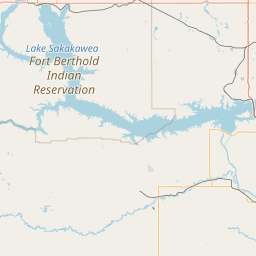
Leaflet | <a href="https://www.openstreetmap.org/copyright">© OpenStreetMap contributors</a>
Item
| Property | Value |
|---|---|
| id | 391610 |
| downstream_mainstem_id | https://geoconnex.us/ref/mainstems/312532 |
| encompassing_mainstem_basins | ['https://geoconnex.us/ref/mainstems/312532', 'https://geoconnex.us/ref/mainstems/312091'] |
| featuretype | ['https://www.opengis.net/def/schema/hy_features/hyf/HY_FlowPath', 'https://www.opengis.net/def/schema/hy_features/hyf/HY_WaterBody'] |
| fid | 16803 |
| head_2020huc12 | |
| head_nhdpv1_comid | 14521157 |
| head_nhdpv2_comid | https://geoconnex.us/nhdplusv2/comid/14521157 |
| head_nhdpv2huc12 | |
| head_rf1id | 26470 |
| lengthkm | 74.1 |
| name_at_outlet | Painted Woods Creek |
| name_at_outlet_gnis_id | 1030618 |
| new_mainstemid | |
| outlet_2020huc12 | |
| outlet_drainagearea_sqkm | 1311.1 |
| outlet_nhdpv1_comid | 14521971 |
| outlet_nhdpv2_comid | https://geoconnex.us/nhdplusv2/comid/14521971 |
| outlet_nhdpv2huc12 | |
| outlet_rf1id | 26464 |
| superseded | False |
| uri | https://geoconnex.us/ref/mainstems/391610 |
Graph Results
| monitoringLocation | https://geoconnex.us/iow/wqp/USGS-471415100550802 |
|---|---|
| siteName | USGS-471415100550802 |
| datasetDescription | Sulfate at USGS-471415100550802 |
| type | Well |
| url | https://www.waterqualitydata.us/provider/NWIS/USGS-ND/USGS-471415100550802/ |
| variableMeasured | Sulfate |
| variableUnit | mg/l |
| measurementTechnique | observation |
| temporalCoverage | 1978-01-01T00:00:00Z/1978-12-31T00:00:00Z |
| distributionName | Water Quality Portal |
| distributionURL | https://www.waterqualitydata.us/data/Result/search?siteid=USGS-471415100550802&CharacteristicName=Sulfate&mimeType=csv |
| distributionFormat | text/comma-separated-values |
| wkt | POINT (-100.9165287 47.2374927) |
| monitoringLocation | https://geoconnex.us/iow/wqp/USGS-471415100550802 |
|---|---|
| siteName | USGS-471415100550802 |
| datasetDescription | Hardness, non-carbonate at USGS-471415100550802 |
| type | Well |
| url | https://www.waterqualitydata.us/provider/NWIS/USGS-ND/USGS-471415100550802/ |
| variableMeasured | Hardness, non-carbonate |
| variableUnit | mg/l CaCO3 |
| measurementTechnique | observation |
| temporalCoverage | 1978-01-01T00:00:00Z/1978-12-31T00:00:00Z |
| distributionName | Water Quality Portal |
| distributionURL | https://www.waterqualitydata.us/data/Result/search?siteid=USGS-471415100550802&CharacteristicName=Hardness, non-carbonate&mimeType=csv |
| distributionFormat | text/comma-separated-values |
| wkt | POINT (-100.9165287 47.2374927) |
| monitoringLocation | https://geoconnex.us/iow/wqp/USGS-471415100550802 |
|---|---|
| siteName | USGS-471415100550802 |
| datasetDescription | Boron at USGS-471415100550802 |
| type | Well |
| url | https://www.waterqualitydata.us/provider/NWIS/USGS-ND/USGS-471415100550802/ |
| variableMeasured | Boron |
| variableUnit | Unknown |
| measurementTechnique | observation |
| temporalCoverage | 1978-01-01T00:00:00Z/1978-12-31T00:00:00Z |
| distributionName | Water Quality Portal |
| distributionURL | https://www.waterqualitydata.us/data/Result/search?siteid=USGS-471415100550802&CharacteristicName=Boron&mimeType=csv |
| distributionFormat | text/comma-separated-values |
| wkt | POINT (-100.9165287 47.2374927) |
| monitoringLocation | https://geoconnex.us/iow/wqp/USGS-471415100550802 |
|---|---|
| siteName | USGS-471415100550802 |
| datasetDescription | Fluoride at USGS-471415100550802 |
| type | Well |
| url | https://www.waterqualitydata.us/provider/NWIS/USGS-ND/USGS-471415100550802/ |
| variableMeasured | Fluoride |
| variableUnit | mg/l |
| measurementTechnique | observation |
| temporalCoverage | 1978-01-01T00:00:00Z/1978-12-31T00:00:00Z |
| distributionName | Water Quality Portal |
| distributionURL | https://www.waterqualitydata.us/data/Result/search?siteid=USGS-471415100550802&CharacteristicName=Fluoride&mimeType=csv |
| distributionFormat | text/comma-separated-values |
| wkt | POINT (-100.9165287 47.2374927) |
| monitoringLocation | https://geoconnex.us/iow/wqp/USGS-471415100550802 |
|---|---|
| siteName | USGS-471415100550802 |
| datasetDescription | Magnesium at USGS-471415100550802 |
| type | Well |
| url | https://www.waterqualitydata.us/provider/NWIS/USGS-ND/USGS-471415100550802/ |
| variableMeasured | Magnesium |
| variableUnit | % |
| measurementTechnique | observation |
| temporalCoverage | 1978-01-01T00:00:00Z/1978-12-31T00:00:00Z |
| distributionName | Water Quality Portal |
| distributionURL | https://www.waterqualitydata.us/data/Result/search?siteid=USGS-471415100550802&CharacteristicName=Magnesium&mimeType=csv |
| distributionFormat | text/comma-separated-values |
| wkt | POINT (-100.9165287 47.2374927) |
| monitoringLocation | https://geoconnex.us/iow/wqp/USGS-471415100550802 |
|---|---|
| siteName | USGS-471415100550802 |
| datasetDescription | Manganese at USGS-471415100550802 |
| type | Well |
| url | https://www.waterqualitydata.us/provider/NWIS/USGS-ND/USGS-471415100550802/ |
| variableMeasured | Manganese |
| variableUnit | ug/l |
| measurementTechnique | observation |
| temporalCoverage | 1978-01-01T00:00:00Z/1978-12-31T00:00:00Z |
| distributionName | Water Quality Portal |
| distributionURL | https://www.waterqualitydata.us/data/Result/search?siteid=USGS-471415100550802&CharacteristicName=Manganese&mimeType=csv |
| distributionFormat | text/comma-separated-values |
| wkt | POINT (-100.9165287 47.2374927) |
| monitoringLocation | https://geoconnex.us/iow/wqp/USGS-471415100550802 |
|---|---|
| siteName | USGS-471415100550802 |
| datasetDescription | Hardness, Ca, Mg at USGS-471415100550802 |
| type | Well |
| url | https://www.waterqualitydata.us/provider/NWIS/USGS-ND/USGS-471415100550802/ |
| variableMeasured | Hardness, Ca, Mg |
| variableUnit | mg/l CaCO3 |
| measurementTechnique | observation |
| temporalCoverage | 1978-01-01T00:00:00Z/1978-12-31T00:00:00Z |
| distributionName | Water Quality Portal |
| distributionURL | https://www.waterqualitydata.us/data/Result/search?siteid=USGS-471415100550802&CharacteristicName=Hardness, Ca, Mg&mimeType=csv |
| distributionFormat | text/comma-separated-values |
| wkt | POINT (-100.9165287 47.2374927) |
| monitoringLocation | https://geoconnex.us/iow/wqp/USGS-471415100550802 |
|---|---|
| siteName | USGS-471415100550802 |
| datasetDescription | Total dissolved solids at USGS-471415100550802 |
| type | Well |
| url | https://www.waterqualitydata.us/provider/NWIS/USGS-ND/USGS-471415100550802/ |
| variableMeasured | Total dissolved solids |
| variableUnit | mg/l |
| measurementTechnique | observation |
| temporalCoverage | 1978-01-01T00:00:00Z/1978-12-31T00:00:00Z |
| distributionName | Water Quality Portal |
| distributionURL | https://www.waterqualitydata.us/data/Result/search?siteid=USGS-471415100550802&CharacteristicName=Total dissolved solids&mimeType=csv |
| distributionFormat | text/comma-separated-values |
| wkt | POINT (-100.9165287 47.2374927) |
| monitoringLocation | https://geoconnex.us/iow/wqp/USGS-471415100550802 |
|---|---|
| siteName | USGS-471415100550802 |
| datasetDescription | Calcium at USGS-471415100550802 |
| type | Well |
| url | https://www.waterqualitydata.us/provider/NWIS/USGS-ND/USGS-471415100550802/ |
| variableMeasured | Calcium |
| variableUnit | mg/L |
| measurementTechnique | observation |
| temporalCoverage | 1978-01-01T00:00:00Z/1978-12-31T00:00:00Z |
| distributionName | Water Quality Portal |
| distributionURL | https://www.waterqualitydata.us/data/Result/search?siteid=USGS-471415100550802&CharacteristicName=Calcium&mimeType=csv |
| distributionFormat | text/comma-separated-values |
| wkt | POINT (-100.9165287 47.2374927) |
| monitoringLocation | https://geoconnex.us/iow/wqp/USGS-471415100550802 |
|---|---|
| siteName | USGS-471415100550802 |
| datasetDescription | Bicarbonate at USGS-471415100550802 |
| type | Well |
| url | https://www.waterqualitydata.us/provider/NWIS/USGS-ND/USGS-471415100550802/ |
| variableMeasured | Bicarbonate |
| variableUnit | mg/l |
| measurementTechnique | observation |
| temporalCoverage | 1978-01-01T00:00:00Z/1978-12-31T00:00:00Z |
| distributionName | Water Quality Portal |
| distributionURL | https://www.waterqualitydata.us/data/Result/search?siteid=USGS-471415100550802&CharacteristicName=Bicarbonate&mimeType=csv |
| distributionFormat | text/comma-separated-values |
| wkt | POINT (-100.9165287 47.2374927) |
| monitoringLocation | https://geoconnex.us/iow/wqp/USGS-471415100550802 |
|---|---|
| siteName | USGS-471415100550802 |
| datasetDescription | Carbonate at USGS-471415100550802 |
| type | Well |
| url | https://www.waterqualitydata.us/provider/NWIS/USGS-ND/USGS-471415100550802/ |
| variableMeasured | Carbonate |
| variableUnit | mg/l |
| measurementTechnique | observation |
| temporalCoverage | 1978-01-01T00:00:00Z/1978-12-31T00:00:00Z |
| distributionName | Water Quality Portal |
| distributionURL | https://www.waterqualitydata.us/data/Result/search?siteid=USGS-471415100550802&CharacteristicName=Carbonate&mimeType=csv |
| distributionFormat | text/comma-separated-values |
| wkt | POINT (-100.9165287 47.2374927) |
| monitoringLocation | https://geoconnex.us/iow/wqp/USGS-471415100550802 |
|---|---|
| siteName | USGS-471415100550802 |
| datasetDescription | Alkalinity at USGS-471415100550802 |
| type | Well |
| url | https://www.waterqualitydata.us/provider/NWIS/USGS-ND/USGS-471415100550802/ |
| variableMeasured | Alkalinity |
| variableUnit | mg/l CaCO3 |
| measurementTechnique | observation |
| temporalCoverage | 1978-01-01T00:00:00Z/1978-12-31T00:00:00Z |
| distributionName | Water Quality Portal |
| distributionURL | https://www.waterqualitydata.us/data/Result/search?siteid=USGS-471415100550802&CharacteristicName=Alkalinity&mimeType=csv |
| distributionFormat | text/comma-separated-values |
| wkt | POINT (-100.9165287 47.2374927) |
| monitoringLocation | https://geoconnex.us/iow/wqp/USGS-471415100550802 |
|---|---|
| siteName | USGS-471415100550802 |
| datasetDescription | Temperature, water at USGS-471415100550802 |
| type | Well |
| url | https://www.waterqualitydata.us/provider/NWIS/USGS-ND/USGS-471415100550802/ |
| variableMeasured | Temperature, water |
| variableUnit | deg C |
| measurementTechnique | observation |
| temporalCoverage | 1978-01-01T00:00:00Z/1978-12-31T00:00:00Z |
| distributionName | Water Quality Portal |
| distributionURL | https://www.waterqualitydata.us/data/Result/search?siteid=USGS-471415100550802&CharacteristicName=Temperature, water&mimeType=csv |
| distributionFormat | text/comma-separated-values |
| wkt | POINT (-100.9165287 47.2374927) |
| monitoringLocation | https://geoconnex.us/iow/wqp/USGS-471415100550802 |
|---|---|
| siteName | USGS-471415100550802 |
| datasetDescription | Silica at USGS-471415100550802 |
| type | Well |
| url | https://www.waterqualitydata.us/provider/NWIS/USGS-ND/USGS-471415100550802/ |
| variableMeasured | Silica |
| variableUnit | mg/l |
| measurementTechnique | observation |
| temporalCoverage | 1978-01-01T00:00:00Z/1978-12-31T00:00:00Z |
| distributionName | Water Quality Portal |
| distributionURL | https://www.waterqualitydata.us/data/Result/search?siteid=USGS-471415100550802&CharacteristicName=Silica&mimeType=csv |
| distributionFormat | text/comma-separated-values |
| wkt | POINT (-100.9165287 47.2374927) |
| monitoringLocation | https://geoconnex.us/iow/wqp/USGS-471415100550802 |
|---|---|
| siteName | USGS-471415100550802 |
| datasetDescription | Specific conductance at USGS-471415100550802 |
| type | Well |
| url | https://www.waterqualitydata.us/provider/NWIS/USGS-ND/USGS-471415100550802/ |
| variableMeasured | Specific conductance |
| variableUnit | umho/cm |
| measurementTechnique | observation |
| temporalCoverage | 1978-01-01T00:00:00Z/1978-12-31T00:00:00Z |
| distributionName | Water Quality Portal |
| distributionURL | https://www.waterqualitydata.us/data/Result/search?siteid=USGS-471415100550802&CharacteristicName=Specific conductance&mimeType=csv |
| distributionFormat | text/comma-separated-values |
| wkt | POINT (-100.9165287 47.2374927) |
| monitoringLocation | https://geoconnex.us/iow/wqp/USGS-471415100550802 |
|---|---|
| siteName | USGS-471415100550802 |
| datasetDescription | Nitrate at USGS-471415100550802 |
| type | Well |
| url | https://www.waterqualitydata.us/provider/NWIS/USGS-ND/USGS-471415100550802/ |
| variableMeasured | Nitrate |
| variableUnit | mg/l as N |
| measurementTechnique | observation |
| temporalCoverage | 1978-01-01T00:00:00Z/1978-12-31T00:00:00Z |
| distributionName | Water Quality Portal |
| distributionURL | https://www.waterqualitydata.us/data/Result/search?siteid=USGS-471415100550802&CharacteristicName=Nitrate&mimeType=csv |
| distributionFormat | text/comma-separated-values |
| wkt | POINT (-100.9165287 47.2374927) |
| monitoringLocation | https://geoconnex.us/iow/wqp/USGS-471415100550802 |
|---|---|
| siteName | USGS-471415100550802 |
| datasetDescription | Iron at USGS-471415100550802 |
| type | Well |
| url | https://www.waterqualitydata.us/provider/NWIS/USGS-ND/USGS-471415100550802/ |
| variableMeasured | Iron |
| variableUnit | % |
| measurementTechnique | observation |
| temporalCoverage | 1978-01-01T00:00:00Z/1978-12-31T00:00:00Z |
| distributionName | Water Quality Portal |
| distributionURL | https://www.waterqualitydata.us/data/Result/search?siteid=USGS-471415100550802&CharacteristicName=Iron&mimeType=csv |
| distributionFormat | text/comma-separated-values |
| wkt | POINT (-100.9165287 47.2374927) |
| monitoringLocation | https://geoconnex.us/iow/wqp/USGS-471415100550802 |
|---|---|
| siteName | USGS-471415100550802 |
| datasetDescription | Chloride at USGS-471415100550802 |
| type | Well |
| url | https://www.waterqualitydata.us/provider/NWIS/USGS-ND/USGS-471415100550802/ |
| variableMeasured | Chloride |
| variableUnit | mg/l |
| measurementTechnique | observation |
| temporalCoverage | 1978-01-01T00:00:00Z/1978-12-31T00:00:00Z |
| distributionName | Water Quality Portal |
| distributionURL | https://www.waterqualitydata.us/data/Result/search?siteid=USGS-471415100550802&CharacteristicName=Chloride&mimeType=csv |
| distributionFormat | text/comma-separated-values |
| wkt | POINT (-100.9165287 47.2374927) |
| monitoringLocation | https://geoconnex.us/iow/wqp/USGS-471415100550802 |
|---|---|
| siteName | USGS-471415100550802 |
| datasetDescription | Sodium, percent total cations at USGS-471415100550802 |
| type | Well |
| url | https://www.waterqualitydata.us/provider/NWIS/USGS-ND/USGS-471415100550802/ |
| variableMeasured | Sodium, percent total cations |
| variableUnit | % |
| measurementTechnique | observation |
| temporalCoverage | 1978-01-01T00:00:00Z/1978-12-31T00:00:00Z |
| distributionName | Water Quality Portal |
| distributionURL | https://www.waterqualitydata.us/data/Result/search?siteid=USGS-471415100550802&CharacteristicName=Sodium, percent total cations&mimeType=csv |
| distributionFormat | text/comma-separated-values |
| wkt | POINT (-100.9165287 47.2374927) |
| monitoringLocation | https://geoconnex.us/iow/wqp/USGS-471415100550802 |
|---|---|
| siteName | USGS-471415100550802 |
| datasetDescription | Sodium at USGS-471415100550802 |
| type | Well |
| url | https://www.waterqualitydata.us/provider/NWIS/USGS-ND/USGS-471415100550802/ |
| variableMeasured | Sodium |
| variableUnit | mg/l |
| measurementTechnique | observation |
| temporalCoverage | 1978-01-01T00:00:00Z/1978-12-31T00:00:00Z |
| distributionName | Water Quality Portal |
| distributionURL | https://www.waterqualitydata.us/data/Result/search?siteid=USGS-471415100550802&CharacteristicName=Sodium&mimeType=csv |
| distributionFormat | text/comma-separated-values |
| wkt | POINT (-100.9165287 47.2374927) |
| monitoringLocation | https://geoconnex.us/iow/wqp/USGS-471415100550802 |
|---|---|
| siteName | USGS-471415100550802 |
| datasetDescription | Potassium at USGS-471415100550802 |
| type | Well |
| url | https://www.waterqualitydata.us/provider/NWIS/USGS-ND/USGS-471415100550802/ |
| variableMeasured | Potassium |
| variableUnit | mg/l |
| measurementTechnique | observation |
| temporalCoverage | 1978-01-01T00:00:00Z/1978-12-31T00:00:00Z |
| distributionName | Water Quality Portal |
| distributionURL | https://www.waterqualitydata.us/data/Result/search?siteid=USGS-471415100550802&CharacteristicName=Potassium&mimeType=csv |
| distributionFormat | text/comma-separated-values |
| wkt | POINT (-100.9165287 47.2374927) |
| monitoringLocation | https://geoconnex.us/iow/wqp/USGS-471420100570201 |
|---|---|
| siteName | USGS-471420100570201 |
| datasetDescription | Silica at USGS-471420100570201 |
| type | Well |
| url | https://www.waterqualitydata.us/provider/NWIS/USGS-ND/USGS-471420100570201/ |
| variableMeasured | Silica |
| variableUnit | mg/l |
| measurementTechnique | observation |
| temporalCoverage | 1967-01-01T00:00:00Z/1967-12-31T00:00:00Z |
| distributionName | Water Quality Portal |
| distributionURL | https://www.waterqualitydata.us/data/Result/search?siteid=USGS-471420100570201&CharacteristicName=Silica&mimeType=csv |
| distributionFormat | text/comma-separated-values |
| wkt | POINT (-100.9509748 47.23888135) |
| monitoringLocation | https://geoconnex.us/iow/wqp/USGS-471420100570201 |
|---|---|
| siteName | USGS-471420100570201 |
| datasetDescription | Hardness, Ca, Mg at USGS-471420100570201 |
| type | Well |
| url | https://www.waterqualitydata.us/provider/NWIS/USGS-ND/USGS-471420100570201/ |
| variableMeasured | Hardness, Ca, Mg |
| variableUnit | mg/l CaCO3 |
| measurementTechnique | observation |
| temporalCoverage | 1967-01-01T00:00:00Z/1967-12-31T00:00:00Z |
| distributionName | Water Quality Portal |
| distributionURL | https://www.waterqualitydata.us/data/Result/search?siteid=USGS-471420100570201&CharacteristicName=Hardness, Ca, Mg&mimeType=csv |
| distributionFormat | text/comma-separated-values |
| wkt | POINT (-100.9509748 47.23888135) |
| monitoringLocation | https://geoconnex.us/iow/wqp/USGS-471420100570201 |
|---|---|
| siteName | USGS-471420100570201 |
| datasetDescription | Sulfate at USGS-471420100570201 |
| type | Well |
| url | https://www.waterqualitydata.us/provider/NWIS/USGS-ND/USGS-471420100570201/ |
| variableMeasured | Sulfate |
| variableUnit | mg/l |
| measurementTechnique | observation |
| temporalCoverage | 1967-01-01T00:00:00Z/1967-12-31T00:00:00Z |
| distributionName | Water Quality Portal |
| distributionURL | https://www.waterqualitydata.us/data/Result/search?siteid=USGS-471420100570201&CharacteristicName=Sulfate&mimeType=csv |
| distributionFormat | text/comma-separated-values |
| wkt | POINT (-100.9509748 47.23888135) |
| monitoringLocation | https://geoconnex.us/iow/wqp/USGS-471420100570201 |
|---|---|
| siteName | USGS-471420100570201 |
| datasetDescription | pH at USGS-471420100570201 |
| type | Well |
| url | https://www.waterqualitydata.us/provider/NWIS/USGS-ND/USGS-471420100570201/ |
| variableMeasured | pH |
| variableUnit | None |
| measurementTechnique | observation |
| temporalCoverage | 1967-01-01T00:00:00Z/1967-12-31T00:00:00Z |
| distributionName | Water Quality Portal |
| distributionURL | https://www.waterqualitydata.us/data/Result/search?siteid=USGS-471420100570201&CharacteristicName=pH&mimeType=csv |
| distributionFormat | text/comma-separated-values |
| wkt | POINT (-100.9509748 47.23888135) |
| monitoringLocation | https://geoconnex.us/iow/wqp/USGS-471420100570201 |
|---|---|
| siteName | USGS-471420100570201 |
| datasetDescription | Fluoride at USGS-471420100570201 |
| type | Well |
| url | https://www.waterqualitydata.us/provider/NWIS/USGS-ND/USGS-471420100570201/ |
| variableMeasured | Fluoride |
| variableUnit | mg/l |
| measurementTechnique | observation |
| temporalCoverage | 1967-01-01T00:00:00Z/1967-12-31T00:00:00Z |
| distributionName | Water Quality Portal |
| distributionURL | https://www.waterqualitydata.us/data/Result/search?siteid=USGS-471420100570201&CharacteristicName=Fluoride&mimeType=csv |
| distributionFormat | text/comma-separated-values |
| wkt | POINT (-100.9509748 47.23888135) |
| monitoringLocation | https://geoconnex.us/iow/wqp/USGS-471420100570201 |
|---|---|
| siteName | USGS-471420100570201 |
| datasetDescription | Iron at USGS-471420100570201 |
| type | Well |
| url | https://www.waterqualitydata.us/provider/NWIS/USGS-ND/USGS-471420100570201/ |
| variableMeasured | Iron |
| variableUnit | % |
| measurementTechnique | observation |
| temporalCoverage | 1967-01-01T00:00:00Z/1967-12-31T00:00:00Z |
| distributionName | Water Quality Portal |
| distributionURL | https://www.waterqualitydata.us/data/Result/search?siteid=USGS-471420100570201&CharacteristicName=Iron&mimeType=csv |
| distributionFormat | text/comma-separated-values |
| wkt | POINT (-100.9509748 47.23888135) |
| monitoringLocation | https://geoconnex.us/iow/wqp/USGS-471420100570201 |
|---|---|
| siteName | USGS-471420100570201 |
| datasetDescription | Sodium at USGS-471420100570201 |
| type | Well |
| url | https://www.waterqualitydata.us/provider/NWIS/USGS-ND/USGS-471420100570201/ |
| variableMeasured | Sodium |
| variableUnit | mg/l |
| measurementTechnique | observation |
| temporalCoverage | 1967-01-01T00:00:00Z/1967-12-31T00:00:00Z |
| distributionName | Water Quality Portal |
| distributionURL | https://www.waterqualitydata.us/data/Result/search?siteid=USGS-471420100570201&CharacteristicName=Sodium&mimeType=csv |
| distributionFormat | text/comma-separated-values |
| wkt | POINT (-100.9509748 47.23888135) |
| monitoringLocation | https://geoconnex.us/iow/wqp/USGS-471420100570201 |
|---|---|
| siteName | USGS-471420100570201 |
| datasetDescription | Boron at USGS-471420100570201 |
| type | Well |
| url | https://www.waterqualitydata.us/provider/NWIS/USGS-ND/USGS-471420100570201/ |
| variableMeasured | Boron |
| variableUnit | Unknown |
| measurementTechnique | observation |
| temporalCoverage | 1967-01-01T00:00:00Z/1967-12-31T00:00:00Z |
| distributionName | Water Quality Portal |
| distributionURL | https://www.waterqualitydata.us/data/Result/search?siteid=USGS-471420100570201&CharacteristicName=Boron&mimeType=csv |
| distributionFormat | text/comma-separated-values |
| wkt | POINT (-100.9509748 47.23888135) |
| monitoringLocation | https://geoconnex.us/iow/wqp/USGS-471420100570201 |
|---|---|
| siteName | USGS-471420100570201 |
| datasetDescription | Depth at USGS-471420100570201 |
| type | Well |
| url | https://www.waterqualitydata.us/provider/NWIS/USGS-ND/USGS-471420100570201/ |
| variableMeasured | Depth |
| variableUnit | ft |
| measurementTechnique | observation |
| temporalCoverage | 1967-01-01T00:00:00Z/1967-12-31T00:00:00Z |
| distributionName | Water Quality Portal |
| distributionURL | https://www.waterqualitydata.us/data/Result/search?siteid=USGS-471420100570201&CharacteristicName=Depth&mimeType=csv |
| distributionFormat | text/comma-separated-values |
| wkt | POINT (-100.9509748 47.23888135) |
| monitoringLocation | https://geoconnex.us/iow/wqp/USGS-471420100570201 |
|---|---|
| siteName | USGS-471420100570201 |
| datasetDescription | Hardness, non-carbonate at USGS-471420100570201 |
| type | Well |
| url | https://www.waterqualitydata.us/provider/NWIS/USGS-ND/USGS-471420100570201/ |
| variableMeasured | Hardness, non-carbonate |
| variableUnit | mg/l CaCO3 |
| measurementTechnique | observation |
| temporalCoverage | 1967-01-01T00:00:00Z/1967-12-31T00:00:00Z |
| distributionName | Water Quality Portal |
| distributionURL | https://www.waterqualitydata.us/data/Result/search?siteid=USGS-471420100570201&CharacteristicName=Hardness, non-carbonate&mimeType=csv |
| distributionFormat | text/comma-separated-values |
| wkt | POINT (-100.9509748 47.23888135) |
| monitoringLocation | https://geoconnex.us/iow/wqp/USGS-471420100570201 |
|---|---|
| siteName | USGS-471420100570201 |
| datasetDescription | Carbon dioxide at USGS-471420100570201 |
| type | Well |
| url | https://www.waterqualitydata.us/provider/NWIS/USGS-ND/USGS-471420100570201/ |
| variableMeasured | Carbon dioxide |
| variableUnit | mg/l |
| measurementTechnique | observation |
| temporalCoverage | 1967-01-01T00:00:00Z/1967-12-31T00:00:00Z |
| distributionName | Water Quality Portal |
| distributionURL | https://www.waterqualitydata.us/data/Result/search?siteid=USGS-471420100570201&CharacteristicName=Carbon dioxide&mimeType=csv |
| distributionFormat | text/comma-separated-values |
| wkt | POINT (-100.9509748 47.23888135) |
| monitoringLocation | https://geoconnex.us/iow/wqp/USGS-471420100570201 |
|---|---|
| siteName | USGS-471420100570201 |
| datasetDescription | Chloride at USGS-471420100570201 |
| type | Well |
| url | https://www.waterqualitydata.us/provider/NWIS/USGS-ND/USGS-471420100570201/ |
| variableMeasured | Chloride |
| variableUnit | mg/l |
| measurementTechnique | observation |
| temporalCoverage | 1967-01-01T00:00:00Z/1967-12-31T00:00:00Z |
| distributionName | Water Quality Portal |
| distributionURL | https://www.waterqualitydata.us/data/Result/search?siteid=USGS-471420100570201&CharacteristicName=Chloride&mimeType=csv |
| distributionFormat | text/comma-separated-values |
| wkt | POINT (-100.9509748 47.23888135) |
| monitoringLocation | https://geoconnex.us/iow/wqp/USGS-471420100570201 |
|---|---|
| siteName | USGS-471420100570201 |
| datasetDescription | Sodium, percent total cations at USGS-471420100570201 |
| type | Well |
| url | https://www.waterqualitydata.us/provider/NWIS/USGS-ND/USGS-471420100570201/ |
| variableMeasured | Sodium, percent total cations |
| variableUnit | % |
| measurementTechnique | observation |
| temporalCoverage | 1967-01-01T00:00:00Z/1967-12-31T00:00:00Z |
| distributionName | Water Quality Portal |
| distributionURL | https://www.waterqualitydata.us/data/Result/search?siteid=USGS-471420100570201&CharacteristicName=Sodium, percent total cations&mimeType=csv |
| distributionFormat | text/comma-separated-values |
| wkt | POINT (-100.9509748 47.23888135) |
| monitoringLocation | https://geoconnex.us/iow/wqp/USGS-471420100570201 |
|---|---|
| siteName | USGS-471420100570201 |
| datasetDescription | Magnesium at USGS-471420100570201 |
| type | Well |
| url | https://www.waterqualitydata.us/provider/NWIS/USGS-ND/USGS-471420100570201/ |
| variableMeasured | Magnesium |
| variableUnit | % |
| measurementTechnique | observation |
| temporalCoverage | 1967-01-01T00:00:00Z/1967-12-31T00:00:00Z |
| distributionName | Water Quality Portal |
| distributionURL | https://www.waterqualitydata.us/data/Result/search?siteid=USGS-471420100570201&CharacteristicName=Magnesium&mimeType=csv |
| distributionFormat | text/comma-separated-values |
| wkt | POINT (-100.9509748 47.23888135) |
| monitoringLocation | https://geoconnex.us/iow/wqp/USGS-471420100570201 |
|---|---|
| siteName | USGS-471420100570201 |
| datasetDescription | Total dissolved solids at USGS-471420100570201 |
| type | Well |
| url | https://www.waterqualitydata.us/provider/NWIS/USGS-ND/USGS-471420100570201/ |
| variableMeasured | Total dissolved solids |
| variableUnit | mg/l |
| measurementTechnique | observation |
| temporalCoverage | 1967-01-01T00:00:00Z/1967-12-31T00:00:00Z |
| distributionName | Water Quality Portal |
| distributionURL | https://www.waterqualitydata.us/data/Result/search?siteid=USGS-471420100570201&CharacteristicName=Total dissolved solids&mimeType=csv |
| distributionFormat | text/comma-separated-values |
| wkt | POINT (-100.9509748 47.23888135) |
| monitoringLocation | https://geoconnex.us/iow/wqp/USGS-471420100570201 |
|---|---|
| siteName | USGS-471420100570201 |
| datasetDescription | Bicarbonate at USGS-471420100570201 |
| type | Well |
| url | https://www.waterqualitydata.us/provider/NWIS/USGS-ND/USGS-471420100570201/ |
| variableMeasured | Bicarbonate |
| variableUnit | mg/l |
| measurementTechnique | observation |
| temporalCoverage | 1967-01-01T00:00:00Z/1967-12-31T00:00:00Z |
| distributionName | Water Quality Portal |
| distributionURL | https://www.waterqualitydata.us/data/Result/search?siteid=USGS-471420100570201&CharacteristicName=Bicarbonate&mimeType=csv |
| distributionFormat | text/comma-separated-values |
| wkt | POINT (-100.9509748 47.23888135) |
| monitoringLocation | https://geoconnex.us/iow/wqp/USGS-471420100570201 |
|---|---|
| siteName | USGS-471420100570201 |
| datasetDescription | Potassium at USGS-471420100570201 |
| type | Well |
| url | https://www.waterqualitydata.us/provider/NWIS/USGS-ND/USGS-471420100570201/ |
| variableMeasured | Potassium |
| variableUnit | mg/l |
| measurementTechnique | observation |
| temporalCoverage | 1967-01-01T00:00:00Z/1967-12-31T00:00:00Z |
| distributionName | Water Quality Portal |
| distributionURL | https://www.waterqualitydata.us/data/Result/search?siteid=USGS-471420100570201&CharacteristicName=Potassium&mimeType=csv |
| distributionFormat | text/comma-separated-values |
| wkt | POINT (-100.9509748 47.23888135) |
| monitoringLocation | https://geoconnex.us/iow/wqp/USGS-471420100570201 |
|---|---|
| siteName | USGS-471420100570201 |
| datasetDescription | Nitrate at USGS-471420100570201 |
| type | Well |
| url | https://www.waterqualitydata.us/provider/NWIS/USGS-ND/USGS-471420100570201/ |
| variableMeasured | Nitrate |
| variableUnit | mg/l as N |
| measurementTechnique | observation |
| temporalCoverage | 1967-01-01T00:00:00Z/1967-12-31T00:00:00Z |
| distributionName | Water Quality Portal |
| distributionURL | https://www.waterqualitydata.us/data/Result/search?siteid=USGS-471420100570201&CharacteristicName=Nitrate&mimeType=csv |
| distributionFormat | text/comma-separated-values |
| wkt | POINT (-100.9509748 47.23888135) |
| monitoringLocation | https://geoconnex.us/iow/wqp/USGS-471420100570201 |
|---|---|
| siteName | USGS-471420100570201 |
| datasetDescription | Calcium at USGS-471420100570201 |
| type | Well |
| url | https://www.waterqualitydata.us/provider/NWIS/USGS-ND/USGS-471420100570201/ |
| variableMeasured | Calcium |
| variableUnit | mg/L |
| measurementTechnique | observation |
| temporalCoverage | 1967-01-01T00:00:00Z/1967-12-31T00:00:00Z |
| distributionName | Water Quality Portal |
| distributionURL | https://www.waterqualitydata.us/data/Result/search?siteid=USGS-471420100570201&CharacteristicName=Calcium&mimeType=csv |
| distributionFormat | text/comma-separated-values |
| wkt | POINT (-100.9509748 47.23888135) |
| monitoringLocation | https://geoconnex.us/iow/wqp/USGS-471420100570201 |
|---|---|
| siteName | USGS-471420100570201 |
| datasetDescription | Carbonate at USGS-471420100570201 |
| type | Well |
| url | https://www.waterqualitydata.us/provider/NWIS/USGS-ND/USGS-471420100570201/ |
| variableMeasured | Carbonate |
| variableUnit | mg/l |
| measurementTechnique | observation |
| temporalCoverage | 1967-01-01T00:00:00Z/1967-12-31T00:00:00Z |
| distributionName | Water Quality Portal |
| distributionURL | https://www.waterqualitydata.us/data/Result/search?siteid=USGS-471420100570201&CharacteristicName=Carbonate&mimeType=csv |
| distributionFormat | text/comma-separated-values |
| wkt | POINT (-100.9509748 47.23888135) |
| monitoringLocation | https://geoconnex.us/iow/wqp/USGS-471420100570201 |
|---|---|
| siteName | USGS-471420100570201 |
| datasetDescription | Specific conductance at USGS-471420100570201 |
| type | Well |
| url | https://www.waterqualitydata.us/provider/NWIS/USGS-ND/USGS-471420100570201/ |
| variableMeasured | Specific conductance |
| variableUnit | umho/cm |
| measurementTechnique | observation |
| temporalCoverage | 1967-01-01T00:00:00Z/1967-12-31T00:00:00Z |
| distributionName | Water Quality Portal |
| distributionURL | https://www.waterqualitydata.us/data/Result/search?siteid=USGS-471420100570201&CharacteristicName=Specific conductance&mimeType=csv |
| distributionFormat | text/comma-separated-values |
| wkt | POINT (-100.9509748 47.23888135) |
| monitoringLocation | https://geoconnex.us/iow/wqp/USGS-471420100570201 |
|---|---|
| siteName | USGS-471420100570201 |
| datasetDescription | Altitude at USGS-471420100570201 |
| type | Well |
| url | https://www.waterqualitydata.us/provider/NWIS/USGS-ND/USGS-471420100570201/ |
| variableMeasured | Altitude |
| variableUnit | ft |
| measurementTechnique | observation |
| temporalCoverage | 1967-01-01T00:00:00Z/1967-12-31T00:00:00Z |
| distributionName | Water Quality Portal |
| distributionURL | https://www.waterqualitydata.us/data/Result/search?siteid=USGS-471420100570201&CharacteristicName=Altitude&mimeType=csv |
| distributionFormat | text/comma-separated-values |
| wkt | POINT (-100.9509748 47.23888135) |
| monitoringLocation | https://geoconnex.us/iow/wqp/21NDHDWQ_WQX-386007 |
|---|---|
| siteName | 21NDHDWQ_WQX-386007 |
| datasetDescription | Phosphate-phosphorus at 21NDHDWQ_WQX-386007 |
| type | River/Stream |
| url | https://www.waterqualitydata.us/provider/STORET/21NDHDWQ_WQX/21NDHDWQ_WQX-386007/ |
| variableMeasured | Phosphate-phosphorus |
| variableUnit | mg/L |
| measurementTechnique | observation |
| temporalCoverage | 2016-01-01T00:00:00Z/2017-12-31T00:00:00Z |
| distributionName | Water Quality Portal |
| distributionURL | https://www.waterqualitydata.us/data/Result/search?siteid=21NDHDWQ_WQX-386007&CharacteristicName=Phosphate-phosphorus&mimeType=csv |
| distributionFormat | text/comma-separated-values |
| wkt | POINT (-100.91988 47.25923) |
| monitoringLocation | https://geoconnex.us/iow/wqp/21NDHDWQ_WQX-386007 |
|---|---|
| siteName | 21NDHDWQ_WQX-386007 |
| datasetDescription | Bicarbonate at 21NDHDWQ_WQX-386007 |
| type | River/Stream |
| url | https://www.waterqualitydata.us/provider/STORET/21NDHDWQ_WQX/21NDHDWQ_WQX-386007/ |
| variableMeasured | Bicarbonate |
| variableUnit | mg/l |
| measurementTechnique | observation |
| temporalCoverage | 2016-01-01T00:00:00Z/2017-12-31T00:00:00Z |
| distributionName | Water Quality Portal |
| distributionURL | https://www.waterqualitydata.us/data/Result/search?siteid=21NDHDWQ_WQX-386007&CharacteristicName=Bicarbonate&mimeType=csv |
| distributionFormat | text/comma-separated-values |
| wkt | POINT (-100.91988 47.25923) |
| monitoringLocation | https://geoconnex.us/iow/wqp/21NDHDWQ_WQX-386007 |
|---|---|
| siteName | 21NDHDWQ_WQX-386007 |
| datasetDescription | Total dissolved solids at 21NDHDWQ_WQX-386007 |
| type | River/Stream |
| url | https://www.waterqualitydata.us/provider/STORET/21NDHDWQ_WQX/21NDHDWQ_WQX-386007/ |
| variableMeasured | Total dissolved solids |
| variableUnit | mg/l |
| measurementTechnique | observation |
| temporalCoverage | 2016-01-01T00:00:00Z/2017-12-31T00:00:00Z |
| distributionName | Water Quality Portal |
| distributionURL | https://www.waterqualitydata.us/data/Result/search?siteid=21NDHDWQ_WQX-386007&CharacteristicName=Total dissolved solids&mimeType=csv |
| distributionFormat | text/comma-separated-values |
| wkt | POINT (-100.91988 47.25923) |
| monitoringLocation | https://geoconnex.us/iow/wqp/21NDHDWQ_WQX-386007 |
|---|---|
| siteName | 21NDHDWQ_WQX-386007 |
| datasetDescription | Nutrient-nitrogen***retired***use TOTAL NITROGEN, MIXED FORMS with speciation AS N at 21NDHDWQ_WQX-386007 |
| type | River/Stream |
| url | https://www.waterqualitydata.us/provider/STORET/21NDHDWQ_WQX/21NDHDWQ_WQX-386007/ |
| variableMeasured | Nutrient-nitrogen***retired***use TOTAL NITROGEN, MIXED FORMS with speciation AS N |
| variableUnit | mg/L |
| measurementTechnique | observation |
| temporalCoverage | 2016-01-01T00:00:00Z/2017-12-31T00:00:00Z |
| distributionName | Water Quality Portal |
| distributionURL | https://www.waterqualitydata.us/data/Result/search?siteid=21NDHDWQ_WQX-386007&CharacteristicName=Nutrient-nitrogen***retired***use TOTAL NITROGEN, MIXED FORMS with speciation AS N&mimeType=csv |
| distributionFormat | text/comma-separated-values |
| wkt | POINT (-100.91988 47.25923) |
| monitoringLocation | https://geoconnex.us/iow/wqp/21NDHDWQ_WQX-386007 |
|---|---|
| siteName | 21NDHDWQ_WQX-386007 |
| datasetDescription | Molybdenum at 21NDHDWQ_WQX-386007 |
| type | River/Stream |
| url | https://www.waterqualitydata.us/provider/STORET/21NDHDWQ_WQX/21NDHDWQ_WQX-386007/ |
| variableMeasured | Molybdenum |
| variableUnit | ppb |
| measurementTechnique | observation |
| temporalCoverage | 2017-01-01T00:00:00Z/2017-12-31T00:00:00Z |
| distributionName | Water Quality Portal |
| distributionURL | https://www.waterqualitydata.us/data/Result/search?siteid=21NDHDWQ_WQX-386007&CharacteristicName=Molybdenum&mimeType=csv |
| distributionFormat | text/comma-separated-values |
| wkt | POINT (-100.91988 47.25923) |
| monitoringLocation | https://geoconnex.us/iow/wqp/21NDHDWQ_WQX-386007 |
|---|---|
| siteName | 21NDHDWQ_WQX-386007 |
| datasetDescription | Cadmium at 21NDHDWQ_WQX-386007 |
| type | River/Stream |
| url | https://www.waterqualitydata.us/provider/STORET/21NDHDWQ_WQX/21NDHDWQ_WQX-386007/ |
| variableMeasured | Cadmium |
| variableUnit | ug/L |
| measurementTechnique | observation |
| temporalCoverage | 2016-01-01T00:00:00Z/2017-12-31T00:00:00Z |
| distributionName | Water Quality Portal |
| distributionURL | https://www.waterqualitydata.us/data/Result/search?siteid=21NDHDWQ_WQX-386007&CharacteristicName=Cadmium&mimeType=csv |
| distributionFormat | text/comma-separated-values |
| wkt | POINT (-100.91988 47.25923) |
| monitoringLocation | https://geoconnex.us/iow/wqp/21NDHDWQ_WQX-386007 |
|---|---|
| siteName | 21NDHDWQ_WQX-386007 |
| datasetDescription | Silver at 21NDHDWQ_WQX-386007 |
| type | River/Stream |
| url | https://www.waterqualitydata.us/provider/STORET/21NDHDWQ_WQX/21NDHDWQ_WQX-386007/ |
| variableMeasured | Silver |
| variableUnit | Unknown |
| measurementTechnique | observation |
| temporalCoverage | 2016-01-01T00:00:00Z/2017-12-31T00:00:00Z |
| distributionName | Water Quality Portal |
| distributionURL | https://www.waterqualitydata.us/data/Result/search?siteid=21NDHDWQ_WQX-386007&CharacteristicName=Silver&mimeType=csv |
| distributionFormat | text/comma-separated-values |
| wkt | POINT (-100.91988 47.25923) |
| monitoringLocation | https://geoconnex.us/iow/wqp/21NDHDWQ_WQX-386007 |
|---|---|
| siteName | 21NDHDWQ_WQX-386007 |
| datasetDescription | Magnesium at 21NDHDWQ_WQX-386007 |
| type | River/Stream |
| url | https://www.waterqualitydata.us/provider/STORET/21NDHDWQ_WQX/21NDHDWQ_WQX-386007/ |
| variableMeasured | Magnesium |
| variableUnit | % |
| measurementTechnique | observation |
| temporalCoverage | 2016-01-01T00:00:00Z/2017-12-31T00:00:00Z |
| distributionName | Water Quality Portal |
| distributionURL | https://www.waterqualitydata.us/data/Result/search?siteid=21NDHDWQ_WQX-386007&CharacteristicName=Magnesium&mimeType=csv |
| distributionFormat | text/comma-separated-values |
| wkt | POINT (-100.91988 47.25923) |
| monitoringLocation | https://geoconnex.us/iow/wqp/21NDHDWQ_WQX-386007 |
|---|---|
| siteName | 21NDHDWQ_WQX-386007 |
| datasetDescription | Temperature, water at 21NDHDWQ_WQX-386007 |
| type | River/Stream |
| url | https://www.waterqualitydata.us/provider/STORET/21NDHDWQ_WQX/21NDHDWQ_WQX-386007/ |
| variableMeasured | Temperature, water |
| variableUnit | deg C |
| measurementTechnique | observation |
| temporalCoverage | 2016-01-01T00:00:00Z/2023-12-31T00:00:00Z |
| distributionName | Water Quality Portal |
| distributionURL | https://www.waterqualitydata.us/data/Result/search?siteid=21NDHDWQ_WQX-386007&CharacteristicName=Temperature, water&mimeType=csv |
| distributionFormat | text/comma-separated-values |
| wkt | POINT (-100.91988 47.25923) |
| monitoringLocation | https://geoconnex.us/iow/wqp/21NDHDWQ_WQX-386007 |
|---|---|
| siteName | 21NDHDWQ_WQX-386007 |
| datasetDescription | Conductivity at 21NDHDWQ_WQX-386007 |
| type | River/Stream |
| url | https://www.waterqualitydata.us/provider/STORET/21NDHDWQ_WQX/21NDHDWQ_WQX-386007/ |
| variableMeasured | Conductivity |
| variableUnit | uS/cm |
| measurementTechnique | observation |
| temporalCoverage | 2016-01-01T00:00:00Z/2017-12-31T00:00:00Z |
| distributionName | Water Quality Portal |
| distributionURL | https://www.waterqualitydata.us/data/Result/search?siteid=21NDHDWQ_WQX-386007&CharacteristicName=Conductivity&mimeType=csv |
| distributionFormat | text/comma-separated-values |
| wkt | POINT (-100.91988 47.25923) |
| monitoringLocation | https://geoconnex.us/iow/wqp/21NDHDWQ_WQX-386007 |
|---|---|
| siteName | 21NDHDWQ_WQX-386007 |
| datasetDescription | Barium at 21NDHDWQ_WQX-386007 |
| type | River/Stream |
| url | https://www.waterqualitydata.us/provider/STORET/21NDHDWQ_WQX/21NDHDWQ_WQX-386007/ |
| variableMeasured | Barium |
| variableUnit | ug/L |
| measurementTechnique | observation |
| temporalCoverage | 2016-01-01T00:00:00Z/2017-12-31T00:00:00Z |
| distributionName | Water Quality Portal |
| distributionURL | https://www.waterqualitydata.us/data/Result/search?siteid=21NDHDWQ_WQX-386007&CharacteristicName=Barium&mimeType=csv |
| distributionFormat | text/comma-separated-values |
| wkt | POINT (-100.91988 47.25923) |
| monitoringLocation | https://geoconnex.us/iow/wqp/21NDHDWQ_WQX-386007 |
|---|---|
| siteName | 21NDHDWQ_WQX-386007 |
| datasetDescription | Ammonia-nitrogen at 21NDHDWQ_WQX-386007 |
| type | River/Stream |
| url | https://www.waterqualitydata.us/provider/STORET/21NDHDWQ_WQX/21NDHDWQ_WQX-386007/ |
| variableMeasured | Ammonia-nitrogen |
| variableUnit | mg/L |
| measurementTechnique | observation |
| temporalCoverage | 2016-01-01T00:00:00Z/2023-12-31T00:00:00Z |
| distributionName | Water Quality Portal |
| distributionURL | https://www.waterqualitydata.us/data/Result/search?siteid=21NDHDWQ_WQX-386007&CharacteristicName=Ammonia-nitrogen&mimeType=csv |
| distributionFormat | text/comma-separated-values |
| wkt | POINT (-100.91988 47.25923) |
| monitoringLocation | https://geoconnex.us/iow/wqp/21NDHDWQ_WQX-386007 |
|---|---|
| siteName | 21NDHDWQ_WQX-386007 |
| datasetDescription | Alkalinity, total at 21NDHDWQ_WQX-386007 |
| type | River/Stream |
| url | https://www.waterqualitydata.us/provider/STORET/21NDHDWQ_WQX/21NDHDWQ_WQX-386007/ |
| variableMeasured | Alkalinity, total |
| variableUnit | mg/l |
| measurementTechnique | observation |
| temporalCoverage | 2016-01-01T00:00:00Z/2017-12-31T00:00:00Z |
| distributionName | Water Quality Portal |
| distributionURL | https://www.waterqualitydata.us/data/Result/search?siteid=21NDHDWQ_WQX-386007&CharacteristicName=Alkalinity, total&mimeType=csv |
| distributionFormat | text/comma-separated-values |
| wkt | POINT (-100.91988 47.25923) |
| monitoringLocation | https://geoconnex.us/iow/wqp/21NDHDWQ_WQX-386007 |
|---|---|
| siteName | 21NDHDWQ_WQX-386007 |
| datasetDescription | Hardness, carbonate at 21NDHDWQ_WQX-386007 |
| type | River/Stream |
| url | https://www.waterqualitydata.us/provider/STORET/21NDHDWQ_WQX/21NDHDWQ_WQX-386007/ |
| variableMeasured | Hardness, carbonate |
| variableUnit | mg/L |
| measurementTechnique | observation |
| temporalCoverage | 2016-01-01T00:00:00Z/2017-12-31T00:00:00Z |
| distributionName | Water Quality Portal |
| distributionURL | https://www.waterqualitydata.us/data/Result/search?siteid=21NDHDWQ_WQX-386007&CharacteristicName=Hardness, carbonate&mimeType=csv |
| distributionFormat | text/comma-separated-values |
| wkt | POINT (-100.91988 47.25923) |
| monitoringLocation | https://geoconnex.us/iow/wqp/21NDHDWQ_WQX-386007 |
|---|---|
| siteName | 21NDHDWQ_WQX-386007 |
| datasetDescription | Carbonate at 21NDHDWQ_WQX-386007 |
| type | River/Stream |
| url | https://www.waterqualitydata.us/provider/STORET/21NDHDWQ_WQX/21NDHDWQ_WQX-386007/ |
| variableMeasured | Carbonate |
| variableUnit | mg/l |
| measurementTechnique | observation |
| temporalCoverage | 2016-01-01T00:00:00Z/2017-12-31T00:00:00Z |
| distributionName | Water Quality Portal |
| distributionURL | https://www.waterqualitydata.us/data/Result/search?siteid=21NDHDWQ_WQX-386007&CharacteristicName=Carbonate&mimeType=csv |
| distributionFormat | text/comma-separated-values |
| wkt | POINT (-100.91988 47.25923) |
| monitoringLocation | https://geoconnex.us/iow/wqp/21NDHDWQ_WQX-386007 |
|---|---|
| siteName | 21NDHDWQ_WQX-386007 |
| datasetDescription | Potassium at 21NDHDWQ_WQX-386007 |
| type | River/Stream |
| url | https://www.waterqualitydata.us/provider/STORET/21NDHDWQ_WQX/21NDHDWQ_WQX-386007/ |
| variableMeasured | Potassium |
| variableUnit | mg/l |
| measurementTechnique | observation |
| temporalCoverage | 2016-01-01T00:00:00Z/2017-12-31T00:00:00Z |
| distributionName | Water Quality Portal |
| distributionURL | https://www.waterqualitydata.us/data/Result/search?siteid=21NDHDWQ_WQX-386007&CharacteristicName=Potassium&mimeType=csv |
| distributionFormat | text/comma-separated-values |
| wkt | POINT (-100.91988 47.25923) |
| monitoringLocation | https://geoconnex.us/iow/wqp/21NDHDWQ_WQX-386007 |
|---|---|
| siteName | 21NDHDWQ_WQX-386007 |
| datasetDescription | Lead at 21NDHDWQ_WQX-386007 |
| type | River/Stream |
| url | https://www.waterqualitydata.us/provider/STORET/21NDHDWQ_WQX/21NDHDWQ_WQX-386007/ |
| variableMeasured | Lead |
| variableUnit | ug/l |
| measurementTechnique | observation |
| temporalCoverage | 2016-01-01T00:00:00Z/2017-12-31T00:00:00Z |
| distributionName | Water Quality Portal |
| distributionURL | https://www.waterqualitydata.us/data/Result/search?siteid=21NDHDWQ_WQX-386007&CharacteristicName=Lead&mimeType=csv |
| distributionFormat | text/comma-separated-values |
| wkt | POINT (-100.91988 47.25923) |
| monitoringLocation | https://geoconnex.us/iow/wqp/21NDHDWQ_WQX-386007 |
|---|---|
| siteName | 21NDHDWQ_WQX-386007 |
| datasetDescription | pH at 21NDHDWQ_WQX-386007 |
| type | River/Stream |
| url | https://www.waterqualitydata.us/provider/STORET/21NDHDWQ_WQX/21NDHDWQ_WQX-386007/ |
| variableMeasured | pH |
| variableUnit | None |
| measurementTechnique | observation |
| temporalCoverage | 2016-01-01T00:00:00Z/2017-12-31T00:00:00Z |
| distributionName | Water Quality Portal |
| distributionURL | https://www.waterqualitydata.us/data/Result/search?siteid=21NDHDWQ_WQX-386007&CharacteristicName=pH&mimeType=csv |
| distributionFormat | text/comma-separated-values |
| wkt | POINT (-100.91988 47.25923) |
| monitoringLocation | https://geoconnex.us/iow/wqp/21NDHDWQ_WQX-386007 |
|---|---|
| siteName | 21NDHDWQ_WQX-386007 |
| datasetDescription | Manganese at 21NDHDWQ_WQX-386007 |
| type | River/Stream |
| url | https://www.waterqualitydata.us/provider/STORET/21NDHDWQ_WQX/21NDHDWQ_WQX-386007/ |
| variableMeasured | Manganese |
| variableUnit | ug/l |
| measurementTechnique | observation |
| temporalCoverage | 2016-01-01T00:00:00Z/2017-12-31T00:00:00Z |
| distributionName | Water Quality Portal |
| distributionURL | https://www.waterqualitydata.us/data/Result/search?siteid=21NDHDWQ_WQX-386007&CharacteristicName=Manganese&mimeType=csv |
| distributionFormat | text/comma-separated-values |
| wkt | POINT (-100.91988 47.25923) |
| monitoringLocation | https://geoconnex.us/iow/wqp/21NDHDWQ_WQX-386007 |
|---|---|
| siteName | 21NDHDWQ_WQX-386007 |
| datasetDescription | Calcium at 21NDHDWQ_WQX-386007 |
| type | River/Stream |
| url | https://www.waterqualitydata.us/provider/STORET/21NDHDWQ_WQX/21NDHDWQ_WQX-386007/ |
| variableMeasured | Calcium |
| variableUnit | mg/L |
| measurementTechnique | observation |
| temporalCoverage | 2016-01-01T00:00:00Z/2017-12-31T00:00:00Z |
| distributionName | Water Quality Portal |
| distributionURL | https://www.waterqualitydata.us/data/Result/search?siteid=21NDHDWQ_WQX-386007&CharacteristicName=Calcium&mimeType=csv |
| distributionFormat | text/comma-separated-values |
| wkt | POINT (-100.91988 47.25923) |
| monitoringLocation | https://geoconnex.us/iow/wqp/21NDHDWQ_WQX-386007 |
|---|---|
| siteName | 21NDHDWQ_WQX-386007 |
| datasetDescription | Nickel at 21NDHDWQ_WQX-386007 |
| type | River/Stream |
| url | https://www.waterqualitydata.us/provider/STORET/21NDHDWQ_WQX/21NDHDWQ_WQX-386007/ |
| variableMeasured | Nickel |
| variableUnit | ppm |
| measurementTechnique | observation |
| temporalCoverage | 2016-01-01T00:00:00Z/2017-12-31T00:00:00Z |
| distributionName | Water Quality Portal |
| distributionURL | https://www.waterqualitydata.us/data/Result/search?siteid=21NDHDWQ_WQX-386007&CharacteristicName=Nickel&mimeType=csv |
| distributionFormat | text/comma-separated-values |
| wkt | POINT (-100.91988 47.25923) |
| monitoringLocation | https://geoconnex.us/iow/wqp/21NDHDWQ_WQX-386007 |
|---|---|
| siteName | 21NDHDWQ_WQX-386007 |
| datasetDescription | Hydroxide at 21NDHDWQ_WQX-386007 |
| type | River/Stream |
| url | https://www.waterqualitydata.us/provider/STORET/21NDHDWQ_WQX/21NDHDWQ_WQX-386007/ |
| variableMeasured | Hydroxide |
| variableUnit | mg/L |
| measurementTechnique | observation |
| temporalCoverage | 2016-01-01T00:00:00Z/2017-12-31T00:00:00Z |
| distributionName | Water Quality Portal |
| distributionURL | https://www.waterqualitydata.us/data/Result/search?siteid=21NDHDWQ_WQX-386007&CharacteristicName=Hydroxide&mimeType=csv |
| distributionFormat | text/comma-separated-values |
| wkt | POINT (-100.91988 47.25923) |
| monitoringLocation | https://geoconnex.us/iow/wqp/21NDHDWQ_WQX-386007 |
|---|---|
| siteName | 21NDHDWQ_WQX-386007 |
| datasetDescription | Total suspended solids at 21NDHDWQ_WQX-386007 |
| type | River/Stream |
| url | https://www.waterqualitydata.us/provider/STORET/21NDHDWQ_WQX/21NDHDWQ_WQX-386007/ |
| variableMeasured | Total suspended solids |
| variableUnit | mg/L |
| measurementTechnique | observation |
| temporalCoverage | 2016-01-01T00:00:00Z/2023-12-31T00:00:00Z |
| distributionName | Water Quality Portal |
| distributionURL | https://www.waterqualitydata.us/data/Result/search?siteid=21NDHDWQ_WQX-386007&CharacteristicName=Total suspended solids&mimeType=csv |
| distributionFormat | text/comma-separated-values |
| wkt | POINT (-100.91988 47.25923) |
| monitoringLocation | https://geoconnex.us/iow/wqp/21NDHDWQ_WQX-386007 |
|---|---|
| siteName | 21NDHDWQ_WQX-386007 |
| datasetDescription | Sulfate at 21NDHDWQ_WQX-386007 |
| type | River/Stream |
| url | https://www.waterqualitydata.us/provider/STORET/21NDHDWQ_WQX/21NDHDWQ_WQX-386007/ |
| variableMeasured | Sulfate |
| variableUnit | mg/l |
| measurementTechnique | observation |
| temporalCoverage | 2016-01-01T00:00:00Z/2017-12-31T00:00:00Z |
| distributionName | Water Quality Portal |
| distributionURL | https://www.waterqualitydata.us/data/Result/search?siteid=21NDHDWQ_WQX-386007&CharacteristicName=Sulfate&mimeType=csv |
| distributionFormat | text/comma-separated-values |
| wkt | POINT (-100.91988 47.25923) |
| monitoringLocation | https://geoconnex.us/iow/wqp/21NDHDWQ_WQX-386007 |
|---|---|
| siteName | 21NDHDWQ_WQX-386007 |
| datasetDescription | Boron at 21NDHDWQ_WQX-386007 |
| type | River/Stream |
| url | https://www.waterqualitydata.us/provider/STORET/21NDHDWQ_WQX/21NDHDWQ_WQX-386007/ |
| variableMeasured | Boron |
| variableUnit | Unknown |
| measurementTechnique | observation |
| temporalCoverage | 2016-01-01T00:00:00Z/2017-12-31T00:00:00Z |
| distributionName | Water Quality Portal |
| distributionURL | https://www.waterqualitydata.us/data/Result/search?siteid=21NDHDWQ_WQX-386007&CharacteristicName=Boron&mimeType=csv |
| distributionFormat | text/comma-separated-values |
| wkt | POINT (-100.91988 47.25923) |
| monitoringLocation | https://geoconnex.us/iow/wqp/21NDHDWQ_WQX-386007 |
|---|---|
| siteName | 21NDHDWQ_WQX-386007 |
| datasetDescription | Kjeldahl nitrogen at 21NDHDWQ_WQX-386007 |
| type | River/Stream |
| url | https://www.waterqualitydata.us/provider/STORET/21NDHDWQ_WQX/21NDHDWQ_WQX-386007/ |
| variableMeasured | Kjeldahl nitrogen |
| variableUnit | mg/L |
| measurementTechnique | observation |
| temporalCoverage | 2016-01-01T00:00:00Z/2023-12-31T00:00:00Z |
| distributionName | Water Quality Portal |
| distributionURL | https://www.waterqualitydata.us/data/Result/search?siteid=21NDHDWQ_WQX-386007&CharacteristicName=Kjeldahl nitrogen&mimeType=csv |
| distributionFormat | text/comma-separated-values |
| wkt | POINT (-100.91988 47.25923) |
| monitoringLocation | https://geoconnex.us/iow/wqp/21NDHDWQ_WQX-386007 |
|---|---|
| siteName | 21NDHDWQ_WQX-386007 |
| datasetDescription | Cations-Anions at 21NDHDWQ_WQX-386007 |
| type | River/Stream |
| url | https://www.waterqualitydata.us/provider/STORET/21NDHDWQ_WQX/21NDHDWQ_WQX-386007/ |
| variableMeasured | Cations-Anions |
| variableUnit | % |
| measurementTechnique | observation |
| temporalCoverage | 2016-01-01T00:00:00Z/2017-12-31T00:00:00Z |
| distributionName | Water Quality Portal |
| distributionURL | https://www.waterqualitydata.us/data/Result/search?siteid=21NDHDWQ_WQX-386007&CharacteristicName=Cations-Anions&mimeType=csv |
| distributionFormat | text/comma-separated-values |
| wkt | POINT (-100.91988 47.25923) |
| monitoringLocation | https://geoconnex.us/iow/wqp/21NDHDWQ_WQX-386007 |
|---|---|
| siteName | 21NDHDWQ_WQX-386007 |
| datasetDescription | Aluminum at 21NDHDWQ_WQX-386007 |
| type | River/Stream |
| url | https://www.waterqualitydata.us/provider/STORET/21NDHDWQ_WQX/21NDHDWQ_WQX-386007/ |
| variableMeasured | Aluminum |
| variableUnit | Unknown |
| measurementTechnique | observation |
| temporalCoverage | 2016-01-01T00:00:00Z/2017-12-31T00:00:00Z |
| distributionName | Water Quality Portal |
| distributionURL | https://www.waterqualitydata.us/data/Result/search?siteid=21NDHDWQ_WQX-386007&CharacteristicName=Aluminum&mimeType=csv |
| distributionFormat | text/comma-separated-values |
| wkt | POINT (-100.91988 47.25923) |
| monitoringLocation | https://geoconnex.us/iow/wqp/21NDHDWQ_WQX-386007 |
|---|---|
| siteName | 21NDHDWQ_WQX-386007 |
| datasetDescription | Iron at 21NDHDWQ_WQX-386007 |
| type | River/Stream |
| url | https://www.waterqualitydata.us/provider/STORET/21NDHDWQ_WQX/21NDHDWQ_WQX-386007/ |
| variableMeasured | Iron |
| variableUnit | % |
| measurementTechnique | observation |
| temporalCoverage | 2016-01-01T00:00:00Z/2017-12-31T00:00:00Z |
| distributionName | Water Quality Portal |
| distributionURL | https://www.waterqualitydata.us/data/Result/search?siteid=21NDHDWQ_WQX-386007&CharacteristicName=Iron&mimeType=csv |
| distributionFormat | text/comma-separated-values |
| wkt | POINT (-100.91988 47.25923) |
| monitoringLocation | https://geoconnex.us/iow/wqp/21NDHDWQ_WQX-386007 |
|---|---|
| siteName | 21NDHDWQ_WQX-386007 |
| datasetDescription | Selenium at 21NDHDWQ_WQX-386007 |
| type | River/Stream |
| url | https://www.waterqualitydata.us/provider/STORET/21NDHDWQ_WQX/21NDHDWQ_WQX-386007/ |
| variableMeasured | Selenium |
| variableUnit | ug/l |
| measurementTechnique | observation |
| temporalCoverage | 2016-01-01T00:00:00Z/2017-12-31T00:00:00Z |
| distributionName | Water Quality Portal |
| distributionURL | https://www.waterqualitydata.us/data/Result/search?siteid=21NDHDWQ_WQX-386007&CharacteristicName=Selenium&mimeType=csv |
| distributionFormat | text/comma-separated-values |
| wkt | POINT (-100.91988 47.25923) |
| monitoringLocation | https://geoconnex.us/iow/wqp/21NDHDWQ_WQX-386007 |
|---|---|
| siteName | 21NDHDWQ_WQX-386007 |
| datasetDescription | Arsenic at 21NDHDWQ_WQX-386007 |
| type | River/Stream |
| url | https://www.waterqualitydata.us/provider/STORET/21NDHDWQ_WQX/21NDHDWQ_WQX-386007/ |
| variableMeasured | Arsenic |
| variableUnit | ppm |
| measurementTechnique | observation |
| temporalCoverage | 2016-01-01T00:00:00Z/2017-12-31T00:00:00Z |
| distributionName | Water Quality Portal |
| distributionURL | https://www.waterqualitydata.us/data/Result/search?siteid=21NDHDWQ_WQX-386007&CharacteristicName=Arsenic&mimeType=csv |
| distributionFormat | text/comma-separated-values |
| wkt | POINT (-100.91988 47.25923) |
| monitoringLocation | https://geoconnex.us/iow/wqp/21NDHDWQ_WQX-386007 |
|---|---|
| siteName | 21NDHDWQ_WQX-386007 |
| datasetDescription | Beryllium at 21NDHDWQ_WQX-386007 |
| type | River/Stream |
| url | https://www.waterqualitydata.us/provider/STORET/21NDHDWQ_WQX/21NDHDWQ_WQX-386007/ |
| variableMeasured | Beryllium |
| variableUnit | ppm |
| measurementTechnique | observation |
| temporalCoverage | 2016-01-01T00:00:00Z/2017-12-31T00:00:00Z |
| distributionName | Water Quality Portal |
| distributionURL | https://www.waterqualitydata.us/data/Result/search?siteid=21NDHDWQ_WQX-386007&CharacteristicName=Beryllium&mimeType=csv |
| distributionFormat | text/comma-separated-values |
| wkt | POINT (-100.91988 47.25923) |
| monitoringLocation | https://geoconnex.us/iow/wqp/21NDHDWQ_WQX-386007 |
|---|---|
| siteName | 21NDHDWQ_WQX-386007 |
| datasetDescription | Sum of anions at 21NDHDWQ_WQX-386007 |
| type | River/Stream |
| url | https://www.waterqualitydata.us/provider/STORET/21NDHDWQ_WQX/21NDHDWQ_WQX-386007/ |
| variableMeasured | Sum of anions |
| variableUnit | meq/L |
| measurementTechnique | observation |
| temporalCoverage | 2016-01-01T00:00:00Z/2017-12-31T00:00:00Z |
| distributionName | Water Quality Portal |
| distributionURL | https://www.waterqualitydata.us/data/Result/search?siteid=21NDHDWQ_WQX-386007&CharacteristicName=Sum of anions&mimeType=csv |
| distributionFormat | text/comma-separated-values |
| wkt | POINT (-100.91988 47.25923) |
| monitoringLocation | https://geoconnex.us/iow/wqp/21NDHDWQ_WQX-386007 |
|---|---|
| siteName | 21NDHDWQ_WQX-386007 |
| datasetDescription | Sum of cations at 21NDHDWQ_WQX-386007 |
| type | River/Stream |
| url | https://www.waterqualitydata.us/provider/STORET/21NDHDWQ_WQX/21NDHDWQ_WQX-386007/ |
| variableMeasured | Sum of cations |
| variableUnit | mg/L |
| measurementTechnique | observation |
| temporalCoverage | 2016-01-01T00:00:00Z/2017-12-31T00:00:00Z |
| distributionName | Water Quality Portal |
| distributionURL | https://www.waterqualitydata.us/data/Result/search?siteid=21NDHDWQ_WQX-386007&CharacteristicName=Sum of cations&mimeType=csv |
| distributionFormat | text/comma-separated-values |
| wkt | POINT (-100.91988 47.25923) |
| monitoringLocation | https://geoconnex.us/iow/wqp/21NDHDWQ_WQX-386007 |
|---|---|
| siteName | 21NDHDWQ_WQX-386007 |
| datasetDescription | Copper at 21NDHDWQ_WQX-386007 |
| type | River/Stream |
| url | https://www.waterqualitydata.us/provider/STORET/21NDHDWQ_WQX/21NDHDWQ_WQX-386007/ |
| variableMeasured | Copper |
| variableUnit | Unknown |
| measurementTechnique | observation |
| temporalCoverage | 2016-01-01T00:00:00Z/2017-12-31T00:00:00Z |
| distributionName | Water Quality Portal |
| distributionURL | https://www.waterqualitydata.us/data/Result/search?siteid=21NDHDWQ_WQX-386007&CharacteristicName=Copper&mimeType=csv |
| distributionFormat | text/comma-separated-values |
| wkt | POINT (-100.91988 47.25923) |
| monitoringLocation | https://geoconnex.us/iow/wqp/21NDHDWQ_WQX-386007 |
|---|---|
| siteName | 21NDHDWQ_WQX-386007 |
| datasetDescription | Antimony at 21NDHDWQ_WQX-386007 |
| type | River/Stream |
| url | https://www.waterqualitydata.us/provider/STORET/21NDHDWQ_WQX/21NDHDWQ_WQX-386007/ |
| variableMeasured | Antimony |
| variableUnit | ppm |
| measurementTechnique | observation |
| temporalCoverage | 2016-01-01T00:00:00Z/2017-12-31T00:00:00Z |
| distributionName | Water Quality Portal |
| distributionURL | https://www.waterqualitydata.us/data/Result/search?siteid=21NDHDWQ_WQX-386007&CharacteristicName=Antimony&mimeType=csv |
| distributionFormat | text/comma-separated-values |
| wkt | POINT (-100.91988 47.25923) |
| monitoringLocation | https://geoconnex.us/iow/wqp/21NDHDWQ_WQX-386007 |
|---|---|
| siteName | 21NDHDWQ_WQX-386007 |
| datasetDescription | Chloride at 21NDHDWQ_WQX-386007 |
| type | River/Stream |
| url | https://www.waterqualitydata.us/provider/STORET/21NDHDWQ_WQX/21NDHDWQ_WQX-386007/ |
| variableMeasured | Chloride |
| variableUnit | mg/l |
| measurementTechnique | observation |
| temporalCoverage | 2016-01-01T00:00:00Z/2017-12-31T00:00:00Z |
| distributionName | Water Quality Portal |
| distributionURL | https://www.waterqualitydata.us/data/Result/search?siteid=21NDHDWQ_WQX-386007&CharacteristicName=Chloride&mimeType=csv |
| distributionFormat | text/comma-separated-values |
| wkt | POINT (-100.91988 47.25923) |
| monitoringLocation | https://geoconnex.us/iow/wqp/21NDHDWQ_WQX-386007 |
|---|---|
| siteName | 21NDHDWQ_WQX-386007 |
| datasetDescription | Zinc at 21NDHDWQ_WQX-386007 |
| type | River/Stream |
| url | https://www.waterqualitydata.us/provider/STORET/21NDHDWQ_WQX/21NDHDWQ_WQX-386007/ |
| variableMeasured | Zinc |
| variableUnit | Unknown |
| measurementTechnique | observation |
| temporalCoverage | 2016-01-01T00:00:00Z/2017-12-31T00:00:00Z |
| distributionName | Water Quality Portal |
| distributionURL | https://www.waterqualitydata.us/data/Result/search?siteid=21NDHDWQ_WQX-386007&CharacteristicName=Zinc&mimeType=csv |
| distributionFormat | text/comma-separated-values |
| wkt | POINT (-100.91988 47.25923) |
| monitoringLocation | https://geoconnex.us/iow/wqp/21NDHDWQ_WQX-386007 |
|---|---|
| siteName | 21NDHDWQ_WQX-386007 |
| datasetDescription | Chromium at 21NDHDWQ_WQX-386007 |
| type | River/Stream |
| url | https://www.waterqualitydata.us/provider/STORET/21NDHDWQ_WQX/21NDHDWQ_WQX-386007/ |
| variableMeasured | Chromium |
| variableUnit | ppb |
| measurementTechnique | observation |
| temporalCoverage | 2016-01-01T00:00:00Z/2017-12-31T00:00:00Z |
| distributionName | Water Quality Portal |
| distributionURL | https://www.waterqualitydata.us/data/Result/search?siteid=21NDHDWQ_WQX-386007&CharacteristicName=Chromium&mimeType=csv |
| distributionFormat | text/comma-separated-values |
| wkt | POINT (-100.91988 47.25923) |
| monitoringLocation | https://geoconnex.us/iow/wqp/21NDHDWQ_WQX-386007 |
|---|---|
| siteName | 21NDHDWQ_WQX-386007 |
| datasetDescription | Escherichia coli at 21NDHDWQ_WQX-386007 |
| type | River/Stream |
| url | https://www.waterqualitydata.us/provider/STORET/21NDHDWQ_WQX/21NDHDWQ_WQX-386007/ |
| variableMeasured | Escherichia coli |
| variableUnit | #/100mL |
| measurementTechnique | observation |
| temporalCoverage | 2016-01-01T00:00:00Z/2023-12-31T00:00:00Z |
| distributionName | Water Quality Portal |
| distributionURL | https://www.waterqualitydata.us/data/Result/search?siteid=21NDHDWQ_WQX-386007&CharacteristicName=Escherichia coli&mimeType=csv |
| distributionFormat | text/comma-separated-values |
| wkt | POINT (-100.91988 47.25923) |
| monitoringLocation | https://geoconnex.us/iow/wqp/21NDHDWQ_WQX-386007 |
|---|---|
| siteName | 21NDHDWQ_WQX-386007 |
| datasetDescription | Thallium at 21NDHDWQ_WQX-386007 |
| type | River/Stream |
| url | https://www.waterqualitydata.us/provider/STORET/21NDHDWQ_WQX/21NDHDWQ_WQX-386007/ |
| variableMeasured | Thallium |
| variableUnit | ppm |
| measurementTechnique | observation |
| temporalCoverage | 2016-01-01T00:00:00Z/2017-12-31T00:00:00Z |
| distributionName | Water Quality Portal |
| distributionURL | https://www.waterqualitydata.us/data/Result/search?siteid=21NDHDWQ_WQX-386007&CharacteristicName=Thallium&mimeType=csv |
| distributionFormat | text/comma-separated-values |
| wkt | POINT (-100.91988 47.25923) |
| monitoringLocation | https://geoconnex.us/iow/wqp/21NDHDWQ_WQX-386007 |
|---|---|
| siteName | 21NDHDWQ_WQX-386007 |
| datasetDescription | Sodium at 21NDHDWQ_WQX-386007 |
| type | River/Stream |
| url | https://www.waterqualitydata.us/provider/STORET/21NDHDWQ_WQX/21NDHDWQ_WQX-386007/ |
| variableMeasured | Sodium |
| variableUnit | mg/l |
| measurementTechnique | observation |
| temporalCoverage | 2016-01-01T00:00:00Z/2017-12-31T00:00:00Z |
| distributionName | Water Quality Portal |
| distributionURL | https://www.waterqualitydata.us/data/Result/search?siteid=21NDHDWQ_WQX-386007&CharacteristicName=Sodium&mimeType=csv |
| distributionFormat | text/comma-separated-values |
| wkt | POINT (-100.91988 47.25923) |
| monitoringLocation | https://geoconnex.us/iow/wqp/USGS-471401100565201 |
|---|---|
| siteName | USGS-471401100565201 |
| datasetDescription | Altitude at USGS-471401100565201 |
| type | Well |
| url | https://www.waterqualitydata.us/provider/NWIS/USGS-ND/USGS-471401100565201/ |
| variableMeasured | Altitude |
| variableUnit | ft |
| measurementTechnique | observation |
| temporalCoverage | 1968-01-01T00:00:00Z/1968-12-31T00:00:00Z |
| distributionName | Water Quality Portal |
| distributionURL | https://www.waterqualitydata.us/data/Result/search?siteid=USGS-471401100565201&CharacteristicName=Altitude&mimeType=csv |
| distributionFormat | text/comma-separated-values |
| wkt | POINT (-100.9481968 47.23360358) |
| monitoringLocation | https://geoconnex.us/iow/wqp/USGS-471401100565201 |
|---|---|
| siteName | USGS-471401100565201 |
| datasetDescription | Nitrate at USGS-471401100565201 |
| type | Well |
| url | https://www.waterqualitydata.us/provider/NWIS/USGS-ND/USGS-471401100565201/ |
| variableMeasured | Nitrate |
| variableUnit | mg/l as N |
| measurementTechnique | observation |
| temporalCoverage | 1968-01-01T00:00:00Z/1968-12-31T00:00:00Z |
| distributionName | Water Quality Portal |
| distributionURL | https://www.waterqualitydata.us/data/Result/search?siteid=USGS-471401100565201&CharacteristicName=Nitrate&mimeType=csv |
| distributionFormat | text/comma-separated-values |
| wkt | POINT (-100.9481968 47.23360358) |
| monitoringLocation | https://geoconnex.us/iow/wqp/USGS-471401100565201 |
|---|---|
| siteName | USGS-471401100565201 |
| datasetDescription | Hardness, Ca, Mg at USGS-471401100565201 |
| type | Well |
| url | https://www.waterqualitydata.us/provider/NWIS/USGS-ND/USGS-471401100565201/ |
| variableMeasured | Hardness, Ca, Mg |
| variableUnit | mg/l CaCO3 |
| measurementTechnique | observation |
| temporalCoverage | 1968-01-01T00:00:00Z/1968-12-31T00:00:00Z |
| distributionName | Water Quality Portal |
| distributionURL | https://www.waterqualitydata.us/data/Result/search?siteid=USGS-471401100565201&CharacteristicName=Hardness, Ca, Mg&mimeType=csv |
| distributionFormat | text/comma-separated-values |
| wkt | POINT (-100.9481968 47.23360358) |
| monitoringLocation | https://geoconnex.us/iow/wqp/USGS-471401100565201 |
|---|---|
| siteName | USGS-471401100565201 |
| datasetDescription | Specific conductance at USGS-471401100565201 |
| type | Well |
| url | https://www.waterqualitydata.us/provider/NWIS/USGS-ND/USGS-471401100565201/ |
| variableMeasured | Specific conductance |
| variableUnit | umho/cm |
| measurementTechnique | observation |
| temporalCoverage | 1968-01-01T00:00:00Z/1968-12-31T00:00:00Z |
| distributionName | Water Quality Portal |
| distributionURL | https://www.waterqualitydata.us/data/Result/search?siteid=USGS-471401100565201&CharacteristicName=Specific conductance&mimeType=csv |
| distributionFormat | text/comma-separated-values |
| wkt | POINT (-100.9481968 47.23360358) |
| monitoringLocation | https://geoconnex.us/iow/wqp/USGS-471401100565201 |
|---|---|
| siteName | USGS-471401100565201 |
| datasetDescription | Chloride at USGS-471401100565201 |
| type | Well |
| url | https://www.waterqualitydata.us/provider/NWIS/USGS-ND/USGS-471401100565201/ |
| variableMeasured | Chloride |
| variableUnit | mg/l |
| measurementTechnique | observation |
| temporalCoverage | 1968-01-01T00:00:00Z/1968-12-31T00:00:00Z |
| distributionName | Water Quality Portal |
| distributionURL | https://www.waterqualitydata.us/data/Result/search?siteid=USGS-471401100565201&CharacteristicName=Chloride&mimeType=csv |
| distributionFormat | text/comma-separated-values |
| wkt | POINT (-100.9481968 47.23360358) |
| monitoringLocation | https://geoconnex.us/iow/wqp/USGS-471401100565201 |
|---|---|
| siteName | USGS-471401100565201 |
| datasetDescription | Total dissolved solids at USGS-471401100565201 |
| type | Well |
| url | https://www.waterqualitydata.us/provider/NWIS/USGS-ND/USGS-471401100565201/ |
| variableMeasured | Total dissolved solids |
| variableUnit | mg/l |
| measurementTechnique | observation |
| temporalCoverage | 1968-01-01T00:00:00Z/1968-12-31T00:00:00Z |
| distributionName | Water Quality Portal |
| distributionURL | https://www.waterqualitydata.us/data/Result/search?siteid=USGS-471401100565201&CharacteristicName=Total dissolved solids&mimeType=csv |
| distributionFormat | text/comma-separated-values |
| wkt | POINT (-100.9481968 47.23360358) |
| monitoringLocation | https://geoconnex.us/iow/wqp/USGS-471401100565201 |
|---|---|
| siteName | USGS-471401100565201 |
| datasetDescription | Bicarbonate at USGS-471401100565201 |
| type | Well |
| url | https://www.waterqualitydata.us/provider/NWIS/USGS-ND/USGS-471401100565201/ |
| variableMeasured | Bicarbonate |
| variableUnit | mg/l |
| measurementTechnique | observation |
| temporalCoverage | 1968-01-01T00:00:00Z/1968-12-31T00:00:00Z |
| distributionName | Water Quality Portal |
| distributionURL | https://www.waterqualitydata.us/data/Result/search?siteid=USGS-471401100565201&CharacteristicName=Bicarbonate&mimeType=csv |
| distributionFormat | text/comma-separated-values |
| wkt | POINT (-100.9481968 47.23360358) |
| monitoringLocation | https://geoconnex.us/iow/wqp/USGS-471401100565201 |
|---|---|
| siteName | USGS-471401100565201 |
| datasetDescription | Fluoride at USGS-471401100565201 |
| type | Well |
| url | https://www.waterqualitydata.us/provider/NWIS/USGS-ND/USGS-471401100565201/ |
| variableMeasured | Fluoride |
| variableUnit | mg/l |
| measurementTechnique | observation |
| temporalCoverage | 1968-01-01T00:00:00Z/1968-12-31T00:00:00Z |
| distributionName | Water Quality Portal |
| distributionURL | https://www.waterqualitydata.us/data/Result/search?siteid=USGS-471401100565201&CharacteristicName=Fluoride&mimeType=csv |
| distributionFormat | text/comma-separated-values |
| wkt | POINT (-100.9481968 47.23360358) |
| monitoringLocation | https://geoconnex.us/iow/wqp/USGS-471401100565201 |
|---|---|
| siteName | USGS-471401100565201 |
| datasetDescription | Silica at USGS-471401100565201 |
| type | Well |
| url | https://www.waterqualitydata.us/provider/NWIS/USGS-ND/USGS-471401100565201/ |
| variableMeasured | Silica |
| variableUnit | mg/l |
| measurementTechnique | observation |
| temporalCoverage | 1968-01-01T00:00:00Z/1968-12-31T00:00:00Z |
| distributionName | Water Quality Portal |
| distributionURL | https://www.waterqualitydata.us/data/Result/search?siteid=USGS-471401100565201&CharacteristicName=Silica&mimeType=csv |
| distributionFormat | text/comma-separated-values |
| wkt | POINT (-100.9481968 47.23360358) |
| monitoringLocation | https://geoconnex.us/iow/wqp/USGS-471401100565201 |
|---|---|
| siteName | USGS-471401100565201 |
| datasetDescription | Sodium, percent total cations at USGS-471401100565201 |
| type | Well |
| url | https://www.waterqualitydata.us/provider/NWIS/USGS-ND/USGS-471401100565201/ |
| variableMeasured | Sodium, percent total cations |
| variableUnit | % |
| measurementTechnique | observation |
| temporalCoverage | 1968-01-01T00:00:00Z/1968-12-31T00:00:00Z |
| distributionName | Water Quality Portal |
| distributionURL | https://www.waterqualitydata.us/data/Result/search?siteid=USGS-471401100565201&CharacteristicName=Sodium, percent total cations&mimeType=csv |
| distributionFormat | text/comma-separated-values |
| wkt | POINT (-100.9481968 47.23360358) |
| monitoringLocation | https://geoconnex.us/iow/wqp/USGS-471401100565201 |
|---|---|
| siteName | USGS-471401100565201 |
| datasetDescription | Calcium at USGS-471401100565201 |
| type | Well |
| url | https://www.waterqualitydata.us/provider/NWIS/USGS-ND/USGS-471401100565201/ |
| variableMeasured | Calcium |
| variableUnit | mg/L |
| measurementTechnique | observation |
| temporalCoverage | 1968-01-01T00:00:00Z/1968-12-31T00:00:00Z |
| distributionName | Water Quality Portal |
| distributionURL | https://www.waterqualitydata.us/data/Result/search?siteid=USGS-471401100565201&CharacteristicName=Calcium&mimeType=csv |
| distributionFormat | text/comma-separated-values |
| wkt | POINT (-100.9481968 47.23360358) |
| monitoringLocation | https://geoconnex.us/iow/wqp/USGS-471401100565201 |
|---|---|
| siteName | USGS-471401100565201 |
| datasetDescription | Manganese at USGS-471401100565201 |
| type | Well |
| url | https://www.waterqualitydata.us/provider/NWIS/USGS-ND/USGS-471401100565201/ |
| variableMeasured | Manganese |
| variableUnit | ug/l |
| measurementTechnique | observation |
| temporalCoverage | 1968-01-01T00:00:00Z/1968-12-31T00:00:00Z |
| distributionName | Water Quality Portal |
| distributionURL | https://www.waterqualitydata.us/data/Result/search?siteid=USGS-471401100565201&CharacteristicName=Manganese&mimeType=csv |
| distributionFormat | text/comma-separated-values |
| wkt | POINT (-100.9481968 47.23360358) |
| monitoringLocation | https://geoconnex.us/iow/wqp/USGS-471401100565201 |
|---|---|
| siteName | USGS-471401100565201 |
| datasetDescription | Magnesium at USGS-471401100565201 |
| type | Well |
| url | https://www.waterqualitydata.us/provider/NWIS/USGS-ND/USGS-471401100565201/ |
| variableMeasured | Magnesium |
| variableUnit | % |
| measurementTechnique | observation |
| temporalCoverage | 1968-01-01T00:00:00Z/1968-12-31T00:00:00Z |
| distributionName | Water Quality Portal |
| distributionURL | https://www.waterqualitydata.us/data/Result/search?siteid=USGS-471401100565201&CharacteristicName=Magnesium&mimeType=csv |
| distributionFormat | text/comma-separated-values |
| wkt | POINT (-100.9481968 47.23360358) |
| monitoringLocation | https://geoconnex.us/iow/wqp/USGS-471401100565201 |
|---|---|
| siteName | USGS-471401100565201 |
| datasetDescription | Sodium at USGS-471401100565201 |
| type | Well |
| url | https://www.waterqualitydata.us/provider/NWIS/USGS-ND/USGS-471401100565201/ |
| variableMeasured | Sodium |
| variableUnit | mg/l |
| measurementTechnique | observation |
| temporalCoverage | 1968-01-01T00:00:00Z/1968-12-31T00:00:00Z |
| distributionName | Water Quality Portal |
| distributionURL | https://www.waterqualitydata.us/data/Result/search?siteid=USGS-471401100565201&CharacteristicName=Sodium&mimeType=csv |
| distributionFormat | text/comma-separated-values |
| wkt | POINT (-100.9481968 47.23360358) |
| monitoringLocation | https://geoconnex.us/iow/wqp/USGS-471401100565201 |
|---|---|
| siteName | USGS-471401100565201 |
| datasetDescription | Depth at USGS-471401100565201 |
| type | Well |
| url | https://www.waterqualitydata.us/provider/NWIS/USGS-ND/USGS-471401100565201/ |
| variableMeasured | Depth |
| variableUnit | ft |
| measurementTechnique | observation |
| temporalCoverage | 1968-01-01T00:00:00Z/1968-12-31T00:00:00Z |
| distributionName | Water Quality Portal |
| distributionURL | https://www.waterqualitydata.us/data/Result/search?siteid=USGS-471401100565201&CharacteristicName=Depth&mimeType=csv |
| distributionFormat | text/comma-separated-values |
| wkt | POINT (-100.9481968 47.23360358) |