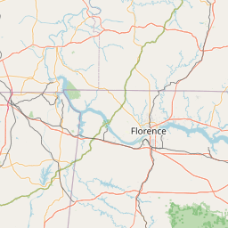
Valley River
Map
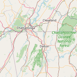
Leaflet | <a href="https://www.openstreetmap.org/copyright">© OpenStreetMap contributors</a>
Item
| Property | Value |
|---|---|
| id | 392323 |
| downstream_mainstem_id | https://geoconnex.us/ref/mainstems/342300 |
| encompassing_mainstem_basins | ['https://geoconnex.us/ref/mainstems/342300', 'https://geoconnex.us/ref/mainstems/316088', 'https://geoconnex.us/ref/mainstems/314849', 'https://geoconnex.us/ref/mainstems/312091'] |
| featuretype | ['https://www.opengis.net/def/schema/hy_features/hyf/HY_FlowPath', 'https://www.opengis.net/def/schema/hy_features/hyf/HY_WaterBody'] |
| fid | 10127 |
| head_2020huc12 | 060200020401 |
| head_nhdpv1_comid | 19674769 |
| head_nhdpv2_comid | https://geoconnex.us/nhdplusv2/comid/19674769 |
| head_nhdpv2huc12 | https://geoconnex.us/nhdplusv2/huc12/060200020401 |
| head_rf1id | 16574 |
| lengthkm | 47.6 |
| name_at_outlet | Valley River |
| name_at_outlet_gnis_id | 1016352 |
| new_mainstemid | |
| outlet_2020huc12 | 060200020404 |
| outlet_drainagearea_sqkm | 303.4 |
| outlet_nhdpv1_comid | 19678433 |
| outlet_nhdpv2_comid | https://geoconnex.us/nhdplusv2/comid/19678433 |
| outlet_nhdpv2huc12 | https://geoconnex.us/nhdplusv2/huc12/060200020404 |
| outlet_rf1id | 16572 |
| superseded | False |
| uri | https://geoconnex.us/ref/mainstems/392323 |
Graph Results
| monitoringLocation | https://sta.geoconnex.dev/collections/USGS/Things/items/'USGS-03550000' |
|---|---|
| siteName | USGS-03550000 |
| datasetDescription | Gage height / USGS-03550000-4eab68a59b604c18836ee3678e694102 |
| type | Stream |
| url | https://waterdata.usgs.gov/monitoring-location/03550000/#parameterCode=00065 |
| variableMeasured | Gage height / USGS-03550000-4eab68a59b604c18836ee3678e694102 |
| variableUnit | ft |
| measurementTechnique | observation |
| temporalCoverage | 2024-08-30T09:15:00Z/2024-09-09T18:30:00Z |
| distributionName | USGS Instantaneous Values Service |
| distributionURL | https://waterservices.usgs.gov/nwis/iv/?sites=USGS:03550000¶meterCd=00065&format=rdb |
| distributionFormat | text/tab-separated-values |
| wkt | POINT (-83.9805555555556 35.1388888888889) |
| monitoringLocation | https://sta.geoconnex.dev/collections/USGS/Things/items/'USGS-03550000' |
|---|---|
| siteName | USGS-03550000 |
| datasetDescription | Gage height / USGS-03550000-4eab68a59b604c18836ee3678e694102 |
| type | Stream |
| url | https://waterdata.usgs.gov/monitoring-location/03550000/#parameterCode=00065 |
| variableMeasured | Gage height / USGS-03550000-4eab68a59b604c18836ee3678e694102 |
| variableUnit | ft |
| measurementTechnique | observation |
| temporalCoverage | 2024-08-30T09:15:00Z/2024-09-09T18:30:00Z |
| distributionName | USGS SensorThings API |
| distributionURL | https://labs.waterdata.usgs.gov/sta/v1.1/Datastreams('4eab68a59b604c18836ee3678e694102')?$expand=Thing,Observations |
| distributionFormat | application/json |
| wkt | POINT (-83.9805555555556 35.1388888888889) |
| monitoringLocation | https://sta.geoconnex.dev/collections/USGS/Things/items/'USGS-03550000' |
|---|---|
| siteName | USGS-03550000 |
| datasetDescription | Discharge / USGS-03550000-dd4674c79d5f456ca1ae7882e38386f5 |
| type | Stream |
| url | https://waterdata.usgs.gov/monitoring-location/03550000/#parameterCode=00060 |
| variableMeasured | Discharge / USGS-03550000-dd4674c79d5f456ca1ae7882e38386f5 |
| variableUnit | ft^3/s |
| measurementTechnique | observation |
| temporalCoverage | 2024-08-30T09:15:00Z/2024-09-09T18:30:00Z |
| distributionName | USGS Instantaneous Values Service |
| distributionURL | https://waterservices.usgs.gov/nwis/iv/?sites=USGS:03550000¶meterCd=00060&format=rdb |
| distributionFormat | text/tab-separated-values |
| wkt | POINT (-83.9805555555556 35.1388888888889) |
| monitoringLocation | https://sta.geoconnex.dev/collections/USGS/Things/items/'USGS-03550000' |
|---|---|
| siteName | USGS-03550000 |
| datasetDescription | Discharge / USGS-03550000-dd4674c79d5f456ca1ae7882e38386f5 |
| type | Stream |
| url | https://waterdata.usgs.gov/monitoring-location/03550000/#parameterCode=00060 |
| variableMeasured | Discharge / USGS-03550000-dd4674c79d5f456ca1ae7882e38386f5 |
| variableUnit | ft^3/s |
| measurementTechnique | observation |
| temporalCoverage | 2024-08-30T09:15:00Z/2024-09-09T18:30:00Z |
| distributionName | USGS SensorThings API |
| distributionURL | https://labs.waterdata.usgs.gov/sta/v1.1/Datastreams('dd4674c79d5f456ca1ae7882e38386f5')?$expand=Thing,Observations |
| distributionFormat | application/json |
| wkt | POINT (-83.9805555555556 35.1388888888889) |
| monitoringLocation | https://sta.geoconnex.dev/collections/USGS/Things/items/'USGS-03550000' |
|---|---|
| siteName | USGS-03550000 |
| datasetDescription | Stream water level elevation above NAVD 1988 in feet / USGS-03550000-28a6f4fdc20b4281bedeb27c57f2d431 |
| type | Stream |
| url | https://waterdata.usgs.gov/monitoring-location/03550000/#parameterCode=63160 |
| variableMeasured | Stream water level elevation above NAVD 1988 |
| variableUnit | ft |
| measurementTechnique | observation |
| temporalCoverage | 2024-08-30T09:15:00Z/2024-09-09T18:30:00Z |
| distributionName | USGS SensorThings API |
| distributionURL | https://labs.waterdata.usgs.gov/sta/v1.1/Datastreams('28a6f4fdc20b4281bedeb27c57f2d431')?$expand=Thing,Observations |
| distributionFormat | application/json |
| wkt | POINT (-83.9805555555556 35.1388888888889) |
| monitoringLocation | https://sta.geoconnex.dev/collections/USGS/Things/items/'USGS-03550000' |
|---|---|
| siteName | USGS-03550000 |
| datasetDescription | Stream water level elevation above NAVD 1988 in feet / USGS-03550000-28a6f4fdc20b4281bedeb27c57f2d431 |
| type | Stream |
| url | https://waterdata.usgs.gov/monitoring-location/03550000/#parameterCode=63160 |
| variableMeasured | Stream water level elevation above NAVD 1988 |
| variableUnit | ft |
| measurementTechnique | observation |
| temporalCoverage | 2024-08-30T09:15:00Z/2024-09-09T18:30:00Z |
| distributionName | USGS Instantaneous Values Service |
| distributionURL | https://waterservices.usgs.gov/nwis/iv/?sites=USGS:03550000¶meterCd=63160&format=rdb |
| distributionFormat | text/tab-separated-values |
| wkt | POINT (-83.9805555555556 35.1388888888889) |