Bennetts River
Map


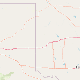

Leaflet | <a href="https://www.openstreetmap.org/copyright">© OpenStreetMap contributors</a>
Item
| Property | Value |
|---|---|
| id | 403565 |
| downstream_mainstem_id | https://geoconnex.us/ref/mainstems/349686 |
| encompassing_mainstem_basins | ['https://geoconnex.us/ref/mainstems/349686', 'https://geoconnex.us/ref/mainstems/320872', 'https://geoconnex.us/ref/mainstems/312091'] |
| featuretype | ['https://www.opengis.net/def/schema/hy_features/hyf/HY_FlowPath', 'https://www.opengis.net/def/schema/hy_features/hyf/HY_WaterBody'] |
| fid | 19871 |
| head_2020huc12 | 110100060801 |
| head_nhdpv1_comid | 7648369 |
| head_nhdpv2_comid | https://geoconnex.us/nhdplusv2/comid/7648369 |
| head_nhdpv2huc12 | https://geoconnex.us/nhdplusv2/huc12/110100060801 |
| head_rf1id | 36945 |
| lengthkm | 62.2 |
| name_at_outlet | Bennetts River |
| name_at_outlet_gnis_id | 713958 |
| new_mainstemid | |
| outlet_2020huc12 | 110100060802 |
| outlet_drainagearea_sqkm | 473.1 |
| outlet_nhdpv1_comid | 7653747 |
| outlet_nhdpv2_comid | https://geoconnex.us/nhdplusv2/comid/7653747 |
| outlet_nhdpv2huc12 | https://geoconnex.us/nhdplusv2/huc12/110100060802 |
| outlet_rf1id | 36949 |
| superseded | False |
| uri | https://geoconnex.us/ref/mainstems/403565 |