South Sauty Creek
Map
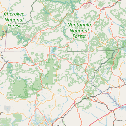
Leaflet | <a href="https://www.openstreetmap.org/copyright">© OpenStreetMap contributors</a>
Item
| Property | Value |
|---|---|
| id | 404696 |
| downstream_mainstem_id | https://geoconnex.us/ref/mainstems/316088 |
| encompassing_mainstem_basins | ['https://geoconnex.us/ref/mainstems/316088', 'https://geoconnex.us/ref/mainstems/314849', 'https://geoconnex.us/ref/mainstems/312091'] |
| featuretype | ['https://www.opengis.net/def/schema/hy_features/hyf/HY_FlowPath', 'https://www.opengis.net/def/schema/hy_features/hyf/HY_WaterBody'] |
| fid | 10162 |
| head_2020huc12 | 060300010503 |
| head_nhdpv1_comid | 19646224 |
| head_nhdpv2_comid | https://geoconnex.us/nhdplusv2/comid/19646224 |
| head_nhdpv2huc12 | https://geoconnex.us/nhdplusv2/huc12/060300010503 |
| head_rf1id | 16632 |
| lengthkm | 62.7 |
| name_at_outlet | South Sauty Creek |
| name_at_outlet_gnis_id | 153507 |
| new_mainstemid | |
| outlet_2020huc12 | 060300010505 |
| outlet_drainagearea_sqkm | 429.0 |
| outlet_nhdpv1_comid | 19647542 |
| outlet_nhdpv2_comid | https://geoconnex.us/nhdplusv2/comid/19647542 |
| outlet_nhdpv2huc12 | https://geoconnex.us/nhdplusv2/huc12/060300010505 |
| outlet_rf1id | 17265 |
| superseded | False |
| uri | https://geoconnex.us/ref/mainstems/404696 |
Graph Results
| monitoringLocation | https://sta.geoconnex.dev/collections/USGS/Things/items/'USGS-03572690' |
|---|---|
| siteName | USGS-03572690 |
| datasetDescription | Discharge cubic feet per second / USGS-03572690-1f5a9225303f494da3d5bf5d601d4a96 |
| type | Stream |
| url | https://waterdata.usgs.gov/monitoring-location/03572690/#parameterCode=00060 |
| variableMeasured | Discharge |
| variableUnit | ft^3/s |
| measurementTechnique | observation |
| temporalCoverage | 2024-08-30T09:15:00Z/2024-09-09T18:45:00Z |
| distributionName | USGS Instantaneous Values Service |
| distributionURL | https://waterservices.usgs.gov/nwis/iv/?sites=USGS:03572690¶meterCd=00060&format=rdb |
| distributionFormat | text/tab-separated-values |
| wkt | POINT (-85.92969661209 34.4986980966554) |
| monitoringLocation | https://sta.geoconnex.dev/collections/USGS/Things/items/'USGS-03572690' |
|---|---|
| siteName | USGS-03572690 |
| datasetDescription | Discharge cubic feet per second / USGS-03572690-1f5a9225303f494da3d5bf5d601d4a96 |
| type | Stream |
| url | https://waterdata.usgs.gov/monitoring-location/03572690/#parameterCode=00060 |
| variableMeasured | Discharge |
| variableUnit | ft^3/s |
| measurementTechnique | observation |
| temporalCoverage | 2024-08-30T09:15:00Z/2024-09-09T18:45:00Z |
| distributionName | USGS SensorThings API |
| distributionURL | https://labs.waterdata.usgs.gov/sta/v1.1/Datastreams('1f5a9225303f494da3d5bf5d601d4a96')?$expand=Thing,Observations |
| distributionFormat | application/json |
| wkt | POINT (-85.92969661209 34.4986980966554) |
| monitoringLocation | https://sta.geoconnex.dev/collections/USGS/Things/items/'USGS-03572690' |
|---|---|
| siteName | USGS-03572690 |
| datasetDescription | Gage height / USGS-03572690-f634cf7a0f8f4ddf8c6cfb32ad97381f |
| type | Stream |
| url | https://waterdata.usgs.gov/monitoring-location/03572690/#parameterCode=00065 |
| variableMeasured | Gage height / USGS-03572690-f634cf7a0f8f4ddf8c6cfb32ad97381f |
| variableUnit | ft |
| measurementTechnique | observation |
| temporalCoverage | 2024-08-30T09:15:00Z/2024-09-09T18:45:00Z |
| distributionName | USGS SensorThings API |
| distributionURL | https://labs.waterdata.usgs.gov/sta/v1.1/Datastreams('f634cf7a0f8f4ddf8c6cfb32ad97381f')?$expand=Thing,Observations |
| distributionFormat | application/json |
| wkt | POINT (-85.92969661209 34.4986980966554) |
| monitoringLocation | https://sta.geoconnex.dev/collections/USGS/Things/items/'USGS-03572690' |
|---|---|
| siteName | USGS-03572690 |
| datasetDescription | Gage height / USGS-03572690-f634cf7a0f8f4ddf8c6cfb32ad97381f |
| type | Stream |
| url | https://waterdata.usgs.gov/monitoring-location/03572690/#parameterCode=00065 |
| variableMeasured | Gage height / USGS-03572690-f634cf7a0f8f4ddf8c6cfb32ad97381f |
| variableUnit | ft |
| measurementTechnique | observation |
| temporalCoverage | 2024-08-30T09:15:00Z/2024-09-09T18:45:00Z |
| distributionName | USGS Instantaneous Values Service |
| distributionURL | https://waterservices.usgs.gov/nwis/iv/?sites=USGS:03572690¶meterCd=00065&format=rdb |
| distributionFormat | text/tab-separated-values |
| wkt | POINT (-85.92969661209 34.4986980966554) |