Spring Creek
Map
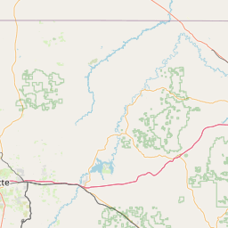
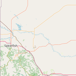
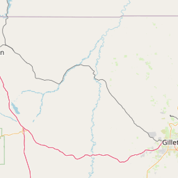
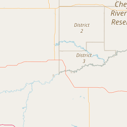
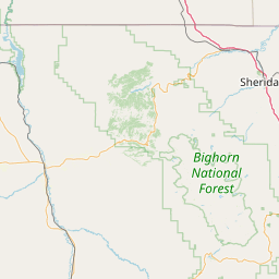
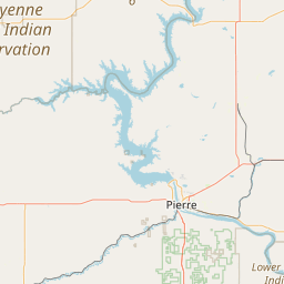
Leaflet | <a href="https://www.openstreetmap.org/copyright">© OpenStreetMap contributors</a>
Item
| Property | Value |
|---|---|
| id | 432277 |
| downstream_mainstem_id | https://geoconnex.us/ref/mainstems/407056 |
| encompassing_mainstem_basins | ['https://geoconnex.us/ref/mainstems/407056', 'https://geoconnex.us/ref/mainstems/328319', 'https://geoconnex.us/ref/mainstems/322818', 'https://geoconnex.us/ref/mainstems/312532', 'https://geoconnex.us/ref/mainstems/312091'] |
| featuretype | ['https://www.opengis.net/def/schema/hy_features/hyf/HY_FlowPath', 'https://www.opengis.net/def/schema/hy_features/hyf/HY_WaterBody'] |
| fid | 16778 |
| head_2020huc12 | 101202020703 |
| head_nhdpv1_comid | 5457766 |
| head_nhdpv2_comid | https://geoconnex.us/nhdplusv2/comid/5457766 |
| head_nhdpv2huc12 | https://geoconnex.us/nhdplusv2/huc12/101202020703 |
| head_rf1id | 26428 |
| lengthkm | 50.1 |
| name_at_outlet | Spring Creek |
| name_at_outlet_gnis_id | 1262490 |
| new_mainstemid | |
| outlet_2020huc12 | 101202020705 |
| outlet_drainagearea_sqkm | 195.5 |
| outlet_nhdpv1_comid | 5457558 |
| outlet_nhdpv2_comid | https://geoconnex.us/nhdplusv2/comid/5457558 |
| outlet_nhdpv2huc12 | https://geoconnex.us/nhdplusv2/huc12/101202020705 |
| outlet_rf1id | 26428 |
| superseded | False |
| uri | https://geoconnex.us/ref/mainstems/432277 |